Peace with the River
Delights and Challenges of an Emerging Retreat Center in Conway, MA
Austin Hammer and Gina Quattrochi Spring 2024


Delights and Challenges of an Emerging Retreat Center in Conway, MA
Austin Hammer and Gina Quattrochi Spring 2024


Harmonium Retreat Center and Botanical Sanctuary sits at the feet of Badger Hill and Pine Hill along the South River in Conway, Massachusetts. Lawrence Domash, the late physicist, left this animate land at 61 Hickory Ridge Road to the Amherst Chapter of Chabad House, an international organization with over 2,700 Jewish community centers throughout the world. Lawrence Domash left the property as his legacy with the hope that it would “advance Jewish spiritual growth by holding retreats and similar types of programming,” (Chabad House at Amherst). Soon after inheriting the property, Chabad House at Amherst connected with Aura Chaya and Rotem Gispan to gauge their interest in developing the future retreat center and becoming full-time caretakers of the land. Aura Chaya and Rotem accepted the invitation, and they are creating a non-profit organization called the Echad Foundation for Equitable, Creative, Holistic, Advancement of Divine Dwelling in the World as an entity to fund and make decisions for Harmonium. The Foundation’s hope is that Harmonium will be a space for visitors to explore their inner worlds through interaction and engagement with the natural world.
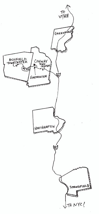
The Echad Foundation hopes to host a range of guests from the whole northeast region for mainly personal, self-guided retreat experiences and occasional workshops or special events led by yoga instructors, dance teachers, herbalists, and other healers of the Pioneer Valley. The peaceful landscape, the various forms of water, and the ecological vitality on the Harmonium property will provide a backdrop for those seeking respite from the busier parts of their lives. Nestled in the South River Valley just off Route 116 between Conway and Ashfield’s town centers, Harmonium is a short drive from Interstate 91 which connects much of the Northeast region. Harmonium’s proximity to state and interstate highways aptly situate the budding retreat center to appeal to its intended audiences. Driving to Harmonium from local population centers, like Greenfield, Northampton, and Springfield, takes twenty to forty minutes. Driving to Harmonium from urban centers throughout the Northeast, like Boston, Albany, and New York City, takes two to four hours. During a community engagement discussion, local herbalists, dance instructors, farmers, and Conway selectboard-members expressed a need for more nature-immersive, retreat spaces like Harmonium in Western Massachusetts, both for local people to rest and rejuvenate and for people from urban areas to experience the natural world in ways they otherwise may never be able to in the city. While some traits of the former private residence will support programatic goals of at Harmonium, some changes to structures and infrastructure may be necessary. The Echad Foundation would like to accentuate the natural space at Harmonium with light touches to the landscape and the addition of some human-centric amenities to expand the comfort zones of visitors by bringing them closer to the natural world, improve functionality of the retreat center space, and enhance programming experiences on the property.
Goals of the Echad Foundation for Harmonium:
Overarching Goal:
Honor the legacy of Lawrence Domash by developing a year-round, non-denominational, intergenerational, nature-immersive retreat center with some fully Kosher offerings.
Subgoals:
• Explore the feasibility of siting possible structures and facilities to conduct various program elements for: meditation (private sitting spaces, mikvah ritual baths, proximity to the landscape as a medium of reflection, benches), creation (art installations, a food forest, a vegetable garden, two large greenhouses, a chicken coop), wellness (a sauna, a trail network throughout the property, opportunities for cold-water immersion), and community building (outdoor gathering spaces, outdoor dining areas, porches around the guest house).
• Site parking for six to ten visitor vehicles and two caretaker vehicles.


Prepared By: Austin Hammer and Gina Quattrochi

Wetland and Pond Area Uphill of Harmonium Buildings

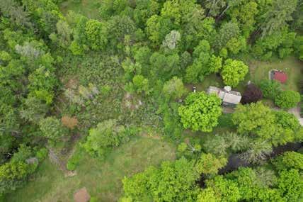
Harmonium Retreat Center sits on a 17-acre, triangular property that includes a highly diverse landscape with several different plant communities and microclimates. The southern property boundary follows the edge of the South River whose rushing waters muffle sound from Route 116 and can be heard from most locations at Harmonium. In addition to the larger triangle, Harmonium also includes a small strip of riverbank east of the public bridge on Hickory Ridge Road. The main area of Harmonium (see page 3) is mown frequently, contains three building, and has several planted trees while much of the rest of the property has been allowed to move through succession with little human influence. A rich, mesic forest resides on the slopes of Badger Hill, wetlands bisect the property, a younger forest regenerates on old farm field along the South River, and a field in the center of the property is mown at least twice each year. Harmonium resides on Hickory Ridge Road, a gravel road that dead-ends a few hundred yards to the east of the property. Traveling along Hickory Ridge Road, whose right-of-way bisects the neighbors’ property across the South River from Harmonium, then over a bridge is the only route to enter the property. The peaceful landscape, the various forms of water, and the ecological vitality on the Harmonium property are part of what will make this future retreat center special.
Prepared By: Austin Hammer and Gina Quattrochi

Storage shed with no plumbing
Caretakers’ Cabin
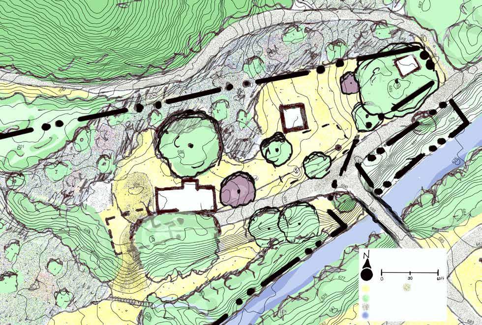
Hickory Ridge Road crosses a bridge over the South River towards the driveway to Harmonium. The guest house sleeps up to nine guests, one of which is on the first floor, includes two large communal kitchens, one of which is certified Kosher, has bathrooms on both floors, and has a lofted studio space in the attic. There are four doors to the guest house. The Echad Foundation is currently remodeling the guest house so that the east door is the main entrance to the house for overnight guests of Harmonium, the south door is a staff and volunteer entrance, the west door leads to a small gift shop, and the north door leads to the bathroom and shower space for day-use visitors. This bathroom and shower room will only be accessible from the north door with no entrance from within the guest house. The caretakers reside in the caretakers’ cabin east of the guest house; this will eventually become their full-time home. There are two parking areas, one west of the guest house with space for four to six cars and one near the shed with space for two to four cars. The turf lawn of the main area is mown regularly; three crabapples, a Norway maple, a Japanese maple, and several sugar maples grow among the turf lawn. In order to travel from the guest house to the picnic area near the South River and the large field in the center of the property, visitors must navigate a >15% slope that wraps around the southern edge of the main area. The guest house has a 1500 septic tank and the caretakers’ cabin has a septic tank with an unknown volume; both structures receive water from the well on-site. In order to reach the parking area west of the guest house, cars must drive over the leach field of the guest house.
Approximate location of leach field for caretakers’ cabin
Wetland Area
Guest House
Door to bath and shower room in guest house
Main Parking Area (4 to 7 spaces)
Old Barn Foundation
Leach field of guest house
Only path down steep slope to lower terrace
Picnic area near South River riverbank (lower terreace)
Culverted wetland outflow buried beneath turfgrass
Wetland Area

Prepared By: Austin Hammer and Gina Quattrochi

Indigenous History in the South River Valley
The floodplain on which Harmonium exists has likely been farmed for thousands of years first by Indigenous people and more recently by European colonists. Conway and the rest of the Deerfield River Valley (the South River is part of the Deerfield River watershed) were and still are home to the Pocumtuck and Nipmuc people, who are part of the Algonquin nation and who farmed floodplain areas with crops like the Three Sisters (maize, beans, and squash). In The Common Pot, Lisa Brooks, an Indigenous scholar living in Amherst, describes how agreements for land use betewen Algonquin people and European colonists did not hold the same meaning for each group. For Algonquin people, “land transactions were essentially diplomatic agreements concerning land use,” and they emphasized primary inhabitants who granted the right to other groups to share the land for trading, camping, and hunting based on the kinship and political ties between them. Consequently, “even as European customs of land alienation [and ownership] and written deeds entered Native space, words on paper held less weight for native people than oral communication and material exchange in council,” (Brooks 35). Native Algonquin people were not agreeing to transfer ownership entirely to European settlers. This dissonance in understanding of these agreements
The Conway Lake Dam
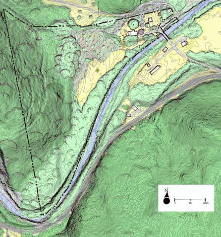
As is the case for all farms within a floodplain, farming in the fertile soils accumulated through consistent flooding comes with the risk of it all being washed away in the next flood. According to a Conway selectboard-member and town historian, the Conway Lake Dam (alternatively known as the Tucker & Cook Dam) was created as part of a large project meant to provide year-round power to several mills in the town’s industry center by straightening and damming the South River. The northern shoreline of the reservoir above the dam was just a few hundred feet downstream of the Harmonium. The risk of flooding has been a significant part of the Conway zeitgeist for centuries during its colonial history of farming, milling, and industry. The breaching of the Conway Lake Dam initially in 1869 and permanently in 1938 after being rebuilt serve as examples of the destructive potential of major flooding in Conway’s South River floodplains. These floods were catastrophic for the town of Conway, though there were no fatalities, and they foreshadowed the major flooding of the South River that continues and is intensifying to this day as storms become more and more severe. Though flooding at Harmonium is discussed in greater detail on page 7, the story of the Conway Lake Dam may serve as a reminder of this ecologically significant disturbance pattern that will continue in floodplains along the South River like that on Harmonium’s property.
enabled European people to claim ownership over land that had never been owned and prompted centuries of marginalization, genocide, and attempted erasure of Indigenous people throughout North America. Indigenous groups, however, have endured and “continuously oppose colonial domination,” (Brooks). Some Indigenous people still live near Conway. Native-led organizations across New England, like Ohketeau Cultural Center, located about four miles up the road from Harmonium in Ashfield, are working to counteract the legacy of this painful history by, “undermin[ing] harmful narratives, stereotypes, and biases about Indigenous cultures and actively acknowledg[ing] and tak[ing] steps to remove invisibility within mainstream settler society,” (Ohketeau). Efforts to return land back to Indigenous people are also taking place across New England. In Belchertown, Nipmuc leaders advocated for the state to return the stolen land at Lampson Brook Farm back to Indigenous people. If this rematriation does occur, it would be the first example of land being returned to Indigenous people in Massachuetts (Berg). Reaching out to local Indigenous groups like Ohketau Cultural Center to explore the possibility for rematriation of the Harmonium landscape to Native people of the Deerfield River Valley is just one of the many ways that the Echad Foundation could take steps towards reversing the legacy of colonial violence in New England.
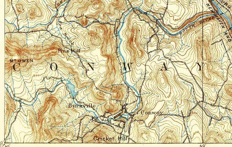
Throughout the Harmonium property are relics and clues of recent landscape history. Stone walls lining the flat area at the base of the Badger Hill slope, an old barn foundation near the guest house, a well-graded old farm road across the slope of Badger Hill, and an old dam foundation upstream of the wetlands recall the history of farming along Hickory Ridge Road. According to residents of the property across the river from Harmonium, much of the flat areas on the property was farmed for tobacco and cucumbers around the turn of the nineteenth century. The property was particularly suitable for colonial-style farming. The five acres of flat terrain on the property would have made plowing the field with animals much easier, and the fertile, floodplain soils from deposited sediments from the South River would have provided ample fertility for the energy-intensive annual crops typical on colonial-style farms. Repurposing some of the historical landmarks on-site at Harmonium may help the Foundation to achieve some of their goals for the retreat center. The old farm road may provide a stable, well-graded path for part of a future trail network; the old dam abutment may provide a foundation for a bridge over a muddy area; the artesian well may provide a crucial, consistent, year-round source of water for immersion baths; the old barn foundation near the guest house may provide a flat surface for a trailhead kiosk, sitting areas or art installations.
Prepared By: Austin Hammer and Gina Quattrochi

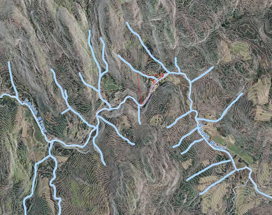
Harmonium is located in the South River watershed. The South River, which defines the southern property boundary of Harmonium, is a 17mile long river whose headwaters are located at the Ashfield Lake Dam and which flows into the Deerfield River before continuing its journey towards the Long Island Sound by way of the Connecticut River. The subwatershed that encompasses Harmonium is approximately 160 acres and stretches between the summits of Badger Hill and Pine Hill whose steep slopes rapidly shed water towards wetlands in the valley bottom and into South River. All of Harmonium’s buildings and infrastructure are located at the base of the Badger Hill and Pine Hill slopes, just north of the South River. For about a mile upstream from Harmonium on the South River, several subwatersheds with similarly steep slopes and narrow stream valleys shed water drain into a segment of the river that is highly confined. As the river collects water and moves through this mile of confined stream course, its waters accelerate and accumulate energy. Consequently, once water reaches the unconfined stretch of the South River surrounding Harmonium, it is traveling at a very high velocity, which increases the rate at which water may carve into the riverbank along the Harmonium site. This
bank is on the outside edge of the curve along this stretch of the river. This stretch of unconfined floodplain that begins at Harmonium is the first chance for the South River to, after a mile of accumulating energy, release some of that energy by widening, slowing down, and flooding into the flatter, more open terrain on Harmonium and the neighboring properties. Recognizing this pattern of topography and hydrology onsite and off-site at Harmonium could be a valuable story to share with guests to the retreat center to help them orient to and begin to develop a connection with the landscape around them. The high erosive potential of the fast-moving water along the banks of Harmonium may warrant stabilizing these slopes, especially in areas where the vegetative riparian buffer is thinnest. Harmonium’s location in the floodplain may also present challenges for siting infrastructure. The unconfined floodplain location of Harmonium in the South River watershed may also situate the Echad Foundation well to deepen their connection with the Conway community by engaging in strategies of flood mitigation, like adding vegetation to the riparian buffer, outlined in the town’s recent Municipal Vulnerability Preparedness (MVP) Grant.
Prepared By: Austin Hammer and Gina Quattrochi


Hints of the pattern of continuous frequent flooding can be seen in several other physical characteristics at Harmonium, like the surficial geology and soils. The two dominant surficial geology types found at Harmonium include glacial till/bedrock and floodplain alluvium. Areas with floodplain alluvium surficial geology align with areas in the bottom of the South River Valley that are relatively flat. Floodplain alluvium comprises the surficial geology for most of the wetlands, the field, the young forest, and the entire main area at Harmonium. The buildup of floodplain alluvium deposits in these areas indicate that flooding has played a significant role in shaping the physical conditions in this landscape for a very long time. Though floods have the capacity to deposit large amounts of floodplain alluvium material in a short period of time, the process of accumulating the several feet of this material present at Harmonium can take thousands of years. Floodplain alluvium is made of deep depositions of sand and gravel which often create drier, more well-draining conditions. However, the presence of wetlands in many of the areas with floodplain alluvium at Harmonium suggest that there are many other factors, like drainage, contributing to Harmonium’s landscape that are explored in greater detail on pages to follow. Soils in the field, large wetland area north of the field, and flat wooded area in the south corner of Harmonium are coarse loamy over sandy soils. These soils are very fertile and are classified as prime farmland in NRCS Web Soil Survey. The soils beneath the main area are sandy mixed mesic soils which implies that, though they are sandy and theoretically well-draining, they are still quite moist. Areas with floodplain alluvium where soils are theoretically well-draining may be most suitable for the Echad Foundation’s goal of growing annual vegetables. Areas with floodplain alluvium that are wet during the
Floodplain Alluvium
Bedrock/Glacial Till
Sand & Gravel
growing season are not well-suited for growing annual vegetables, even though they are classified as prime farmland soils, because these plants do not thrive with wet feet. Ground-truthing and observation are necessary for selecting areas with well-draining soils.
The soils on Badger Hill are shallow because soils accumulate slowly and erode more readily there, and they are highly influenced by the calcareous bedrock surficial geology beneath them. The soils on these slopes are coarse-loamy mixed, rich, mesic soils. Because bedrock is so close to the surface on these steep slopes and because there are several springs on the hillside, there is a high potential for mineral leaching from the bedrock into the soil. As water seeps over the calcareous bedrock, it dissolves essential minerals for plants like calcium and magnesium that then accumulate in relatively high concentrations in the soils. This, in combination with several other environmental factors like concavity and aspect of the slope, create ideal growing conditions for a variety of rare, specialist plant communities that are discussed in greater detail on page 12 (mass.gov). The bedrock for all of Harmonium is calpelite, a rock type that typically has high concentrations of carbonates, bicarbonates, magnesium, and calcium and usually causes these rich, alkaline soil conditions. The rich, mesic soil types found on Harmonium can support a suite of rare plant species, some of which are already present on-site, which may support some of the Echad Foundation’s wellness goals like foraging for edible and medicinal plants. The ecosystem on Badger Hill is ecologically rare for this region, but the shallow bedrock and thinner soils on steep slopes in this part of Harmonium may pose challenges for building trails since there is less material to shape and regrade.
Prepared By: Austin Hammer and Gina Quattrochi


In the month of July 2023, Conway received more rainfall than anywhere else in North America. In one storm, Conway received eight inches of rainfall in just two hours. The severity of storms like this exacerbate the risks of flooding along the South River. When high volumes of water runoff rapidly from the steep slopes that line the South River, the river swells and gains tremendous amounts of energy. When the South River accumulates such high levels of energy, Conway experiences severe damage in areas along the river. Conway recognizes that the risk of severe flooding in their town will only increase in years to come as a result of our rapidly changing climate; they recently received a $450,000 MVP Grant that largely focuses on flood mitigation.
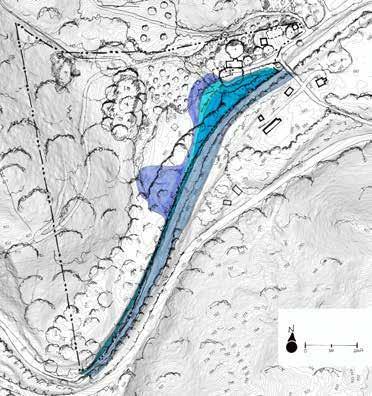
The patterns of flooding at Harmonium, documented in the landscape by the presence of floodplain alluvium in the surficial geology of much of the property, continue to this day and have been observed frequently on-site in the past two decades as storm severity has increased. Map 5 shows FEMA’s 100-year floodplain (Zone A) overlaid with the Harmonium property. In this map, flooding is shown to the top of the riverbank for much of the southern property boundary and overlaps a large slice of the northeastern main area closest to Hickory Ridge Road. This map was generated in 1980 when a 100-year storm was equivalent to storms that happen at a much higher probability today (10-year or less). The trend of large storms becoming more frequent is increasing and will likely continue to increase as the climate continues to warm. In short, though it is often used as a standard for evaluating flood risk and flood insurance requirements, this FEMA Floodplain Map is outdated and may not accurately represent the extent of potential flooding at Harmonium.
Map 6 shows a recent attempt by Franklin County Regional Council Governments to predict more accurately what land along the South River would actually be flooded in today’s 100-year storm event. In this map, almost all flatter areas of Harmonium, including areas on the upper terrace of the main area with all of the structures on-site, are shown to be at risk of flooding. The updated predictions shown in this map take into account the recent trend of increasing storm severity and the larger volume of today’s 100-year storm compared to forty years ago. If these predictions are accurate, today’s 100-year storm event has the potential to cause incredible damage at Harmonium!
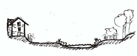
These models are coarse predictions, and it is very difficult to predict flooding with high levels of precision. When Hurricane Irene swept through much of New England in 2011, Harmonium’s neighbors across the river were forced to evacuate as flood levels rose dangerously close to their house even though floods were not predicted to reach this level. In the summer of 2023 when Conway broke several records for precipitation, Harmonium caretakers observed that the picnic area just south of the guest house flooded several times throughout the summer. The extent of this observed, frequent flooding is shown in Map 7 as the darkest shade of blue; it includes the areas around the wetland outflow where water often flows over the land bridge over the clogged culvert. This flooding represents flood levels that are eight feet above the streambed of the South River. The teal shows flood levels at nine feet above the streambed, just one foot above the observed floodlines from July 2023, and the purple shows the floodline ten feet above the streambed. In areas where the caretakers observed flooding in 2023, the riverbank is several feet lower than the upstream banks at Harmonium. The higher banks in the southern corner of the property keep flooding at bay if the floodline remains low enough. Once the floodline reaches ten feet above the stream-bed, however, water will likely jump the banks near the south end of the field and flood a large area. There are some sections of the field that seem to be somewhat well-protected from flooding because the topography on the north side of the field creates a berm that may keep floodwaters from the South River from expanding into the field. This map does not take into account the high potential for the wetlands on-site and uphill of Harmonium to overflow into many areas around the property.
Combined, these flood maps suggest that large portions of Harmonium are at risk of regular flooding, and these areas will likely continue to expand in years to come. The areas that are shown at risk of flooding in all three maps are the picnic area south of the guest house, the strip of land along the crest of the riverbank, and the flat areas on the south edge of the field. Structures and trails in these areas should be designed to be floodable, or they should not be built in these locations. Vegetation planted in areas that flood should be able to withstand this disturbance regime. Though the risks associated with living in a floodplain can be high, they are balanced with the opportunity to witness and live alongside a natural process that is incredibly powerful and is necessary for certain floodplain ecosystems to survive.

Observed Flooding
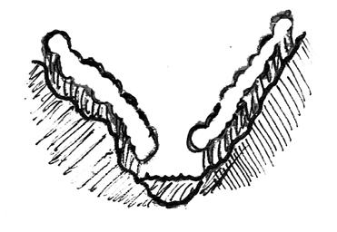
Site section showing the frequent floodline observed in July 2023.
Prepared By: Austin Hammer and Gina Quattrochi


Neighborhood Drainage Analysis
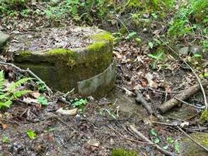
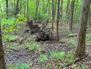
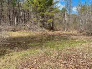
Badger Hill and Pine Hill, which slope down to Harmonium, are almost entirely forested which means they intercept and slow runoff, but the bedrock close to the surface limits infiltration into the soil. These hillsides also have an abundance of springs scattered throughout their faces, which provide year-round flows of water and saturate various areas. One such spring feeds the artesian well at Harmonium that may help to realize the Echad Foundation’s goals of constructing mikvah ritual baths, which require living waters (i.e., water from a natural source) to be considered Kosher. Because of the springs, soils on these slopes are often wet and much of the precipitation that they receive likely does not absorb and sheds quickly down the steep slopes. Parts of Badger Hill’s slopes shed water directly towards the field and flat wooded areas at Harmonium where the soil can become spongy and wet during rainier times of the year. When water collects in these areas, challenges may arise for certain program elements of Harmonium that may occur in these areas like annual vegetable gardening and building tent platforms or new cabins. These activities will likely require drier soil conditions. Much of the steep face of Badger Hill funnels water towards a stream that flows along the left half of Harmonium’s northern boundary and much of the steep face of Pine Hill funnels water towards a stream that flows through the northern neighbors’ property. These streams are the hydrologic connections for the various wetlands in the lowlands of Harmonium and their neighbors’ property to the north. In these wetlands, water creates anaerobic soil conditions where microorganisms that decompose organic matter cannot survive, so carbon is likely sequestered in these wetlands. The wetland on the north neighbors’ property drains into the South River by way of a stream that flows east of Harmonium. The wetland at Harmonium drains into the South River by way of a culvert on the west edge of the picnic area south of the guest house. This culvert often clogs with organic material and requires consistent maintenance in order to function properly. Because this culvert often contributes to flooding around the land bridge above it, the culvert may need to be resized or redesigned to prevent future clogging.
Prepared By: Austin Hammer and Gina Quattrochi


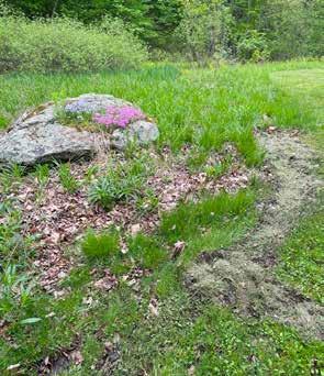

Within the main area at Harmonium, the wetland extending into the yard between the guest house and caretakers’ cabin is spring-fed from seeps on Pine Hill and often overflows and creates an erosion path through the grass, on the driveway, and into the river near the bridge. To prevent sediments from polluting the South River and ensure the stability of any future walking pathways that cross this erosion path, the overflow from the wetland may need to be directed more intentionally and detained to allow it to absorb into the soil and limit erosion. There are several flat areas in the main area where pooling of water has been observed after rain events or where there is a possibility of water pooling after rain events. The area west of the guest house borders a wetland and is often noticeably soggy. Because the soils in this area are often saturated, pooling is likely to occur. Water may pool in the areas south of the guest house and west of the shed because slopes direct water to these areas where terrain flattens out and where water may collect. Paths and infrastructure built in these areas should be graded and built to prevent standing water from causing more rapid wear. The positive drainage away from the guest house and caretakers’ cabin helps to limit pooling water around their foundations as a result of roof runoff. However, since there is so much groundwater around the structure, flooding in the basement of the guest house is still likely. Both roofs shed water into bands of river-washed stone that border the foundations of the houses where it then flows away from the houses. The positive drainage pattern around these structures should be preserved in order to continue directing water away from their foundations. Because all water in the main area of Harmonium flows a very short distance to the South River with minimal opportunity for filtration of chemicals or sediments, water from any zones, like parking areas, that are most likely to emit these pollutants should be detained and filtered and allowed to infiltrate the soil where possible.
Water embodies a variety of forms on the Harmonium property, ranging from the strong currents rushing down the South River to the trickling springs seeping from the steep hillsides to the stagnant and soggy mud storing carbon in the wetlands. The Echad Foundation has expressed their intention to incorporate discussion of this range of forms of water into their meditation programming at Harmonium. They hope to bring visitors close to the streams, rivers, wetlands, and seeps and invite visitors to accept all the forms water can take. They hope that this practice of acceptance may initiate a practice of acceptance towards all the different parts of ourselves that we embody throughout our lives. The Echad Foundation hopes to hold water as a central feature in the programming that occurs at Harmonium while minimizing inputs to these sensitive ecosystems. For this and other reasons, it is important to understand how water is moving and draining on the property.
Prepared By: Austin Hammer and Gina Quattrochi


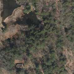

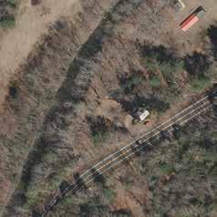

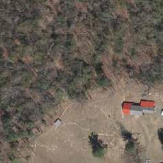

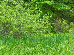
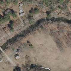

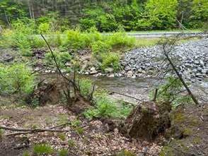

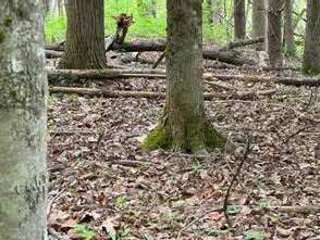
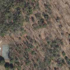
The Massachusetts Rivers Protection Act mandates a 200-foot Riverfront Area around the South River. This Act identifies eight purposes, which overlap with those of the Wetlands Protection Act. These include protection of private or public water supply, protection of groundwater, flood control, prevention of storm damage, prevention of pollution, protection of land containing shellfish, protection of wildlife habitat, and protection of fisheries. Proposed projects in a Riverfront Area are reviewed according to two standards: “no permit shall be granted for work in the Riverfront Area that would result in a significant adverse impact on the Riverfront Area for the eight purposes, and no permit shall be granted if there is a practicable and substantially equivalent economic alternative to the proposed project with less adverse impacts to the eight purposes” (www.mass.gov).
Program features, such as a sauna, ritual baths, and a demonstration farm, or structures within this regulated area will likely require the filing of a Notice of Intent (NOI) with the Conservation Commission of the Town of Conway and a MESA (Massachusetts Endangered Species Act) check list filing with the NHESP (Natural Heritage and Endangered Species Program) because the property is also within NHESP’s designated Priority Rare Species Habitat zone. Alterations to the landscape or soil biology, through constuction or intensive agriculture, may impact the riparian species that live on the property or migrate through it.
The Massachusetts Wetlands Protection Act mandates a 100-foot buffer around wetlands, whether they are emergent or established (the regulations for the Rivers Protection Act are included in Wetlands Protection Act Regulations; wetlands include swamps, floodplains, riverfront areas as well as rivers, perennial streams, river banks, land under a water body, banks, dunes, beaches, vernal pools and bordering vegetative wetlands.)
According to the Conservation Commission in Conway, the following WPA regulation is applicable to this property: 310 CMR 10.58(6), Notwithstanding the Provisions of 310 CMR 10.58 (1) through (5), Certain Activities or areas are
Grandfathered or Exempted from Requirements for the Riverfront Area: “Any excavation, structure, road, clearing, driveway, landscaping, utility line...septic system, or parking lot within the riverfront area in existence on August 7, 1996. Maintenance of such structures or areas is allowed (including any activity which maintains a structure, roads (limited to repairs, resurfacing, repaving but not enlargement), clearing, landscaping, etc. in its existing condition) without filing of a Notice of Intent for work within the riverfront area, but not when such work is within other resource areas or their buffer zones except as provided in 310 CMR 10.58(6)(b). Changes in existing conditions which will remove, fill, dredge or alter the riverfront area are subject to 310 CMRn10.58.”
When applied to wetlands mapped by MassDEP (not official delineations), the wetland buffer includes a significant area around the guest house and caretaker’s cabin. Upon observation with a wetland ecologist, the wetlands at Harmonium seem to extend beyond the MassDEP mapped wetlands. Much of the property is wet and soggy, particularly between the guest house and cabin where most human and vehicle circulation is concentrated and around the north edge of the field. Having the wetlands at Harmonium delineated will confirm which areas are subject to regulation.
To protect the ecology of both the river and the wetland on site, particularly flood control and wildlife habitat, retreat functions should have minimal impact. For human and vehicle ciruclation to be accessible and safe, it will need to be built above ground or avoid the wettest areas.
In addition to these environmental restrictions, the town of Conway also has several zoning bylaws. No primary building or structure shall be located within twenty-five feet of any boundary or within fifty feet of a public way. Off-street parking must be at least ten feet from the public way, not require backing out into a public way, have more than one entrance or exit, and be screened from any abutting residential properties by densely planted vegetation. These zoning bylaws must be followed when siting new buildings and parking areas.
Prepared By: Austin Hammer and Gina Quattrochi


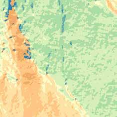

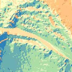
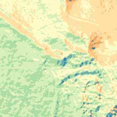
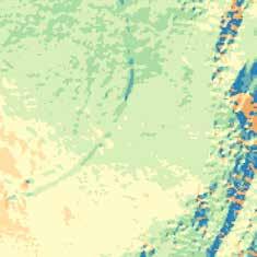

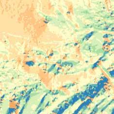


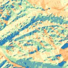


The terrain at Harmonium is highly variable. Some areas are flat and others are very steep, and there are slopes with aspects in most directions. In map ###, lighter shades of blue, which represent less steep slopes, to darker shades of blue, which represent the steepest slopes at Harmonium, demonstrates a gradient of the varied topography. Aspect is shown in map ### by displaying slopes facing each of the eight primary directions with different colors. The east- and southeast-facing steep slopes of Badger Hill on the west side of Harmonium, the northand north-facing slopes across Route 116, and the south- and southwest facing slopes of Pine Hill to the northeast are the steepest slopes in proximity to Harmonium with a range of 10 to >50% grade. The steep slopes of Badger Hill limit accessibility on the site and may pose challenges when constructing trails on this hillside. Grading trails on the steep slopes at no more than 10 to 15% grade will allow for easier accessibility for some people in these areas, and grading trails between 0 to 5% grade could accomodate people using wheelchairs. The flat areas of the historic floodplain are visible with the lighter shades of blue ranging from 0-10%. The flatter slopes of this area are more suitable for annual vegetable production, which often involves tilling soil which increases the likelihood of erosion, than many other parts of the property where steep slopes would increase the rate of erosion. The lower grade may also allow for the Echad Foundation to carry-out some of their agricultural aspirations more easily since maneuvering farming equipment like wheelbarrows is more easily done on flatter ground. There is also a thin band of >20% slopes that begins at the north end of the bridge and rays out to the west. This steep slope separates much of the property into two terraces; all structures at Harmonium are on the upper terrace while the field, riverbank, and much of the wetland area are all on the lower terrace. This band of steep slopes limits accessibility, especially for people using wheelchairs, to the river and most areas outside the main
Prepared By: Austin Hammer and Gina Quattrochi


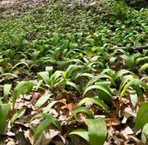
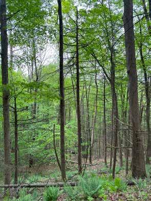
Topography, soil, slopes, aspect, hydrology, and disturbance history contribute to Harmonium’s ecologically diverse landscape with several ecosystem types. Some of these ecosystems are quite rare. The preciousness of these ecosystems can most directly be seen in the vegetation responding to these diverse conditions. The southeast and east facing slope on Badger Hill with its calcareous bedrock, concave shape, and elevations below 2,400 feet provides conditions for a rich, mesic forest ecosystem type that only exists in Massachusetts under these conditions. Rich, mesic forests house a variety of rare, herbaceous plants specific to this ecosystem type, such as Sanguinaria canadensis (bloodroot), Adiantum pedatum (maidenhair fern), Caulophyllum thalictroides (late blue cohosh), Osmorhiza claytonii (sweet cicely), Dicentra cucullaria (Dutchmen’s breeches), Allium tricoccum (wild leek ramps), Dryopteris goldiana (Goldie’s fern), and Solidago flexicaulis (zigzag goldenrod) are just some of the long list of plants that thrive in rich, mesic forests like that of Badger Hill. Many of these plants are either medicinal or edible and may support the Echad Foundation’s wellness goals of supporting guests with delights from the land. However, many of these rare plants are very delicate and take decades to regenerate when disturbed or overharvested, so it is very important to research how to harvest these herbaceous plants sustainably without eliminating them from Badger Hill. The shaded understory on Badger Hill includes shrubby perennial species like Hamamelis virginiana (witch hazel) and Sambucus racemosa (red-berried elderberry). Ostrya virginiana (hop hornbeam) is another indicator species of rich, mesic forests in the shrub layer, but this plant has not yet been witnessed at Harmonium. The overstory on Badger Hill largely displays Acer saccharum (sugar maple), Fraxinus americana (white ash), Fagus grandifolia (American Beech), and Pinus strobus (white pine). Many Carya cordiformis (bitternut hickory) saplings are regenerating in the understory on Badger Hill, which indicates the presence of a mature bitternut hickory somewhere on the hillside, however the parent tree of these saplings was not observed. Sugar maple, white ash, and bitternut hickory, though not as specific to rich, mesic forests, are all species characteristic of this ecosystem. Because many of these plants, especially those in the herbaceous layer, have such narrow ecological niches and because this forest type is so rare in the state of Massachusetts, efforts to preserve this forest by minimizing disturbance to vegetation from building structures, trails, and other infrastructure should be taken. Structures should be designed to have a small footprint, and trails should avoid areas with rare plants. Taking these measures to preserve these ecosystems will support the Echad Foundation’s goal of creating a botanical sanctuary and nature-immersion experience for guests at Harmonium.


Prepared By: Austin Hammer and Gina Quattrochi

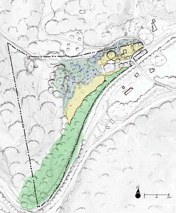
Other parts of the property outside of the rich, mesic forest on Badger Hill also host a diverse community of plants, though the vegetation in these areas reflects the history of colonial farming, landscape alteration, and other disturbances from the past few centuries of post-colonial occupation of the land. The band of wetlands that bisects Harmonium supports a novel ecosystem of typical wetland plant species, such as Salix spp. (willow), Onoclea sensibilis (sensitive fern), Scirpoides holoschoenus (roundheaded bulrush), Iris pseudacorus (yellowflagged iris), and Cornus sericea (red-twigged dogwood), and newly arrived species, such as Lonicera morrowi (Morrow’s honeysuckle) and Rosa multiflora (multiflora rose). Selective removal of honeysuckle and multiflora rose from areas where guests are most likely to interact with them and replacing them with native species may help to realize Harmonium’s goals of creating a peaceful, botanical sanctuary for guests. Multiflora rose, for example, has large and sharp spines along its stalks that can easily puncture people’s skin, so removing it may improve guest experience. This plant can outcompete native plants and transform areas into monocultures.
The open field in the center of Harmonium and the grass in the main area have been maintained in the early stages of ecological succession through mowing several times each year. The edge of the bordering wetland vegetation ends at the northern mown edge of the field. The field supports several early-succession plants, such as Achillea millefolium (common yarrow), Erigeron pulchellus (Robin’s plantain), Potentilla spp. (cinquefoil), and Houstonia spp. (bluets). The south half of the field, which is closer to the South River and which receives the most shade, is blanketed with moss that surrounds the fenced-in garden bed. Many of these early-succession plants have potential to spread rapidly in cultivated areas, so they may become weeds in future vegetable gardens of Harmonium. Many of them also have several medicinal uses, so their spontaneous appearance in a cultivated space may be welcome contributions towards the Echad Foundations’ goal of demonstrating how people can enhance their wellness through interaction with the landscape. The absence of woody perennials in the field may make it suitable for vegetable gardening since this area is already in the first stage of ecological succession when annual
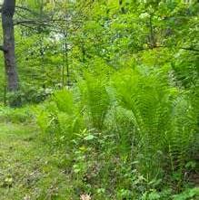

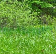
plants, like most vegetables, are most abundant. Since this area borders a wetland, however, careful observation of soil moisture conditions is necessary to determine which patches of the field are most well-draining. The understory of the young, regenerating forest in the flat areas along the South River is much less diverse than the rich, mesic forests on Badger Hill. However, the overstory reflects similar species to those of the steep hillside. Frequent tilling of colonial agriculture likely happened most intensively in this area, so trees are much younger and smaller here. Young sugar maple, bitternut hickory, American beech, white pine, eastern hemlock, and red oak comprise the overstory in this area. The understory and shrub layers for much of this area is quite sparse with sporadic honeysuckle and multiflora rose taking advantage of occasional sunny patches. Near the picnic area south of the guest house, the herbaceous layer begins to include more plants typical of emergent floodplain forests like Matteuccia struthiopteris (ostrich fern) and sensitive fern. Reynoutria japonica (Japanese knotweed) grows along some stretches of the riverbank around the picnic area. The presence of Japanese knotweed along the river is becoming increasingly more common in New England and decreases biodiversity along riparian corridors because few plants are able to outcompete it. Because this plant is relatively new to the New England landscape, knowledge of how to manage it and how it interacts with other plants and animals is limited. Encouraging biodiversity in plant communities along the riverbank by planting native species for transitional floodplain forests, like ostrich fern and Laportea canadensis (wood nettle), and slowing the spread of Japanese knotweed as much as possible may support the Echad Foundation’s goals of creating a diverse botanical sanctuary for guests and plants alike. However, Japanese knotweed shoots are edible, so they too can be incorporated into wellness programing at Harmonium by demonstrating how one engages with and adapts alongside an ever-changing landscape!
Prepared By: Austin Hammer and Gina Quattrochi

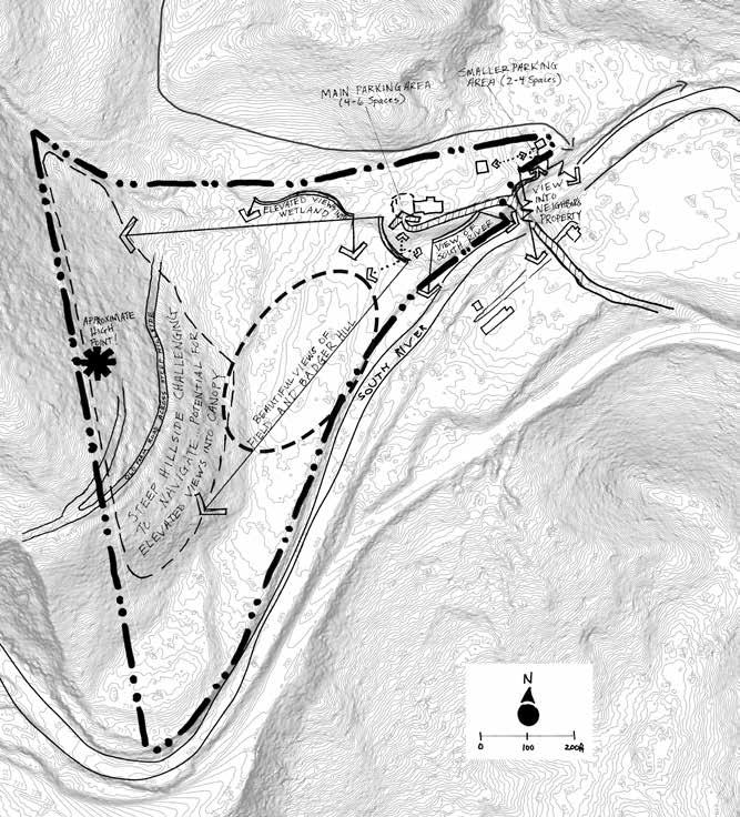


The only entrance to Harmonium is through Hickory Ridge Road, a gravel, dead end street off of Route 116. This is a narrow road with a small bridge that crosses the river and leads to the Harmonium property, as well as two other properties to the north and east. Current foot and vehicle circulation is concentrated in the main area of the property where the guest house and caretaker’s cabin are located. Currently, the caretakers park in front of the shed on compacted dirt and walk over grass to access the cabin. They are concerned about exposure to ticks walking throughout unmown areas of the property.
The neighbor across the South River is concerned about unsightly views of parking and increased vehicle traffic along Hickory Ridge Road, which bisects their property. Hickory Ridge Road is narrow and does not accommodate twoway traffic.
There are clear sightlines between the caretaker’s cabin and the guest house, which may result in decreased privacy for the caretakers when they’re living full time in the cabin and Harmonium is open to the public. It is also unclear to newcomers to the property where to go when they arrive and are walking around Harmonium; clearly defining which areas are for public or retreat use would give the caretakers more privacy and protection from retreat functions.
Other guests and workers park in an area to the west of the guest house, driving over the guest house’s leach field for the septic tank, which may impact the integrity of the leach field over time. This gravel parking area can accommodate about four cars, which may be insufficient for future retreat center guests. There are no paths on the property except for the driveway that ends at that parking area.
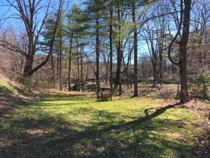
People walk over grass, down a very steep slope south of the guest house, to access a clearing on the riverbank where there is currently a dining table and chairs. They also walk down this slope to access the mown open field and the rest of the property.
When Aura needs the site to be mowed or otherwise maintained, she directs vehicles over the same steep slope, just south of the leach field, to access the rest of the property. Vehicles drive directly over the leach field to access this slope to the river. This slope is not paved. In order to mitigate damage to the guest house septic system, vehicles should no longer drive over the leach field and distribution box, and septic tank.
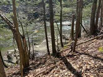
While there are no paths on the forested slope of Badger Hill, there is an old farming road that was once cleared and leveled to accommodate vehicles. This former road may be useful for establishing trails on Badger Hill and improving access to this steep area.
Steep slopes to the west and emergent wetland throughout make it difficult to navigate much of the property, but there are ample desirable views of the river and the surrounding hills. Retreat functions should take advantage of these vantage points by preserving sightlines to the river from the guest house, and having some sightlines available from paths and meditation spots, without cutting down forest or other significant vegetation.
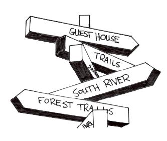
Circulation and wayfinding can be improved with accessibe paths and signage. Signage pointing out various retreat features such as ritual baths and saunas would enhance the experience for guests of Harmonium. Similarly, a cohesive path system from a parking area, through the main area and lodging, and to the rest of the property could allow for a better welcoming experience and build anticipation for what’s to come in the larger portion of the property.
Prepared By: Austin Hammer and Gina Quattrochi

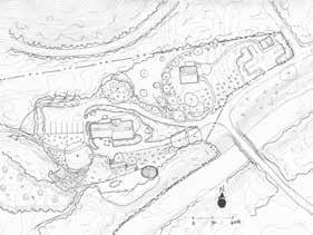
This design focuses on making the entire property ADA accessible. Paths are graded at less than 5% slope, and three loops of varying distances (0.25 mi, 0.4 mi, and 0.6 mi) are nested within one another so guests have several opportunities to take a shortened turnoffs. The shortest loop includes a wetland boardwalk. All retreat features, including a certified Kosher mikvah bath and a sauna, are all accessible via these paths.
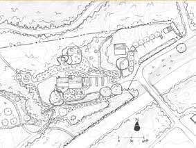
In the main area, parking has been added just west of the shed and just east of the guest house. The parking nearest the guest house has one accessible van parking spot and two accessible compact car spots. An accessible ramp offers a path from these parking areas to the entrance of the guest house for visitors in wheelchairs. The driveway no longer leads cars over the guest house’s septic system and leach field, and leach field friendly vegetation is planted above the leach field. Gardens throughout the main area create privacy between the caretakers’ cabin and the eastern parking area. An accessible path through gardens leads visitors from the upper terrace down to the picnic area. There are gardens throughout and an accessible path from the guest house down to the flat area by the river.
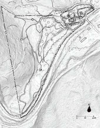
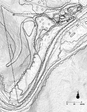
This design imagines including every retreat program feature possible. It creates intrigue with an undulating forest edge, adjacent to the existing open field, resulting in an intersting trail and a robust vegetative river buffer. Trails extend through most of the property, following the river into the southeast corner of the property, and then gradually climbing the eastern slope to secluded meditation spots. It also includes a designated mikvah, or ritual bath, area, and keeps foot traffic out of the wetlands by having a path north of the wetland that connects back to the main area of the property.
In the main area, parking has been added next to the shed as well as to the east of the guest house, and a driveway has been added behind the guest house so vehicles can avoid driving over the leach field.
The steep slope from the guest house to the flat area on the riverbank has been covered in terraced gardens, and access down the slope is through a combination of steps and paths. A pavillion has been added in the flat area for outdoor performances and workshops.
This design aims to keep programming out of the river and wetland buffer zones. Adjacent to the open field, a successional food forest is planted with floodplain crops such as paw paw and elderberry. The field is turned into a meadow with pollinator grasses. A boardwalk trail traces the outline of the wetland with an art installation in the middle of the field.
The boardwalk ends at a gravel hiking trail that climbs the steep eastern slope of Badger Hill, ending at a secluded cabin at the peak of the mountain. The trail continues to several meditation spots and to a raised mikvah bath at the northern edge of the property. Another art installation guides the path back to the main area of the property, where the trail again turns into a boardwalk to cross the wetland.
In the main area, there is a sauna placed in close proximity to the bathrooms in the guest house and an accessible path from the guest house down to the riverfront. The flat area near the riverbank is left open as a multi-use gathering space.
The shed is removed from the property to allow for 4-5 parking spaces in the northwest corner of the property.
Berm directs water into a rain garden Gathering Space New Bridge
Pros:
• Completely ADA Accessible
• Trails through all ecotones
Ritual Baths Wetland Boardwalk
Parking ADA Path
• Foraging opportunities for people in wheelchairs
• Traffic redirected off of leach field
Cons:
• Some expensive features
• Private program features close to main trails
• Some development in buffer zones
• Limited parking on-site
• May be challenging to maintain far away features
• Tight turnaround for parking near guest house
Parking
Berry Bushes for Wheelchair-Friendly Foraging Sauna Benches near River
ADA Path
Pros:
Leach Field friendly plants Rain Garden
Multi-Use Gathering Space
• Exceeds target parking range and redirects traffic off leach field
• More variation in trail lengths and ecotone exposure
• Largely ADA Accessible
• Riverside of guest house becomes pedestrian only
• Riparian buffer expands with extenuated forest edge
• Minimal development in buffer zones
Cons:
• Parking eats into north wet area
• East parking quite visible for neighbors
• Few program features in far, south curve of trail
• No food production
ADA Path
Accessible River Path Gathering Space
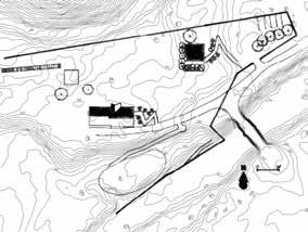
Pros:
• Least expensive alternative
• Includes some additional parking
• Protects the rare species core/riparian habitat
• Increases vegetative buffer along the riverbank
• Includes meditation points, art installations, bath, and sauna
Cons:
• Does not have 10-12 parking spaces; off-site parking would be needed
• Does not include a structure for all-weather, all-season gathering
• Minimal access to the river
Prepared By: Austin Hammer and Gina Quattrochi

Social Zone Parking

Trailhead Sauna
Homestead Demonstration Zone
Multi-Use Gathering Space
Steps Down to River
Rotating Art Installtation Zone
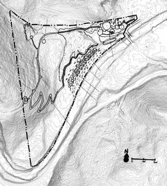
A diversity of program elements at Harmonium provide a diversity of experiences for guests. A network of trails radiates out from the main area to meditation platforms, ritual baths, homestead demonstrations, benches, and other program elements. Some spaces, like the meditation platforms high on Badger Hill and the mikvah ritual baths among the white pine trees, are sited far from the main trails and other program features to provide privacy and space for uninterrupted reflection. Other spaces, like the homestead demonstration area in the center of the property and the sauna west of the guest house, are sited in more central locations to encourage guests to collaborate and socialize with one another. Program features throughout Harmonium immerse guests in the beautiful, natural features of the landscape, like the rich, mesic forest on Badger Hill and the swift water of the South River.
Paths in the main area bring guests from the new parking area in the east corner of the property, through a garden densely planted with species found in other parts of the property, through a social zone near the day-use entrance of the guest house, and eventually to a quieter space west of the guest house with a sauna and trailhead to the broader trail network around the property. Several branches from this main circulation path lead visitors to the guest house entrance for overnight guests, to the gift shop door, and around the south side of the guest house. By bringing guests through these thresholds of socialization and familiarity, the arrival experience of the main area is intended to calibrate guests to the quieter spaces to be found in the forest of Harmonium.
*Almost all features in this design will require permitting from the Conservation Commission and MESA since they may involve alteration of the landscape in the buffer zone of the wetlands, the buffer zone of the South River, and on the NHESP Priority Rare Wildlife Habitat Corridor. All design features should be implemented with miminimal disturbance to tree root systems, pollution of waterways, and disturbance to the variety of ecosystems throughout the property. Trails should avoid where rare species grow since many of these species are delicate and take a long time to regenerate after disturbance.
Prepared By: Austin Hammer and Gina Quattrochi


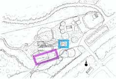
A Paths: The primary circulation path directs guests from the parking area to the day-use visitor door on the north side of the house. An 8.3% graded spur path branches from this main circulation route, providing overnight guests with an accessible path to the east door of the guest house. The main circulation path continues to the sauna and trailhead area west of the house and loops back around to the south side of the house.
B Rain Garden: A rain garden captures and slows some overflow from the wetland to mitigate erosion on the paths and on the driveway.
C Social Zone: The area north of the guest house marks where day visitors arrive. The path leads guests to a covered porch with lockers adjacent to the north door to bathrooms only accessible from this door where they can store their belongings. A Goshen stone patio with tables and chairs and a mown area with two benches below the sugar maple tree provide social space for guests to interact.
D Art Installation/Trailhead Area: Visitors walking west from the social zone cross a threshold of vegetation into quieter zone with a trailhead for the northern trail that leads west into the forest. This zone includes fewer sitting spaces to encourage visitors to continue moving and help preserve a quieter, less sociable experience in this area since it serves as a transition zone between the guest house and the forest where guests are encouraged by Harmonium to embark on individual outings. The sauna in this area sits separate from the social zone close enough to the bathrooms and showers in the guest house for sauna users to still easily access this infrastructure.
E Outdoor Staff Area: Since the south door of the guest house leads to a kitchen where staff and volunteers may be working, this door leads to an outdoor rest area for staff and volunteers at the retreat center. This area is also on the opposite side of the house from the social zone to the north, so privacy is maintained for both staff members and Harmonium guests. Raised beds with various culinary and medicinal herbs border this area and create separation from spaces for guests.
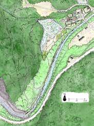
F Vehicle Access to Lower Terrace: A six-foot-wide path crosses the steep slope south of the guest house at <5% slope to allow a small, maintenance ATV to access the lower terrace. This path also serves as an ADA-accessible path from the upper terrace to the lower terrace. The gravel surface of the path is held in place by large boulders that also help to stabilize a slope that would otherwise be prone to erosion from runoff or flooding of the South River. Vegetation hides the path from view of guests looking out the window of the guest house while preserving the view of the South River. This path also allows visitors to bypass the picnic area and just continue on to either the homestead demonstration area or the riverwalk. A set of stairs provide a more direct path down the slope to the picnic area and gathering space where guests can more intimately experience the river.
Multi-Use Gathering Space: An open air pavilion in the east corner of the picnic area provides a sheltered space for guest teachers to host dance workshops, yoga classes, meditation groups, and other programs. This space is not visible from much of the main area, giving users a sense of privacy while they delve into their respective workshops. The South River flows just a few feet from the shelter, producing a wonderful soundscape for workshops. The structure must be designed to be floodable since this area experiences annual flooding.
Bridge over Daylit Water: The wetland outflow has been converted from a culvert to a stream course to reduce the need to keep the culvert clear. A bridge that can bear the weight of a small ATV provides a path over the daylit stream course and brings visitors close to one of the many ways water moves through Harmonium. This daylit stream also provides less interruptions for any wildlife that may be travellling between the South River and the wetland. Removing the culvert may also help to prevent flooding from the wetland overflow in this area.The structure must be designed to be floodable since this area experiences annual flooding.
Prepared By: Austin Hammer and Gina Quattrochi

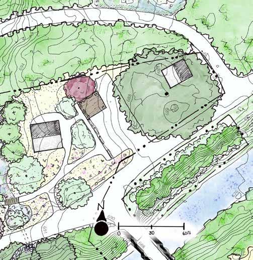
Parking Area: Guests of Harmonium cross over the bridge and are directed by a sign to turn right towards the main parking area. The gravel parking lot with six parking spaces, two of which are ADA-compliant and two of which are covered, is regraded slightly so runoff flows towards the large sugar maple.The crabapple tree has been removed to allow space for parking and the Japanese maple tree has been transplanted to the northwest corner of the parking area to provide aesthetic appeal for the caretakers.
Native Plants on Riverbank: The view between the parking area and the neighbors’ house across the river is buffered by native plants. The native plants are selectively chosen to increase stability of this slope, replace the invasive species, and increase the ecological vitality of the riverbank.
Caretaker Privacy: Vegetation creates a privacy buffer for the caretakers’ cabin.
Signs: Signs are placed at the various turn-off points from the primary circulation route to help visitors with wayfinding to the guest house, day-use areas, picnic area, and trails around Harmonium.

Prepared By: Austin Hammer and Gina Quattrochi

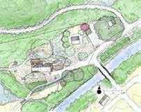
Northern Trailhead: The northernmost trail circumnavigates the wetland on top of the steep slope, allowing visitors to see, hear, and smell the wetland without venturing into it.
Bridge: The old dam abutments are repurposed here as the foundation of a footbridge that crosses a sometimes wet and sometimes muddy swale.
Ritual Baths: A series of runnels direct water from the historical artesian well to gravity-fill three private baths nested in the forest. The baths are each located at least one-hundred feet from other baths and trails on mounded areas in the forest where water drains more readily and soils may be less soggy than much of the rest of the mesic forest making these areas easier to navigate. A visitor could start their excursion at the guest house and access the northernmost bath, a certified Kosher mikvah among a stand of tall pine trees, by wheelchair along a gravel path whose grade does not exceed 5%. The easternmost bath is located on the crest of the steep slope bordering the wetland, providing bathers with another, more private view into the wetland core. Outflow from these baths is directed by more runnels to a large cistern in the homestead demonstration area where it is held until needed to irrigate crops.
Trail Network: The single, northern trail becomes three trails at a trail sign. Two of the trails lead visitors to the southern corner of Harmonium near a sharp bend in the South River; one of these two trails (~0.35mi loop) follows a 0 to 5% graded path while the other climbs more steeply up Badger Hill. This provides visitors with accessibility requirements to have a similar experience of walking through the rich, mesic forest to visitors who choose the steeper, longer trail of the two (~0.6mi loop). The third trail (~0.25mi loop) leads downhill towards the homestead demonstration area just south of the wetland and offers guests the option of walking a loop shorter than the other two trails.
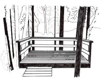
Sitting Platforms: Visitors who follow the steepest path up Badger Hill will have the option to visit sitting platforms even higher up the hillside. These platforms provide private space for relaxing, meditating, and enjoying views of tops of trees downslope. Like the ritual baths, the sitting platforms are accessible by spur trails off the main trail to allow guests to sit comfortably without worry of other people interrupting their solitude. Guests can indicate on the signs at the beginning of the spur trails that the spaces are occupied.

Benches along the more accessible trail provide a view into the treetops of the rich, mesic forest.
Rotating Art Installations: Both the steeper trail and the accessible trail arrive at the flat wooded area in the southern corner of Harmonium where rotating art installations provide an additional destination for these trails and offer creative inspiration for guests. Here, they begin to turn northeast towards the main area of Harmonium.
Riverwalk Trail: A trail between the main area and the rotating art installation area to the south travels along the top of the bank of the South River, allowing visitors to enjoy the sights and sounds of the river. Two sets of stairs made of large stones offer guests the chance to lounge by, swim in, and become closer to the river. This trail also gives guests the option of bypassing the homestead demonstration area.
Final Design: Whole Property
Homestead Demonstration: A loop trail connects various program features in a homestead demonstration area showcasing various ways to grow food. Two greenhouses (14’ x 40’ and 14’ x 60’) are placed in the sunniest part of the open field and angled slightly off the north-south line to increase sun exposure. The greenhouses extend the growing season in the cold climate of Massachusetts. The vegetable garden has also been moved to the sunnier patch of the field to increase the length of time that it receives full-sun exposure. A chicken coop is located on the shadiest section of the field where chickens can take refuge from the hot sun. A perimeter fence with gates on the northeast and southwest ends of the field encircles these features to deter predators of the chickens and larger browsing animals from eating the vegetables. Just outside the perimeter fence are two food forest gardens that include perennial plants that serve a variety of anthropocentric and ecological functions (see page 22). The food forest closest to the main area widens the wooded area buffering the river and covers the approximate area most prone to flooding with floodresilient plant species. The food forests also mark transitions between areas of Harmonium where human presence is most visible and areas where natural processes are allowed to evolve more spontaneously.
Prepared By: Austin Hammer and Gina Quattrochi

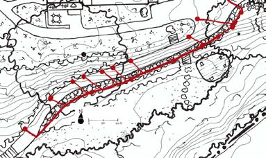
grading plan for the new driveway.
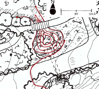
Conceptual grading plan for the rain garden east of the guest house.
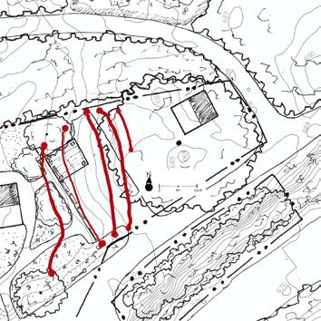
Conceptual grading plan for the new parking area.
The driveway has been narrowed and redirected to cross the steep slope south of the guest house and maintain small, all-terrain vehicle access from the upper terrace to the lower terrace of Harmonium without driving over the leach field of the guest house. A retaining wall made of large boulders (two to five feet in diameter) holds gravel fill in place on top of the existing slope. This new driveway allows vehicle access to the trail that leads to the homestead demonstration area and provides a path for wheelchair users to access the picnic area and most of the trails throughout the property. This grading project would require permitting through the Conservation Commission and NHESP since construction would occur within the South River and wetland buffers and within the NHESP Rare Wildlife Habitat Corridor.

A rain garden slows down water outflowing from the wetland between the guest house and the caretakers’ cabin. This rain garden prevents erosion through the lawn and along the driveway to mitigate deposition of pollutants in the South River. The rain garden overflows into a culvert that runs below the driveway and outfalls onto a pad of boulders south of the driveway to spread out water. This grading project will require permitting through the Conservation Commission and NHESP since construction would occur within the South River and wetland buffers and within the NHESP Rare Wildlife Habitat Corridor.

The parking area has moved to the eastern corner of Harmonium, where it is not visible from much of the rest of the property. Construction of this parking area should avoid disturbing the root zone of the large sugar maple near the shed. Fill is added to create a more level parking surface for visitors. The surface is graded to shed water downslope to the east where it will disperse across the surface of the ground. This grading project will require permitting through the Conservation Commission and NHESP since construction would occur within the South River and wetland buffers and within the NHESP Rare Wildlife Habitat Corridor. It is also important to determine the exact location of the caretakers’ cabin leach field before constructing this new parking area so that damage to the septic system is avoided.
Prepared By: Austin Hammer and Gina Quattrochi

Common
Speckled Alder Alnus rugosa
Bigtooth Aspen Populus grandidentata tree
Northern Arrowwood Viburnum recognitum shrub
American Basswod Tilia americana tree rich
Black Birch Betula lenta tree
Yellow Birch Betula lutea tree moderate to moist moderate to moist
Highbush Blueberry Vaccinium corymbosum shrub acidic
Butternut Juglans cinerea tree rich moist
Red-osier Dogwood Cornus stolonifera shrub
Common Elderberry Sambucus canadensis shrub rich
Slippery Elm Ulmus rubra tree moderate to rich
Bitternut Hickory Carya cordiformis tree rich moist
Sheep Laurel Kalmia angustifolia shrub acidic
Leatherleaf Chamaedaphne caluculata shrub acidic
Ashleaf Maple Acer negundo tree alluvial
Silver Maple Acer saccharinum tree rich, alluvial
Nannyberry Viburnum lentago shrub rich
Spicebush Lindera benzoin shrub rich
Black Spruce Picea mariana tree acidic
Sycamore Plantanus occidentalis tree rich, alluvial moist
Tamarack Larix laricina tree acidic
Virginia Creeper Parthenocissus quinquefolia vine rich
Wild Raisin Viburnum cassinoides shrub acidic
Hop Hornbeam Ostrya virginiana tree slightly acidic moist
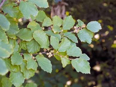
American Witchhazel Hamamelis virginiana shrub moderate moist
Bloodroot Sanguinaria canadensis perennial mesic
Dutchman's Breeches Dicentra cucullaria perennial acidic moist
to wet
Squirrel Corn Bicuculla canadensis perennial rich moist
Slender Toothwort Cardamine angustata perennial moderate moist
Zigzag Goldenrod Solidago flexicaulis perennial acidic moist
Privacy Screening from Parking
Bigtooth Aspen Populus grandidentata tree moderate
Black Birch Betula lenta tree moderate moderate
Yellow Birch Betula lutea tree moderate to moist moderate to moist
Butternut Juglans cinerea tree rich moist
Slippery Elm Ulmus rubra tree moderate to rich moist
Bitternut Hickory Carya cordiformis tree rich moist
Ashleaf Maple Acer negundo tree alluvial moist
Silver Maple Acer saccharinum tree rich, alluvial moist
Sycamore Plantanus occidentalis tree rich, alluvial moist
Pin Cherry Prunus pensylvanica shrub moderate moderate
Eastern Cottonwood Populus deltoides alluvial moist
Alternate Leaf Dogwood Cornus alternifolia shrub moderate moderate
Red Maple Acer rubrum tree moderate moderate
Hop Hornbeam Ostrya virginiana tree slightly acidic moist
American Witchhazel Hamamelis virginiana shrub moderate moist
Eastern Red Cedar Juniperus virginiana tree moderate dry
American Hazelnut Corylus americana shrub moderate dry to moist
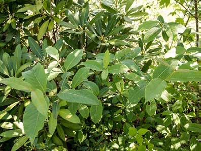
White Rhododendron Rhododendron albiflorum shrub moderate dry to moist to wet

to wetland
to wetland
to wetland
close to wetland
close to wetland
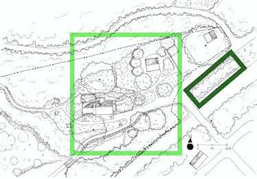

Common Name
Red Chokeberry Aronia arbutifolia shrub well-draining dry to wet
Black Chokeberry Aronia melanocarpa shrub well-draining dry to wet
Beautyberry Callicarpa americana shrub well-draining moist
Red Twig Dogwood Cornus stolonifera shrub well-draining moist
Inkberry Ilex glabra shrub well-draining wet to dry
Winterberry Ilex verticillata shrub well-draining wet to moist
Sweetspire Itea virginica shrub well-draining moist
Fetterbush Leucothoe racemosa shrub well-draining wet to moist
Swamp Azalea Rhododendron viscosum shrub well-draining wet to moist
Elderberry Sambucus canadensis shrub well-draining wet to moist
American Cranberrybush Viburnum trilobum shrub well-draining wet to moist
Columbine Aquilegia perennial well-draining moist
Swamp Milkweed Asclepias incarnata perennial well-draining wet to moist
White Turtlehead Chelone glabra perennial well-draining wet to moist
Bugbane Cimicifuga racemosa perennial well-draining moist
Joe Pye Weed Eupatorium maculatum perennial well-draining wet to dry
Queen of the Prairie Filipendula rubra perennial well-draining moist
Coral Bells Heuchera perennial well-draining moist
Rose Mallow Hibiscus moscheutos perennial well-draining wet to moist
Blue Flag Iris versicolor perennial well-draining wet to moist
Ostrich Fern Matteuccia pennsylvanica perennial well-draining moist
Cinnamon Fern Osmunda cinnamomea perennial well-draining moist
Leadwort Ceratostigma plumbaginoides groundcover well-draining moist to dry
Moss Phlox Viburnum trilobum groundcover well-draining moist to dry
Little Bluestem Schizachyrium scoparium grass well-draining dry
Common Rush Juncus effusus rush well-draining moist to wet
Asimina triloba
Sambucus canadensis shrub
Blueberry Vaccinium corymbosum shrub
Red Mulberry Morus rubra tree
Red Raspberry Rubus idaeus shrub acidic moderate
Black Chokeberry Aronia melanocarpa shrub moderate dry to wet
Red Chokeberry Aronia arbutifolia shrub moderate dry to wet
Stinging Nettle Urtica dioica perennial moderate moist
American Cranberrybush Viburnum trilobum shrub
Ostrich Fern Matteuccia pennsylvanica perennial
Wild Ginger Asarum canadense perennial acidic
American Chestnut Castanea dentata tree acidic
Wild Sarsaparilla Aralia nudicaulis perennial moderate moist
Red Baneberry Actaea rubra perennial acidic moist
Persimmon Diospyros virginiana tree rich moist
Cornelian-cherry Dogwood Cornus mas tree rich moist
Bitternut Hickory Carya Cordiformis tree rich moist
Barren Strawberry Waldsteinia fragarioides perennial moderate dry to moist
Southern Green and Gold Chrysogonum virginianum perennial acidic dry to moist
Common Name
Moss Phlox Viburnum trilobum groundcover moderate moist to dry
Wild Blue Phlox Phlox divaricata groundcover moderate moist to dry
Partridgeberry Mitchella repens shrub acidic moist
Eastern Teaberry Gaultheria procumbens groundcover acidic moist
Royal Fern Osmunda regalis perennial acidic wet
Cinnamon Fern Osmunda cinnamomea perennial well-draining moist
Big Bluestem Andropogon gerardii grass acidic moist
Switchgrass Panicum virgatum grass alkaline dry to moist
Bluejoint Calamagrostis canadensis grass moderate moist
Owlfruit Sedge Carex stipata grass moderate moist
Canada Wildrye Elymus canadensis grass acidic moist
Sweetgrass Hierochloe odorata grass moist moist
Little Bluestem Schizachyrium scoparium grass well-draining dry
American Witchhazel Hamamelis virginiana L. shrub moderate moist
Bloodroot Sanguinaria canadensis perennial mesic moist to wet
Plantainleaf Sedge Carex plantaginea grass rich moist
Blue Cohosh Caulophyllum thalictroides perennial rich moist

Prepared By: Austin Hammer and Gina Quattrochi

Leach Field
Appalachian False Goat's-Beard
Appalachian Barren Strawberry
Astilbe biternata perennial rich moist
Waldsteinia fragarioides perennial moderate dry to moist
Black-eyed Susan Rudbeckia hirta perennial acidic dry to moist
Blanket Flower
Blazing Star
Butterfly Millkweed
Zigzag Goldenrod
Lupine
Moss Phlox
Purple Coneflower
Gaillardia pinnatifida perennial moderate moderate
Chamaelirium luteum perennial acidic moderate
Asclepias tuberosa perennial moderate dry to moist
Solidago flexicaulis perennial acidic moist
Lupinus perennis perennial moderate dry
Viburnum trilobum groundcover moderate moist to dry
Echinacea purpurea perennial rich dry
Tickseed Coreopsis auriculata perennial acidic moist
Wild Bergamot
Yarrow
Smallflower Columbine
Monarda fistulosa perennial moderate dry to moist
Achillea millefolium perennial moderate dry
Aquilegia brevistyla perennial moderate dry to moist




Accesible trails should follow the Forest Service Trail Accessibility Guidelines (FSTAG):
Surfaces must be firm and stable (made of native soil, stablized native soil and imported material, or imported material).
• The trail running slope of 5% is permitted for any distance
• The running slope of any segment of trail shall not be steeper than 12%
• No more than 30% of the total trail length may exceed a running slope of 8.33%
• At least 70% of the trail must be less than 8.33% slope.
• Maximum length of segmeents between resting intervals:
If the trail is >5% and >8.33%: 200 feet
If the trail is >8.33% and <10%: 30 feet
If the trail is >10% and <12%: 10 feet
• The cross slope shall not exceed 5%. Where the surface is paved or is elevated above the natural ground, the cross slope shall not be steeper than 2%.
Prepared By: Austin Hammer and Gina Quattrochi

Berg, Matt. “Nipmuc Leaders Push for State-Owned Land Back in Belchertown.” The Shoestring, 15 Feb. 2022, theshoestring.org/2022/02/15/nipmucleaders-push-for-state-owned-land-back-in-belchertown/.
Brooks, Lisa Tanya. The Common Pot: The Recovery of Native Space in the Northeast. University of Minnesota Press, 2008.
Chabad House at Amherst. “The Domash Estate.” Chabad House at Amherst, chabadhouseatamherst.org/the-domash-estate/.
MA Division of Fisheries and WIldlife. Classification of Natural Communities of Massachusetts: Rich, Mesic Forest, 2016, www.mass.gov/doc/richmesic-forest-0/download.
Ohketeau Cultural Center, 2017, www.ohketeau.org/.
Thomas, Peter A. Trees: Their Natural History. Cambridge University Press, 2014.
Thurlow, Emily. “Nipmuc Nation Wants Return of Ancestral Land in Belchertown.” Daily Hampshire Gazette, Daily Hampshire Gazette, 13 Apr. 2022, www.gazettenet.com/Lampson-Brook-Farm-45612978.
U.S. Geological Survey. “The 100-Year Flood.” The 100-Year Flood | U.S. Geological Survey, 7 June 2018, www.usgs.gov/special-topics/water-scienceschool/science/100-year-flood#:~:text=The%20term%20%22100%2Dyear%20flood%22%20is%20used%20in%20an,1%2Dpercent%20chance%20of%20 occurring.
Wessels, Tom. Reading the Forested Landscape: A Natural History of New England. Countryman Press ; Distributed by W.W. Norton, 1999.
Prepared By: Austin Hammer and Gina Quattrochi
