

Sowing Seeds of Success Designs for Martin Luther King Jr. Charter Elementary School
Jessica Ladin and Daniella Portal Spring 2024
Introduction
The School
The school’s beginnings can be traced back to the dedication and vision of Alan Katz; Katz was an attorney in Springfield who, after volunteering with the Springfield-based Martin Luther King Jr. Community Center, founded the charter school. The Martin Luther King Jr. Charter School (MLKCS) first opened in 2006, operating in crowded conditions within two separate buildings on State Street in Springfield, MA.
The school relocated to the East Forest Park neighborhood in 2010, after purchasing and renovating the Goodwill Industries property that had been located on Dorset Street for forty years; this property included nine acres of land and a 67,000 square-foot building. This site was originally chosen by MLKCS for its ample indoor space, quantity of land, and on-site parking.
There are 356 students enrolled in kindergarten through fifth grade. The student body is chosen by a random lottery system, so the school serves children from all over Springfield. Because most students live outside the immediate neighborhood of the school, the majority rely on cars and bus transportation; only a handful of students live close enough to walk to school. MLKCS is a Title 1 school serving a diverse and high needs population: 87% low income, 21% English Language Learner (ELL), 98% minority enrollment, 14% special needs, and 93% high needs. The student to teacher ratio is 9:1.

Experiential Learning Focus
MLKCS is hoping to strengthen their curriculum by including more experiential learning, which is also mandated in the school's charter. MLKCS' 2022-2023 annual report outlines criteria for this goal, where at least eighty-five percent of classroom teachers should deliver at least four experiential learning opportunities to students each year (MLKCS Annual Report, 2023). During the 2022-2023 school year, seventy-two percent of teachers reached this goal. Experiential learning can take many forms, and bringing students outdoors and utilizing landscape as a learning resource is one powerful avenue. Thus, MLKCS' nine acre property is a valuable asset, but its current use by teachers is fairly limited.
Project Partners
Funded by a USDA grant with the goal of introducing youth to the natural resources field, Martin Luther King Jr. Charter School partnered with Eagle Eye Institute and the Conway School to envision experiential learning opportunities on school grounds. Eagle Eye Institute works to develop "learning programs and opportunities for primarily Black and Brown youth to experience well-being, belonging and empowerment through a relationship with nature" (Eagle Eye).
Project Goals
MLKCS and Eagle Eye hope to enhance the hands-on potential of the school's outdoor space in several ways, but with a core goal of establishing, maintaining, and reaping the benefits of a demonstration food forest. Such a project would align with the school's current focus on science and engineering, and would serve as a multidisciplinary project for all grade levels.
Guiding Question
How can outdoor elements at Martin Luther King Jr Charter School, especially a food forest, be best situated and designed to support experiential learning and provide for the school and neighborhood community?
Summary of Goals
• Site and design a food forest on school grounds to serve as both a school and neighborhood resource
• Develop a pollinator garden design for the space outside of the kindergarten entrance doors
• Cultivate experiential learning opportunities through design throughout the school grounds
• Improve connectivity and safety around the site to facilitate use of outdoor
Communities Involved
The communities involved include both social and ecological systems. This project is not only about creating a landscape design for the school, but also creating and nurturing connections in the overlap between these communities. Program elements exist in the overlap between the social and ecological systems.


Special thanks to the Franklin County Community Development Corporation (FCCDC) and John Waite (Executive Director, FCCDC), who made the project possible. Also, thank you to the Blue Yak Foundation. We appreciate Kira Jewett (Educator) and Chris Cato (Board President, Eagle Eye Institute) for their time and valuable input in the initial stage of this project.
Martin Luther King Jr. Charter School (2024)


Regional Context
Martin Luther King Jr. Charter School (MLKCS) occupies the traditional, ancestral, and contemporary homelands of the Agawam tribal peoples. The first inhabitants of the Connecticut River Valley ecoregion settled close to the river and used it not only for navigation and trading routes, but also for its natural resources such as fertile hunting and farming lands. Since displacement of indigenous people, this area has experienced the rise and decline of industry Springfield is now one of the largest cities in Western Massachusetts, with a population of approximately 156,000 people and growing (US Census, 2020). Subgroups of this population experience discrimination, and all neighborhoods are mapped as Environmental Justice (EJ) communities.
In Massachusetts, a community is identified as an Environmental Justice (EJ) community if it meets any of three conditions: a census block group whose annual median household income is equal to or less than 65% of the statewide median; 25% or more of the residents identify as a race other than white; or 25% or more of households have no one over the age of 14 who speaks English only or who speaks English very well (referred to as "English isolation") (Mass.gov 2020). These communities are often affected by inadequate access to resources, such as healthy food, transportation, air and water pollution, and suitable housing.
Access to green space and parks has become a particularly prominent environmental justice topic. The Trust for Public Lands (TPL) has made it their mission to ensure that every person across America has a quality park within a 10-minute walk of their home. 11% of Springfield’s land is used for parks and recreation (the National median is 15%), and 94% of Springfield residents live within a 10-minute walk of a park (Trust for Pubic Land). For residents of the East Forest Park neighborhood and their neighbors in East Longmeadow, MLKCS functions as the nearest green space.


Connecticut River
An Urban Food Forest?
More than 80% of the U.S. population now resides in urban areas. One approach to maximizing use of existing open space, a scarcity in cities, is increasing access to food through sustainable management of edible landscaping. There are many reasons to grow food in an urban neighborhood: food justice, food security, building healthy communities, recreation, gaining skills, saving money, providing wildlife habitat, building healthy soil, and so much more. As living costs and populations rise, utilizing available land to produce more local and healthy food will become increasingly important.
What is a Food Forest?
A food forest attempts to mimic the spatial and functional patterns of a naturally occurring forest ecosystem, while providing edible products. This involves layering a highly integrated community of plants with varying heights and root structures. There is no minimum height or size requirement for a food forest, but they usually have at least three layers of vertical vegetation. Plants are typically perennials, but can include annuals, that contain overlapping functions such as producing edible foods, fixing nitrogen, and/ or improving nutrient availability for other plants. When choosing a plant community for a food forest, also known a guild, anticipating changes in the guild as plants mature may yield a more productive and resilient system. Designed to operate as an ecosystem, a food forest guild is a combination of trees, shrubs, vines, perennials, and/or self-seeding annuals. With all tree guilds, the plant communities will change as the canopy trees grow and shade the ground beneath. Once established, food forests require only a little help from people to be very productive (Bukowski and Munsell, 2018).
a note about the term “forest”:
Not to be confused with the forested area in the northern portion of the MLKCS property, a food forest does not have to be a particular size. The term refers to the layered structure of canopy, understory, shrub, and ground level plantings that mimic the layers of a natural forest community.
Food Forests and Community
Food forests are not just a physical place, but also a social space that can foster emotional, cultural, and environmental connections. While food forests can initially be developed with educational goals in mind (e.g., demonstrating how to grow food using sustainable methods), they oftentimes become social hubs; food is a powerful means of bringing people together. When people visit food forests, they bring with them their values and identity, and through shared acts of tending to and harvesting from a common resource, people are given the space to cultivate community growth and empowerment. Food forests can incorporate paths for wandering, small spaces for private contemplation, or large gathering spaces.
Food forests can help to address environmental justice when a participatory planning process is used that engages all members in site design and social activities, giving them agency to define how public land should be used to serve their community. Food forests that are designed with public input, are maintained by community volunteers, and include individuals with varying knowledge and skills, are typically most successful because participants gain a sense of pride and ownership (Bukowski and Munsell).
perennial plants
green space
wildlife habitat
sustainable food production
recreation
solace
hands on education
food literacy
community development
A Demonstration Food Forest
A demonstration food forest is smaller in size and may have different goals than a larger food forest that aims for maximum food productivity, but community is a common thread. Alongside the ecological benefits of a food forest, demonstration areas at Martin Luther King Jr. Charter School could allow individuals to learn and practice concepts such as self-sufficiency, sustainable agriculture, and connecting with traditional foods and recipes. Topics and knowledge that were once key to community life have been mostly lost over time; however, through shared skill-building and transfer of knowledge gained at the site to yards and neighborhoods, the community can become more resilient.

Hands-On Learning: Food Literacy
Education is a powerful outcome of a food forest. Participants learn about sustainable food production, ecology, food literacy, cultural practices such as foraging, identification of food producing plants and wildlife, gardening and harvesting skills, and so much more.


A Layered Food Forest
“Community food forests serve multiple functions on one piece of land.” - Bukowski and Munsell
Beacon Food Forest is a 7-acre public food forest in Seattle, WA, with goals of building a resilient community and ecosystem.
Formerly a vacant lot in Mattapan, MA, community came together to create the 0.25-acre Edgewater Food Forest.
Photo courtesy
Nature-Based Learning
What is Experiential Learning?
Scholars have long pointed to the central role that experience—or "learning by doing"—plays in human learning and development. Early-to-mid-1900s theorists that set the stage for recent concepts of experiential learning include William James, John Dewey, Kurt Lewin, Jean Piaget, Lev Vygotsky, Carl Jung, Mary Parker Follett, Carl Rogers, and Paulo Freire. Piaget, for example, believed that children learn in stages and often through making sense of their environment through trial and error. Vygotsky believed that children gain new knowledge through hands on experiences, and that the learning process continues through development into adulthood. The belief that knowledge is constructed, and also based on the individual's developmental stage, is the thread that connects all of the theorists.
"Our students engage in experiential learning opportunities to deepen their understanding of the knowledge and skills demanded by the content standards...Research shows that by engaging students in hands-on experiences and reflection, they are better able to connect knowledge learned in the classroom to real-world situations."
- MLKCS 2021-22 Annual Report
Experiential Learning at MLKCS
Teachers at MLKCS are encouraged to design cross-curricular experiential learning for their students. During the 2022-23 school year, 72% teachers delivered at least four experiential learning activities, leaving students feeling more interested and excited about learning (MLKCS Annual Report, 2023). School leadership is committed to honoring Dr. Martin Luther King Jr.'s legacy in many ways, especially civic engagement and community service, and creates opportunities for students to be active participants in projects. In 2023, ecologically-focused, hands-on projects on school grounds included a community clean up of the forest trail “Perserverance Path” on Martin Luther King Jr. National Day of Service. This activity was done in partnership with families and students of MLKCS, as well as students attending Springfield College; similarly, kindergarten students planted and tended to garden beds, pairing what they learned in science classes with community service. "Looking ahead, our goal is to be more strategic with opportunities for our students and broader community" (MLKCS Annual Report, 2023).
Eagle Eye Offers Hands on Learning for Young Adults
Eagle Eye Institute sees the value in hands-on outdoor learning and offers programs for primarily Black and Brown youth and young adults to connect with nature and have a positive impact on both their community and the environment. Since 1991, the organization has partered with schools, environmental agencies, universities, and community organizations with the purpose of offering authentic nature-based experiences. Studies regularly show that lack of exposure to nature is a key barrier to pursuing a career in the natural resources field (Ostmann, 2024). Eagle Eye youth and MLKCS could work together to give young adults experiences working with local natural resource professionals and training in sustainable agriculture, forestry and invasive species management, helping to diversify the natural resources workforce and promoting equity in the outdoors.
Engaging the Senses, Academics, and Play
Hands on learning via nature-based activities engages young minds and bodies as they internalize background knowledge of natural systems. The students from MLKCS, as well as the youth from Eagle Eye Institute, would benefit greatly from learning activities that apply the child development theories of Piaget, Vygotsky, and others. Example of such activities related to the goals of creating a food forest and pollinator garden could include:
• Growing a garden to learn about life cycles of plants
• Observing insects in a garden to learn about pollinators
• Working with local experts to gain forestry management skills
• Balancing on logs to develop coordination skills and confidence
• Identifying and tagging trees to visit, observe, and monitor over time

Inclusive Outdoor Learning
Studies have shown that "when children regularly go outdoors into nature-rich environments at school their levels of self-esteem, focus, and participation in social settings improved" (Green Schoolyards America). For people with special needs, time spent in natural settings can be a break from challenges, providing a space to think differently and manage their emotions. Simply going outdoors and experiencing nature may increase academic performance and also “reduce symptoms of ADHD, serve as a buffer to depression and anxiety, help prevent and reduce obesity and myopia, boost the immune system” and offer many other physical and psychological health benefits (Louv, 2021).

“Well-designed living school grounds model the ecologically-rich cities we would like to inhabit, at a smaller scale, and teach the next generation how to live more lightly on the Earth—shaping places where urbanization and nature coexist and natural systems are prominent and visible, for all to enjoy.”
- Sharon Danks, CEO, Green Schoolyards America
How to Promote Outdoor Learning at MLKCS
- Dress for the weather

When children have appropriate clothing they will be more comfortable and less distracted by feeling too hot or cold. (As the Norweigan saying goes, "There's no bad weather only bad clothing.")
- Include families
Create annual events that involve families, such as counting birds, gardening, or just being together outdoors. Parents and caregivers might have expertise they can share, or they might learn new skills alongside the children.
- Connect to curriculum standards
Outdoor learning can deliver lesson objectives, is appropriate for every age group, and can be embedded across the curriculum.
- Make outdoor time part of the routine
Establishing a weekly schedule helps to ensure learning happens outdoors on a regular basis (e.g., "Nature Fridays" and "Mossy Mondays" ensures that outdoor learning will happen regularly
EXISTING CONDITIONS
The 9-acre school property is surrounded by East Forest Park residential properties on three sides. The property borders the YWCA of Western MA to the north. Fences and vegetation provide some physical and visual separation from residential backyards and the developed portion of the YWCA property. The communities that use the school grounds include students and their families, school staff, and neighborhood residents.
Entrance to the school from Dorset Street. This is the singular point of vehicular entry. A sidewalk extends from Dorset Street, which does not contain sidewalks, to the building.
Dumpsters for trash and recycling, and bulk discarded materials, are located west of the building.
Asphalt parking lot with 81 spaces, 4 of which are designated for accessible parking.
A cement platform [50' x 8'] has one picnic table, and a handpainted mural adorns the building wall.
Students and staff enter and exit the school through designated doors on the front of the building.
Kindergarten classroom doors open to a sidewalk that leads to the playground area, and raised beds are used during hands-on science lessons.
The playground contains structures for swinging and climbing. The area is mulched and three mature oak trees provide some shade for children during recess in warmer months.
Open area where mature oak trees were removed. The stumps were mostly ground but some roots remain.


The mown turf field is flat and open. It is divided using cones during recess and two classes use it separately.
Informal footpaths lead onto the school property through a knotweed patch from Tulsa Street and a city-owned parcel on Dorset Street.
City-owned parcel on Dorset Street, maintained as mown grass, provides access to the school via a informal path.
High pressure petroleum gas line runs along the western boundary and extends beyond the school property.
Vegetation, including staghorn sumac and wild brambles (Rubus spp.), provide a physical and visual barrier to neighboring properties.
An established and gently used trail winds through the forest. Seven trees are numbered with signs from a previous


Basketball court
trail project.
View from above showing part of the parking lot, Kindergarten classroom and raised beds, basketball court, deforested area, playground, and part of the northern forest
Painted mural, picnic table, and cement platform
The front of the school, where students are dropped off and picked up
Kindergarten classrooms and location of raised beds
Circulation Considering Connectedness, Efficiency, and Safety in the Schoolyard
The school's building and parking lot echo its past land use as a Goodwill store. This can be seen with the large percentage of the interior of the school being kept as storage space. Since the landscape was not designed for use by a school, outdoor spaces often feel disjointed; additionally, the parking lot cannot hold the number of vehicles visiting the school each day to drop off and pick up students, leading to long queues that back up onto the public street. The current parking lot hosts just enough vehicle spaces for the typical school day, but during larger events on site it can overflow.
Drop Off and Pick Up
Most students enter and exit through a side door to and from classrooms.
Staff and late students enter through the main entrance.
Cars and buses queue around the parking lot. With minimal traffic, cars are redirected through the pedestrian crosswalk; with heavy traffic, cars back up onto the city street.


The parking lot currently runs alongside the entire front of the school, allowing students to move directly between vehicles and building doors during pick up and drop off. However, although the school has several full-length buses and mini-buses, many are not filled to capacity, and most students are dropped off by a guardian. Subsequently, this lot—initially designed for a small team of Goodwill employees—must support hundreds of vehicles arriving and departing at once. Thus, as vehicles queue alongside the parking lot's perimeter, they at times line up on Dorset Street. Dorset Street is city-owned, and as a result, the City of Springfield has notified MLKCS that it must find a way to avoid street queuing, which blocks traffic.
The school is seeking solutions to remediate the long queue line spilling outside their property. Any student residing 1.5 miles or farther from the school is entitled to bus transportation—which includes the vast majority of students, so many parents may prefer driving their children. However, the large number of family vehicles leads to more traffic congestion, wait times, carbon emissions, and air pollutants compared to schools more reliant on bus transportation.


Playground zone
Students exit from cafeteria and through a side door; most classes re-enter here.
Grade K re-enters directly to classrooms.
Most students walk around the perimeter of the parking lot on asphalt—no sidewalks are available.
Basketball zone
Few classes use the pedestrian crosswalk; a few vehicles move around the lot during recess.
Field zones; a row of cones are set up to divide the space into zones for different classes.
After lunch, classes move from the cafeteria through the side door and walk to a predetermined play zone, which rotates on a weekly basis. The four play zones include the playground, the basketball court, and two halves of the grass field. To reach the play zones, students walk clockwise along the edge of the parking lot; this route does not contain sidewalks. Recess lasts about twenty minutes, including moving to and from the building to play zones. Students normally do not use the northern forest, but on the rare occasion do if supervised; the deforested area directly north of the basketball court, and the forest area south of it, are not designated play zones and are unused during recess.
The schoolyard offers several types of play, including sports and play equipment, as well as open lawn. However, these areas are physically disconnected from one another, with the parking lot acting as a wall. There is a safety risk involved when pedestrian movement intersects parking lots, which may be part of the reasoning behind the specified play zone for each class; allowing students to move freely from one area to another requires crossing the parking lot, which can be dangerous as some cars move during recess. Having play spaces and pedestrian circulation separate from parking and vehicular circulation can prevent overlap and increase safety. A benefit of having connected play spaces is that students would be able to follow their unique interests or curiosities that day, promoting creativity through exploration. Several unused but potential areas for additional play zones include the northern forest, the deforested patch between the playground and basketball court, and the southeast forest patch.
Circulation Considering Connectedness, Safety, and Efficiency in the Schoolyard
In order to move the vehicle queue off of Dorset Street, the school has hired an engineering team that developed the draft design below, which significantly expands the parking lot and on-site queuing stations. Total impervious surface for the parking lot is shaded in gray. 34 new parking spaces are added to the lot, totaling 115 spaces; a dedicated queue lane is added, generally increasing space for waiting vehicles to 1435 linear feet from the original 925 linear feet. While this design accomplishes the goal of conglomerating all the school's vehicle traffic on site, the design makes compromises regarding safety, connectedness of play zones, and overall experience of the schoolyard.

Vegetated border is cut down for expansion:
Views are considerably opened between residential homes/backyards and the schoolyard, decreasing privacy for both residents and students; residents now also face traffic in both the front and back of their homes.
Afternoon shade is removed, increasing temperatures within the turf play zone and areas of the parking lot.


A new van queuing station removes trees shading the basketball court, increasing surface temperatures; it also appears potentially difficult for vans to properly back in and line up as depicted.
Students must cross the parking lot's driving lanes in order to reach the turf play zones; this area is also the intersection of many different lanes, which decreases safety.
Pedestrian crosswalk is not extended to the turf play zones; students must walk in between parked cars.
Addition of impervious surface noticeably increases surface temperatures, making the parking lot and surrounding areas more uncomfortable in hot weather; impervious surface also increases stormwater runoff.
Asphalt on all sides of the play field decreases play space, removes bordering vegetation, and presents safety concerns.
The Case for School Buses
Identifying barriers preventing parents and children from using buses may be the most cost-effective solution to solving vehicle density during drop off and pick up. Bus commute may be popularized by:
Improving student safety, whether actual or perceived
Redesigning routes to be more efficient to cut down on long trips
Simplifying the process of requesting a new bus stop; for instance, providing multi-lingual forms or contact people can increase accessibility
Aside from buses, developing a system for parents interested in carpooling to find one another
Emphasizing shared transportation can improve not only vehicle congestion, but also air quality. Similarly, minimal asphalt reduces stormwater contamination, runoff, and surface temperatures.
Open Views
Asphalt already stretches across a large portion of the site, and frames the entire front of the school.
A large portion of this patch of trees south of the basketball court would be cut down in the proposed expansion. Many remaining trees would likely be damaged during construction.
Topography and Drainage
This site is generally flat, with 1-5% slopes across the majority of school grounds, and up to 11% in the northern forest. All walkways and outdoor play spaces are graded at an accessible slope, though some play surfaces (turf and trails) may not be accessible to those using wheelchairs.
Water runoff from the building is managed via gutters, drains, underground storage, and pipe connections. Curbs, which can act as a barrier for runoff, line some but not all edges of the parking lot. One storm drain, on the southwestern edge of the lot, conveys runoff into an underground detention system; some roof gutters empty onto the ground, while others go directly underground and may connect to this detention system. There are some areas where pooling water has been observed, such as along the south and eastern edges of the lot, that should be considered when siting project features such as new vegetation or outdoor classrooms. At a low point in the northern forest, water is seen during wet seasons (winter/spring), indicating a seasonally high water table. Standing water has also been observed where the parking lot meets the turf field, which is likely due to compaction that prevents water from infiltrating into the soil. By channeling surface water underground and out of sight, there is a missed educational opportunity to treat stormwater at the surface using green infrastructure, such as permeable pavement, bioswales, or rain gardens.
Sun/Shade and Microclimate
Distinct areas of sun and shade create microclimate pockets around the school that inform vegetation selection and where to site outdoor features.
The forest north of the school building contains many deciduous canopy trees. When leafed out in the warmer seasons, the forest's soil and understory layers are kept cool and moist; when leafless in colder seasons, the sunlight is able to reach and warm the forest floor. Thus, the trees in this forest play a major role in keeping temperatures comfortable in comparison with areas lacking canopy. Similarly, along the southeast, south, and southwest property edges, a vegetated buffer provides similar benefits.
The playground is shaded for most of the day by three mature oak trees throughout the warmer seasons, and additionally by the school building in the late afternoon. The basketball court is shaded for part of the day by the canopy it borders on its south and eastern sides. Temperatures are overall regulated in these areas.
The south-facing mulched areas and raised beds in front of the kindergarten classrooms receive full sun for most of the day, before the building casts some shade in the afternoon; the ample sunlight can get uncomfortable in hot weather, but creates productive growing conditions for sun-loving perennials and vegetable plants.


Both the parking lot and turf field are flat and open, and subsequently receive full sun throughout the day Temperatures can reach the most extreme in these areas, but especially within the parking lot during the summer. Not only does the lot receive little shade, but asphalt's dark surface color absorbs sunlight more than lighter shades do; this combination may transform the parking lot into an uncomfortable heat island.


The oak trees and the building provide shade for the playground.
underground detention
Low point in the forest where water pools in the winter and spring.
Stormwater flows off the asphalt parking lot and collects at the edge.
Stormwater runoff is visible at the edge of the parking lot.
Gutters empty at ground level on the north side of the building.
Vegetation
Distinct plant communities create varying microclimates and guide the use of spaces.
The main vegetative zones include forest, turf field, and shrub thicket. Mature tree canopy covers 35% of the site. A gem on this property is the three-acre forest north of the building. Of note is the change in plant communities moving west to east within the forest, creating two distinct vegetative zones there. The north and northwest zone is high quality forest with a layered structure of mixed oak forest/woodland habitat. The dominant deciduous trees include oaks, birches, beech, and pines. The northeast corner is characterized by a smaller patch of more novel plant communities including invasive species, such as Norway maple, English ivy and euonymus.
The turf field and mulched areas, known as "developed open space" according to MassGIS Land Use Land Cover data, is maintained by school staff and used by students during recess and the community after school hours.
Sumac and wild Rubus species buffer the turf field from views of neighbors. This vegetative buffer, running along (and beyond) the entire property edge, grows on top of the gas line where railroad tracks used to be.
Considering the current vegetation, wildlife value, climate resilience, and management of invasive species, potential locations for project elements emerge.
Pollinator species planted in place of mulch and unused turf areas can serve as an urban patch for pollinator species.
There is a large open area on the eastern edge where oak trees were removed; it is not currently in use and has excellent potential as a food forest. The area is fairly flat, receives full sun exposure, and is easily accessible to the school building. Native species within the food forest will attract and serve beneficial insects, while increasing access to healthy food.
The northern forest offers great potential for creating spaces that invite recreation and outdoor learning. A trail already exists, as well as a desire for more hands-on learning as expressed by the school.

Hands-On Learning: Forest Management
The tree symbols represent an initial survey of mature canopy trees (>20" DBH). MLKCS staff and Eagle Eye staff might consider having their students and program participants monitor certain trees and learn about forest management from professionals in the natural resources field.
Assessing tree health and species, along with how the spaces are being used by people and wildlife, can inform recommendations for preserving or removing particular trees. Location is the biggest factor when considering removal. Questions to ask might include: Is it a hazard to people or structures? What will happen to the understory if trees are removed? How can the space be used once trees are removed? Will the benefits of leaving or removing trees outweigh costs?
Oak
red and white


MLKCS Land Cover Land Use (MassGIS 2016)
Mixed
forest/woodland community includes
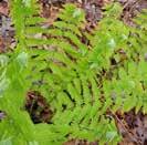
oaks, paper birch, black birch, beech, red maple, and red pine. Understory species include eastern white pine saplings, lowbush blueberry, mountain laurel, maple viburnum, bird cherry, and ferns
The entrance to the school and much of the front is landscaped with specimen trees and mulched beds
Students play on the open turf field during recess and neighbors use it after school Sumac and wild rubus vegetative buffer
Knotweed encompasses the southern tip of the property. There are undefined paths through the knotweed and onto the school property
Mature Norway maples, with bird cherry in the understory buffers views to the neighbors' yards
A patch of canopy includes a cottonwood tree and rubus understory
A stand of oak trees was recently removed, and some of their roots remain The playground is shaded by large oak trees with compromised root zones
Novel plant communities include: red oak, Norway Maple, English ivy, Norway maple, euonymous
Sumac is a native early succession plant with tremendous ecological benefits to birds and small mammals
White oaks provide high quality food for wildlife and are essential to the forest food web
Red maples are known as a foundational species, providing for local species diversity
Ferns provide forage and shelter for ground-dwelling wildlife, and sequester carbon and some chemicals
Black birch also known as sweet birch and once the source of birch beer and wintergreen oil, also host numerous wildlife species
Habitat Patches & Connectivity
The ecological landscape patterns and functions in the East Forest Park neighborhood is typical of Springfield. The school grounds are a patch of habitat within an urban residential matrix, where open space is fragmented by impervious surfaces (roadways, sidewalks, buildings, parking lots, etc.).
How does MLKCS fit into the greater landscape mosaic of patches in Springfield and the greater region? In general, vegetation at the school can serve as patch of habitat for wildlife, connecting populations found in otherwise isolated habitats. Providing corridors and patches of meadows, forest, or flower-rich roadsides can improve the resilience of insects and other wildlife populations. In addition, the gas line might already serve as a north-south corridor for plants to seed and spread and wildlife to freely move to other habitats beyond the school property
The Butterfly Effect
Like the "butterfly effect", when seemingly small occurrences have a profound effect on the whole system, what ecological and social effects can a school pollinator garden and food forest have on the greater Springfield region? The school serves children from all over Springfield, most of whom are transported by their families. Demonstration gardens at the school can impact roughly 350 students' families, who may then transfer new skills and knowledge related to pollinators, host plants, food forests, and tree canopy home to their communities all over Springfield.
A Priority Urban Forest at MLKCS
Deciduous and evergreen trees cover 30% of the land in Springfield (MassGIS Land Cover Land Use 2016). Developed open space and impervious surfaces are close to 30% each. Urban tree canopy includes street trees in open spaces, parks, and forested patches. Due to impervious surfaces and constrained spaces for trees, it is known that urban areas face increased threats from climate change such as increased temperatures, flooding, and tree loss due to extreme weather In 2020, the Massachusetts Department of Conservation and Recreation (DCR), compiled a Forest Action Plan, which reports on the current condition and future threats to trees in Massachusetts across rural, suburban, and urban landscapes. Due to the numerous environmental and public health benefits of trees, DCR has identified Springfield as a priority area for protecting and rebuilding tree canopy cover, and is a target area of the DCR Urban Community Forestry (UCF) program (Massachusetts Forest Action Plan, 2020). The forested area at the school is a valuable resource, and according to the state's recommendations, should be preserved for both people and wildlife. Selective tree cutting on school grounds should come after analysis and documentation of tree health, with the conclusion that the location of cutting is the only option for a program element.
Small Patches Make a Difference
The school has an opportunity to increase forest canopy and plant pollinator species, and contribute to the solution rather than exacerbate the problems that come with removing forest canopy and maintaining turf lawns. Native plants are important components of urban landscapes: not only do they increase biodiversity, but they provide resources for urban wildlife species.


One Back [or Front] Yard at a Time
Native plants support pollinators such as hummingbirds, bees, and butterflies, and create a foundation for the entire local food chain. Most birds rely on insects for part of their life, and many insects eat only native plants as larvae.
Even backyard seed-eating birds like chickadees and finches raise their chicks almost exclusively on caterpillars. Scientists have found that Carolina Chickadees nested more often in yards with more native trees than in yards with more introduced species. In particular, oaks, cherries, elms, and maples host the most moth and sawfly larvae—important food sources for breeding birds.
"Because backyards and lawn grass occupy over 40 million acres of the US, homeowners have the collective power to conserve biodiversity with their landscaping choices. Replacing lawns with native plants and avoiding yard chemicals are important ways to strengthen local ecosystems, one backyard at a time" (Mass Audubon).
Research has found that if a yard has more than 70 percent native plants, "chickadees have a chance to reproduce and sustain their local population. As soon as the number of native drops under 70 percent, that probability of sustaining the species plummets to zero" (Narango & Tallamy, 2018).


Martin Luther King Jr. Charter School
Forest Park
Heritage Park Treetop Park
Entry Dingle Park 83
Connectivity between forested areas (habitat patches) surrounding Martin Luther King Jr. Charter School
Habitat Patch
Habitat Connectivity
Monarda fistulosa & ruby-throated hummingbird
Asclepias syriaca & monarch butterfly
Soils Analysis
The Ground's Nutrients, Elements, and Opportunities: Soil Test Results
Soil tests were conducted throughout three areas on site: the forest north of the school building (blue), the in-ground beds directly outside of the kindergarten classes (green), and the shrub borders surrounding the play field (orange).
The northern forest and field border were chosen for testing due to their current underuse by students; the front beds were tested due to the school's request to place a pollinator garden there.
The following page summarizes these results.


Northern Forest
Field Border
Kindergarten In-Ground Beds
Soils Analysis
The Ground's Nutrients, Elements, and Opportunities
Physical Characteristics

MLKCS is located within the Connecticut River Basin; 15,000 years ago, this basin was flooded by Glacial Lake Hitchcock, which subsequently deposited sediments (small rocks and soil particles) as it collected water from rivers and eventually drained. The effect of this geologic history can be seen today, as the site is situated upon sand and gravel deposits. Such deposits are considered excessively draining, so water tends to percolate quickly, which is a soil condition favored by many plants.
The soil type on site is classified (by the Natural Resources Conservation Service) as Urban-Hinckley-Windsor. Hinckley-Windsor soils are typically sandy loam and acidic. However, this site has had a long history of development and varying land uses, so variation in soil texture throughout the property is expected.

Soil jar tests confirmed a high sand content around the property; the actual percentage varied throughout the site.
Chemical Characteristics
Soil tests obtained throughout the site provided detailed information (previous page), and revealed the following:
Soils throughout the site are acidic, with pH values ranging from 4.5-5.9. The northern forest of the property was the most acidic (4.5); this pH range is common for New England soils. Plant palettes can utilize species adapted to acidic conditions, such as many native plants.
The northern forest and field border have soils that are low in macronutrients. UMass Soil Lab defines "optimum ranges" with regards to agricultural crops, but naturally-occurring New England soils commonly have the same lower levels of macronutrients. The kindergarten in-ground beds have higher levels due to manual enrichment of soil. Plant palettes can utilize native species that are adapted to low nutrient soil conditions; edible nonnative species may need to have their soils enriched with compost.
Micronutrients are satisfactory for all areas.
Lead levels appear to be safe for all areas, and do not restrict siting of edible plants or use of spaces.
Iron and aluminum levels are well above the optimum levels defined in the northern forest. As mentioned, UMass Soil Lab defines "optimum ranges" based on agricultural crops, many of which are highly sensitive to aluminum and exhibit stunted growth. Thus, this threshold is not intended to indicate the success of native plant species, many of which are adapted to specific soil types, as some New England forest soils naturally have higher aluminum levels than this site; the current vegetation in the northern forest appears healthy and vigorous. This threshold is also not intended to indicate human toxicity levels.
Past Land Use and Soil Implications
The current school building (visible at bottom of map, property of Goodwill) was once directly south of an industrial site, Diamond Match Affiliates. This factory originally owned the two parcels that are currently forested north of the school, and sold them to Goodwill in 1999 . This Diamond Match factory relied on the New Haven Railroad directly west of the property for transportation of materials.

Aluminum starts to become bioavailable when pH is lower than 5.0; however, bioavailability becomes much more significant when pH is lower than 4.4.
The current school property was once directly adjacent to two industrial parcels, a factory and a railroad. Evidence of such land use, such as coal slag within dirt, can still be seen within the forest north of the school. Because of the potential that materials from industrial processes may have been dumped or deposited around the site and perhaps have leached elements and compounds into the soil overtime, it is not recommended that food is grown within this northern portion of the site, and is instead prioritized in other areas. If MLKCS would like a more detailed understanding of the soil in this portion of the site, conducting soil testing for heavy metals and/or contacting a licensed professional who deals with contaminated soils is recommended.

Sand Silt Clay
Coal slag found on site in northern forest
U.S. Geological Survey
Summary Analysis
Martin Luther King Jr. Charter School comprises 9 acres of both forested and developed land, surrounded on three sides by residential neighborhoods and private land to the north. Student and vehicle movement around the property is highly regulated. The school has one vehicle entry/exit point and traffic flows in one direction around the central parking lot. Students and staff enter and exit through designated doors at the front of the building. During recess, play is contained in specific zones. Overall, the forest is underused and student outdoor programming is heavily concentrated to the south and on the eastern edge.


Focus Areas
The school grounds are flat overall, with distinct areas of sun and shade, which will influence siting pollinator gardens, the food forest, outdoor classrooms, and gathering spaces. In each of these areas there are also microclimates to consider for planting and visitors' comfort. Use of the school grounds by the students and neighboring community, proximity to the building and doors, and vegetation worthy of preserving will also guide placement of design features. The presence of vegetation strongly influences the experience of the spaces on the property.
Northern Forest
The northern forest is shady, biodiverse, and stimulating, but underused as a play or learning zone. Seasonal high water in the forest is an opportunity to learn about ground water and feature wet tolerant plant species. Elevated aluminum in this area might not be an issue but further testing is recommended before suggesting a food forest here. Though a relatively flat trail exists, it is seldom used. The forest has excellent potential for meeting goals of outdoor classroom spaces and opportunities for experiential learning.
Outdoor Learning and Play Spaces
Three traditional play zones make up the outdoor play spaces used during recess, and the raised beds are used for hands-on learning. Spaces are separated and students cannot move freely between them. Though all are flat and dry, the turf area is exposed to sun. The school would like more experiential learning opportunities, which could utilize underused areas such as the forest and the open area where oaks were recently removed north of the basketball court.
Front of School
The zone directly in front of the school is heavily used with many overlapping functions. It is south-facing, open, sees a lot of movement by both vehicles and children, and is a great location for demonstration gardens for learning and enjoyment. Replacing existing turf lawn and mulch in front of the school that is not currently used for recreation or access to the building with native perennial plants and shrubs could increase foraging and nesting grounds for pollinators.
The Parking Lot
The school has one asphalt parking lot that is open and sunny, with conflicts between safety, views, stormwater and vehicles. Currently, the parking lot and play areas lack physical and visual separation, and students crossing the parking lot to access the play field poses safety concerns. Stormwater flows off the impervious asphalt, onto compacted turf, and pools in various places. Planting a bioswale and vegetative buffer would enhance views and create the feeling of separated spaces, while also assisting with water absorption. The school would also like to address the City's complaints regarding the vehicle queue that overflows onto Dorset Street during drop off and pick up times. An additional queue lane could help with this issue.
Design Criteria

Pollinator Garden
Some MLKCS staff would like to convert mowed turf lawns, mulched beds, and other highly managed landscapes to biodiverse pollinator gardens that increase the amount of larval foods, nectar, pollen, and shelter available to local pollinator species. Such pollinator gardens can also serve as a demonstration to community members that may want to do something similar in their yards.
Plants with a variety of structure, height, and color, with varied bloom times across the seasons, can take many forms, from patchworks of flowering ground covering plants to expansive wildflower meadows to perennial beds.
Criteria:
• Directly outside kindergarten classrooms, which is easily accessible and in full sun.
• Plants native to Massachusetts, and ideally non-cultivars; native species tend to thrive better in naturally-occurring soils and many local insects rely on specific species during their larval stage.
• Plants tolerant of soils that are excessively draining with lower nutrient concentrations; plants should also be able to thrive in full sun.
• Plants with variety in structure, bloom period, and host species to attract multiple types of pollinators and support them consistently throughout the year.
• Dedicated space for the movement of people within and around the garden.
• Plants without toxic parts.

Food Forest
The USDA grant focuses on establishing a food forest on school grounds to promote connections between youth and sustainable land practices. A food forest could serve as both a school and neighborhood educational resource.
Criteria:
• High sun exposure, as many plants produce more yields with higher levels; however, the forest structure should be designed to create favorable microclimates for specific species' needs.
• Visibility from the most used areas of the property, such as the front of the school; this can make the space feel more welcoming to students, staff, and neighbors.
• Connectivity to key destination points on the property and include ADA accessible path surfaces and features.
• A variety of structural layers; the garden should be designed and managed for a shrub land composition, with a mixture of sparse trees, some shrubs, and expansive herbaceous cover, which can offer high productivity (Jacke and Toensmeier, 2005).
• Involvement of local community members early on and throughout development to ensure the food forest welcomes and represents the needs of all individuals being served.
• Plants that provide a variety of functions, ranging from producing edible parts, attracting beneficial insects, and/or building up soil quality; are mostly perennials, are adapted to microclimate, soils, and anticipated climate change impacts.

Outdoor Classroom & Experiential Education
Experiential learning is a core component in the school's charter, as well as a foundation for Eagle Eye Institute's activities. Both organizations see potential for authentic learning opportunities at MLKCS, including the creation of an outdoor classroom.
Criteria:
• Accommodate about 23 students, plus support staff.
• ADA-accessible option
• Located away from or have views blocked from recreational areas (e.g., the playground) to keep students focused on learning.
• Outdoor classroom could be used after hours by students and other community members.
• Outdoor classroom and other features may be constructed by Eagle Eye youth, using resources on site (e.g., cut trees); this is an opportunity to teach forestry management practices and woodworking.
• Trail connections between educational areas to prevent soil compaction and habitat disturbance
• Additional educational features may include:
¤ Observation areas with a focus on natural processes (e.g., decomposition, forage, habitat)
¤ Areas for social and motor development (e.g., performance stage or balance beam)
¤ Interpretive signs

Pollinator Garden Plan
This pollinator garden includes perennial species native to Massachusetts that are known to attract and support many species of caterpillars, butterflies, moths, bees, and birds. Individual plants are shown at their full, mature width, and are planted in clusters to aid in identification, legibility, and weeding. Plants can be transplanted from small plugs or started from seed; if the design is established over several years, new seedlings can be separated and relocated from mature plants, and/or seeds may be spread when dry into desired areas.

ParkingLot
Key Botanical Name Common Name
AC Aquilegiacanadensis Eastern red columbine
AM Achielleamillefolium Common yarrow
AMA Anaphalismargaritacea Pearly everlasting
AS Asclepiassyriaca Common milkweed
AT Asclepiastuberosa Butterfly weed
BA Baptisiaaustralis Blue false indigo
EP Echinaceapurpurea Eastern purple coneflower
FV Fragariavirginiana Wild strawberry
LB Linderabenzoin Spicebush
LP Liatrispycnostachya Prairie blazing star
Key Botanical Name Common Name
LS Lonicerasempervirens Trumpet honeysuckle
MF Monardafistulosa Bee balm
RH Rudbeckiahirta Black-eyed Susan
SH Sporobolusheterolepis Prairie dropseed
SN Solidagonemoralis Prairie goldenrod
SNA Symphyotrichumnovae-angliae New England aster
ST Sibbaldiopsistridentata Three-toothed cinquefoil
TP Thymuspraecox Creeping thyme
VA Vacciniumangustifolium Lowbush blueberry
VP Violapedata Birdfoot violet


Raised bed
Full Plan
Main Entrance
Kindergarten Classrooms
Pollinator Garden Plan


Key Botanical Name Common Name
AC Aquilegiacanadensis Eastern red columbine
AF Agastachefoeniculum Anise hyssop
AM Achielleamillefolium Common yarrow
AS Asclepiassyriaca Common milkweed
AT Asclepiastuberosa Butterfly weed
BA Baptisiaaustralis Blue false indigo
EP Echinaceapurpurea Eastern purple coneflower
FV Fragariavirginiana Wild strawberry
MF Monardafistulosa Bee balm
PS Phloxsubulata Creeping phlox
SB Stachysbizantina Lamb’s ear
SD Salixdiscolor Pussy willow
SE Symphyotrichumericoides Heath aster
SN Solidagonemoralis Prairie goldenrod
SNA Symphyotrichumnovae-angliae New England aster
SO Solidagoodora Sweet goldenrod
SS Schizachyriumscoparium Little bluestem
TP Thymuspraecox Creeping thyme
VA Vacciniumangustifolium Lowbush blueberry
VP Violapedata Birdfoot violet
Food Forest: Axon View
This food forest incorporates numerous perennial plant species to create a garden diverse in structure, microclimates, and harvestable foods. Several constructed features encourage individuals to both steward, explore, and relax within the space.
Dwarf Trees
Dwarf or semi-dwarf varieties of fruitproducing trees make harvesting, or simply grabbing a snack, simpler for kids and others, as ladders are not a requirement.
Trunk Circle
A simple gathering space allows kids and others to relax and socialize in the shade of a tall red oak that currently stands. This area could be constructed with logs sourced on site.
Raised Beds
Annual plantings are planted in raised beds alongside the western edge of the food forest, where sunlight is ample. There are three types of raised beds: traditional beds (low to the ground and similar to the ones outside of the kindergarten classrooms), adult ADA beds (which can be wheeled up to), and child ADA beds (a smaller version of the adult form). A mixture of these three beds ensures that individuals of all ages and abilities are able to use and enjoy the space. While the school may currently not have students who use wheelchairs, these beds may be used by neighbors or future students/staff who do; additionally, ADA beds are more comfortable for individuals who have difficulties crouching or bending over.


Shed and Amenities
A small shed serves as a space to organize tools for maintenance of plants and harvesting of foods. An outdoor sink and worktable allows individuals to clean and process produce before eating or bringing it home. These features allow for easy harvesting and use of the overall food forest.
Seating
Enclosed central seating creates a welcoming gathering spot while blocking noise and views of surrounding areas. Specialty tables are lower than regular models and have a bench removed to allow for use by individuals in wheelchairs.
Sitting Nook
A bench surrounding this Dolgo crabapple trunk creates a fun and shady reading nook.
Writing Surface
A white or blackboard organizes garden tasks, notifies people of what can be harvested, and holds notes and reminders.
Entryway Trellis
A simple trellis with a trained grapevine creates a welcoming entryway into the food forest and helps denote a change in space from the parking lot and other adjacent areas.

Food Forest: Plan View
This simplified aerial view of the food forest design displays the placement of individual trees and bushes, herbaceous plant patches, and constructed features.
Wandering Paths
Mulched paths connect frequented destination points to one another. Additionally, they allow plants within the food forest to be easily accessed for maintenance and harvesting.
Garden Transition
Species that are shared with the pollinator garden, such as New England aster and anise hyssop, are located close and create a visual flow from one garden to the other.
ADA Paths
A five-foot-wide path, under 5% slope, and made of traprock gravel allows the central seating area, raised beds, and some perennials to be accessed by those with mobility issues.
Another ADA path connects the food forest area to the pollinator garden/kindergarten zone and the basketball court. Stones lining the path discourage cars from driving over the pedestrian zone, but allow students to walk onto the path from the parking lot during pick up and drop off.
See the following sheet for a detailed plant palette for this food forest.


Mushroom Logs
The shade and moisture created by the tall red oak currently on site creates favorable habitat for fungi. If MLKCS and gardeners are interested in inoculating and farming mushrooms, chicken of the woods (Laetiporus spp.) is a strong candidate. It is an easily identifiable mushroom, and grows on deciduous trees such as oak. Logs for inoculation could be sourced from the northern forest.
Sunny Microclimate
This portion of the food forest has minimal trees to encourage maximum sun reaching herbaceous plants here, all of which thrive in full sun. Most fruit trees are located north of this area to keep this area in full sun.
Shady Microclimate
As fruit trees grow and cast larger patches of shade, a cool, moist microclimate develops directly underneath and slightly north of the tree. This patch creates an opportunity to plant shade-tolerant species such as ostrich fern (Matteuccia struthiopteris). Such species should be planted later on in the successional growth of the food forest, when deeper shade is developed. This tree Dolgo crabapple tree specifically also casts shade across the central seating area as it matures.
Food Forest: Plant Palette


Groundnut can be trained onto arbors or planted at the base of a tree to wrap around its trunk.
Overstory trees may be too large for the main food forest; listed species may be planted and used within elsewhere on the property, such as the northern forest or one of the vegetated borders of the property.
Consider fall-bearing varieties that fruit during the academic year.
Thornless varieties exist for many Rubus species.
Seed clover and violets around base of trees and other areas for a groundcover that can take light foot traffic.
Concord grape should be trained onto arbors, as the species can grow too vigorously for tree stems.
The Forest: A Living Classroom
With the purpose of connecting students and community with the natural resources that lie right outside their door, the forest on the northern part of the property, just behind the elementary school, features the MLK Jr. Nature Trail and outdoor classrooms. The forest has restricted access during school hours (for the non-school community), but during other daylight hours members of the public are welcomed to park in the school parking lot and walk the trail.
ADA Accessibility
Features compliant with ADA standards include a gravel path, wooden boardwalk, and pavilion. An ADA accessible, five-foot-wide, gravel path connects the sidewalk on the east side of the building to the forest entrance and boardwalk. The 0.14 mile, five-foot-wide, wooden boardwalk loops through the northeastern forest and around an outdoor classroom.
Nature Trail
The forest trail, previously named "Perseverance Path" by the school community, contains 0.25 miles of footpaths in addition to 0.14 miles of accessible wooden boardwalk to accommodate walkers of varying physical abilities. The trail takes visitors past seasonal pools and native oak-birch-beech forest, connecting students, teachers, and the community to the natural resources in their own backyard.
Preserve vs Manage
Opportunities exist for Eagle Eye youth and MLKCS students to learn about preserving and managing plants based on forest management best practices. An initial tree survey identified large trees (with a diameter greater than 20 inches) and other species present. As noted in the MA Forest Action Plan (2020), preserving this urban forest ecosystem in Springfield is a top priority. A management strategy could include working with a professional to identify and remove invasive species, selective cutting of trees in declining health, or to make space for programming.
Outdoor Classrooms
Students can use the outdoor classrooms for more than science class. Surrounded by mature canopy trees, these gathering spaces provide a sense of being in a distinct place that is separate from the school landscape, yet close enough to the building for ease of access. On the east side, an 18-foot wide pavilion, off the accessible wooden boardwalk, has movable benches that can be placed in a ring, rows, or other configuration. The open air classroom, on the west side of the forest trail, is comprised of a ring of wooden benches.

Educational Signage

Educational signage points out ecologically significant features, such as seasonal high water, native species

Invitations to Learn and Play
The nature trail winds through diverse forest layers, with several small nodes for learning and play that are all within sight of the school. Teachers can use the trail as an extension of their classroom, fostering experiential learning in a way that would not be possible in the classroom. Invitations to learn include stumps for

A Living Classroom Design Details
Natural features and an upgraded trail in the forest encourage exploration and learning.

A welcoming forest entrance marks the threshold from the playground zone into the forest. The existing trail, "Perseverance Path," is revived and enhanced with learning, play, and exploration nodes. The accessible gravel and boardwalk path is 0.14 miles long, and the footpath totals an additional 0.25 miles.


Not all classrooms have four walls. Outdoor learning spaces allow groups to gather in a ring of benches on the northwest side of the forest, or under an accessible covered pavilion off the boardwalk loop.

Learning and movement nodes placed along the path focus attention and encourage lingering (e.g., stumps and ropes for balancing and hopping, a platform for resting or playing, and ecological concepts such as observing decomposition and plant identification).

Outdoor classroom, Williamsburg, MA B B
Community Porch
An accessible porch, surrounded by food forest elements, provides a welcoming space for the community to enjoy. This underutilized area becomes a “community porch”—perfect for an art class, an evening workshop, outdoor meals with students, weekend meetups, and more.
Arbor
Annual deciduous vines, such as cucumber or butternut squash, and perennial vines, such as concord grape, climb along a 10' by 50' arbor. The living roof provides shade in the warmer months and additional space for food production.
ADA Accessibility
Features compliant with ADA standards include a ramp (5 foot width and 5% slope) up to the cement porch. Outdoor seating can accommodate individuals in wheelchairs.
Demonstration Food Forest
A living lesson in food forests in a highly visible location, layered communities of trees, shrubs, and understory plants are working together and inviting visitors to explore and learn. This demonstration food forest not only connects students and the community to the principles of sustainable agriculture, but also features an outdoor gathering space and interpretive signage with family-friendly gardening and harvesting guides. Educational signs can highlight harvesting, seed collecting, wildlife benefits, and ways to use different plants for food or medicine.


Parking Alternative #1: Original Proposed Lot
This parking lot design includes most aspects of the draft plan developed by the engineering team, the details of which can be found on page __. Minor alterations to this draft design increase safety and ease van queuing. Rain gardens and vegetated buffers are included to address stormwater runoff and separate outdoor spaces.
Specifications:
Current number of parking spaces: 81
Proposed number of parking spaces: 106
Approximate current queue length: 925 linear ft
Approximate proposed queue length: 1435 linear ft
Stormwater Management
Asphalt takes up the majority of surface area in the southern portion of the school grounds, and is an impervious surface. To address pooling at the edges of the lot and treat runoff from added driving and parking lanes, additional drains may need to be added throughout the lot, and the capacity of the underground stormwater system should be verified.
However, rain gardens are effective features that can lighten the load such a system would have to undertake; additionally, they can be visually attractive and serve as an educational tool. Rain gardens are located directly adjacent to the largest patch of asphalt. No curb should block runoff from reaching the rain garden.
Vegetated Buffer
A collection of canopy trees, lower canopy trees, and shrubs create a living barrier between the mown play field and the asphalt parking lot/ queuing lane. This barrier blocks some views between the play zone and the vehicle zones. As mentioned, this parking lot design opens up views between the field and residents' backyards southwest of the school property, so a vegetated buffer would also assist in blocking views in this regard as well—though residents will still see parked and queuing cars. Thick vegetation between play and vehicle zones may also deter students from walking onto the queue lane.


Pedestrian Crosswalk
In the engineering team's design, the pedestrian walkway within the current parking lot was not extended, which means there was no defined pedestrian connection between the building and play field. This design extends that crosswalk, and raises it along its length, which decreases vehicle speeds; these modifications improve safety. Students would have an easier time accessing the play field through this crosswalk, rather than the path they currently use which would involve walking along the edge of the lot and crossing driving lanes.
Van Queuing


The van queuing spaces are rotated 90 degrees to help drivers align themselves within the space more easily. The van queuing station with or without this modification requires no cars to be present at the beginning of the queue strip during arrival and departure of vans.

Martin Luther King Jr. Charter School
RAIN GARDENS
Parking Alternative #2: Reorganizing the Schoolyard
This parking lot design drastically reimagines the placement and shape of the school's parking lot, in order to increase the efficiency and safety of the overall schoolyard. Considering that MLKCS already has plans to replace and expand the current parking lot, this alternative may not be drastically more expensive than others.
Specifications:
Current number of parking spaces: 81
Proposed number of parking spaces: 101
Approximate current queue length: 925 linear ft
Approximate proposed queue length: 930 linear ft
Continuous Parking and Play
The main goal of this parking lot alternative is to distinctly separate the parking lot from the students' play zones. As described, the current parking lot acts as a wall on the property, requiring students to skirt around it to reach fragmented play zones. Here, students would only walk along the edge of the lot on a raised sidewalk during pick up and drop off, and otherwise not interact with vehicular space; a vegetated border surrounding the parking lot reinforces this separation. The field is now located closer to the school, and is nestled between major zones: the school entrance, pollinator garden/kindergarten classrooms, the future food forest, and the basketball court. Students would be able to move between all these zones safely throughout the day, and especially during recess.
Vegetated Buffer
The vegetated buffer between the schoolyard and residential homes is preseved; this maintains some privacy and sense of separation. Additionally, the surface above the gas line underneath this vegetated buffer remains soil, rather than asphalt, which allows for easier gas line maintenance and no parking lot disturbance.


Pick Up & Drop Off Zone
Although the queue length for this design is roughly the same as the current parking lot, this queue contains more space for pick up and drop off than the current design or alternative number one. The queue lane along the eastern edge of the parking lot is framed by a raised sidewalk, allowing students to exit vehicles and thus the parking lot directly and safely; they can then walk up the sidewalk to enter the school or cross it to enter the play field. The longer queue lane allows many vehicles at once to access the drop off and pick up zone, increasing efficiency and decreasing time spent waiting.
Stormwater Management
A parking lot of this size and capacity involves large portions of the site being covered in impervious surface. Drains may have to be introduced throughout the lot to collect water, but the inclusion of swales and a larger infiltration basin can decrease the amount of runoff entering the underground stormwater system. The swale runs along the western edge of the parking lot and deposits water in the southernmost region of the property, where a knotweed patch currently exists. Rainwater collects and infiltrates into the soil in this area.


Martin Luther King Jr. Charter School
Turf Field
Parking Alternative #3: Queue Management
This design preserves much of the original parking lot in order to disrupt the environment as little as possible while increasing the car and bus queue area, integrating food forest layers throughout multiple vegetative zones, and treating stormwater along the edge of the parking lot.
Additional Queue Lane
To improve the safety and efficiency of the dropoff and pick-up process, an additional queue lane with separate car and bus lines is added along the southern edge of the existing lot. The lane provides an additional 800 linear feet for vehicles to line up on school property, one of the goals of the engineering team's draft design. Approximately 20 cars or 10 buses can wait in the far right lane, which is next to the permeable sidewalk. When cars and buses merge, buses have the right of way.
Green Infrastructure
Stormwater currently flows off impermeable surfaces and sometimes results in standing water, or is funneled to underground detention via one storm drain near the parking lot. In this design stormwater is captured and infiltrated as it leaves the parking lot via visible green infrastructure. Surface water flows off the parking lot, onto the permeable sidewalk, and into the bioswale, which then recharges groundwater or is piped to underground detention. (See page 27 for details.)
Parking Lot Buffer
The bioswale and band of trees and shrubs creates visual and physical separation between the impermeable asphalt parking lot and mown turf playing field. This vegetation buffer not only separates the different uses, but also provides ecological benefits. The fruit and flowers of the buffer attract birds and butterflies, the foliage provides shade and refuge for small animals, and the layered structure beautifies the area while the roots filter runoff and capture subsurface pollutants.

Connected Zones
Play zones are connected via a short nature trail through the canopy on the Eastern edge of the property. Shadetolerant food forest species are planted in the understory.

Green Infrastructure Design Details
Stormwater is treated as it leaves the parking lot via visible green infrastructure. Trees, shrubs, and herbaceous perennials that make up the bioswale, rain garden, and vegetation buffer also screen views and create a sense of enclosure of different use zones.

Permeable Asphalt
Pervious pavement and permeable asphalt may be installed in place of traditional asphalt or concrete parking lots and sidewalks, paths, or streets to infiltrate water rather than shedding it as runoff. Compared to traditional pavement, alternative materials allow rain and snowmelt to filter through layers of rock, gravel, and soil. Subsurface pipes may be installed to rout water to a storm sewer or natural channel (USEPA).

Bioswale
Designed to slow and infiltrate stormwater runoff from nearby impervious surfaces, while removing debris and pollution, a bioswale is a vegetated channel with gently sloped sides. They are typically vegetated, mulched, or xeriscaped. Plants and soil microbes break down pollutants and improve water quality, reduce the amount of water entering the drainage system, and recharge the groundwater (NACTO).

Rain Garden (See page 24)
Rain gardens are vegetated basins designed to temporarily collect and absorb stormwater runoff from impermeable surfaces such as rooftops, driveways, parking lots, sidewalks, and lawns. A garden of deep-rooted shrubs, grasses or flowers, planted in a small depression, infiltrates and recharges groundwater while building soil structure (Groundwater Foundation). When planted with native plants, they not only provide an attractive alternative to a detention basin but also support pollinators and other wildlife. To take pressure off existing infrastructure, rain gardens may be constructed around storm drains.

Works Cited
Amherst Elementary School Garden Program. "Garden Curriculum Connections." https://sites.google.com/arps.org/ amherstschoolgardens/garden-curriculum-connections
Beacon Food Forest. "Community Grows Here." https://www.beaconfoodforest.org/.
Bukowski,Catherine and John Munsell. The Community Food Forest Handbook. Chelsea Green Publishing, 2018.
Eagle Eye Institute, https://eagleeyei.org/.
Green Schoolyards America. “Inclusive Design for Outdoor Spaces.” https://www.greenschoolyards.org/inclusive-design.
Groundwater Foundation. "All About Rain Gardens." https://groundwater.org/rain-gardens/.
Jacke, Dave and Eric Toensmeir. Edible Forest Gardens: 2 Volume Set. Chelsea Green Publishing, 2005.
Louv, Richard. “Outdoors for All: Access to Nature is a Human Right.” Children and Nature Network, 2021, https://www. childrenandnature.org/resources/outdoors-for-all-access-to-nature-is-a-human-right/.
Massachusetts Forest Action Plan. (2020). Mass.gov. https://www.mass.gov/doc/massachusetts-forest-action-plan.
Mass Audubon. "Native & Beneficial Plants." https://www.massaudubon.org/nature-wildlife/plants/native-beneficial-plants.
MassGIS (Bureau of Geographic Information). Mass.Gov, Commonwealth of Massachusetts, www.mass.gov/orgs/ massgis-bureau-of-geographic-information. Accessed 26 June 2024.
MLKCS 2022-2023 Annual Report. (2023). Martin Luther King Jr. Charter School. zhttps://www.mlkcs.org/_files/ ugd/5f928b_7e10e70f69504d6da8edee7eed4ddb42.pdf.
Moran, Barbar. "A 'food forest' in Mattapan is a space to harvest food and grow community." WBUR, 2023, https://www. wbur.org/news/2023/05/25/edgewater-food-forest-mattapan-boston-food-forest-coalition.
Mulder J, N. Van Breemen, L. Rasmussen, and C.T. Driscoll. 1989. Chapter 10: Aluminum Chemistry of Acidic Sandy Soils with various inputs of Acidic deposition in the Netherlands and Denmark. In T.E. Lewis (Ed) Environmental Chemistry and Toxicology of Aluminum. Lewis Publishers, pg171-194.
Narrango, Desiree and Douglas Tallamy. "Nonnative plants reduce population growth of an insectivorous bird." PNAS, 2018, https://www.pnas.org/doi/10.1073/pnas.1809259115.
NACTO. “Bioswales." https://nacto.org/publication/urban-street-design-guide/street-design-elements/stormwatermanagement/bioswales/.
Ostmann, Julia. "Meet the Teens Changing the Face of Conservation Careers." Sierra, 2024, https://www.sierraclub.org/ sierra/meet-teens-changing-face-conservation-careers.
Springfield Public Schools. "Transportation." https://www.springfieldpublicschools.com/departments/transportation/ about#:~:text=If%20a%20student%20resides%20over,entitled%20to%20no%20cost%20transportation.
The Wildlife Trusts. "Chicken of the Woods." https://www.wildlifetrusts.org/wildlife-explorer/fungi/chicken-woods.
Trust for Pubic Land. "Springfield, MA." https://www.tpl.org/city/springfield-massachusetts.
United States Environmental Protection Agency. "Soak Up the Rain." https://www.epa.gov/soakuptherain.
