A LANDSCAPE PLAN FOR THE GREENE FAMILY PROPERTY
s 2023
Thank you to Caitlin Greene, Kristie Greene, and Howard Rich. In addition, thank you for housing us during our journeys to Hamburg from Massachusetts, and for welcoming us to your community. Thank you to the Conway faculty
staff who guided and informed the project with their expertise and grace.

i n D ex of s hee T s 1 The Greene Vision: Project Overview 2 Site Overview 3 Access and Circulation 4 Land Use History 5 The Story of Succession 6 Shrublands 7 Forest 8 Wetlands 9 Soils 10 Topography and Watersheds 11 Drainage 12 Climate + Climate Change 13 Zoning 14 Design Alternatives 15 Final Design Overview 16 Design Details: The North End 17 Design Scenes 18 Design Details: The Back Lot 19 Plant Lists 20 Planting Considerations 21 Precedents 22 Cost Estimate 23 Works Cited 25 Appendix A: Zoning 26 Appendix B: Zoning 27 Appendix C: Soil Tests
Acknowledgements
and
reene




T he c L ien T s
Kristie and Caitlin Greene, along with Howard Rich, have had roots in the Hamburg area for a very long time. They purchased this bucolic 32-acre property with visions of families getting away from the distractions of modern life, reengaging with nature in an intentional way, and overcoming isolation by bringing the community together. Their vision is about giving back and making a space where all are welcome.
What would a place that accomplished this vision look like? What might (re) introducing people to a natural New York landscape consist of? Where might ecological agriculture play a role? How can children be activated and engaged in such a space? What might be the all-season uses of the space? These were questions Kristie, Caitlin, and Howard had already been working on when they came to the Conway School.
c L ien T g oa L s f or T he s i T e
The current ideas Caitlin, Kristie, and Howard are exploring range from U-pick orchards, Christmas tree farms, a petting zoo, organic farming, farmer education programs, food truck events, walking trails, weddings, natural playspaces, craft food events, community event space, tech detox camps, and nature education opportunities for all ages. These varied ideas can be understood as desires for agricultural use of the site, recreational opportunities for all, in all seasons, and education.
The purpose of this project is to investigate what this 32-acre site can accommodate given the ecological, social, and regulatory conditions present at the site and regional scale. Analyses of the existing conditions is one major factor in determining which programming ideas may be most feasible on the site. The designs at the end of this document explore ways to meet the client's goals while incorporating the existing conditions of the site and the implications that development may have on the site.
L ocaT ion

Five miles from the shores of Lake Erie, fifteen miles south of Buffalo, sits Hamburg, New York. Residents live in a rural-feeling landscape with close proximity to city life. This area along the Erie coast was farmed by the Erie people, who grew bean, corns, and squash, before eventually becoming a part of the Haudenosaunee confederacy, also known as the Iroquois. Now, many generations of settlers work the land and contribute to local and national agricultural markets.



1/27 88 Village Hill Rd.Northampton, MA 01060 413-369-4044 www.csld.edu Not for construction. Part of a student project and not based on a legal survey. Greene Family Property 3315 South Creek Road, Hamburg, NY 14075 Designed By liam Gude + Tyson Neukirch Spring, 2023 The Greene Vision
T he g
V ision Hamburg Buffalo . Lake Erie
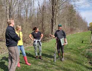
Howard, Kristie, Caitlin, and Tyson discussing the soil conditions on the site.
Liam, Kathleen McCormick, Caitlin, and Kristie discuss the scope of the project.
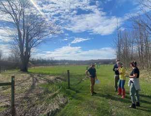
Liam and the core team explore the current experiential nature of the site.
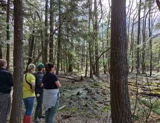
The core team explore the hemlock swamp.
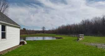
The horse fence, pond, and existing garages and house on the property.
The constructed pond is a favorite area on the site, enticing young visitors to play along its banks and observe the carp and bass that call the pond home. The roughly 100x120 foot pond is unlined, with a bottom of native clay. Our observations indicate that the water level does not fluctuate much during the year, belying the high water table at the site.


Pasture fencing still stands, and along the property lines on the east and west are legacy drainage ditches and wetland species of trees, shrubs, herbaceous plants, and animals.


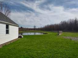
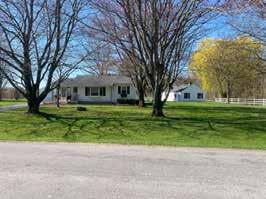
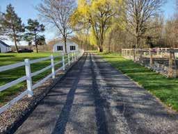


The 32-acre property is an exceptionally flat site with a narrow neck for the northernmost portion. This is where all the buildings reside: three garages and one small house. The foundation of the horse barn that burned down is still present next to the parking lot, and the horse fencing for paddocks and horse runs are still standing throughout the site. The site has a strong north-south character to it, and running in the same direction are the remnants of past agricultural use: long lines of drainage ditches and tillage lines. The northern half of the property remains cleared of trees, originally for agriculture, then maintained for pasturing horses, though a shrubland is beginning to emerge. The southern half of the property remains wooded, and this is also where known wetlands exist.

2/27 88 Village Hill Rd.Northampton, MA 01060 413-369-4044 www.csld.edu Not for construction. Part of a student project and not based on a legal survey. Greene Family Property 3315 South Creek Road, Hamburg, NY 14075 Designed By liam Gude + Tyson Neukirch Spring, 2023 s i T e o V er V iew A' A x C D x x x x x
Arrival to the site is characteristic of the neighborhood, with the house and outbuildings clustered close to the road, surrounded by a neatly kept lawn with shade trees along the road.
s i T e o V er V iew A B C D E F
Flat grasslands, some previously for pastures, have shrubs emerging.
Existing horse fencing and pastures.
Three garages and the remains of the horse barn (right).
An old raised structure near the forest edge.
E F J L I H G K G H I J K L A A'
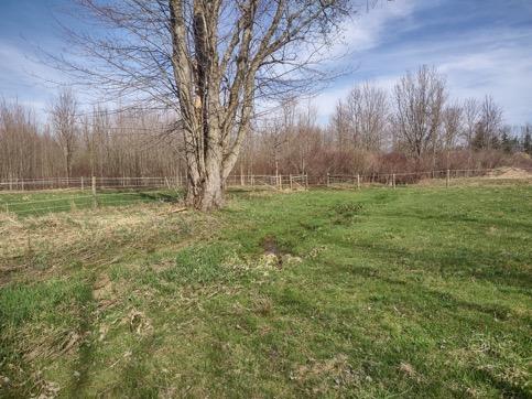
Lone maple and seasonal stream Grass and Pasture Pond Structures x x x A B
The abrupt edge of the field and forest.
Young
forest Emergent Shrubland
Grass
and Pasture
a ccess an D c ircu L aT ion

The driveway allows easy four-season access off South Creek Road to the house, outbuildings, and accompanying parking area and is well suited for personal use. The Greene family's vision of increasing public access to the site for recreational, educational, and agricultural programing will likely require changes to this existing infrastructure in order to accommodate increased vehicular flow and parking, and potentially offer access for school buses and other large vehicles while preferably separating public and private access.
Vehicular Movement and Parking
The u-shaped asphalt driveway has east and west entrances, allows for one-way vehicle traffic and provides easy access to the house and outbuildings. Both entrances are currently only wide enough for one-way traffic and their proximity to existing structures and property lines may constrain establishing two-way traffic through these areas without adjusting building placement or seeking an easement from an abutter. The outbuildings can collectively accommodate five vehicles under cover if fully parked. The north section of the paved area between the west garage and the east garage can accommodate three to five vehicles when parked at an angle, without obstructing the driveway. There is also space for another eight to ten vehicles on the foundation of the former horsebarn.

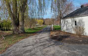
Beyond the paved driveway, all-terrain vehicles can access more of the property to the south via the turf-surfaced west access road. Currently approximately 180 feet of the north section of the west access road appear to be on the abutting property to the west. The roadbed was improved with shale slag and sand for the first approximately 1,000 feet. These improvements end just south of where the road crosses the seasonal stream via an impaired culvert. During dry conditions, 2WD vehicles can successfully navigate this section of the west access road. The road is currently not wide enough for two-way traffic but could be widened to the east if the fence were removed. The road continues along the periphery of the non-forested areas of the site but is only accessible by 4WD vehicles. The east access road is seasonally wet and impassible in many areas, with no improved crossing at the seasonal stream.
Remnant logging roads provide some access to the forested southern portion of the property. Many sections of these roads are seasonally inaccessible to pedestrians and vehicles due to wet, flooded conditions and may not be appropriate areas for increased circulation without accommodations like boardwalks.
Pedestrian Movement
There is a history of informal public access to the site for passive recreation including hiking and cross country skiing, particularly through the shrubland and forested portions of the site, but there are no discernable trails beyond the logging roads in the forest and the seasonally mowed paths along the perimeter of the property. Current patterns of pedestrian circulation through the property follow the existing vehicular circulation, much of which is seasonally inaccessible due to wet conditions. Limiting seasonal access to wet areas will be crucial to minimizing the ecological impact of current circulation patterns.

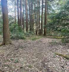
If possible, the Greene family would like to separate pedestrian circulation from vehicular circulation as they develop more programing and amenities on the site. Establishing a simple trail network that explores the stages of succession and offers four-season opportunities for passive recreation could draw more folks to the site and establish and cultivate positive relationships with neighbors. Limiting ecological impact to sensitive areas and creating visual interest will be key elements in siting a trail network.
Design Directives
• Delineate between public and private vehicle circulation.
• Separate pedestrian and vehicular circulation where possible.

• Explore opportunities for accommodating school bus access and parking on the site.
• Keep vehicular and pedestrian circulation entirely on the client's property.
• Design a simple trail network that entices visitors to explore the varied stages of plant succession on the site and minimizes impact to ecologically sensitive areas.


3/27 88 Village Hill Rd.Northampton, MA 01060 413-369-4044 www.csld.edu Not for construction. Part of a student project and not based on a legal survey. Greene Family Property 3315 South Creek Road, Hamburg, NY 14075 Designed By liam Gude + Tyson Neukirch Spring, 2023 a ccess an D c ircu L a T ion
souTh creek roaD souThcreek roaD
4WD Vehicles Pedestrians 2WD Vehicles logging roads a reas where exis T ing circu L aT ion paTT erns ex T en D B eyon D proper T y L ines
The west access road is the most improved vehicle and pedestrian access route to the areas south of the paved driveway. The east access road is often flooded and impassible in the spring.
C D E F E F C D 17.63 feet 18.9 feet A B A B
Conditions vary along the logging roads in the south of the property. Some areas are relatively dry while others remain wet or flooded for significant portions of the year.
20 feet h ouse g arage ( p arks 1) WEST ACCESS ROAD CIRCULATION ROUTES
TO
FLOODED CONDITIONS g arage ( p arks 2) g arage ( p arks 2) p arks 3-5 f oun D a T ion ( parks 8-10) P Av ED D RI v EWAY
Options for expanding both the west and east driveways are constrained by property lines and existing buildings.
THAT ARE FREQUENTLY IMPASSIBLE DUE
WET OR
L an D use his T ory
The 32-acre property has gone from mostly undisturbed forest before colonial settlement, and by the 1920's was cleared and used for agricultural enterprises. This type of agriculture involved the establishment of drainage ditches, used to drain the otherwise poorly draining soils, and the tilling of the soil to grow crops and fodder. These types of uses of the land have long lasting affects. Tilling, for example, has long-term effects on the soil structure, and in turn on plant communities. The pastures have seen disturbance in the form of regrading and reseeding with plant mixes for horse grazing, especially the northernmost pasture running the narrow neck of the property. This northernmost pasture has had drainage installed to make it drier year round. Dump sites and burial grounds for farm animals are newer additions to the history of this site. Two separate dump sites sit in close proximity to each other, just inside the forest edge, with the newer dump site sitting just outside the forest edge. The graves of horses and smaller farm animals are unmarked, save for the indents caused by the excavation of the soil, leaving depressions in the earth.
The area that was never cleared, which is where the wetlands are, is subsequently where the oldest trees on the property still stand. A logging road from the previous owner is still visible, where bur oak, ash, and black cherry were harvested. The logging road in some areas seem to be always inundated with water, and a drainage ditch appears to have been dug by the logger. None of these aspects of the history of the site directly conflict with the goals and visions stated by the clients, though they come with certain considerations. Dump sites could be leaking toxic materials, and do happen to be located near wetlands. The content of those dump sites is not known exactly. Drainage ditches that once collected water from otherwise saturated soils now harbor their own little ecosystems of plants and animals. Reviving the tillage-based agriculture would require a resuscitation of these ditches, a large task with questionable reward, considering the challenges of making small-scale agriculture profitable.
Design Directives
• Design elements that include food crops or livestock management areas should avoid areas with buried refuse, animal remains, or dump sites.


• Test the soil in the building burial pit and the dump site for heavy metals and remediate these areas as necessary.
• Take advantage of already impacted areas for development, which can mitigate increased ecological impact while also using pre-existing infrastructure (like drainage).
OCTOBER 2001
OCTOBER 202O

When the previous owner purchased the property in 2003 with the intention of establishing a horse recreation site, they demolished many of the existing outbuildings to make space for a 40x60 foot barn (right image). These structures were buried in a pit in the south west corner of the shrubland near the border to the maple plantation. When the horse barn burned down in 2021 (with all the animals inside), the collective animal remains were buried in an area in the shrubland just to the south of the southern horse paddock.
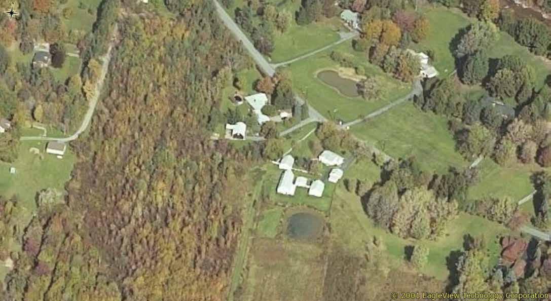

cleared and drained agricultural landscape in the oldest available aerial image of the site from 1920 (not shown), likely evidence that even with an active landscape-scale drainage network, these areas were simply too wet to justify clearing. In the 1951 image, the property, save the southern forest, appears to have been managed for pasture, while the fields to the east of the property appear to have been in a mix of crops. In 2020 aerial image (right), the imprint of past agricultural management is still highly legible on the landscape.


4/27 Not for construction. Part of a student project and not based on a legal survey. Greene Family Property 3315 South Creek Road, Hamburg, NY 14075 Designed By liam Gude + Tyson Neukirch Spring, 2023 L an D u se h is T ory 10/10/2001
This photo aerial photo from 1951 (left image) show large trees in the hemlock hardwood swamp in the southwest part of the property as well as patch of mature woodland to the northwest. These patches of forest are also visible as mature patches of forest in an otherwise
B
1951 2020
Dump sites
Animal Burials
Drainage in the north horse pasture. A rectilinear drainage ditch most likely created by a logger.
A A B
Legacy Forest Area
T he s T ory of s uccession
T he Va L ue of D ifferen T ecosys T ems on one proper T y
The Greene property is rich in habitats at differing successional stages; this is one of the exciting and ecologically important aspects of the site. But what is succession, and why does it matter?

Succession is the series of changes on the landscape as it moves from one type of ecosystem to a new stage. This transformation in ecosystem types is driven in large part by the changing plant communities. Successional stages on the Greene property can be seen in the transition from pasture land to shrubland, shrubland to young forest, and young forest to intact, older forests. This process is cyclical and spiral, as every ecosystem is always in flux between these many stages.

m anagemen T
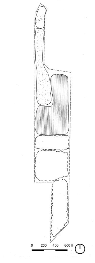
There are many forms of landscape management that aim to maintain a diversity of species. Timed mowing and burning practices maintain landscapes as meadows and shrublands, which maintains the plant communities as meadow species, and in turn protects the animal species that depend on them. Protecting and managing intact forests often involves increasing the distance between development and forests with buffers of undeveloped land, often young forests or shrublands. These buffers help maintain the levels of abundance found in these older ecosystems. Management may also look like maintaining forest paths in order to contain and mitigate human impacts to otherwise undisturbed ecosystems.
When practicing ecologically minded management, rather than conventional landscape management, a more holistic set of factors are taken into consideration. The timing of management is one such factor. For example; not mowing fields between the months of May and August, or only mowing paths that are necessary and letting the rest grow until fall, permits ground-nesting field birds to raise their young without being killed or scared away. Avoiding the use of herbicides and pesticides, and using more ecologically sensitive practices, like smothering invasive plants and hand pulling, are other restorative management practices.
Disturbances
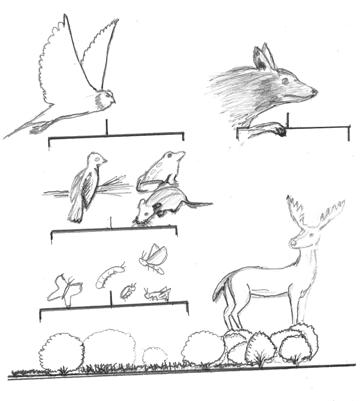
The shrubland, the young forest, and the old forest each have a host of species (plants and animals) that depend on these specific landscapes. Each stage is associated with different ecological communities. Ecological communities are the food webs and relationships of an ecosystem, and are made up of different plants and animals on a landscape. A food web is the chain of organisms that eat other organisms, such as an insect that is then eaten by a bird, which in turn is predated by a hawk. Unfortunately, some of these plant communities are threatened (such as large intact meadows, shrublands, and forests) and in turn the species dependent on them are as well. Less diverse landscapes means less diverse food webs, which in turn threatens the stability of our own food systems.
A less diverse landscape means fewer organisms to fill the different levels of a food chain, which exposes an ecosystem to greater risk. For example, If there was only one pollinator in a system and that species were to go extinct or decline drastically, this would endanger the entire ecosystem/food web. If there are numerous pollinator species in an ecosystem the whole ecosystem is in a stronger position to reproduce itself on a long-term basis.
Design Directives
• Take advantage of the multiple stages of succession on the property to create varied experiences throughout.
• Protect and improve the habitat on the property to ensure the site adds to the health of the ecosystem.

Ecologically minded management also takes into consideration plant succession. For example, removing and/or coppicing trees in a shrubland or meadow maintains the landscape as such. This keeps the landscape habitable for shrubland or meadow species. Similarly, not disturbing forests, or only doing so in places already disturbed (from a windstorm, for example) maintains the continuity required by intact, contiguous forest species like birds and mammals (oven bird, winter wren, hermit thrush, scarlet tanager, fisher cats, and porcupine).
If programming at the property were to involve conservation and wildlife education, it would be vital to ensure that the landscape management practices support the species that would make that programming and education successful. The site is a strong candidate for education on succession, the value of wetlands, plant migration, birds, and disturbance ecology studies.
Shrublands are facing developmental pressures regionally and potentially on this site. Below are some research-backed management tips for increasing shrubland birds nesting conditions, according to Shake, Moorman, and Burchell (2008).
• "Create habitat patches 15 acres or larger. If this is not possible, patches should be at least 6 acres to improve the likelihood that they will be used by shrubland bird species of conservation concern, such as the prairie warbler.

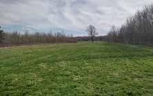
• Avoid habitat patches that are narrow and linear-shaped or that have many irregular edges, especially if they are less than 10 acres.


To reduce nest predation and increase shrubland bird breeding productivity, we recommend that managers:
• Create habitat patches that are sufficiently wide to avoid increased nest predation near cropland edges. For habitats adjacent to cropland, we recommend that patches be at least 350 ft wide.
• Maintain habitat patches with a dense and diverse growth of grasses, herbaceous plants, and low, woody vegetation (e.g., shrubs, tree saplings, and blackberries) "
5/27 88 Village Hill Rd.Northampton, MA 01060 413-369-4044 www.csld.edu Not for construction. Part of a student project and not based on a legal survey. Greene Family Property 3315 South Creek Road, Hamburg, NY 14075 Designed By liam Gude + Tyson Neukirch Spring, 2023 T he s T ory of s uccession
Pasture
Meadow/Shrubland
Young Forest
Hemlock/Black Gum Swamp
Bur Oak-Red Maple-Spicebush
Meadow habitats
Shrubland habitats
Young Forests
Mature Forests
i mpor Tan T ha B i TaT
Rich in bird habitat, the shrublands are where most of the liveliness on the property is observed. From dawn to dusk a whole host of birds can be heard and observed in the shrubland. In spring the willows (Salix sp.) bloom before any leaves have appeared, creating hazy yellow orbs in the fields, buzzing with pollinators. The ecological value of this part of the property stems, in part, from the fact that shrublands are not regionally common. In fact, shrublands in the region have been declining for decades:
“Shrubland habitat and wildlife species have been declining throughout most of New England since the 1950s. Many songbirds have been declining at a rate of 4 to 7 percent per year in New England, and these species require large openings to breed. Large shrubland openings are uncommon and today’s birds rely primarily on humans to create and maintain their required habitats” -Holm, Kerr 2016
i nsec T s
The shrublands on the Greene property are made up primarily of Salix sp. (possibly Bebb's willow, gray willow, rusty willow, and pussy willow), Cornus sp. (silky dogwood, Gray dogwood), and Viburnum sp. (arrow-wood viburnum, nannyberry). Also present were young Fraxinus sp. (black and green ash). Native willows are considered a pollinator powerhouse: they not only provide large amounts of food in the form of pollen and nectar, but they also act as host plants to butterflies and other insects (over 450 species of moths and butterflies alone!) (Tallamy 2007).
Common Name Genus Butterfly and Moth Species Supported


Oak Quercus 534
Willow Salix 456



Cherry, Plum Prunus 456
Birch Betula 413

Poplar Populus 368
Maple Acer 285
Ash Fraxinus 150
Source: Tallamy 2007
Why do insects matter?
Without healthy insect populations food webs break down, creating a cascading effect on mammals, birds, reptiles, and even humans. Without pollinators, such as moths, butterflies, flies, wasps, and bees, our own food production would begin to fail. That's why protecting and designing landscapes rich in native plants is crucial. That means more than just having flowers around: pollinators need various habitats to survive, such as contiguous shrubby areas, open undisturbed ground, and undisturbed leafy organic matter where they can overwinter, rest, and reproduce. These are landscape types that are already present on the property.
B ir D s
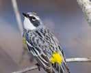
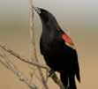
Because of the varied stages of succession on the property (primarily shrubland and forest), birds are present that prefer the structure and food sources that each provides. Nests will be built in the thicket of willow branches or even on the ground, hidden within the shrubs and grasses. Berries, seeds, and insects present in shrublands will make up most of these birds' diets. From the forest can be heard another group, those that prefer canopies for their nests and insect hunting among the trees. While many more birds probably frequent the site, these are the species observed over two days on the cusp of June 2023.






Design Directives

• Create shrubland experiences that create all-season interests for human and animal visitors. Shrublands have spring interests like early flowering willows and the return of migrating birds; paths through shrublands offer berry-picking, horse-riding, and sleigh rides.
h uman u se of s hru BL an D s
Across continents and spanning centuries, shrublands have been used by humans, and have been created by human uses both intentionally and unintentionally. Willows, which make up much of the shrubland on the property, are used to create baskets, fencing, furniture, and even pain medication in preand post-industrial countries. Willows and the crafts that rely on them may be an opportunity for programming, such as crafting lessons for children and adults, or coppicing for wood fuel to make a closed-loop farm operation. Many shrublands also consist of edible shrubs, such as blueberry, serviceberry, elderberry, hazelnut, and raspberries, to name a few native to Upstate New
6/27 88 Village Hill Rd.Northampton, MA 01060 413-369-4044 www.csld.edu Not for construction. Part of a student project and not based on a legal survey. Greene Family Property 3315 South Creek Road, Hamburg, NY 14075 Designed By liam Gude + Tyson Neukirch Spring, 2023 s hru BL an D s
s hru BL an D s
York.
Red-eyed Vireo
Red-winged Blackbird
American Goldfinch Song Sparrow
Common Yellowthroat
Northern Cardinal American Robin Yellow Warbler
Swamp Sparrow Wood Thrush American Crow
Warbling Vireo Gray Catbird
Alder Flycatcher
Red-bellied Woodpecker
Rose-breasted Grosbeak Baltimore Oriole
Blue Jay
Great Horned Owl
Winter Wren
Ovenbird
Scarlet Tanager Eastern WoodPewee
Yellow-rumped Warbler
Willow Flycatcher
"It is estimated that shrubland bird species have experienced a 70% decline in recent decades and much of that decline is attributed to habitat loss and fragmentation"- Kuhajda
2020
Example of Meadow and Shrubland Food Web
i mpor Tan T ha B i TaT
The southern half of the 32-acre property is a rich, wet forest of red maple (Acer rubrum), Eastern hemlock (Tsuga canadensis), black gum (Nyssa sylvatica), green ash (Fraxinus pennsylvanica), bur oak (Quercus macrocarpa), American beech (Fagus grandifolia), and black birch (Betula lenta), with an understory of spicebush (Lindera benzoin) and mayapple (Podophyllum peltatum). Under this forest canopy, especially in the hemlock grove, is where the coolest temperatures are to be found. In both summer and winter these dense canopies are where many species take refuge (both under and within).
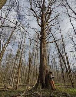

Forest landscapes that have had little recent disturbance often have high levels of biodiversity and rare species (Haney 1999 in Lapin 2005). However, these landscapes must be large enough for species to comfortably exist and thrive in. While the Greene property does not contain a large extent of any one habitat, the forest is far less disturbed than the rest of the site, and a diverse level of species (plant and animal) were present during observation. While they may not necessarily be considered true old-growth forests yet, they have many oldgrowth characteristics. They also connect to habitat beyond the property bounds.
"Our current forests are much different from the forests our native plants and wildlife adapted with over thousands of years ... many species—particularly native birds, including some woodpeckers, warblers, and thrushes, as well as certain mammals, such as fishers and martens—have been shown to reach greater abundance in forests with old-growth characteristics, such as large trees with cavities and complex canopy structures." -D'Amato,
Catanzara
k eys T one s pecies
The forest on the Greene property is an ecosystem with the ability to support hundreds of other species, from insects to large mammals. Species like oak (the bur oak is present in the Greene forest) are considered keystone species, as well as a mast species. A keystone species is the "keystone" to an ecosystem because of the unique dynamics it creates. Being a mast producer is one way oaks do this. Mast is the fruit a tree produces, in this case acorns. Acorns feed a truly vast amount of species, including humans.
[Oaks] "have become keystone species within the ecosystem and are of major importance in maintaining biodiversity. Not only do the large number of oak ... contribute to community richness but they are known to provide food and support for a substantial number of wildlife species. Moreover, the structure created by dominance of oak ... provides an environment for a highly diverse herbaceous understory." -Fralish
2004

Common Name Genus Butterfly and Moth Species Supported
Oak Quercus 534
Willow Salix 456
Cherry, Plum Prunus 456
Birch Betula 413
Poplar Populus 368
Maple Acer 285
Ash Fraxinus 150
Source: Tallamy 2007
Much like shrublands, intact forests are dwindling due to development pressures and fragmentation of ecosystems. The unique opportunity of this site lies in the chance to safeguard such ecosystems while also constructing programming that celebrates, educates, and inspires connection with shrublands and forests. In doing this arises the opportunity to learn about and connect with the myriad species that call these ecosystems home.
Two very old red maples, one near the hemlock grove and another back in the bur oak and spicebush wetland woods. The structure of old trees like these provides particular habitat that is not found in young forests. Holes, crevasses and large, plated bark all contribute to increasing the quantity and quality of habitat in a forest, subsequently increasing species abundance (Lapin 2005).
"Only 0.4% of the current forestland in the Northeast is old growth ... Nevertheless, the evidence gleaned from old-growth remnants in eastern deciduous and mixed forest and in other temperate forest types clearly indicates that old-growth forests do in many ways differ from their younger counterparts." -Lapin 2005
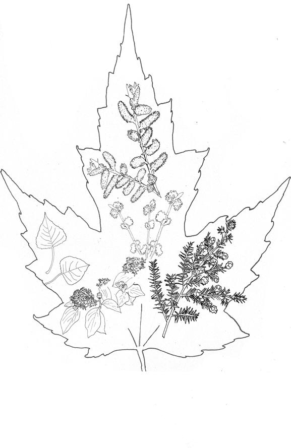
The primary woody species on site are red maples, hemlocks, and willows. Ash, cottonwood, viburnum, dogwood, spicebush, and bur oak are also present, creating a rich and diverse landscape with all-season interests for wildlife and people alike.
Design Directives
• Create forest experiences that provide all-season interests for human and animal visitors. Forests provide cool, shady experiences in the summer and animal tracking opportunities in the winter. Trails through the forests should create moments for observation, reflection, and contemplation.
7/27 88 Village Hill Rd.Northampton, MA 01060 413-369-4044 www.csld.edu Not for construction. Part of a student project and not based on a legal survey. Greene Family Property 3315 South Creek Road, Hamburg, NY 14075 Designed By liam Gude + Tyson Neukirch Spring, 2023 f ores T
f ores T
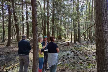
The team appreciating the peacefulness of the hemlock swamp.
w e TL an D s
In addition to providing critical habitat to a wide variety of species, wetland ecosystems provide an array of ecosystem services including flood and stormwater control, surface and groundwater protection, pollution treatment, nutrient cycling, and erosion control (DEC). Freshwater wetlands, like those found in the southern portion of the site, are also key to regional and global climate resiliency. Wetland ecosystems store roughly 20 to 30% of all estimated global soil carbon while only covering between 5 and 8% of earth's land surface. Broadly speaking, the less historical disturbance within a wetland system, the more carbon is stored within it (Nahlik and Fennessy), making the forested wetlands in the hemlock-hardwood swamp and other areas of , which have seen the least soil and vegetative disturbance of the wetlands on the site, have greater conservation value.
In New York State, the Lake Plain eco-region is home to the largest percentage of wetlands by number and total area outside of Adirondack Park. Most of the wetlands in the Lake Plain eco-region (75.4%), like those on the site, are forested. The Lake Plain region is also the region with the largest net gain in wetland coverage starting in the mid-1980s, primarily from wetlands that had been drained for agriculture reverting to wetlands, similar to those on the site (Status and Trends of Freshwater Wetlands in NYS). Through careful stewardship of the wetlands on the site, the Greene family can contribute to regional climate resiliency while offering low-impact educational and passive recreation opportunities that highlight the importance of these critical ecosystems.
Regulatory Implications

The New York State Department of Environmental Conservation (DEC) is the regulatory agency responsible for ensuring compliance with the NYS Freshwater Wetlands Act (1975). A DEC permit is required for any activity that has the potential to negatively effect any DEC delineated wetland and/or adjacent area. Activities that require a permit include construction of buildings, septic systems, and roadways; placement of fill, excavation, or grading; drainage, except for agriculture; and application of pesticides. Exempt activities include recreational activities, normal agricultural activities, and selective timber harvests for non-commercial uses (Freshwater Wetlands Program).
The DEC wetlands shown here are the approximate boundaries of the state - regulated wetlands and their respective adjacent areas and check zones (see definitions to right). To have a definitive understanding of regulatory implications for the site, the wetlands should be delineated by a DEC professional before finalizing any plans for activities that would require a DEC permit. This delineation will determine what methods are available for trail and road construction in the southern half of the property and may influence the types of agricultural and recreational activities that are appropriate in these areas. Starting in 2025, any areas that meet the DEC's wetland criteria will fall under their jurisdiction and permitting process regardless of whether they appear on the official DEC maps (Freshwater Wetlands Program).
Most of the wetlands in New York are regulated by the US Army Corps of Engineers (USACOE) under the Clean Water Act and many wetlands that do not meet the size criteria for DEC classification fall under USACOE jurisdiction. The recent US Supreme Court Case Sackett v. EPA has greatly constrained the definition of what wetlands fall under the Clean Waters Act and it is not yet clear how these changes will affect the federal regulation of any wetlands on the site that extend beyond the DEC delineated wetlands, though it is likely that they will no longer be federally protected as they do not connect directly to a federally protected surface water. While this may change the regulatory implications for this subset of wetlands on the site, it does not diminish their ecological significance to the site and the watershed. While the Town of Hamburg has additional wetlands protections that exceed state and federal regulations, they do not pertain to any of the client's proposed uses for the site.
Design Directives
• All areas within the check zone are treated as DEC wetlands in the designs to ensure that proposed activities and design details are compatible with any future delineation. To have a definitive understanding of regulatory implications for the site, the wetlands should be delineated by a DEC professional before finalizing any plans for activities that would require a DEC permit.

• Educational and passive recreational activities in delineated wetlands and adjacent areas should minimize disturbance to soils, hydrology, and vegetative communities.
• Since the boundary of the wetlands will likely expand over time, development of infrastructure in areas beyond the delineated wetlands that have hydric soils and already show signs of wetland plant communities should be limited and temporary/easily disassembled.
There are 11.05 acres of Federally Identified wetlands on the site as mapped by the US Fish and Wildlife Service as part of the National Wetlands Inventory. These are classified as palustrine (inland, non tidal wetlands with trees, shrubs or emergent vegetation) forested wetlands with a mix of hardwoods and conifers and are predominantly seasonally saturated with some areas having standing water for extended periods during the season and others normally lacking visible surface water but having a saturated soil profile for extended periods of time. The USOCE has its own official maps that are it uses for regulatory purposes but this layer is a useful proxy.
There are of 1.82 acres of New York DEC identified forested/ shrub wetlands on the site though these are part of a contiguous wetland of 96 acres.
The DEC also classifies wetlands based on criteria that rate their ecological significance and the ecosystem services they provide ranging from Class I wetlands, which provide the most ecological benefits, to Class IV wetlands, which provide fewer benefits (6 CRR-NY 664.5). All of the DEC Identified Wetlands on the site are listed as Class II wetlands.
There is a 100' buffer around DEC Identified Wetlands referred to as the 'adjacent area.' These areas are not wetlands but they are regulated by the DEC to prevent disruption and impairment of the wetlands they surround.
Nearly half of the site (16.1 acres) falls under the DEC Wetland Checkzone. This zone includes areas adjacent to DEC Identified Wetlands that have soils, hydrology, and plant communities typical of wetlands. Based on field observations, it is likely that much of the area in the check zone would meet these criteria.
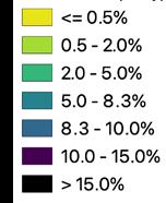
90%+Likelihood of Hydric Soils
Hydric soils are formed under conditions of saturation, flooding, or ponding long enough during the growing season to develop anaerobic conditions in the upper part (NRCS). While not all hydric soils are classified as wetlands, they are a key wetland indicator. Hydric soils preclude or complicate many forms of development and agricultural use including septic leach fields, tillage based agriculture, and most building construction.
8/27 88 Village Hill Rd.Northampton, MA 01060 413-369-4044 www.csld.edu Not for construction. Part of a student project and not based on a legal survey. Greene Family Property 3315 South Creek Road, Hamburg, NY 14075 Designed By liam Gude + Tyson Neukirch Spring, 2023 w e TL an D s ny Dec chec k Zone
ny D ec w e TL an D B uffer ( a D jacen T a rea ) ny D ec w e TL an D f e D era LLy i D en T ifie D w e TL an D s L ike Ly h y D ric s oi L s
The site's silt loam soils have a high clay content and are rich in nutrients but are poorly drained, are prone to compaction, and produce surface runoff.



The soils on the site derive from deep deposits of fine silt and clay particles that accumulated on the lakebeds of a series of glacial lakes that extended beyond the shores of modern Lake Erie during the period of the Wisconsin glaciation (Calkin). These rich, fine textured sediments support a diversity of native plant species that thrive in fertile, wet soil conditions. However, this same combination of particle size and moisture makes the soils on the site highly susceptible to compaction, which can further impede drainage and increase the likelihood or surface pooling and runoff.
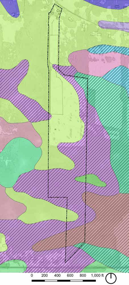
Soils on the site range from somewhat poorly drained to very poorly drained. The Churchville silt loam soils on the north and west of the site are classified by the USDA as "somewhat poorly drained" but are the best drained soils on the site. These areas still show signs of a seasonally high water table, including oxidized root zones within the top 12" of the soil profile, evidence that the soils experience both aerobic and anaerobic conditions during the growing season. Well drained soils are crucial to most forms of agriculture, particularly farming practices that rely on tillage, including most annual fruit, vegetable, and flower production, which is why most of the commercial vegetable production in Erie County is done on sandy or gravelly loam soils or soils with engineered drainage. Without engineered drainage, the soils on the site are not well suited for intensive agricultural production.
In areas where coarser textured fill has been added to the native soil surface, like the west access road and the horse run, the surface is drier and more stable in wet conditions than the unaltered soil. If increased circulation, access, and public amenities are developed on the site, using similar techniques may be helpful in compensating for the poorly drained soils.
The Churchville silt loam soils have the best drainage potential of the soils on the site. All of the existing infrastructure is located on this soil type.
Soil Types and Characteristics
The horse run and west access road have improved drainage from the addition of coarse fill.
18.38 acres (50.92%) of the site is Churchville silt loam, listed by the USDA as Prime Farmland if drained. This classification denotes a combination of soil properties, favorable climatic conditions, and water availability suitable for the economic production of a wide range of crops if the soils can be adequately drained. This classification, in part, explains the past agricultural use of much of the site when there was an actively maintained, landscape-scale, drainage infrastructure. Churchville silt loam is the relatively well drained soil on the site but still experiences a seasonally high water table in the spring and becomes extremely hard in dry conditions, particularly in compacted areas.
14.46 acres (40.06%) of the site is Canadice silt loam, listed as a Farmland of Statewide Importance. These soils tend to have a high seasonal water table, are poorly drained, and may meet the criteria for hydric soils (see below). They are not well suited for most forms of agriculture and based on soil type and observation in the field, these soils experience saturation and surface ponding during spring conditions.
Recreational and educational activities in these areas may need to be restricted during wet periods to avoid soil compaction. Strategies such as boardwalks could potentially allow for lowimpact circulation during wet conditions.
1.98 Acres (5.4%)
.94 Acres (2.6%)
.33Acres (<1%)
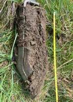
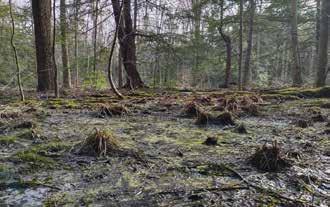
Even in the relatively well drained areas of the site, soils show evidence of a seasonally high water table like the oxidized root channels that appear rust colored , a sign that even near the surface, conditions are water-logged and anaerobic for part of the year. Soils in the paddocks, shrublands and maple plantation show evidence that they were once tilled for agriculture, with uniform color and texture through the top 8 plus inches of soil , while the soils in the hemlock-hardwood swamp are representative of soils undisturbed by tillage, with diffuse transition between a dark organic layer at the surface and the mineral soil below .
Design Directives
• Tillage based agricultural practices should be minimized or avoided altogether on the site unless engineered drainage is added. Perennial crops, limited seasonal grazing, and agroforestry practices may be more appropriate agricultural activities for most of the site.
• Buildings, parking areas, and other high impact design elements and activities should be sited in areas of the site with the Churchville silt loam soils since these are the best draining soils on the site.
• The poorly drained soils are likely not suitable for standard septic systems and a percolation test should be performed prior to siting any structure requiring wastewater disposal.

• When selecting plant communities, native plants that are successful in wetland conditions should be prioritized, particularly in areas where they will be planted into native soil.
• Utilize raised beds, planting on berms, and other approaches to elevating plant root zones above the seasonally high water table.
Poorly Drained Soils With Extreme Limitations for Development
17.38 acres (48.12 %) of the site are rated as poorly to very poorly drained, have a 90% or greater chance of meeting the criteria for hydric soils, and have a C/D or D hydraulic classification (see below).
Hydric soils "are formed under conditions of saturation, flooding, or ponding long enough during the growing season to develop anaerobic conditions in the upper part (NRCS Hydric)." While not all hydric soils are classified as wetlands, they are a key wetland indicator. Hydric soils preclude or complicate many forms of development and agricultural use including septic leach fields, tillage-based agriculture, and most building construction.
Hydraulic Classifications of C/D to D denote soils that have high runoff potentials, low water infiltration rates, high water tables, and high clay contents. These soils pose challenges to for development and agricultural use because they are prone to compaction, poorly suited for stormwater infiltration, and can contribute to nonpoint source pollution of surface waters due to their high runoff potential (NRCS Hydraulic).


9/27 88 Village Hill Rd.Northampton, MA 01060 413-369-4044 www.csld.edu Not for construction. Part of a student project and not based on a legal survey. Greene Family Property 3315 South Creek Road, Hamburg, NY 14075 Designed By liam Gude + Tyson Neukirch Spring, 2023 s oi L s A B s
oi L s
C D
A B C D
B C
A
D
T opography an D w aT ershe D s


The extremely flat nature of the site means that water tends to stay where it falls and surface flow can be easily altered by small changes to grade.
The entire site lies between 769 and 782 feet above sea level, with the low point of the site along the east side of the pond and high point along a small rise in the Hemlock-Hardwood swamp in the south of the property. Nearly the entire site is less than 2% slope (30.11 acres or 83.34% of the site), which is generally considered the slope at which an area, such as an athletic field, can still feel flat but effectively drain water. Many areas are less than 0.5% slope (8.85 acres or 23.49%), essentially dead flat.
The imprint of past land use on the topography of the site and the neighborhood is evident, with rectilinear patterns running parallel or perpendicular to property boundaries, which are remnants of drainage ditches or other soil disturbance in areas that have a history of tillage-based agriculture. The topographic patterns in southern portions of the site are more curvilinear, likely due to the fact that the forested wetlands in this area were unfit for tillage-based agriculture.

When combined with poorly draining, predominately hydric soils, the extremely flat nature of the site means that water tends to stay where it falls. It also means that even small alterations to topography can significantly alter surface flow. Depressions become puddles and ponds and raised areas become dams.
Watersheds: Macro to Micro

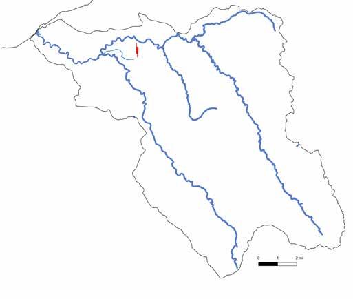
The site is situated in the Eighteenmile Creek (EC) sub-watershed of the larger Niagara River/Lake Erie Watershed. Located 1.75 miles east of the convergence of Eighteenmile Creek and an unnamed stream. Water from the site flows into both of these streams and eventually drains to Lake Erie, roughly 5.25 miles west of the site as the crow flies and between 9 and 10 miles via Eighteenmile Creek's serpentine stream channel.
There are four much smaller watersheds and catchment areas active at the site scale (see map at far right for descriptions and delineations). These areas were determined by using GIS analysis to delineate channelized flow and calculate flow direction based on topography and slope. While water on most of the site eventually drains to Eighteenmile Creek, water that falls within the pond's catchment area does not have an outflow and remains on site. Small grade changes, particularly around these existing micro-watershed and catchment area boundaries can significantly alter how water moves on the site and where it eventually outflows. Most of the water draining to and falling on the site eventually drains to or through the seasonal stream channel. Land use in this micro watershed has a direct impact on the water quality of the stream. The areas around this channel and the other channels on the site that drain into it are opportunities to improve water quality on the site and downstream. Additionally, much of the pond's catchment area is on site, providing the same balance of responsibility and opportunity to protect and improve water quality.
Design Directives
• Consider development buffers around the seasonal stream and pond that limit or exclude animal access, vehicle access, pedestrian access, and storage of potential pollutants.
The solid blue lines of various shades on this map represent channelized flow, both human-made and natural, the darker the tone, the more water is collected in the channel. Slope determines the directional flow of these channels, which in turn, determine the boundaries of the micro watersheds and catchment basins.
(north BranCh)
The pond has a small catchment area (shown in green), collecting water from much of the north paddock and part of the neighboring property.
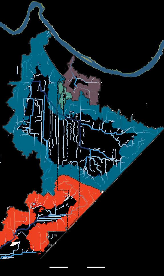
Water enters the site from the fields, forests, and residential areas to the east and north, moving west/ northwest across the site and eventually into the north branch of Eighteenmile Creek.
The small ridge in the hemlock-hardwood swamp is a watershed break, with water in the south of the site draining an unnamed stream that joins Eighteenmile Creek where the north branch and south branch converge.
10/27 88 Village Hill Rd.Northampton, MA 01060 413-369-4044 www.csld.edu Not for construction. Part of a student project and not based on a legal survey. Greene Family Property 3315 South Creek Road, Hamburg, NY 14075 Designed By liam Gude + Tyson Neukirch Spring, 2023 T opography an D w a T ershe D s
EigthEEnmilECrEEk
Drains to unnamed stream.
souThcreek roaD % Slope h igh p oin T 782 fee T ( waT ershe D B reak ) seasonaL sTream L ow p oin T 769 fee T aT eas T s L i D e of pon D a L ong T he proper T y L ine \
raiLLine h ickox r oa D
BuffaLo
Lake Erie Eighteenmile Creek
Stream Sub Watershed Boundary Site
South Branch of Eighteenmile Creek
Unnamed
D rainage
Surface flow, drainage ditches, and a seasonal stream bring water onto the site, where it tends to linger, especially where outflows back up onto areas with hydric soils. These inflows, together with a storm drain infrastructure at the north of the property move water off the site, albeit slowly.
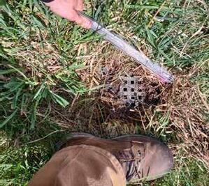
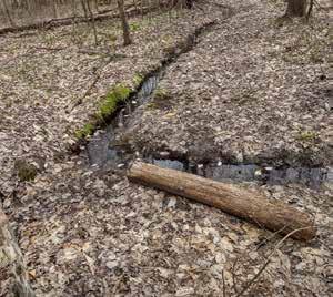
Water drains to the site from the fields, forests, and shrublands to the east and north through a combination of surface flow and drainage ditches that empty into the seasonal stream channel that bisects the site. Most of the site also drains to this channel which carries water off site to the northeast, where it drains to Eighteenmile Creek. In places where this movement is impeded by vegetation, silt, or grade changes, water backs up and pools. The seasonal stream was once channelized in a clay pipe but was daylighted by the previous owner of the property. The culvert where the stream channel runs under the west access road is undersized and shows evidence of pooling on both the inflow and outflow sides.
The remnants of a landscape-scale network of drainage ditches that were used to drain fields for agricultural use border portions of the east and west boundaries of the site. Like most of the drainage ditches in the neighborhood, the ones on the site are no longer actively maintained. They have filled with sediment over time and are now home to their own wetland plant communities. Water pools in these ditches, particularly during the spring. Though surface water is absent during dryer periods, the soil in these ditches remains moist.
Water in the wooded southern portion of the site collects in the forested wetland and eventually drains west/southwest towards the South Branch of Eighteenmile Creek. Water also pools along the network of logging roads in this part of the property and in any other natural or human-made depression, limiting access and circulation in these areas, particularly during the spring and early summer when water tables are highest.
There is a small catchment area that drains to the pond, which receives water from the eastern half of what is now the north paddock and most of the horse run. There is also inflow from the property to the east. The previous owner also installed two tile drains in the north paddock, which connect to the outflow of the drainage ditch along the eastern property line and drain into the pond from the south. There are two drains under the east side of the barn foundation which drain into the north end of the pond. With no surface water inflows or outflows to recharge and oxygenate the pond, it is particularly susceptible to eutrophication, low dissolved oxygen levels, and nutrient loading. Any activity within the pond's small catchment area will have a direct effect on the water quality of the pond. Strategies for protecting the pond from nutrient loading and pollution from runoff should be considered in the design process.
The north end of the site is also tied into the Erie County stormwater system, which parallels South Creek Road. The outfall from this storm drain system enters the channel of the seasonal stream downstream of the site, before entering the north branch of Eighteenmile Creek. There are two storm drains situated in the utility easement between the northern property line and the road which drain water from the front yard. A third storm drain captures untreated stormwater from the paved parking area. Tying into this conveyance system may be useful, given the challenges of dealing with stormwater on site, but opportunities to pre-treat this runoff should be explored to protect water quality down stream.
Design Directives

• Pre-treat stormwater runoff from buildings, impervious surfaces, and agricultural fields prior to discharge into surface waters and storm drains.


• Site new buildings, parking lots, and roads so that they can overflow to existing stormwater infrastructure wherever possible.
• Design of buildings should include stormwater capture to diminish the stormwater runoff impacts to the surrounding landscape.


• Protect the pond from nutrient loading and pollution by minimizing polluting activities within the pond's catchment basin.
• Consider options for restoring the seasonal stream including establishing wetland plant communities, repairing the culvert, protecting from grazing, and potentially regrading the inflow and depth of the channel where the stream bisects the property


• Consult with a hydrologist and abutting land owners when considering any major alterations to the seasonal stream channel or drainage ditches.
11/27 88 Village Hill Rd.Northampton, MA 01060 413-369-4044 www.csld.edu Not for construction. Part of a student project and not based on a legal survey. Greene Family Property 3315 South Creek Road, Hamburg, NY 14075 Designed By liam Gude + Tyson Neukirch Spring, 2023 D rainage DRAINAGE DITCH SEASONAL STREAM small channels and surface Flow Poorly drained, hydric soils storm sewer line C D E
B B D amage D cu LV er T seasona L s T ream poo L ing an D s L ow mo V emen T of surface waT er , par T icu L ar Ly in areas wi T h hy D ric soi L s D rainage T i L e L ines A
A
Storm drains collect water from the parking area and the area between the house and South Creek Road.
E F D C
Water stagnates and pools where the outflow of the seasonal stream and the west drainage ditch connect on the west side of the failing culvert.
The seasonal stream where it bisects the property.
The pond's small catchment area includes inflows from tile drains installed by the previous owner.
Water in the southern part of the site collects in the forested wetlands, eventually draining to the south branch of Eighteenmile Creek.
F
A drainage channel made in the red maple - bur oak swamp in the south of the property in an attempt to move water off the network of logging roads.
L imaT e + c L imaT e c hange
Moderated by the lake effect, Hamburg sits in a narrow climactic band along the eastern shore of Lake Erie where winter temperatures are warmer than most of the state and the region. Situated in USDA Zone 6a with well distributed summer rainfall, the region is well suited to agricultural and horticultural production of a wide variety of crops, though as local farmers will tell you, the killing spring frosts often come well into May and fall frosts return in late September/early October. The lake effect is also responsible for high winter snowfalls, averaging over 105 inches per year. A recent storm in November of 2022 dropped 81.2 inches of snow over a four day period.
Climate Averages Hamburg, New York United States

Rainfall 42.4 in. 38.1 in
Snowfall 105.6 in. 27.8 in.
Precipitation 170.2 days 106.2 days
Sunny 157 days 205 days
Avg. July High 80 degrees 85.8 degrees
Avg. Jan Low 16 degrees 21.7 degrees

Comfort Index (higher=better) 6.2 7
Design Directives
• Design and site buildings, parking areas, and other key infrastructure with heavy snow-loads in mind.
• Cluster uses to maximize the efficiency of snow removal.
• Roofs of temporary and permanent structures should have a steep pitch to easily shed snow and have sufficient clearance for mechanical snow around the perimeter, and be south facing for adding solar photovoltaics
• Plan for ponding and excessively wet soil conditions.

• Prioritize native wetland plants in areas that are likely to experience increased periods of excess soil moisture.
In addition to rising temperatures, the Erie County Climate Vulnerability Assessment (2020) identified increases in extreme precipitation events and flooding, and an increase in frequency and severity of high wind events as the three top climate-related hazard categories facing Erie County. Due to the poorly drained heavy soils, increases in extreme precipitation events are particularly worrisome.
In their report Anatomy of a Wet Year: Insights from New York Farmers, researches from Cornell and The Nature Conservancy shared key findings from farmer experiences from 2017's record rainfall, which showed that:

• Crops grown on clay soils suffered an estimated 53% loss in crop yield and crops grown on gravelly, sandy, or siltier soils suffered estimated crop yield losses of 25% or less.
• In addition to yield losses, 95% of farmers said the quality of their crop was negatively impacted.
• 30% of farmers said they would have increased their drainage infrastructure, including adding tiling and drainage ditches, if they had known how wet 2017 would be.
12/27 Not for construction. Part of a student project and not based on a legal survey. Greene Family Property 3315 South Creek Road, Hamburg, NY 14075 liam Gude + Tyson Neukirch Spring, 2023 c L ima T e c hange 88 Village Hill Rd.Northampton, MA 01060 413-369-4044 www.csld.edu
c
g enera L Z oning
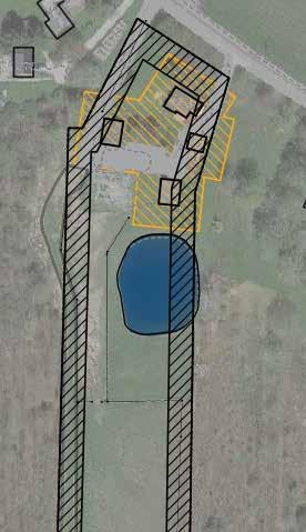
The zoning district of Residential-Agricultural (R-A) permits agricultural land uses with some restrictions. Regulations most directly related to the client goals are listed below.
Setbacks and Buffers
Setbacks are where buildings and other structures are not permitted:
Front of property: 40 foot setback
Sides of property: 30 foot setbacks
Rear: 50 foot setback
Existing Structures: 30 foot buffer around existing buildings.
Front and Side Yard Setbacks
a gricu LT ure
Concerning buildings for animals, the zoning regulations stipulate that "Buildings, pens and runways for the confinement of livestock or poultry shall be at least 100 feet from any property line" (Hamburg Zoning Document). This may not apply to horses who are neither livestock nor poultry. The previous owner of the property had a horse barn built 30 feet from the property line that apparently also held other farm animals.
Height of farm buildings: No limit. Farm buildings shall be no closer to side or rear lot lines than their heights.
s T ormwaT er
Any development disturbing one or more acres will need to have a stormwater pollution prevention plan (SWPPP) that specifies how erosion will be minimized during construction. See Appendix A for the required elements of the stormwater pollution prevention plan.


arking
In order to maintain a residential aesthetic, zoning in the R-A district tries to keep parking inconspicuous by limiting on-street parking and suggesting how on-site parking should be organized. See Appendix B for more details. Off-street parking (parking on the property): For "institutions of a religious, charitable, rehabilitative or philanthropic nature ... no off-street parking is allowed in front of the principal structure." This means no parking is permitted between the residential building on site and the road if the project fits any of the above categories.
Where should parking go?
In addition to regulatory setbacks, wetland regulations and other ecological considerations (forest buffers and shrubland preservation) help demarcate where parking should not go. Together this information reveals the least problematic areas to consider for parking. But functionality is the third consideration for parking placement. Parking should be near main activities while not intruding on them, and placement should not impede the function of other uses of the space. For the above reasons the most suitable locations for parking are on the northern section of the property. This places parking near already developed, and hence impacted, areas. It also keeps parking near primary activities based on client goals (recreation, picnicking, and gardening along the "neck" of the property).
Maximum Height of Buildings


Dwellings: 2 1/2 stories, not to exceed 35 feet.
Accessory buildings: one story, not to exceed 18 feet.
Noise
Sleep-disturbing noises shall mean any unnecessary and unreasonably loud or disturbing sounds occurring during the hours between 11:00 p.m. and 7:00 a.m. (See Appendix B). Any programming that involves live music or other loud outputs will need to conform to these hours.
30'
Best places for parking
Prime
30'
50'
Pasture
13/27 88 Village Hill Rd.Northampton, MA 01060 413-369-4044 www.csld.edu Not for construction. Part of a student project and not based on a legal survey. Greene Family Property 3315 South Creek Road, Hamburg, NY 14075 Designed By liam Gude + Tyson Neukirch Spring, 2023 Z oning
p
Z oning
Avoid developing on wet soils and shrublands
side yard setbacks
recommended buffer around pond for water quality
PARKING SUITABILITY
stream buffer
40' FRONT YARD 30' SIDE YARD 30' SIDE YARD 30' Buffer around Exising Structures
areas for recreation/agriculture
The following design alternatives were informed by site analyses; the broad project themes of recreation, agriculture, and education; and design elements proposed by the Greene Family. The designs each highlight and emphasize a different aspect of the project goals. Subsequent feedback from the Greene Family led to the final design.

Birds, Berries, and Sanctuaries
This design celebrates the rich successional ecology of the site and welcomes the public with a parking area for 12 vehicles, a natural play area to the south of the pond, and meandering paths through wildflower meadows, shrublands, and forests.

Pros:
• Natural play space for children at a safe distance from road, pond, and parking.

• Creates spaces for visitors to experience solitude while surrounded by plant communities.
• Celebrates ecological succession by welcoming visitors through the whole property.

• Design can accommodate multiple uses, such as birdwatching, free play, picnics, and educational experiences.
Cons:
• Seasonal maintenance required to maintain the meadows and shrubland.

Meeting House
Making space for horses and people to gather is the theme here. A horse barn is located at the extant parking lot, with an additional parking lot for around 25 cars hidden in the back, where a large social space surrounded by pollinator gardens, pastures, and shrublands is the primary focal point of this design.

Pros:
• Picnic space near the pond accommodates smaller gatherings.
• Opportunities for equestrian recreation and larger social events.
• Paths bring visitors through rich, dense shrubland habitat where guests can acquaint themselves with the shrubland suite of species.
Cons:
• Parking may still be difficult for larger gatherings (more than 30 cars)


• Seasonal maintenance would be required to keep shrubland from transitioning to forest.

• Large costs may be associated with extending utilities to event space and the options for septic may be limited by soils.
Erie Plain Agriculture Re-imagined
Diverse forms of agricultural production that are adapted to the conditions of the site offer broad opportunities for programming, partnership, and community interaction.
Pros:
• Includes areas for raised bed vegetable and fruit production, and a small community orchard. Designated appropriate areas for seasonal grazing, mushroom production, and woody polyculture for cut flowers.
• Multiple parking areas allow guests to park close to their chosen activity.
Cons:
• Climate change is likely to increase severity of precipitation events in Erie County and investing in agricultural infrastructure on a site with poorly draining soils is a risk.
• Large costs may be associated with extending utilities to orchard barn and the options for septic may be limited by soils.

88 Village Hill Rd.Northampton, MA 01060 413-369-4044 www.csld.edu Designed By liam Gude + Tyson Neukirch Spring, 2023 D esign a LT ernaT i V es
Pavilion and pollinator gardens Expanded parking Natural play space Contiguous meadow matrix Paths and a second pond Forest paths and boardwalk Picnic area Barn and parking for twenty Edible woody plantings Expanded driveway for bus access Parking Area Wetland edibles Revegetated stream Raised beds Greenhouses Path with pollinator gardens and winter interest plantings Hidden parking lot Event barn with patio and plantings Pastures Paths through shrublands
Pastures Parking is unchanged Picnic area Pollinator garden spiral and pavilion Horse barn with solar
Opportunities for recreation, education, and climate-resilient agriculture abound in the proposed conceptual design and can be developed over-time in proportion to community interests as the Greene family continue to deepen their relationship to place. Distinct zones of activity are connected by thematic design elements that provide the scaffolding for educational, recreational, and agricultural programming that honor client requests and celebrate the site's diverse succussional habitats.

Vehicle Circulation and Parking

Visitors enter the site via the expanded west driveway A and continue along the improved west access road to the singleloaded parking area B that provides space for ten vehicles including one handicap-accessible van space. The location brings visitors to the hub of community activity with easy access to the natural play space, pavilion, and orchard garden. Public vehicle access is limited to this corridor to minimize the ecological footprint of the infrastructure and contribute to the sense that the site becomes less developed,quieter, and increasingly wild as one moves from north to south. Access for four wheel drive vehicles continues past the public parking area, providing access to the horse paddocks, shrubland, and forests for trucks, UTVs, and tractors.
Places to Gather, Places to Play, Places for Quiet Reflection
Open-air structures, natural rooms, and seating areas situated throughout the site invite folks to come together and offer opportunities for solitary reflection. An area dedicated to nature-based play C extends south from the pond D to the timberframed pavilion E . A wooden pergola F nestled among native wildflowers and flowering shrubs in the garden offers a shady spot for visitors to take in views of the orchard garden.
Community-Engaged Agriculture


Climate-resilient agricultural practices adapted to the site's ecological conditions abound and offer opportunities to partner with school groups, extension researchers, and the broader public. Infrastructure-intensive activities are sited in the orchard garden G where raised-bed vegetable and cut-flower production is situated amongst rows of fruit trees and pollinator gardens. To the south, the blueberry orchard H takes advantage of the site's nutrient-rich, wet, acidic soils to grow a crop beloved by the community. An area dedicated to free-range poultry I amidst mast-bearing trees is nestled between the edge of the maple plantation and southern limit of the horse paddocks. In the agroforestery area J a culinary mushroom yard utilizes bolts cut from selectively harvested hardwood trees from the maple plantation, cultivating nutritious yields while encouraging a more diverse forest canopy and understory to establish over time.
Trails
A sinuous network of trails invites the public to explore the site's diverse habitats and zones of activity. A combination of crushed stone paths and raised boardwalks, the trail system offers opportunities for passive recreation for all users and minimizes the ecological impact to sensitive areas while offering folks opportunities to interact with the site's spectacular forests, wetlands, and shrublands. In addition to solo and group recreation, the trail system offers access for educational programs focused on birdwatching and wetland ecology.
Horse Infrastructure
The barnyard at the north of the property includes a 40 x 60 foot barn L and adjacent horse run M , keeps these high impact areas close to existing utilities and infrastructure. Located to the south of the seasonal stream, three paddocks N for rotational grazing share a central shade structure and water station.
15/27 88 Village Hill Rd.Northampton, MA 01060 413-369-4044 www.csld.edu Not for construction. Part of a student project and not based on a legal survey. Greene Family Property 3315 South Creek Road, Hamburg, NY 14075 Designed By liam Gude + Tyson Neukirch Spring, 2023 f ina L D esign o V er V iew F G H The "North End"
f ina L D esign o V er V iew
The "Back Lot"
N D I J L E A B C M ft
Design Details: The North End
A Clarified Arrival Experience A

An expanded western driveway provides two way public access to the site and can also accommodate large vehicles for farm deliveries. The east driveway is reserved as a private drive and the area around the house is screened from the public access with native shrubs and wildflowers.
A Quiet Private Residence Remains B
The house, small garage, and yard are kept as a space for visiting family members or short-term rental guests to say during the summer months, or a home for a farm caretaker to live yearround. Keeping this area as a private residence also helps maintain the residential character of the neighborhood is a spatial buffer between the close neighbors and more public uses of the property to the south.
Barnyard C
The barnyard is the threshold between private and public space on the site. The 40'x60' barn is sited on the existing building pad. Close to the existing outbuildings, this location allows for easy connection to existing utilities and stormwater infrastructure, takes advantage of an already impacted area with relatively good drainage, and keeps animals within easy access during the snowier months. A roof-mount PV array provides electricity to the farm. A large rainwater catchment system from the metal roof is stored in a cistern and provides irrigation to the surrounding landscape and backup livestock water via an electric pump while minimizing the concentrated stormwater discharge to the surrounding landscape.
A small horse run extends to the south between the road and the pond. Horses can be led to the pastures in the back lot along the road or can walk along the trail through the nature-based play space and orchard garden before reconnecting with the road just north of the seasonal stream
Pond D
The pond edge teems with life. Native wetland plants filter stormwater, provide abundant insect habitat, and encourage visitors to engage more directly with the water in the designated use area on the south shore. Here, children play at the waters edge or walk out onto the observation platform to catch a glimpse of the pond's giant carp. On the north edge of the pond, a stone fire pit with natural log seating is a favorite spot for the Greene Family to gather.
Nature-Based Play Area E

Under a growing canopy of native trees and shrubs well suited to endure rambunctious play, natural play structures made from site-harvested materials make this spot is a favorite of children and caretakers alike. A crushed stone trail from the parking area and pavilion lead to a shaded picnic area near the pond with four wheelchair accessible picnic tables. Nestled between the pond, barnyard, and orchard garden, this open space can also be used for nature-based wellness programs for people of all ages.
Pavilion F
A 20'x30' timber-framed pavilion stands at the heart of the community space. This flexible three-season space serves as a shady spot for picnics, educational workshops, music, and farm-to-table meals.
Orchard Garden G
Crushed stone paths through native pollinator gardens lead to a small but productive space for growing vegetables, cut flowers, and perennial fruits. Raised beds are used to improve drainage for annual crops and a gothic - style greenhouse provides space for seed-starting and growing specialty crops. A dedicated tool shed ensures that everything needed to tend to the garden is close at hand. A small apiary to the south of the greenhouse helps keep the gardens humming with pollinators. While the site's soils and drainage characteristics are not well suited to commercial production, this space could be a be home to a community or educational garden, a micro-enterprise, or intensive homestead production.
Boardwalk Trail to the Back Lot H
Visitors gather on the grass lawn between the orchard garden and the seasonal stream, where the crushed stoned trail transitions to a wooden boardwalk. Natural log seating invites them to stay and relax a while on their way to or from their excursions in the back lot, where orchards, shrublands, and trails await.
Riparian Restoration I
A 50-foot wide buffer from the seasonal stream is planted to native wetland herbaceous plants and wildflowers that filter stormwater and bringing a diversity of textures and colors to this part of the site. An open bottom box culvert supports the road, extending beyond bankfull width, allowing the stream to flow unimpeded off the property to the northwest

A D E I
B C F G ft H
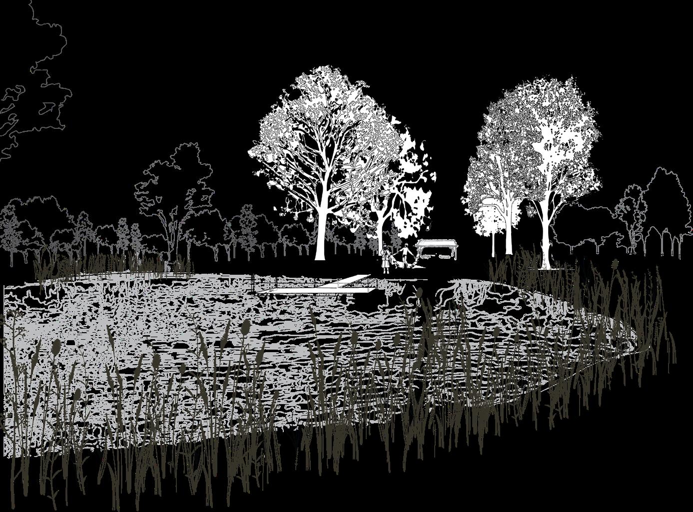
Standing at the north end of the pond looking south to the doc, a diversity of wetland species add texture and color to the pond edge in addition to filtering stormwater. The canopy of red maple, bur oak, swamp white oak, and cottonwood provide shade to the naturebased play area beyond while maintaining long views to the south towards the pavilion and orchard garden.


Under shade of the lone maple, a family stops on their way to the orchards in the back lot to observe a bald eagle soaring over the shrublands. A favorite spot for local birdwatchers, the observation deck is the first stop on the boardwalk trail that connects the north end of the property with the back lot. Moving south along the boardwalk, visitors cross the seasonal stream and its restored wetland buffer and through an outdoor room surrounded by wild edibles on their way to the u-pick orchards.

17/27 88 Village Hill Rd.Northampton, MA 01060 413-369-4044 www.csld.edu Not for construction. Part of a student project and not based on a legal survey. Greene Family Property 3315 South Creek Road, Hamburg, NY 14075 Designed By liam Gude + Tyson Neukirch Spring, 2023 D esign s cenes
Orchards
Orchards are accessed from the boardwalk that connects the northern neck of the property with the wider back lot. Before reaching the orchards, visitors pass through an open room surrounded by edible and wetland shrubs.


Pastures
Visitors coming down the horse path can enter the pasture via the centralized node where each rotational pasture connects with shade and water. Pasture trees of hackberry, black willow, and tulip tree act as natural shade for the horses. These are wet tolerant native species that grow quickly and are nontoxic to horses.
Shrublands


The native shrubland plantings give this otherwise flat site a sense of mystery and depth. Throughout the season flowering shrubs of viburnum, spicebush, dogwoods, and willows will splash the landscape with color. Later in the season and into winter their berries will stand out in the leafless and snowy landscape, attracting photographers, nature-lovers, and animals alike.
Trails
The trails through the wet woodlands grant visitors the opportunity to walk alongside very old trees, underneath dense hemlock groves, and over rich wetlands.
A note on trail construction: The placement and construction of boardwalks and trails should be pursued with a trail building expert that takes into consideration the experiential nature of the trails, the ecological impact of the placement and methods used, the goals of the trails, and the accessibility of the trails. This is all doubly important when building trails in ecologically sensitive, and environmentally important habitats, like wetlands (which do exist in these forests).
Pastures
The paddock entrance is consolidated; this is where shade and water are provided. This system allows for the rotation of paddocks if desired, as well as a central water filling station.
A boardwalk over wet soils leads to an outdoor room before continuing to the orchards.
Pastures for horses
Orchard berms for blueberries or other fruits in enough abundance for a U-pick operation.
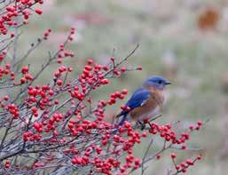

Trails through native shrublands are wide enough for horses and wild enough for animal spotting, providing all-season sights and uses.
Chicken tractors, which can be moved all over the property, are situated under shade trees amidst the fields and shrublands, where chickens can graze.
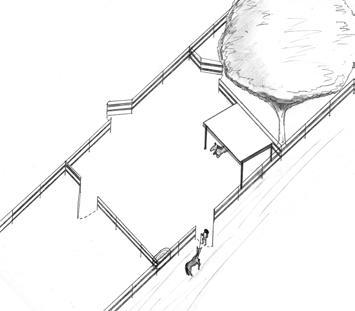

Mushroom cultivation in young hardwoods can be used for education and income.
Trails lead to boardwalks throughout the hemlock and black gum wetlands, permitting visitors to embrace the peaceful, wet woodlands.


18/27 88 Village Hill Rd.Northampton, MA 01060 413-369-4044 www.csld.edu Not for construction. Part of a student project and not based on a legal survey. Greene Family Property 3315 South Creek Road, Hamburg, NY 14075 Designed By liam Gude + Tyson Neukirch Spring, 2023 T he B ack L o T
D esign D e Tai L s : T he B ack L o T
Road Access
Orchards
Path Access Path Access Path Access
Shrublands
A A' A A'
Back Lot Design
The Playspace Plantings
Criteria: Native trees that can tolerate compaction from foot traffic, are fast growing, and provide shade. Must be compatible poorly draining, acidic, soils with a high clay content.
Common Name Latin Name Height & Width in Feet Notes
Red Maple Acer rubrum H 60 x W 40 Good fall color, very versatile and resilient tree
Bur Oak Quercus macrocarpa H 70 x W 80' Mast producer: good tree for feeding wildlife and farm animals (not horses)
Swamp Oak Quercus bicolor H 60 x W 60' Mast producer: good tree for feeding wildlife and farm animals (not horses)
Cottonwood Populus deltoides H 100 x W 70' Fastest growing, but more prone to broken limbs
Pollinator Garden
Criteria: Native herbaceous and woody plants that provide food and habitat to pollinators throughout the seasons, are visually striking, and are compatible with poorly draining, acidic, soils with a high clay content.
Common Name Latin Name Wetland Status/ Notes
Agricultural Trees and Shrubs
Criteria: Plants that are edible to humans and can withstand poorly draining, acidic, soils with a high clay content.
Note: all edible plants should be planted on berms to raise their roots from the high water table.
The Shrubland Matrix
Criteria: Shrubs that are native to the regional food web, provide all-season food, and are ompatible with poorly draining, acidic, soils with a high clay content.
Color and Bloom Time
Early Goldenrod Solidago juncea Yellow, Summer to fall
New York Ironweed Vernonia naveboracensis FACW Purple, Late summer
HollowStem Joe Pye Weed Eutrochium fistulosum FACW Pink, Late summer
Wild Blue False Indigo Baptisia australis FACU Blue, Spring to early summer
New England Aster Aster novaeangliae FACW Pink/purple, Late summer
Blue Vervain Verbena hastata FACW Blue/purple, Summer to fall
Marsh Blazing Star Liatris spicata FAC Pink, Summer
Common Sneezeweed Helenium autumnale FACW Yellow, Late summer to fall
Ox Eye Sunflower Heliopsis helianthoides UPL Yellow, Summer
Lance Leaved Coreopsis Coreopsis lanceolata FACU Yellow, spring to summer
Black Eyed Susan Rudbeckia hirta FACU Yellow, Summer
Butterfly Milkweed Asclepias tuberosa FACU Orange, Spring to summer
Riverbank Wild Rye Elymus riparius FACW
Canada Wild Rye Elymus canadensis FACU
Partridge Pea Chamaecrista fasciculata FACU Yellow, Summer
Indian Grass Sorghastrum nutans UPL
Red Fescue Festuca rubra FACU
Little Bluestem Schizachyrium scoparium FACU
Button Bush Cephalanthus occidentalis OBL White, Summer
Pussy Willow Salix discolor FACW White/yellow, Spring
Pagoda Dogwood Swida alternifolia White, Late spring
Silky Dogwood Swida amomum
Key:
OBL: Obligate wetland species
FACW: Usually found in wetlands

FAC: Sometimes found in wetlands
FACU: Usually found in uplands
UPL: Obligate uplands species
Common Name Latin Name Height & Width in Feet Notes
Highbush Blueberry Vaccinium corymbosum
H 5-8' x W 5-8'
Pear Pyrus H 15-20' x W 12-15' Semi-dwarf variety encouraged
Peach Prunus persica H 15-20' x W 12-15' Semi-dwarf variety encouraged
American Persimmon Diospyros virginiana H 50' x W 40' Native variety is a large tree. Can be pruned or allowed to become canopy tree. Fruits must fully ripen to be eaten.
Asian Persimmon Diospyros kaki H 15-20' x W 12-15' Less cold resistant than native, but ripen faster
Paw Paw Asimina triloba H 25' x W 15' Native fruit tree. Requires first two years in dappled shade
Plum Prunus H 15-20' x W 12-15' Semi-dwarf variety encouraged
Elderberry Sambucus H 12' x W 6' Medicinal, should be boiled before consumed
Concord Grape Vitis labrusca Grown on horizontal trellis Require high potassium levels and a pH of 6.5 (soil would need to be amended).
Shade Trees in the Pastures (and chicken tractors)
Criteria: Not toxic to horses, can tolerate wet, acidic, clay soils.
Common Name Latin Name Height & Width in Feet
Hackberry Celtis occidentalis H 40-60' x W 40-60'
Black Willow Salix nigra H 30-60 x W 30-60'
Tulip Poplar Liriodendron tulipifera H 70-90 x W 35-50'
Chicken Tractor Plantings
Beb's Willow Salix bebbiana H 25' x W 25'
Red Mulberry Morus rubra H 40-60' x W 40-60
Bur Oak Quercus macrocarpa H 70 x W 80'
Common Name Latin Name Height & Width in Feet Notes
Winterberry Ilex verticillata
H 20' x W 12' Beautiful red berries in winter.
Possum Haw Ilex decidua H 15' x W 12'
Silky Dogwood Swida amomum H 12' x W 10' Red stems provide winter beauty.
Grey Dogwood Swida racemosa H 15' x W 15' White berries.
Red-twig Dogwood Swida sericea H 8' x W 8' Bright red stems, strong winter interest.
Flowering Dogwood Cornus florida H 15-30' x W 15-25'
Highbush Cranberry Viburnum trilobum H 12' x W 12' Edible berries.
Arrowwood viburnum Viburnum dentatum H 10' x W 10'
Wild raisin Viburnum nudum/ cassinoides
H 10' x W 10'
Nannyberry Viburnum lentago H 18' x W 10'
Beb's Willow Salix bebbiana H 25' x W 25'
Pussy Willow Salix discolor H 15' x W 12'
Meadow Willow Salix petiolaris H 10' x W 10'
Shining Willow Salix lucida H 20' x W 20'
Red Chokeberry Photinia arbutifolia H 10' x W 6'
Black Chokeberry Aronia melanocarpa H 10' x W 6'
Highbush Blueberry Vaccinium corymbosum H 5-8' x W 5-8' Edible berries.
Meadow-sweet Spiraea alba H 4' x W 4' Steeplebush Spriaea tomentosa H 4' x W 4'
Male-berry Lyonia ligustrina
H 12' x W 20'
Smooth Alder Alnus serrulata H 20' x W 15'
Swamp Azalea Rhododendron viscosum H 5' x W 5'
Spicebush Lindera benzoin H 12' x W 12'
Serviceberry Amelanchier canadensis, laevis, arborea, and sanguinea
H 25' x W 15' Edible berries.
19/27 88 Village Hill Rd.Northampton, MA 01060 413-369-4044 www.csld.edu Not for construction. Part of a student project and not based on a legal survey. Greene Family Property 3315 South Creek Road, Hamburg, NY 14075 Designed By liam Gude + Tyson Neukirch Spring, 2023 p L an T L is T s
p L an T L is T s
p L an T ing T ips
Because the property is so flat, wet, and with fine texture soils, choosing the plants that can flourish in these conditions is vitally important. However, there are methods to grow plants that otherwise would not thrive in such conditions. Such methods involve raising plants' roots from the poorly drained soils. This can be done with raised beds and berms, respectively. Beds can be used for smaller plantings, while berms are used for larger plantings.
For Pollinator Garden


Pollinator Tip: If planting with plugs (as opposed to seeds), group species in clusters. If planting by seed, some annual management to clump species after germination can be done. Planting by plugs is more expensive and takes more immediate labor, resulting in a more organized planting. Seed spreading can create a more wild and meadow-like planting. Either way, the plantings will change over time. Succession and change is part of the fun!
Planting in wet soils
Planting above the soil level with berms increases plant success in wet soils.
Planting in wet soils
There are two methods for planting in wet soils. Both methods raise the roots from the saturated soils:
1
) Planting with the root collar above the soil level
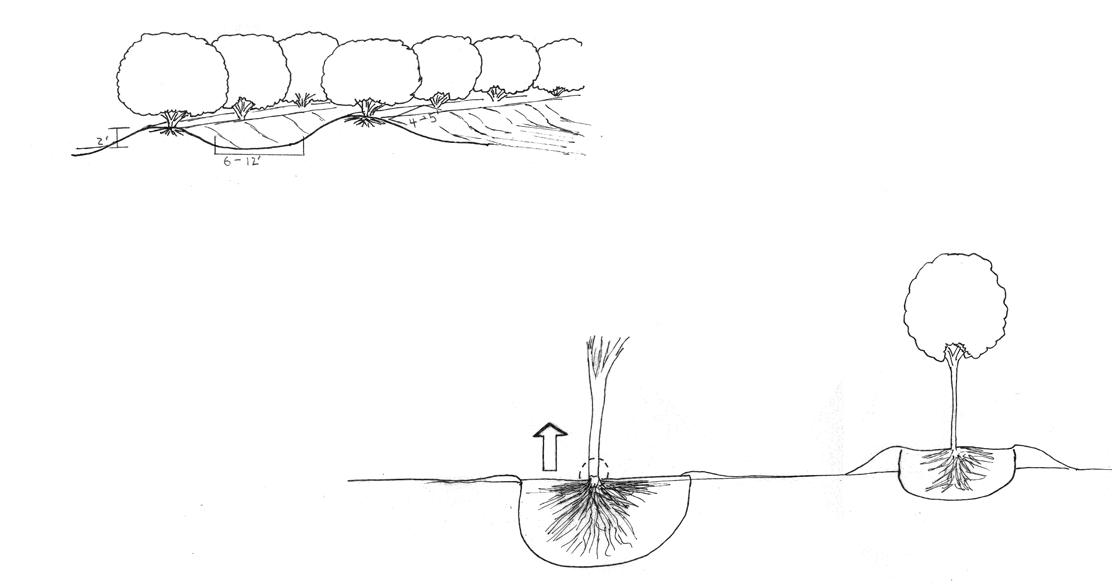
2
) Planting above soil level with berms

The native red mulberry (Morus rubra) is a preferred fruit by humans, chickens, and wildlife.



The buttonbush's (Cephalanthus occidentalis) unique white orb flowers are a pollinator powerhouse, and also look exquisite.
New York Ironweed's (Vernonia naveboracensis) tall purple flowers create beautiful structure in a pollinatorfocused planting design.
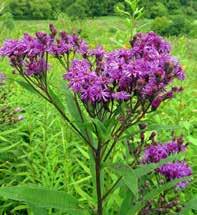
Helianthus autumnale, is a staple member of any pollinator garden, and provides late season blooms for butterflies and bees.
Winterberry (Ilex verticillata) holds on to its berries throughout winter, livening up winter landscapes and providing a vital food source for over-wintering birds.

20/27 88 Village Hill Rd.Northampton, MA 01060 413-369-4044 www.csld.edu Not for construction. Part of a student project and not based on a legal survey. Greene Family Property 3315 South Creek Road, Hamburg, NY 14075 Designed By liam Gude + Tyson Neukirch Spring, 2023 p L an T ing c onsi D era T ions
p L an T ing c onsi D eraT ions
Pollinator Garden with paths and benches
Tulip Tree (Liriodendron tulipfera) in autumn
Cottonwood (Populus deltoides) in autumn
The wide canopy of a field grown bur oak (Quercus macrocarpa)
1 2


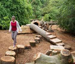

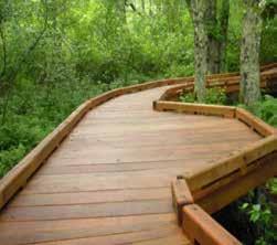


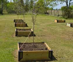

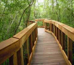


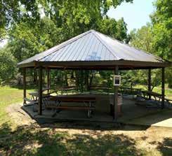

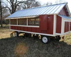


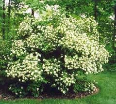
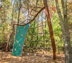


21/27 88 Village Hill Rd.Northampton, MA 01060 413-369-4044 www.csld.edu Not for construction. Part of a student project and not based on a legal survey. Greene Family Property 3315 South Creek Road, Hamburg, NY 14075 Designed By liam Gude + Tyson Neukirch Spring, 2023 p recenen T s p rece D en T s n aT ura L p L ay spaces B oar D wa L ks B erms an D r aise D B e D s p o LL inaT or g ar D ens f L owering s hru B s m ushroom c u LT i VaT ion p aV i L ions g o T hic roof g reenhouses c hicken T rac T ors r e V ege TaT e D p on D e D ges

22/27 88 Village Hill Rd.Northampton, MA 01060 413-369-4044 www.csld.edu Not for construction. Part of a student project and not based on a legal survey. Greene Family Property 3315 South Creek Road, Hamburg, NY 14075 Designed By liam Gude + Tyson Neukirch Spring, 2023 c os T e s T ima T e c os T e s T imaT e Item (and area) Quantity Unit Cost/Unit Total Cost Notes PHASE 1 Plantings: Pasture + Chicken Canopy (2-3 feet tall) 11 Each $50 $550 Plantings: Recreation Canopy, (2-3 feet tall) 20 Each $50 $1,000 Plantings: Orchard Trees/Shrubs (plugs) 450 Each $6.20 $2,790 Assumed blueberries as chosen fruit Orchard Berms Created $7,500.00 $12-15 per cubic yard Barn (40'x60') 2,400sq.ft 1 LS $144,000 $144,000 Horse Fencing 1 LS $2,000 $2,000 Reuse old fencing Shade Structure for Horses (25'x18') 450' SF $15 $6,750 Stormwater Drainage Needs to be considered Total for Phase 1 $164,590 PHASE 2 Plantings: Edible Shrubs/Trees 17 Each $50 $850 Plantings: Pollinator Garden 1 LS $2,500 $2,500 Estimate assumes use of plugs: Seed will be cheaper, while plugs will be more intentionally designed Plantings: Shrubland Paths 1 LS $5,000 $5,000 Parking (10 parking spots) 1 LS $8,000 $8,000 Greenhouse (55'x20') 1 LS $30,000 $30,000 Pavilion (20'x30') 1 LS $45,000 $45,000 Shed (25'x12') 1 LS $3,000 $3,000 Raised Beds (4'x20') materials and soil 20 Each $500 $10,000 Gravel surfacing (85x60'x4" depth) 1 LS $3,000 $3,000 60 yards Picnic Tables 4 Each $400 $1,600 Stormwater Drainage Needs to be considered Total for Phase 2 $108,950 PHASE 3 Chicken Tractor (2) 2 Each $400 $800 Apiary 1 LS $2,500 $2,500 Boardwalk 650' LF $70 $45,000 $60-80 per foot Dock (210 sq ft) 210' SF $70 $14,700 $60-80 per foot Stormwater Drainage Needs to be considered Total for Phase 3 $63,000 PHASE 4 Boardwalk 650' LF $80 $52,000 $60-80 per foot Mushroom Cultivation LS $2,000 $2,000 Total for Phase 4 $54,000 Grand Total: $390,540 SF: Square Feet LF: Linear Feet LS: Lump Sum
Shrublands
Song Sparrow: By Rhododendrites - Own work, CC BY-SA 4.0, https://commons. wikimedia.org/w/index.php?curid=118193669
American Goldfinch: By Breck22 - Own work, CC BY-SA 3.0, https://commons. wikimedia.org/w/index.php?curid=32276284
Red-winger Blackbird: By Charles Homler d/b/a FocusOnWildlife - Own work, CC BY-SA 4.0, https://commons.wikimedia.org/w/index.php?curid=132224768
Red-eyed Vireo: By John Benson from Madison WI - Red-eyed VireoUploaded by Snowmanradio, CC BY 2.0, https://commons.wikimedia.org/w/index. php?curid=7723653
Yellow Warbler: By Mdf - Own work, CC BY-SA 3.0, https://commons.wikimedia. org/w/index.php?curid=2145326
American Robin: By en:User:Mdf - Own work, CC BY-SA 3.0, https://commons. wikimedia.org/w/index.php?curid=253938
Northern Cardinal: By Rhododendrites - Own work, CC BY-SA 4.0, https:// commons.wikimedia.org/w/index.php?curid=115093761
Common Yellowthroat: By Rhododendrites - Own work, CC BY-SA 4.0, https:// commons.wikimedia.org/w/index.php?curid=105248018
Swamp Sparrow: By Cephas - Own work, CC BY-SA 3.0, https://commons. wikimedia.org/w/index.php?curid=19418982
Wood Thrush: By Charles J. Sharp - Own work, from Sharp Photography, sharpphotography.co.uk, CC BY-SA 4.0, https://commons.wikimedia.org/w/index. php?curid=130686357
American Crow: CC BY-SA 3.0, https://commons.wikimedia.org/w/index. php?curid=2310490
Willow Flycatcher: By photo credit Jim Rorabaugh/USFWS - http://www.fws.gov/ southwest/es/arizona/images/Rorabaugh/Willow%20flycatcher%20Glendale%20 AZ3%20D4.jpg, Public Domain, https://commons.wikimedia.org/w/index. php?curid=9398160
Gray Catbird: By Hari Krishnan - Own work, CC BY-SA 4.0, https://commons. wikimedia.org/w/index.php?curid=89881817
Warbling Vireo: By John Harrison, CC BY-SA 3.0, https://commons.wikimedia. org/w/index.php?curid=6037955
Alder Flycatcher: By Cephas - Own work, CC BY-SA 3.0, https://commons. wikimedia.org/w/index.php?curid=7513505
Baltimore Oriole: By TonyCastro - Own work, CC BY-SA 4.0, https://commons. wikimedia.org/w/index.php?curid=81518401
Rose-breasted Grosbeak: By John Harrison, CC BY-SA 3.0, https://commons. wikimedia.org/w/index.php?curid=6038070
Blue Jay: By Rhododendrites - Own work, CC BY-SA 4.0, https://commons. wikimedia.org/w/index.php?curid=103770921
Great Horned Owl: By Greg Hume - Own work, CC BY-SA 3.0, https://commons. wikimedia.org/w/index.php?curid=28866977
Red-bellied Woodpecker: By Ken Thomas - KenThomas.us(personal website of photographer), Public Domain, https://commons.wikimedia.org/w/index. php?curid=1663200
Eastern Wood Pewee: By Jim Conrad - JIM CONRAD'S NATURALIST NEWSLETTER. Mostly written in Yokdzonot and issued from a ciber in Pisté Yucatán, MÉXICO.http://www.backyardnature.net/n/08/081020.htmhttp://www. backyardnature.net/n/08/081020pw.jpg, Public Domain, https://commons. wikimedia.org/w/index.php?curid=6138982
Yellow-rumped Warbler: By Chuck Homler - Own work, CC BY-SA 3.0, https:// commons.wikimedia.org/w/index.php?curid=19117960
Ovenbird: By Rhododendrites - Own work, CC BY-SA 4.0, https://commons. wikimedia.org/w/index.php?curid=123591552
Scarlet Tanager: By Bmajoros - Own work, CC BY-SA 4.0, https://commons. wikimedia.org/w/index.php?curid=47481226
Winter Wren: By Rhododendrites - Own work, CC BY-SA 4.0, https://commons. wikimedia.org/w/index.php?curid=114651150
Willow Basket: https://royalimports.com/shop/wholesale-floral-baskets/dark-stainwillow-round-rustic-baskets-set-of-3/
Children crafting with willows: http://www.monalisaarts.co.uk/willow.html
Living willow hedge entrance: https://www.pinterest.com/ pin/68750331800575940/
Land Use History
October 2001 Aerial Image: https://gis.erie.gov/Html5Viewer133/index. html?viewer=ErieCountyNY.HTML5_2_11_0
October 2020 Aerial Image: https://gis.erie.gov/Html5Viewer133/index. html?viewer=ErieCountyNY.HTML5_2_11_0
1951 Aerial Image: https://www3.erie.gov/sites/default/files/images/ aerialphotos/1951/51_2H104.jpg
The Plant List
Pollinator Garden: https://www.union-bulletin.com/lifestyles/pollinator-gardensare-beautiful-and-beneficial/article_eaf587fe-6ac0-11e9-ae83-db3d6ff7f8f8.html
Quercus macrocarpa: https://www.pinterest.com/pin/129548926753367219/
Liriodendron tulipfera: https://www.lovetoknow.com/home/garden/tulip-tree
cottonwood: https://www.pinterest.com/pin/294985844315258835/ Red muluberry: https://www.rarexoticseeds.com/en/morus-rubra-seeds-redmulberry-seeds.html
Buttonbush: https://naturalcommunities.net/products/cephalanthus-occidentalisbuttonbush
Common Sneezeweed: https://fineartamerica.com/featured/commonsneezeweed-helenium-autumnale-dr-nick-kurzenko.html
New York Ironweed: https://www.pinterest.com/pin/new-york-ironweed-vernoianoveboracensis-photograph-taken-at-independence-marsh-beaver-county-paconservation-distr--336362665897435980/
Ilex verticillata: https://www.pinterest.com/pin/206743439133601541/
Precedents
Natural Playspace: https://www.quietnature.ca/natural-landscapes/landscapeservices/natural-play-spaces/
Stumps and logs playspaceL https://www.pinterest.ca/pin/513832638712741766/
Log play structure: https://www.pinterest.co.uk/pin/99290366757926050/
Verticle Play Space: https://www.beavercreekreserve.org/learn/nature-nooksobstacle-course/
Boardwalks: https://trailbuilders.com/index.php
All-persons boardwalk: https://www.massaudubon.org/places-to-explore/wildlifesanctuaries/allens-pond/accessibility
Swale: https://www.permaculturenews.org/2015/05/10/200m-swale-systemplanting-job-noosa-area-queensland-australia/

Raised fruit trees: https://www.pinterest.com/pin/garden--65161525843206596/
Residential Pavilion: joystudiodesign.com
City Park Pavilion: https://carlylelake.com/park-pavilion-rentals/
Pollinator Garden with Pavilion in back: https://medium.com/climate-conscious/ why-planting-a-bee-garden-is-good-for-pollinators-good-for-the-planet-and-goodfor-you-100de8a228e2
Pollinator Garden: https://cincinnatizoo.org/polinator-garden/
Flowering Silky Dogwood: https://www.thespruce.com/growing-silky-dogwood5091600Mushroom cultivation logs: http://www.vermontmushrooms.com/ outdoorcultivationmethods.html
Fruiting Logs: https://e-cultivationtheory.blogspot.com/2013/01/growing-shiitakelentinus-edodes-on.html
Child with Chicken Tractor: https://www.summerinajar.com/chicken-tractor/
Large Chicken Tractor: https://www.backyardchickens.com/articles/largeportable-chicken-coop.66459/
Gothic Greenhouse: https://www.gothicarchgreenhouses.com/cust_tann.htm
Large Gothic Greenhouse: https://www.growerssupply.com/prod/gs1_ commercial_greenhouses/104841C.html
Flowering arrowwood viburnum: http://plants.minorsgardencenter.com/12100004/ Plant/495/Arrowwood
Revegtated Pond with intentional plants and seating: https://www.jonathan-rhind. co.uk/blog/rewilding-a-holistic-approach-to-biodiversity-net-gain-in-your-project/ Rewilding pond edge with dock: https://www.elmorecourt.com/journal/rewildingproject-plans/
Back Lot Design
Paths through shrubland: https://jrdingwall.ca/portfolio/2017/09/01/hort27/ Wet Forest Boardwalk: https://www.pinterest.com/pin/451415562642170754/ Blueberry orchard: https://www.onlyinyourstate.com/new-york/buffalo/u-pickblueberries/
Winterberry Bluebird: https://ajgphotography67.blogspot.com/2016/12/thewinterberry-bush_28.html
Boardwalk through tall grass: https://www.flickr.com/photos/ darkstream/3558653725
23/27 88 Village Hill Rd.Northampton, MA 01060 413-369-4044 www.csld.edu Not for construction. Part of a student project and not based on a legal survey. Greene Family Property 3315 South Creek Road, Hamburg, NY 14075 Designed By liam Gude + Tyson Neukirch Spring, 2023 w orks c i T e D w orks c i T e D p ho T o a TT ri B u T ion
Tallamy, Douglas W. “Chapter 12.” Bringing Nature Home: How You Can Sustain Wildlife with Native Plants, Timber Press, Portland, OR, 2020, p. 147.
Catanzaro, Paul & D'Amato, Anthony. 2022. Restoring Old-Growth Characteristics to New England's and New York's Forests. 10.13140/ RG.2.2.22226.84163.
Calkin, Parker E. “Strand Lines and Chronology of the Glacial Great Lakes in Northwestern New York.” The Ohio Journal of Science, vol. 70, no. 2, Mar. 1970, pp. 78–96.
Fralish, James S. 2004. The Keystone Role of Oak and Hickory in the Central Hardwood Forest. Gen. Tech. Rep. SRS-73. Asheville, NC: U.S. Department of Agriculture, Forest Service, Southern Research Station. pp. 78-87
Freshwater Wetlands Program - NYS Dept. of Environmental Conservation. https://www.dec.ny.gov/lands/4937.html. Accessed 9 June 2023.

Holm, Erica and Gibson Kerr, Jenny Leigh, "Determining Presence/Absence and Abundance of Declining Shrubland-Dependent Songbirds in Human-created Shrublands in Southeastern New Hampshire" (2016). Inquiry Journal. 9. https:// scholars.unh.edu/inquiry_2016/9
Kuhajda, Nancy. “Missing the Middle: The Importance and Fragility of the Shrublands Habitat.” College of Agricultural, Consumer & Environmental Sciences Illinois Extension, Naturalist News, 17 Dec. 2020, https://extension.illinois.edu/blogs/naturalist-news/2020-12-17-missing-middleimportance-and-fragility-shrublands-habitat.
Lapin, Marc. “Old-Growth Forests: A Literature Review of the Characteristics of Eastern North American Forests.” Vermont Natural Resources Council, July 2005.
Nahlik, A. M., and M. S. Fennessy. “Carbon Storage in US Wetlands.” Nature Communications, vol. 7, no. 1, Dec. 2016, p. 13835, https://doi.org/10.1038/ ncomms13835.
Shake, Corey, et al. Improving Woody, Early Successional Habitat Patches for Shrubland Birds. https://efotg.sc.egov.usda.gov/references/public/NC/Improving_ Habitat_Shrubland_Birds.pdf.
Status and Trends of Freshwater Wetlands in NYS - NYS Dept. of Environmental Conservation. https://www.dec.ny.gov/lands/85861.html. Accessed 7 June 2023.
Sweet, Shannan, et al. “Anatomy of a Wet Year: Insights from New York Farmers.” Whats Cropping Up Blog, 5 Mar. 2018, blogs.cornell.edu/ whatscroppingup/2018/03/01/anatomy-of-a-wet-year-insights-from-new-yorkfarmers/.
United States Department of Agriculture, National Resources Conservation Service. Field Indicators of Hydric Soils in the United States; A Guide for Identifying and Delineating Hydric Soils; Version 8.2. L.M. Vasilas, G.W. Hurt, and J.F. Berkowitz (eds.). USDA, NRCS, 2018.
United States Department or Agriculture, Natural Resources Conservation Service. “Chapter 7, Hydrologic Soil Groups.” National Engineering Handbook, Part 630 Hydrology, USDA, NRCS, 2007.
State of New York, Official Compilation of Codes, Rules, and Regulations of the State of New York 6 CRR-NY 664.5, Freshwater Wetlands Maps and Classification, https://govt.westlaw.com/nycrr. Accessed 31 May 2023.
24/27 88 Village Hill Rd.Northampton, MA 01060 413-369-4044 www.csld.edu Not for construction. Part of a student project and not based on a legal survey. Greene Family Property 3315 South Creek Road, Hamburg, NY 14075 P age T i T le Designed By liam Gude + Tyson Neukirch Spring, 2023 w orks c i T e D L i T eraT ure c i T e D
A. Stormwater pollution prevention plan requirement. No application for approval of a land development activity shall be reviewed until the appropriate board has received a stormwater pollution prevention plan (SWPPP) prepared in accordance with the specifications in this article and Chapter 226A.
B. Contents of stormwater pollution prevention plan.
(1) All SWPPPs shall provide the following background information and erosion and sediment controls:
(a) Background information about the scope of the project, including location, type and size of project.
(b) Site map/construction drawing(s) for the project, including a general location map. At a minimum, the site map should show the total site area; all improvements; areas of disturbance; areas that will not be disturbed; existing vegetation; on-site and adjacent off-site surface water(s); wetlands and drainage patterns that could be affected by the construction activity; existing and final slopes; locations of off-site material, waste, borrow or equipment storage areas; and location(s) of the stormwater discharges(s);
(c) Description of the soil(s) present at the site;
(d) Construction phasing plan describing the intended sequence of construction activities, including clearing and grubbing, excavation and grading, utility and infrastructure installation and any other activity at the site that results in soil disturbance. Consistent with the New York Standards and Specifications for Erosion and Sediment Control (Erosion Control Manual), not more than five acres shall be disturbed at any one time unless pursuant to an approved SWPPP;
(e) Description of the pollution prevention measures that will be used to control litter, construction chemicals and construction debris from becoming a pollutant source in stormwater runoff;
(f) Description of construction and waste materials expected to be stored on-site with updates as appropriate, and a description of controls to reduce pollutants from these materials, including storage practices to minimize exposure of the materials to stormwater, and spill-prevention and response;
(g) Temporary and permanent structural and vegetative measures to be used for soil stabilization, runoff control and sediment control for each stage of the project, from initial land clearing and grubbing to project close-out;
(h) A site map/construction drawing(s) specifying the location(s), size(s) and length(s) of each erosion and sediment control practice;
(i) Dimensions, material specifications and installation details for all erosion and sediment control practices, including the siting and sizing of any temporary sediment basins;
(j) Temporary practices that will be converted to permanent control measures;
(k) Implementation schedule for staging temporary erosion and sediment control practices, including the timing of initial placement and duration that each practice should remain in place;
(l) Maintenance schedule to ensure continuous and effective operation of the erosion and sediment control practice;
(m) Name(s) of the receiving water(s);
(n) Delineation of SWPPP implementation responsibilities for each part of the site;
(o) Description of structural practices designed to divert flows from exposed soils, store flows, or otherwise limit runoff and the discharge of pollutants from exposed areas of the site to the degree attainable; and
(p) Any existing data that describes the stormwater runoff at the site.
(2) Land development activities as defined in § 280-350 of this article and meeting Condition A, B or C below shall also include water quantity and water quality controls (postconstruction stormwater runoff controls) as set forth in Subsection B(3) below as applicable:
(a) Condition A: Stormwater runoff from land development activities discharging a pollutant of concern to either an impaired water identified on the Department's 303(d) list of impaired waters or a total maximum daily load (TMDL) designated watershed for which pollutants in stormwater have been identified as a source of the impairment.
(b) Condition B: Stormwater runoff from land development activities disturbing five or more acres.
(c) Condition C: Stormwater runoff from land development activity disturbing between one and five acres of land during the course of the project, exclusive of the construction of single-family residences and construction activities at agricultural properties.
(3) SWPPP requirements for Conditions A, B and C:
(a) All information in Subsection B(1);
(b) Description of each postconstruction stormwater management practice;

(c) Site map/construction drawing(s) showing the specific location(s) and size(s) of each post construction stormwater management practice;
(d) Hydrologic and hydraulic analysis for all structural components of the stormwater management system for the applicable design storms;
(e) Comparison of post development stormwater runoff conditions with predevelopment conditions;
(f) Dimensions, material specifications and installation details for each postconstruction stormwater management practice;
(g) Maintenance schedule to ensure continuous and effective operation of each postconstruction stormwater management practice;
(h) Maintenance easements to ensure access to all stormwater management practices at the site for the purpose of inspection and repair. Easements shall be recorded on the plan and shall remain in effect with transfer of title to the property;
(i) Inspection and maintenance agreement binding on all subsequent landowners served by the on-site stormwater management measures in accordance with § 280-353;
(j) For Condition A, the SWPPP shall be prepared by a landscape architect, certified professional or professional engineer and must be signed by the professional preparing the plan, who shall certify that the design of all stormwater management practices meets the requirements in this article and Chapter 226A.
C. Other environmental permits. The applicant shall assure that all other applicable environmental permits have been or will be acquired for the land development activity prior to approval of the final stormwater design plan.
D. Contractor certification.
(1) Each contractor and subcontractor identified in the SWPPP who will be involved in soil disturbance and/or stormwater management practice installation shall sign and date a copy of the following certification statement before undertaking any land development activity: "I certify under penalty of law that I understand and agree to comply with the terms and conditions of the Stormwater Pollution Prevention Plan. I also understand that it is unlawful for any person to cause or contribute to a violation of water quality standards."
(2) The certification must include the name and title of the person providing the signature, address and telephone number of the contracting firm; the address (or other identifying description) of the site; and the date the certification is made.
(3) The certification statement(s) shall become part of the SWPPP for the land development activity.
E. A copy of the SWPPP shall be retained at the site of the land development activity during construction from the date of initiation of construction activities to the date of final stabilization.
25/27 88 Village Hill Rd.Northampton, MA 01060 413-369-4044 www.csld.edu Not for construction. Part of a student project and not based on a legal survey. Greene Family Property 3315 South Creek Road, Hamburg, NY 14075 Designed By liam Gude + Tyson Neukirch Spring, 2023 a ppen D ix a s T ormwaT er p o LL u T ion p re V en T ion p L an
a ppen D ix a
§ 280-266. Automotive use areas.
Except for farms, any portion of a lot used for open off-street parking or reservoir space or for open sales, service or storage areas for motor vehicles, contractors' equipment or boats shall be deemed to be an "automotive use area" and shall be subject to the following requirements:

A. Surfacing. Every automotive use area and access driveway thereto shall be surfaced with a durable and permanent material (concrete, asphalt or similar materials) and shall be graded and drained so as to dispose of surface water accumulation.
B. Lighting. Any fixture used to illuminate any automotive use area shall be so arranged as to direct the light away from the street and away from any adjoining premises.
C. Screening. Every automotive use area, except off-street parking areas for less than five vehicles, shall be screened from any adjoining lot in any R District, including lots situated across the street, as follows:
(1) Along a street line, by a planting strip of natural vegetation five feet wide; provided, however, that no shrub planting or tree foliage shall be placed or maintained which obstructs vision at an elevation between three feet and seven feet above the street level. Such screening may be interrupted by normal entrances and exits.
(2) Along a rear lot line or an interior side lot line which abuts an existing or future rear yard or side yard on such adjoining lots, by a compact evergreen hedge which will reach a height of five feet within three years or by a solid uniformly painted fence or an unpierced masonry wall five feet in height. Such screening shall be maintained in good condition at all times.
(3) Plastic or other types of artificial plantings or vegetation shall be prohibited.
D. Access.
(1) No entrance or exit to any automotive use area shall be permitted within 30 feet of any intersecting street lines, and, except for off-street parking areas for uses permitted in any R District requiring less than 10 parking spaces, no entrance or exit shall be permitted within 20 feet of a lot in any R District.
(2) Access to automotive use areas, except for off-street parking areas in an R District for less than five vehicles, shall be approved by the Town Highway Superintendent and shall be so arranged that vehicles shall not be required to back into a street.
E. Restriction on use. No automotive use area shall be used for auto wrecking or for the storage of wrecked, partially dismantled or junked vehicles or equipment or motor vehicles which do not qualify for New York State motor vehicle registration.
Size of parking spaces:
"For the purpose of computing the gross parking area for required off-street parking, 350 square feet of unobstructed net standing, maneuvering or access area shall be considered as one parking space. However, a lesser area may be considered as one parking space if the Building Inspector certifies that the layout and design of the parking area are adequate to permit convenient access and maneuvering. In any event, the size of a parking space shall be at least 18 feet long and nine feet wide, exclusive of access or maneuvering area. Parking spaces for the handicapped shall conform to ANSI A117.1-1980."
c hap T er 175 noise
ARTICLE I
Legislative Intent
§ 175-1. Legislative intent.
By adoption of this chapter, the Town Board of the Town of Hamburg declares its intent to prohibit and/or regulate in a manner consistent with the health, welfare and safety of the citizens of this town breaches of the peace, improper assembly, unreasonably loud and disturbing noises, profane, vulgar and/or obscene language or conduct. Therefore, the Town Board, in the exercise of its police power vested in it under § 130 of the Town Law of the State of New York, does hereby enact the following ordinance:
ARTICLE II
Loud Noises Prohibited
§ 175-2. Prohibitions. [Amended 6-14-1982 by L.L. No. 2-1982]
A. The creation of any unnecessary and unreasonably loud or disturbing noise is prohibited as a public nuisance.
B. Noise of such character, intensity and duration as to be detrimental to the life, health or welfare of the inhabitants of the Town of Hamburg is prohibited as a public nuisance.
C. In particular, without excluding other types of prohibited sounds by failure to enumerate them, all sleep-disturbing noises are prohibited. Sleep-disturbing noises shall mean any unnecessary and unreasonably loud or disturbing sounds occurring during the hours between 11:00 p.m. and 7:00 a.m. and unreasonably interfering with the sleep, comfort, health and repose of any individual within hearing thereof or in the vicinity.
26/27 88 Village Hill Rd.Northampton, MA 01060 413-369-4044 www.csld.edu Not for construction. Part of a student project and not based on a legal survey. Greene Family Property 3315 South Creek Road, Hamburg, NY 14075 Designed By liam Gude + Tyson Neukirch Spring, 2023 a ppen D ix B a u T omo T i V e u se a reas
a ppen D ix B
a ppen D ix c
s oi L T es T s
Soil samples were taken from areas A and B shown on the map to the right in April 2023 and sent to the UMass Soil Lab for analysis. Each sample was an aggregate of 7 to 10 subsamples taken from the top 6 to 8 inches of soil within the broader sample area. Sample A consisted of subsamples from the north pasture and Sample B consisted of sub samples of the entirety of the south pasture within the existing fence line. These areas were chosen at the time because soil surveys and past land use indicated that they were the most likely areas for intensive plantings.
These results can serve as a baseline in helping the Greene family understand how their management is impacting the soils on the site. Regular soil testing is advisable, especially in areas where intensive plantings are planned. The most comparable results come from samples taken from the same area at the same time of year and sent to the same lab. Before implementing any of the plantings proposed in this conceptual plan, a site-specific soil test should be submitted to ensure optimum plant selection and soil preparation.
Soil Test Report
Sample Information:
Sample ID: Greene Back
Prepared For:
Soil Test Interpretation
Tyson Neukirch Conway School 88 Village Hill Road Northampton, MA 01060
Order Number: 66576
Nutrient Very Low Low Optimum Above Optimum
Phosphorus (P): Potassium (K): Magnesium (Mg): Calcium (Ca):
neukirch23@csld.edu
541-954-9513
Results
Area Sampled: 3.5 acres
Lab Number: S230519-111 Received: 5/19/2023 Reported: 5/25/2023

* Micronutrient deficiencies rarely occur in New England soils; therefore, an Optimum Range has never been defined. Values provided represent the normal range found in soils and are for reference only.
Soil Test Interpretation
Nutrient Very Low Low Optimum Above Optimum

27/27 88 Village Hill Rd.Northampton, MA 01060 413-369-4044 www.csld.edu Not for construction. Part of a student project and not based on a legal survey. Greene Family Property 3315 South Creek Road, Hamburg, NY 14075 Designed By liam Gude + Tyson Neukirch Spring, 2023 a ppen D ix c
Soil and Plant Nutrient Testing Laboratory 203 Paige Laboratory 161 Holdsworth Way University of Massachusetts Amherst, MA 01003 Phone: (413) 545-2311
e-mail: soiltest@umass.edu website: soiltest.umass.edu
Value Analysis Found Optimum Range Value Analysis Found Optimum Range 5.4 Soil pH (1:1, H2O) Modified Morgan extractable, ppm Macronutrients 1.4 Phosphorus (P) 4-14 123 Potassium (K) 100-160 1292 Calcium (Ca) 1000-1500 207 Magnesium (Mg) 50-120 20.4 Sulfur (S) >10 Micronutrients * 0.2 Boron (B) 0.1-0.5 21.0 Manganese (Mn) 1.1-6.3 1.8 Zinc (Zn) 1.0-7.6 0.2 Copper (Cu) 0.3-0.6 114.4 Iron (Fe) 2.7-9.4 78 Aluminum (Al) <75 2.6 Lead (Pb) <22 19.1 Cation Exch. Capacity, meq/100g 10.6 Exch. Acidity, meq/100g Base Saturation, % 34 Calcium Base Saturation 50-80 9 Magnesium Base Saturation 10-30 2 Potassium Base Saturation 2.0-7.0 0.92 Scoop Density, g/cc
Potassium (K): Magnesium (Mg): Calcium (Ca):
Phosphorus (P):
Results Value Analysis Found Optimum Range Value Analysis Found Optimum Range 5.4 Soil pH (1:1, H2O) Modified Morgan extractable, ppm Macronutrients 1.4 Phosphorus (P) 4-14 123 Potassium (K) 100-160 1292 Calcium (Ca) 1000-1500 207 Magnesium (Mg) 50-120 20.4 Sulfur (S) >10 Micronutrients * 0.2 Boron (B) 0.1-0.5 21.0 Manganese (Mn) 1.1-6.3 1.8 Zinc (Zn) 1.0-7.6 0.2 Copper (Cu) 0.3-0.6 114.4 Iron (Fe) 2.7-9.4 78 Aluminum (Al) <75 2.6 Lead (Pb) <22 19.1 Cation Exch. Capacity, meq/100g 10.6 Exch. Acidity, meq/100g Base Saturation, % 34 Calcium Base Saturation 50-80 9 Magnesium Base Saturation 10-30 2 Potassium Base Saturation 2.0-7.0 0.92 Scoop Density, g/cc
1 of 3 Lab Number S230519-111 Sample ID: Greene Back A B A B
* Micronutrient deficiencies rarely occur in New England soils; therefore, an Optimum Range has never been defined. Values provided represent the normal range found in soils and are for reference only.


