RE-LAME RE-LAME RE-LAME RE-LAME
RE-LAME
FOREWORD
Warning to Humanity
Biodiversity Addressing Climate Crisis
ANALYSIS OF PUGLIA
Cultural Heritage
Biodiversity Research Natural Areas Protected Areas
Biodiversity Hotspots
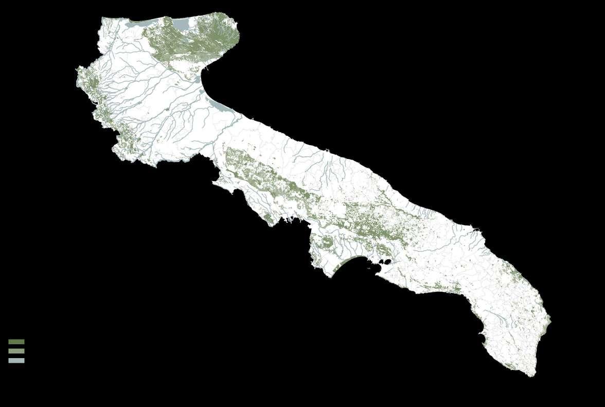
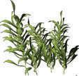
Plant and Animal Species Land Use of Puglia
Population Density Industries and buildings
VISION AND STRATEGY
Questions Sustainable Development Goals Manifesto
RE-LAME PUGLIA 2
REGIONAL SCALE
Ecosystem of Connections
Layers of Biodiversity
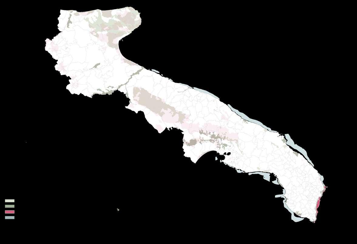
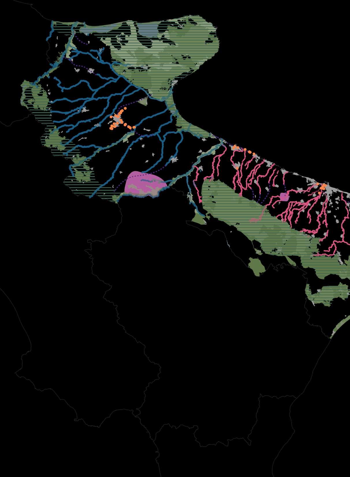
Synthesis Map
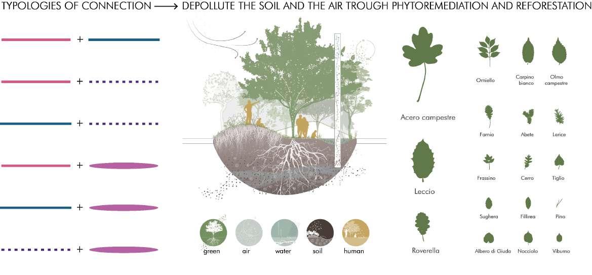
Typologies of Connection
Phytoremediation
AFforestation
LAME Park to the Sea Layers of Lame Biodiversity
Decade Evolution Strategy in Bari Catalogue of Industries
URBAN SCALE
Pilot Project
Afforestation of Lame Recycling Abandoned Sites
Architectural Projects
SOURCES
3
TABLE OF CONTENT
RE-LAME PUGLIA 4
“We should try to have a future in communion with our living planet to make her strong again and able to counter the disabling impacts that are due”
James Lovelock 2009
The world scientists warning to humanity is a warning was created more than 25 years ago in 1992 to warn about the climate change. For scientists it is a moral obligation to clearly warn humanity of catastrophic threats, by now the manifesto has more than 15 000 scientist who signed the declaration (Krogh, 2020).
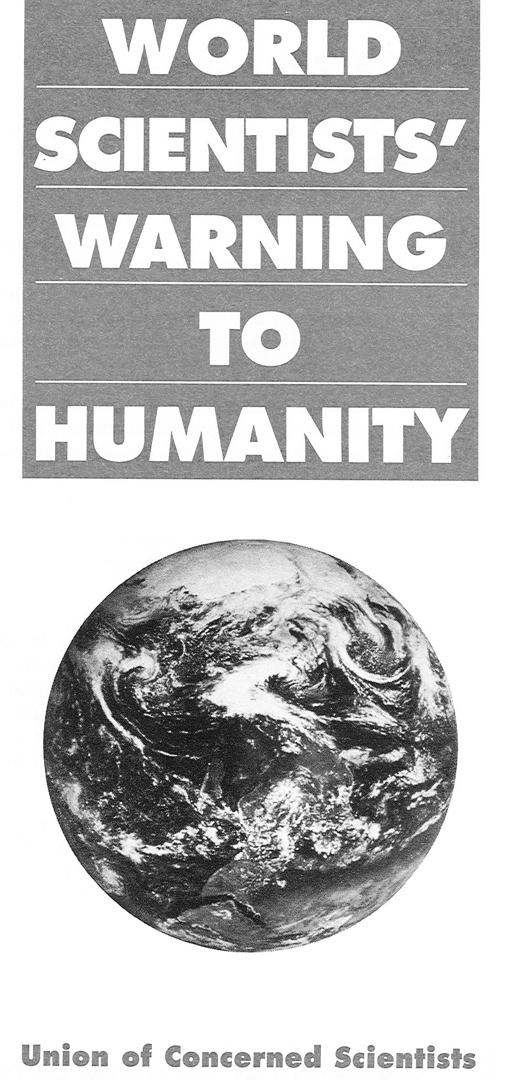
The secon warning was penned in 2017, it explains the rapid collision course between nature and humans, as well as the environmental destruction which is leading to ozone depletion, climate change, biodiversity destruction, marine life depletion, forest lost, ocean dead zones and urges the significance of the ongoing population growth of humans (Ripple, 2017).
In 2019 a third declaration was developed including six interrelated steps to fight climate change: energy, shortlived, pollutants, nature, food, economy and population (Krogh, 2020). Still after 40 years of negotiation concerning climate change not much has changed and “we have generally conducted business as usual” while failing to tackle the often irreversible damage to the environment.
The scientist James Lovelock explains that the earth is a unitary ecosystem which is formed by all living organism and the environment as a complex system, where human beings are only a partner species in the great enterprise (Lovelock, 2009). The earth know as a blue-white icon undergoes permanent changes where “the white ice fades away, the green of forest and grassland fades into the dun of desert, and the oceans lose their blue-green hue and turn a purer, swimming-pool blue as they, too, become desert“, Lovelock states the urgency of the situation on earth.
The Gaia theory clarifies the current phenomena and the changes of the environmental conditions, he manifests that we should try to “have a future in communion with our living planet to make her strong again and able to counter the disabling impacts that are due” (Lovelock, 2009).
5 WARNING TO HUMANITY
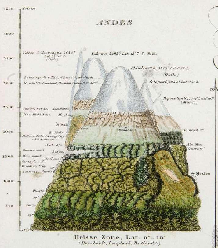
Alexander von Humboldt, a naturalist from 1769 observed the specimens of the flora, fauna and geology which he later described and formed a “systematic taxonomy of plants, animals, minerals and rocks” (Krogh, 2020). He was the first person to discover and formulate his most transformative finding, that life is a unifying phenomenon connected by all living organisms.
Humboldt explicitly articulated the fundamental significance of biological diversity for the earth to operate and therefore human society (Krogh, 2020). Figure 2 represents the vertical distribution of the vegetation of Andes, a sketch from 1845 published in the Cosmo by Alexander von Humboldt, representing the botanical species and the different latitudes of the mountain systems (Buttimer, 2012).
RE-LAME PUGLIA 6
Figure 2: Sketch by Alexander von Humboldt
7 BIODIVERSITY
“By felling the trees which cover the tops and sides of mountains, men in all climates seem to bring upon future generations two calamities at once; want of fuel and a scarcity of water.”
Alexander von Humbolt 1852
Richard Weller, 2021
RE-LAME PUGLIA 8
“We cannot live without biodiversity and yet we are perpetrating the sixth extinction.”
It is our duty to change the perception of our world by addressing the climate crisis and changing the relationship towards nature. Acknowledging the natural sphere and facing the reality we must integrate the transformation in our everyday live, we should talk, think and design in appreciation for and with nature.
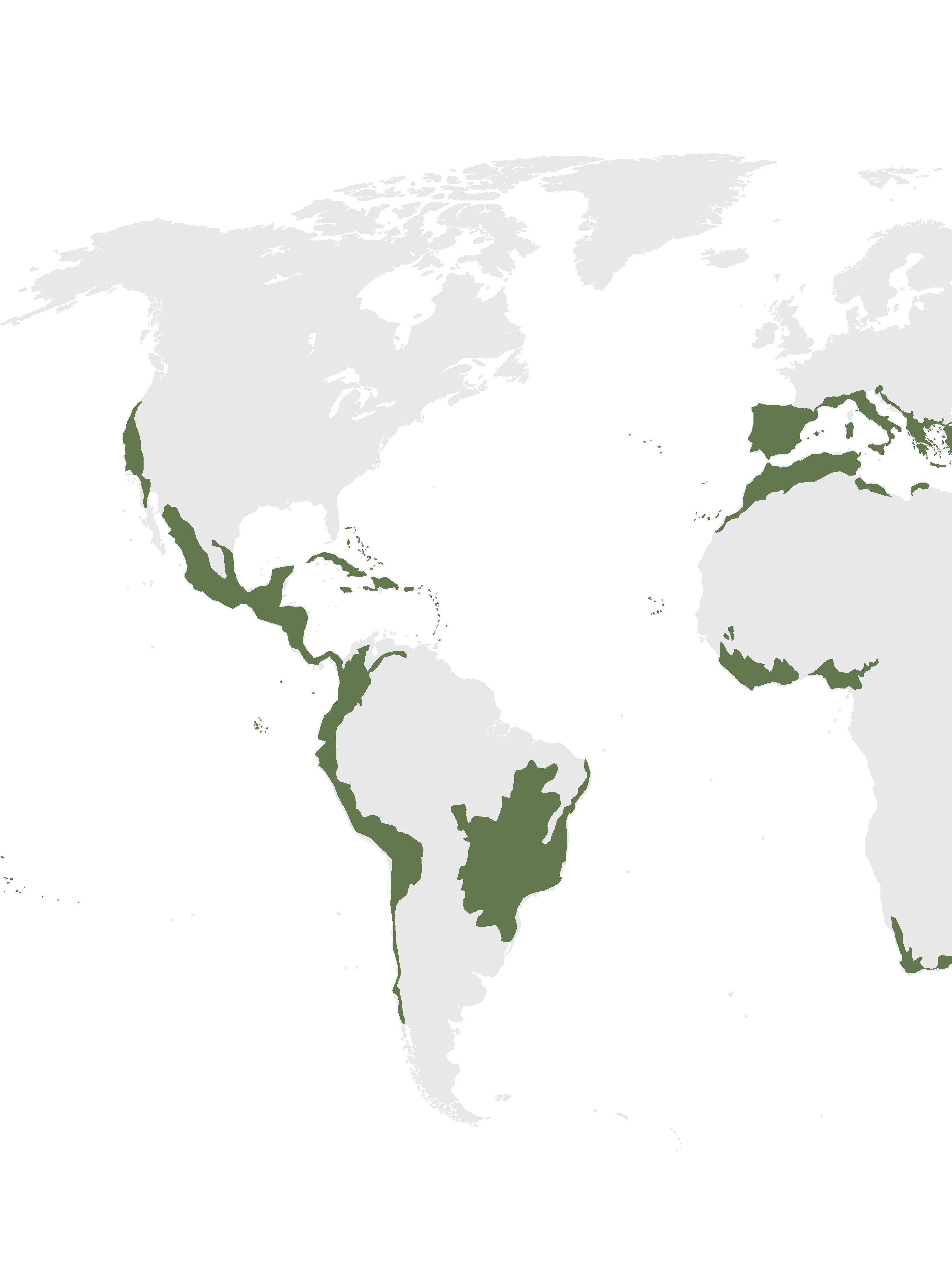
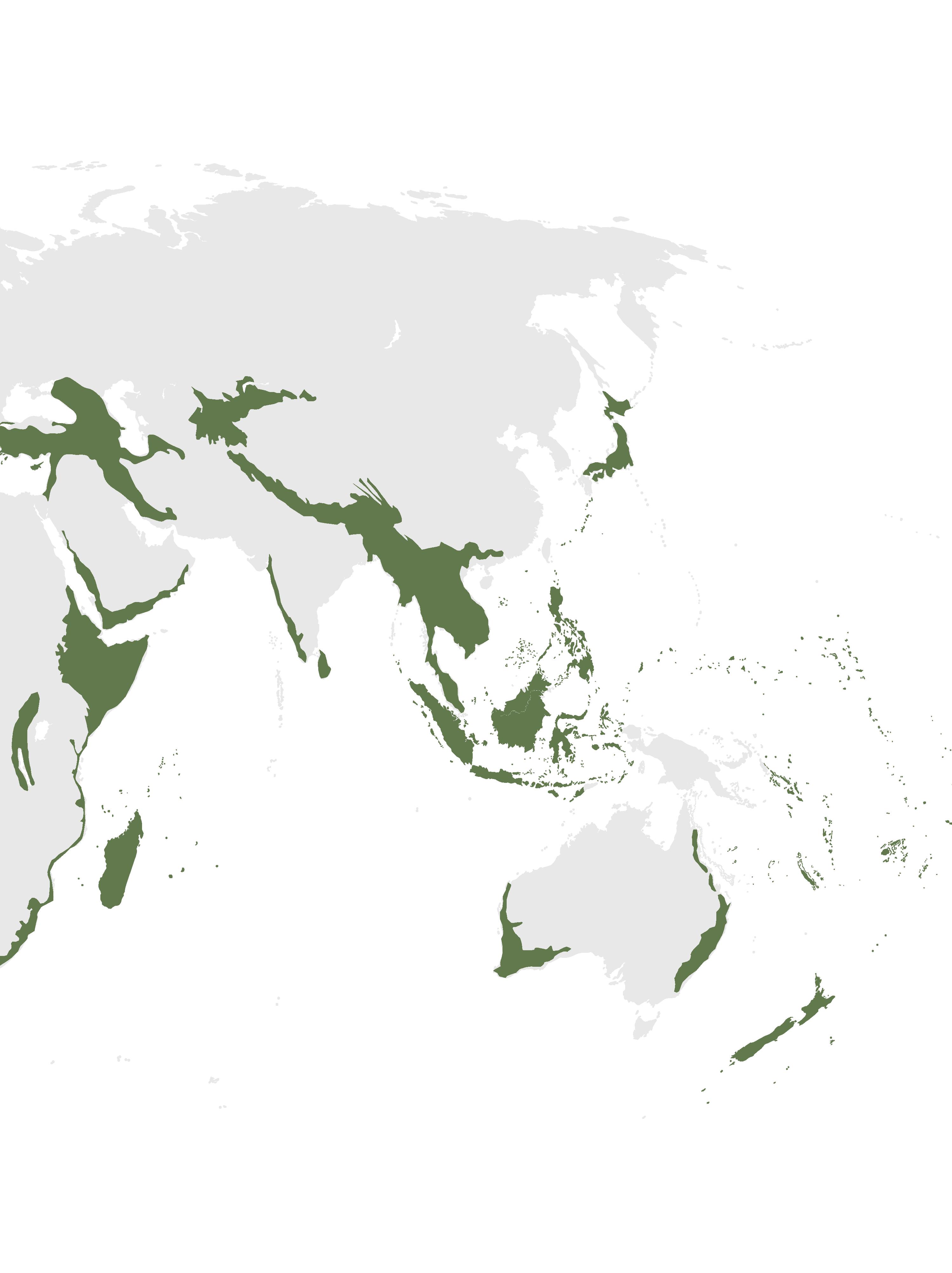
Biodiversity hotspots, regions that contain exceptional and irreplaceable diversity of life, which are threatened of extinction, are a fundamental element in this movement (Weller, Atlas for the end of the world , 2021). The hotspots are the sum of the worlds genetic inheritance, which have to formally be placed under protection to save these.
The World park is main case study for this project and it is a fundamental part of Richard Wellers work, who is an Australian landscape architect and academic. The preservation and reconstruction of the wilderness on a planetary scale is crucial to create a continuous and restored habitat for the protection of endangered species. Cultivating wilderness is a pressing issue concerning NGOs, governments, scientists and engaged citizens. The landscape is under immense pressure, due to the rising “killing fields”, such as the chemically dependent monocultures, which are caused by humans. Weller raises the question, how landscape architecture can find redemption and recover as well as manage the novel ecosystem. The enhancement, maintenance and restoration of ecosystems is vital for this process. Furthermore, a continuous global matrix must be formed to connect the 867 recognized ecoregions and foster the ecosystem. The large-scale contemporary conservation park “Yellowstone to Yuckon (Y2Y)” started in 1992 is a model project presenting the possibilities of a project in such scale, complexity, and sustained effort (Weller, World P-ark, 2019).
It demonstrates the specific potential in high altitude landscapes showing the connection on a continental scale. Another project that is explained, “robust corridors” presents an interesting approach on constructing a national ecological network of protected areas by linking existing fragments of habitat, while allowing the coexistence between urbanism, agriculture, and biodiversity. Dividing the scheme into three categories, the green ways, ecological networks, and wildlife corridors eases the understanding of the different methods.
The 21st century approach of the world park can lead to immense success for the recreation, restoration and protection of the ecosystem, by creating a multifunctional system that actively engages people in its conception. The fragmentation of biological ecosystems must be preserved with a focus on biodiversity.
9 ADRESSING CLIMATE CRISIS
RE-LAME PUGLIA 10
PART I
ANALYSIS OF THE REGION OF PUGLIA
11
RE-LAME PUGLIA 12
13 BIODIVERSITY HOTSPOTS
RE-LAME PUGLIA 14
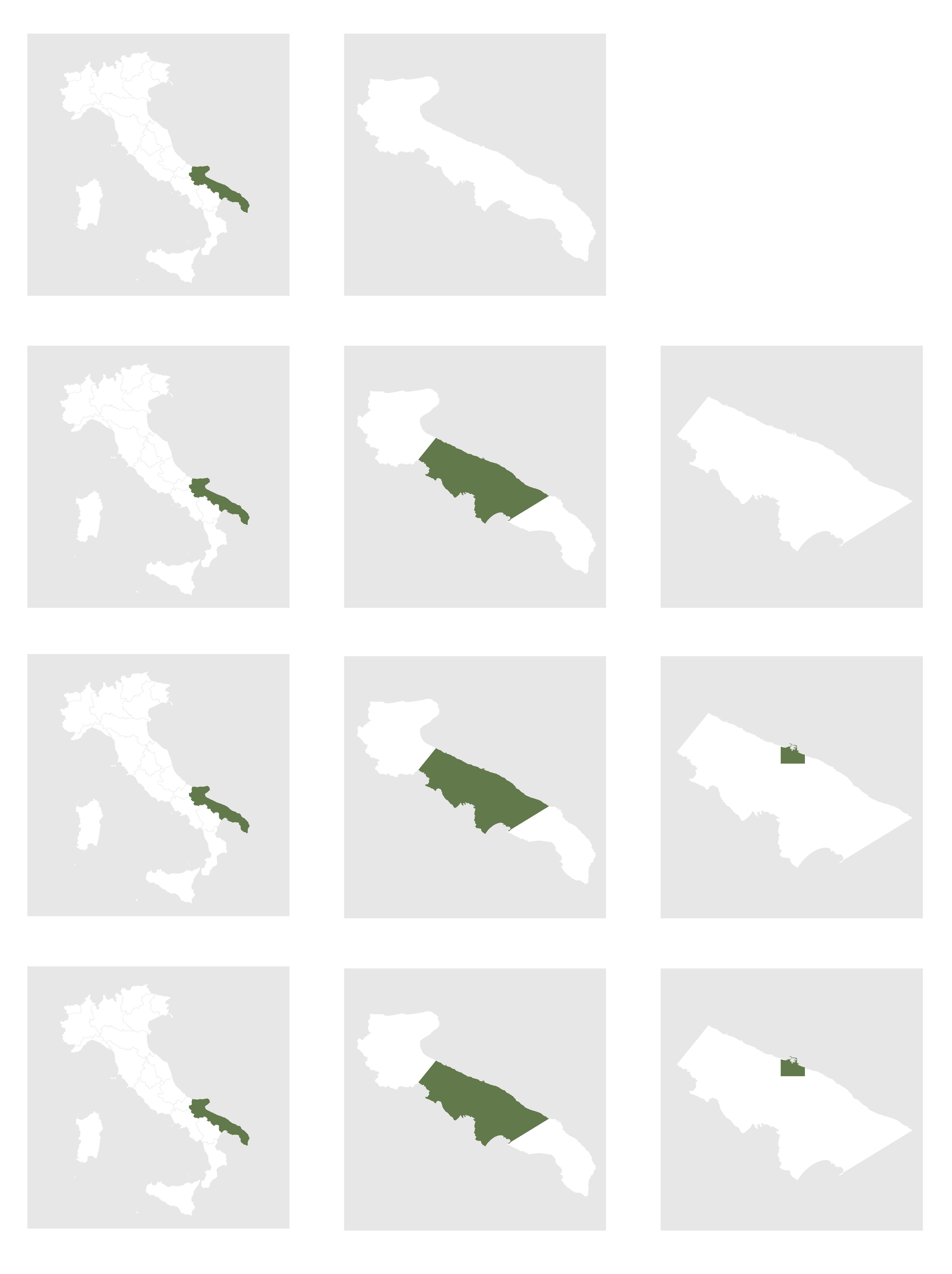
15 THE REGION OF PUGLIA
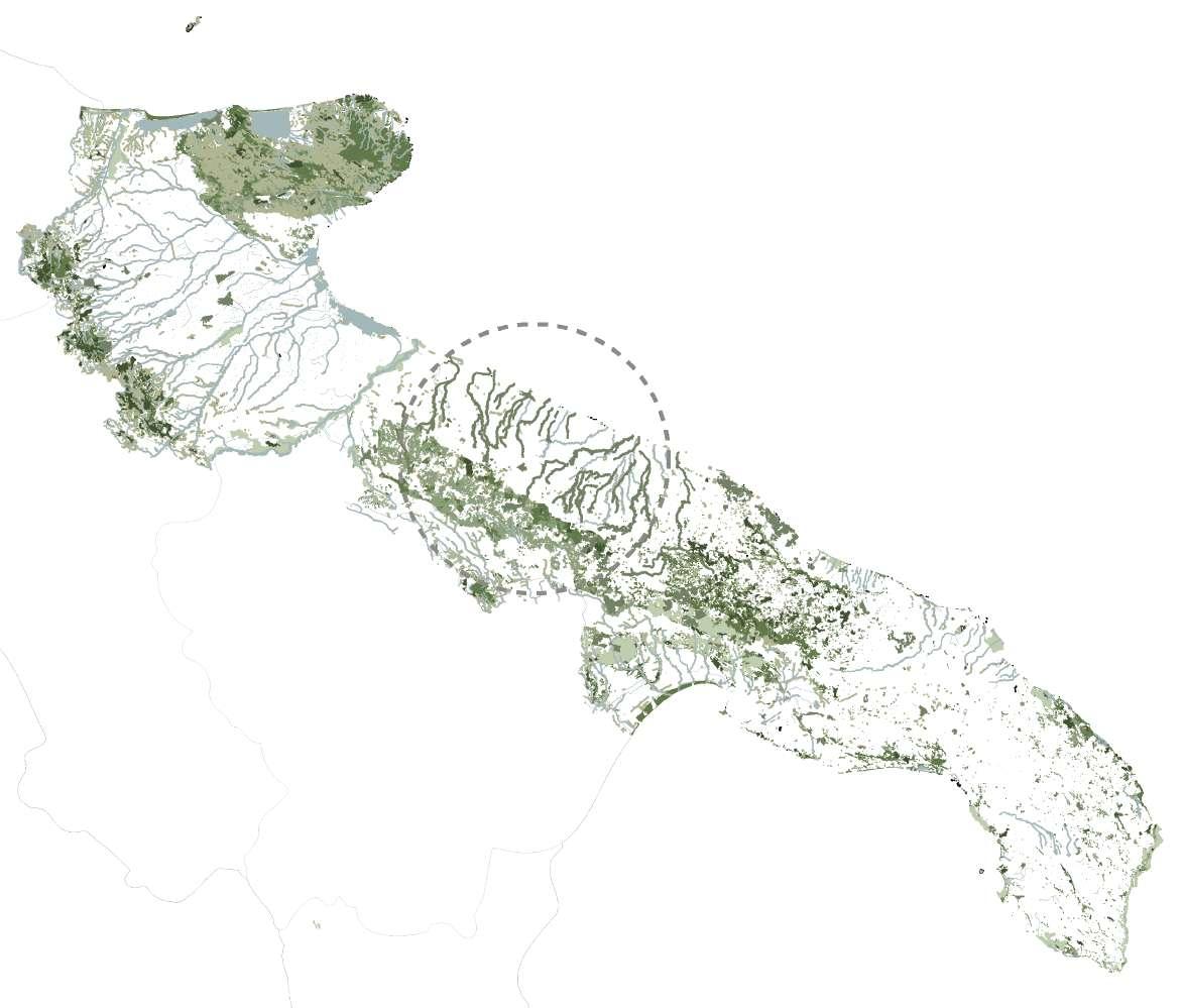
The project Parco Italia focuses on the simulation and research as an attempt to adapt ecological corridors in the whole country, using these as a vehicle to create an Italian atlas on natural capital. The aim is to utilize a “different way of scrutinizing the correspondences between space and society”, employing the atlas as a visual position (Boeri, 2017).
Imaging green and blue infrastructures for ecological transmission and mitigation to create a multiscale project of connections. How can we reconnect ecological corridors and biodiversity hotspots? This question is tackled in this research, starting with an extensive analysis of the region of Puglia.
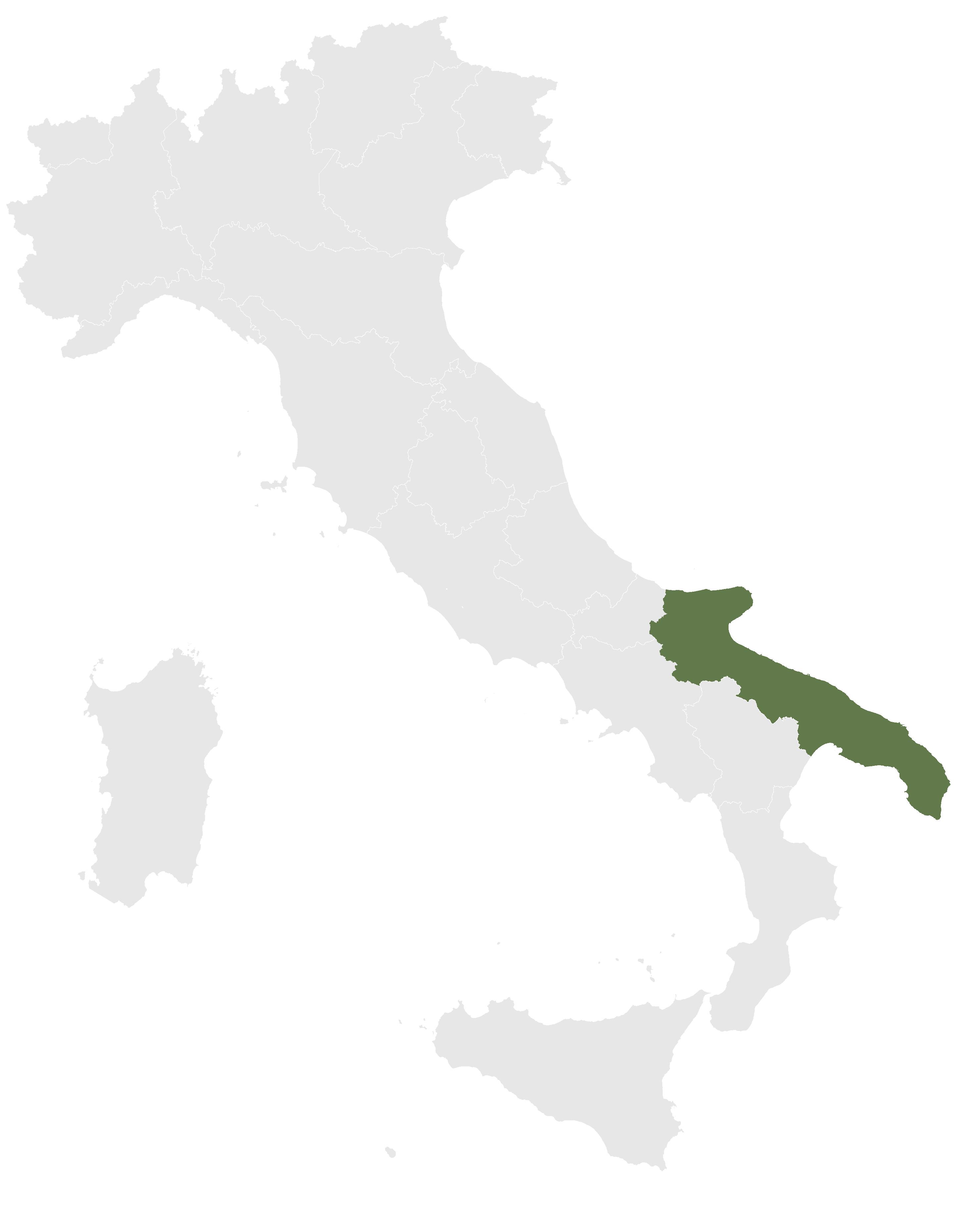
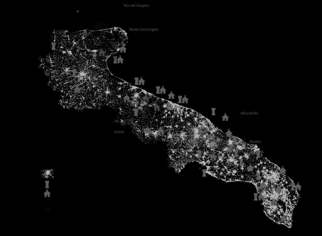
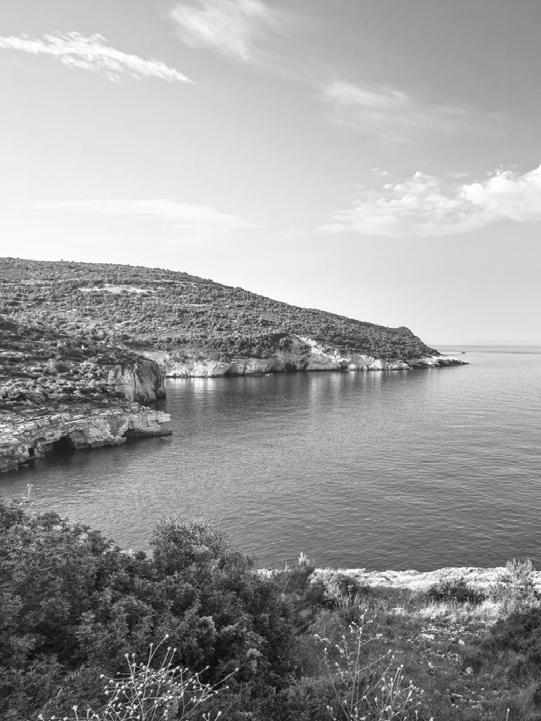
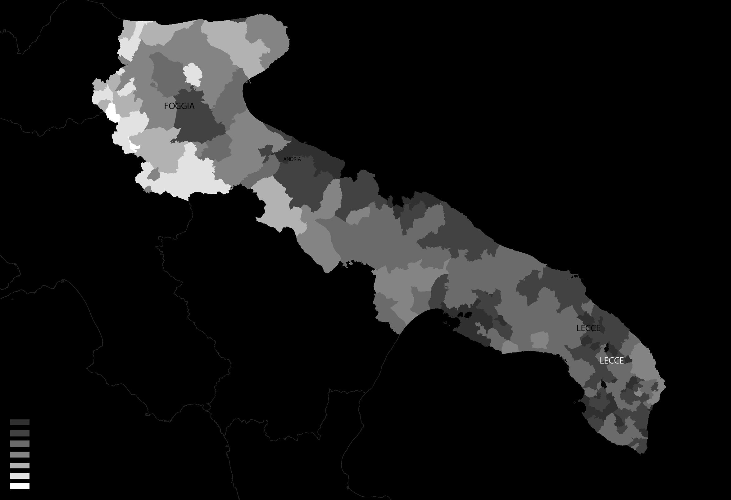
Puglia is located in south of Italy, bordering the Adriatic Sea to the east and Ionian Sea to the southeast, it is also known as the heel to Italy’s boot on the most eastern tip of the peninsular. The region is composed of six provinces: Barletta-Andira-Trani, Brindisi, Foggia, Lecce, Bari and Taranto. Puglia is Italys seven largest region, with more than 4 million inhabitants, covering 19,300 km2 and a magnificent coastline with sandy beaches and azure seas.
The diversified landscapes of the region are plentiful, attracting many tourists each year, especially in the summer months between May to August. This is also causing issues in the region, as more than 4 million tourists visit Puglia during a short time causing immense pressure on the infrastructure and nature. Especially the plastic pollution along the beaches and in the historic city centers is severe.
Tourism is also an important economic factor for the region and has been one of the fastest growing destinations in Europe. Due to the extensive cultural and environmental sites, Puglia is offering a range of activities for tourists, where the cultural heritage and natural capital serve as the base for the development of tourism. (Eni CBCMED, 2021)
Puglia is classified as „less developed”, with a population of 4.09 million inhabitants, where 85.1% live in rural areas. Bari is the Capital City with about 338.401 inhabitants. The employment rate is only at 45%, which is below the below national average, resulting in a high unemployment rate of 15.7% and 43.6% for 15-24 years old in 2018, again above the national average (EC Europa , 2019).
RE-LAME PUGLIA 16
17 THE REGION OF PUGLIA
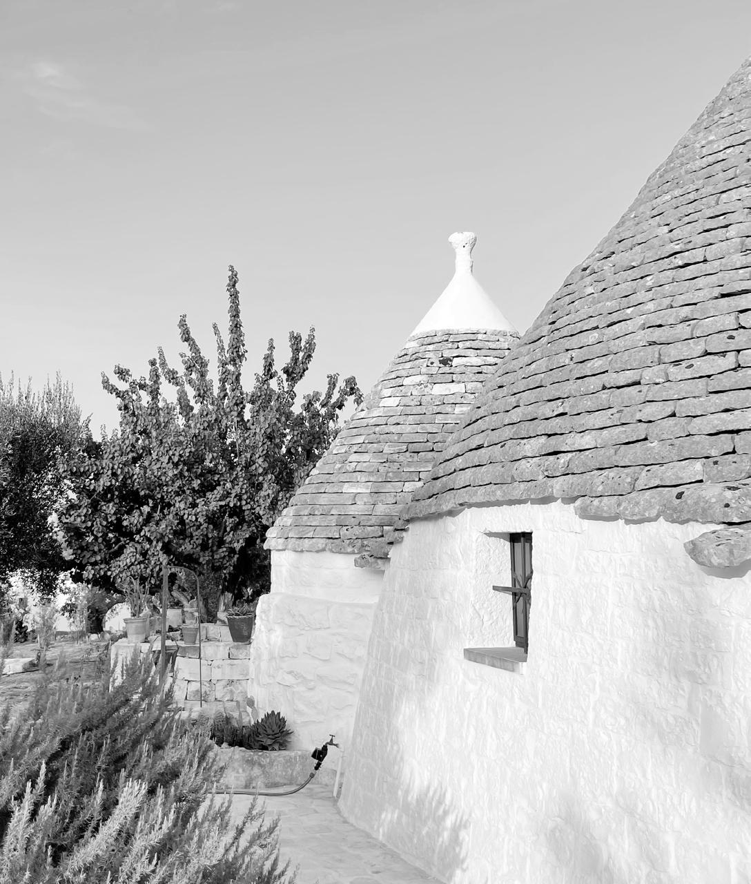
Traditional Trulli in Cisternino (Schmitz, 2021)
RE-LAME PUGLIA 18
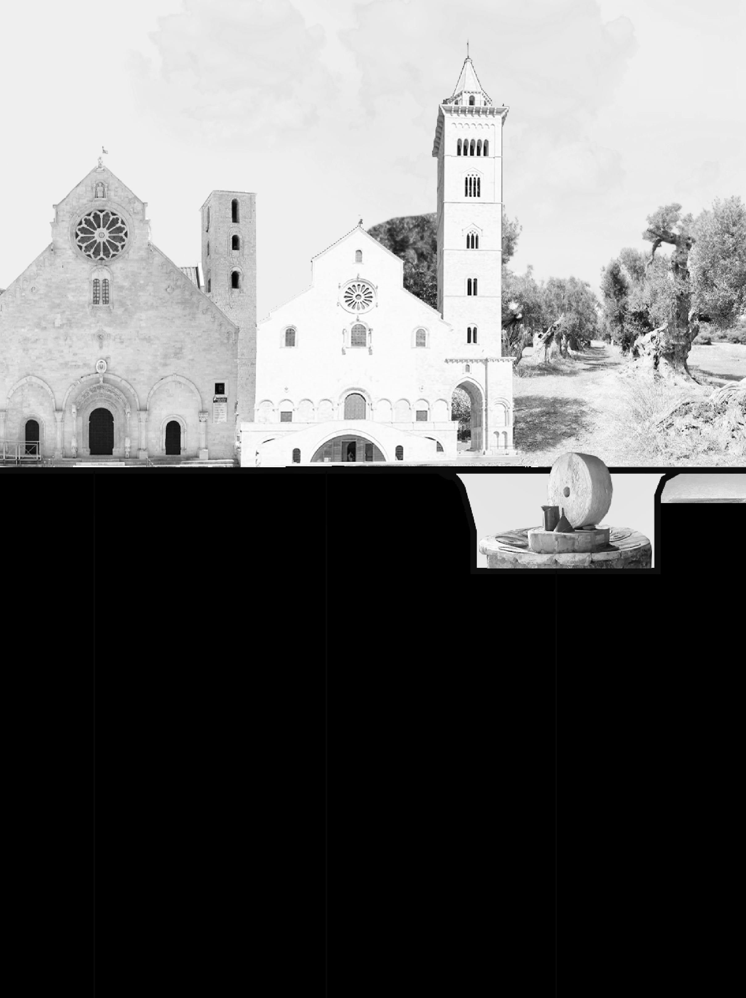
19 HISTORICAL HERITAGE
RE-LAME PUGLIA 20
Puglia region is characterized by no less than 20 castles that, together with the coastal towers and fortified farmhouses, which guarantee a strong identity and recognizability to it. The current configuration of almost all the castles of Salento dates to the Renaissance period (15th and 16th centuries).
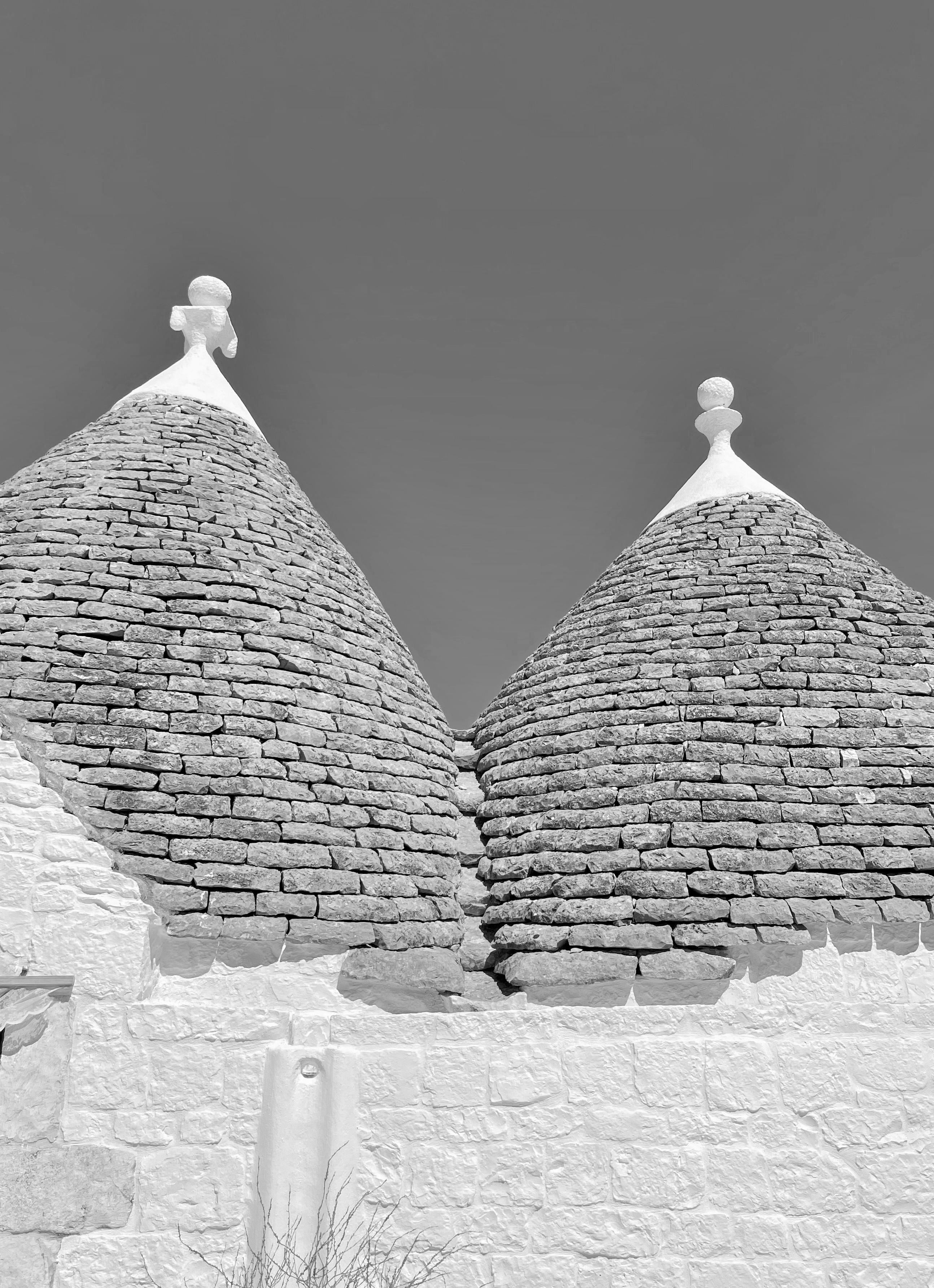
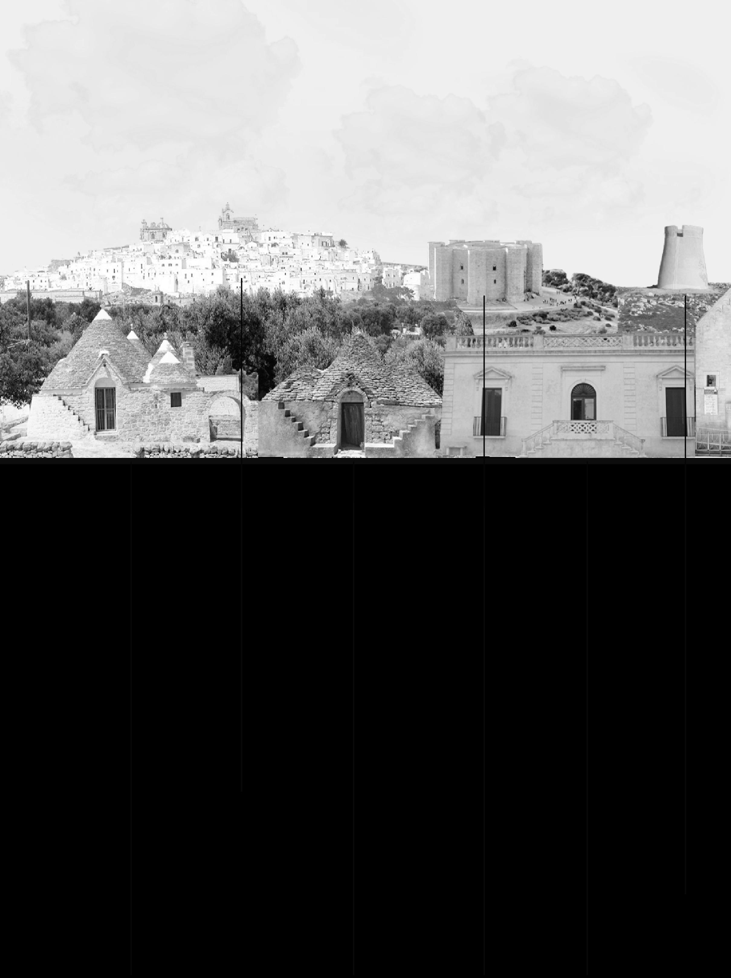
Farms are more frequent in the south of the peninsula. Coastal towers and the numerous fortified farms are in the Terra d’Otranto. The most famous ancient architecture in Puglia is the trullo: a traditional Apulian dry stone hut with a conical roof. Their style of construction is specific to the Itria Valley, in the Murge area.
In the town of Alberobello, in the province of Bari, whole districts contain dense concentrations of Trulli. The golden age of Trulli was the nineteenth century, especially its final decades, which were marked by the development of wine growing.
In Salento there also are the so-called ‘green gold mines. It is a series of underground oil mills which, starting from the olives of the area, produced a truly prized olive oil. Most of the oil mills in this area are carved into the rock. There are four Apulian sites that are part of the Unesco Heritage list: Monte Sant’Angelo, Alberobello, Castel del Monte and Foresta Umbra.
FESTIVALS AND ANNUAL EVENTS
Puglia and Salento are a land rich in traditions, folklore, events and village festivals. Between religious rites, historical re-enactments and local fairs, Puglia is a place that offers hospitality all year round. In January, a few kilometers from Lecce, the focara takes place. It’s the largest bonfire in the whole Mediterranean.
Towards the end of winter, in February, there is the Apulian carnival in Manfredonia. During the summer in Puglia there are many events related to entertainment and culinary events, like the ‘sagra delle orecchiette’ which is one of the most typical foods. One of the most important events in all of Italy is certainly the Apulian festival: la notte della taranta, it is an event linked to music and ‘pizzica’, most intense expression of the Salento culture.
21 HISTORY AND ANNUAL EVENTS
Traditional Trulli in Cisternino (Schmitz, 2021)
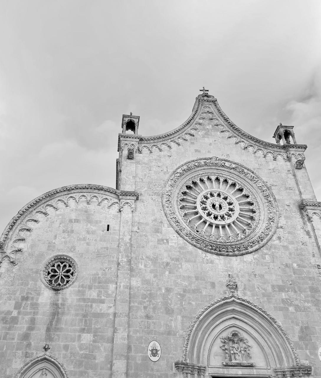
Duomo di Ostuni (Schmitz, 2021)
RE-LAME PUGLIA 22
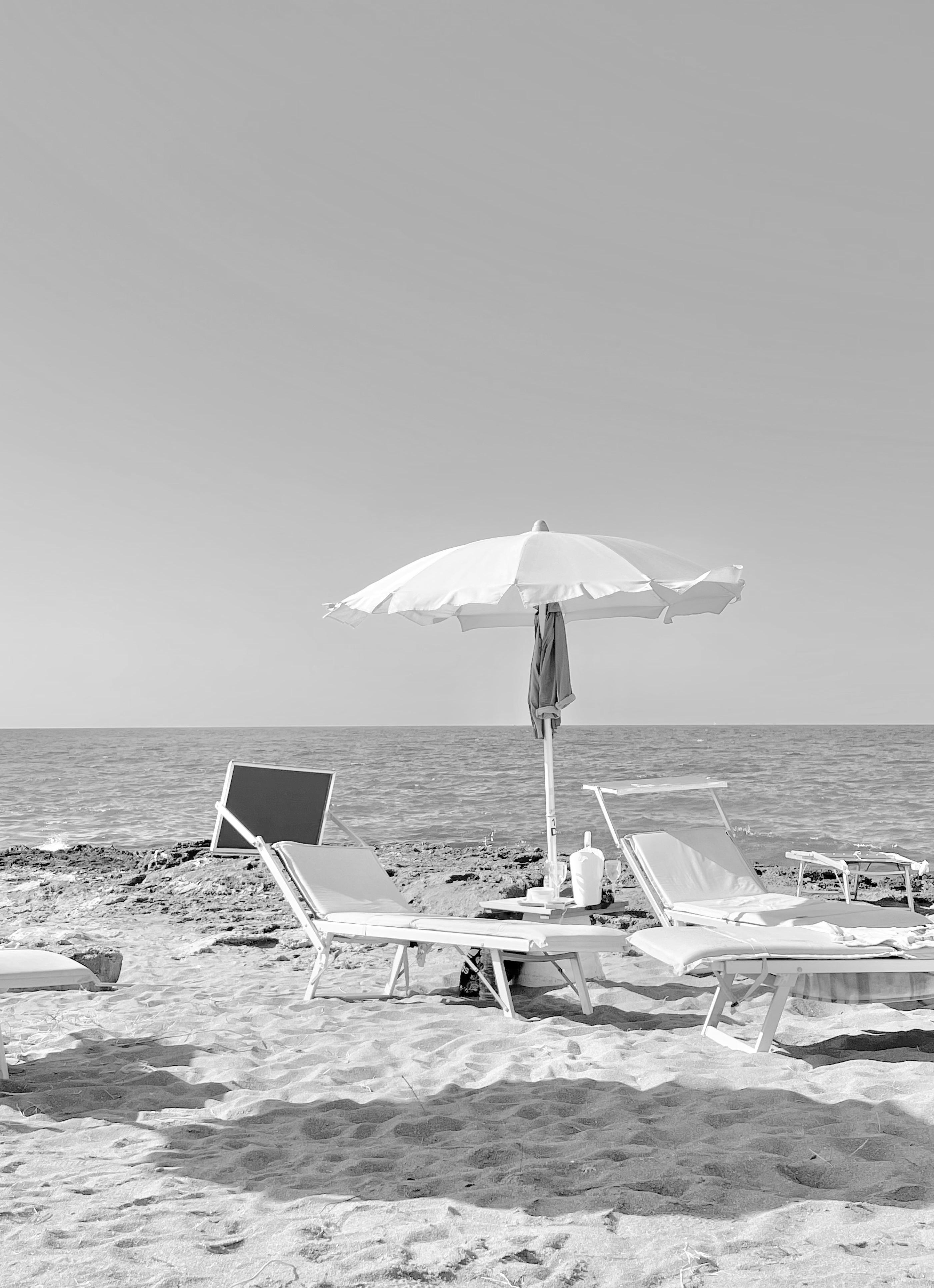
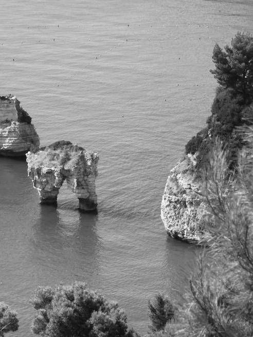
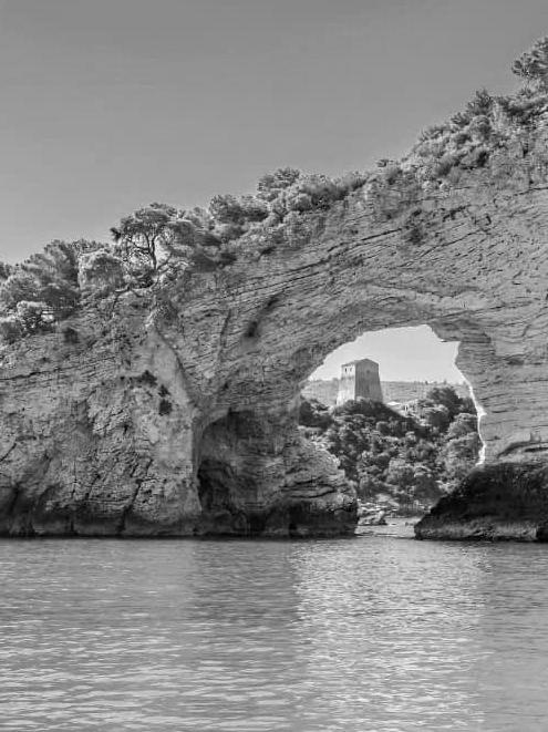
Puglia is known for its beautiful coast which stretches over 829km and is the longest coast of an Italian mainland region. Moreover, Puglia is one of the driest and hottest areas
in Italy with temperature up 45C in summer, the heat is causing heat islands especially in the ancient cities with limited to no greenery and great amounts of stone. Whereas
the coastal areas along the Adriatic Sea towards the Salento Peninsula are exposed to varying winds affecting changes in temperature and conditions.
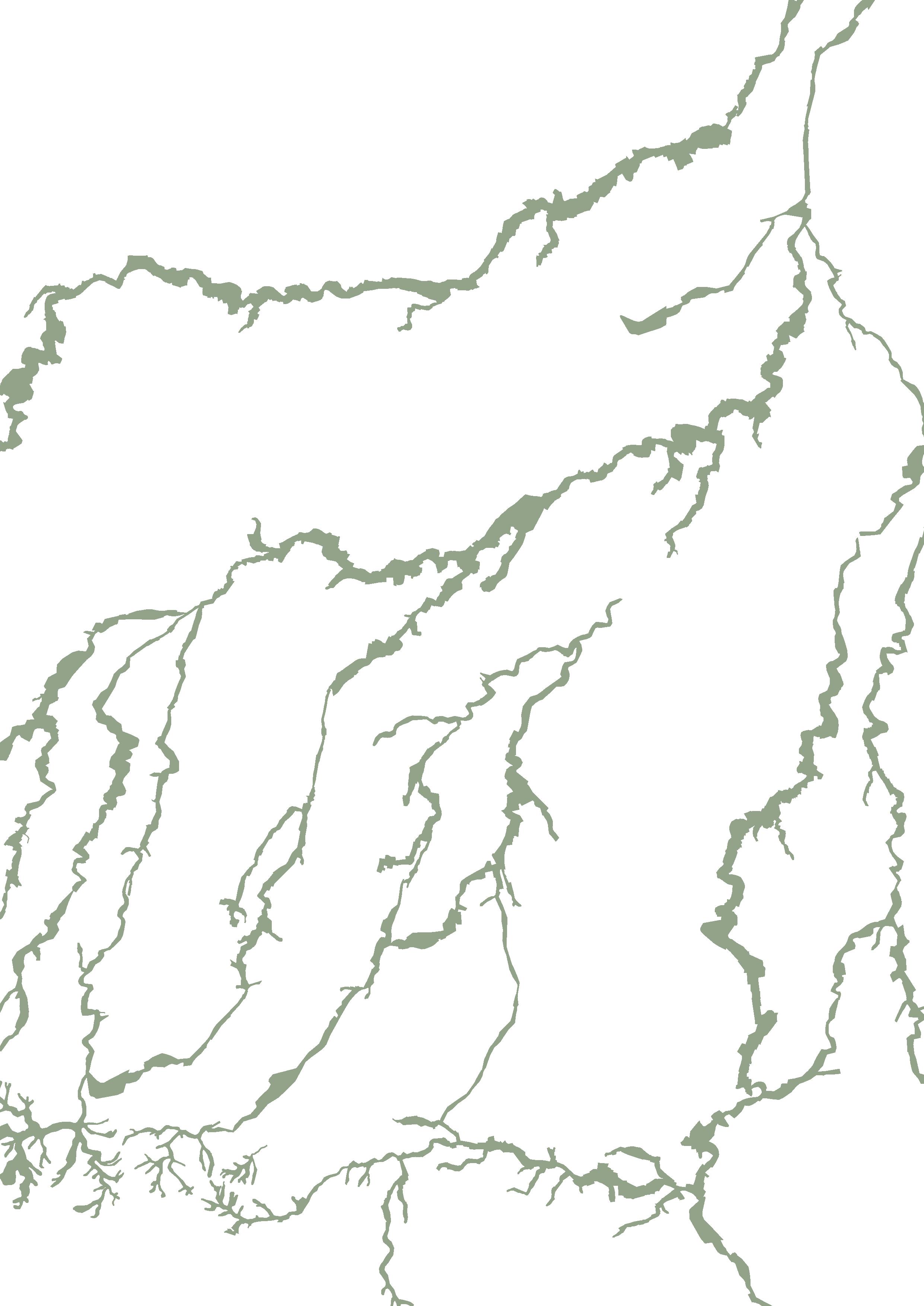
Map of Natural Areas
 by GIS
23
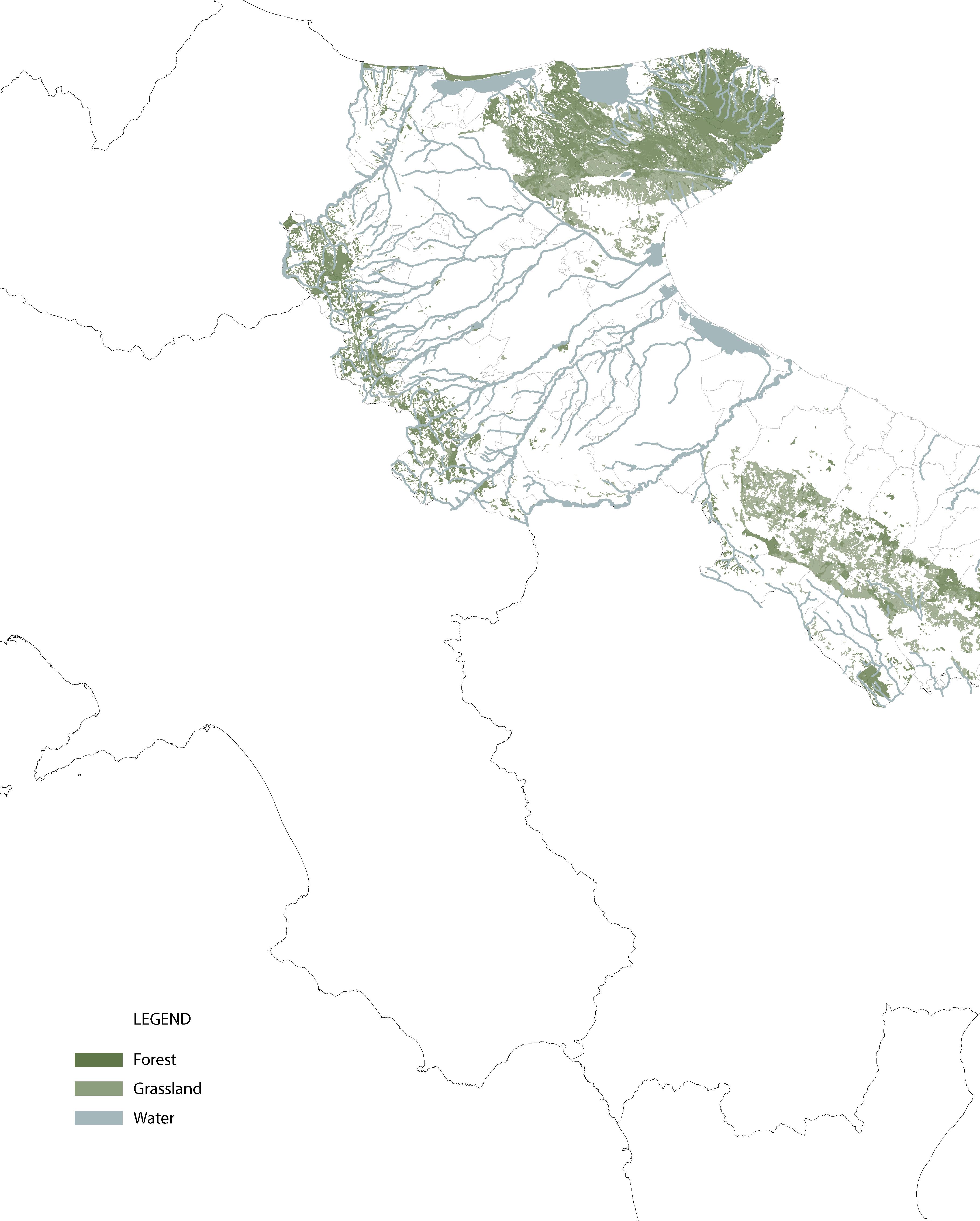
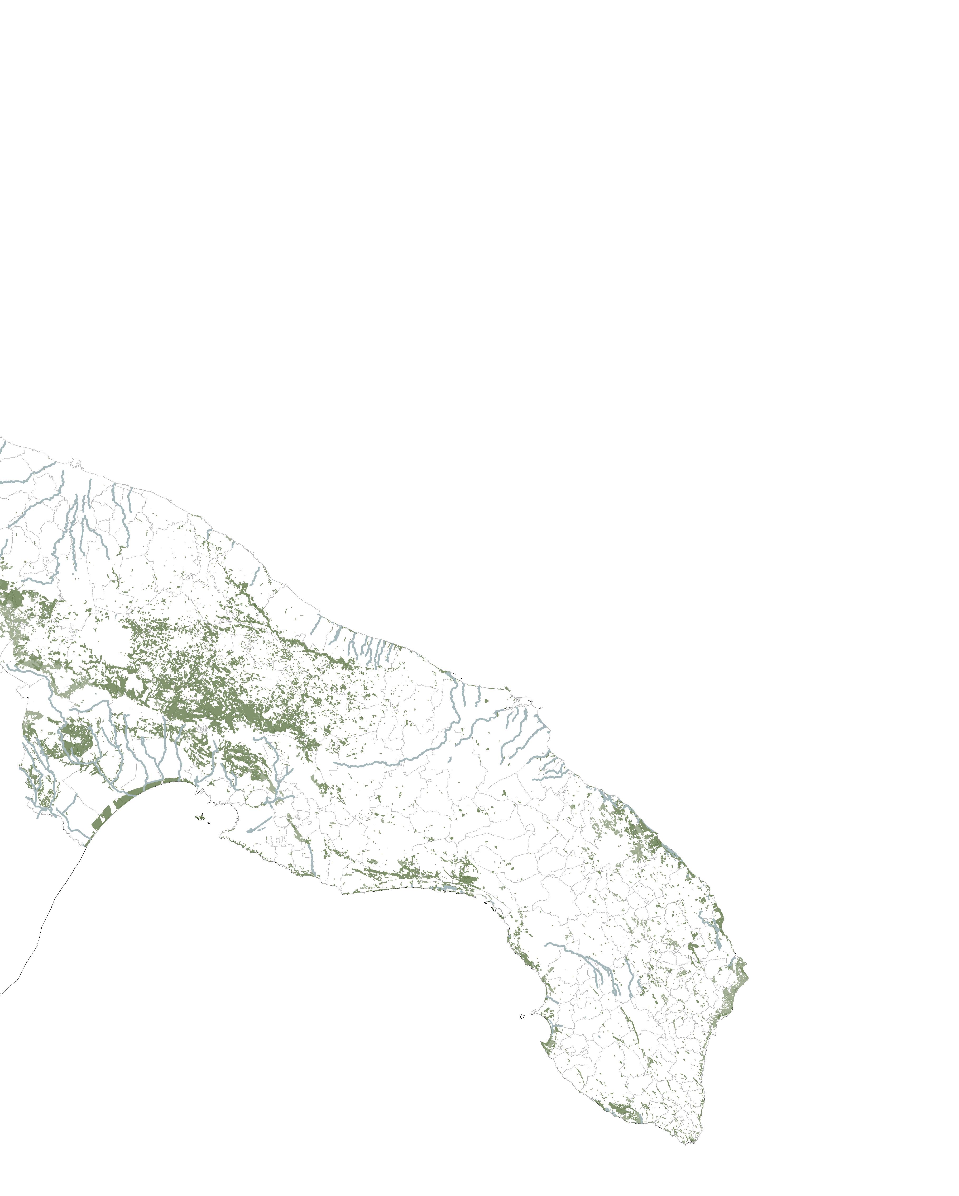
NATURAL AREAS IN PUGLIA
RE-LAME PUGLIA 24 PARCO NAZIONALE DEL GARGANO PARCO NAZIONALE DELLE ALTA MURGIA Area Marina Protetta di Torre Guaceto Conversano e Gravina di Monsignore Palude del Conte e Duna Costiera Marina Protetta di Torre Guaceto Riserva Naturale Isole Tremiti Bosco delle Pianelle Oasi Salso Lago Forest Umbria Palude la Vela Bosco Cerano

25
Area Marina Protetta di Torre Guaceto
Parco Nazionale del Gargano
Bosco delle Pianelle
Palude del Conte e Duna Costiera
Area Marina Protetta di Torre Guaceto
Area Marina Protetta di Torre Guaceto
Conversano e Gravina di Monsignore
Forest Umbria
Oasi Salso Lago
Parco Nazionale delle Alta Murgia
Palude del Conte e Duna Costiera
Palude la Vela
Riserva Naturale Isole Tremiti
Parco Nazionale delle Alta Murgia
Bosco Cerano
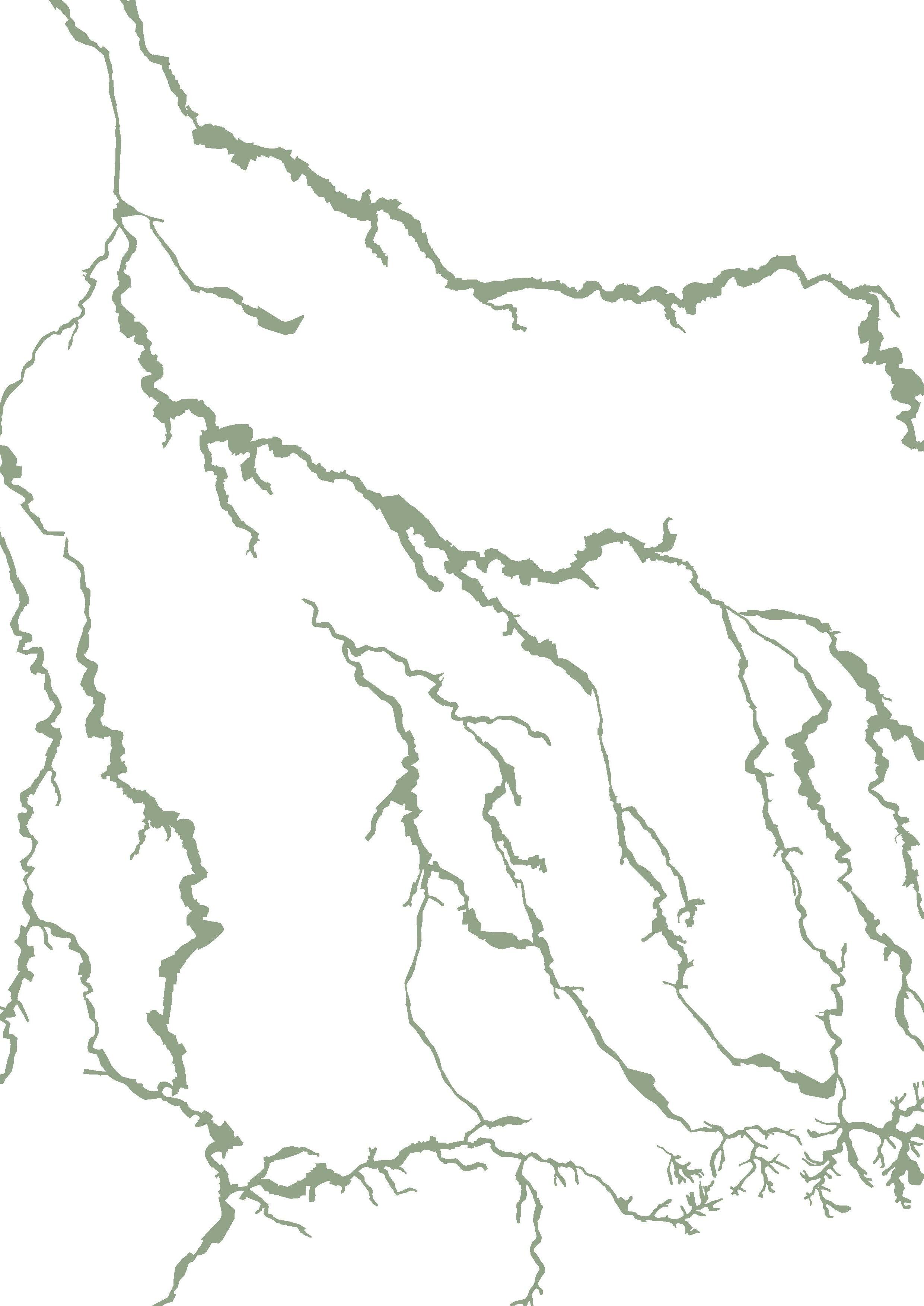
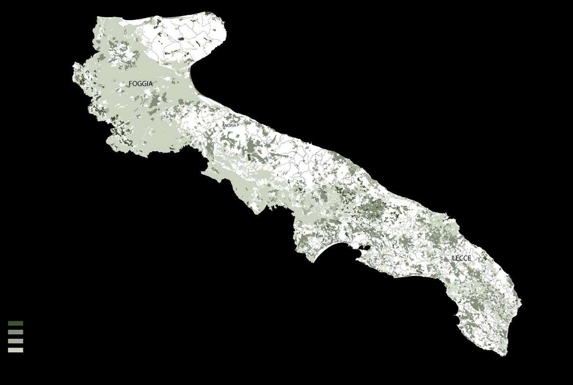
PROTECTED AREAS AND NATIONAL PARKS
Area Marina Protetta di Torre Guaceto
RE-LAME PUGLIA 26
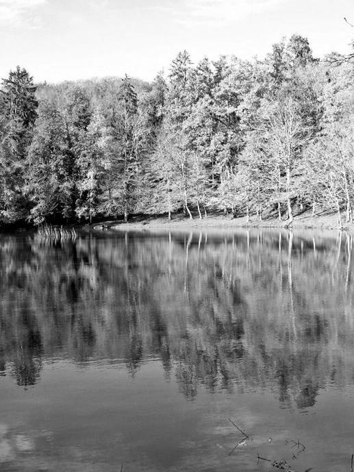
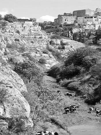
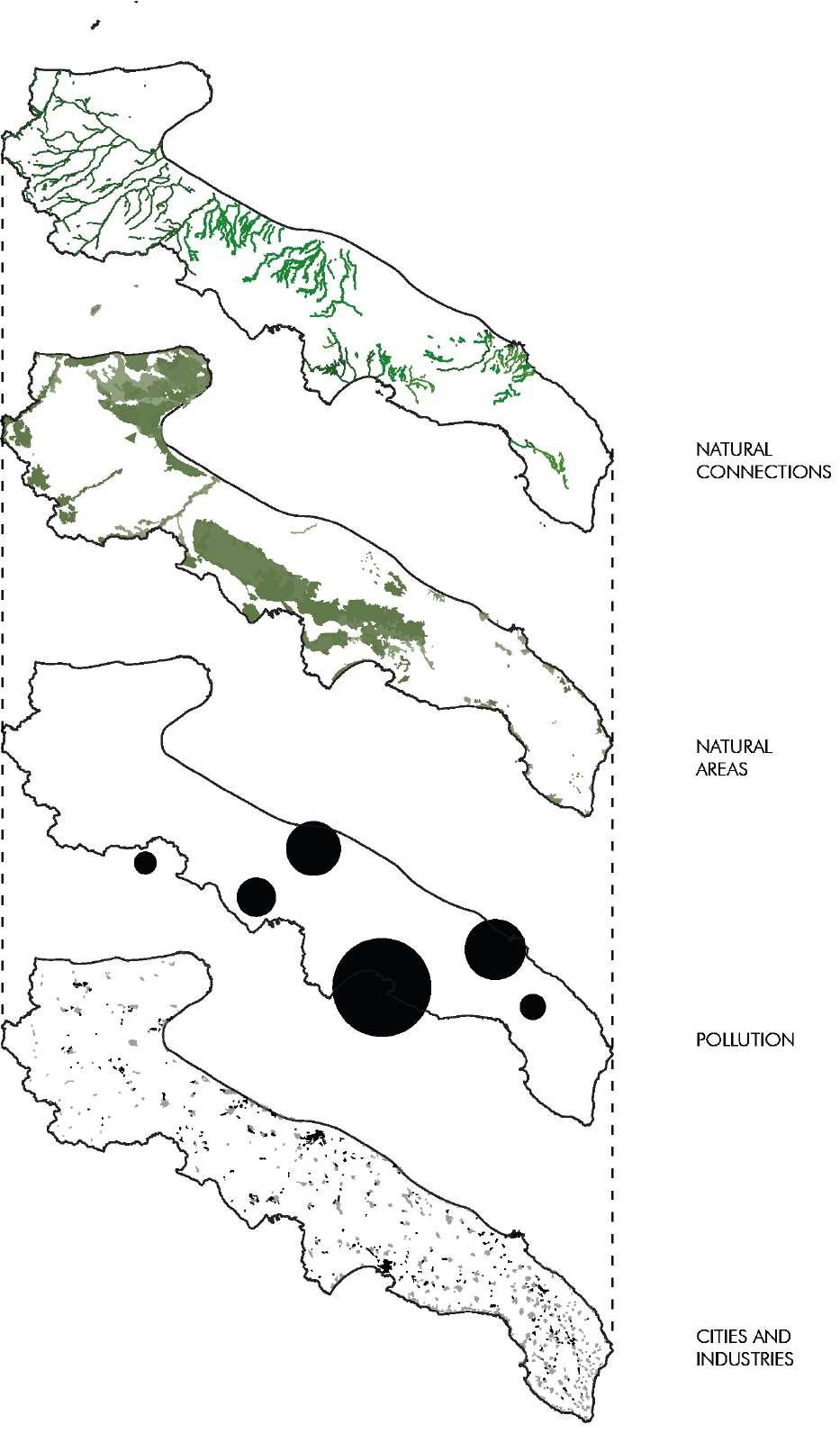
The nature in Puglia is diverse, ranging from blue sea, sandy beaches, and dunes to pine forests and ancient olive trees. The biodiversity in the region has decreased drastically in the recent decades due to the extensive agricultural use and the countless industrial sites, causing industrial pollution. Besides several protected parks, Puglia offers two nationals parks: the Gargano and Alta Murgia, which host important fauna and flora.
The Mountain Garango reaches from the north to Santa Maria di Leuca in the most southern part. Additionally, the region consists of many regional parks and nature reserves, such as the Regional Natural Coastal Park, Costa Otrantio – Santa Maria di Leuca e Bosco di Tricase it features natural and historical attractions such as Ciolo a rocky cove.
Puglia directly borders three other Italian regions in the northwest; Molise, Campangia and Basilicata. Puglia is known for its beautiful coast which stretches over 829km and is the longest coast of an Italian mainland region.
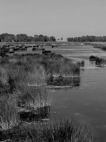
On the Adriatic coast, blue beaches, cliffs and caves compose the landscape while agricultural fields, olive trees and vineyards occupy the territory. The biodiversity values of Puglia is described with low naturalness throughout the region, where only 6 % of the surface consist of forest and more than 65% of the area utilized for agriculture. The Natura 2000 project preserves agricultural and forestry land with high natural value, to decrease soil erosion and maintain the extensive agriculture.
Puglia is a region that is still not excessively urbanized, where green and cultivated areas, are still fairly large, however, the forest surface area is only between 6-7% of the region. Unfortunately, the biodiversity has decreased over the recent decades, but the existing fauna species are still varied and numerous. Some of them are typical of the Mediterranean area, while others are specific to this region.
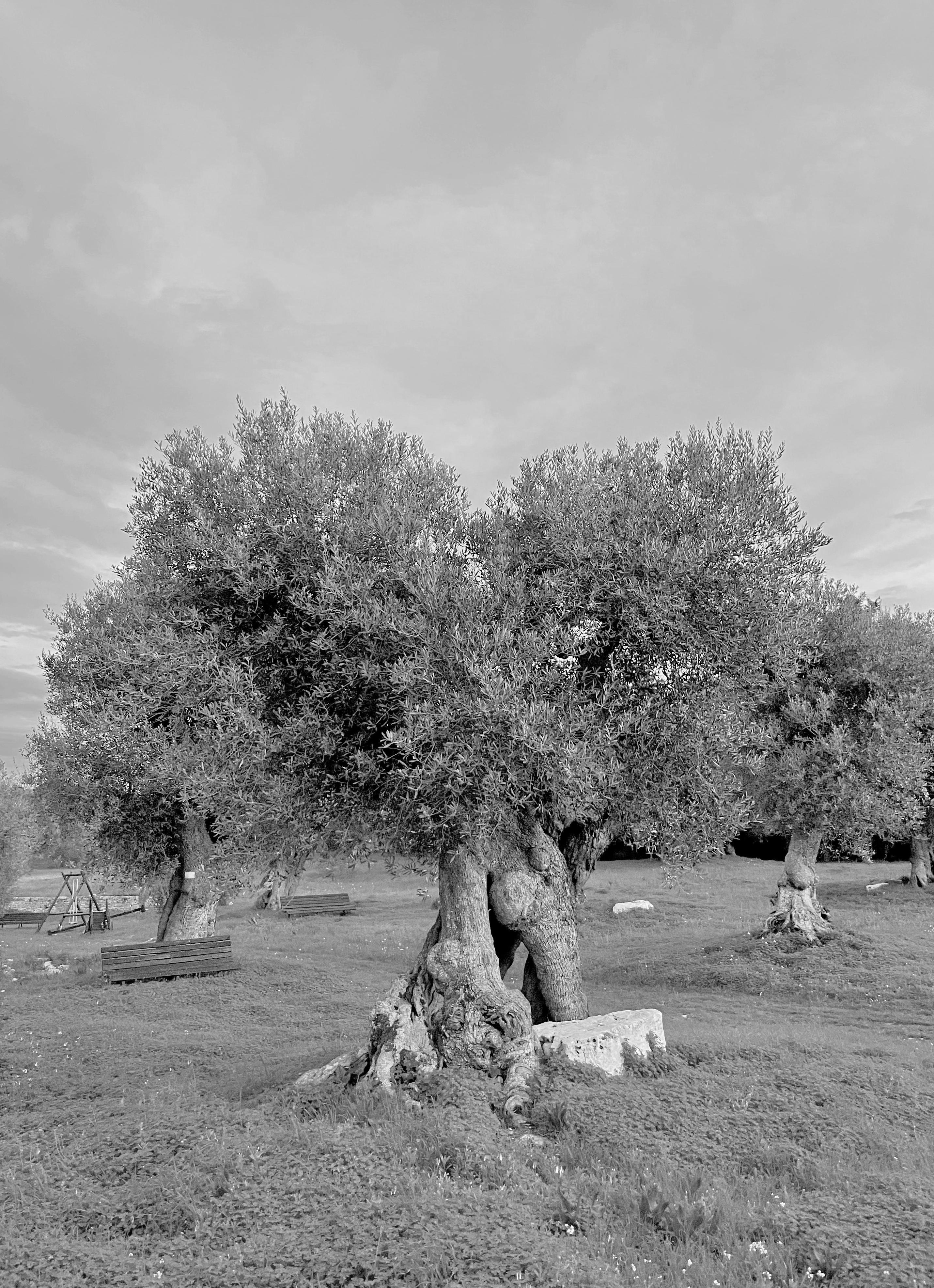
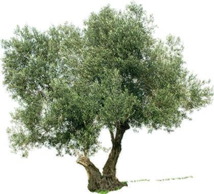
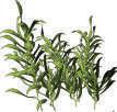
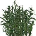
As far as the flora is concerned, this region is dominated by the omnipresent olive tree. To surround the immense expanses of olive trees we find another element strongly present throughout the region, the Mediterranean scrub, beautiful to look at and always fragrant, with aromatic herbs that often find ample space also in regional cuisine.
The ‘fichi d’india’ is worth highlighting, as it is a common tree inhabiting streets and gardens. Pine forests are at constant presence along the coast, the beautiful shape and fragrant enrich the surroundings.
Puglia is one of the driest and hottest areas in Italy with temperature up 45C in summer, the heat is causing heat islands especially in the ancient cities with limited to no greenery and great amounts of stone. Whereas the coastal areas along the Adriatic Sea towards the Salento Peninsula are exposed to varying winds affecting changes in temperature and conditions. The climate of Puglia is typically Mediterranean: coastal and flat areas have hot, dry and windy summers, with generally mild and relatively rainy winters. Precipitation, concentrated in late autumn and winter, is however rare and especially rainy. However, in northern Puglia, summers are rather fresh and snowfall and night fog are not uncommon in winter. Taking into account the ten weather stations present in Puglia, the annual average temperatures in the North East are between 11.7°C and 13°C, while they are 4°C higher in the Taranto, Brindisi and Lecce region.
The high risk of forest fires is mainly concentrated in areas with high vegetation, such as the Gargano National Park or Alta Murgia one. Also, the warm and dry climate of southern Puglia promotes the risk of forest fire. However, more than 70% of fires in Italy are caused by humans, voluntarily or not, aided to a small extent by climate change.
The industrial development of Puglia has mainly been developed in the sixties, where industrial establishments were rapidly built, mainly in around the trade and port cities Taranto, Brindisi and Bari. This allowed Puglia flourish in economic activities, generating new employment possibilities. However, the rapid expansion led to dangerous pollution on regional scale, but also a national and European one. For the past decades, certain cities in the Puglia Region have been faced with the consequences of the industrial era, such as polluted soil, contaminated water, increase of cancer cases, air pollution and more.
27
OVERVIEW OF PUGLIA
RE-LAME PUGLIA 28
Olive Tree Cisternino (Schmitz, 2021)
29 AGRICULTURE
RE-LAME PUGLIA 30
Pictures: Google Earth
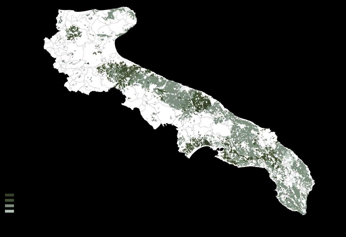
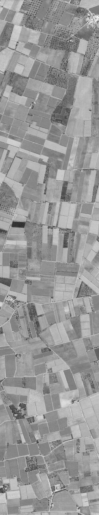
The Region is characterized by flatland and smaller hills with only some mountainous areas in the north. Puglia has always been an agriculture region, due
to its beneficial flatness, offering excellent conditions for cultivation. Agriculture is the one of the main economic factors in Puglia mainly intensive
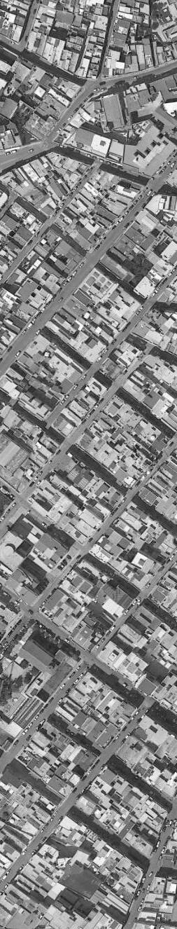
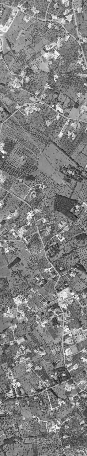
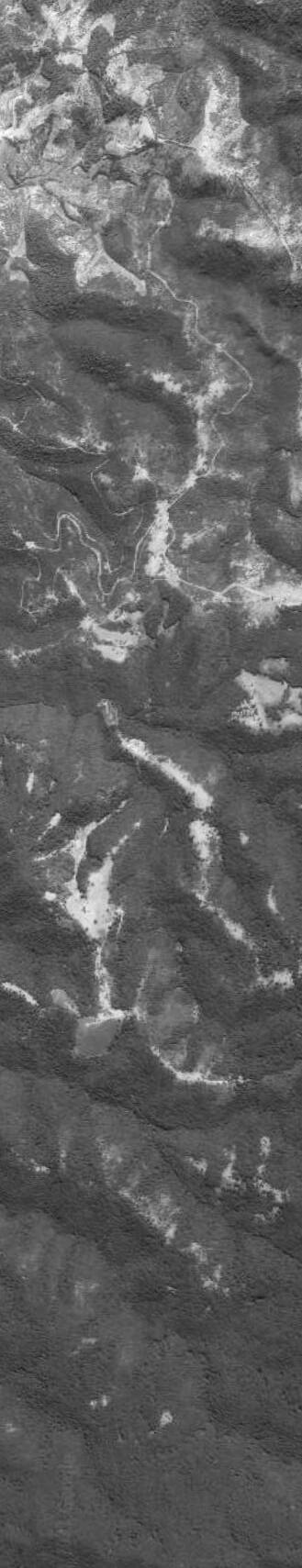
agriculture, such as wheat, tomatoes, grape, olive oil and vegetable. With a slowly decreasing population of about 4 million in 2019 (Tutti Italia , 2021).
31
POPULATION AND
Rural Areas
Agricultural Land
Intermediate Rural Areas Peri-Urban and Urban Areas
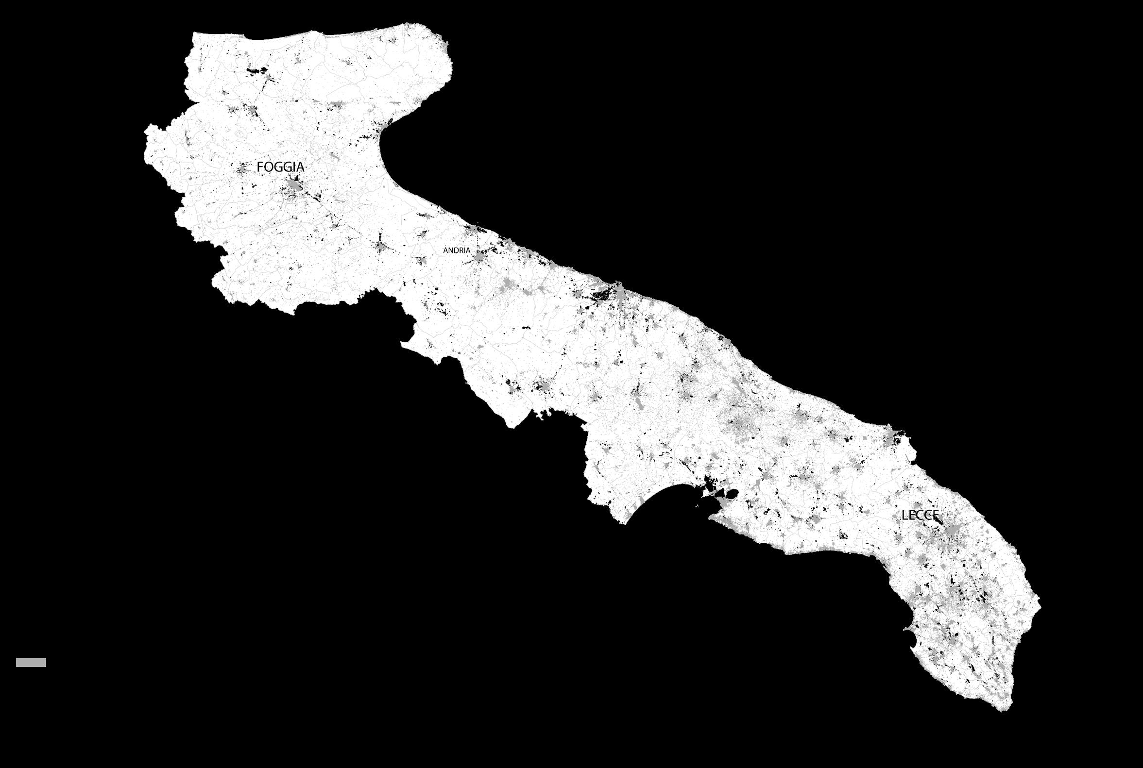
The industrial pollution in Puglia has been an issue for decades, affecting the whole soceity of Italy. Especially in Puglia the pollution has a tremendeous affect on its inhabitants.
There are countless articles about the pollution in Puglia, harming the citizen, environment and habitat, endangering Apulian health. Indeed, Taranto, one of the most polluted cities in Europe, it has the highest number of cases of cancers related to occupational diseases in Italy in 2019.
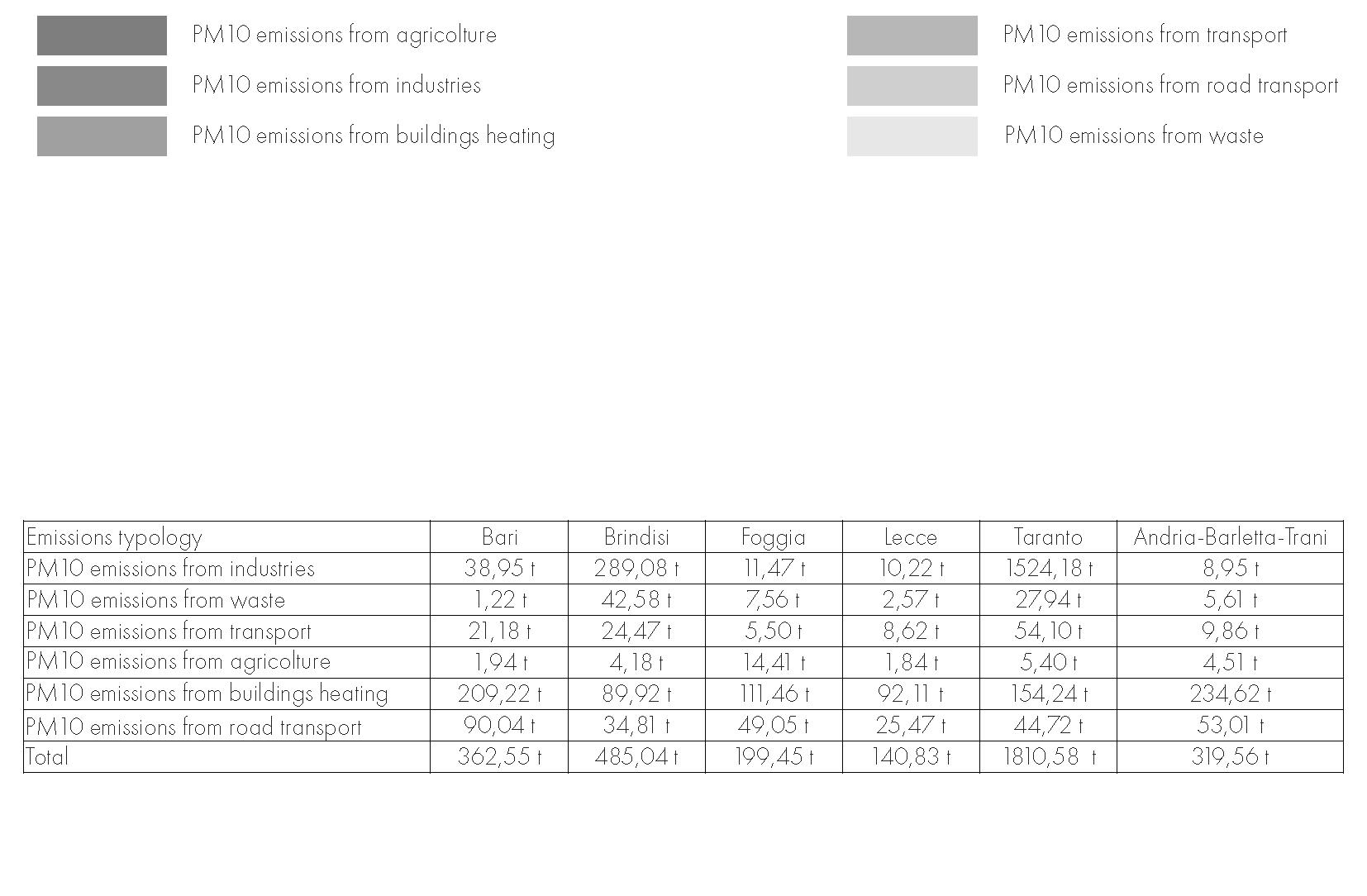
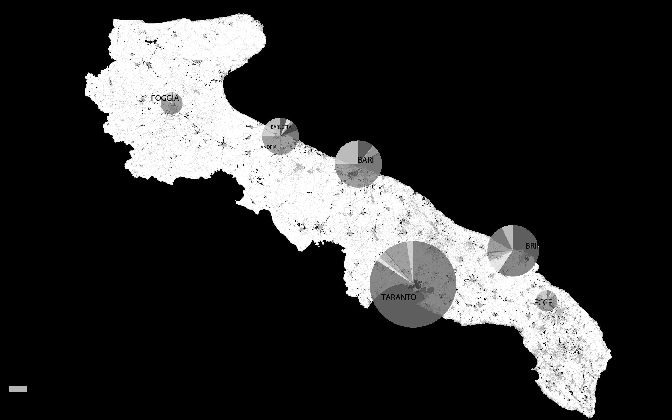
Brindisi on the other hand is also listed as the fourteenth place in Italy, after Taranto.It’s the second most polluted city located in Puglia, after Taranto. Ilva, the biggest steel factory in Europe, is the most polluting factory in Italy. Only 7% of the pollution is from habitants and 93% from industrial origin. In may 2021, the two previous Ilva owners were convicted of allowing carcinogenic pollution to emanate from the factory for over fifty years.
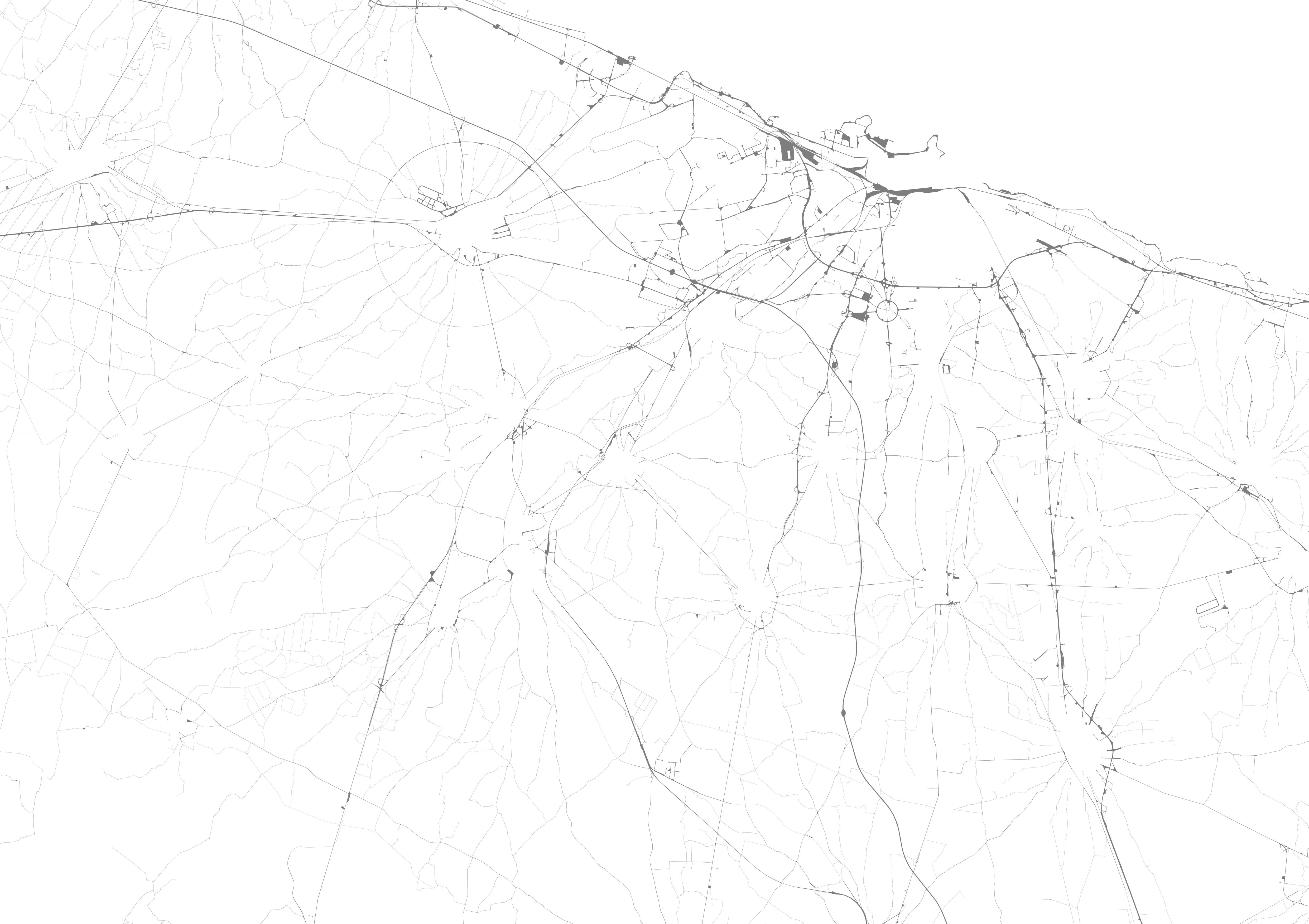
This map indicates the high density of buildings and industries in Puglia, it especially shows the location of factories, close to cities and villages, scattered around the region. The map correlates with the map of rural and urban areas, as well as the population density, demonstrating the human settlements while highlithing the human intervention on the region of Puglia. Furthermore, it can be seen that the coastal cities are surrounded by factories and industrial sites.
RE-LAME PUGLIA 32
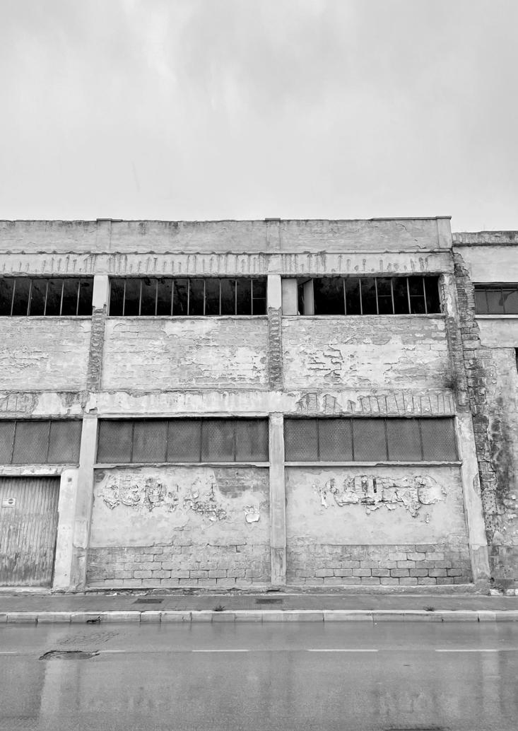
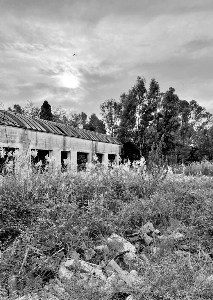
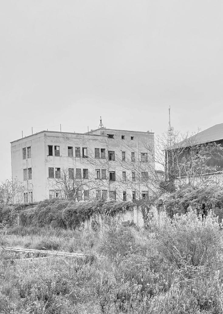
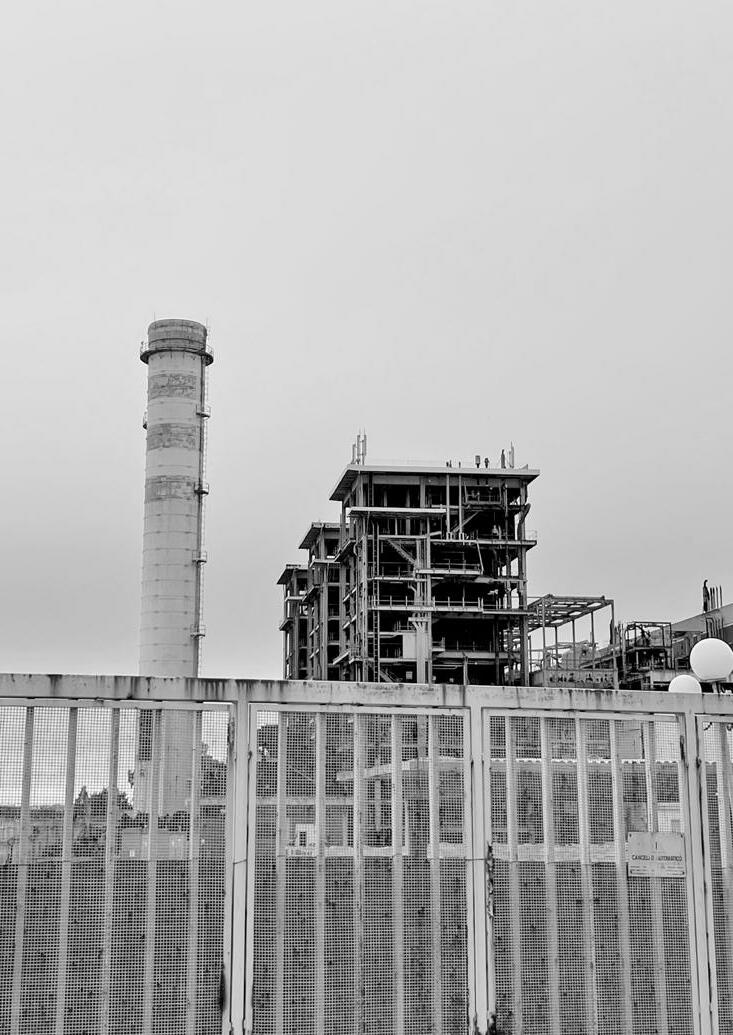
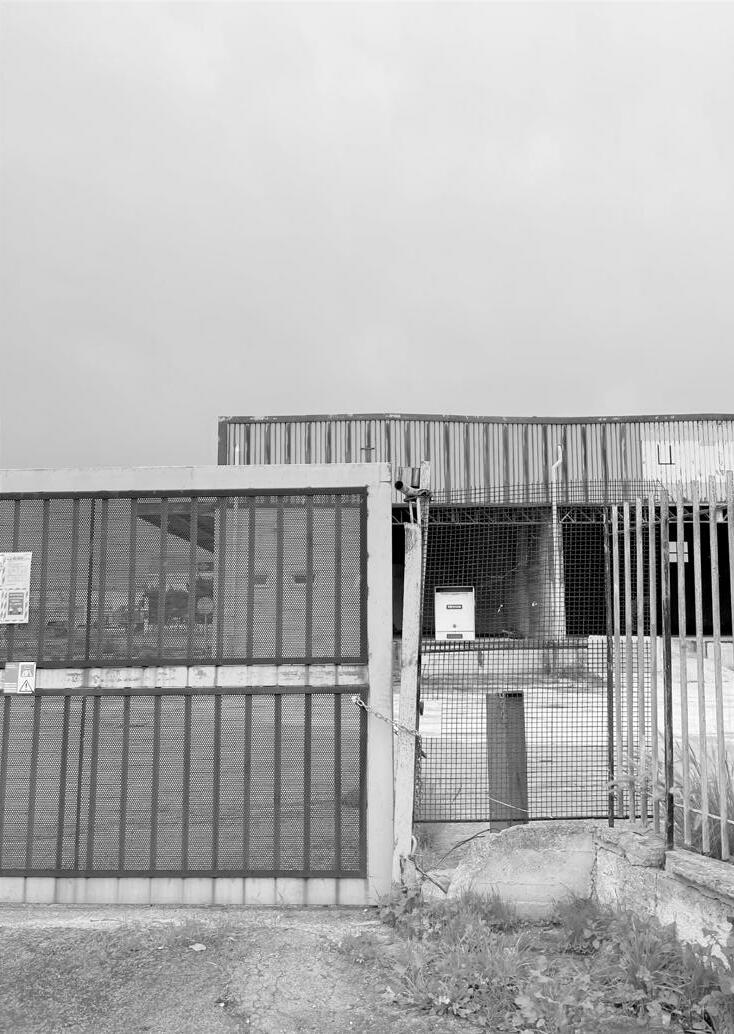
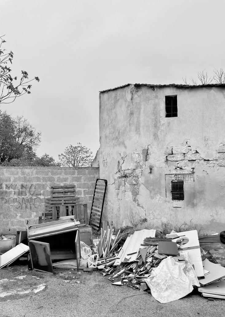
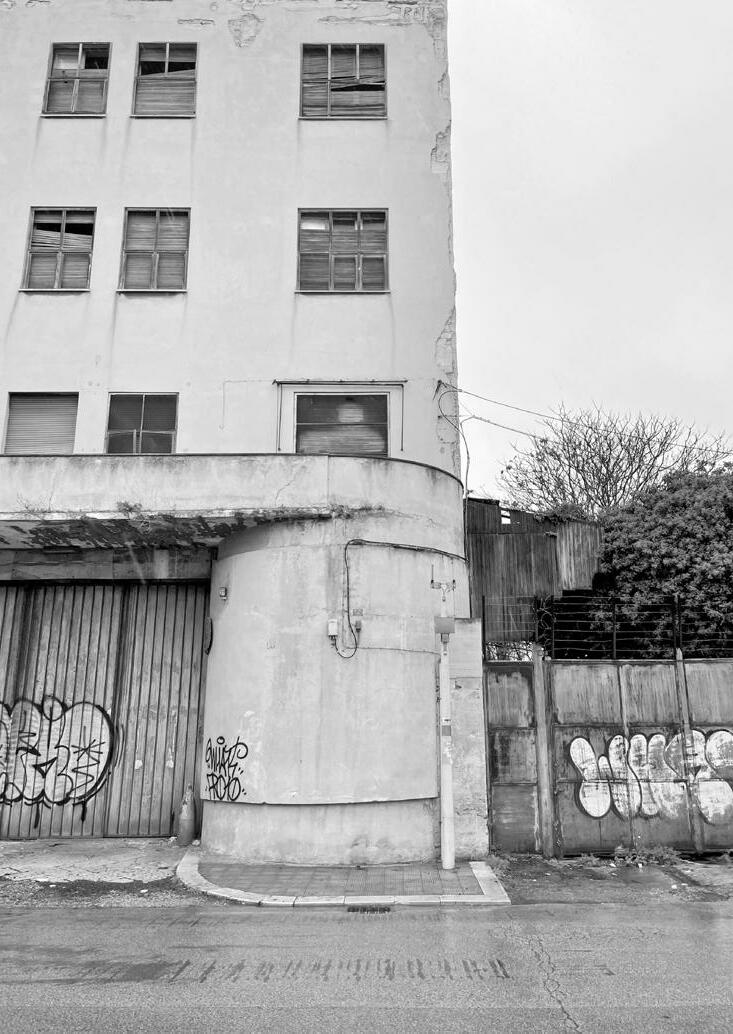
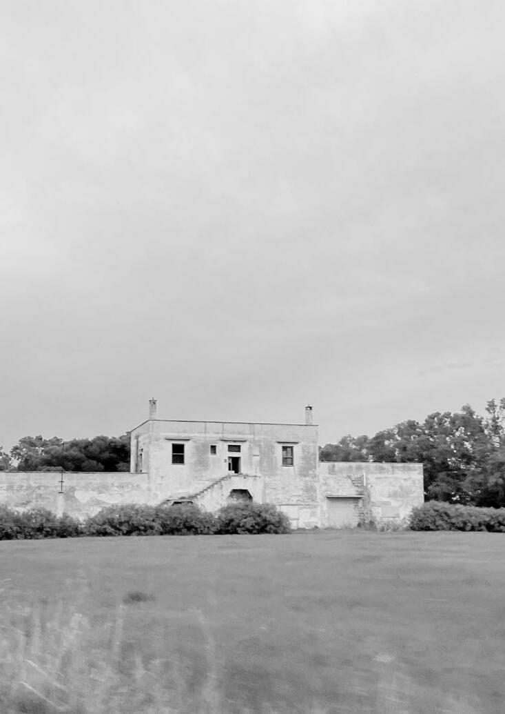
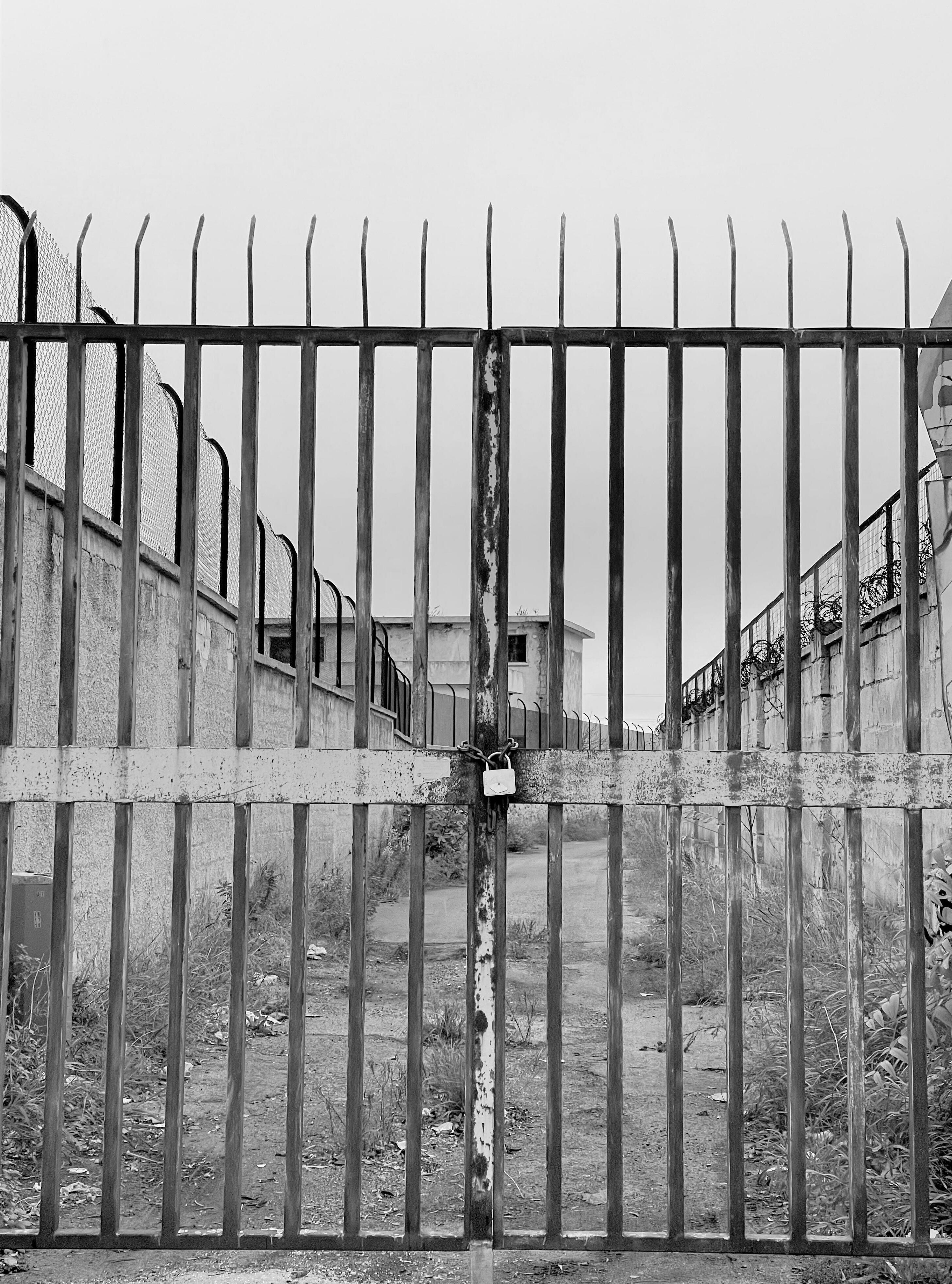
33 POLLUTION AND ABANDONED SITES
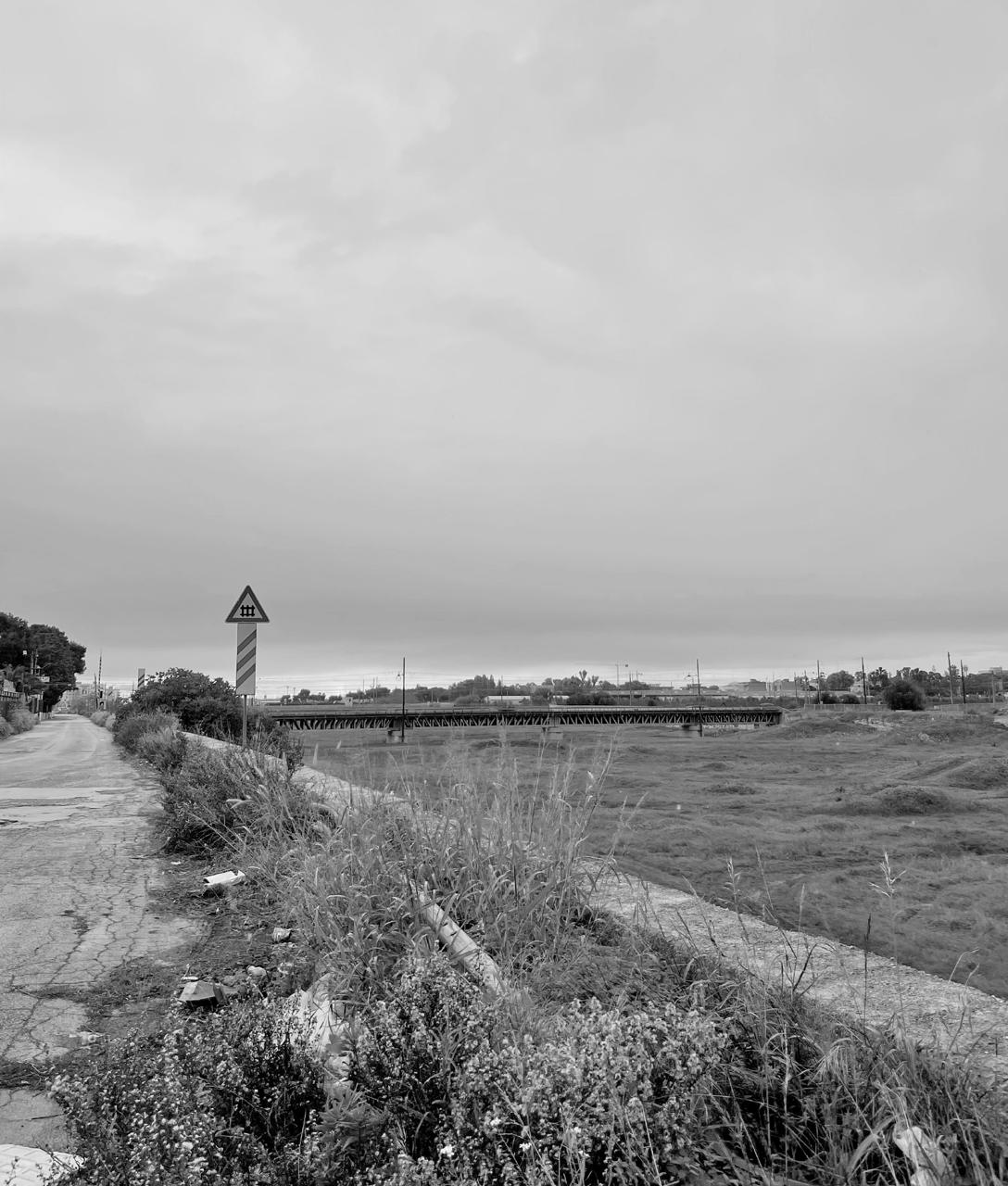
Collection of Abandoned Sites in Puglia (Schmitz, 2021)
RE-LAME PUGLIA 34
VISION AND STRATEGY
35
PART II

RE-LAME PUGLIA 36
37 MANIFESTO
RE-LAME PUGLIA 38 How can we enhance and improve the biodiversity of Puglia? How can we reconnect ecological corridors? How can we use abandoned sites to revive cities, regrow nature and reduce air pollution? How can we remove pollutants from the air of our cities?
We are in the midst of an exponentially escalating catastrophe and face a twin challenge of climate change and biodiversity lost. After our extensive research and analysis we comprehended the oppor-tunities and possibilities Puglia offers.
The Sustainable Development Goals by the United Nations are a guiding principle for and an urgent call for action by countries around the world to work in a global partnership (Nations, 2022). Addressing the combined aim to fight climate change, enhancing the preservation of our forests and ocean, ending deprivations, and improving health and education, are some of the objectives.
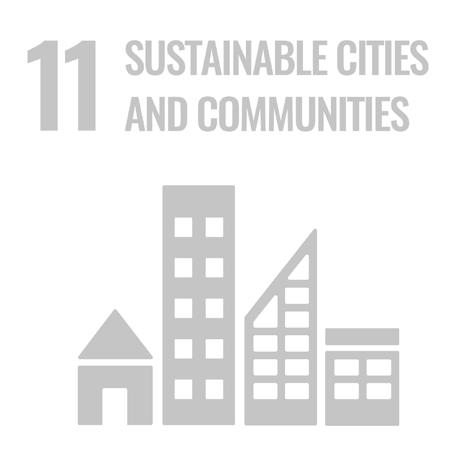
The completion of the RELAME project will improve most of the goals and we are tackling four goal directly. “(11) Make cities and human settlements inclusive, safe, resilient and sustainable” (Nations, 2022). The renaturation of abandoned and unsafe sites, such as the industrial sites in Bari, strengthen an inclusive and sustainable life in the city, generating jobs and valuable space for life. Furthermore, it ensures access to nature for the residents while improving the quality of life in the city.
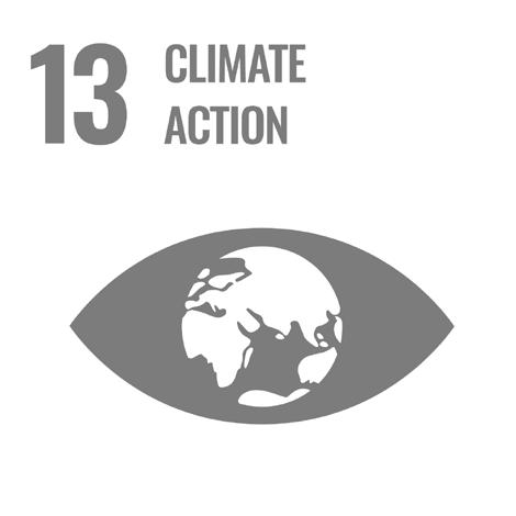
“(13) Take urgent action to combat climate change and its impacts (Nations, 2022).” This target forms the basis of the research and the project and is the fundamental goal within every operation. Giving all attention to the recovery and growth of biodiversity, is the aspiration of RELAME while allowing nature to blossom and thrive, leading to connected biological corridors.
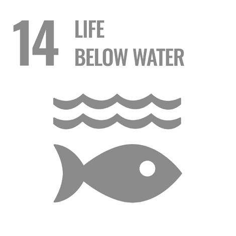
“(14) Conserve and sustainably use the oceans, sea and marine resources for sustainable development” (Nations, 2022). The severe threat of the oceans is affecting the whole ecosystems, it is our duty to sustainably protect and manage costal and marine ecosystems. The Region of Puglia has the longest coastline on the mainland of Italy, most of the Lame will end in the sea, where the beaches will be placed under protection to give back to the nature and allow living organisms to move freely ins the corridor.
“(15) Protect, restore and promote sustainable use of terrestrial ecosystems, sustainably manage forest, combat desertification, and halt and reserve land degradation and halt biodiversity loss” (Nations, 2022).” This goal combines all of the goals of the RELAME project and emphasizes the significance and importance of the afforestation of the Lame in Puglia.
39 SUSTAINABLE DEVELOPMENT GOALS
RE-LAME PUGLIA 40
41
LAME ABANDONED SITE ICONS OF CONTENT
CITY OF BARI CITY OF BARI


RE-LAME PUGLIA 42
43 BIODIVERSITY IN PUGLIA
RE-LAME PUGLIA
SYNTHESIS MAP
RE-LAME PUGLIA 46
REUSING and REVITALISING existing connections as a prototype to improve the biological ecosystem
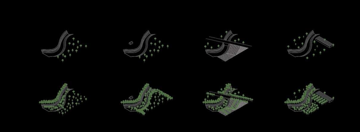
47 CONNECTION SCHEMES
RE-LAME PUGLIA 48
the
after Afforestation
Section of
Lama
Lame in Puglia
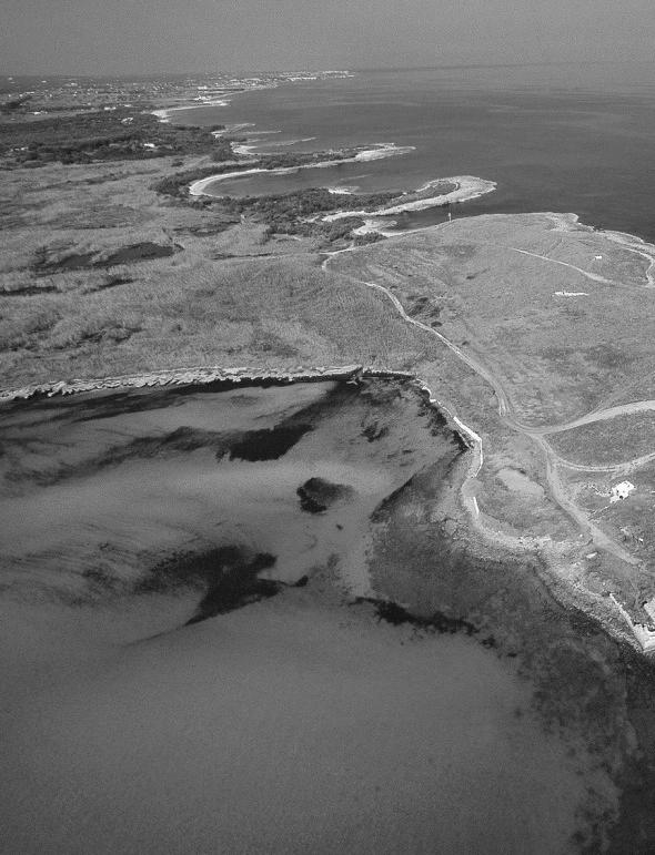
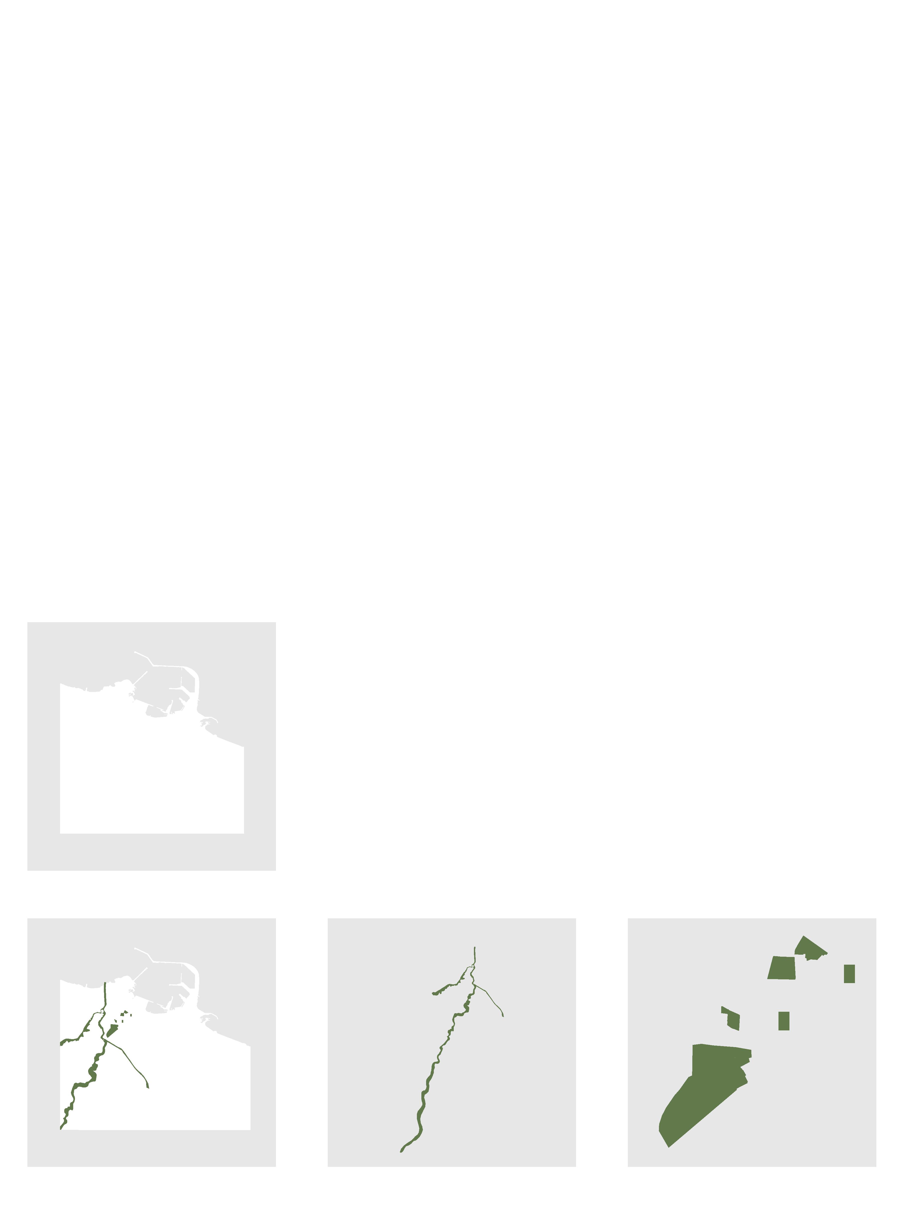
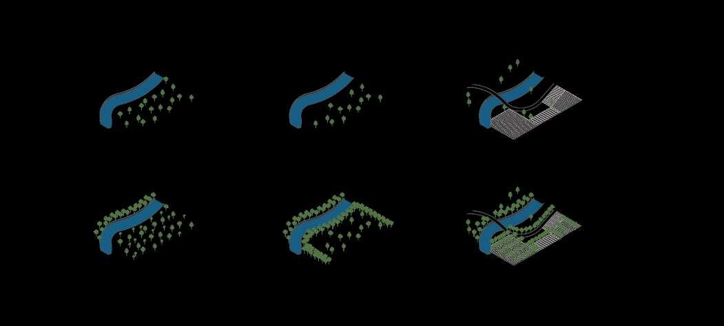
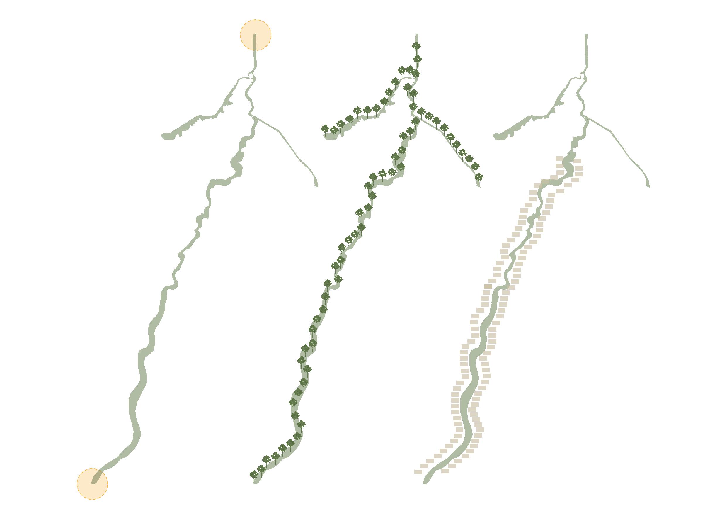
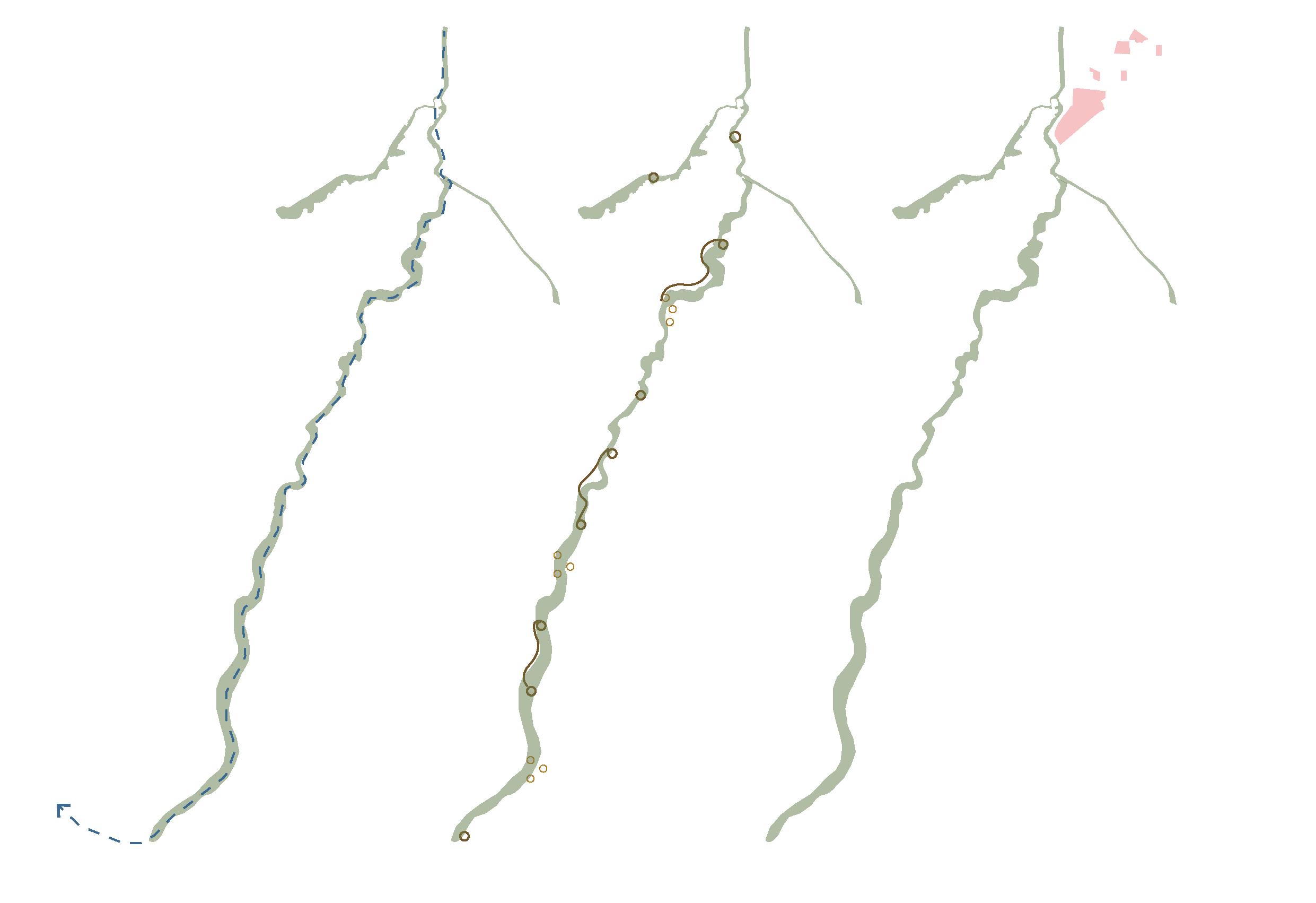
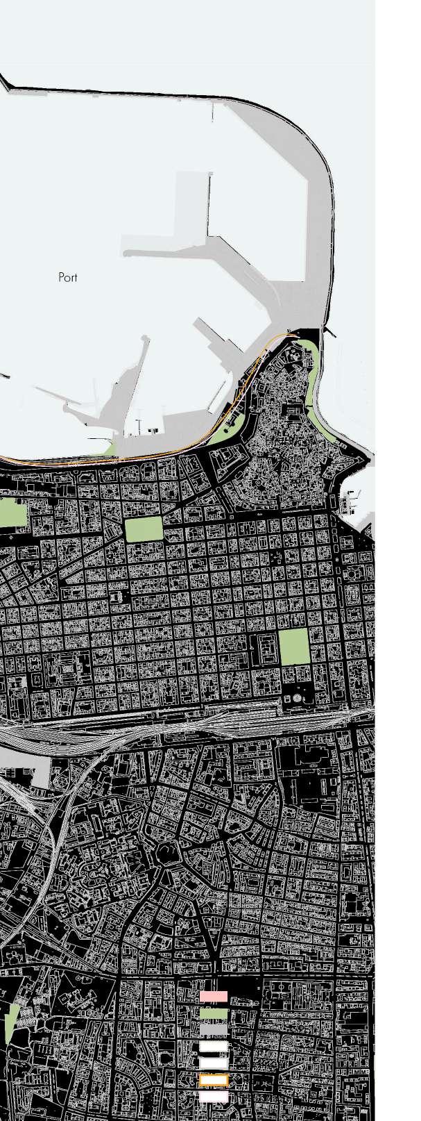
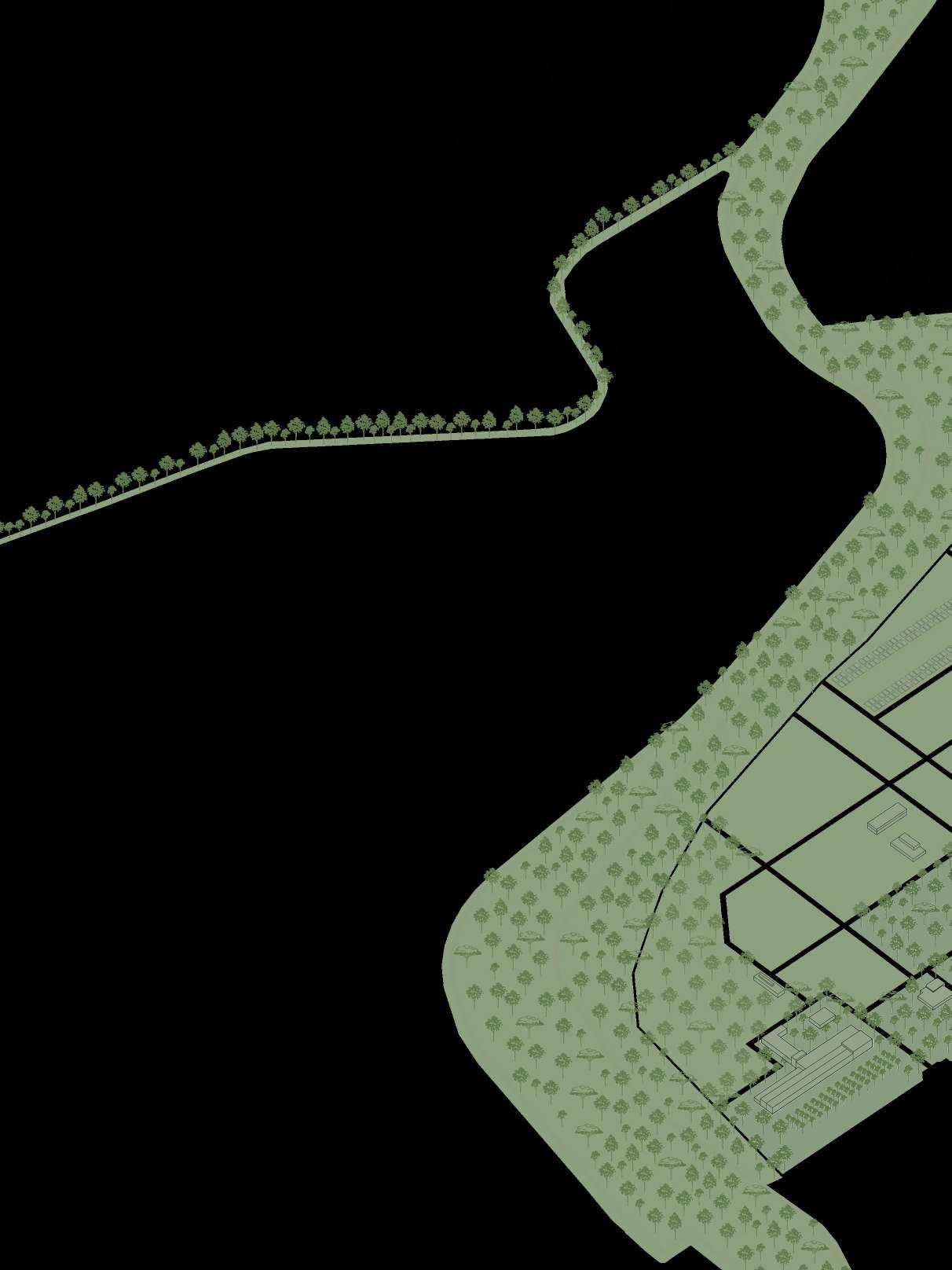
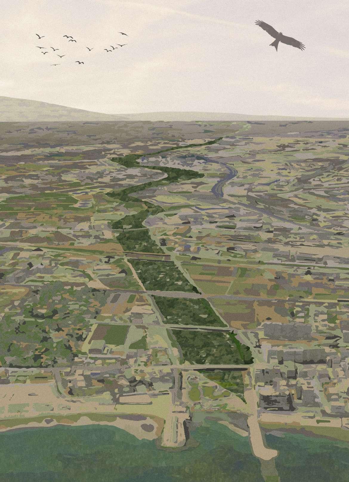
The “lame” are shallow furrows and a long-lasting element of Apulian Landscape, as they have conditioned the development of permanent settlements since ancient times. Orthogonal to the coastline, they partly structure paths and urban centers, linking them to the particular morphological structure of the territory.
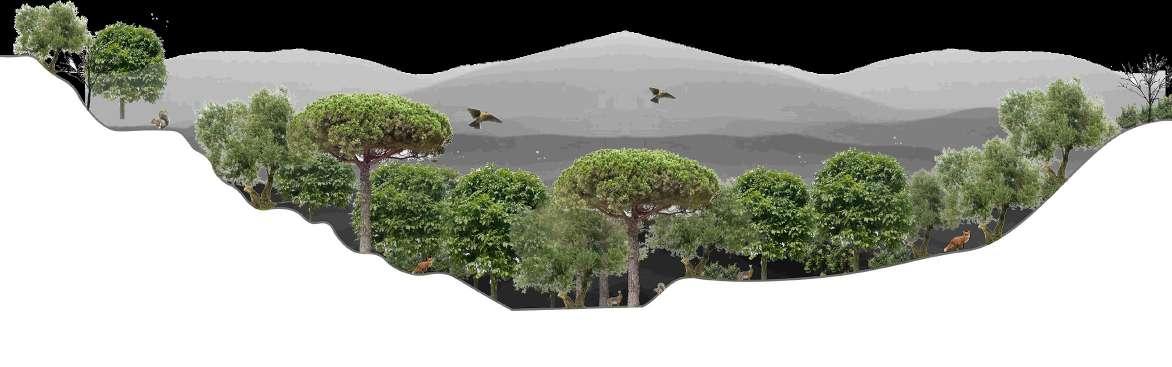
The “lame” offers great potential for enhancing biodiversity. The dried rivers are precious from a naturalistic and landscape point of view because they interrupt the landscape of intensive olive agriculture with impulsive vegetation, connecting the coast with the land of Apulia.
The Lame progresses along inhabited centers, agricultural fields, espeically olive tree fields. The depressed bed portrays the opportuniy to foster plant species, fauna and avifauna. Evenutally forming a green ecological corridor, allowing plant and animal speices to move freely and connect vital natural areas.
The requalification of the Lame is the main landscape intervention. The beginning of the Lame Sinatata originates on the west of Bari from the Adriatic Sea, continues through the abandoned industrial sites, emerging into the agricultural fields of Puglia all the way to the Parco Alta Murgia.
Here the nature thrives, the park is described as biodiversity hotspot with a variety of plant and animal species. The lame will turn into a biological corridor allowing species to move freely while also connecting two important ecosystems – the coastal marine life to the forest. The Vision is to Reconquer the landscape as a model to balance nature and city, connecting fundamental corriidors.
49 REQUALIFICATION OF LAMA
Lame in Bari (Schmitz, 2021)
RE-LAME PUGLIA 50
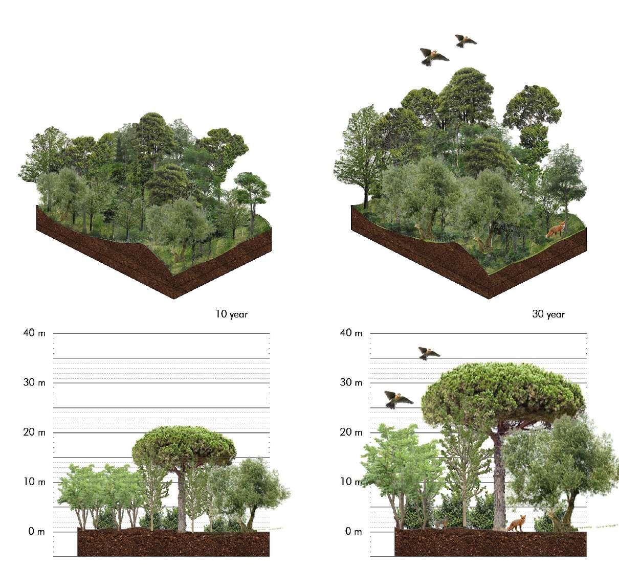
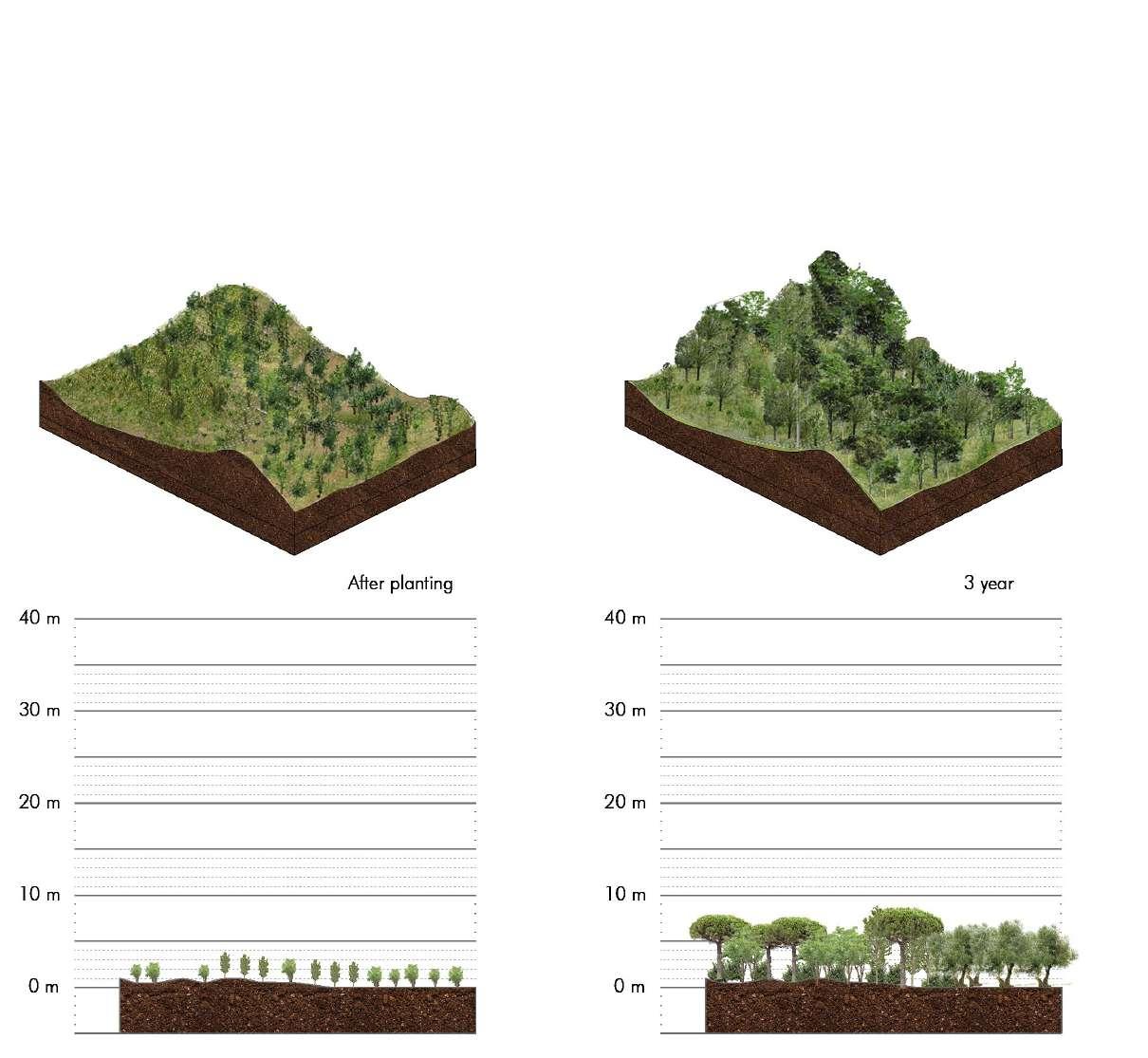
51 GROWTH OF LAMA OVER 30 YEARS
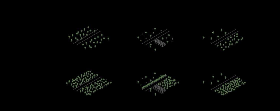
AFFORESTATION OF LAME
Biological Corridors
Respect Native Species
New Habitat for Flora and Fauna
Increase Biodiversity
Connection to Nature
Provide Knowledge and Skills
Sustainable Forestry and Architecture
Education on Biological Ecosystems
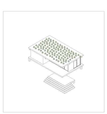
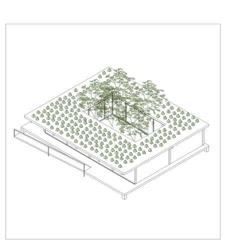
ARCHITECTURAL PILOT PROJECT
RE-LAME PUGLIA 52
ADRIATIC SEA PROTECTED BEACH SAND DUNES WETLANDS GRASSLAND
REFORESTATION PARCO ALTA MURGIA

53 RECONNECTING HABITAT


54
Reforestation
Alta Murgia Park


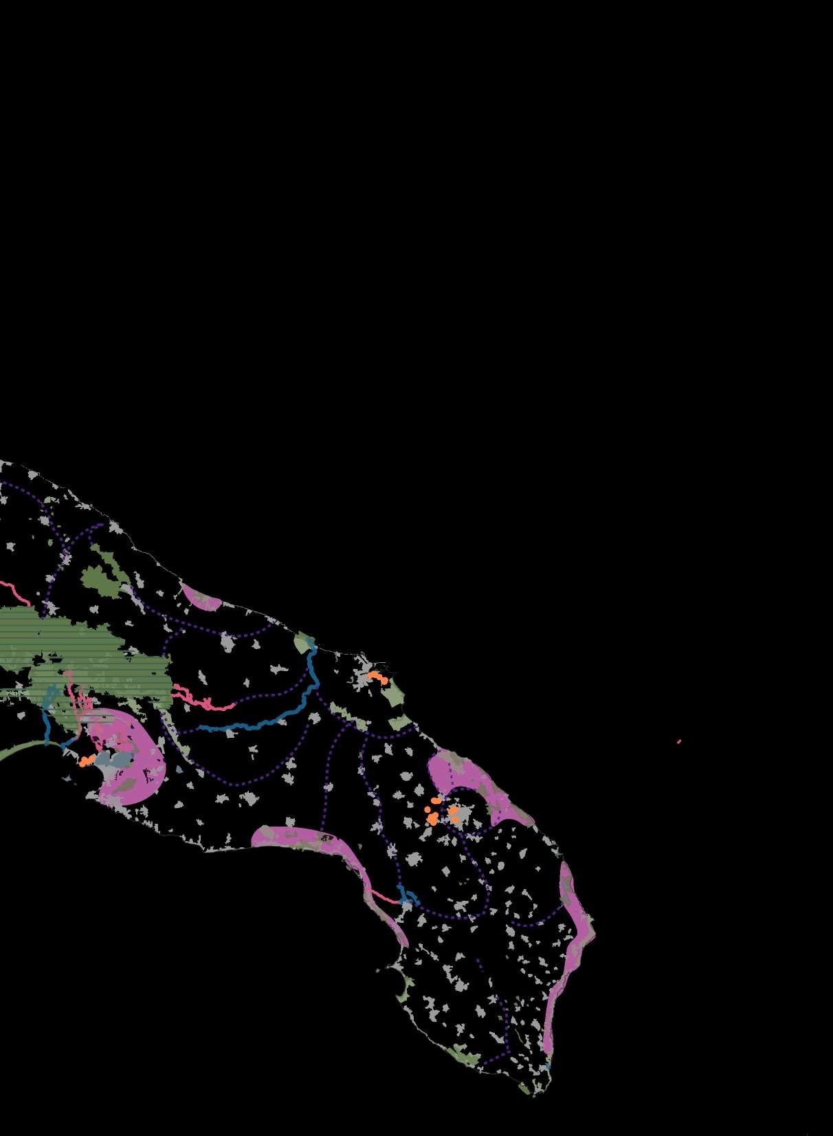
55 Adriatic Sea Wetlands Reforestation Lame CONNECTION TO THE WATER
The Valorisation and Protection of Biodiversity in Puglia
RE-LAME PUGLIA 56 RE-LAME
reuse of industrail sites
Bitonto Palo del Colle Binetto Toritto Mellitto
Modugno
Bitetto
Sannicardo di Bari
Bitritto
tree house 14 km 24 km tree house tree house
50 km
observatory observatory observatory
35 km 35 km 60 km
observatory
57
Adelfia
Le Monacelle
Ceglie del Campo
Parco Alta Murgia MAP FROM PARCO ALTA MURGIA TO SEA
Bari
AFFORESTATION
RECONNECTING HABITAT AGROFORESTRY
RE-LAME PUGLIA 58
EXPERIENCING LAME BIKE AND PEDESTRIAN PATH RECYCLING ABANDONED SITES
59 LAME STRATEGY LAYERS
TREE SLALOM
This is a fun way to experience the trees and views from different perspectives
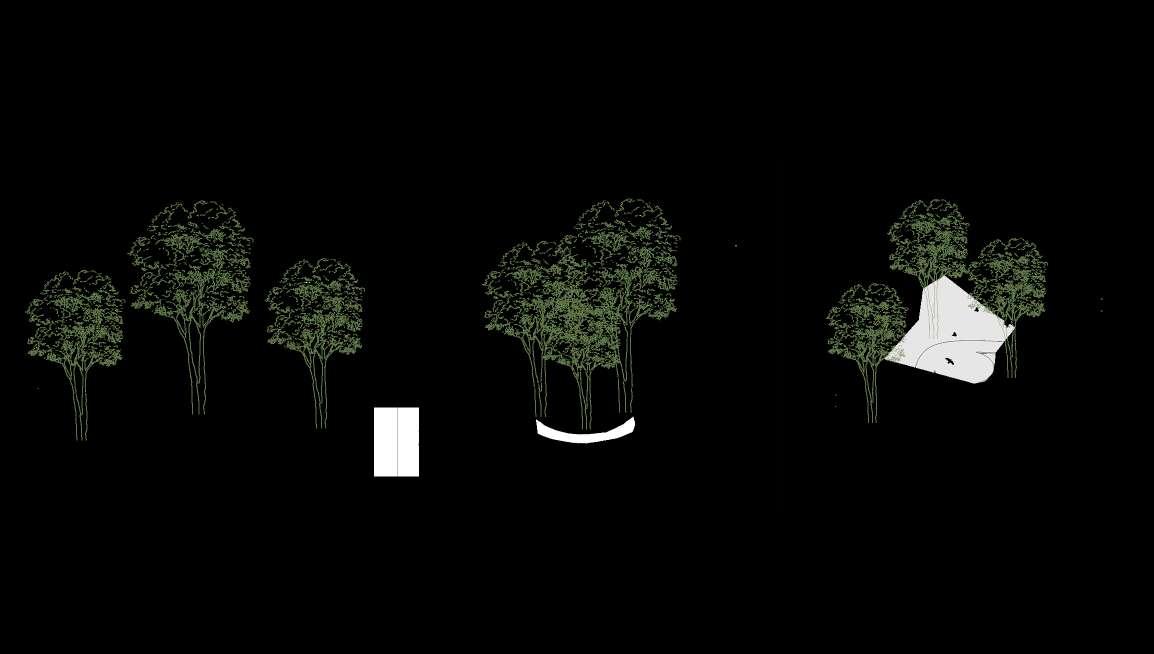
TREE LOOP
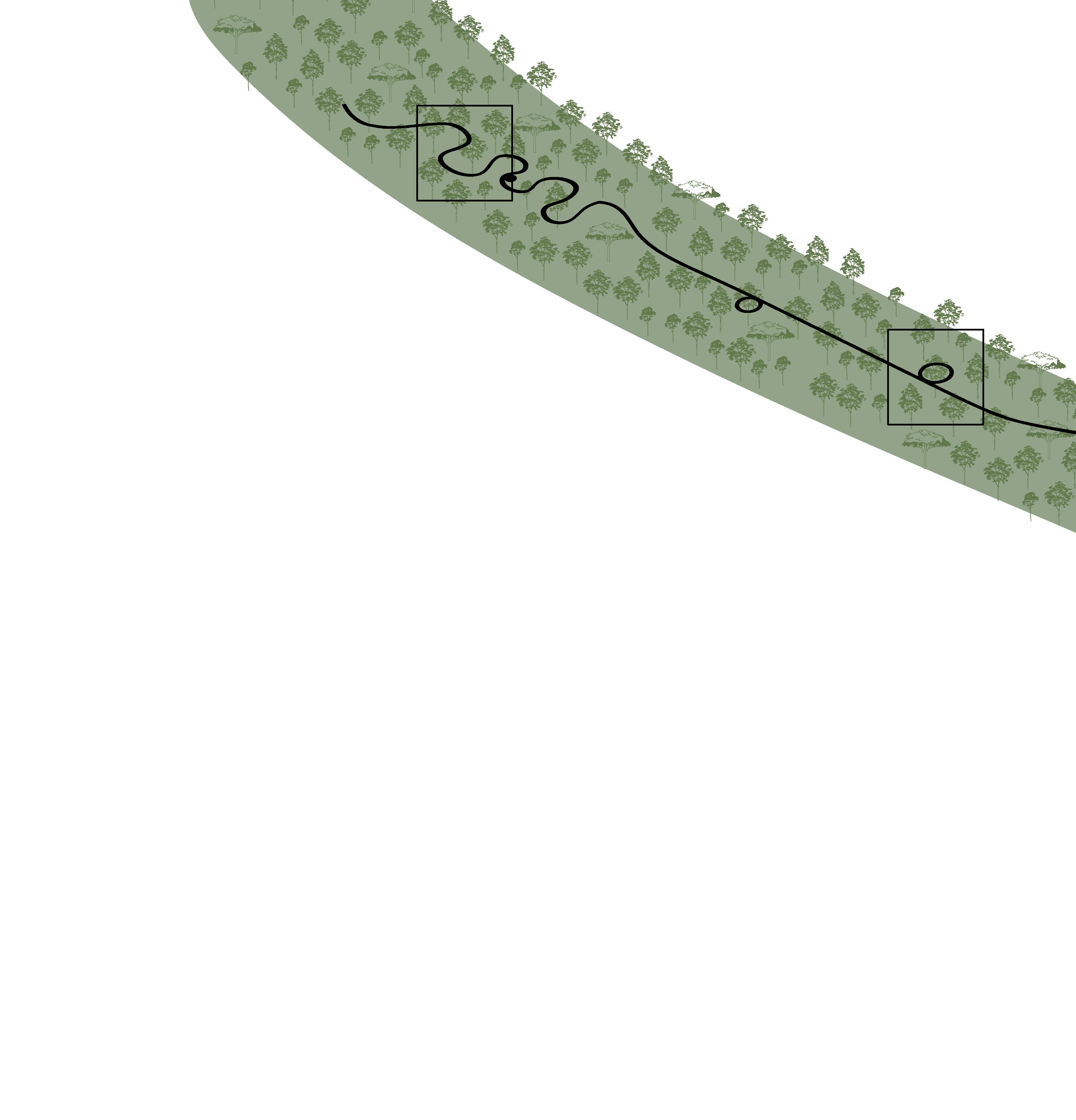
Here the tree loop invites to a detour around the tree crown to experience the foliage close up
VOLIERE
This offers the visitors to switch the role with the birds and be a “guest” in the birds voliere
RE-LAME PUGLIA 60
ENHANCING BIODIVERSITY
also making it accessible to the public
The 1000 meter boardwalk is designed as a sequence of micro-experiences along the Lame, offering the unique possibility to enjoy the nature and the views
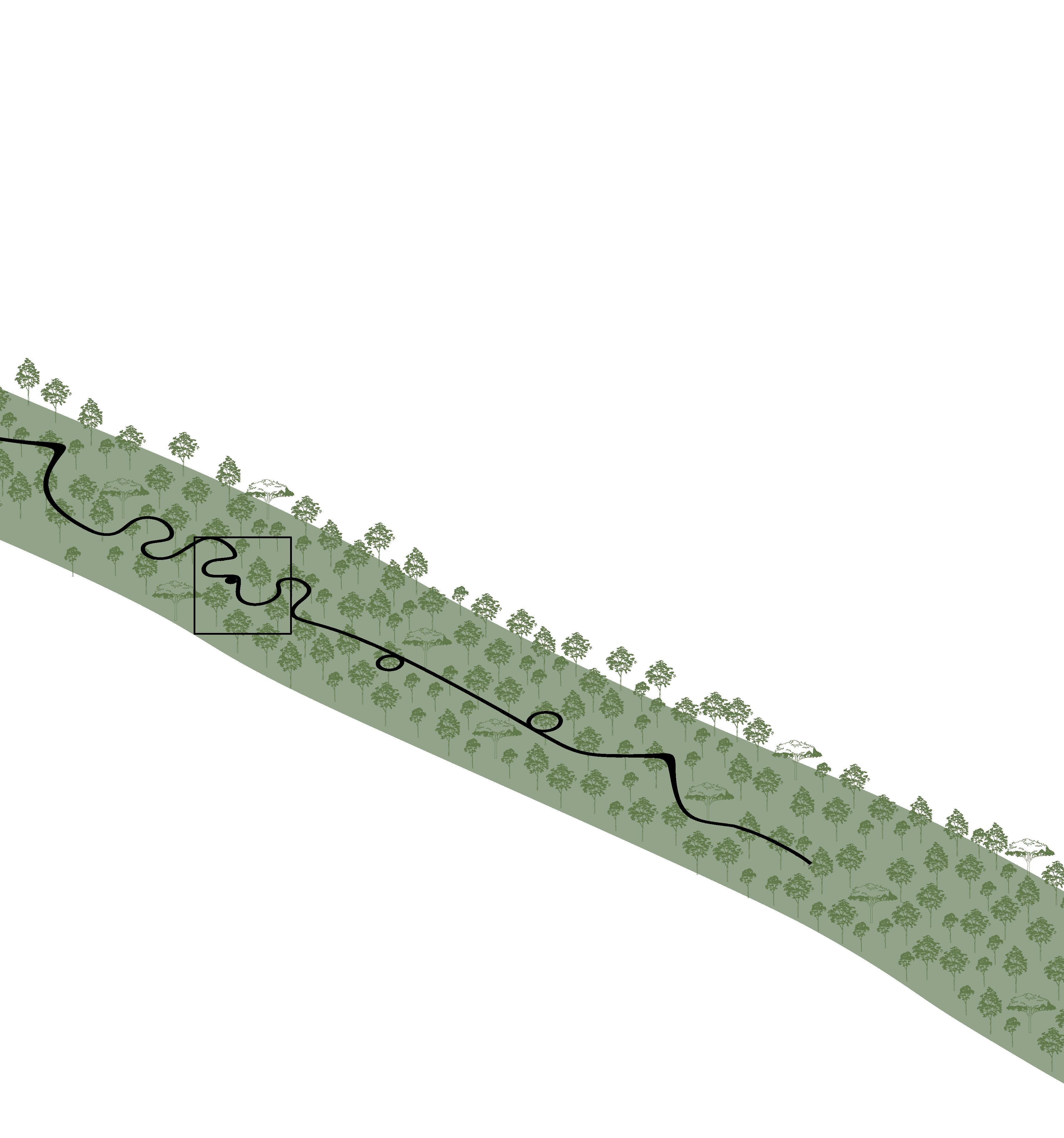
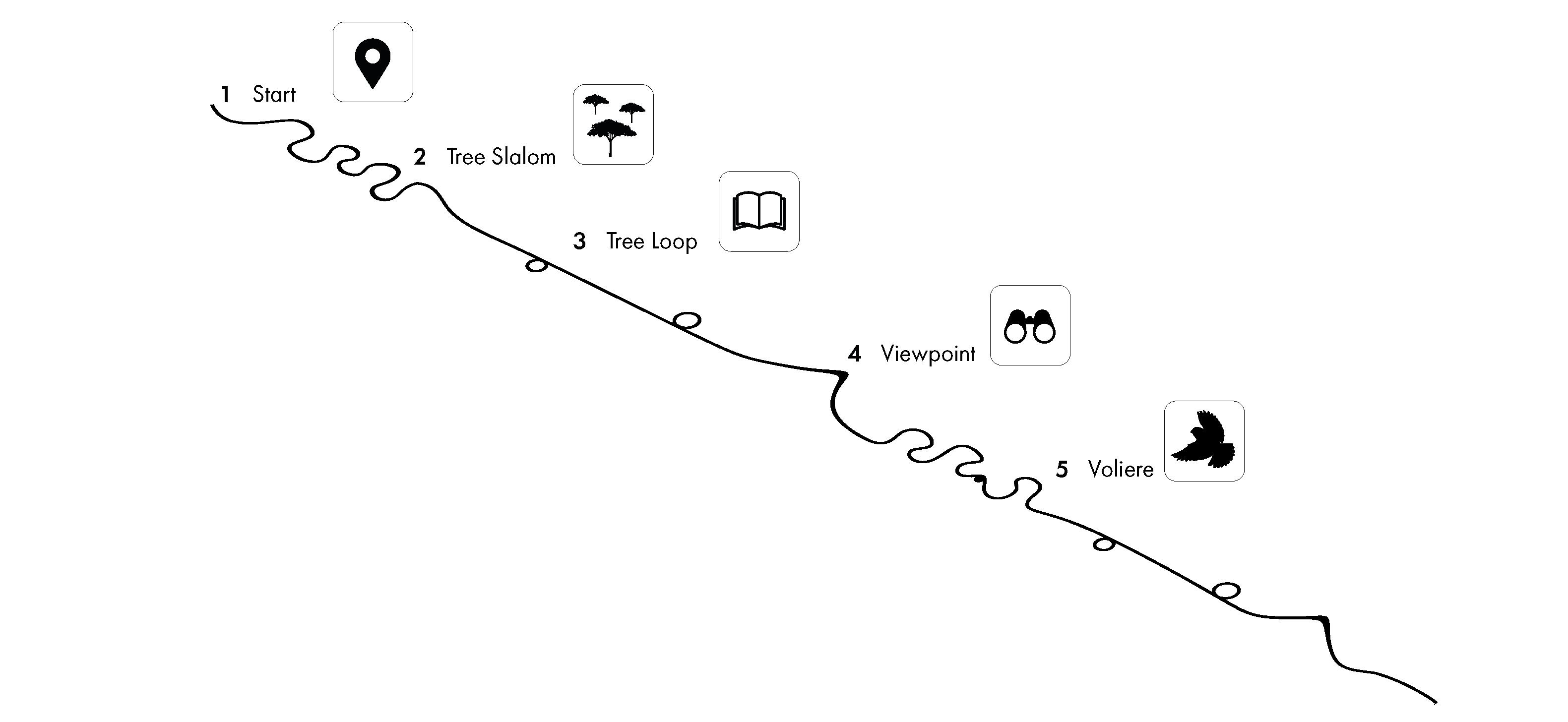
with strategic rest-points. The rich biodiversity can be experienced from another perspective, as it makes the human a visitor in the untouched nature. The route
through the trees is sensitivley planned to minimize the distubance of the nature.
61
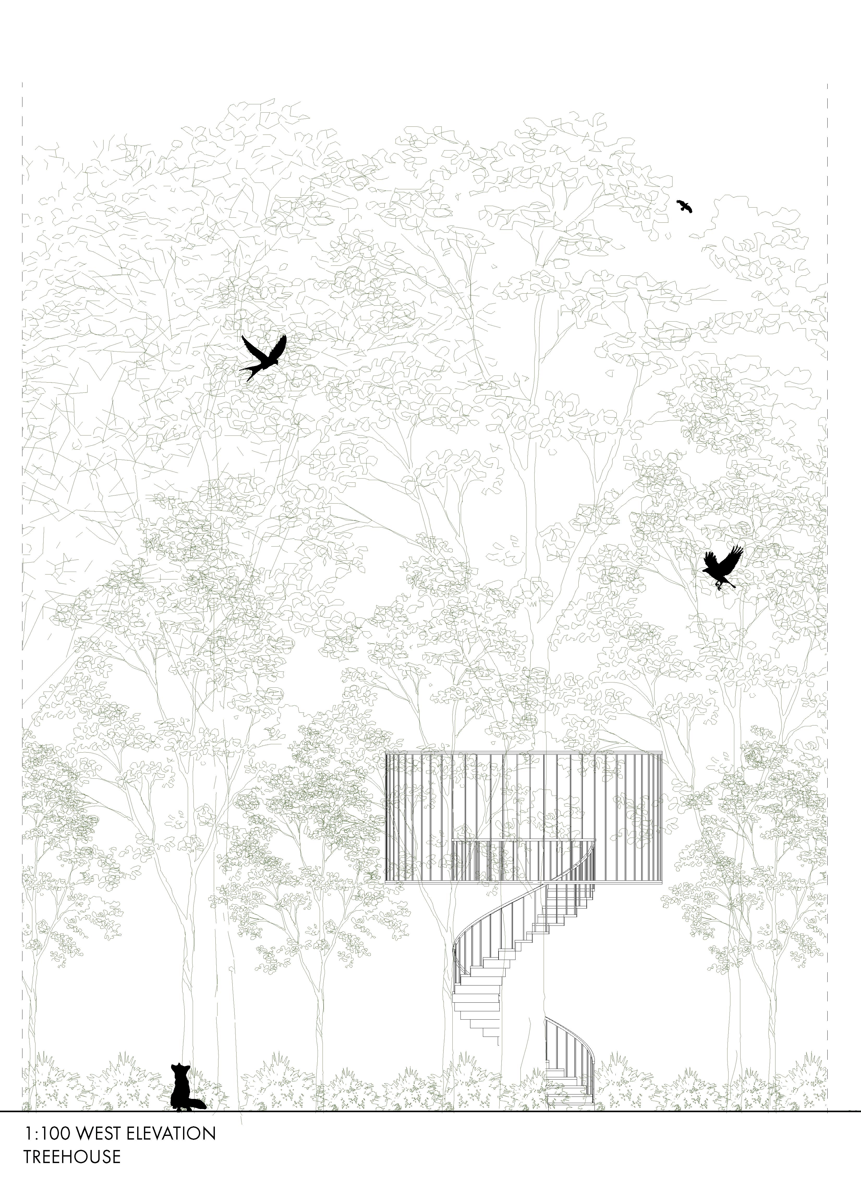
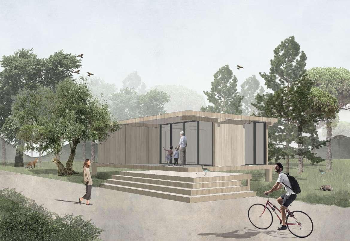
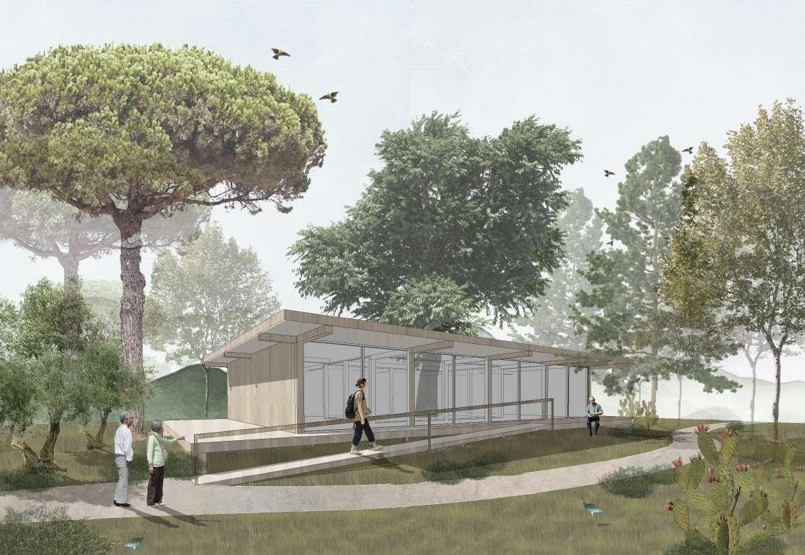
RE-LAME PUGLIA 62 ELEVATION TREE HOUSE IN LAME
relationship between humans and
63
We REDEFINE the
We REBALANCE NATURE in and with the CITY TREEHOUSE
We RECONNECT ecosystems with biological corridors
nature
RE-LAME PUGLIA 64
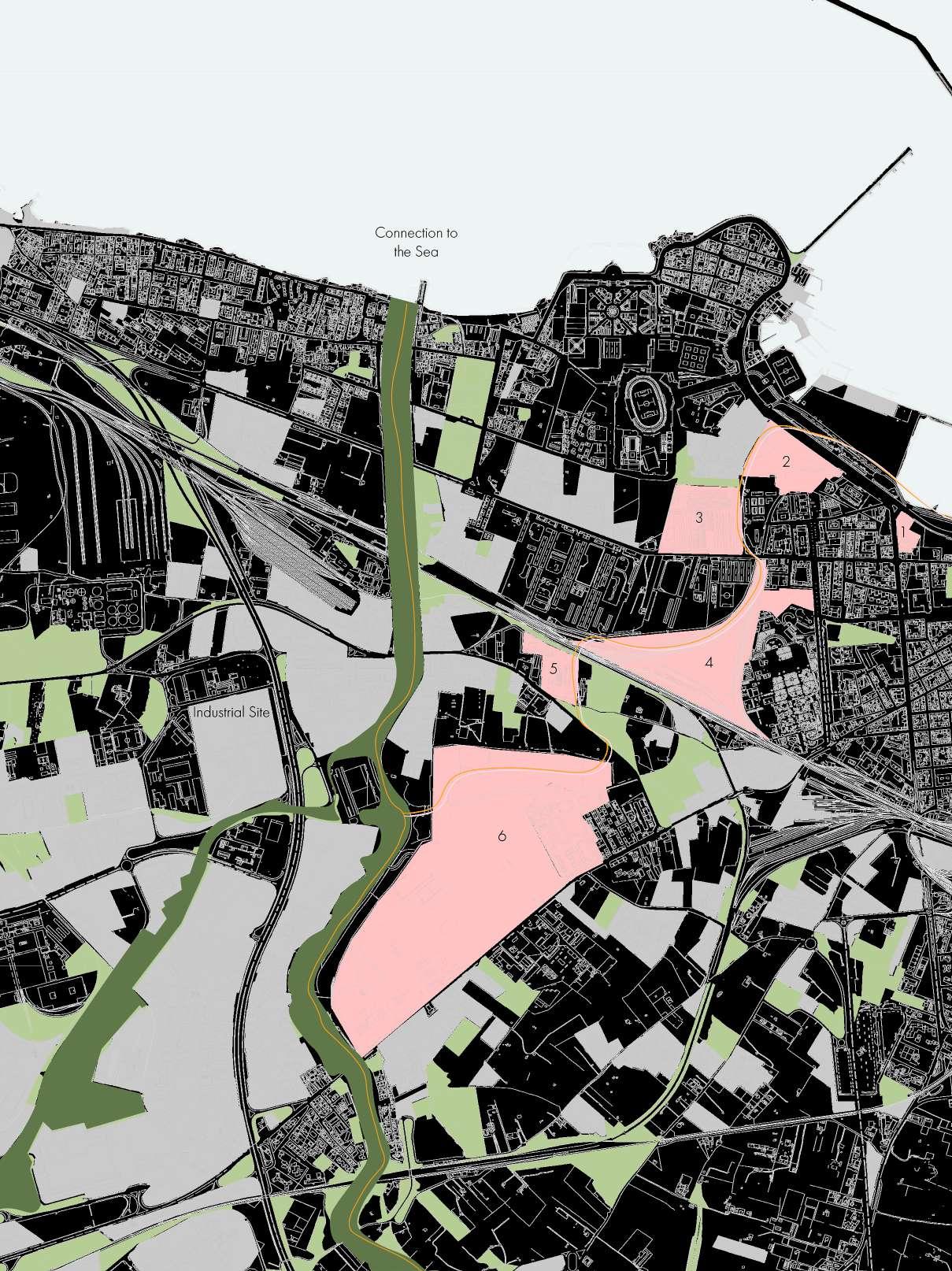
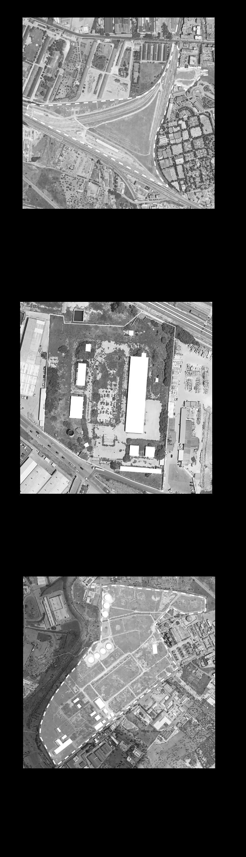
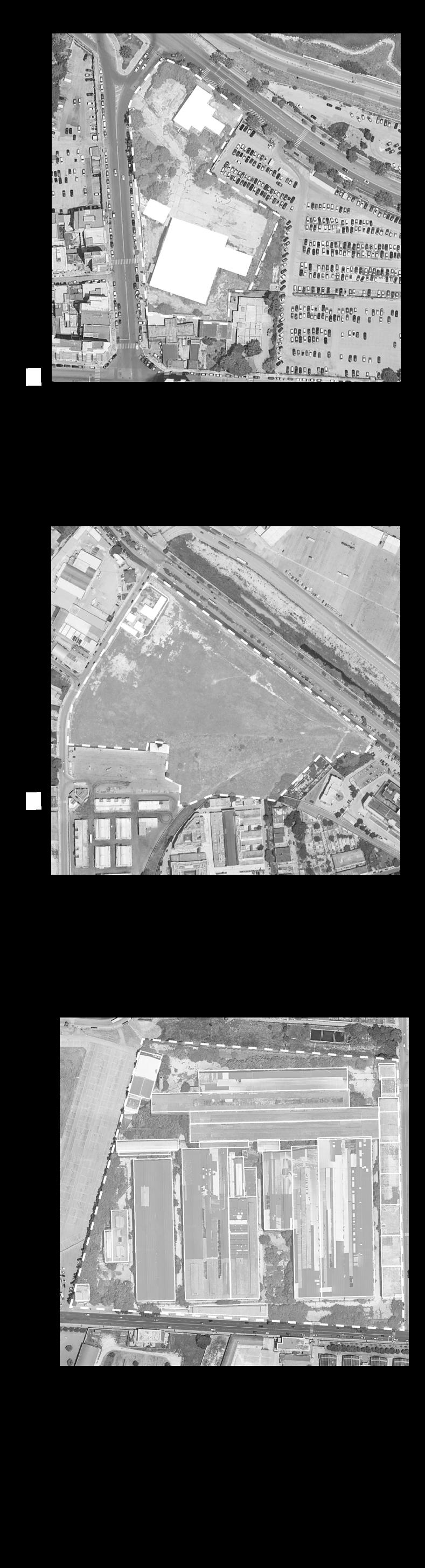
BARI - The reconfiguration of the urban fabric of Bari is an element of the landscape intervention and especially of the requalification of the Lama. The beginning of the Lama Sinatata originates on the west of Bari, continues through the heavy industrial sites, all the way to the Parco Alta Murgia.
The abandoned industrial sites and railways are the key elements for this strategy, as they connect the Lama directly to the centre of Bari, allowing citizen to enjoy the green areas. The new pedestrian system articulates an ecological, visual and physical connection between the Lama, the contemporary city and the historic centre.
URBAN JUNGLE BARI - Six selected abandoned industrial sites are envisaged as an integral part of the green connection extending to the Lama Lamasinta to the city of Bari. The reconfiguration of the urban fabric of Bari permits the conclusion and integration of the green connection from the Parco alta Murgia.
URBAN FORESTRY - The abandoned industrial sites in close proximity to the city offer tremendous potential for urban forestry and transforming grey zones into healthier places for human and animals, as well as reduce pollution, enhance the existing biodiversity and absorb CO2.
65 LAME CONNECTION TO BARI
City of Bari (Schmitz, 2021)
RE-LAME PUGLIA 66
67 RENATURING INDUSTRIAL SITES
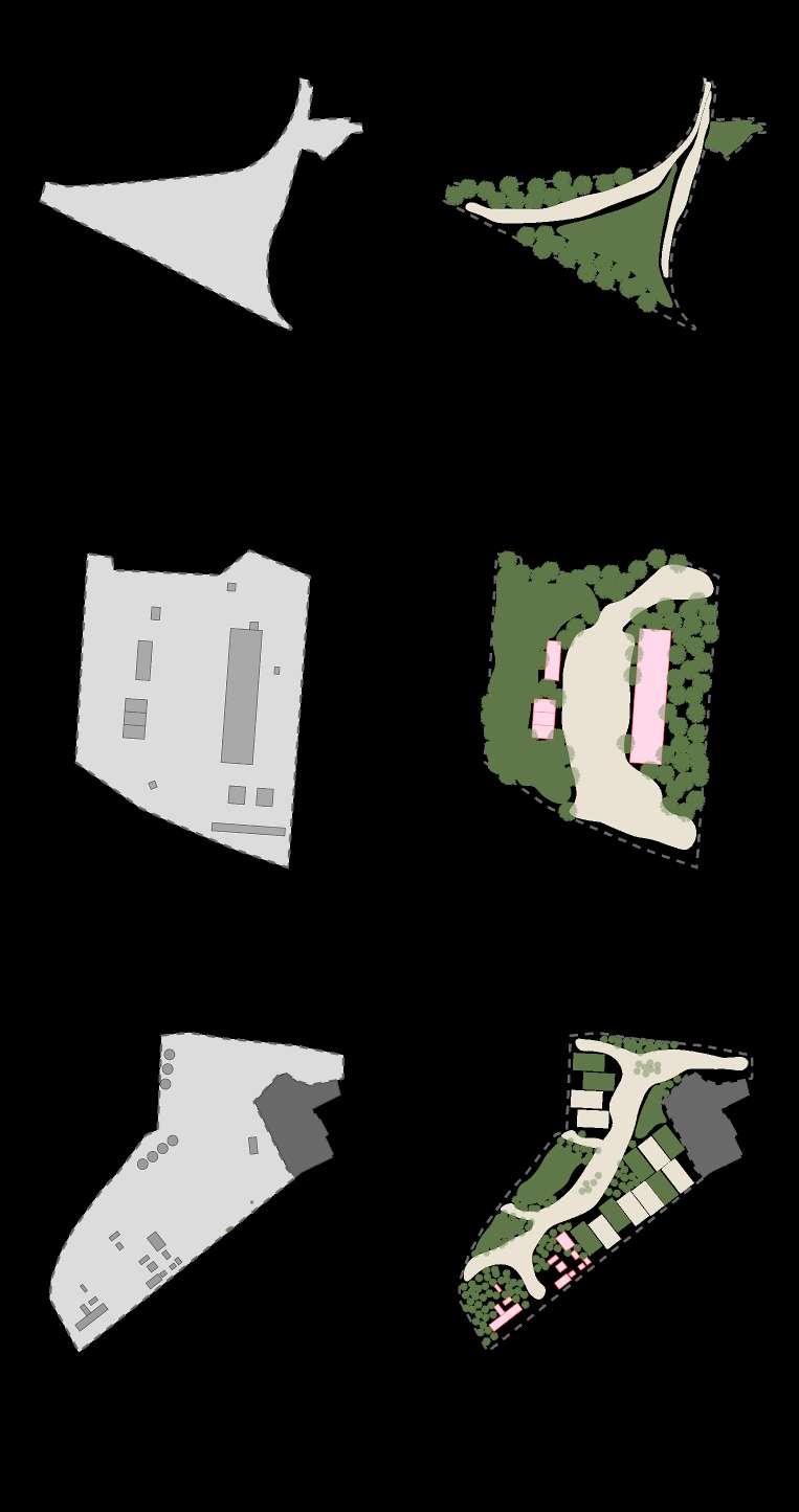
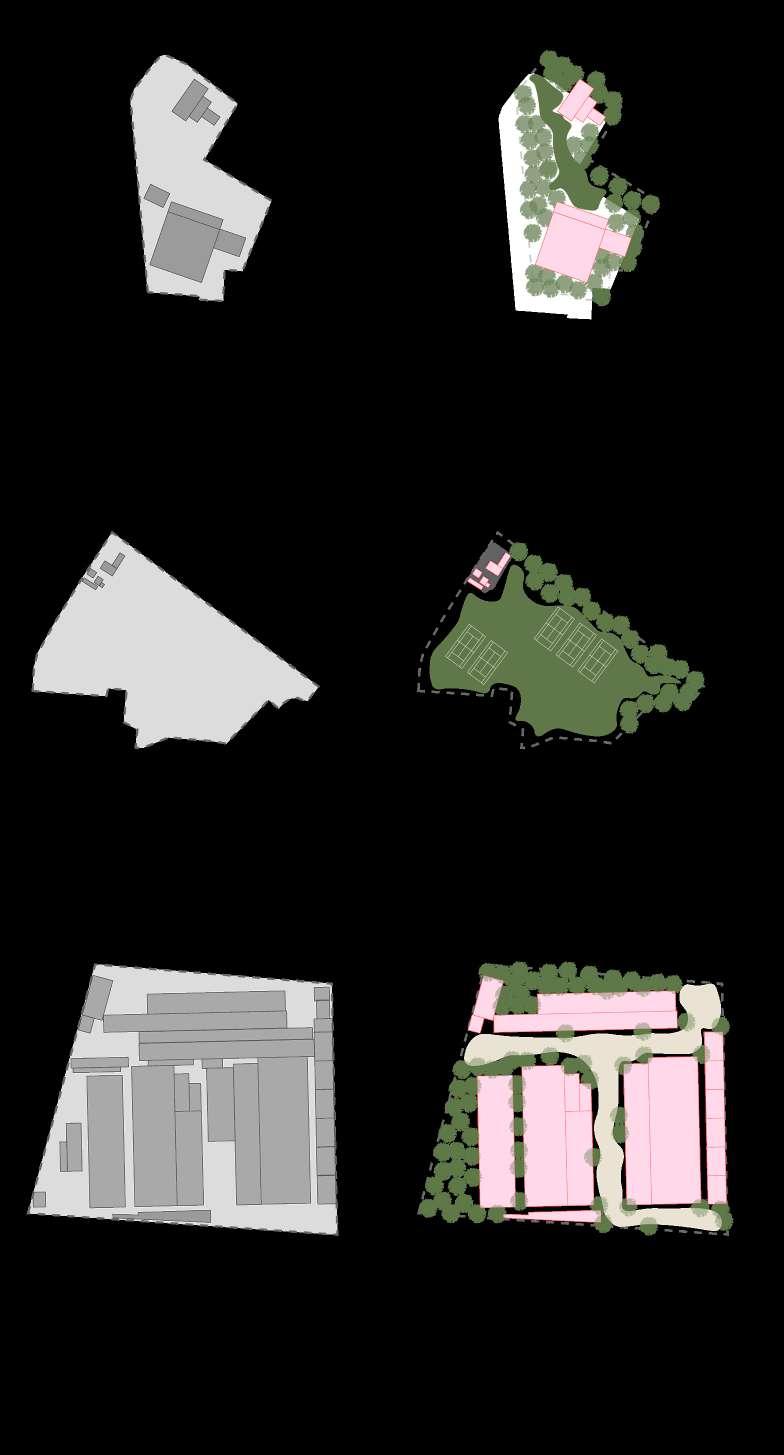
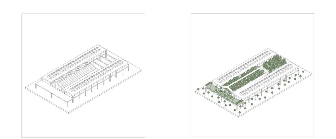
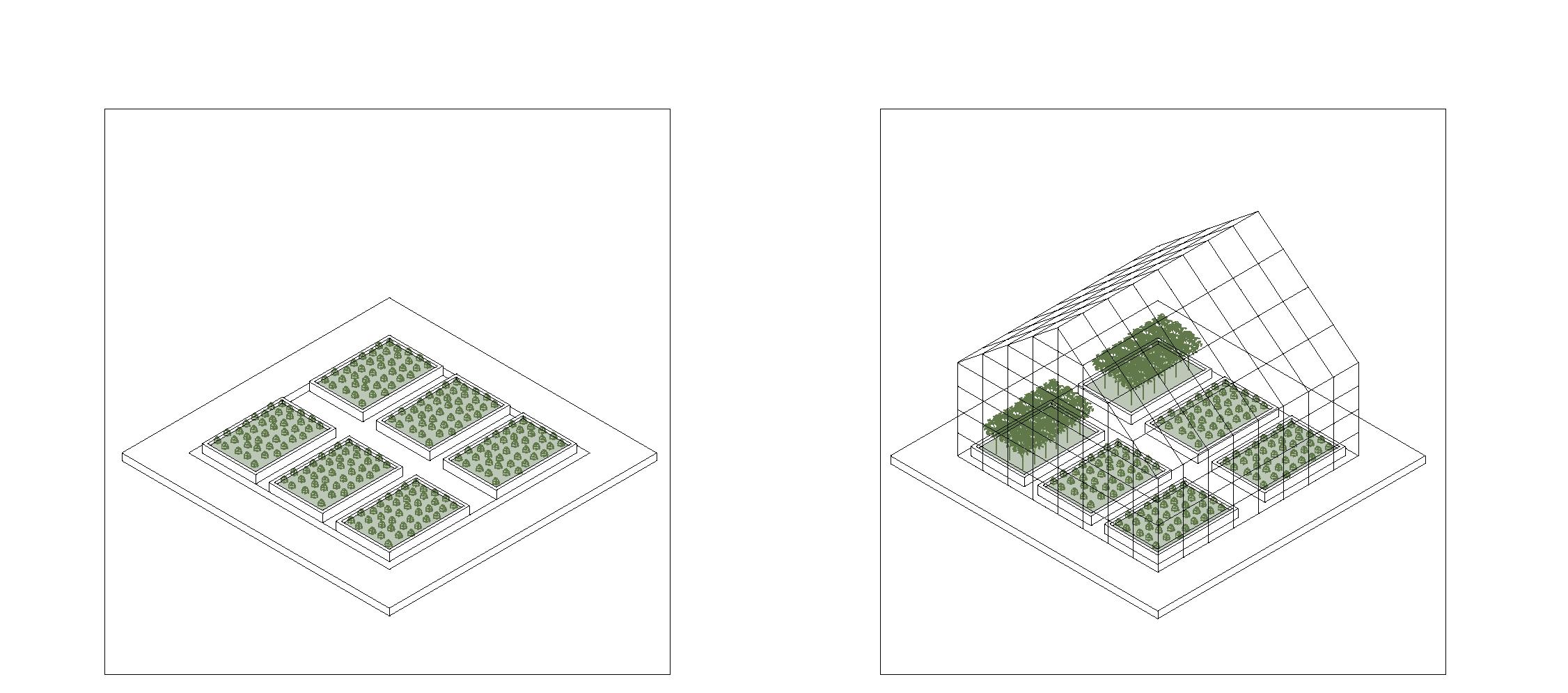
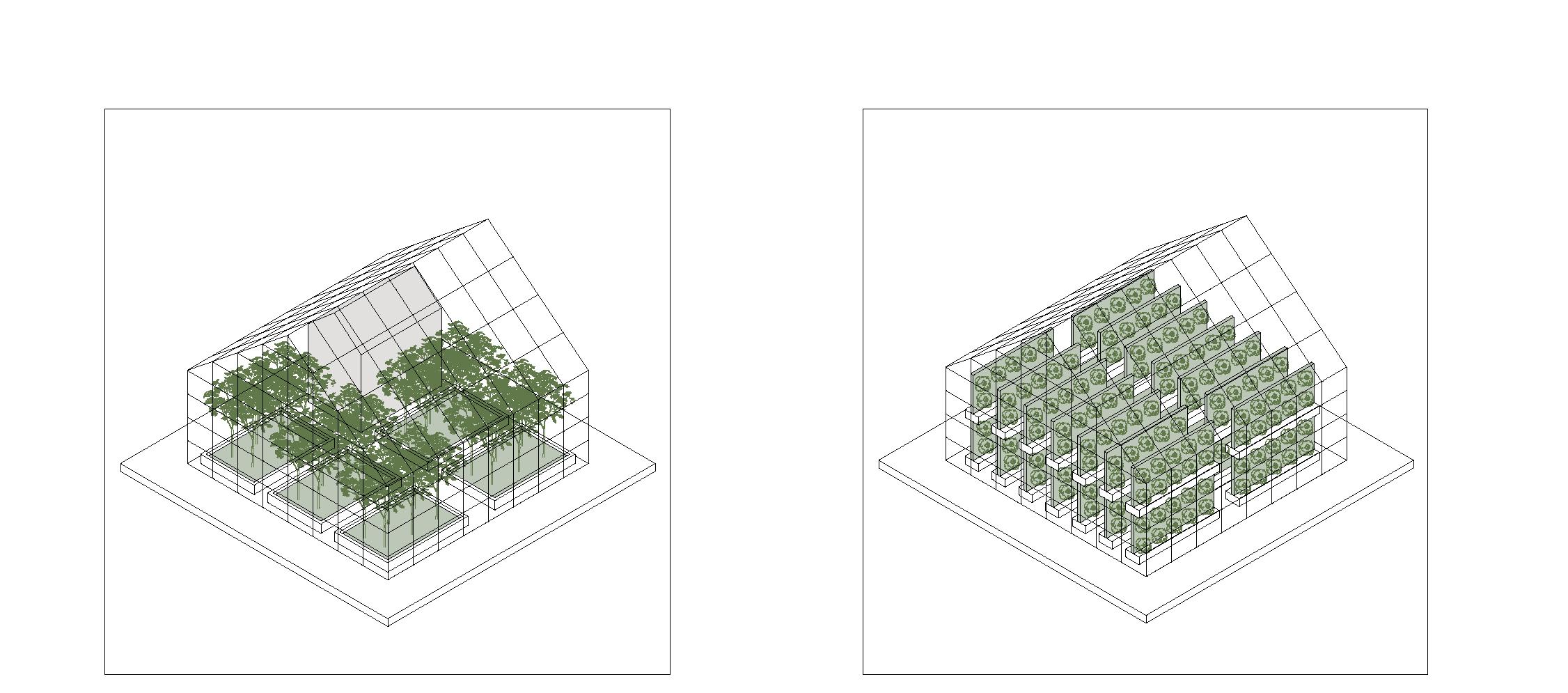
SITE STRATEGY - The aim of the abandoned indutrial site is to reactivate the space for the citizen by recycling exsiting structures to create an attractive urban green park. The existing greeenery is strengthend by adding new local trees and different plant species from puglia to frame the outdoor spaces. A primary path is introduced to connect the industrial site with the city in the north east and with the new project on the Lame in the south.Secondary paths from the connections between the buildings on site to create an ecosystem throughout the site.
TRANSFORMATION STRATEGY
1. MAPPING
The first step of the transformation of the abandoned industrial site is the mapping of what structures are worth preserving and what structures can be demolished to clear the site and buildings.
2. PRESERVATION
The roof, walls, columns and structural elements are analysed for each building to decide what can be removed and what preserved.
3. NEW STRUCTURES
The existing structures are restored and new elements such as facade are added in resepct to the industrial site.
4. NEW DESTINATION
By demolishing existing buildings new space is generated and clearly defined to strengthen the organisation of the urban space and create meeeting spaces.
RE-LAME PUGLIA 68
Animal Sanctuary
Biodive
Xylotheque
Oil Lab
Research
Plant
Local
Xylotheque
Market
Garden

69
Center
search Facility eque Botanical Garden Vegetable Field Seasonal Garden Vegetable Field Educational Farm Farm Seasonal Garden Plant Nursery
REVITALISATION OF INDUSTRY 6 We RECYCLE
to cultivate NEW LIFE
Sustainability
Biodiversity
Farmers Market Sensational Rehabilitation Garden
existing territory
RE-LAME PUGLIA 70
Abandoned Industrial Site 6 Bari (Schmitz, 2021)
have the potential to become protagonists of a radical change”
 Stefano Boeri, 2018
71
ARCHITECTURAL INTERVENTIOINS
Abandoned Industrial Site Transformed into Botanical Garden
“Cities
RE-LAME PUGLIA 72
Seasonal Garden
Heated Greenhouse
Greenhouse Hydroponics
73 SUSTAINABLE AGRICULTURE
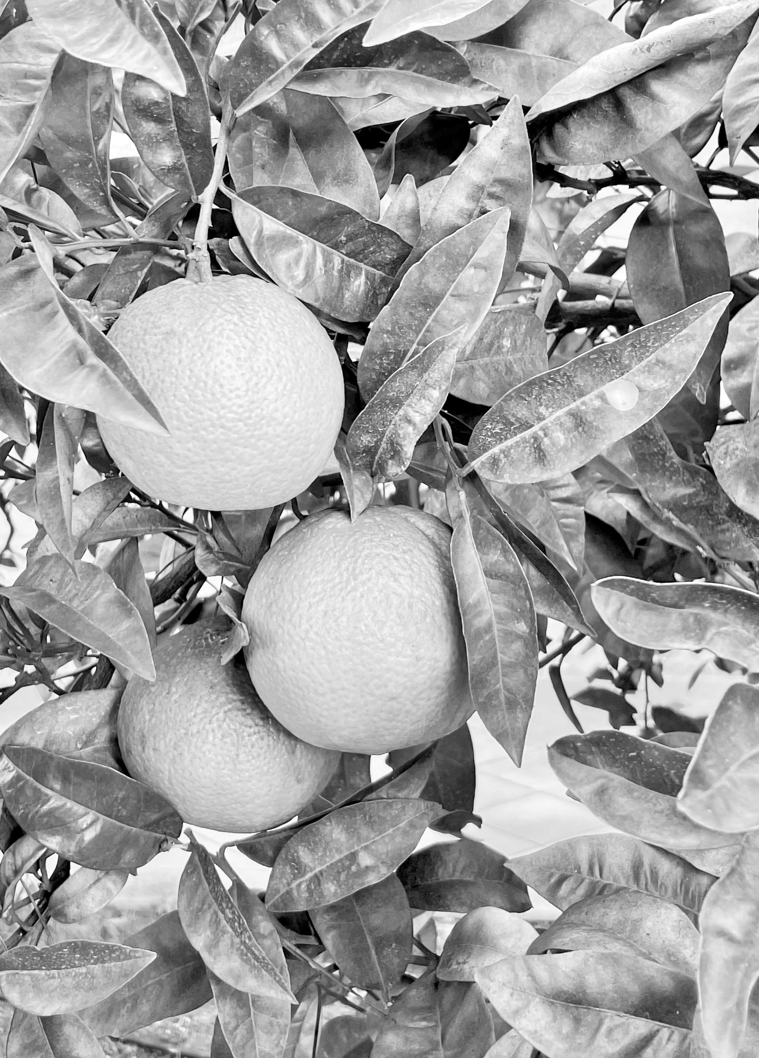
Orange Tree in Ostuni (Schmitz, 2021)
Oil OLIIVELabOIL LAB
The significane of Olive Trees in Puglia is explained and the sustainable production of Olive Oil is highlighted to show the importance of the ancient trees
RE-LAME PUGLIA 74
Xylotheque XYLOTHEQUE
Valuable Specimen of Apulian trees are exhibited and grown to educate about the diverse selection of plant species specific to Puglia
75 INFORMING ABOUT BIODIVERSITY
RE-LAME PUGLIA 76
RE-LAME WINNING IMAGE
77 WINNING IMAGE
RE-LAME PUGLIA 78
Arpa Puglia. (2021). From http://arpapuglia.it/ Boeri, S. (2017). Eclectic Atlases.
Buttimer, A. (2012). Alexander von Humboldt and planet earth’s green mantle. From Open Edition: https://journals. openedition.org/cybergeo/25478?lang=en
Ciseria, F. (2021). Puglia .
EC Europa . (2019). From Eurostat: https://ec.europa.eu/eurostat/documents/2995521/9746862/1-29042019-BP-EN. pdf/329a9132-20c0-485b-aa22-b34864c22fde
Enel . (2020, May). From https://www.enel.com/media/ explore/search-press-releases/press/2020/05/enelearly-closure-of-the-brindisi-thermal-plants-unit-2-authorized0
Eni CBCMED. (2021). From https://www.enicbcmed.eu/ medusa-puglia-has-been-among-fastest-growing-tourism-destinations-europe-over-past-ten-years
Google Earth . (2021). From https://earth.google.com/ web/ Krogh, M. (2020). Connectedness.
Lovelock, J. (2009). The Vanishing Face of Gaia . Perseus Books Group New York. From https://courses.seas.harvard.edu/climate/eli/Courses/EPS281r/Sources/Gaia/ Gaia-hypothesis-wikipedia.pdf
Nations, U. (2022). Sustainable Development Goals. From https://sdgs.un.org/goals
Population Density. (2017). From https://popdensitymap. ucoz.ru/news/153_population_density_administrative_ boundaries_map_of_provincia_di_puglia_italy_abitanti_densita_italia_provincija_apulija/2017-01-26-174
(2018). Puglia Region, Italy . World Health Organisation . Pugliacon. (2021). From https://pugliacon.regione.puglia. it/web/sit-puglia-paesaggio/rete-natura-2000 PugliaSalute. (2021). From Centro Salute Ambiente Puglia: https://www.sanita.puglia.it/web/csa/ qualita-dell-aria-e-salute
Ripple, W. (2017). World Scientists’ Warning to Humanity: A Second Notice . (2010). Rural Development Programme.
Schmitz, A. M. (2021). Impressions of Puglia. Puglia. Schmitz, T. u. (2016). Leitbild Luitpoldblock .
Statista . (2021). From https://www. statista.com/statistics/1007019/ reports-of-cancers-related-to-occupational-diseases-in-italy/ The 17 Goals . (2020, September). From United Nations : https://sdgs.un.org/goals Tutti Italia . (2021). From https://www.tuttitalia.it/puglia/ statistiche/popolazione-andamento-demografico/ Tutti Italia. (2021). From https://www.tuttitalia.it/puglia/ statistiche/popolazione-andamento-demografico/ United Nations . (2018, May 16). Retrieved 2020 from Department of Economic and Social Affairs: https://www. un.org/development/desa/en/news/population/2018-revision-of-world-urbanization-prospects.html
Weller, R. (2019). World P-ark.
Weller, R. (2021). Atlas for the end of the world .
79
BIBLIOGRAPY
Images are either generated from the Web and Lectures or exclusively taken on the research trip to the region of Puglia in November 2021, by Francesca Ciseria, Vincenzo Forese, Alice Loney, and Anna Schmitz.
Image 1: World Scientists’ Warning to Humanity (KROGH M. 2020)
Image 2: Sketch by Alexander von Humboldt (KROGH M. 2020)
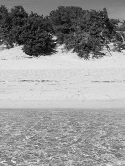
Image 3: Torre Canne Beach in Puglia (Schmitz A. M., 2021)
Image 4: Traditional Trulli Cisternino in Puglia (Schmitz A. M., 2021)
Image 5: Traditioinal Trulli Cisternino in Puglia (Schmitz A. M., 2021)
Image 6: Duomo di Ostuni in Puglia (Schmitz A. M., 2021)
Image 7-22: Parco Nazionale del Gargano, Parco Nazionale delle Alta Murgia, Marina Protetta di Torre, Guaceto, Oasi SalsoLago, Riserva Naturale Isole Tremiti, Parco Nazionale delle Alta Murgia, Bosco delle Pianelle, Conversano e Gravina di Monsignore, Palude del Conte e Duna Costiera, Bosco Cerano, Area Marina Protetta di Torre Guaceto, Forest Umbria, Palude la Vela (Pugliacon.2021)
Image 23: Olive Groves in Ostuni (Schmitz A. M., 2021)
Image 24: Rural Areas in Puglia (Google Earth , 2021)
Image 25: Agricultural Land in Puglia (Google Earth , 2021)
Image 26: Intermediate Rural Areas (Google Earth , 2021)
Image 27: Peri-Urban and Urban Areas (Google Earth , 2021)
Image 28-36: Abandoned Industrial Sites in Bari (Schmitz A. M., 2021)
Image 37: Sustainable Development Goals (Nations, 2022)
Image 38: Abandoned Site in Brindisi (Schmitz A. M., 2021)
Image 39: Lame in Bari (Schmitz A. M., 2021)
Image 40: City of Bari (Schmitz A. M., 2021)
Image 41: Abandoned Industrial Site 6 in Bari (Schmitz A. M., 2021)
Image 42: Orange Tree in Ostuni (Schmitz A. M., 2021)
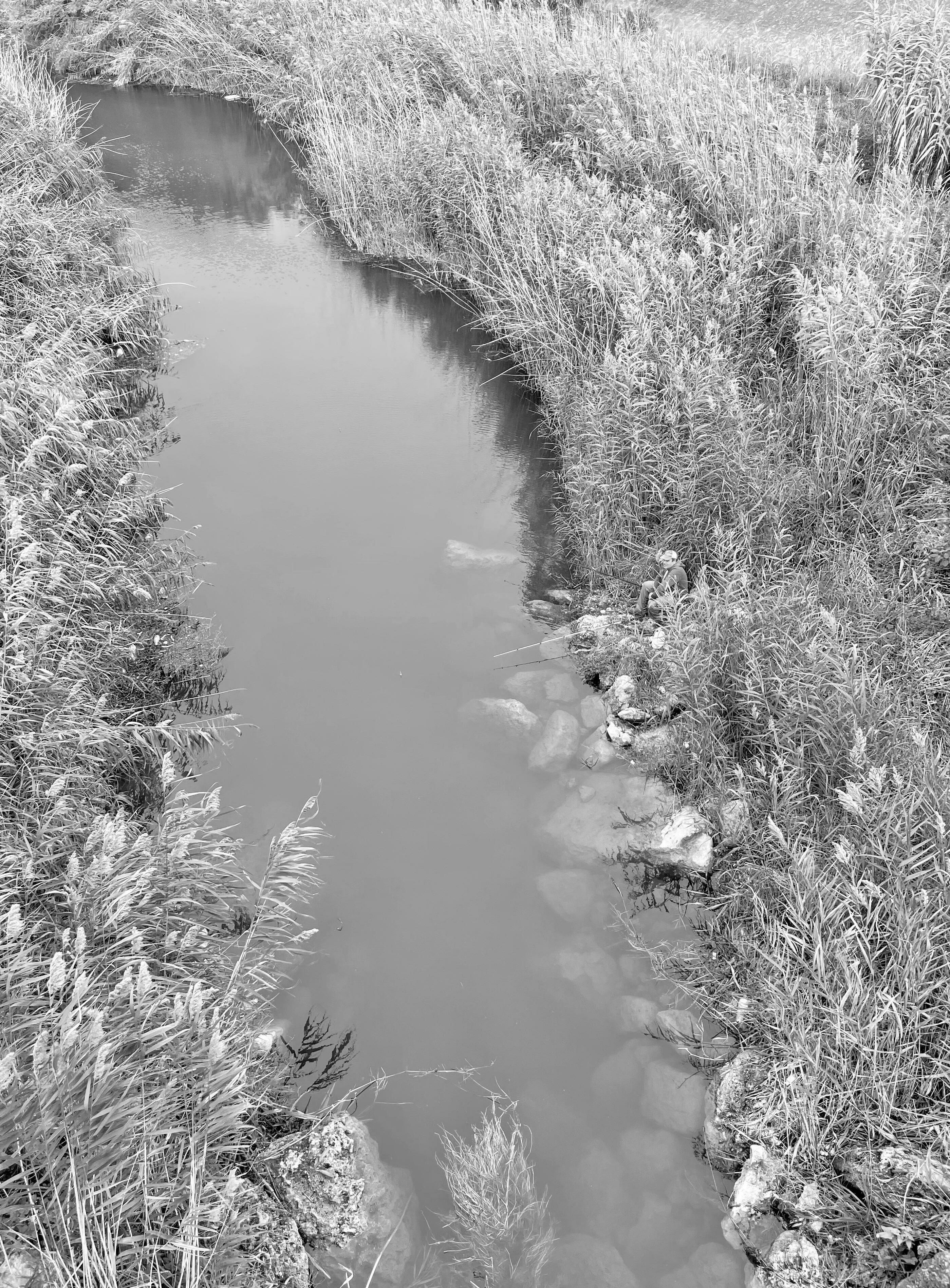
Image 43: Fishermen in Bari (Schmitz A. M., 2021)
RE-LAME PUGLIA 80 Table of Imags
Table of Diagrams
Table of Maps
All diagrams in this research booklet are entirely produced and drawn by Francesca Ciseria, Vincenzo Forese, Alice Loney, and Anna Schmitz.
Diagram 1: Collage of Historical Heritage
Diagram 2: Puglia - Icons of Content
Diagram 3: Collage of Plant and Animal Species
Diagram 4: Typologies of Connection
Diagram 5: Connection Scheme of River, Lama and Land
Diagram 6: Section of the Lama after Afforestation
Diagram 7: Growth of the Lama over 30 Years
Diagram 8: Reforestation of Lame
Diagram 9: Parco Alta Murgia to the Adriatic Sea
Diagram 10: Section Reconnecting Habitat
Diagram 11: Section of new protected Habitat
Diagram 12: Strategy Layers of the Lame
Diagram 13: Afforestation of Lame and Pedestrian Path
Diagram 14: Experience the Lame
Diagram 15: Tree House
Diagram 16: Tree Slalom
Diagram 17: Tree Loop
Diagram 18: Voliere
Diagram 19: Elevation of the Tree House in Lame
Diagram 20-26: Renaturing Industrial Sites
Diagram 27: Abandoned Industrial Site 6 in Bari
Diagram 28: Transformation of Abandoned Industry
Diagram 29: Sustainable Agriculture
Diagram 30: Olive Oil Lab
Diagram 31: Visualisation of the Olive Oil Lab
The Maps presented are solely produced for this research booklet, with the primary base from QGIS, by Francesca Ciseria, Vincenzo Forese, Alice Loney, and Anna Schmitz.
Map 1: Biodiversity Hotspots indicated on World Map (Weller & QGIS, 2021)
Map 2: Region of Puglia indicated on Italy Map Map 3: Historical Heritage and Sites Map 4: Festivals and Events throughout the year in Puglia Map 5: Natural Areas in Puglia Map 6: Natural Areas in Puglia
Map 7: Protected Areas and National Parks in Puglia Map 8: Agricultural Areas in Puglia Map 9: Agriculture in Puglia Map 10: Buildings and Cities in Puglia Map 11: Population Density in Puglia (Population Density, 2017) Map 12: Pollution indicated in cities in Puglia (PugliaSalute, 2021) Map 13: Layers of Natural Areas, Pollution and Cities in Puglia Map 14: Synthesis Map of Puglia Map 15: Lame in Puglia
Map 16: Parco Alta Murgia to the Adriatic Sea Map 17: City of Bari and Connection to the Adriatic Sea
81 TABLE OF IMAGES, DIAGRAMS & MAPS