DESIGN STUDIO
ERIK G L’HEUREUX
ASSOCIATE PROFESSOR

DESIGN STUDIO
ERIK G L’HEUREUX
ASSOCIATE PROFESSOR
GOH JIA LI
OH SHU YI LISA
STEINMETZ ROTEM
JOERG REKITTKE
ALEX LEHNERER
ADRIANNE JOERGENSEN
ATREYEE SANDILYA
MAYURA PATIL
CHEN JIAHUI LI
JIN MU
CHEONG WAN YING
LEE XIAO LING LYNN
ALEX LEHNERER
ADRIANNE JOERGENSEN
BAK JIANXUN
NG KAH YEE

FENG YUANQIU
FRANK LOW
DON EUGENE LONG SHIGUANG
PANG YU RONG
HU WEN
WONG CUI-WEN AMANDA
ONG WEE JIN
NG AI LIAN SARAH
OSCAR G. KORINTUS
TAN JIA XIN JAX
FU YINGZI
DEPARTMENT OF ARCHITECTURE
SCHOOL OF DESIGN AND ENVIRONMENT
NATIONAL UNIVERSITY OF SINGAPORE
The ArchiTecTure of informAl lAndsc Apes
p.06-09
Resilience in the Informal Territories of Baseco, Manila
p.10-13
The Big Village: Strategies of Inhabitation Along The Ciliwung River, Jakarta
p.14
After#Sandy: On the Water’s Edge
singApore meTropoliTAn region And The ArchiTecTure of borders
p.16-19
Coastarina: The Architecture of the Coastal Borders of Sijori
p.20-23
Borders between the Wild and the Fabricated: Pasir Ris, Singapore
The ArchiTecTure of The Tropics
p.29-34
A Collection of Architectural Love Stories
new modes of reAding
p.36
Comfort Routines and Air-Condition
Behavior in Occupants of Public Housing: The Case of Singapore
p.37
Photographing the Singapore House: The Construction of A Tropical Fantasy
p.38
Thick Envelopes
School of Design and Environment
National University of Singapore

4 Architecture Drive, Singapore 117566
Tel: +65 6516 3452
ISBN: XXX-XXX-XX-XXXX-X
© Individual Contributors
All rights reserved; no part of this publication may be reproduced, stored in a retrieval system, or transmitted in any form or by any means, electronic, mechanical, photocopying, recording, or otherwise without prior written permission of the publisher.
The publisher does not warrant or assume any legal responsibility for the publication’s contents. All opinions expressed in the book are of the authors and do not necessarily reflect those of the National University of Singapore.
A by-product of hardwork, sweat is hot, slippery, and sometimes smelly. It is the consequence of the friction between physical exertion as well as our climate. Living on the equator creates a special relationship with sweat— we secrete it after mere few minutes being outside. Indeed, it is what defines tropical living with all of its pleasure and occasional
The Climate+Territory Design Section at the Department of Architecture at NUS illustrates its own sweat in this simple pamphlet. The intent is to make visible the questions of architecture and landscape that keep us awake and thinking late at night while we navigate the massively changing territories of South East Asia.
The work is crude, the pamphlet a collage, the designs partially digested. The ambition is simple: to render visible the sweat in the Climate+Territory design section to the public, with the hope and promise that future work will get better, more articulate, and refined.
Erik G. L’Heureux Climate + Territory Design Section LeaderThe Climate + Territory Design Section focuses design and research efforts on the relationship between environment, territory, and urban architecture located in the hot and wet tropical regions of South East Asia. Efforts are directed particularly towards the interface between the mediums in the construction of architecture and landscape: atmosphere, water, land-form, nature, and building that constitute the hot and wet Asian Mega-City.
The research ambition is to develop robust design strategies that incorporate the natural and built environment as a cohesive and complex whole within the contexts of rapid population growth, social and material inequalities, and cultural and global identity in a tropical territory of rapid change.
The Climate + Territory Design Section has ten unique design academics with cross-disciplinary expertise and interests. Their individual foci include architecture, urban planning, landscape architecture, history and theory. Students benefit not only from the rigorous and lively debate within the Climate+Territory Design Section but also from the faculty’s extensive networks in South East Asia. Past collaborations include design research located in Manila, Jakarta, Bangkok, Mumbai, Cambodia, Johor and Batam with partner institutions including the FCL/ETH Zurich, Tongji University, Pratt University and Washington University in St. Louis.
Faculty:
Erik G. L’Heureux
Oscar Carracedo
Abel Tablada
Chang Jiat Hwee
Teh Kem Jin
Tomohisa Miyauchi
Rafaella Sini
Joerg Rekittke
Hwang Yun Hye
Tan Puay Yok
Graphics
Goh Jia Li (Oscar Carracedo)
v Vision of New Cluster Living
Plot densities
Cluster mapping

> Phasing development
Housing design

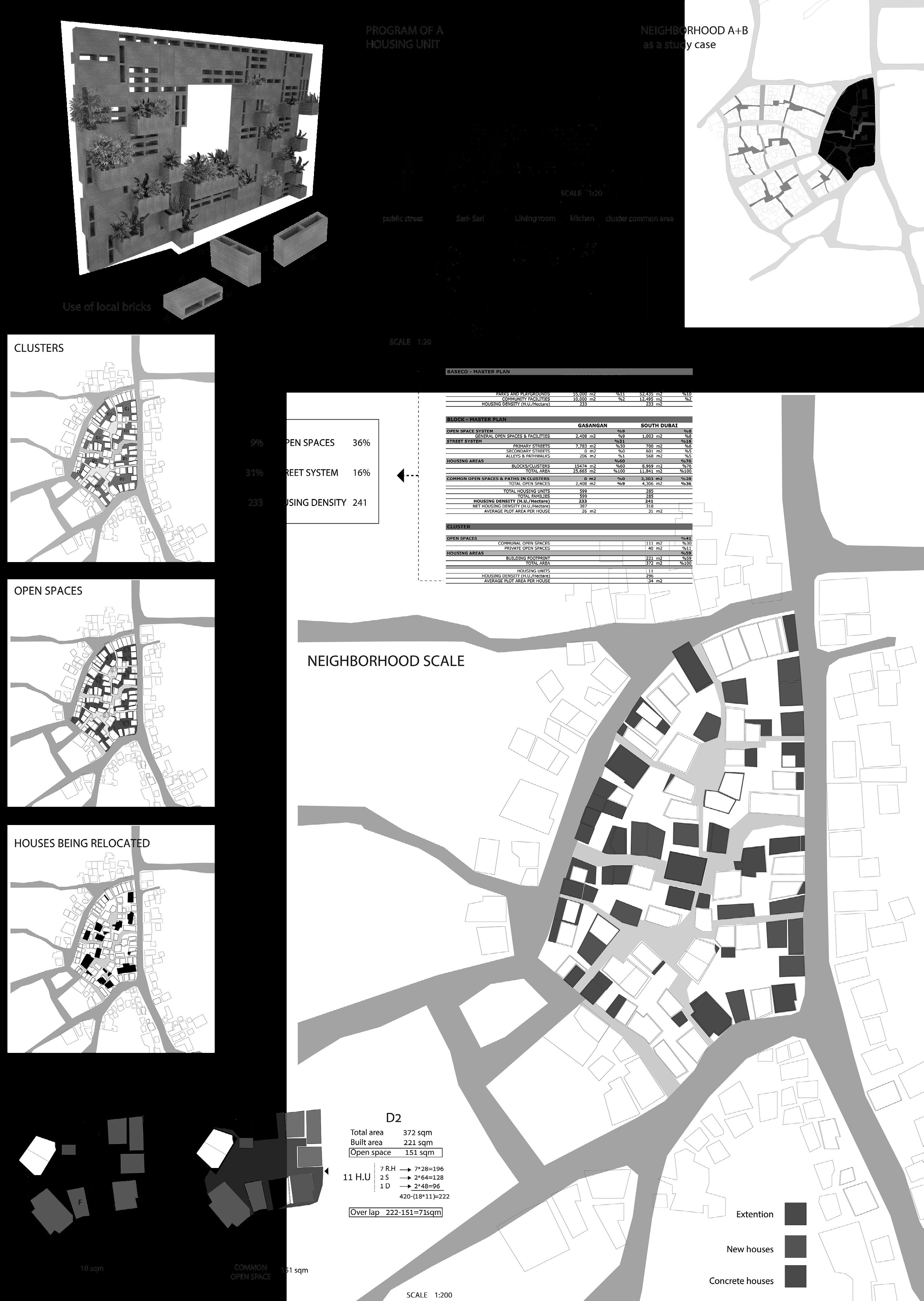
Divided from Manila by the Pasig River, the Baseco compound is often seen as a planned unit development, and treated in isolation from Manila. A masterplan proposal, the Pasig River Rehabilitation Plan, intends to promote greater use of the river as a transport system. Since the mouth of the river is located within the Baseco compound, Baseco can be utilized as a dock, allowing ferries to travel along the river, therefore opening up new possibilities of reconnecting the Baseco compound back to Manila. Where can an architect intervene within these informal territories in preparation for future development? How far can we go before disruption to lifestyle occurs?
Graphics
v Oh Shu Yi Lisa
Timeline of phasing, section interfaces and design methodologies

> Steinmetz Rotem (Oscar Carracedo)
Cluster scale calculations and catalog of solutions
Barangay 649 - Baseco
Population: 60,000 (2013)
12,000 Families
Area: 49 hectares
Average density: 250 H.U./Ha
In dealing with informal territories, careful caliberation is demanded of the planning phases at the various scales, namely district, neighbourhood, cluster and housing, while balancing environmental, social and economical considerations. Extensive research on plot densities, clustering patterns and street interfaces were conducted and timelines are drawn up in aid of determining the most beneficial yet minimally invasive course of action.


Stringent guidelines in the Building Code are abided by in calculating cluster size for each plot. Planar and sectional explorations are grouped according to social, environmental and economical intentions to form guidelines for development.


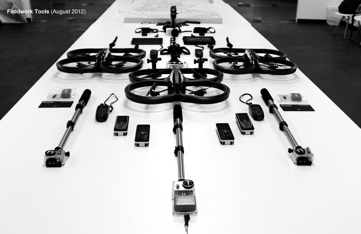
An ongoing series of design research and investigation along the Ciliwung River in Jakarta looks at the modes of habitation found in the area and its shifting ground made fluid by constant inundation. Looking at this city so engaged with its rivers, their tenuous coexistence and the modes of adaptation, fortification, and compromise. Rigorous study into the river’s rhythms and its realistic implications on the urban trimline and those in vulnerable and susceptible positions will serve to enable and inform positive design applications.

Making the urban river visible. Making plot ownership visible.
(Joerg Rekittke Studio)^ The big village in tandem with its waters
> Modes of habitation
v Implications of a fluid landscape



Installation / Anticipation -


Joerg Rekittke
Alex Lehnerer
Adrianne Joergensen
Atreyee Sandilya
Mayura Patil
Chen Jiahui Li
Jin Mu
Cheong Wan Ying
Lee Xiao Ling Lynn (NUS)
In Collaboration with Alex Lehnerer
Adrianne Joergensen (ETH FCL)
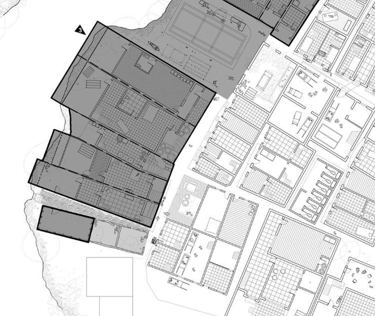
An installation is in place. A series of lines are manually inscribed on the vertical and horizontal planes demarcating sequential layers of privacy by use. These stark boundary lines contrast strongly against the once grey territories that exist between the public and private, giving rise to new understandings of plot ownership and spatial experience.


The consequences of climate change are becoming increasingly evident and increasingly devastating for millions of people around the world. Higher temperatures are generating more droughts, increasingly violent storms and heavy flooding that affect settlements and urban and rural areas. All this implies the destruction of homes, workplaces, food resources, and the unfortunate loss of lives.
In 2012 Hurricane Sandy hit New York, destroying more than 900 buildings, significantly damaging at least 12.000 more and flooding streets and public spaces.
One of the areas affected by the hurricane was the Red Hook neighborhood in southern Brooklyn. Despite this unfortunate circumstance, this situation confronts us to a new challenge and at the same time, a new opportunity to reorient the neighborhood’s and the city’s future in a sustainable manner.

The workshop site in Red Hook, bounded by the Gowanus Expressway, the mouth
of the Gowanus Canal and the Brooklyn Cruise Terminal, is an area with an important productive industrial waterfront where industry, housing, open spaces and heritage elements of the nineteenth century are mixed together.
42 students from different countries (Singapore, Belgium, Colombia, Spain, Italy and Switzerland), four from NUS, participated in the workshop. Students faced the concept of Resilient Urban Design and Planning and the opportunities that disaster recovery creates to address long-term urban issues in order to adapt to the challenges of climate change. Proposals mainly worked with regeneration strategies, urban renewal and punctual and selective urban repair, understanding resilience as a pro-positive attitude for remastering the future of the city.
(Oscar Carracedo)^ Present, historical, and proposed schemes for Red Hook


v New waterfront plan


Between the polarities of land and water exists a third category—the flank between the land the sea. Neither entirely dry nor wet, hard nor soft, soil nor water, ground nor fluid, the shore is a constantly adjusting, flexible space of tremendous diversity, beauty and livelihood. Or so the imagery is conjured in a pastoral vision of what the ‘Coast’ should be. The tropical coast—at least of our imaginary - is the most vibrant of coastlines. It has implicit ideas of abundance and pleasure, relaxation and escape. Images replicated throughout the world imagine the
tropics as a paradise, a garden of eden full of bounty. The coast is fundamental to this imaginary, the very idyllic space between the wild of the jungle and the unknown of the sea.
In the Singapore Metropolitan Region, an entirely different manifestation of paradise has developed over the past 100 years. The coast has been reframed as a space of nation building and industrial developments—a depository to be developed and exploited.Can we begin to conceive an alternate architecture for such an edge?
 (Erik G. L’Heureux Studio)




<
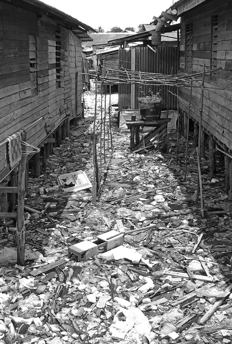
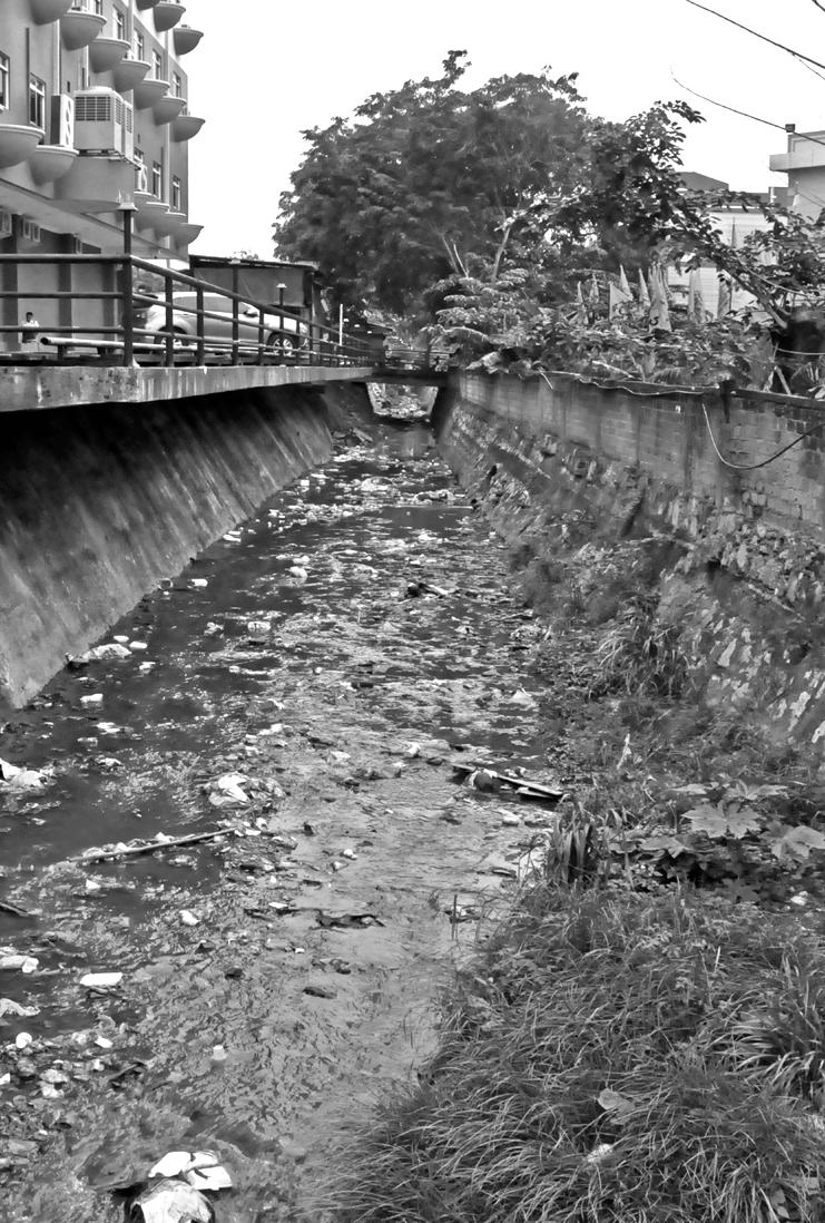
Tracing urban infrastructures, the site extends to encompass a wider territorial perspective of the geographical water basin. Uncontrolled dumping and perception of drainage infrastructures at Batam have led to the amassing of a garbage landscape at the basin’s outlet; an estuary of waste upon which local kampungs tiptoe. Can drains become architectural? How could we begin to conceptualise infrastructural languages as architecture?

v
A spine running across a natural ridge serves as exit for an adjacent community saddled between inundation from sea and waste in both directions. But in this mode of low-cost housing how much intervention is too much and where does plausibility cease? Basic frames for a crystallisation and impetus of urban development are tested as as almost pre-architecture, its skeleton but not yet its flesh.
As an established and acknowledged urban slum, municipal governance has stepped in to improve conditions and garner political points. Concrete pavements on piles weave through the neighbourhood flanked by houses of a more transient, make-shift quality. In this stilted commune a desire for land and its greenery perpetuates, here proposed as planter boxes strategically inserted.
 Bak Jianxun (Erik G. L’Heureux)
Eva ??? (Erik G. L’Heureux)
> Ng Kah Yee (Erik G. L’Heureux)
Located in the north-eastern tip of the city, a 2 ha sized woodland surrounded by a variety of land uses including private & public residential, commercial, industrial, preserved nature areas and urban parks plays a role as a haven for endangered birds and rare species of trees. Neighbors and residents have considered the area as a priceless asset and have voiced out to save the place against the new development plan of an international school which would happen in the coming three years.
Besides the woodland, the neighboring built environment is neither a distinctive place nor a variety of experiences: monotonous greenery, similar streetscapes, plastic playgrounds every eight uniformed blocks, and open spaces occupied by identical sports facilities. As a town having its own unique set of requirements and landscapes to respond to, cookie-cutter plans may not make sense in terms of accepting both human and nature’s demands.
How then can we balance between nature and the increasing built environment? When the city has an unavoidable development plan, how do we guide our environment towards a more ecologically sustainable direction? Beyond simply preserving the site, could landscape architects propose ecologically sustainable prototypes to infuse ecological diversity and a healthy lifestyle into the complicated urban context with the awareness of the multi-faceted value of the natural landscape?
(Hwang Yun Hye Studio)^ Measuring the wild forest
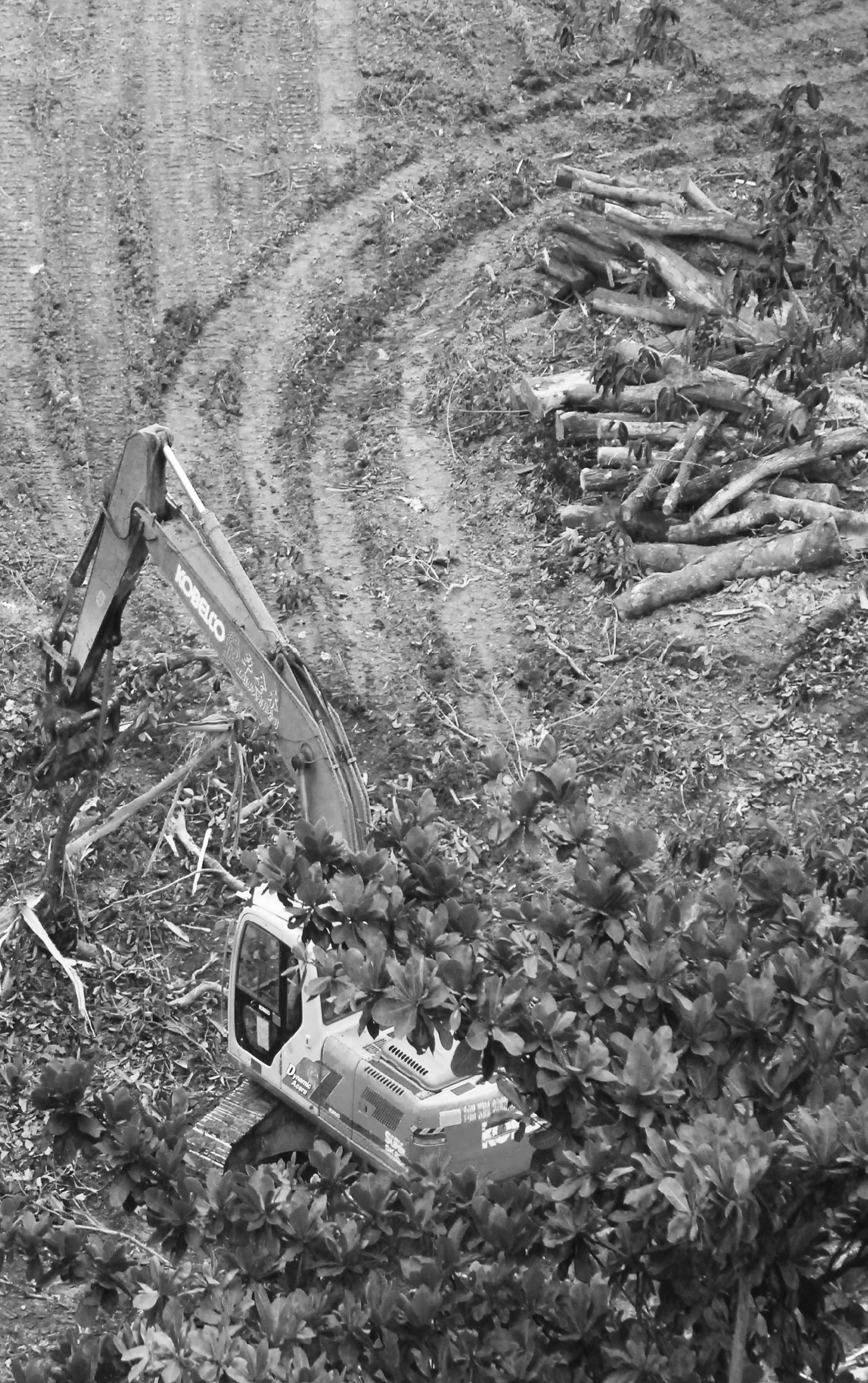

< Clearing of the the woodlands at Pasir Ris to make way for new development
> Comparision of open space amongst local towns


Maturing complex landscapes in a rapidly changing urban environment
 Feng Yuanqiu (Hwang Yun Hye)
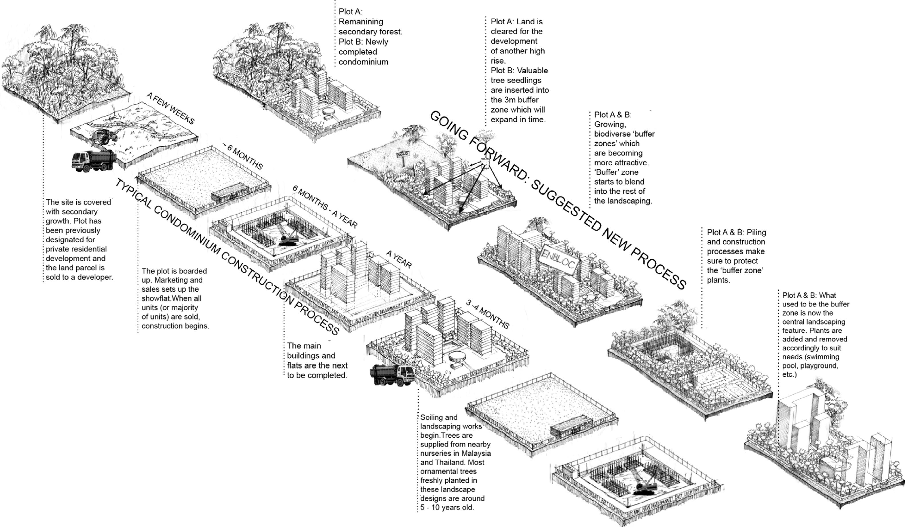
Conventional real estate practice has always been to clear, build, and revegetate as an afterthought. This process of destruction as the first stroke of realised architecture concludes with the contrived returning of nature onto site by design and curation. Is there a way for the natural to be preserved throughout the seasons of real estate cycles, even becoming an asset? How can we begin to consider a harmonious and synchronised relationship between the urban and the natural?
By mediating at the interstitial networks around existing planning intervals, a green buffer is conceptualised with imbued permanance, envisioned to endure and enhance its shifting urban surroundings.
By moderating the extremes of unrestricted growth with selective alteration, these green networks can work beautify and provide for new developments while decreasing the amount of waste produced and clearing required. A renewed landscape of wild overgrowth may begin to operate and be woven into the hardened urban edges. Between the wild and the fabricated, the urban jungle in its literal sense may emerge and suggest a plausible alternative for the ways in which we plan, build, and live.
^ Conventional and suggested processes
v Vision of a matured urban jungle


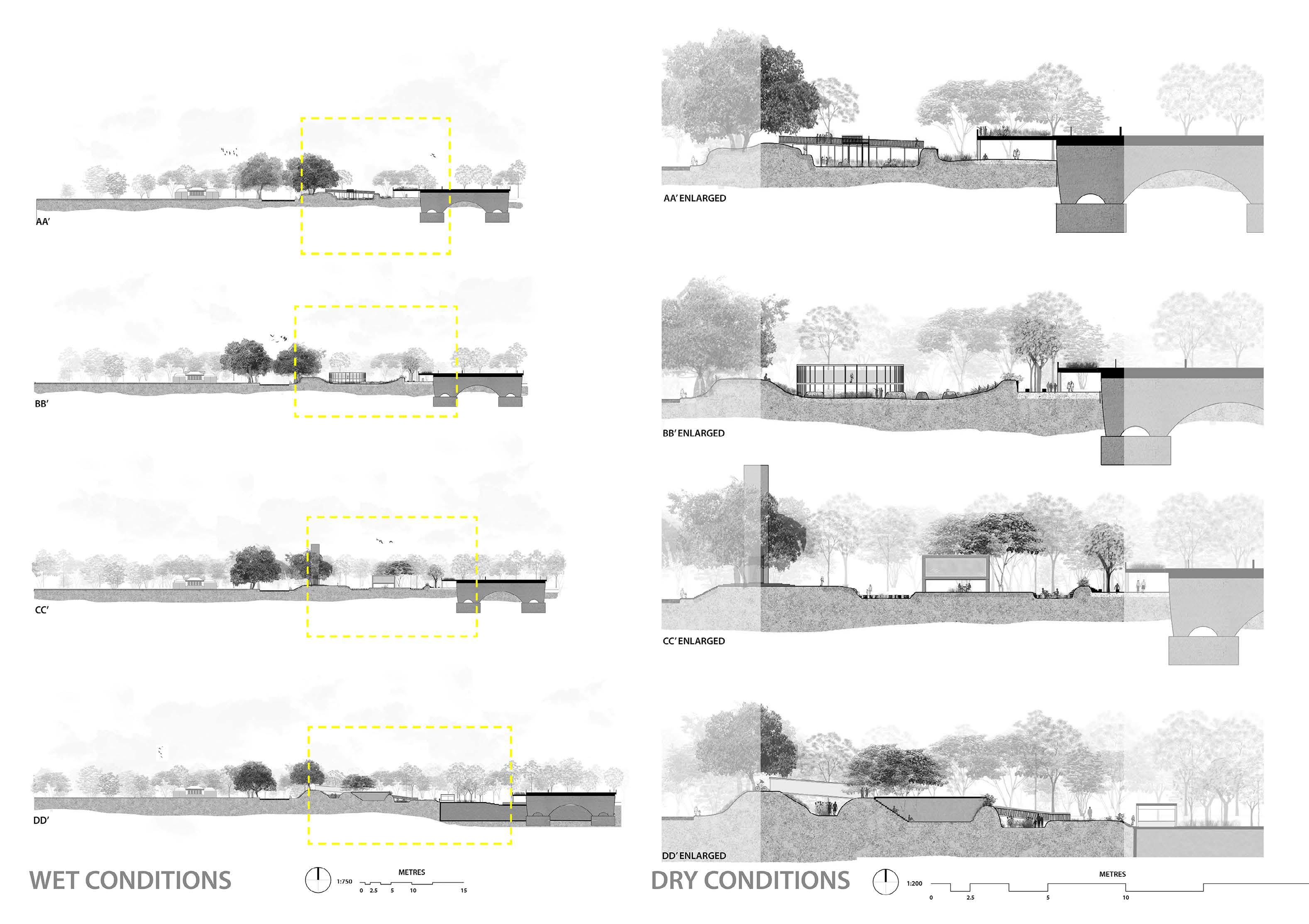
The project aims to reintroduce the cultural tradition of the ‘bird singing corner’ within the scope of the larger urban space, and away from the surburban neighbourhood where the activity has largely retreated to in modern day. Esplanade Park, a locale nestled in urban, historical and cultural significance, was the given site charged for the revitalisation of ‘bird singing’ in Singapore’s downtown core.
The design of the bird singing station is influenced by the movement of sound as it travels through the air. Bird cages are hung on the lower floor; their singing retracted upwards. Here, bird owners and visitors alike circumambulate on the second floor and catch the sound of birds singing. Unlike the open air second storey, the first storey is intentionally designed with a green roof to roost wild birds, attracted by the singing, in the immediate vicinity. Thus, the second storey acts as both a stage for listening and viewing.
(Facing page)
The project centers around the rehabilitation of Esplanade Park. Inspired by the complexity of overlapping modes of networking at the site, the proposal intervenes in the park’s existing state by reconciling fragmented green spaces and scattered monuments. Thus, establishing new vertical and horizontal spatial relationships through three-dimensional layering. The ambition here is to not only establish new connections, also, to sculpt interacting networks and create spaces that support and facilitate the vicinity’s emerging art scene.


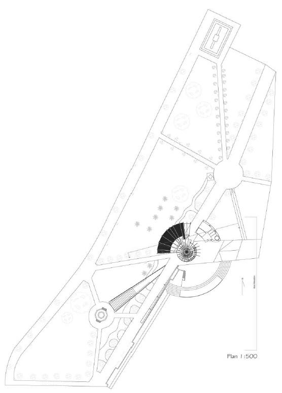


Esplanade Park, Singapore
Hot & Wet is a series of thematic investigations into the coastal regions of the Singapore Metropolitan Region - consisting of Singapore, Johor and the Riau Islands.


The first chapter (LAND LUST) is about Singapore’s lust for land, and the hard realities when it can no longer thicken itself. The second chapter (SAMA-SAMA) is about Batam’s love affair with Singapore, and its unfulfilled waterfront desires. The third chapter (COMPRESSIONS) tells Johor’s attempt to be Singapore’s extension, as it compresses its coasts into binaries of land and water. The fourth chapter (LEAKS) looks at how Singapore leaks, and the infrastructure of these leakages. The last chapter (CRISIS) concludes with the hotter & wetter reality of the climate crisis, specifically Johor’s defensive strategies against flooding.
These five themes are ultimately linked to each other. And keeping with the spirit of looking at the big picture, we try to review works by others that are looking at similar topics. These are interspersed between the chapters. We see the final product as a book that you will perhaps find in a book store in the future. At the same time, it also becomes a foundation of research & speculation that will become our separate thesis projects.
Research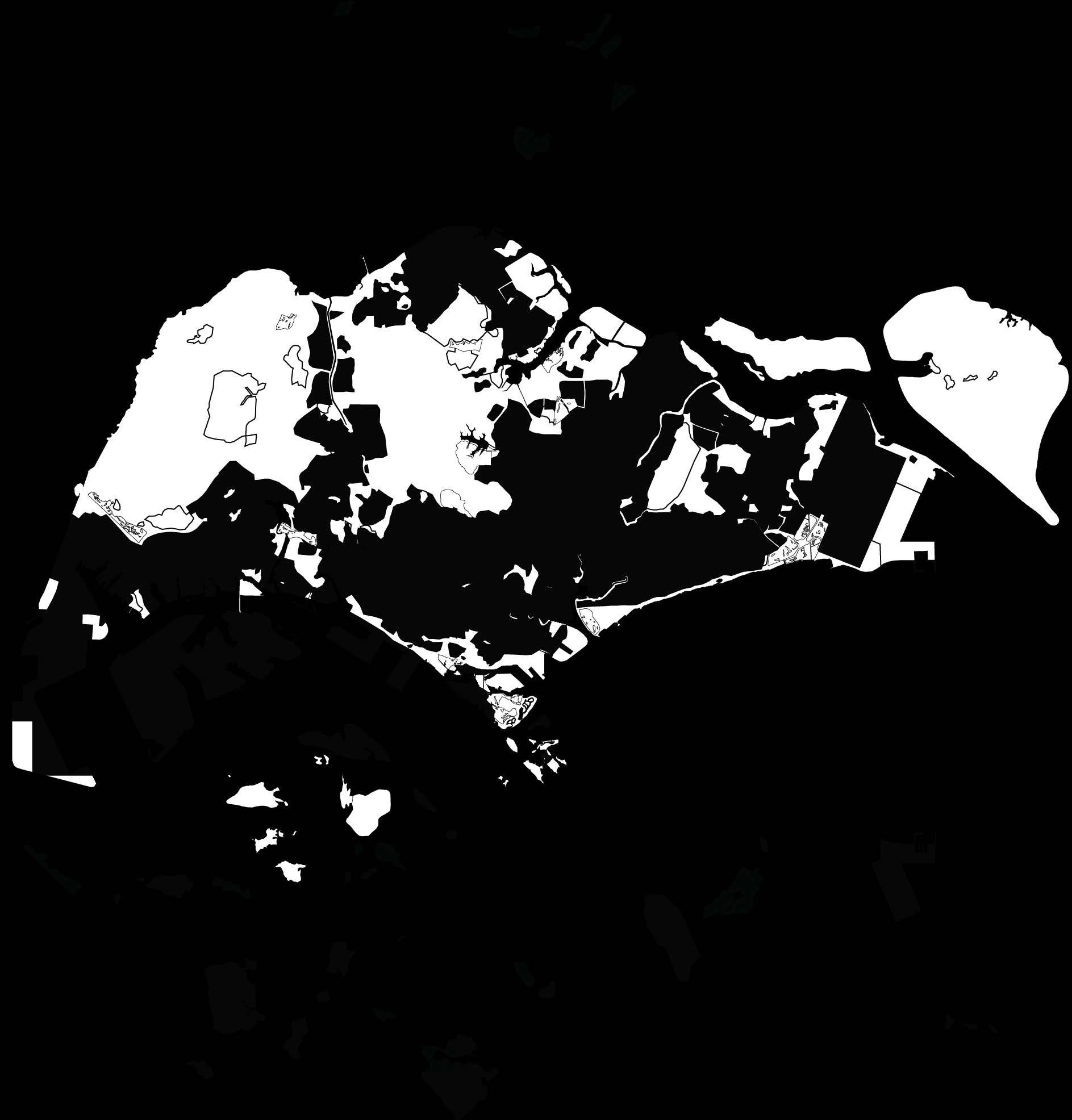
Land is precious – because we have so little of it.
In Singapore, every piece of land is designed to the tiniest detail to ensure maximum efficiency. Yet, out of the 50% of land that we have used up, 4% is spent on 19 golf courses which serves only 0.9% of the population. Since land is so precious, what should be allowed on it?
What happens if we flip them into the sea? What happens if we stack them up and squeeze them into areas a sixth of their existing area? What happens if we have HDB golfs towers…
In Singapore, the built environment is systematically cleaned, maintained and replaced as a form of resistance towards tropical forces of decay. Aquatic infrastructure is implemented primarily to resist climatic conditions, i.e. to control or overcome tropical forces such as rain and floodwater for short periods and divert its forces into the sea through high-speed evacuation. This “architecture of leaks” operates like a form of parasitic-growth that aggressively alters landscape and cityscape alike, creating a network of infrastructural territory that is untouched by any other form.
This thesis is rooted in studying leaks, and struggles to understand the peculiar relationship between architecture, infrastructure and weather. By bringing leaks to the foreground, it questions architecture’s supposed opposition to weather (that has often been used to define it) and critiques the static notion that the infiltration of weather is seen as a sign of failure.


Since their separation from one another in 1965, the Straits of Johor has served to divide the two nations of Singapore and Malaysia, an invisible line drawn along it to demarcate territory. This stand-off is both peaceable yet tensioned, mired in a history of political skirmishes but perceptibly tranquil in its tangible being. The status quo has never been one to be maintained, with Singapore’s tireless efforts to widen its girth constantly pushing its terra-firma outwards as it inches closer to the boundary line. With the implementation of the Iskandar project, Malaysia has returned the salvo with its own land expansion agenda, and the Straits is looking to become its narrowest ever.
As the two distinct masses approach, the project seeks to re-conceptualise the narrowed Straits not as a site of exacerbated tension but rather as a place of reunion, where Singapore and Malaysia may begin to reconcile the grudge from decades past. The liquid territory nestled between and reaching into the two nations is thus sought to be read as binding agent, a glue to seal a rift.
The vision of Iskandar Malaysia sees much of Johor’s coasts as an asset, subject to rapid urbanisation. The coast is seen as ideal ground for living, in spite of the vulnerability of low-lying land to natural forces. Here, the onset of the built environment is premised on Vitruvian virtue of firmitas, as it applies to architecture under a state of stability. Coastal ground is stabilised as land by infrastructural measures that preserve firmitas. The coast, as a transitory zone where spatial interactions between sea and land occur, is therefore contradicted.
Kampong Pasir is an example of firmitas along Johor’s coast that lies vulnerable to fluid ground. In 1983, a bund was constructed to protect the neighbourhood from the overflowing Skudai river. Today, its houses face the added threat of interior flooding during the tropical monsoons. Under the advent of intensifying climate change, can firmitas truly be preserved along the coast? Or can architecture diverge from firmitas and deal with fluid ground in a new way?

Since the 1970s, Batam has oscillated between trying to rival Singapore and feeding off Singapore’s success. In its admiration for Singapore, Batam copies many models that Singapore itself obtained from the West. One of these is the efficient multiplying of waterfronts, maximizing real-estate values. Possibly the most ambitious of these projects around the region is Coastarina in Batam. Clearly inspired by The World in Dubai, it failed spectacularly in the cycles of speculations and recessions, leaving a vision unfulfilled. Does architecture have a role here? Is architecture only concerned with success, and development? What can architecture do in a failed state?


 Tan Jia Xin Jax (Chang Jiat Hwee)
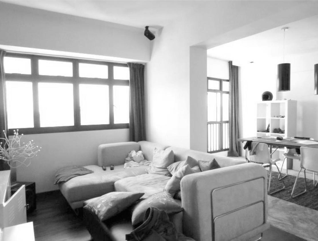
This paper seeks to understand how air-condition consumption of occupants are related to routinised behaviour and environmental design of public housing in Singapore. It aims to evaluate the impacts of passive-design strategies used in public housing on home occupants consumption of air-conditioning, as well as the implication of the socio-cultural contexts on routinised air-condition consumption behaviours.

It is commonly acknowledged that good passive-design naturally cultivates sustainable energy consumption behaviour in occupants. However, I argue that air-condition consumption is hardly so straightforward. Rather, it is complicated by the human factor such as socio-cultural perceptions deeply embedded in their daily routine. In the discourse of sustainable architecture, the human factor has
^ Aerated clerestories and internal airwells in old SIT flats allow for natural lighting and ventilation
v Newer and more condensed flats can be found to adopt alterations like wall removals to achieve a continuous and more ventilated space
always been neglected and this poses an impediment to the preparation for a more sustainable future in facing the threats of global warming.
The public housing landscape in Singapore has always been designed to facilitate natural ventilation. It is crucial to understand the limits of architecture’s role in the constructs of occupant’s air-condition consumption, and at the same time, anticipate consumption behaviours and their daily routines to better design for housing in the future.
 Fu Yingzi (Erik G. L’Heureux)
The Singapore House series, written and edited by Robert Powell and photographed by Albert Lim Koon Seng, is one of the most significant and definitive books in the Singapore architectural discourse. This series of publications showcases contemporary tropical homes produced by notable designers.
The key to the Singapore House series is its extensive use of compelling and striking architectural photography by Albert Lim. Photography functions as a major currency for the dissemination and consumption of architecture, so much so that our understanding of the architecture is in fact, largely mediated by our encounters with these photographs rather than the actual physical building itself. Further, we often mistakenly conflate the experience of the former with the latter, and this error has led to the practice of photography and its particular properties being left unexamined.

This dissertation thus aims to uncover the various conventions and devices that are employed in the construction of the photographs in Singapore Houses. Far from being a transparent medium that simply represents reality, Lim’s photography produces a new reality: One that is highly calibrated and crafted under selective conditions, in order to construct and perpetuate the vision of a tropical fantasy. The idealization of the tropical experience is hence contingent on the rigorous exclusion of undesirable, un-photogenic but very pertinent realities, such as climate, context, nature and colour.
By way of such a mode of enquiry and the interrogation of the construction of a view, this dissertation hopes to question the relatively uncontested normative way of perceiving and documenting Singapore architecture. With a renewed photographic curiosity and agency, the diversification of the discursive parameters can hopefully open up new ways of seeing, understanding, imagining and designing our environment.
< 26 Cable Road by ip:li archtiects
v Lim / Shulman Juxtapositions I
v Lim / Shulman Juxtapositions II

The seduction of the glass box takes form in many masks - transparent, reflective, and translucent. Borne of the temperate amidst the heat of modernism it has nimbly adapted to the constantly shifting trends and standards of culture, aesthetics, and performance. Over time, it has become equated to a standard of quality and excellence and the de facto mode of producing the iconicity so desired today. The legacy of thin, flat, and closed envelopes first perpetuated by fixations with transparency continue to hold true even as representations change. Energy is relied upon to create insular and separate environments from nature with glass providing the illusory connection to it. The domain of the glass box has thus extended to reach to all geological locations and climatic regions today, its possibility in tropical heat and humidity enabled.
While the ability of the glass box to function adequately is proven by its ongoing utility and almost a century of progress, the assumption of it as the default building envelope has greatly diluted the pool of archetypes found in the urban fabric. Major landmarks of the city show predeliction for the glazed envelope and embrace the sculptural outline it emphasises; the projected image of the city now a collective of shiny objects.

Against this grain of the current normative, this dissertation seeks to remove assumptions and search of an envelope more consistent and coherent to the tropics. With Singapore as the site of inquiry, it aims to derive an alternate way of producing the building envelope - one that pans out inversely to the glass narrative and its ambitions. Thick, textured, and open are the properties sought to define this counternarrative; not so much as a deliberate antithesis to transparency but rather for the allowances it makes towards a more optimal and suitable envelope.
The thick envelope consists of several core characteristics but remains open to further intervention and modulation. It returns the envelope to an interrogative state as to the limits of its potentials and the possibility of its definition; and hopes to find sustained validity and ignite a dialogue of the envelope as a site for architectural innovation.


Department of Architecture
School of Design and Environment

Issue #01 [Semester 1 AY2013/2014]