St. Croix Resilience Plan

Fall 2022
University of Pennsylvania
Weitzman School of Design
 Image: UPenn Studio
Table of Contents Introduction 2 14 66 70 72 98 114 144 184 200 Existing Condition Analysis Defining Resilience for St. Croix Resilience Projects Reimagining Ecotourism Exploring the Landscape of Disaster Recovery Funding Emergency Management in Community Spaces Embracing the Guts Resilient R&D Through Sargassum Farming for Change
Introduction
The following adaptation plan is the culmination of a semester-long study of climate-related effects on the environment, infrastructure, and people of St. Croix in the U.S. Virgin Islands. Through the lens of city planning and environmental studies, students engaged with local partners in USVI to better understand the challenges and opportunities associated with climate change resilience on the island. Students had the opportunity to travel to St. Croix meeting with local partners, leaders, and residents to gain a first-hand perspective into the complex social, physical, and environmental factors informing the Island’s responses to extreme weather events, sea level
rise, and other impacts of climate change. Informed by the experiences and knowledge shared from the local partners, data collected on the island, and remote research, students developed a series of adaptation strategies for target areas or subjects on the island which are reflected in this document. By no means a comprehensive adaptation strategy for the island of St. Croix or USVI, this project is intended to provide a summary of student’s observations from four months of studying the island and, hopefully, offer some inspiration or alternative ideas for St. Croix’s future resilience.
2 ST. CROIX RESILIENCE PLAN
UPenn Studio Team

This project was conducted by the St. Croix Resilience Studio at the University of Pennsylvania (UPenn Studio). Led by Scott Page and Jaime Granger, 15 master’s students from a variety of backgrounds in city planning and environmental studies worked together to investigate resilience in St. Croix.


Master of Environmental Science


Master of City Planning
Housing, Community, and Economic Development

Land Use and Environmental Planning
Public Private Development
Urban Design
3 INTRODUCTION
Wynter Adams
Scott Page
Makayla Davis
Jamie Granger
Emily Goldstein
Lexi Lee-Ittah
Helen Lea
Jaylene Gutierrez
Changhao (Chauncy) Li
Amelia Marcantonio-Fields
Olivia Marcus Eliza Nobles
Gabriel Orduña
Kylee Pierce Charlie Townsley
Zihan (Joann) Zhao Julian Turley
Process
Case Studies
In the first weeks of the studio students created shared definitions for climate change terminology and researched case studies of adaptation strategies worldwide.
St. Croix Research

The students then transitioned into research about St. Croix to establish foundational knowledge about the island.
Travel to St. Croix
Near the conclusion of the learning phase, the entire studio traveled to St. Croix for seven days. During the trip students collected information about existing conditions of the environment and urban centers that could not be uncovered remotely. They also met with several community leaders and stakeholders from a variety of backgrounds and interests.

4 ST. CROIX RESILIENCE PLAN
October September November
Case Studies
St. Croix Research Planning Framework
Travel to St. Croix
Image: UPenn Studio Image: Illustreret Tidende, November 1878
Resilience Projects
Planning Framework
After returning from St. Croix, the studio worked to refine their research into a comprehensive analysis structured around a driving narrative. This also helped inspire the studio’s shared definition of resilience for St. Croix.

Resilience Projects
In the final phase, the studio broke out into small teams to tackle specific resilience projects for St. Croix. These projects cover a variety of topics based on student interest in areas of need uncovered through the analysis phase and working with studio partners.

5 INTRODUCTION December
Image: UPenn Studio
Image: UPenn Studio
Partners
This project would not have been possible without the support of our partners. Throughout the semester the studio has collaborated with local leaders in St. Croix and others who are actively involved with resilience and climate work in St. Croix. Additional partners provided case study and precedent presentations through guest lectures to inform and inspire. These partners have generously shared their time and knowledge and provided invaluable input. Thank you!
Scott Bishop Bishop Land Design
Kirk Chewning Cane Bay Partners
Teresa Crean Director of Planning, Building and Resiliency (Barrington, RI)
Haley Cutler St. Croix Foundation
Rich DiFede
Gold Coast Yachts
Joe Dwyer
NOAA’s CAP (RISA) program, Climate Program Office
Ryan Flegal Feather Leaf Inn
Frandelle Gerard
Crucian Heritage and Nature Tourism (CHANT)
Greg Guannel
Caribbean Green Technology Center, University of the Virgin Islands
St. Croix St. Thomas Mainland
Wayne Huddleston Small Business Administration
Deanna James St. Croix Foundation
Daryl Jaschen Virgin Islands Territorial Emergency Management Agency (VITEMA)
Josh Lippert Former Floodplain Manager, City of Philadelphia
Hilary Lohmann
Department of Planning and Natural Resources (DPNR), USVI
Kirsten McGregor SAGAX Associates
Gerville Rene Larsen Taller Larjas LLC
Richard Roark OLIN
Jessica Ward The Nature Conservancy
6 ST. CROIX RESILIENCE PLAN

7 INTRODUCTION
Image: UPenn Studio
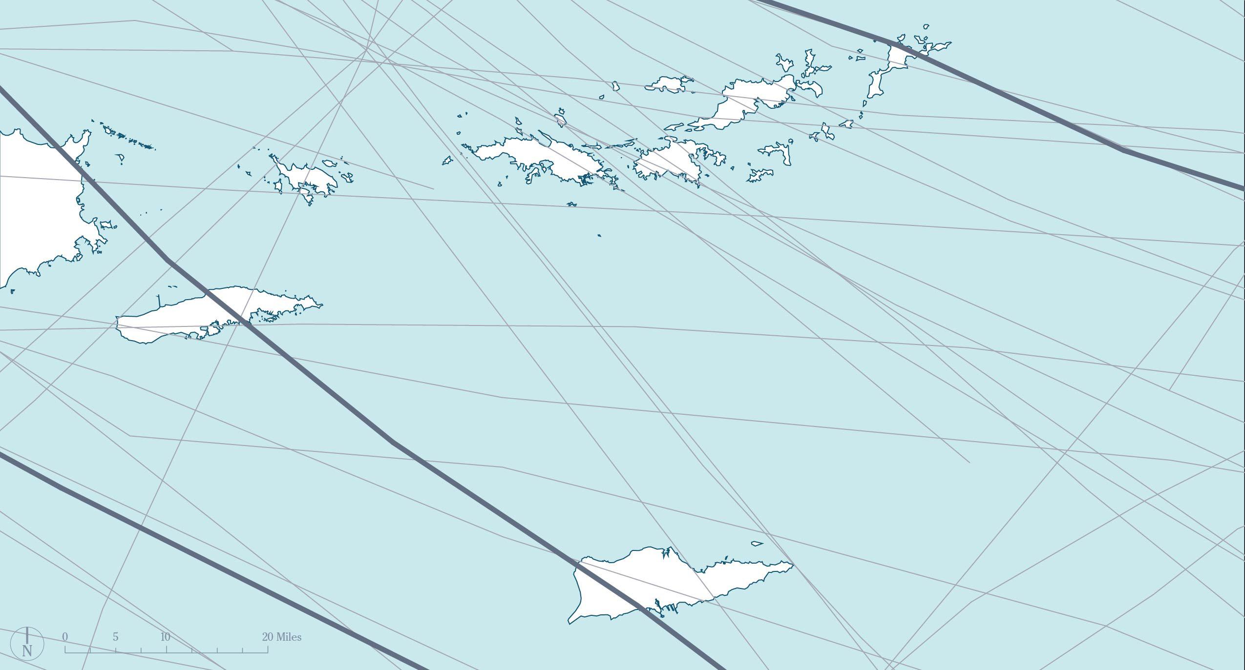
St. Croix is one of the many islands that make up the Caribbean region. The island is nestled in the warm waters of the Caribbean Sea brought across the Atlantic Ocean via the North Atlantic current.1 St. Croix is one of the 4 islands that make up the United States Virgin Islands (USVI), a US territory. USVI are the westernmost islands of the Lesser Antilles, neighbored to the west by Puerto Rico and to the east by the British Virgin Islands (BVI). St. Croix is the largest and most southern island in USVI, with St. Thomas, St. John, and Water Island lying approximately 35 miles to the north.
St. Croix itself is a beautiful island with mountains, moist forests, industry, and a barrier reef that stretches around the entire island shelf. The two main towns of St. Croix include Christiansted on the north shore and Frederiksted on the west shore. The island covers an area of 84 square miles and is 7 miles wide and 28 miles long.2

8 ST. CROIX RESILIENCE PLAN
Images: ESRI
St. Croix
Caribbean Sea
Atlantic Ocean
Gulf of Mexico


9 INTRODUCTION
Caribbean Sea
Atlantic Ocean
St. Croix
Saint John
35 miles 38miles
British Virgin Islands
Puerto Rico
Saint Thomas Water Island
Image: UPenn Studio
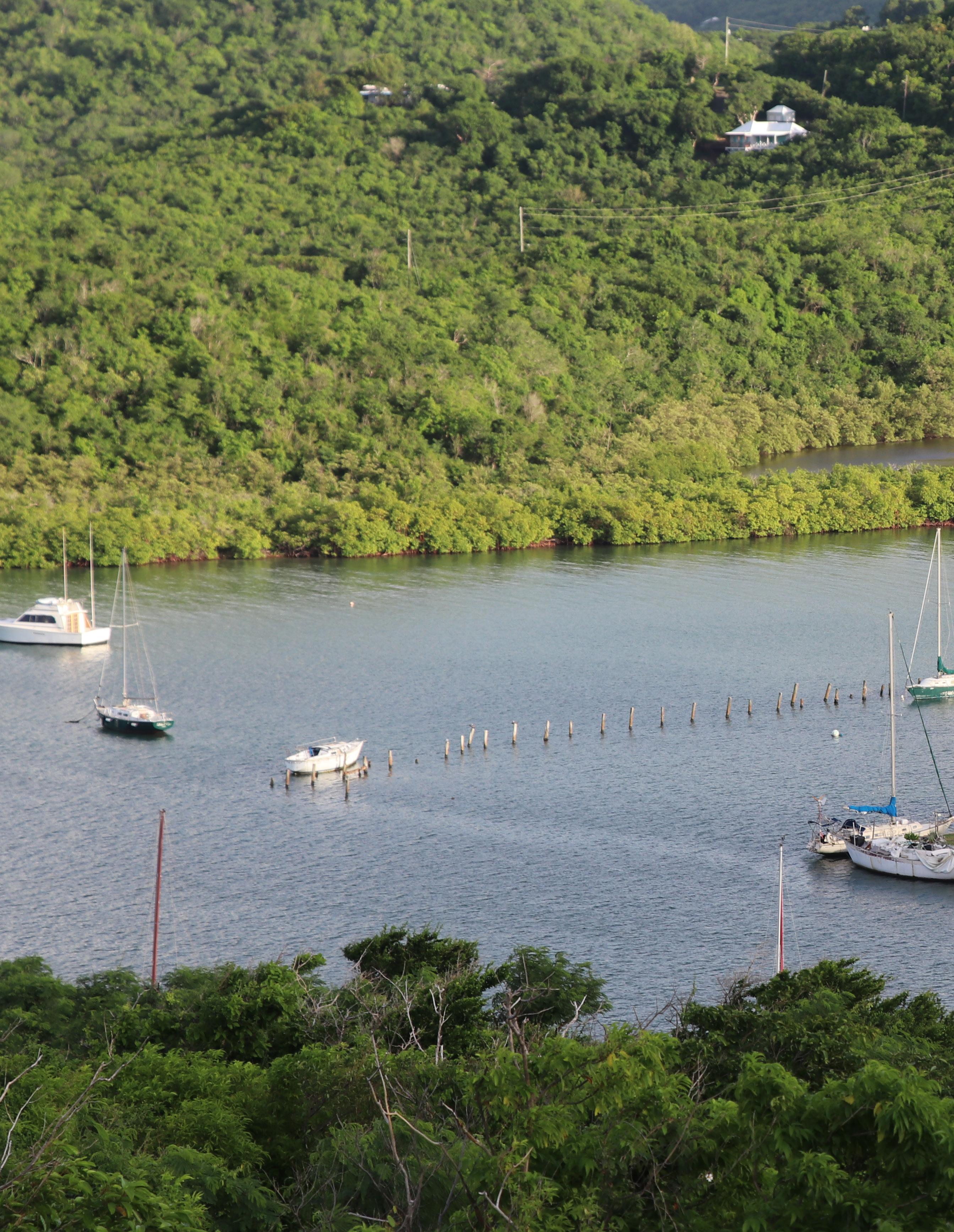
St. Croix has beautiful landscapes, crystal clear Caribbean waters, and a rich culture.
 Christiansted
3 4 2
Puerto Rico
Frederiksted
 St. Thomas, St. John, and Water Island (USVI)
British Virgin Islands
St. Thomas, St. John, and Water Island (USVI)
British Virgin Islands
1
Caribbean Sea
Island Shelf
1. Buck Island
2. Christiansted Harbor Seaplane Base
3. Henry E. Rohlsen Airport
4. Limetree/HOVENSA Oil Refinery
St. Croix is filled to the brim with life and opportunity. The Crucian culture is beloved by residents and visitors and boasts beautiful art, great music, and delicious food. The island’s identity is grounded in its rich history of resilience. The boardwalks along the waterfronts of Christiansted and Frederiksted welcome visitors to eat and shop with beautiful sea views. Miles of beaches let you touch the crystal-clear Caribbean waters and soak up the sun.

However, St. Croix is also facing many challenges. As the climate crisis worsens, St. Croix is feeling the impact
of severe weather events, such as the destruction caused by Hurricane Maria in 2017. Severe weather paired with declining infrastructure creates increased risks from hazards such as flooding, erosion, and pollution. These challenges take a toll on the natural environment as well, threatening beaches, coral reefs, and mangroves that help protect the island. While these circumstances are putting St. Croix at risk, the natural resilience of Crucians and their desire to protect their island and their community keep St. Croix strong. These diverse opportunities and challenges are the focus of this studio.
12 ST. CROIX RESILIENCE PLAN
Image: UPenn Studio
Resilience lies at the heart of St. Croix’s culture, environment, and economy.

The following chapters of this plan cover an analysis of St. Croix’s current conditions conducted during this studio. Island ecologies, impacts of colonialism, infrastructure, equity, and the effects of climate change were all investigated in order to establish a baseline understanding of St. Croix’s resilience today. Following the analysis, this plan presents a common resilience
References
definition for St. Croix that has guided the work of the studio. Finally, six resilience projects will address the challenges and opportunities identified for St. Croix and present just a handful of ways that Crucians can fortify their resilience to climate, social, and environmental threats in the years to come.
1. “Geography Of The Caribbean,” n.d. https://www.worldatlas.com/geography/geography-ofthe-caribbean.html.
2. 2. “St. Croix: Facts & History,” n.d. https://www.vinow.com/stcroix/history/.
13 INTRODUCTION
Image: UPenn Studio
Existing Conditions


St. Croix has shown resilience in the face of colonialism.
The history of St. Croix can be represented by resiliency in the face of colonialism. The island was first inhabited by indigenous peoples including the Arawaks and the Tainos before being claimed by the Spanish in the early 1500s. It was later occupied by the Dutch, and then the Danish, who established the first permanent European settlement on the island in 1653.1 The Danish colonized the island to act as an economic hub for the nation, becoming the ‘Garden of the Indies’ where enslaved islanders enriched their colonizers through the production of sugar cane.
In 1917, the Danish West Indies were sold to the United States, the islands latest colonizer, and St. Croix became a part of the U.S. Virgin Islands. Today, St. Croix remains a popular tourist destination and is home to a diverse population, with roots in the Caribbean and Africa, who in the face of colonialism have remained a vibrant and resilient people.2
16 ST. CROIX
RESILIENCE PLAN


17 EXISTING CONDITIONS
“Ruins of Rust Op Twist Plantation Sugar Mill Plantation” (Image: St. Thomas Source)
Seven Flags of St. Croix’s Colonizers (Image: UPenn Studio)
Enslaved people on St. Croix endure 355 years of the sugar cane and slave trade from six different colonizers.5
St. Croix was inhabited by the Arawak Indian tribe as early as 800 AD, followed by the Taino people and eventually the Carib people about a century before Columbus arrived.3
November 14, 1493
The Carib people fought against the Spanish upon their arrival at Salt River Bay. This represents the first violent altercation between the Old World and the New. War continued between the Caribs and Spaniards for nearly a century.4


18 ST. CROIX RESILIENCE PLAN SPAIN FRANCE NETHERLANDS & ENGLAND KNIGHTS OF MALTA 1500 1493
1600 1700
Image: First Landing of Columbus, Frederick Kemmelmeyer
Image: U.S. National Park Service
The island known today as St. Croix has endured seven different colonizers on its land for 529 years and counting.
General Buddhoe led a slave rebellion and demanded that Governor-General Scholten of Denmark emancipate enslaved people on St. Croix. Despite the emancipation, former slaves would continue to be subjected to forced labor due to laws that were created to limit their freedom.6


St. Croix, St. John, and St. Thomas were purchased by the United States of America from the Danish government for military reasons. The U.S. represents the last and current power asserting imperial rule.8
Fireburn revolt ends the slave-like conditions that persisted after emancipation. Over 879 acres of sugar cane were burned, and many laborers were killed. The revolt was led by four women known as the “Queens” of the revolt- Queen Mary, Agnes, Mathilda, and Susanna- who were later sentenced and jailed in Denmark.7
19 EXISTING CONDITIONS
UNITED
1848
3, 1848 October 1878 1917 1800 1900 2000
DENMARK
STATES
July
Image: Illustreret Tidende, November 1878
Image: UPenn Studio
The government of St. Croix is organized as a territorial government within the federal system of the United States. St. Croix, St. Thomas, St. John, and Water Island make up the US Virgin Islands, a group of islands in the Caribbean Sea that were acquired by the US from Denmark in 1917.
St. Croix’s government is composed of three branches: the executive, the legislative, and the judicial. The executive branch is led by the Governor of the Virgin Islands –currently Governor Albert Bryan Jr, who was elected by popular vote in 2018. The Governor is responsible for implementing the laws of the territory and for overseeing the various agencies and departments that make up the executive branch.9
The legislative branch of the government of St. Croix is the Virgin Islands Legislature, which consists of a 15-member Senate and a 31-member House of Representatives. The members of the Legislature are elected by the people of St. Croix to serve fouryear terms. The Legislature has the power to pass laws and to approve the budget for the territory.10
The island’s judicial branch is
as states. composed of the Virgin Islands Superior Court, the Virgin Islands Court of Appeals, and the Virgin Islands Supreme Court. The Superior Court is the trial court of the territory and has jurisdiction over a variety of civil and criminal cases. The Court of Appeals and the Supreme Court are the territory’s intermediate and highest courts, respectively, and have the power to review decisions made by the lower courts.11
In addition to the territorial government, St. Croix is also subject to the laws and regulations of the federal government of the United States. The US Constitution applies to the territory, and the people of St. Croix are represented in Congress by a delegate to the House of Representatives – Congresswoman Stacey Plaskett - who has a voice in congressional debates but does not have the right to vote on the final passage of legislation.
The people of St. Croix, along with the people of the other US territories (such as Puerto Rico and Guam), are not represented in the US Senate and do not have the right to vote in presidential elections. As a territory of the United States, St. Croix does not
20 ST. CROIX RESILIENCE PLAN
Despite being a U.S. territory, St. Croix and USVI still do not have the same rights
Governmental Structure
have voting power in federal elections. Because territories are not granted the same level of political representation as states, residents of St. Croix do not have the same rights and privileges as citizens of the mainland.12
Overall, the government of St. Croix operates in a similar manner to the governments of the other states and
territories of the United States, with one major exception, the right to vote. The existing power structure between the United States and St. Croix bears close similarities to the island’s previous colonial regimes.
21 EXISTING CONDITIONS
Federal Federal Territorial State Local
St. Croix has shifted core industries since its initial colonization. Early in the 18th century, the Island’s economy was primarily agriculture based, focusing on sugar cane production, and relying on slave labor. It was in this period that the island was known as the Garden of the West Indies due to its high production of sugar cane. After the abolition of slavery in the Danish West Indies in 1848, the island’s economy struggled, and many plantation owners went bankrupt. The
plantation economy was eventually replaced by a system of small farms, but these were not able to support the population, leading many people to leave the island in search of work and the island to continue to find its economic identity.13
After the United States acquired St. Croix from the Danish West Indies, the federal government invested in infrastructure on the island, including roads and ports, and St. Croix became

22 ST. CROIX RESILIENCE PLAN
St. Croix’s population has remained vibrant and resilient without clear economic footing.
“The Mill Yard” by William Clark, 1823 (image: The British Library)
an important center of trade and commerce in the Caribbean.14
Between 1966 and 2018, oil refineries were the primary industry on St. Croix. It was the main source of income for many as the HOVENSA refinery was one of the largest refineries in the western hemisphere. However, the toxicity of oil refining has left many who lived near the refineries suffering health complications due to their proximity to the toxic chemicals. In the past decade, the refinery closed, reopened to new ownership, and closed again following environmental violations.15
Today, St. Croix is a popular destination for tourists, with its white sandy beaches and historic towns, drawing visitors from around the world. It is also home to a vibrant local culture and a diverse population with roots in the Caribbean, Africa, and Europe. Around 30% of Crucians work in tourism related industries and around 20% have found work in government positions. Despite its history of colonization and economic struggles, St. Croix has retained its unique identity and continues to thrive as a vibrant, diverse, and resilient community.16 17

23 EXISTING CONDITIONS
Limetree Bay Oil Refinery, previously known as HOVENSA (Image: St. Thomas Source)
Resilience is deeply ingrained in the history, culture, and life of St. Croix. The island has been ruled under seven colonial powers over the past 529 years and yet continually shows immense strength. However, the impacts of colonialism are still felt today with vulnerable populations still bearing the burden of historic inequities.
The population of St. Croix is not a monolith--there are a multitude of ways to experience the island. The tourist experience differs greatly from the local reality, which also differs greatly from the experience of wealthy second homeowners. The wealth
disparities on the island are evident. The East End of the island is decorated with multi-million-dollar homes that could even have staff and sweeping views, while many of the buildings in Frederiksted remain uninhabitable after the destruction from the 2017 hurricanes. The impact of the 2017 hurricanes is very visible today as much of the infrastructure is still recovering.
24 ST. CROIX RESILIENCE PLAN
Vulnerable populations still bear the burden of historic inequities.
Multiple Identities of St. Croix


Tourist Experience
Vacant Businesses


Recovering Community
East End Luxury
Damaged Homes

25 EXISTING CONDITIONS
Images: St. Croix Island Life Real Estate (bottom left); UPenn Studio (remaining photos)
Beach Paradise
Social vulnerability and racial disparities divide the island and its residents.

In 2011, the Center for Disease Control created the Social Vulnerability Index, which uses various socioeconomic factors to determine the social vulnerability of an area, including unemployment, income, disability, and English proficiency.18 Since its creation, the Social Vulnerability Index has become an invaluable tool for analyzing and advocating for communities. In St. Croix, the most socially vulnerable areas are located around Christiansted, Frederiksted, and in the southwest portion of the island—just slightly west of key
industrial sites such as the Limetree Bay Oil Refinery and the Anguilla Landfill. Over 37% of the population lives in the top 10% of the most socially vulnerable estates.19 20
The most vulnerable estates are also majority Black and Hispanic/Latino communities. Racial disparities related to income and educational attainment are stark. White residents are likely to have higher incomes, while Black and Hispanic/Latino residents are more likely to live below the poverty level and lack a high school diploma.21
26 ST. CROIX RESILIENCE PLAN Total Vulnerability Index Increasing Vulnerability No Population 1 2 3 4 Top 10% Most Vulnerable
Data: J. Dwyer, G. Guannel, H. Lohmann. 2022. U.S. Virgin Islands SVI Map.
Christiansted
Frederiksted
Limetree Bay Oil Refinery Anguilla Landfill STX Airport
Data: 2010 Decennial Census of Island Areas Data: 2010 Decennial Census of Island

27 EXISTING CONDITIONS Race Dot Density Black 1 Dot = 15 people Hispanic/Latino White
Black & Hispanic/Latino Household Income Less than $25,000 41.6% 21.3% 9.3% 24.7% 29.3% 12.9% 38.7% 5.9% Household Income $100,000 or More Below Poverty Level No High School Diploma White Christiansted Frederiksted Limetree Bay Oil Refinery Anguilla Landfill STX Airport
Areas
Seemingly contradictory to the social disparities present throughout the island, St. Croix has a high percentage of homeownership, with 56% owner-occupied units.22 St. Croix residents have an immense desire to be homeowners despite systemic roadblocks—many of them bypassing banks and achieving homeownership through mutual aid or their own construction.
However, despite this high percentage of homeowners, as of 2010, 22% of housing units were vacant.23 Further with many houses suffering damage from the 2017 hurricanes, it is likely that vacancy rates have only increased over the last decade.
As the island’s median income of just over $36,00024 and traditional mortgages or insurance is not the norm, many households may not have been able afford to rebuild, leaving many houses abandoned. Even in the towns of Christiansted and Frederiksted that are prime tourist destinations, abandoned structures, such as the one on the following page, are a common sight.
Over the last decade, the total number of housing units has grown by less than 1%,25 indicating that the island has struggled to produce new housing units, even with a high demand for housing for both Crucians and incoming disaster recovery workers.
28 ST. CROIX RESILIENCE PLAN
In the wake of the 2017 Hurricanes, many homes have been damaged and abandoned, creating a high percentage of vacancy on St. Croix.


29 EXISTING CONDITIONS
Houses in downtown Frederiksted (Image: UPenn Studio)
Vacant building in Frederiksted (Image: UPenn Studio)
Given the changing outlook for St. Croix, the island is struggling to keep up with the modern challenges presented. This is not just on a social and economic level, but also on the infrastructure found on the island and its capacity to provide reliable resources. The following limitations begin to explain the constraints of infrastructure systems that have consequently taken a toll on the quality of life on the island.
There are 5 main infrastructures on the island of St. Croix:
1. Waste Management
2. Water
3. Energy
4. Transportation
5. Internet
Although these are five independent systems, they are closely intertwined and reliant on each other to provide services to the entire island. Because one closely impacts the others, they cannot be discussed independently of each other.
30 ST. CROIX
PLAN
RESILIENCE
Infrastructure systems struggle to keep pace with modern challenges.
The U.S. Virgin Islands Waste Management Authority (VIWMA) is the governing body of waste management on St. Croix. There are two dumping sites servicing the island. However, illegal dumping is one of the major infrastructural issues on the island. This is partially due to inaccessibility. Residents are required to take their own waste to the sites; however, this is not always possible due to unpredictable hours of operation and tipping fees required
to dump which often exceeds what residents can afford to pay. Most recently the trash hauler strikes have caused an additional hurdle to waste management. Since 2019, VIWMA owes the trash haulers upwards of $6 million with an overall debt of $24 million.26 All of this has led to an increase in illegal dumping in various parts of the island and has had devastating impacts on other infrastructural systems and wildlife.

31 EXISTING CONDITIONS
These five systems are closely intertwined and reliant on each other to provide services to the entire island.
WAPA
WAPA
Waste
STX
WAPA
Broadband Landing
Christiansted
STX
St
Global
Energy Infrastructure Systems Transportation Water Internet Waste
St. Croix Gas Company
Utility Office Peter’s Rest Convenience Center Anguilla Landfill
Sub Station
Water Treatment Facility
Seawater Reverse Osmosis Facility
Power Facility
Station
Harbor Seaplane Base
Airport USVI Energy Office
Croix Fiber Technology Inc.
Crossing Fiber Terminal
The water system can be broken down into two components; water mitigation through the guts network and water distribution through the potable water system and cisterns.
One of the systems most impacted by illegal dumping has been the guts system. The guts systems are important for directing water coming into the island from storm surge and

from excessive water intake. Guts come in two forms, natural and urban, with the biggest natural gut being on the south shore and draining 11 square miles. When trash is dumped in the path of a gut, it impedes drainage and causes backup and erosion from a clogged system. Additionally, many natural guts have been altered by drought on the island and being paved over.
The gut network directs water from storm surge and excessive water intake.
Gut Network Guts
River Gut
Jolly Hill Gut
Salt River
Creque Gut


33
Natural guts (Image: UPenn Studio)
Urban guts (Image: UPenn Studio)
The potable water system is the public water system on the island. It is a system of electrically powered pumps and pipes that source up to 2.2 billion gallons of drinking water per day from the island’s desalinization plant. However, since the pumps are electrically powered and the system has very few backup generators, when there are power outages, the population reliant on this water system does not have access to water. Additionally, the pipes are outdated and in need of upkeep, contributing to the limited reliability of the potable water system.
Because of the uncertainty of the water system, 70% of households on St. Croix have cisterns, in addition to tapping into the public water system.27 However, cisterns are also electrically powered and susceptible to power outages. Additionally, their design makes them vulnerable to contamination from animals and other sources, like the ones caused by the refinery oil spill in 2012.28

34 ST. CROIX RESILIENCE PLAN
Potable Water Network Roads Potable Water Network
Data: U.S. Decennial Census (2010); USVI Hurricane Recovery and Resilience Task Force (2018)
28% of households rely solely on the public water system.


35 EXISTING CONDITIONS
WAPA Water Storage Tank (Image: UPenn Studio)
Cisterns (Image: UPenn Studio)
St. Croix has its own electric grid capable of producing up to 140 megawatts daily.29 However, given how reliable other systems are on electricity and the islands susceptibility to power outages, this is a very fragile system. Since 2017, some improvements have been made to the system to make it more resilient to shock. Some of these improvements include more backup generators, inputting underground electric lines, and installing composite electric polls.
In addition to the traditional electric power grid, solar power is the primary form of renewable energy on the island. Even so, this only accounts for less than 10% of the island’s power usage.30 Petroleum is still the primary supplier of energy for St. Croix, in addition to being the biggest import and export making it an important resource for the island.

36 ST. CROIX RESILIENCE PLAN
Petroleum meets nearly all of the island’s energy needs.
Richmond Power Plant (Image: UPenn Studio)


37 EXISTING CONDITIONS
Solar Panels (Image: UPenn Studio)
Composite Poles (Image: UPenn Studio)
Data: VITRAN
St. Croix has 4 main public bus routes, providing service from Frederiksted to Christiansted and the airport, among other destinations. The island also has a ferry port and cruise port. However, only 7% of the population uses public transit or walks.31 87% use a private car as their primary source of transportation.32 The condition
of roads provides an explanation for this division; 88% of roads have no sidewalks, 47% have no lighting, and 78% have no walkable destinations.33 This impacts accessibility to resources, safety concerns, as well as where people are willing to travel to and how far to access essential services like jobs, food, education, and health care.

38 ST. CROIX RESILIENCE PLAN
Cargo Port Cruise Port Seaplane Base Ferry Terminal
88.6% of streets have no sidewalk. 78.2% of streets have no walkable destinations. 46.7% of streets have no lighting.
Ferry Terminal/Cargo Port/Cruise Bus Routes Route 27-103: Christiansted - Frederiksted
28-103: Frederiksted - Christiansted
302: La Reine Terminal - Tide Village
502: Sunshine Mall - La Reine Terminal Bus Stops Airport/Seaplane Base Arterials Roads
Transportation
Route
Route
Route
Public


39 EXISTING CONDITIONS
Roadway Infrastructure in Frederiksted (Image: UPenn Studio)
Lack of Sidewalk Infrastructure (Image: UPenn Studio)
6 fiber-optic lines connect in St.
St. Croix is uniquely situated in the convergence of 6 fiber-optic lines servicing the entire region and beyond. Even so, 22% of households do not have internet access.34 This is an issue of accessibility, not supply, and can be attributed to a multitude of factors including cost and connection. Recently there have been efforts to eliminate this gap. ViNGN, a private company, has begun to install free Wi-Fi hotspots throughout the island. Currently, there are an estimated 27 locations.35


40 ST. CROIX RESILIENCE PLAN
Caribbean Sea
Atlantic Ocean
Gulf of Mexico
St. Croix
Global Submarine Fiber-optic Cables
Cables that pass through St. Croix
Broadband
Data: kvangraafeiland_oceans
Croix.
East End (Image: UPenn Studio)
Free Wi-Fi Hotspots

Community Wi-Fi Locations

41 EXISTING CONDITIONS
Christiansted
7 7 3
Frederiksted
Data: viNGN
Frederiksted Street Infrastructure (Image: UPenn Studio)
Human systems depend on natural systems.
St. Croix’s unique and complex natural environment plays an important role in the island’s opportunities and challenges. Rich soils on the island advanced a long agricultural history under colonialism. But in the present day, the island’s hot and dry climate puts stress on island systems, while natural threats like sargassum and flooding jeopardize island infrastructure. While the rich biodiversity of the island is a major selling point, contributing to its resilience and beauty, it is also under threat. In the midst of a changing climate, the protection of St. Croix’s natural environment will inform how the island responds to shocks now and into the future.
The climate of St. Croix is defined by its geographic positioning, which places it in the sub-tropical zone, where the trade winds blow along the length of the island. The island is warm all year, with little variation in average temperature between months or seasons. Temperatures are expected to
grow more extreme with the onset of climate change.36
Precipitation across the island is quite variable. The western part of the island receives substantially more precipitation than the east end. Annually, on average, it rains 30 inches in the east and 50 inches in the west and most rainfall occurs during the hurricane season.37 Precipitation varies substantially by season. The wettest month is September and the driest months are February and March. Severe seasonal droughts are a reoccurring problem on the island and are expected to worsen in the future.38
42 ST. CROIX
PLAN
RESILIENCE
Geology
Geology and Groundwater
Terrestrial systems depend heavily on soil types. Soils contribute to the diversity of habitat types on the island and range from stony, to gravelly, sandy, silty, and loamy.39 Some soils are more suitable for agricultural practices than others, but these properties would not exist without the underlying geology of St. Croix. Much of St. Croix is well-suited for agriculture, and it has historically been known as the breadbasket of the Lesser Antilles.40

St. Croix is an elevated island with few regions existing below 70 feet;41 this topography influences how and where rainwater collects. When St. Croix formed, it was uplifted and created
an extensive reef system composed of limestone.42 The Limestone Plain separates the Northside Range and the East End Range. However, limestone and alluvial deposits (small areas with a specific geologic features) exist throughout the island. During rain events, the alluvial deposits are responsible for recharging the aquifer systems on St. Croix.43 The aquifers on St. Croix are associated with dissolved solids contaminants, complicating access to fresh water.44 The threats of drought on the island are compounded by the lack of fresh groundwater or freshwater streams.
43 EXISTING CONDITIONS
Data: National Park Service, “Buck Island Reef National Monument Geologic Resources Inventory,” 2011.
Kingshill Marl (MIkh) Caledonia Formation (Kc, Kce) Surficial Deposits (Qal)
Allandale Formation (Ka) Cane Valley Formation (Kcvs, Kcvr, Kcvh) Judith Fancy Formation (Kj, Kjr, Kjb, Kjc)
Jealousy Formation (OLj) Fountain Gabbro (Kg) Southgate Diorite (TKdi)
Ecology
St. Croix’s natural environment is rich in unique features and biotic communities, from the rugged terrain of the upland forests to the grassy plains down the south coast and the immense coral reef system.45 The island’s natural resources provide a variety of habitats that sustain diverse species, and this rich biodiversity contributes to the resilient systems that support human life.
The marine shelf, reef system, and mangroves all have a unique relationship with the hydrology of St. Croix. The increasing depth of the marine shelf, composed of scattered elkhorn, brain, fire, boulder, and staghorn corals, and its associated


canyon help attenuate wave action.46 However, attenuating wave action is something mangroves and coral reefs do as well. Coral reefs can help stabilize shorelines and support a variety of marine life.
Likewise, mangroves stabilize shorelines and blossom with various wildlife species; additionally, mangroves sequester carbon and reduce flooding. Red, black, and white mangroves are located primarily along shorelines with red being the most salt and water-depth tolerant and white mangroves dominating inland regions and higher elevations.47 Mangroves are unique systems playing a specific role in marine and terrestrial ecosystems
44 ST. CROIX RESILIENCE PLAN
72% of the island is categorized as subtropical dry habitat, with the remaining being categorized as subtropical moist forest.
Subtropical dry forest (Image: UPenn Studio)
Subtropical moist forest (Image: USDA)
Mangroves cover less than 1% of the island’s land and reefs cover 67% of its shelf.

due to their unique tolerance to flooding and salinity. The underwater habitats created by submerged mangrove roots are important to the life cycles of some economically relevant fish species. Unfortunately, the USVI has lost 50% of mangrove habitats between 1980 and 2005. The largest mangrove forest on St. Croix was destroyed in the 1960s to build the island’s oil refinery. The loss of these special habitats threatens the biodiversity of the island as well as its resilience to storm forces.
St. Croix has diverse terrestrial habitats as well; these habitats include forests and shrublands. 72% of the island is categorized as subtropical dry habitat, with the remaining being categorized as subtropical moist forest.48 Variations in rainfall across the island create a variety of ecosystems. Most protected natural spaces on St. Croix include one of the above natural systems - highlighting the need to appreciate and steward these systems well. These spaces are not only protected for their beauty but, also, for their ecological services.
45 EXISTING CONDITIONS
Data: Forest Service Research Data Archive, “Virgin Islands land cover and forest structure,” 2021 ; NCCOS U.S. Virgin Islands Coral Reef Prioritization Digital Atlas, 2001.
Sand Surface Water Salt Pond/Salt Flat
Forest
Developed
Mangroves
Grassland/Scrub Agricultural
Hardbottom
Reef Benthic Habitat Land Cover
Macroalgae Seagrass Scattered Coral
The existing conditions of some of St. Croix’s natural systems display how interconnected human systems are with natural systems. One native species, Sargassum—a type of floating seaweed, has led to several challenges for St. Croix’s infrastructure ultimately resulting in a declared emergency. Sargassum is naturally occurring; however, it is currently overabundant and creates thick mats. These thick mats clog the guts and the Seven Seas Desalination Plant intake pipes. Clogged guts can lead to slow drainage of water on land and clogged Plant intake pipes make it nearly impossible to treat and deliver potable water. The Sargassum influx may be linked to pollution that originates outside of the Caribbean.49
The threat of pollution is significant given the island’s industrial history, which has impacted air, soil, and water quality. Pollution is a major threat to coral reefs and aquatic ecosystems because these systems rely on delicate water chemistry to survive. Similarly, mangroves and other important terrestrial and shoreline systems are threatened by development, which can either decrease the functionality of or completely remove habitats altogether.

46 ST. CROIX RESILIENCE PLAN
Protected Areas Protected Land Reef management zones
Data: Iowa State University, “Virgin Islands Community Food Systems Assessment” 2019.
Development, pollution, and climate change threaten beaches

and reefs.

47 EXISTING CONDITIONS
Sargassum inundates St. Croix’s shore (Image: UPenn Studio)
Climate change and pollution threaten the island’s coral reefs (Image: UPenn Studio)
St. Croix still contends with the aftermath of recent events.
Three major events defined the last decade for St. Croix. The events include the closing of the refinery between 2012-2019, the 2017 hurricanes, and the COVID-19 pandemic. Over the last decade, these three major events have changed aspects of the makeup and function of the island. Not only was the refinery a major economic engine on the island, but it also supplied residents with stable, middleincome employment. Since its primary closure in 2012 and shut down of reinstallation efforts in 2019, there has yet to be an operation to fill its gap.
In 2017, Hurricane Maria ravaged St. Croix, a natural disaster the island is still rebuilding from. Lastly, the COVID-19 pandemic has helped St. Croix turn into a tourist destination, but it is important to note this might be at the expense of residents’ health. These three recent events will forever be part of St. Croix’s history and shape how the island operates in the future.
48 ST. CROIX
RESILIENCE PLAN
HurricaneIrma(2017)
HurricaneHugo(1989)
HurricaneMaria(2017)
Hurricanes
Hurricanes (1922-2022)
Important Storms
Data: NOAA
Hurricane Hugo served as a turning point on the island as disaster management methods and planning greatly increased after Hugo.
In 1989, Hurricane Hugo left a devastating path of destruction on the island, causing severe human and ecological loss.50 This served as a turning point on the island as disaster management methods and planning greatly increased after Hugo. However, these remedies would prove only a small step in the right direction as decades later in 2017, St. Croix was severely hit by a category 5 Hurricane Maria. Maria came right on the heels
of another category 5 hurricane, Irma, where the neighboring Virgin Islands were devastated as well. Five years later, St. Croix is still recovering from the physical impacts of Maria. For example, homes still have blue tarps covering roofs and composite telephone poles are still being installed. That said, St. Croix fared rather well in managing the population’s safety with few fatalities; this is due to preparations after Hugo.
49 EXISTING CONDITIONS
Caribbean Sea
St. Croix
Another major event that has impacted the island is the COVID-19 pandemic. Surprising to some, St. Croix emerged as a newfound tourism hot spot as many Americans could not travel outside of borders. Tourism increased significantly between 2019 (640,887 visitors) and 2021 (738,040 visitors).51 While this is beneficial from an economic development perspective, it has not been as generous for the health of islanders. Hurricane Maria left the

only hospital on St. Croix in disrepair, additionally a history of mistrust made it difficult to persuade the public to opt into taking the vaccine. Thus, the vaccination rate for the island is relatively low (55% compared to 81% in Puerto Rico), meaning that with every tourist, there is higher risk for residents to get sick and a limited number of resources to treat them.52
Hurricanes Irma and Maria decimated the hospitals on St. Croix and St. Thomas in 2017, requiring them to be torn down and rebuilt, which left them weak and exposed to the COVID-19 pandemic.
50 ST. CROIX RESILIENCE PLAN
Image: New York Times
$140 million in annual tax revenue lost
The final major event was the volatile closing of the HOVENSA / Limetree Bay Refinery in 2012 and again in 2021. Prior to its closure, the refinery was the largest employer on the island. The refinery closed due to EPA violations and a tragic acid rain incident that polluted the island’s aquifers.53 While the closure of the refinery may be beneficial to the environment, it slashed USVI exports by 50%, lost 2K jobs, and $140M in annual tax revenue. The island is still recovering from the economic loss of the refinery.


51 EXISTING CONDITIONS
Limetree Bay Oil Refinery (Image: Alvin Baez/Reuters)
Limetree Bay oil refinery (Image: The Washington Post)
~ 2,000 jobs lost 50% of USVI exports
From this report’s analysis, we have identified these major events as contributing factors in St. Croix’s population loss. From 2010, St. Croix has lost 19% of its population base — mirroring the population decline the entire USVI is seeing.54 While these three events cannot be the sole causes for the observed population loss, they did have a significant impact on the population.

St. Croix & USVI Population Change, 2000-2020
Data: 2000, 2010, & 2020 Decennial Census of Island Areas and 2005 & 2015 Virgin Islands Community Survey, Eastern Caribbean Center

52 ST. CROIX RESILIENCE PLAN
Frederiksted (Image: UPenn Studio)


53 EXISTING CONDITIONS
Frederiksted Buildings (Image: UPenn Studio)
Frederiksted Roadway (Image: UPenn Studio)
Climate change compounds existing challenges.
Climate change compounds the previously mentioned challenges St. Croix faces. Whether the island is contending with a future of flooding or drought or both, the way of life on St. Croix must adapt to future climate threats. As discussed further below, climate change impacts both all natural and man-made systems on the island. The current reality of St. Croix is that infrastructure is flooded all too easily, crops and agriculture struggle from increased temperatures and lack of irrigation, and all of this impacts the well-being of people.
Unfortunately, the young, the elderly, and especially the socioeconomically vulnerable individuals, will face the brute of the impacts of these future threats. Planning for resilience strengthens and empowers all citizens of St. Croix to prepare for, adapt to, and recover from climate-related threats.
CROIX RESILIENCE PLAN
54 ST.
Climate models project temperature increases, rising coastlines, and increasingly frequent flooding. 55

In looking at climate projections, St. Croix is facing two dire situations. In the climate average scenario of Global Climate Models (GCMs), St. Croix is expected to become much drier—a worry for the island’s water supply. And, in the climate extreme scenario, St. Croix is expected to become slightly wetter—meaning increased flooding and rising coasts.56
More modeling suggests that it is heavily indicated that St. Croix will become warmer by roughly 2 degrees Fahrenheit by the 2050s and 3.3 degrees Fahrenheit by the 2100s.57 Night temperatures are expected to
increase, as well.58 The temperature changes will cause a multitude of emerging issues. For example, the large elderly population of St. Croix at a higher risk of heat-related illness and vector-borne diseases and agriculture on the island will be negatively impacted, as well. It is important to remember that increase in temperature is not a localized phenomenon. Several regions across the globe are increasing in temperature leading to the melting of land ice and expansion of the ocean; this melting and expansion cause sea level to rise.
55 EXISTING CONDITIONS Climate Average Wetter Drier Climate Extreme -40% -20% 20% 40% 0%
Image: Intergovernmental Panel on Climate Change
St. Croix St. Croix
Sea Level Rise Impact
Sea Level Rise by 2090 Roads Arterials Arterials Impacted

Airport/Sea Plane Base Ferry Terminal/ Cargo Port
By 2050, sea level rise will capture 3.7% of the island and 40 years later, that figure will increase to 8.2%.
Sea level rise would impact the vibrant Christiansted boardwalk and several historic buildings in Frederiksted. Sea level rise will critically impact infrastructure on St. Croix, as 23% of the arterials and many beaches will be underwater—a major economic assets to the island.
Without beaches, the tourism industry of St. Croix will decline. Beaches on the island are also facing other problems, like storm surge, which can cause dramatic flooding and erosion on the beaches.
56 ST. CROIX RESILIENCE PLAN
Christiansted
Frederiksted


57 EXISTING CONDITIONS
Christiansted
Altona Lagoon Park
Boardwalk
Christiansted Harbor Seaplane Base
Map of sea level rise impact on Christiansted
Map of sea level rise impact on Frederiksted
Virgin Islands Economic Development Authority
Fort Frederik
Caribbean Museum Center for The Arts
Storm surge will also exacerbate natural and infrastructural flooding. As storm surge is a result of storm events, such as hurricanes and hurricanes are expected to increase in intensity, so will storm surge.
While St. Croix has a gut system that tries to alleviate flooding, guts do not completely solve the problem and the potential flooding and run-
off threatens millions of dollars in infrastructure, including homes. 32% of the island is within a flood zone and 3,656 are endangered. While “storms [are generally] considered part of living on barrier islands”, flooding of infrastructure should not be.59

Flooding Impact
Flood Zone Roads
Arterials Impacted
Bus Routes Impacted
Airport/Sea Plane Base
Ferry Terminal/ Cargo Port
58 ST. CROIX RESILIENCE PLAN
32% of the island is within a flood zone, including 3,656 buildings that are at risk of flooding.
Christiansted
Frederiksted


59 EXISTING CONDITIONS
Aftermath of storm surge event at the Christiansted boardwalk (Image: Caribbean Hurricane Network)
Flooding event (Image: The St. Croix Source)
2022 STX Total Operating Budget:

$1.17 Billion
Data: Government of the US Virgin Islands Open Finance
60 ST. CROIX RESILIENCE PLAN
Although an abundance of disaster recovery funding is available to St. Croix, the local government struggles to access these funds.
the middle of the United States Virgin Islands, the middle of the Caribbean, and not too far from Florida. However, when storm events, such as hurricanes, occur ports are often closed. Since most goods and services are imported to St. Croix, this heightens the reality of isolation and the challenges of living on an island; again, proclaiming the importance of planning for the resilience of St. Croix.
St. Croix is an isolated island, but it is not alone. The geographical context of St. Croix is such that it is situated in

61 EXISTING CONDITIONS
St. Croix of Miami
Port of San Juan
Port
Potential funding exists to address the above climate change related issues through resilience projects, but the ability to access these funds is complex. Grant applications, the project approval process, and finding labor are common challenges for utilizing these funds. Nonetheless, it is pertinent that St. Croix plans for resilience.
References
1. “Columbus Landing 1493 St Croix,” November 11, 2021. https://mystcroix.vi/columbuslanding-1493-st-croix/.
2. “St. Croix: Facts & History,” n.d. https://www.vinow.com/stcroix/history/.
3. “St. Croix History,” n.d. https://www.soulofamerica.com/international/st-croix/st-croixhistory/.
4. Ibid.
5. “St. Croix: Facts & History,” n.d. https://www.vinow.com/stcroix/history/.
6. “The Slave Rebellion on St. Croix and Emancipation,” n.d. https://www.virgin-islandshistory.org/en/timeline/the-slave-rebellion-on-st-croix-and-emancipation/.
7. Angela Golden Bryan. Fireburn the Documentary, 2021. https://www.newday.com/films/ fireburn-the-documentary.
8. “St. Croix: Facts & History,” n.d. https://www.vinow.com/stcroix/history/.
9. “United States Virgin Islands: Government and Society.” In Britannica, n.d. https://www. britannica.com/place/United-States-Virgin-Islands/Government-and-society.
10. Ibid.
11. “History of the V. I. Judiciary,” n.d. https://www.vicourts.org/about_us/overview_of_ judiciary_of_the_virgin_islands/history_of_the_v__i__judiciary.
12. “United States Virgin Islands: Government and Society.” In Britannica, n.d. https://www. britannica.com/place/United-States-Virgin-Islands/Government-and-society.
13. “St. Croix History,” n.d. https://www.soulofamerica.com/international/st-croix/st-croixhistory/.
14. “St. Croix: Facts & History,” n.d. https://www.vinow.com/stcroix/history/.
15. “Refinery on St. Croix, U.S. Virgin Islands.” United States Environmental Protection Agency, n.d. https://www.epa.gov/vi/refinery-st-croix-us-virgin-islands.
16. “St. Croix History,” n.d. https://www.soulofamerica.com/international/st-croix/st-croixhistory/.
17. “St. Croix: Facts & History,” n.d. https://www.vinow.com/stcroix/history/.
18. “CDC/ATSDR Social Vulnerability Index.” November 16, 2022. https://www.atsdr.cdc.gov/ placeandhealth/svi/index.html.
19. J. Dwyer, G. Guannel, H. Lohmann. “U.S. Virgin Islands SVI Map.” 2002. ArcGIS Online. https://arcg.is/181TD5.
20. “2010 Island Areas - U.S. Virgin Islands Dataset.” United States Census Bureau, n.d.
21. Ibid.
22. Ibid
23. Ibid.
24. Ibid.
25. “2020 Island Areas - U.S. Virgin Islands Dataset.” United States Census Bureau, n.d.
26. Bill Kossler. “STX Trash Haulers Unpaid Again, Stop Hauling Again,” July 6, 2022. https:// stthomassource.com/content/2022/07/06/stx-trash-haulers-unpaid-again-stop-hauling-
62 ST. CROIX RESILIENCE PLAN
again/.
27. “2010 Island Areas - U.S. Virgin Islands Dataset.” United States Census Bureau, n.d.
28. Suzanne Carlson. “EPA Investigating Limetree Bay Refinery’s Contamination of Cisterns on St. Croix,” March 5, 2021. http://www.virginislandsdailynews.com/news/epa-investigatinglimetree-bay-refinerys-contamination-of-cisterns-on-st-croix/article_53ac355d-bd2e-59df8c1c-da1fe697ba23.html.
29. “US Virgin Islands: Territory Profile and Energy Estimates Profile Analysis.” U.S. Energy Information Administration, January 20, 2022. https://www.eia.gov/state/analysis. php?sid=VQ#:~:text=The%20USVI%20has%20significant%20solar,scale%20solar%20 power%20generating%20capacity.&text=The%20USVI’s%20first%20large%20solar,at%20 King%20Airport%20on%20St.
30. Ibid.
31. “2010 Island Areas - U.S. Virgin Islands Dataset.” United States Census Bureau, n.d.
32. Ibid.
33. Ibid.
34. Ibid.
35. “Virgin Islands Next Generation Network,” n.d. https://vingn.com/.
36. Bowden, Jared H., Adam J. Terando, Vasu Misra, Adrienne Wootten, Amit Bhardwaj, Ryan Boyles, William Gould, Jaime A. Collazo, and Tanya L. Spero. “High‐resolution Dynamically Downscaled Rainfall and Temperature Projections for Ecological Life Zones within Puerto Rico and for the U.S. Virgin Islands.” International Journal of Climatology 41, no. 2 (February 2021): 1305–27. https://doi.org/10.1002/joc.6810.
37. Donald G. Jordan. “A Survey of the Water Resources of St. Croix Virgin Islands.” National Park Service, 1975. https://pubs.usgs.gov/of/1973/0137/report.pdf.
38. The University of the Virgin Islands. “Climate Change Adaption Planning Assessment and Implementation: Final Vulnerability and Risk Assessment Report,” 2019. https://www.doi. gov/sites/doi.gov/files/1.-usvi-climate-vulnerability-and-risk-assessment-report-final.pdf.
39. “Web Soil Survey - Areas of Interest.” United States Department of Agriculture, n.d. https:// websoilsurvey.sc.egov.usda.gov/App/WebSoilSurvey.aspx.
40. “St. Croix’s Locavore Revolution,” 2013. https://www.nationalgeographic.com/travel/ article/st-croixs-locavore-revolution.
41. “Saint Croix Topographic Map.” US Topographic, n.d. https://en-us.topographic-map.com/ map-qjqtj/Saint-Croix/?center=17.60814%2C-64.7437&zoom=14&popup=17.61695% 2C-64.77496.
42. G. E. Hendrickson. “Ground Water for Public Supply in St. Croix Virgin Islands,” 1963. https://pubs.usgs.gov/wsp/1663d/report.pdf.
43. Ibid.
44. National Park Service. “Salt River Bay: Natural Features and Ecosystems,” n.d. https://www. nps.gov/sari/learn/nature/natural-features-and-ecosystems.htm.
45. Tristan Alan Pierre Allerton and Skip J. Van Bloem. “Forest Health Conditions of St. Thomas and St. Croix, US Virgin Islands.” Baruch Institute of Coastal Ecology and Forest Science, n.d. https://www.researchgate.net/publication/343489268_Forest_Health_of_St_ Thomas_and_St_Croix.
46. Ibid.
63 EXISTING CONDITIONS
47. Ibid.
48. National Park Service. “Salt River Bay: Natural Features and Ecosystems,” n.d. https://www. nps.gov/sari/learn/nature/natural-features-and-ecosystems.htm.
49. “Sargassum White Paper: Turning the Crisis into an Opportunity.” UN Environment Programme, 2021. https://wedocs.unep.org/bitstream/handle/20.500.11822/36244/ SGWP21.pdf?sequence%E2%80%A6.
50. William Branigin. “Hurricane Hugo Haunts Virgin Islands.” Washington Post Foreign Service, October 31, 1989. https://www.washingtonpost.com/wp-srv/national/longterm/ hurricane/archives/hugo89a.htm.
51. “USVIBER.” U.S. Virgin Islands Bureau of Economic Research, n.d. https://usviber.org/.
52. Susan Ellis. “Just 55 Percent of USVI Vaccinated as COVID-19 Infections Continue,” May 26, 2022. https://stthomassource.com/content/2022/05/26/less-than-half-usvivaccinated-as-covid-19-infections-continue/.
53. Juliet Eilperin. “St. Croix Refinery Halts Operations after Raining Oil on Local Residents Once Again.” Washington Post, May 13, 2021. https://www.washingtonpost.com/climateenvironment/2021/05/12/limetree-bay-refinery/.
54. “USVI Population Drops a Stunning 18.1 Percent to 87,146 From 106,405.” The Virgin Islands Consortium, October 28, 2021. https://viconsortium.com/vi-top_stories/virginislands-usvi-population-drops-a-stunning-18-1-percent-to-87146-from-106405.
55. “Predictions of Future Global Climate.” Center for Science Education, n.d. https://scied. ucar.edu/learning-zone/climate-change-impacts/predictions-future-global-climate.
56. Ibid.
57. Ibid.
58. “What Climate Change Means for the U.S. Virgin Islands.” U.S. Environmental Protection Agency, 2016. https://www.epa.gov/sites/default/files/2016-11/documents/climatechange-usvi.pdf.
59. Gaul, Gilbert M. The Geography of Risk: Epic Storms, Rising Seas, and the Costs of America’s Coasts. First edition. New York: Sarah Crichton Books/Farrar, Straus and Giroux, 2019.
64 ST. CROIX RESILIENCE PLAN

65 EXISTING CONDITIONS
Image: UPenn Studio
Defining Resilience

Defining Resilience
Based on the research conducted in the first half of the studio and the on-island travel experience, our studio team developed a shared definition of resilience to apply specifically to our work in St. Croix. We looked at stakeholders, strategies, actions, and other elements that contribute to resilience and brought them together to uncover commonalities and priorities. The definition was driven as much by research as it was by lived experiences in St. Croix, as travel week had a significant impact on the framing of previous research and allowed the team to approach this resilience definition with a new perspective.
This resilience definition serves as a guiding vision for the studio and has been used to steer the resilience projects pitched in the second half of this plan. Each project speaks to this definition by proposing ways in which existing systems on St. Croix can anticipate changes that may come in the future and prepare for them now. This definition unifies the projects with the goal of helping St. Croix maximize its resilience and promote the well being of all people on the island.
68 ST. CROIX RESILIENCE PLAN
St. Croix’s strength lies within its resilience. It is the ability to adapt to and recover from environmental, social, and economic shocks in order to ensure the prosperity of the island and its people.

69 DEFINING RESILIENCE
Image: Benjamin Velazquez/Getty Images
Resilience Projects


Reimagining Ecotourism
Reimagining Ecotourism was conceptualized from our personal experiences while visiting St. Croix. Seeing the abundance of cultural and environmental assets that the island offers and realizing that tourism is concentrated much more heavily in St. Thomas inspired this project, which aims to make St. Croix more competitive as a tourism destination. This project is inspired by and builds upon the incredibly valuable existing work of so many cultural organizations – CHANT, VITAL, VIEDA, The Nature Conservancy, St. Croix Environmental Association, and the St. Croix Foundation to name a few.
We aim to reframe how tourism is viewed in St. Croix, appreciating the island’s resilience and culture while envisioning St. Croix as a median between St. Thomas and St. John, valuable for both its environmental and cultural assets. Overall, this project is about celebrating St. Croix’s people, building upon the existing work of Crucians and reimagining ecotourism in a way that puts islanders first.
72 ST. CROIX RESILIENCE PLAN
Withstanding Recent Shocks

Some of the most major impacts on the tourism industry are those discussed previously. The COVID-19 pandemic has drastically altered the way that tourists visit the USVI. Mainland Americans can travel more easily without passports; however, incoming tourists pose greater risks to the health and safety of islanders. Without sufficient hospital infrastructure, tourism in the age of COVID-19 significantly affects St. Croix’s economy and existing population. The 2017 hurricanes and other natural disasters caused destruction to both infrastructure and the environment, and the island is still recovering from the effects of major weather events. With the refinery’s closure causing the loss of the island’s main job industry, tourism grew to be a primary economic driver.

It is most important that Reimagining Ecotourism acknowledges the ways that St. Croix has been resilient, appreciating both Crucian culture and environment. Ecotourism creates the perfect opportunity to rebuild the tourism industry in a way that benefits different people.

73 RESILIENCE PROJECTS
Oil Refinery Aerial (Image: Axios)
Library Disaster Recovery Project (Image: UPenn Studio)
Increased Flight Travel (Image: Caribbean Journal)
Defining Ecotourism
To understand how ecotourism can benefit St. Croix, it is important to define it and distinguish it from traditional tourism.
The UN World Tourism Organization defines sustainable tourism development as “tourism that takes full account of its current and future economic, social and environmental impacts, addressing the needs of visitors, the industry, the environment and host communities.”1
A more general definition for ecotourism: “tourism directed toward exotic, often threatened, natural environments, intended to support conservation efforts and observe wildlife.”2
Reimagining Ecotourism merges these ideas and applies them specifically to St. Croix. To do that, we have defined ecotourism in a St. Croix-specific context to address the ways that we envision ecotourism benefiting the island’s people.
Ecotourism
It should
• Acknowledge island history and Crucian resilience
• Preserve natural assets
• Link tourists and Crucians to the environment
• Contribute to the local economy
• Redistribute wealth to native islanders
• Return agency to islanders, protecting the people and the natural environment
74 ST. CROIX RESILIENCE PLAN
in St. Croix should be
A sustainable tourism industry that seeks to preserve people, culture, and environment
Case Study: Belize

To help illustrate the possibilities of ecotourism and frame this project, we have analyzed two case studies.
Belize has successfully implemented a sustainable tourism industry while minimizing its impact on nature. With more than 70% of the country being forested, there are 103 protected areas, many of which serve as animal sanctuaries.3 Additionally, the country’s barrier reef is no longer endangered, and offshore oil exploration and drilling is banned.4 One of the main draw-in points for ecotourism in Belize is volunteering and conservation groups in the rainforests, a unique opportunity to appreciate the country’s landscapes.5 With such forward-thinking approaches to environmentalism and great opportunities for tourism, Belize’s impressive tourism industry draws in many visitors to Central America.
75 RESILIENCE PROJECTS
Belize Rainforest (Image: Copal Tree Lodge)
Case Study: Palau
The Republic of Palau is renowned for its innovative approach to environmental conservation and sustainable tourism. When tourists arrive on the islands, they must sign the Palau Pledge, requiring them to act in an ecologically and culturally responsible manner.6 With over 740,000 pledges taken, tourism, the country’s most significant economic driver, benefits both the visitors and native islanders.7 Additionally, Ol’au Palau, a travel rewards program via a smartphone application, provides visitors exclusive access to island activities by interacting with sustainable initiatives, accredited local businesses, and customs.8
With such creative and effective approaches to supporting the tourism industries, both Belize and Palau inspired new ways to envision how Reimagining Ecotourism can flourish in St. Croix.

76 ST. CROIX RESILIENCE PLAN
Palau Islands (Image: BBC Travel)
Data Analysis
In 2019, more than 2 million people visited the United States Virgin Islands, bringing in more than $1 billion in expenditures.9 That year, cruise passengers and day-visit excursionists made up 75% of visitation but only 33% of expenditures.10 On the other hand, the remaining 25% of visitors were longer-stay tourists who brought in the majority of expenditures.11 This demonstrates the significant impact that longer stay tourists can have on the island’s economy, and as such more resources should be geared towards developing these longer stays.
However, cruise ship passengers and day excursionists make up the majority of visitors to both the USVI12 and BVI.13 This day-visit-focused travel industry model contradicts the function of normal tourism, and the USVI, especially St. Croix, which could greatly benefit from the longer-term travel industry growth.
It is abundantly apparent that tourism is an established industry in St. Croix and the USVI; this project merely aims to strengthen it in favor of both native islanders and the environment, ideally attracting more longer-stay visitors that spend more money at local businesses, thus having a greater economic impact.

77 RESILIENCE PROJECTS
East End, St. Croix (Image: UPenn Studio)
Air Passenger Arrivals
2017 - 2022
According to USVI Bureau of Economic Research data, longer-stay/air travel to St. Croix after the onset of COVID-19 in 2020 has recovered decently well to pre-COVID levels.14 This is likely because travel in the age of COVID-19 is easier for mainland Americans, as they do not need passports to visit the USVI. However, there are still significantly fewer travelers to St. Croix in comparison to St. Thomas.15 In 2019, only 25% of all air passengers arriving at the USVI came to STX.16 The industry may have recovered closer to pre-COVID levels, but the island still falls short as a tourist destination.
Cruise Passenger Arrivals

2017 - 2022
On the other hand, the cruise industry has not recovered to pre-COVID levels.17 Only a tiny fraction of cruise
ships come to St. Croix; in 2019, not even 4% of cruise ships arriving in the USVI came to St. Croix.18 Given that cruise passengers make up most visitors and that St. Croix receives very little benefit from the cruise industry (by comparison to St. Thomas), the travel industry needs revitalization.19 At this rate, the cruise industry is not likely to recover from COVID soon. However, the cruise and day visit market is not serving our goal of improving economic investment and experiencing the full potential of St. Croix’s environmental assets. By shifting the travel industry to focus on longer-term stays, the tourism industry can have a much stronger economic impact on St. Croix.
78 ST. CROIX RESILIENCE PLAN
Data: USVI Bureau of Economic Research
St. Thomas St. Croix St. Thomas St. Croix
Analyzing the accommodations industry, St. Croix falls short compared to St. Thomas. In 2021, the average hotel occupancy rate in St. Thomas was 66%, while it was only 55% in St. Croix.20 In their respective high seasons, St. Thomas occupancy rates reached up to 88% in March, and St. Croix reached 80% in May.21 During the low seasons, however, St. Thomas dropped down to 41% in July, and St. Croix dropped to 34% in October.22 For reference, an ideal occupancy rate is between 70% and 95%. That same year, St. Thomas had about 775,000 Room Nights Available, which is the number of nights that accommodation units are available for occupancy in a given period, while St. Croix had not even 300,000 Room Nights Available.23 This data shows that visitor capacity is lower in St. Croix. Even with decent occupancy rates in the high season, tourism is still much slower than that in St. Thomas. To address this discrepancy, we do not want to build more hotel rooms in St. Croix. It is clear that the accommodation infrastructure is already there; we just want to encourage more people to make longer-term stays, to replace the people making day visits from cruise ships. More longer-stay visitors filling out these rooms has the potential to bring St. Croix much more revenue, ideally in ways that can directly benefit Crucians.


79 RESILIENCE PROJECTS
Club Comanche (Image: GoToStCroix.com)
Company House Hotel (Image: GoToStCroix.com)
Hotel on the Cay (Image: GoToStCroix.com)
In sum, this data shows us that the discrepancy between island visitation and the unrecovered cruise industry creates the perfect opportunity to target the longer-stay tourism industry in St. Croix. Tourism is already an established economic driver for the USVI. However, with a much
larger port and more tourist-centric programming, the industry is much stronger in St. Thomas. By promoting and effectively rebranding St. Croix for experiential ecotourism, the travel industry can reach a broader market, encouraging greater spending and longer stays.

80 ST. CROIX RESILIENCE PLAN
Reimagining Ecotourism aims to diversify the economy, making St. Croix more competitive with other Caribbean islands.
East End, St. Croix (Image: UPenn Studio)
Recommendations
To appropriately address the findings of this data and find ways to encourage the evolution of the travel industry in a way that prioritizes the island’s people and environment, we have outlined a list of policy and practice recommendations. These recommendations address
specific environmental issues and ways of preserving island assets, not just for the benefit of incoming tourists, but also to give Crucians a cleaner, healthier place to live. By recommending policies that preserve environmental assets, we can create actionable steps to ensure that the island is safe for all, protecting it for future generations..

81 RESILIENCE PROJECTS
Eastern Waters, St. Croix (Image: UPenn Studio)
Recommendation: Waste Management Plan


The first recommendation for targeting and improving St. Croix’s travel industry is a waste management plan. Reducing litter and maintaining clean, livable land is key to environmental preservation. By managing waste and disposal, St. Croix can better preserve its beautiful vernacular landscape. To do this, we recommend that the island continues phasing out plastic, effectively protecting both marine and land environments while reducing carbon footprints. In the spirit of the 2022 law banning single-use, nonrecyclable plastic bags, continuing to phase out plastic would greatly improve the island’s waste issue. Additionally, St. Croix can greatly benefit from litter and landfill control. By creating more accessible waste disposal sites, we could mitigate illegal dumping in guts and undesignated locations. Currently, the island’s two dump sites have inconsistent hours and increasing tipping fees and stable waste disposal sites would provide great benefit to the island. However, this cannot be done without providing the VI Waste Management Authority with more consistent support and funding. By ensuring stable funding, the industry can reduce worker strikes and service unreliability.

82 ST. CROIX RESILIENCE PLAN
Waste in guts and roadways (Image: UPenn Studio)
Recommendation: Open Space and Environmental Protection Plan
The second recommendation, an open space and environmental protection plan, is aimed at proactively protecting St. Croix’s open space so that the island can be viewed as a destination that tourists want to visit for both its beauty and forwardthinking approaches to environmental preservation. This plan should continue banning environmentally hazardous materials, like the existing law prohibiting sunscreens with ingredients that are harmful to the coral reef. It should also have stricter development guidelines and limitations in locations where the environment needs to be preserved –specifically the coral reef, rainforest, mangroves, guts, and beaches. These assets are hubs of biodiversity, and the protection of island species is highly dependent on the preservation of these landscapes. One of the most effective ways that St. Croix can protect these landscapes is by regulating land use and preserving existing open spaces.


83 RESILIENCE PROJECTS
Forest, beaches, guts (Image: UPenn Studio)
Recommendation: Sargassum Management Plan


The third recommendation, a sargassum management plan, seeks to preserve beaches, one of the main assets drawing visitors to the Caribbean. With sea level rise and growing influxes of sargassum, St. Croix could benefit from seasonal policies to manage the seaweed. The plan should publicize health and safety measures for making contact with decomposing seaweed, ensure water filtration services are clean and sufficient, organize sargassum removal before it can settle on beaches, and proactively protect beaches to avoid the need to declare national emergencies. Sargassum is only projected to increase, and St. Croix must be prepared to handle it safely.

84 ST. CROIX RESILIENCE PLAN
Sargassum on beaches (Image: UPenn Studio)
Marketing Ecotourism
The last recommendation, and potentially the most important, is defining ecotourism and marketing why it is valuable to both visitors and island residents. Awareness is key to showing the possibilities of ecotourism and helping the industry grow safely and mindfully. By marketing the island’s assets to a broader audience, focused on longer-term stays, St. Croix can build a travel economy that is not solely dependent on the cruise industry. This can take form online through:

• An increased social media presence that markets the assets of the island.
• Travel applications that incentivize activities connected to cultural sites.
• Interactive travel experiences that provide new ways of linking people to island assets and resources. We want to push ecotourism as a new medium for economic investment in St. Croix, and increased methods of interacting with the island can be a great first step for growing the travel industry.
85 RESILIENCE PROJECTS
Eastern Landscape Conditions (Source: Image Studio)
Awareness is key to helping the industry grow safely and mindfully.
Existing Tourism Infrastructure
Envisioning Ecotourism
To illustrate the possibilities of ecotourism in St. Croix, this project features experiential tour routes, each highlighting historical and cultural sites, natural preserves, festivals, and special events that can draw visitors to the island. These Eco-tours highlight the potential for interactive elements like smartphone applications and story maps that can bring visitors closer to the island’s people and culture. When choosing sites and locations of interest for these tours, we had very specific goals:
• Connecting assets around the entire island, not concentrating solely around the cities

• Locating ecological interests with the potential for greater engagement
• Engaging tourists in the landscape while preserving it
• Giving islanders autonomy over the narrative and image taught to tourists
• Creating employment and entrepreneurial opportunities for islanders
86 ST. CROIX RESILIENCE PLAN
Hotels Sports Interests
Beaches
Ecotourism Resource Map
Envisioning ways that tourism can flourish while putting islanders first, this project aims to reshape the industry to accommodate more longerstay visitors in the post-COVID age. These Eco-tours inspire potential jobs surrounding guided tours, ecological maintenance, activity businesses, and restaurant growth. They demonstrate the ways that we envision St. Croix linking tourists, Crucians, and the environment. We hope that these tours can inspire more ways of bringing visitors closer to St. Croix’s culture while building opportunities for Crucians to benefit from this industry.

87 RESILIENCE PROJECTS
East End Hiking Tour
Sandy Point Wildlife Observation Tour
Scenic Road Rainforest Walking Tour
Historical Sites Natural Scenery Crucian
Attractions Potential Eco-Tour Route Marine Biodiversity Index High Low
Crucian Culture/Marine Reserve Tour Rainforest/Mangrove Forest/Wetland
Culture
Scenic Road Rainforest Walking Tour

Historical
Natural Preserve
Cultural/Special Event
Interactive
1. Salt River Bay National Historical Park and Ecological Preserve
• Christopher Columbus Landing Site
• Kayak Tour
• Serenity’s Nest Concert Hall
2. Windsor Farm Trails / Scenic Road Trail Tour
3. Rustoptwist Sugar Mill / Scenic West Sugar Mill / Hams Bluff Sugar Mill / Estate Mount Washington Ruins

4. Annaly Bay / Carambola Tide Pools / Cane Bay Beach
• Educational, entrepreneurial, and employment opportunities: rainforest preservation, hazard protection, trail maintenance, sargassum management, bioluminescence
• Activity opportunities: live music, performances, marathons, bike races, kayaking, partnership with non-profit environmental organizations
• Interactive smartphone application topics: colonial history, traditional Crucian music, stargazing, biking trail map
88 ST. CROIX RESILIENCE PLAN
Sugar Mills & Ruins
Image: St. Thomas Source


89 RESILIENCE PROJECTS
Live Music Performance Image: St. Thomas Source
Hiking Windsor Farm Trails Image: The Nature Conservancy
Salt River Bay Kayak Tour Image: Viator.com
Christiansted Crucian Culture / Marine Reserve Tour


1. Fort Christiansvaern / Danish West India and Guinea Company Warehouse / Steeple Building / The Scale House

2. Marine Nature Reserve Tour
• Buck Island
3. Boardwalk Tour
Fort Christiansvaern Image: StCroixTourism.com
• Educational, entrepreneurial, and employment opportunities: emergency management, coastline and natural disaster threats
• Activity opportunities: shopping, dining, live music and performances, boat tours, scuba diving, snorkeling, fishing charters and tours, water sports, parasailing, paragliding, surfing, windsurfing, kitesurfing, kayaking, canoeing, boat rental, partnership with the St. Croix Foundation
• Interactive smartphone application topics: Crucian culture, colonial history, marine life and habitats, animal and plant identification, walking tour guide
90 ST. CROIX
PLAN Historical Cultural/Special
Natural Preserve Interactive
RESILIENCE
Event
Boardwalk Tour Image: Caribbean Journal
Marine Nature Reserve Tour Image: UPenn Studio
Christiansted Boardwalk (Image: UPenn Studio)


Frederiksted History & Culture / Sandy Point

Wildlife Observation Tour
Historical
Natural Preserve
Cultural/Special Event
Interactive
Sandy Point
Frederiksted
• Historic District
• Fort Frederik
• Caribbean Museum Center for The Arts


• Athalie Petersen Public Library
• Walking tour with CHANT
• Educational, entrepreneurial, and employment opportunities: sea turtle protection, sargassum management

• Activity opportunities: shopping, dining, wildlife observation, wildlife art contests

• Interactive smartphone application topics: Crucian culture, colonial history, marine life and habitats, animal and plant identification, walking tour guide, shopping guide for traditional Crucian handcraft

93 RESILIENCE PROJECTS
1. Frederiksted Historical Sites Walking Tour
2. Sandy Point National Wildlife Refuge
Sea Turtle Protection Image: Sea Turtle Census
Wildlife Observation Image: St. Croix Source
Fort Frederik Image: CoastCaribbeanImages.com
Crucian Art Image: GoToStCroix.com
East End Hiking Tour
Point Udall (Image: Gotostcroix.com)


Historical
Natural Preserve
Cultural/Special Event
Interactive
Hiking Goat Hill Image: Uncommon Caribbean


• Educational, entrepreneurial, and employment opportunities: trail maintenance, natural and marine environment preservation
• Activity opportunities: marathon, bike race, Whale Point Trail, Fairleigh Dickinson Territorial Park

• Interactive smartphone application topics: stargazing, walking tour guide, biking trail map

95 RESILIENCE PROJECTS
1. 14 Mile Bike Path along HW60, ending at Point Udall
2. Goat Hill Hiking Tour
Point Udall Sunset Image: GoToStCroix.com
Biking Trail Image: St. Thomas Source
Conclusion

Reimagining Ecotourism seeks to highlight the untapped potential of the tourism industry in St. Croix. Tourism is already an established economic driver; however, rebranding tourism as ecotourism and finding new ways of caring for the environment can be a more effective method of increasing longer-stay visitors while caring for Crucians. We hope that this begins to inspire a new framework for ways of viewing the tourism industry and give way to ecotourism linking tourists to Crucians and the landscape in a mindful way.


96 ST. CROIX RESILIENCE PLAN
Sea Turtle Calendar Art Contest (Image: Sea Turtle Census)
Historic Sugar Mill (Image: UPenn Studio)
Moko Jumbies Performance (Image: GoToStCroix.com)
1. “Sustainable Development.” UN World Tourism Organization. https://www.unwto. org/sustainable-development#:~:text=Sustainability%20principles%20refer%20to%20 the,guarantee%20its%20long%2Dterm%20sustainability.
2. “Ecotourism: Argument/Persuasion.” Argument/Persuasion - Ecotourism. LibGuides at St. Petersburg College. https://spcollege.libguides.com/ecotourism#:~:text=Ecotourism%20 is%20tourism%20directed%20toward,conservation%20efforts%20and%20observe%20 wildlife.
3. O’Connell, Jeff. “Why Belize Is the Ultimate Ecotourism Destination.” Travel Belize, May 15, 2021. https://www.travelbelize.org/why-belize-ultimate-ecotourism-destination/.
4. Ibid.
5. Tzul, Sayuri. “Ecotourism Belize.” November 9, 2022. https://www.ecotourismbelize.com/.
6. Lin, Dan. “Palau Becomes First Country to Require ‘Eco-Pledge’ Upon Arrival.” Travel. National Geographic, May 3, 2021. https://www.nationalgeographic.com/travel/article/ passport-stamp-ecotourism-pledge.
7. Palau Pledge. https://palaupledge.com/.
8. Ol’au Palau. https://olaupalau.com/.
9. “U.S. Virgin Islands Annual Tourism Indicators.” Charlotte Amalie: USVI Bureau of Economic Research, 2022.
10. Ibid.
11. Ibid.
12. Ibid.
13. “Tourist Arrivals by Category 2019 (January - December).” Statistics. Government of the Virgin Islands.
14. “U.S. Virgin Islands Annual Tourism Indicators.” Charlotte Amalie: USVI Bureau of Economic Research, 2022.
15. Ibid.
16. Ibid.
17. Ibid.
18. Ibid.
19. Ibid.
20. “H21-DEC-REVISED-1.” Charlotte Amalie: USVI Bureau of Economic Research, 2022.
21. Ibid.
22. Ibid.
23. “RA-21-DEC-1.” Charlotte Amalie: USVI Bureau of Economic Research, 2022.
97 RESILIENCE PROJECTS
References
Exploring the Landscape of Disaster Recovery Funding
The rapid succession of hurricanes Irma and Maria in 2017 were devastating for the USVI. Collectively, the storms caused widespread power outages, flooding, storm surge, and infrastructure damage. The damages were profound and long lasting— estimated at over $10.76 billion in total, including sustained damages to 52% of the housing stock, 12% of which was severely damaged.60 The storms also hit during a time of significant budgetary strain for the territory with a total of $5.4 billion in public debt and unfunded obligations. These conditions coupled with the territory’s isolated geography, positioned it for a challenging recovery.
Like the storms, the recovery response has been substantial, with USVI anticipating as of October 2022 a total of $10 billion in federal recovery funding over the next 5–8 years. While the recovery response has been considerable, it has struggled with implementation challenges and delays, requiring the extension of some programs’ time horizons and, recently, the announcement of an audit by HUD on the administration of CDBG –Disaster Recovery funds.
This report explores the governmental entities, programs, and data being used to support USVI’s recovery from the 2017 hurricanes. As a highly complicated bureaucratic process, this work is intended to bring clarity to the funding process and shed some light on the dynamics impacting the current state of recovery funding in USVI.
We focused our approach around three central questions:
• Who are the primary federal funders and programs active in USVI?
• What does the delivery of these programs look like?
• What’s the current state of funding in 2022?
With these questions as our research basis, we have structured the following report with a summary of our research process followed by our main observations from our exploration of the federal recovery funding landscape and concluding with four central themes and a related recommendation for future work supporting the efficacy and equity in the allocation and expenditure of federal recovery dollars.
98 ST. CROIX RESILIENCE PLAN
Step 1 Step 2 Step 3
amount of money available to a federal agency for a specific purpose
once funding has been allocated for a given purpose, an agency can incur an obligation—a legally binding commitment
Summary of Process
In framing our approach to this subject, we wanted to acknowledge the plethora of existing research on recovery and funding in USVI as well as recovery plans already made for the territory. Namely, the St. Croix Community Recovery Plan (2018), and Recovery in the U.S. Virgin Islands, otherwise known as the RAND Report (2019), were essential guides for our work and revealing foils to one and another (which we explore in more detail later). In addition to existing territory-level recovery and planning reports, we started our research by looking at major repositories of funding and government spending data. These two resources including USAspending.gov, which is a database of all transactions since 2008 by the US government, and the Office of Disaster Recovery (ODR), which was established in 2019 by the Territory to streamline the recovery funding
when a federal agency liquidates an obligation
process as the central coordinating and tracking entity of all recovery dollars coming into USVI.
We also analyzed some recovery programs active in the USVI. These included the Department of Housing and Urban Development’s (HUD) Community Development Block Grants Disaster Recovery (CDBG-DR) program and the Federal Emergency Management Agency’s (FEMA) Program Assistance (PA) recovery program. Given the recent HUD audit announcement and that it is one of the least expended funding sources thus far in recovery (22.4% expended), we particularly centered the CDBG-DR program for much of our programmatic analysis using it as example of potential challenges slowing or impeding the expenditure of recovery funds.
99 RESILIENCE PROJECTS
Allocated Obligated Expended
Historic Funding Uses
Since 2008, USVI has been allocated almost $19 billion dollars, or $187,000 per resident, in federal funding. Of that total, 70 percent of the funds, or $13 billion, $132,000 per resident, has been allocated since the 2017 hurricanes. To provide some reference, the entire USVI annual 2022 budget is around $1.1 billion, or $11,000 per resident. While the relative size of these funding amounts is staggering in and of itself, the bulk of the allocation
(70%) occurred following the storms which accounts for just 36%, or 5 of the 14 years, over the entire available data period. Given the size of USVI, this is tremendous amount of capital to handle in an extremely compressed time frame. The volume and timescale of these funds also underscores the profound potential effect they might have on the USVI’s economy and various on-island industries.
187K 132K 11K $$$ $$ $
100 ST. CROIX
PLAN
RESILIENCE
dollars allocated per USVI resident since 2008 dollars allocated per USVI resident since 2017 dollars allocated per USVI resident in annual budget
Source: USA Spending
Source: USA Spending
$18.7B amount of money allocated to USVI since 2008
$13.2B amount of money allocated to USVI since 2017
$1.1B average annual USVI budget
101 RESILIENCE PROJECTS
Source: Office of Disaster Recovery
Tracking ODR Funds Over Time
In an effort to increase the efficacy of managing these funds, the USVI established the Office of Disaster Recovery (ODR) in 2019 to support the tracking and monitoring of federal dollars entering USVI. Using ODR’s available allocated, obligated, and expended data, we calculated the current burn (use) rate of federal recovery dollars, finding that USVI is currently projected to expend the entire $10 billion by June of 2034 with

only 30% of funds spent as of 2022 ($2.9 billion). As most of the federal recovery dollars have set expenditure deadlines typically ranging between five to seven years, at the current rate, USVI will not be able to meet these time horizons, leaving funds on the table and need unmet. While extensions are possible, the USVI faces a significant challenge in turning around its current low burn rates.
In 2019, ODR projected 80% of funds to be spent by the end of 2022, but only 30% ($2.9B) has been spent.
June 2034
projected to expend $10B
Source: Office of Disaster Recovery
102 ST. CROIX RESILIENCE PLAN
Finding 1 – The funding amount allocated is massive, but St. Croix is getting a smaller share.
Using USA Spending data, we tracked the overall share of federal funding allocations by USVI island: St. Thomas, St. Croix, and St. John (Water Island not indicated in data set). We found that while St. Croix and St. Thomas were relatively on par with Islandspecific federal spending prior to 2017, they experienced radical shifts in funding following the 2017 storms. Despite both islands receiving similar degrees of damage, St. Thomas is getting the lion’s share of funding, with St. Croix receiving just 13 percent of the entire funding pool.

While this divergence is likely due to a multitude of reasons, it is important to note that St. Thomas is the center of tourism for the territory with as many as six ships docked in a single day in its port Charlotte Amalie pre-pandemic. While St. Croix has a larger population and is the largest island in the territory it is very much a secondary island in terms of tourism and economic generation, and it would appear is being allocated funds in accordance with this observation.
St. Croix received
13%
Share of Federal Funding Allocated Over Time
of funds since 2017
Source: USA Spending
103 RESILIENCE PROJECTS
Finding 2 – There are major systemic barriers
utilizing funding.
For our second finding, we evaluated some of the programs used to distribute the allocated funds to the island, namely at HUD’s Community Development Block Grants –Distracter Recovery (CDBG-DR). Transferred from HUD to the USVI’s Housing Finance Authority (HFA) for distribution, the CDBG-DR funds are broadly directed in four ways: for housing, infrastructure, economic revitalization & recovery, and public services.
The funds are used for a multitude of recovery efforts, one such notable use being the “Local match for FEMA,” which accounts for almost half of all total funds during just the first and second tranches alone. Most FEMA funding available to USVI is delivered on a reimbursement basis, which the USVI has addressed partially by diverting CBDG infrastructure funding to foot the upfront FEMArelated costs. Accounting for a huge
to
share of the total infrastructure allocation, these dollars could be used towards infrastructure separate from FEMA projects, if the reimbursement requirements changed.
Another potential challenge facing the system is the allocation of all CBDG funds to the Housing Finance Authority, even though the majority of the funds are not used for housing. Having the HFA as the primary recipient of CBDG funds creates the potential for this, already heavily used, Authority to be overburdened with assigned programs beyond its staffs’ scope and capacity.
104 ST. CROIX RESILIENCE PLAN
105 RESILIENCE PROJECTS
U.S. Department of Housing & Urban Development: Community Development Block Grant –Disaster Recovery (CDBG – DR)
Tranche 1 & 2
Tranche 3
SUPPL. INFRA. $54M INFRASTRUCTURE $574M
Tranche 4
Source: HUD, Virgin Islands Housing Finance Authority
CDBG-DR
CDBG MITIGATION $774M HOUSING $326M ECON. DEV. $65M PUBLIC SERVICES $37.5M Rental Rehab $25M Ports & Airport $38M Rehab/New Public Facilities $37M Workforce Dev. $10M Tourism Industry $10M New Housing Infra. $82M Homeowner Rehab $150M Affordable Housing $82M Infra. Rehab $46M Electrical System Improvement $96M Local Match for FEMA $433M Public Services $500K
Virgin Island Housing Finance Authority:
$1B
As of September 2022, according to VI Housing Finance Authority:
A potential example of this maxing out of capacity for the authority is the current status of the EnVIsion Tomorrow Homeowner Rehab program. Designed to support homeowners repair and rebuilding after disaster, the program enables eligible households to have up to $350,000 worth of work towards rehabilitating their homes. A critical effort as 52 percent of all housing stock in the territory experienced major or severe damage, the program has experienced significant program
mobilization and matriculation delays. As of September 2022, the program had over 600 eligible-homes approved for work, but only 44 under active construction and 14 homes that have completed the program since its approval in 2018. While increasing costs of materials and labor, in additional to the limit supply of labor on island, there are clearly systemic breakdowns occurring with the implementation and execution of the program.
EnVIsion Tomorrow Program Flows
106 ST. CROIX RESILIENCE PLAN
program-eligible homes enrolled homes under construction completed homes >600
Stage 1 Application & Pre-Construction
&
&
of Property Award Letter Given Grant Agreement Signed Including Scope of Work Construction Begins Property Owner Move In Notification of Construction Closeout Stage 2 Construction
44 14
Intake Application Staff Review for Eligibility
Priority Determination On-Site Inspection
Assessment
As part of our research process, we evaluated several plans and reports related to recovery from the 2017 storms. In this evaluation a stark contrast began to emerge between plans created by the community and from individuals on island and those created by mainland researchers. While all of the reports clearly had the best of intentions in mind, some had inconsistent levels of genuine community engagement and had a noticeable lack of community voice and representation. This observation was most salient in the comparison of the island-specific, St. Croix community recovery plans created in 2018 with a diverse set of on-island stakeholders, and the RAND report on Recovery in the US Virgin Islands, which was released in 2019 by a mainland USbased research group.
The St. Croix Community plan included a detailed history of each island acknowledging colonialism and community-oriented recommendations. While the RAND report lacks substantive engagement with the territory’s history and has little mention of the community plans already in existence while proposing major structural governmental changes that expand beyond the territorial
government’s purview. From our observations and discussions with partners on the island, this dynamic seems to be a consistent issue with planning and governance between the territory and the mainland.
An example of the disconnect from the RAND report is the report’s consistent emphasis on a need to change FEMA’s match funding requirement for territories (outlined in Finding 2). While we believe this to be a meaningful recommendation, this requires Congressional approval over which USVI has limited political power. A vestige from the colonial forces that continue to dictate governance in the territory, Virgin Islanders cannot vote in presidential elections and there is only one VI delegate in the Congress (a non-voting member of the House of Representatives).
107 RESILIENCE PROJECTS
Finding 3 – The territory’s colonial past and present could be centered in this process.
4 – The territory,
Despite the challenges identified in our prior findings, USVI has also made great strides in creating capacity, expending funds, and navigating the system. One of the efforts to improve recovery response has been the discussed establishment of the ODR in 2019. All of this being said, it is important to review programs. ODR is in charge of putting forward priority projects for the territory to complete. Since inception, ODR has identified 45 priority projects just on St. Croix that are in varying stages of planning, construction, or completion. To complete the current 45 priority projects, it would take $1.2B or around 15% of total allocated recovery funding. Of these 45 projects over half are managed by just three government agencies, Department of Public Works (12); Department of Sports, Parks, and Recreation (7); and Department of Human Resources (4).
For this analysis, we mapped the priority projects across St. Croix and from the two maps, one could see there is a distribution of projects that span the whole island. That being said, when mapping features of the projects, there are nuances to address.
One of the maps shows projects’ respective cost in relation to the Social Vulnerability Index. Notably from this map, we identified more investment in terms of project costs near Christiansted whereas Frederiksted has less investment despite being a more socially vulnerable area. This inequity between the towns was further identified when examining intervention type (or what the action of the project would be). In this map, we noticed that Frederiksted only has repair projects whereas Christiansted has more diversity in project interventions (repair, new installation, demolition and reconstruction)–creating more potential for additional investment in the area. While great strides have been made in recovery for the territory, we believe that equity should be at the center of implementation.
108 ST. CROIX RESILIENCE PLAN
Finding
and St. Croix, have made huge strides, but equity is paramount.
Source: ODR, the Government of the Virgin Islands


Estimated Project Cost Intervention
$10,000,000< Total Vulnerability Index Increasing Vulnerability No Population 1 2 3 4 Top 10% Most Vulnerable N/A Demolition Demolition & Reconstruction New Installation Repairs Priority Roads Christiansted Christiansted
$2,500,000 - $5,000,000 $5,000,000 - $10,000,000
Frederiksted
Frederiksted
Concluding Thoughts
While this is an academic exercise to better understand and peak behind the curtains of how governments handle disaster recovery initiatives, our prior analysis lends to both new methodologies and key insights. Some of the new aspects of this research included analyzing funding out inside the territory (by island), mapping out USVI’s CDBG-DR program, and a comparison of previously published recovery and resiliency plans from various stakeholders. From this analysis, we have identified four takeaways and two recommendations.
There are many stakeholders in this process, and the process itself is often-top down.
Cataloging all of the funding sources and their requirements is quite a feat for any government agency, especially one lacking capacity. The siloed nature of each program, whether FEMA Public Assistance or HUD CDBG, exacerbates this issue. Further, scaling down to track individual projects is quite complicated and many of the sources for data tracking are inconsistent with one another.
There are implications of “recovery” vs. “resilience.”
In this research, it has become clear from accounts by government officials and private contractors that many of the recovery funds, particularly FEMA funds, are earmarked for restoration to prior conditions. In this sense, the idea of “recovery” to only prior conditions is retrospective and leaves little room for new ideas or innovations for what resilience could or should look like. Due to the requirement to restore, there is little potential to take advantage of advances in building or construction techniques, move built assets to safer locations, or enhance built assets if they needed to provide new services. The idea of repair is a major shortcoming of these programs and severely hinders the ability to be future-oriented and resilience promoting.
110 ST. CROIX RESILIENCE PLAN
There is a need for capacity for meaningful action.
This research comes two years after the RAND report, which highlighted many of the challenges facing the USVI’s ability or inability to utilize allocated resources.
In this context, USVI is struggling with capacity from two angles: the first of which is a lack of locals to make up an efficient workforce, which is outlined in the existing conditions portion of this book and the second is broader political power, which is outlined in finding 3. Both types of capacity are required to make headway with recovery and resiliency efforts. Without this capacity (and even with time horizon extensions for funding programs), many of the funds will not be completely used—leaving money on the table and needs unmet.
There are increasing opportunities for community influence.
Through this analysis, it has been clear that in the right setting, community engagement on the island produces great plans. St. Croix has a history of doing this well and this analysis and the below recommendations encourages to keep operating with this framework. This takeaway is inspired by the Hurricane Recovery and Resilience Task Force created after the 2017 hurricanes and the St. Croix Community Recovery Plan discussed in Finding 3.
111 RESILIENCE PROJECTS
Recommendations
These four takeaways inform the two recommendations to be proposed.
1 2
Create of a citizen’s budgetary oversight committee.
This action requires little overhead, with precedents noted above. The benefits of a citizen’s budgetary oversight committee will be plentiful: it will be an initiative to get the community involved, create meaningful engagement and allow locals to share their experiences on where money should go, and manifest as an act of transparency that will actively engage residents into the community-wide recovery process.
Strengthen ODR’s data releases.
Only established in 2019, ODR has been a tremendous step forward in progress for utilization of the funds. For both an internal and external use, ODR regularly updates funding tracking statistics. This analysis has identified a few ways to make ODR’s data releases more efficacious, which include:
1. Mapping funding by island to promote island-wide equity.
2. Mapping Capital Improvements Planning projects with overlays of flood, hazard, and sea level rise zones.
3. Releasing more detailed information on where funding is going, i.e. which specific projects and contracts of work signed, breaking down how much money is used for overhead.
4. Creating a repository of all past Executive Dashboard findings.
112 ST. CROIX RESILIENCE PLAN
1. “United States Virgin Islands Recovery Plan: State and Local Fiscal Recovery Funds 2022 Report.” Government of the United States Virgin Islands, 2022. https://home.treasury.gov/ system/files/136/VirginIslands_2022RecoveryPlan_SLT-6922.pdf.
2. Culbertson, Shelly, Blas Nunez-Neto, Joie Acosta, Cynthia Cook, Andrew Lauland, Kristin Leuschner, Shanthi Nataraj, et al. Recovery in the U.S. Virgin Islands: Progress, Challenges, and Options for the Future. RAND Corporation, 2020. https://doi.org/10.7249/RRA282-1.
3. “All Funds Executive Dashboard, Oct. 31, 2022.” USVI Office of Diaster Recovery, October 2022. https://www.usviodr.com/wp-content/uploads/2022/11/ODR-Executive-Dashboard_ October-2022.pdf.
4. “USVI Monitoring of 2017 CDBG DR.” US HUD, Office of the Inspector General, 2022. https://www.hudoig.gov/library/ongoing-work/usvi-monitoring-2017-cdbg-dr.
5. We particularly want to thank Kirsten McGregor of Sagax Associates for sharing her extensive knowledge and experience with the federal recovery funding system with us. Her expertise was as a critical point of guidance for this project.
6. “St. Croix Community Recovery Plan,” 2018. https://www.usviodr.com/wp-content/ uploads/2019/07/STX_Community_Plan_Final_3_12s.pdf.
7. Culbertson, Shelly, Blas Nunez-Neto, Joie Acosta, Cynthia Cook, Andrew Lauland, Kristin Leuschner, Shanthi Nataraj, et al. Recovery in the U.S. Virgin Islands: Progress, Challenges, and Options for the Future. RAND Corporation, 2020. https://doi.org/10.7249/RRA282-1.
8. All Funds Executive Dashboard, Oct. 31, 2022.” USVI Office of Diaster Recovery, October 2022. https://www.usviodr.com/wp-content/uploads/2022/11/ODR-Executive-Dashboard_ October-2022.pdf.
9. “U.S. Virgin Islands.” USA Spending, 2022. https://www.usaspending.gov/state/us-virginislands/latest.
10. All Funds Executive Dashboard, Oct. 31, 2022.” USVI Office of Diaster Recovery, October 2022. https://www.usviodr.com/wp-content/uploads/2022/11/ODR-Executive-Dashboard_ October-2022.pdf.
11. “United States Virgin Islands Recovery Plan: State and Local Fiscal Recovery Funds 2022 Report.” Government of the United States Virgin Islands, 2022. https://home.treasury.gov/ system/files/136/VirginIslands_2022RecoveryPlan_SLT-6922.pdf.
12. “St. Croix Community Recovery Plan,” 2018. https://www.usviodr.com/wp-content/ uploads/2019/07/STX_Community_Plan_Final_3_12s.pdf.
13. USVI Housing Finance Authority. USVI Housing Finance Authority CBDG-DR Action 3 Presentation, 2022.
14. Government of the US Virgin Islands. “Hurricane Recovery and Resiliency Task Force Emphasizes Growth, Opportunity through Collaboration,” n.d. https://www.vi.gov/ hurricane-recovery-and-resiliency-task-force-emphasizes-growth-opportunity-throughcollaboration/.
15. All Funds Executive Dashboard, Oct. 31, 2022.” USVI Office of Diaster Recovery, October 2022. https://www.usviodr.com/wp-content/uploads/2022/11/ODR-Executive-Dashboard_ October-2022.pdf.
113 RESILIENCE PROJECTS
References
Emergency Management in Community Spaces
In September 2017, two major hurricanes hit the U.S. Virgin Islands, causing billions of dollars in damage. In response, the Federal Emergency Management Agency provided more than $1.9 billion in grant funding to help repair damaged infrastructure, among other efforts.1
As noted throughout this Studio’s research and work, natural disasters and storms are a great threat to St. Croix. Additionally, with climate change, these natural threats, such as hurricanes and flooding, are expected to increase in intensity.2
Citizens vulnerable to these threats may seek shelter or assistance in community safe rooms. Community safe rooms are classified as any safe room not defined as a residential safe room, such as those intended for use by the general public.3 Thus, it is important that not only do community safe rooms exist, but also that citizens are familiar with the locations of these sites, feel safe and welcomed, and are
protected and accommodated in these spaces.
Modern community safe rooms aim to be functional, inviting areas for assembly in the everyday life of citizens. Spaces of majority gathering and workforce development, such as places of worship and club meeting spaces, that are especially familiar to the ecologically vulnerable, elderly, and socioeconomically disadvantaged populations were preferred locations in our analysis.
The Emergency Management in Community Spaces Project is inspired by the St. Croix Foundation’s work with the Alexander Theater.
The Emergency Management in Community Spaces Project was created by Joann Zhao, Lexi Lee-Ittah, Olivia Marcus, and Wynter Adams. The Project focuses on the Williams Delight Basketball Court as a proposed safe room location.
114 ST. CROIX RESILIENCE PLAN
Extreme Weather Hazard in St Croix
Tsunami Evacuation Zone
Riverine/ Coastal Flooding Zone
Storm Surge Zone
Extreme Weather Hazard Evacuation Map
Airport/ Seaplane Base
Assembly Point
Anchorage Area Hotels Beaches
Sirens Health Clinic Campground Area
Ferry Terminal/ Cargo Port/ Cruise
Tsunami Evacuation Zone

Flooding Evacuation Zone

115 RESILIENCE PROJECTS
A
Local Culture and History Heritage
Island-wide Community Resources

Potential Community Space Functions
Funding
Programming
STX Hazard Study
Safe Room
Contingency Plans
Multifunctional Facilities
Building Code/ Requirements
Community Safe Hub
Emergency Management Community Space Design
Site Plan of New Community Hub
Island-wide Proposed New Safe Room Locations
Summary & Our Process
Our analysis began by researching information about FEMA Safe Rooms, including requirements, codes, regulations, and funding. This led us to question what best practices exist around emergency management and creating safe rooms- regarding general location and site-specific characteristics, population capacity, target demographic, and potential funding sources. With this, we concluded that an effective, modernday safe room should be located close to a densely populated area and serve as a multifunctional facility that
benefits the local community in both times of disaster and blue-sky days. Additionally, a safe room located in a high poverty area would best serve the needs of vulnerable populations.
Focusing on St. Croix, we researched, analyzed, and mapped existing safe room sites, as well as future safe room sites planned. Our finding indicated that there are not enough safe room sites or capacity to serve the island’s population, and that safe room sites are not adequately or evenly distributed thorough the island.

117 RESILIENCE PROJECTS
Image: boats litter a beach after Hurricane Irma struck. (Joe Raedle/Getty Images)
About 19,900 people are living in the extreme weather hazard zone.
Enhance the existing safe rooms
VISIONS
Convey the new contingency plan
Our team also did a deep dive into community spaces and resources on the island. While there are several notable organizations, resources, and spaces that serve various communities on the island, we found that there is potential to increase as well as improve or renovate the condition of these spaces.
Taking all this information into account, we narrowed down areas and specific sites on the island that would benefit from the presence of community safe rooms. We developed a methodology and criteria for our project’s proposed safe room to be an existing community space, outside of natural disaster hazard zones, in densely populated areas with high socioeconomic vulnerability, located close to a main roadway, and in an area absent of safe rooms. Further
Embrace local culture and community life
information on this can be found in Safe Room Location Selection Filters.
Throughout our process, meetings with local organizations on the island and subsequent virtual meetings with VITEMA and the St. Croix Foundation heavily influenced this process and project proposal.
118 ST. CROIX RESILIENCE PLAN
How can we plan community spaces to serve as safe rooms during emergencies to adapt to increasing intensity of extreme weather events and fortify the neighborhood identity?


119 RESILIENCE PROJECTS
“A safe room is a hardened structure specifically designed to meet the Federal Emergency Management Agency (FEMA) criteria and provide near-absolute protection in extreme wind events, including tornadoes and hurricanes.”
Image: Community Safe Room (FEMA)
Image: FEMA
Meetings with Local Organizations

As part of our research process, our team met with local organizations (such as VITEMA and the St. Croix Foundation) virtually after our studio’s trip to St. Croix. Below are some of the main takeaways from our discussions:
• Lack of multifunctional community safe rooms on the island (with the exception of the Alexander Theater)
• Preference for existing community assets
There tends to be a preference, from both FEMA and the community, for transforming and fortifying existing community assets as safe room sites. There is an opportunity to work with the many underutilized spaces on the island rather than to build new construction.
• Importance of outreach, accessibility, and visibility as part of emergency management

• Disadvantages of schools as community safe rooms
As safe rooms may serve as long term shelter, this affects the ability for students and children to return to school.
• Frederiksted and Williams Delight neighborhood
Densely populated and high poverty.

During our studio’s trip to Stx, we were heavily inspired by Stx Foundations work on the Alexander Theater.
In 2019, the STX Foundation was awarded a FEMA Hazard Mitigation Grant to partially fund the renovation
built in nineteen fifty four, transforming it into a performing arts center, convening space, and the only downtown Christiansted Community Disaster Safe Room.4

Alexander

121 RESILIENCE PROJECTS
Image: Alexander Theater (St Croix Foundation)
Image: Vision of Alexander Theater Community Safe Room (St Croix Foundation) of the
Theater,
FEMA Code for Community Safe Rooms

FEMA divides different flood hazard zones according to wave actions and elevations in different areas. The location restrictions for safe rooms are mainly based on these flood zones.
The community safe room restricted zones are zone VE, AE, and Shaded X. Besides, floodway is also a restricted zone. Based on this code, we can draw our own safe room restricted area map of St Croix island.

122 ST. CROIX RESILIENCE PLAN Limit of Moderate Wave Action Coastal High Hazard Area Coastal A Zone Base Flood Elevation Wave Height >= 3ft Wave Height >= 1.5ft Wave Height <1.5ftModerate Flood Risk Lower Flood Risk Tsunami Safety Zone Elevation > 82 ft (25 m) Shaded X Unshaded X ZONE VE Stillwater Elevation ZONE AE AE COMMUNITY SAFE ROOMS RESTRICTED AREA
P.S. FLOODWAY IS ALSO A RESTRICTED AREA FOR COMMUNITY SAFE ROOMS
Emergency Management in Christiansted


Emergency Management in Frederiksted
Flood
Community
Future Community
Flood Hazard Zone (Community Safe Room Restricted Zone) Existing
Safe Rooms
Safe Rooms Tsunami Evacuation Zone
St. Dunstan School
D.C.
Herbert L. (Richmond) Canegata Fire Station Safe Room
Alexander
Theater
Canegata Complex
Emile Henderson Fire Station Safe Room
Claude O. Markoe Elementary School Department of Human Services Division of Family Services Head Start
Hazard Zone (Community Safe Room Restricted Zone) Existing Community Safe Rooms Future Community Safe Rooms Tsunami Evacuation Zone
St. Croix Existing & Future Safe Rooms
With only three existing locations and nine future expected locations5-9, our findings indicated that there is an insufficient number of safe rooms in St. Croix. Moreover, there are not
enough safe room sites, there is not enough capacity to serve St. Croix’s population, and safe rooms are not adequately or evenly distributed throughout the island.
St.
Department of Human Services Division of Family Services Head Start (Capacity: 35)
Arthur Richards PK-8 & Safe Room (Capacity: 690)
Central High School (Capacity: 938)
St. Croix Educational Complex (Capacity: 600)
DC Canegata Complex (Capacity: roughly 54)
Alexander
Existing & Future Safe Rooms on the Island
Existing Safe Rooms
Future Safe Rooms
Tsunami Evacuation Zone
Hurricane/ Flooding Evacuation Zone

124 ST. CROIX RESILIENCE PLAN
Herbert L. (Richmond) Canegata Fire Station Safe Room (Capacity: 9)
Dunstan Episcopal School
Claude O. Markoe Elementary School (Capacity: 500)
Emile Henderson Fire Station Safe Room
Theater (Capacity: roughly 300)
The planned capacity for safe rooms is meant to be 10% of the population, which is roughly 5,060 for St. Croix as of 2021.10 However, as of 2022, the St. Croix shelters can take 792 people.11
Community Spaces & Resources
Before we developed our site plan, researched and mapped island-wide community resources, including youth centers, recreational spaces, churches and other religious institutions, art and cultural centers, and more.

While there are several notable organizations, resources, and spaces
Existing Community Resources
Existing Community Spaces
Evacuation Zone
that serve various communities on the island, we found that additional and improved spaces may benefit local communities, especially those that are particularly vulnerable. Additionally, many of the spaces that do exist could be improved or renovated to maximize their potential and use.

125 RESILIENCE PROJECTS
Image: Williams Delight Community Space (UPenn Studio)
Safe Room Location Selection Filters
• Population
-High density
-High social vulnerability
• Outside of Natural Disaster Hazard Zones
-Outside of Floodway Boundary, Flooding Zones (X, AE, and VE), 2090 Sea Level Rise Zone, and Tsunami Hazard Zone
- Preferred community safe room location in Zone X
• Areas Lacking Safe Room Sites
• Accessibility
In close proximity to a main roadway
• Existing Community Asset
• Input from Local Organizations
-No schools- disadvantages of schools as community safe rooms because they transition into long term shelter which affects students returning to school
- Frederiksted- densely populated and high socioeconomic vulnerability
Sunny Isle Williams Delight
Christiansted
Population Density Map

Existing Safe Rooms
Future Safe Rooms
Population Density High Low
Evacuation Zone
Extreme Weather Hazard in St Croix
Tsunami Evacuation Zone

Riverine/ Coastal Flooding Zone
Storm Surge Zone
Existing Community Spaces
Existing Safe Rooms
Future Safe Rooms
Social Vulnerability
Safe Rooms and Community Resources
5 Minute Reachable Range by Foot
15 Minute Reachable Range by Foot
Evacuation Zone


Increasing Vulnerability No Population 1 2 3 4 Top 10% Most Vulnerable Christiansted Bethlehem
Frederiksted and Williams Delight
South
With this, several sites stood out to us as potential new safe room locations- such as the Five Corners Office Building and Shopping Center, Cruz St Baseball Field, Williams Delight Basketball Court, Renholdt Jackson Sports Complex, and St. Joseph’s Catholic Church. Based on our


research, analysis, and methodology
we decided to develop a site plan for the Williams Delight Basketball Court especially as meetings with local organizations led us to focus on Frederiksted, and particularly the neighborhood of Williams Delight.

129 RESILIENCE PROJECTS
Five Corners Office Building and Shopping Center Cruz St Baseball Field
St Joseph’s Catholic Church
Williams Delight Community Basketball Court
Renholdt Jackson Sports Complex
Room Candidate Overview: Williams Delight Basketball Court
Our team conducted a market study to understand the currently present and missing resources in the Williams Delight neighborhood, where the William’s Delight Basketball Court is located. Williams Delight has various grocers and restaurants, sports recreation spaces, retail presence, a historical place, and other community assets.
In our research, we found that William’s Delight has struggled with violent crimes. Cultural hubs that allow expression through art can help individuals, especially teens and young adults, invest in healthy selfexpression. The St Croix Walls Mural Chain is a collaborative effort from Sea Walls, Clean Sweep Frederiksted, and St. Croix Walls Project, Inc to utilize art to inspire healing and community, and shed light on local challenges, such as environmental health.12

130 ST. CROIX RESILIENCE PLAN
MelvinH.EvansHwy. Williams Delight Rd. CenterlineRd. K Mart CommercialCenter
Safe
ConcordiaRd.Farmland
Community Facilities Churches/ Community Spaces
ToFrederiksted
NeighborhoodPharmacy
ToAirport
STX Energy Office Community United Methodist Church/School
CrucianRum Distillery
Demographics:
According to 2020 Census Data, Williams Delight has a total population of 2,202. Sixty-nine percent of the population is Black; twenty-seven percent is Hispanic or Latino; and two percent of the population is white. The population is relatively young as twenty-nine percent of the residents are under eighteen years old. On the other hand, fifteen percent of the population is sixty-five years old and over. In terms of educational attainment, forty-seven percent of the population over twenty-five years old have not graduated high school. The neighborhood is mostly comprised of families as seventy percent of total households are families.
There are 978 housing units in the area, with eighty-four percent of them being occupied, and only two percent used for seasonal use. Owners comprise fifty-four percent of occupied units, while renters make up forty-six percent of occupied units. Furthermore, thirty-nine percent of renters, and twenty percent of owners, are cost burdened renters and owners, respectively. High proportions of cost burdened renters and owners may be, in part, explained by high poverty and low incomes, as the neighborhood has a median household income of $25,492. In fact, nearly half of households (49%) have a household income of less than $25,000.13
The demographics of the neighborhood indicate that Williams Delight is largely home to a historically marginalized and underserved population that may still bear the effects and challenges linked to cycles of systemic poverty. Low levels of income and education highlight the need, as well as opportunity, for youth and educational programming, especially given the large proportion of residents under eighteen years old.

131 RESILIENCE PROJECTS
MelvinH.EvansHwy. CenterlineRd. Williams Delight Rd.
Community Basketball Court
Community Basketball Court Service Area (5min Running)
New Community Safe Hub
Community Resources in Evacuation Zone
Community Basketball Court:
The area could increase its walkability; few sidewalks connect major areas of assembly or have walkable destinations. Establishing more paths and walkways can increase the accessibility and health of the community. Moreover, roads often flood in this area which can lead to run-off pollution, increase habitat for vector-borne diseases, and cause infrastructural damage; road drainage systems and green spaces are two potential solutions


to decrease flooding. Additionally, William’s Delight is no exception to the occasional power outages. Perhaps, green spaces allocated for flooding, such as rain gardens, can double as solar parks.
The William’s Delight Basketball Court was ultimately selected as the site for our Project as it met the criteria set forth above. William’s Delight Basketball Court is located at 784 Estate, Frederiksted, St Croix 00840and has a capacity of 20 sq ft per person during non-COVID conditions.
Community uses for the site may include recreation, nature-based recreation, entrepreneurship, climate mitigation, energy and water generation, crop production, general public services, as well as after-disaster uses.
132 ST. CROIX RESILIENCE PLAN CenterlineRd. Williams Delight Rd. Williams Delight Rd.
The current condition of the basketball court shows that there is an opportunity to maximize the recreational potential of the space while enhancing emergency management preparedness by creating a safe room aspect. Community

uses for the site may include recreation, nature-based recreation, entrepreneurship, climate mitigation, energy and water generation, crop production, general public services, and after-disaster uses.
Community Safe Hub Emergency Management Community Space Playground Pathway to Safe Rooms Sports Complex Rain Garden Farmer’s Market Temporary Exhibition Performance Multifunctional Open Space Public Bathroom Assembly Point Resource Distribution Safe Room Guide System Food/Water Storage Parking Lot
Design Concept: Accessibility & Community Life
Accessibility Analysis
By integrating the road system around the community basketball court parcel, the accessibility of the community safe hub can improve a lot. Three publicly owned parcels around the community safe hub were transferred into three emergency parking lots and pathways to the community safe rooms.
Within a five-minute pedestrian traffic range, this community safe hub can serve 74.7% of Willams Delight’s community area. About half of the people who live in the area this community safe hub can serve to live in the extreme weather hazard evacuation area.

134 ST. CROIX RESILIENCE PLAN
Vehicle Circulation Parking Pedestrian Circulation Community Basketball Court N P
Williams Delight Rd.
Programming
Community
Basketball Court & Safe
Hub
Sports Complex
In daily life, the community safe hub can also provide a variety of public spaces for the community.
Landscape
Recreation
Multifunctional Space
Community Safe Hub
Parking
For programming, we create different types of interactive spaces and landscape to help enrich the function of a community center.
Main Pathways
Secondary Pathways
Water Management
Besides the main pathways that serve as a quick access to the safe hub, there are also a secondary pathways which connect the vibrant community spaces.

135 RESILIENCE PROJECTS
Rd.
Williams Delight
N P
Community Safe Hub Site Plan
In different scene, the multifunctional spaces and the indoor basketball court can provide different community functions.

136 ST. CROIX RESILIENCE PLAN 1 2 3 4 6 7 8 9 10 11 11 11 5 Williams Delight Rd.
1. Indoor Basketball Court
2. Safe Room Auxiliary Space
3. Multifunctional Space
4. Volleyball Courts
5. Badminton Courts
6. Biofiltration Marshland
7. Community Farm Garden
8. Cooling Center/ Splash Pads
9. Kids Playground
10. Interactive Spaces
11. Parking
Site Plan
Stormwater Management: Biofiltration Marshland


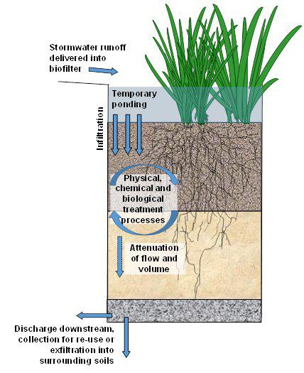
We also use biofiltration as one of our main landscape strategies to help create a beautiful landscape area for the community. Meanwhile, it can gather and purify the water from the garden and cooling center/ splash pads.
During an emergency such as riverine flooding, the biofiltration marshland can help manage the stormwater and reduce the impact of extreme weather hazards.
137 RESILIENCE PROJECTS
Emergent Scene


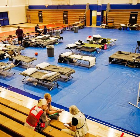


138 ST. CROIX RESILIENCE PLAN
Indoor Basketball Court
Community Farm Garden Biofiltration Landscape Sports Complex
Temporary Performance or Farmers Market
Community Interactive Spaces
Community Safe Room
Stormwater Management
Disaster Relief Resource Distribution
Daily Scene
Funding
A crucial component to our proposal is the funding portion. FEMA has a variety of grants available designated for safe rooms.
Within the Hazard Mitigation Grant Program, the Hazard Mitigation Assistance Program and the Building Resilient Infrastructure and Communities grants are applicable to St. Croix.14 These specific grants fund the fortification and construction of community safe rooms.15
Also, Pre-Disaster Mitigation Funds are available to fund this proposal.16 In addition, The US Department of Housing and
Urban Development offers the Community Development Block Grant. This grant is designed to “support community development activities to build stronger and more resilient communities.”17
Although these grants are available, they are extremely competitive to win. We propose creating a partnership with students enrolled in the “Winning Non-Profit & Faith Based Grants! Essential 21st Century Proposal Writing Techniques Class” at the University of the Virgin Islands. This partnership would include an internship for students to use their skills learned in the classroom in a real-world scenario.
In the future, the community safe hub can also serve as a natural disaster knowledge dissemination center.


1. “U.S. Virgin Islands Recovery: Additional Actions Could Strengthen FEMA’s Key Disaster Recovery Efforts.” GAO, November 19, 2019. https://www.gao.gov/products/gao-20-54
2. “Predictions of Future Global Climate.” Center for Science Education, n.d. https://scied. ucar.edu/learning-zone/climate-change-impacts/predictions-future-global-climate.
3. “Flood Hazard Siting and Floor Elevation Criteria for Community Safe Rooms.” Federal Emergency Management Agency, 2021. https://www.fema.gov/sites/default/files/ documents/fema-com-safe-room-flood_fact-sheet_2021.pdf.
4. “The Alexander Theater: Approved for Renovation & Retrofit!” St. Croix Foundation, n.d. https://www.stxfoundation.org/alexander-theater/
5. “USVI Recovery Leaders Summit Report.” USVI Office of Disaster Recovery, n.d. https:// www.usviodr.com/wp-content/uploads/2022/05/FINAL-2021-USVI-Recovery-LeadersSummit-Report-RS-1.pdf.
6. Government of the US Virgin Islands. “Capital Projects FY23 & FY24 Operating Budget,” n.d. https://stories.opengov.com/usvi/published/1rdtxgdMW.
7. Virgin Islands Territorial and Emergency Management Agency. “Human Services Announces Territory’s Shelters for the 2019 Season,” 2019. http://www.vitema.vi.gov/ news/news-details/2019/07/30/human-services-announces-territory-s-shelters-for-the2019-season.
8. USVI Department of Health Services. “St. Croix Head Start Center,” n.d. http://www.dhs. gov.vi/OCCRS/documents/HeadStartListings.pdf.
9. Commissioner Kimberley Causey-Gomez. “Updates on Plans for 2021 Hurricane Season Testimony.” Virgin Islands Department of Human Services, 2021. http://www.legvi. org/committeemeetings/Committee%20on%20Homeland%20Security,%20Justice,%20 Public%20Safety/5.25.21%20Homeland%20Security/Testimonies/Testimony.VIDHS%20 Cmte%20Homeland%20Security.MAY%2025%202021.FINAL.KCG.pdf.
10. Commissioner Kimberley Causey-Gomez. “Updates on Plans for 2021 Hurricane Season Testimony.” Virgin Islands Department of Human Services, 2021. http://www.legvi. org/committeemeetings/Committee%20on%20Homeland%20Security,%20Justice,%20 Public%20Safety/5.25.21%20Homeland%20Security/Testimonies/Testimony.VIDHS%20 Cmte%20Homeland%20Security.MAY%2025%202021.FINAL.KCG.pdf.
11. “VITEMA Director Says Agencies Learned from Maria and Irma.” Don Buchanan, October 14, 2022 https://stthomassource.com/content/2022/10/14/vitema-director-says-agencieslearned-from-maria-and-irma/.
12. “St. Croix’s Public Art Trail,” n.d. https://www.gotostcroix.com/st-croix-blog/st-croixspublic-art-trail/.
13. “2010 Island Areas - U.S. Virgin Islands Dataset.” United States Census Bureau, n.d.
14. “Building Resilient Infrastructure and Communities.” Federal Emergency Management Agency, November 21, 2022. https://www.fema.gov/grants/mitigation/building-resilientinfrastructure-communities
142 ST. CROIX RESILIENCE PLAN
References
15. “Safe Room Funding.” Federal Emergency Management Agency, January 12, 2022. https:// www.fema.gov/emergency-managers/risk-management/safe-rooms/funding
16. “Pre-Disaster Mitigation (PDM) Grant.” Federal Emergency Management Agency, November 21, 2022. https://www.fema.gov/grants/mitigation/pre-disaster
17. “Community Development Block Grant.” HUD Exchange, n.d. https://www.hudexchange. info/programs/cdbg/
143 RESILIENCE PROJECTS
Embracing the Guts
Guts are an essential part of St. Croix’s stormwater management system, but they face many challenges, from dumping to residential flooding. This project aims to tackle these issues through a stewardship approach, redesigning the areas adjacent to the guts in a way that allows Crucians to interact with them on a daily basis. These sustained, meaningful interactions will help break down the barriers between humans and nature, creating a more symbiotic relationship between the two and promoting a more resilient future for the island.
This project focuses on five sites of intervention along the Golden Rock gut. Each site has multiple site-specific approaches that are tailored to the changing conditions along the gut and imagine different futures depending on the funding and capacity available to develop the surrounding parcels. The chapter concludes with a series of takeaways from this design process that could be applied to future gut interventions across St. Croix.
144 ST. CROIX RESILIENCE PLAN
Guts are essential to the ecosystem and stormwater infrastructure of St. Croix.

The USVI development code defines guts (also “ghuts”) as any “natural or constructed waterway or any permanent or intermittent stream.”1 As St. Croix is a mountainous island with steep slopes leading down from the mountain ridges, there are no rivers or streams. All natural conveyance of water on the island occurs in the guts, carrying stormwater and other runoff from the peaks of mountains down to the shoreline, where water is released into the Caribbean Sea. The guts are an essential part of St. Croix’s natural resilience, working as an infrastructural system for stormwater
management while also contributing to natural habitats.
While the guts provide a lot of positive benefits for St. Croix, they also pose a number of risks. When the capacity of the guts is overwhelmed in severe weather events, the guts can flood and become a hazard that threatens the environment, property, and most of all human life. Future climate change scenarios predict that major storms –such as tropical storms and hurricanes – will only increase in severity and frequency, so addressing flooding of the guts and its impact on the island is of critical importance.

145 RESILIENCE PROJECTS
Guts Network Guts
Flood Zones
Data: UVI
Existing Plans
The importance of the guts has been thoroughly documented through the past studies and management plans. The following plans formed the basis of the background for this project, in addition to site observation and inventory of the guts conducted during travel week as a part of this studio.

Watershed Management Plans
In 2022, Watershed Consulting Associates LLC, in partnership with the Virgin Islands Department of Planning and Natural Resources (DPNR) and the Office of Disaster Recovery (ODR) produced 8 watershed management plans for priority watersheds on St. Thomas and St. Croix.2 Five of these plans were for priority watersheds on St. Croix. The plans thoroughly document the existing physical conditions of the watersheds, analyze the issues that they face, and identify project sites to implement best management practices.3

146 ST. CROIX RESILIENCE PLAN
A gut adjacent to D.C. Canegata Ballpark (Image: UPenn Studio)
Image: DPNR
A Strategy for Management of Ghuts in the U.S. Virgin Islands

In 2008, this report was released by the Water Resources Research Institute at the University of the Virgin Islands. The report identifies a number of prevalent issues that the guts face, but more importantly makes the distinction that the guts need to be managed as a resource, rather than as simply a pollution issue.4 The report concludes by proposing five key strategies for gut management, including specific recommendations such as gut monitoring, buffer zones, recreational opportunities, and education.
Hazard Mitigation and Resilience Plan
Most recently, the Hazard Mitigation and Resilience Plan (HMRP) has been looking at the future of St. Croix in context of hazards such as flooding, hurricanes, and drought. In the analysis on flooding, the HMRP has identified that flooding today has been impacted greatly by development, as changing land uses and land cover types reduce the permeability of the landscape and increase runoff.5 Additionally, debris and uncontrolled plant growth in the guts can cause water to back up in the channel and contribute to flooding.

147 RESILIENCE PROJECTS
Image: UVI
Image: HMRP
Gut Issues
Hardening
Especially in more developed areas of the island, natural gut infrastructure has been replaced with concrete channels or underground piping. These hardened structures prevent water infiltration, and piped drainage may become overwhelmed during storm events, causing flooding in the surrounding areas.

Dumping
Due to the lack of adequate waste management on St. Croix, many guts experience dumping of household waste and other items. This dumping can prevent stormwater conveyance and lead to residential flooding.


Flooding
Due to other issues with hardened infrastructure and dumping, many guts are often unable to properly channel and discharge water, contributing to flooding in areas adjacent to the guts. Climate change is only exacerbating this issue, causing more frequent and intense rainfall.
148 ST. CROIX RESILIENCE PLAN
(Image: UPenn Studio)
(Image: VI Free Press)
(Image: St. Croix Source)
Sea Level Rise
Rising sea levels will make it even harder for guts to discharge stormwater as seawater is pushed further up the guts, leaving less room for water conveyance on the island.

Sargassum
USVI has been experiencing a large influx of sargassum seaweed that washes ashore and clogs both natural and man-made infrastructure. As sargassum creeps up the guts, it also hinders water discharge and causes nearby flooding.

Coral Bleaching
Coral reefs are vulnerable to the effects of climate change, such as temperature increases and increased storm intensity. Because many guts have been hardened and lack the natural ability to filter water, the guts can carry polluted water that is discharged into the sea, contributing to coral bleaching.

149 RESILIENCE PROJECTS
(Image: UPenn Studio)
(Image: UPenn Studio)
(Image: National Park Service)
Stewardship
Vision
“...the responsible use and protection of the natural environment through conservation and sustainable practices to enhance ecosystem resilience and human well-being” 7
4
Create a symbiotic relationship between human and natural systems
Mitigate flooding along the guts
Increase public access to the guts for community space
150 ST. CROIX RESILIENCE PLAN
Goals Promote stewardship of the guts
1
2
3
To tackle the many issues that guts face, this project proposes a plan grounded in stewardship. Stewardship promotes resilience for both human and natural systems and can help sustain the well being of the guts in the long term. Creating sustainable norms and promoting behaviors such as not dumping or staying clear of floodwater will also improve the health of the gut.6 Ultimately, stewardship is essential because it tackles issues at the source and reduces negative interactions with the guts. The goals for this project fold stewardship, design, and equity into one. The first goal (Promote stewardship of the guts) calls for the guts to be embraced by the community as a beloved asset. The second goal (Create a symbiotic relationship between human and natural systems) looks for ways that the guts can better serve human health, and vice versa. The third goal (Mitigate flooding along the guts) promotes new methods of stormwater management, and the fourth goal (Increase public access to the guts for community space) envisions the guts as places where people can recreate and enjoy nature.
Case Study: Copenhagen Cloudburst Formula
After Copenhagen’s 2011 cloudburst, a major rain event that left $1 billion in damages, the city strategized new ways to address climate change and floodable development. As a part of this project they identified the cost of doing nothing as $60 million a year, and publicized the effects of climate change to the public. The result was has been that the city as a whole has rallied to the challenge of tackling increased rainfall and become a city focused on stewardship.8

Case Study: Rotterdam Waterplein
Completed in 2013, Rotterdam’s Waterplein is a series of three public plazas designed to collect water during storm events. The plazas act as pools that will fill up with water and then release it when the city’s drainage systems have more capacity. This project combines community space and hard infrastructure in a costeffective way that brings more awareness of water management and creates a better public realm.9

151 RESILIENCE PROJECTS
Image: Ramboll and Ramboll Studio Dreiseitl
Image: De Urbanisten
To make this investigation of the guts more tangible, we chose to identify a gut to use as a pilot. By studying a specific gut, we can conduct analysis of specific conditions occurring in the guts today, and provide recommendations that can be applied to the island at large in the future.
Intervention Need Index
We started by identifying factors that would help us find a gut to use for this pilot. We looked for vulnerable areas where intervention and improvements in the gut would provide the most benefit to the community. Social vulnerability, population density, and flooding were the key factors that we chose. These factors indicate areas where people are more susceptible to the hazards that guts can create. We combined these factors into an Intervention Need Index and were able to see areas where new management strategies for the guts the most necessary.
152 ST. CROIX RESILIENCE PLAN Risk score of 3 Social Vulnerability Index Top 10% of Estates Government owned land Population Density Top 10% of Estates Close proximity to residential areas Flood Zones 100 yr Storm St. Croix Site Need Assessment Suitability Assessment
Process
Data: 2010 Decennial Census of Island Areas, UVI

Based on the Intervention Need Index, we identified three areas where gut interventions could provide a benefit to vulnerable populations. These areas included some of the most dense, vulnerable, and flood prone estates.

Christiansted has a large socially vulnerable population, and the diverse urban conditions create unique challenges as the gut moves to the sea.
Williams Delight
As of the most dense and socially vulnerable estates in St. Croix, Williams Delight is especially vulnerable to intense storms and flooding.
Of these three key areas, we chose to look further at Christiansted, as there was a larger population to serve, greater availability of publicly owned land, and diverse conditions that provided a good breadth of challenges for the pilot to address.
Directly adjacent to the closed refinery, Bethlehem’s watershed faces issues of environmental justice for nearby neighborhoods.
153 RESILIENCE PROJECTS
Christiansted
Bethlehem
Intervention Need Index Bethlehem Williams Delight Christiansted Intervention Need Index 0 (no risk factors) 1 2 3 (all risk factors)
The guts are an opportunity to serve vulnerable populations and enhance ecosystem services
Golden Rock Gut
Within Christiansted, we chose to base our pilot on the Golden Rock Gut. The Golden Rock estate stretches from mountainous terrain to the south to white sand beaches to the north. The estate is also located directly next to the Water and Power Authority (WAPA) Desalination Plant and Power Plant, which can be detrimental to the nearby homes, condos and apartments. Northside Road runs through the center of this gut as well, and houses a number of commercial uses.
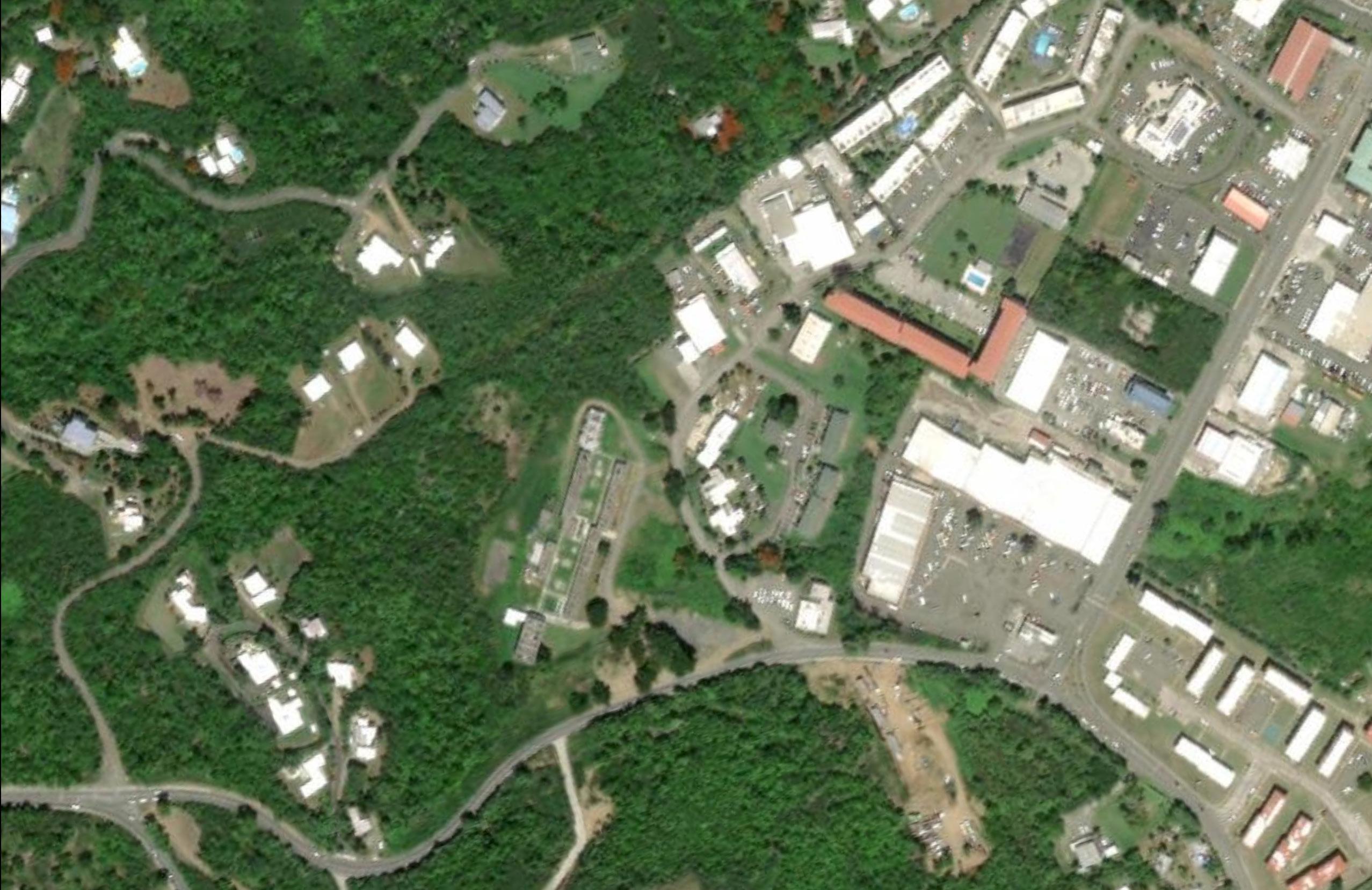
154 ST. CROIX RESILIENCE PLAN
NORTHSIDE ROAD
NORTHSIDE ROAD
St. Dunstan’s School
Golden Rock Shopping Mall Caribbean Community Theatre District Court of the Virgin Islands
1 1 5 3 3 7 7 7 2 2 6 4 8 8
WAPA Desalination Plant and Power Facility Sugar Beach Gas Stations Supermarket


155 RESILIENCE PROJECTS
Aerial view of the Golden Rock neighborhood and gut (Image: Google)
5 6 4 0
N
Overlooking Golden Rock Gut and downtown Christiansted (Image: UPenn Studio)
250 500 Feet
Gut Typologies & Edge Conditions
Gut Typologies
Natural
Channeled
Piped
Roadway Crossing
Edge Conditions
Vegetated

Developed
Piped
Drainage has been piped underground; may experience issues in collecting surface-level runoff directly above it.


Channeled
Base of the gut has been hardened to get water downstream as quickly as possible.
156 ST. CROIX RESILIENCE PLAN
Natural Hybrid
Dominated by vegetation and natural features; mostly untouched by human development.
Vegetation on one side while experiencing developmental pressure (buildings, roadways, etc.) on the other side.


157 RESILIENCE PROJECTS
Gut Life Cycle
Each gut goes through a life cycle from “ridge to reef” and must perform different functions as it passes through different areas of the island. This project identifies three phases that correspond with these functions:
Conveyance
The conveyance phase focuses on getting stormwater downstream and takes place in more developed areas that have higher risks of infrastructure and residential flooding.

The retention phase provides opportunities to hold water, slow it down, and encourage infiltration. This phase requires areas of open space that have the capacity to retain water without affecting nearby development.
The release phase is the final section of the gut where it meets the sea and focuses on how to eliminate pollutants and remove trash and debris before stormwater is discharged into the sea and can affect marine ecosystems, including mangroves and coral reefs.
158 ST. CROIX RESILIENCE PLAN
1. Conveyance
2. Retention
3. Release
1 2 3
Design Approach
Because funding and capacity to develop a site will change over time, it is important to consider what different futures of the guts will look like, giving more flexibility in choosing which design interventions to implement. This project has selected five different sites of intervention, providing multiple approaches for each.
The first approach is a set of Baseline Recommendations, which represent the starting point and the minimum considerations that should be taken into account when intervening in the design of a gut.
The Retrofit Approach imagines what more could be done within the constraints of the existing building footprints. The Rebuild Approach then imagines what could be done if the site were to be completely redeveloped.
Northside Road Crossing
Retention Park Release Point

159 RESILIENCE PROJECTS
Retention Release 0 250 500 Feet N
4 5 1 2 3 4 5
St. Dunstan’s School
Golden Rock Shopping Mall
Flood Zone
Vulnerable Buildings
St. Dunstan’s School
Site Context


St. Dunstan’s School is the most upstream site of the Golden Rock gut. The school is currently closed but has been identified as a potential safe room site for emergencies and could be put back into use in the future. Half of the buildings are in the flood zone, making them vulnerable during storm events.
Baseline Recommendations
Apply
wet flood-proofing
measures to ground level and basement level spaces.
May include creating openings to allow water to flow in and out of spaces easily or choosing flood-resistant materials, such as ceramic tile and concrete.
160 ST. CROIX RESILIENCE PLAN
0 100 200 Feet N
St. Dunstan’s School
Existing Conditions of the area and the floodplain
Rebuild Approach
Build a new residential development outside of the flood zone.
With St. Croix’s housing shortage, this site is a good opportunity to build more housing units.
Create a new open space amenity within the flood zone area.
The leftover space could become a new amenity for the residential development with a walking path and vegetation.

161 RESILIENCE PROJECTS
0 100 200 Feet N New Apartment Buildings Playground
PROPERTYLINE
Walking Path
Proposed site redevelopment for Rebuild Approach
Golden Rock Shopping Mall
Site Context

The Golden Rock Shopping Mall is home to a supermarket, a gas station, a few small businesses, and multiple vacant storefronts. The gut is piped underneath the site and bends around the existing buildings, finally emerging above ground in a channel that leads it to Northside Road.
Baseline Recommendations
Assess water runoff that is not captured by the piped gut drainage.
Almost the entire site is currently in the flood zone, and the piped drainage may be limiting the flow of stormwater into the gut.

162 ST. CROIX RESILIENCE PLAN
Flood Zone Channeled Piped 0 100 200 Feet N
Existing Conditions of the area and the floodplain
Retrofit Approach
Create an art installation that reveals “invisible infrastructure” of the piped gut.
This would be accompanied by “No Dumping” signage that would provide more information about the gut ecosystem and the harmful effects of dumping.
Improve permeability across the site.
The existing parking lot is largely impervious, so increasing permeability with new landscape features may help reduce surface flooding during future storm events.

163 RESILIENCE PROJECTS
Expanded Channel Improve Permeability Art Installation 0 100 200 Feet N
Proposed site interventions for Retrofit Approach
Retrofit Approach
(cont.)
Expand the capacity of the existing channeled gut section.
A channel redesign could include gabions and other landscape features that channel water while also encouraging infiltration.


164 ST. CROIX RESILIENCE PLAN
Example of gabion channel (Image: Kente Mesh)
Existing Channel
Expanded Channel
Approach
Create new residential complex and retail center around rerouted gut.
Redeveloping the site entirely would give the opportunity to daylight and reroute the gut to follow a more natural path of water conveyance. New buildings and public space amenities could be placed on either side of the gut, allowing it to become the new focal point of the site.


165 RESILIENCE PROJECTS
Rebuild
Section A-A Apartment Building Amphitheater Terraced Area with Gut Access Public Patio New Retail Center 0 100 200 Feet N A A Proposed site redevelopment for Rebuild Approach
Northside Road Crossing
Site Context

As the gut approaches Northside Road, the water is channeled into a pipe that goes underneath the roadway and emerges out into an open vegetated area.
Baseline Recommendations
Perform hydrology study to determine if existing piping can accommodate flooding and runoff.
If there are issues with flooding on the adjacent parcels, it is recommended to increase the capacity of the piped drainage.
166 ST. CROIX RESILIENCE PLAN
Flood Zone 0 50 100 Feet N
Existing Conditions of the area and the floodplain
Rebuild Approach
Install new pedestrian signal to connect new development to new park.
A safe crosswalk would be needed if both sites were to be redeveloped. This crossing would include a new pedestrian signal, curb bump-outs, and a pedestrian island.


Improve sidewalk network along roadway.
A better sidewalk network along Northside Road would enhance connectivity beyond the gut and along the commercial corridor.
167 RESILIENCE PROJECTS
Gut 8’ Median 12’ Travel Lane 12’ Travel Lane 14’ Sidewalk 14’ Sidewalk A A Section A-A Proposed
Rebuild Approach
Piped
site plan for
Retention Park
Site Context

This section of the gut is entirely natural, and the large parcels of undeveloped land make it ideal for developing the Retention Park. This site is intended to slow the flow of water and retain stormwater in order to lessen the burden on downstream sections of the gut.
Baseline Recommendations Control floodwater and prevent it from flowing into residential areas.
The flood zone encroaches slightly into the residential area next to the park, so the first priority for this site is to control floodwaters and flood-proof existing buildings.

168 ST. CROIX RESILIENCE PLAN
Flood Zone 0 200 400 Feet N
Existing Conditions of the area and the floodplain
Enhance the existing park for surrounding residents and the community.

On the east edge of this site there is an existing park. It is currently just an open field with a ballcourt. Simple interventions like signage, maintenance, and seating are affordable but high-impact ways to add value to the existing space. This improvement will also set the stage for future rebuild interventions.
Provide accessible spaces for all members of the community.
Any park needs to be accessible to people of all ages and abilities. Ensuring street parking is clear of debris and walkways are maintained can help make people feel more welcome in the space.
169 RESILIENCE PROJECTS
Hiking through Mahogany Gut, another gut with a natural typology (Image: UVI)
Rebuild Approach
Provide public space amenities, such as benches, tennis courts, an education center, and walking paths.
The new park design brings people closer to the gut and allows for responsible interactions with nature. Amenities help make this experience more comfortable for people and supports various programs for the space.

Foster accessibility with the use of ramps, accessible pathways, and other features.
Continuing from the baseline recommendations, accessibility is still paramount in the new park. Building ramps and making sure pathways are kept clear and safe ensure that this park can be a resource for all people of St. Croix.
170 ST. CROIX RESILIENCE PLAN
Proposed redesign of the park and gut areas
Terraced Garden Floodable Area
Walking Trails
0 200 400 Feet N C D B A C D B A
Tennis Courts Education Building
Use retaining walls and expand the capacity of the guts for flood control.
Rather than confine the gut to its natural course and fight against flooding, this design proposes to put water at the center of the experience and build in floodable areas with walls, terraces, and berms. By expanding these designated areas for stormwater the site can protect people from hazards and retain water that can be used for irrigation in droughts.


171 RESILIENCE PROJECTS
Waterfront Path
Waterfront Path
Nature Trail
Terrace Garden
Flooding Area
Flooding Area
Nature Trail
Nature Trail
Section A-A
Section C-C
Section D-D
Section B-B
Release Point
Site Context

The final intervention site focuses on filtering the water that flows through the gut before it reaches the sea. With the WAPA facility to the east and residential on all sides, this site is a prime location to consider how environmental sustainability can become part of daily life for St. Croix.

Baseline Recommendations
Organize a gut stewardship team.
To support any recommendations for this site, it is important to have a team dedicated to maintaining and preserving the gut. This stewardship team can include paid employees and volunteers who clean, monitor, and create programming.
172 ST. CROIX RESILIENCE PLAN
Existing Conditions of the area and the floodplain Flood Zone 0 150 300 Feet N
Perform further studies to fully understand the complex system of the gut.
While plans and data from HMRP, DPNR, and UVI provide essential data and analysis of the guts today, future development will be best served by an in depth understanding of specific sites along the gut. Supplemental analyses of this site would allow for a more precise approach to filtration and provide a baseline that progress can be compared against.
The following studies would be essential in monitoring the health of the guts and any hazards it poses:
• Water quality and nearshore pollution

• Sedimentation and dumping
• Water flow rate and volume
• Physical conditions (i.e., grade, vegetation, piping)
173 RESILIENCE PROJECTS
Condominiums along Sugar Beach with Golden Rock Gut in the background (Image: Sea Glass Properties)
Retrofit Approach
Establish sea level rise (SLR) protection zone.
Based on USVI’s 2 foot SLR scenario, the mouth of the gut could be protected to prevent development in at-risk areas.
Construct runoff barriers.
Small berms and gravel infiltration strips can be installed along the road edges to further prevent pollution from the road.
Expand buffer zones.
USVI code currently mandates a 15 foot setback from the gut.10 Expanding this to at least 25 feet would allow for more room for gut enhancement interventions. It would also create a greater distance between the road and the gut, reducing the amount of runoff from the road that enters the gut.

174 ST. CROIX RESILIENCE PLAN
Proposed buffers and protections 0 150 300 Feet N SLR Protection Zone Expanded Buffer Road runoff barriers
Mangroves help protect the shoreline and contribute to the island’s ecosystems (Image:


175 RESILIENCE PROJECTS
Rocks and pilings at the gut’s outflow (Image: Sea Glass Properties)
UPenn Studio)
Rebuild Approach
Enhance and protect mangroves.
Mangroves along the water’s edge are the first and last line of defense for flooding and erosion. Preserving these will protect the rest of the gut.
Construct new walking paths to the shoreline.
Connecting the Retention Park to the shoreline enhances the public realm and completes the open space system, fostering stewardship and use.
Create an education and research center.
A new facility adjacent to WAPA’s lift station near the shoreline can house research and monitoring programs, as well as educational programs for children, students, and tourists.

176 ST. CROIX RESILIENCE PLAN
Proposed redesign of the release point 0 150 300 Feet N Beach Access Sargassum Barrier Research Center Trash Catch Basin Walking Paths Terracing C C B B A A
Install barriers and filtration devices.

A catch basin for trash and a sargassum barrier off shore can prevent the guts from becoming clogged, which can cause flooding.

Build gut terracing to prevent erosion.
Fast moving water can gradually erode the guts, causing sedimentation offshore. Terracing can fortify the banks of the gut and create additional spaces for rest and recreation.


177 RESILIENCE PROJECTS
Boulders to reduce runoff velocity
Enhanced mangrove edge
Sargassum Barrier
Catch Basin Filter Options 10’ Runoff Barrier 10’ Walking Path 25’ Gut Setback 25’ Gut Setback
Section A-A
Section C-C
Section B-B
Embracing Golden Rock Gut
Educational Programming A Complete System
From conveyance to retention and release, the reimagined Golden Rock Gut is designed to put people and environment first while not interrupting the daily lives of the people of St. Croix. Sustainability, culture, education and economy are infused from ridge to reef. Hazards are mitigated and assets are celebrated.
In order to maximize the impact of these recommendations, any physical or policy interventions in the guts should be accompanied by educational programming. There are two schools located close to the Golden Rock Gut: St. Croix Montessori to the west and Juanita Gardine K-8 School to the east. The redesign of the gut creates numerous spaces for this programming to occur, and the spaces can accommodate all ages of learners. Learning about the guts is an essential part of advocating for their future.

178 ST. CROIX RESILIENCE PLAN
1 5 3 2 6 4
Commercial Programming
Commercial programming is equally important, as the economic potential of this area should not be compromised by environmental and social priorities. A large new plaza in the Golden Rock Shopping Center can host markets, outdoor dining, and provide places for shoppers to rest, increasing activity around businesses. Additionally, the connection to the beach allows nearby residents to access the shoreline more easily, promoting ecotourism, water sports, and other blue economy activities.

179 RESILIENCE PROJECTS Overall masterplan of design proposals for Golden Rock Gut Programming Sites Educational Commercial
Amphitheater Potential Daycare Commercial Plaza Interactive Terraces Exhibits Interpretive Signage Education Building Monitoring and Research Center Beach Access 1 5 3 7 7 9 9 2 6 6 4 8 8 10 10 0 250 500 Feet N
Playground
Takeaways
Although the strategies on the previous pages are meant to be viewed as a potential pilot project applied only to this specific gut, this process could inform future gut interventions across the island. The following page lists some key takeaways from the design process, based on the different sitespecific approaches.
The guts are a critical piece of St. Croix’s infrastructure and should be treated as such. They’re incredibly complex systems, performing different functions and facing different issues
throughout their life cycle. Although designing physical interventions to address current issues may be difficult, it’s crucial to find ways to highlight their importance in the daily lives of Crucian residents. Creating sustained and meaningful interaction with the guts will help achieve the goal of stewardship and lead to a more resilient St. Croix.

180 ST. CROIX RESILIENCE PLAN
View above Golden Rock gut and surrounding area (Image: UPenn Studio)
1 2 3 4 5
Find a balance between mitigating flood risk and keeping buildings operable for the community.
Draw attention to the gut as an asset for the local community and, especially where the pipe is not immediately visible, uncover its presence and importance to the island’s infrastructure.
Maintain access and connectivity along the gut in order to promote stewardship and community benefit, allowing people to interact with the gut in a variety of ways.
Integrate critical gut functions with public space to promote natural alternatives to hardened gut infrastructure.
Eliminate pollutants within stormwater carried by the guts to protect marine ecosystems at the end of the gut life cycle, fostering sustainable systems beyond the physical gut itself.
181 RESILIENCE PROJECTS
References
1. “2019 US Virgin Islands Code Title 29 - Public Planning and Development Chapter 3 - Virgin Islands Zoning and Subdivision Law Subchapter I - Zoning Law § 225. Definitions,” n.d. https://law.justia.com/codes/virgin-islands/2019/title-29/chapter-3/ subchapter-i/225/.
2. Watershed Consulting Associates, LLC. “Bethlehem, St. Croix Watershed Management Plan,” 2022. https://dpnr.vi.gov/wp-content/uploads/2022/11/Bethlehem-WatershedManagement-Plan.pdf.
3. ———. “Diamond, St. Croix Watershed Management Plan,” 2022. https://dpnr.vi.gov/wpcontent/uploads/2022/11/Diamond-Watershed-Management-Plan.pdf.
4. Lloyd Gardner. “A Strategy for Management of Ghuts in the U.S. Virgin Islands.” Water Resources Research Institute, University of the Virgin Islands., 2008. https://www. ncei.noaa.gov/data/oceans/coris/library/NOAA/CRCP/other/other_crcp_publications/ Watershed_USVI/steer_exisiting_studies/strategy_management.pdf.
5. “Riverine Flooding in the U.S. Virgin Islands.” USVI Hazard Mitigation & Resilience Plan, n.d. https://resilientvi.org/riverine-flooding-usvi.
6. McKenzie-Mohr, Doug. “Fostering Sustainable Behavior through Community-Based Social Marketing.” American Psychologist 55, no. 5 (2000): 531–37. https://doi. org/10.1037/0003-066X.55.5.531.
7. National Oceanic and Atmospheric Administration. “Environmental Stewardship,” n.d. https://www.noaa.gov/office-education/noaa-education-council/monitoring-resources/ common-measure-definitions/stewardship-definitions#:~:text=Environmental%20 education%20that%20includes%20stewardship%20provides%20opportunities%20 for,and%20protecting%20these%20resources%20%28NOAA%20Education%20 Council%2C%202015%29.
8. American Society of Landscape Architects. “The Copenhagen Cloudburst Formula: A Strategic Process for Planning and Designing Blue-Green Interventions” n.d. https://www. asla.org/2016awards/171784.html.
9. “Watersquare Benthemplein.” De Urbanisten, n.d. https://www.urbanisten.nl/work/ benthemplein.
10. “U.S. Virgin Islands Development Code.” Center for Planning Practice, Rutgers, The State University of New Jersey, 2014. https://dpnr.vi.gov/wp-content/uploads/2022/09/USVIRevised-Zoning-Subdivision-Code_7_29_14.pdf.
182 ST. CROIX RESILIENCE PLAN

183 RESILIENCE PROJECTS
Image: UPenn Studio
Resilient R & D Through Sargassum
What is Sargassum? Where is it Located?
Sargassum is a large brown seaweed that is a type of algae found in the ocean. It is made up of leafy appendages with berry-like structures. The berry-like structures are called pneumatocysts and are primarily filled with oxygen. The pneumatocysts are part of the algae that makes sargassum float in a mass and never attach to the seafloor.1
Marine life such as turtles feed off the pneumatocysts for nutrients. Sargassum is quite harmless while in the ocean. However, once it reaches the shore and lands on the beach it is where problems can occur. Once the brown seaweed reaches a beach shoreline it will begin to dry and decompose. As it decomposes it will produce a sulfuric odor. During this process is when sargassum emits gases that are harmful to humans. According to the University of South Florida there are over 24.2 million tons of sargassum which is equivalent to about 17 million cars.2
Sargassum can be found primarily in the Sargasso Sea. This includes the Atlantic Ocean stretching from the Northern Atlantic Ocean to the Caribbean Sea. Furthermore, it is also found in the Gulf of Mexico where sargassum is washed up on the shores of Mexico, Florida, Mississippi, and Alabama. As well, sargassum can be found washed up on the West African coast, the Antilles, Central America, and Northern South America.
The Sargasso Sea is named after sargassum due to the large amount that can be found. In addition, it is the only sea without a land boundary. It is the only sea that is defined by the ocean current. The Sargasso Sea was feared by many sailors due to the stories that were told about sargassum. The fear was that the algae was hiding the coral reefs because it was difficult to see through the ocean.3 If the ships were to hit the coral reefs, it could sink the ships in the ocean.
184 ST. CROIX RESILIENCE PLAN


185 RESILIENCE PROJECTS
Image: UPenn Studio
Image: Ocean 71
Turtles use sargassum mats for their hatchlings as a food source.

The brown algae have many benefits to the aquatic ecosystem. Sargassum, in effect, is an important habitat and food source for much of the marine life. For example, humpback whales, tuna, and birds migrate through the Sargasso Sea and use it as a food source. Turtles use sargassum mats for their hatchlings to use as a food source and shelter. Furthermore, sargassum is an essential home for crab, shrimp,
and other marine life including protecting endangered marine life.4 There are more than 100 species of invertebrates, 280 species of fish, and 23 species of seabirds.5
Image: Turtle Island Restoration Network
Economic Benefits of Sargassum6
• $500M Revenues from whale watching

• $100M Revenues from commercial fisheries
• $66M Revenues from commercial eel harvests
• $15M Revenues from Turtle Tourism in the Caribbean
• $.6M Revenues in Bermuda from recreational fishing
The indirect use of value of the Sargasso Sea is about $2.7B annually.
187 RESILIENCE PROJECTS
Image: New England Inns & Resorts
Sargassum Challenges
The main challenge with Sargassum overall is that there is too much of it that ends up on coastlines and beaches. There has been an increase of 6 million tons of sargassum covered in the Atlantic Ocean from May to June of 2022.7 In some places sargassum has increased by 20% higher than the previous record that was set in 2018.8 Scientists believe that the increase in this type of algae is due to an increase in nutrients found in the ocean and warmer waters due to climate change.
In order to remove the seaweed from the shorelines of USVI it would
cost about $25,000 per day.9 The challenge in removing the algae would be limiting the amount that can be transported to landfills. Transporting substantial amounts of sargassum would be dangerous as it is highly flammable. Furthermore, removing sargassum would require a delicate process to ensure that the habitat is not disrupted. There are also economic impacts on the tourism industry within the Caribbean, Gulf of Mexico, and along the east coast of the United States from the influx of sargassum.
 Image: UPenn Studio
Tourism Disruption
Tourism is a significant industry for the Caribbean. For the United States Virgin Islands travel and tourism contributed over $1 billion in 2019.10 Tourism accounts for about 60% of St. Croix’s economy from about 2 million people visit the United States Virgin Islands every year. Though data has shown growth in the tourism industry during the first quarter of 2022 this might be due to the surge that many tourism destinations have seen growth in the tourism industry. To sustain tourism, it’s important for tourists to have memorable experiences. Desalination is the process of removing salt water and minerals from water and therefore turning it into fresh water. Within St. Croix, two reverse osmosis water production plants produce 3.6 million gallons of fresh water per day for Crucians to use for drinking, cooking, and other uses.11 This is very crucial given that St. Croix faces droughts. From the influx of sargassum, it overwhelmed the desalination plants and forced Governor Albert Bryan to declare a state of emergency to receive support from the federal government to mitigate the problem.12

Desalination

Electricity
For most of St. Croix to use electricity would require the use of purified water. Water is needed for the heat recovery steam generator which can add 19 megawatts of power; which is the equivalent of about 17,000 homes per year.13 The lack of water forces the government to use diesel which is more expensive. Crucians spent about 43 cents per kilowatt hour which is more than 3 times the cost of the national average at 14 cents per kilowatt hour.14

189 RESILIENCE PROJECTS
Image: UPenn Studio
Image: St. Thomas Source
Image: Aireko
Sargassum Uses

• Agriculture
• Antifouling
• Bioenergy

• Bioplastics

• Bioremediation & Purification
• Clothing, Footwear & Accessories
• Construction
• Cosmetics
• Electrochemical Industry

• Environmental Restoration
• Food & Beverages
• Lubricants, Surfactants and Adhesives

• Paper Products
• Pharmaceutical & Biomedical
• Carbon Sequestration
There are about 15 industries that sargassum can be used.15
190 ST. CROIX RESILIENCE PLAN
Clothing Biomedical Bioplastics
Construction
Sargassum
Sargablocks
An entrepreneur from Mexico, Omar Vázquez Sánchez, also known as “Mr. Sargassum”, created Sargablocks.16
Costing about $.50 per brick to make, it requires less water than standard bricks and is less harmful to the environment. Each brick contains 40% sargassum, and the remaining contains 60% of organic materials which includes limestone that can be found on St. Croix. Sargablocks are also very resilient. One of the houses that he built using sargablocks endured 5 hurricanes and 6 tropical storms. This material can be used in the Caribbean and abroad considering the increase in severe weather events.

191 RESILIENCE PROJECTS
Image: El Quintanarroense
Costing about $.50 per brick to make, it requires less water than standard bricks and is less harmful to the environment.
Sargassum R&D Hub
Though there are many ways which sargassum can be used, there is still a significant amount of research and development needed to scale and build sustainable industries that would best work for St. Croix. For this to happen, St. Croix should make investments to create a research development hub focused on sargassum. This would involve the following.
 1. Research & Development Consortium
2. Sargassum Investment Fund
3. Annual Sargassum Conference
Image: National Student Exchange
1. Research & Development Consortium
2. Sargassum Investment Fund
3. Annual Sargassum Conference
Image: National Student Exchange
Why St. Croix?
Unique challenges create unique opportunities that produce greater outcomes. Given that St. Croix is in the Caribbean better positions the island to understand and serve the needs of the island and abroad. Another aspect is that St. Croix has fiber optic cables which allows for sharing big data regarding sargassum amongst other researchers. Lastly, St. Croix has existing investments ready to be utilized from RT Park, and University of the Virgin Island (UVI’s) Center for Marine and Environmental Studies.
St. Croix has fiber optic cables which allows for sharing big data.

193 RESILIENCE PROJECTS
Image: UPenn Studio
1. R&D Sargassum Consortium

The University of the Virgin Island’s (UVI) Center for Marine and Environmental Studies (CMES) should expand to collaborate with other university programs to focus on studying the impacts and uses of sargassum.17 In doing so, researchers can close the knowledge gap regarding sargassum and work towards creating scalable solutions that can be implemented in St. Croix and beyond. Furthermore, creating a consortium will provide an opportunity for St. Croix to gain resources to address the challenges of sargassum while also being the place to create new businesses related to sargassum. The University of the Virgin Island should
consider collaborating with Texas A&M Galveston18, the University of South Florida19, and the University of Miami20 which have established centers and experts focused on studying sargassum.

194 ST. CROIX RESILIENCE PLAN
Image: RT Park
Case Study: University of the Sunshine Coast


In Queensland, Australia the University of the Sunshine Coast established a seaweed research group to improve the environmental, economic, and social of seaweed through research and development.21 The university seaweed research group has more than 30 leading experts in the space focused on helping communities, governments, and businesses to identify opportunities that can create solutions through seaweed. The research group has found that seaweed is growing at a rate of 8% per year and represents an industry of over $7 billion.
Case Study: NOAA Restore Science Program
The NOAA Restore Science Program is a program that carry out research, observation, and monitoring to support the long-term sustainability of the ecosystem, fish stocks, fish habitats, and the recreational, commercial, and charter-fishing industry in the Gulf of Mexico.22 Researchers from the University of South Florida, and the University of Southern Mississippi were awarded $1.7 million to better understand sargassum and the impact that it has on fisheries.23 Programs such as the NOAA Restore Science Program can be used to support a sargassum research and development consortium to further the understanding of sargassum and creating solutions to the algae.
195 RESILIENCE PROJECTS
Image: NOAA Restore Science Program
Image: University of the Sunshine Coast
2. Sargassum Investment Fund Case Study: Blue Natural Financing Facility


A sargassum investment fund should be established to further the work of the researchers’ exploring solutions to scalable uses for sargassum. To implement a fund, a collaboration with RT Park, the USVI Economic Development Authority, the USVI’s Small Business Development Center, and other impact funds that focus on the blue economy should be involved. In doing so would attract talent interested in studying marine life to further their research and possibly create businesses that address challenges elsewhere. This could create an economic clustering effect that could attract companies in the blue economy to move and invest in St. Croix directly or indirectly.
The Blue Natural Financing Facility is a program through Blue Natural Capital, an organization that builds business cases for marine life-based solutions, to attract private capital and make usable products.24
196 ST. CROIX RESILIENCE PLAN
3. Host Sarg’Expo
Through a newly formed research consortium St. Croix should host Sarg’Expo. This will provide an opportunity for all researchers, businesses, and organizations to meet and collaborate on new developments related to sargassum. The USVI department of tourism could market and sponsor this event which has the potential to bring more tourists to St. Croix but it could also be an opportunity to attract tourists to make regular visits and therefore grow the local economy.
Case Study: Sarg’Expo
Sarg’Expo is an international exhibition of innovative techniques for forecasting, monitoring, surveillance collection, and recovery of sargassum based in Guadeloupe which is southeast of St. Croix and is a territory of France.25 Hosted before the pandemic in October of 2019, Sarg’Expo hosted several companies, scientists, and government officials who have a stake in Sargassum attended the event. There are no current plans to continue Sarg’Expo however, there are numerous events focused on sargassum.

197 RESILIENCE PROJECTS
Image: NOAA Restore Science Program
Image: Sargassum Information Hub
References
1. NOAA Ocean Exploration. “What Is Sargassum?,” n.d. https://oceanexplorer.noaa.gov/ facts/sargassum.html.
2. Martin Vassolo. “Sargassum Seaweed Interrupts Fun in the Sun in Miami.” Axios, August 22, 2022. https://www.axios.com/local/miami/2022/08/22/miami-beaches-seaweedsargassum.
3. NOAA Ocean Service. “What Is the Sargasso Sea?,” n.d. https://oceanservice. noaa.gov/facts/sargassosea.html#:~:text=While%20there%20are%20many%20 different,vegetatively%20on%20the%20high%20seas.
4. Ibid.
5. Elizabeth Wilson. “Underwater Treasures of the High Seas: Unique Habitats and Biodiversity Could Be Protected with a New U.N. Agreement.” Pew Trusts, 2016. https:// www.pewtrusts.org/de/research-and-analysis/issue-briefs/2016/03/underwater-treasuresof-the-high-seas.
6. Sargasso Sea Commission. “About the Sargasso Sea,” n.d. http://www. sargassoseacommission.org/sargasso-sea/economic-value.
7. Elesha George. “Sargassum Blooms Cost $25,000 a Day to Remove From Territory’s Shorelines, DPNR Says as Problem Grows in USVI.” The Virgin Islands Consortium, July 19, 2022. https://viconsortium.com/vi-environment/virgin-islands-sargassum-blooms-cost25000-a-day-to-remove-from-territorys-shoreline-dpnr-says-as-problem-grows-in-usvi-.
8. NPR. “A Record Amount of Seaweed Is Choking Shores in the Caribbean,” July 3, 2022.
https://www.npr.org/2022/08/03/1115383385/seaweed-record-caribbean.
9. NPR. “A Record Amount of Seaweed Is Choking Shores in the Caribbean,” July 3, 2022.
https://www.npr.org/2022/08/03/1115383385/seaweed-record-caribbean.
10. United States Virgin Islands. “U.S. Virgin Islands Governor Celebrates Spirit of Travel,” May 6, 2020
11. Judi Shimel. “Government House Says St. Croix Water Plant Operations ‘Normal,’” July 28, 2022. https://stthomassource.com/content/2022/07/28/government-house-says-st-croixwater-plant-operations-normal/.
12. St. Thomas Source. “Bryan Declares State of Emergency over Sargassum Seaweed Inundation,” July 24, 2022. https://stthomassource.com/content/2022/07/24/bryandeclares-state-of-emergency-over-sargassum-seaweed-inundation/.
13. Office of Energy Efficiency & Renewable Energy. “Energy Transformation in the U.S. Virgin Islands,” n.d. https://www.energy.gov/eere/technology-to-market/energy-transformationus-virgin-islands.
14. Erik Linask. “St. Croix, St. Thomas Hit by Island-Wide Power Outages.” Power Protection (blog), n.d. https://www.powerprotectionresource.com/articles/442829-st-croix-st-thomashit-island-wide-power.htm.
15. “CERMES Sargassum Reference Repository.” In Sargassum Information Hub, n.d. https:// sargassumhub.org/research-information/.
16. Mexico Daily News. “‘Mr. Sargassum’ Has Built 13 Houses with Blocks Made from the Smelly Seaweed,” July 20, 2022. https://mexiconewsdaily.com/mr-sargassum-built-13houses-with-seaweed-blocks/#:~:text=Sargassum’%20has%20built%2013%20houses%20
198 ST. CROIX RESILIENCE PLAN
with%20blocks%20made%20from%20the%20smelly%20seaweed&text=These%20 bricks%2C%20dubbed%20’sargablocks%2C,homes%20for%20low%2Dincome%20families.
17. University of the Virgin Islands. “Center for Marine and Environmental Studies (CMES),” n.d. https://www.uvi.edu/research/center-for-marine-environmental-studies/index. html#:~:text=Ideally%20situated%20in%20the%20United,marine%20topics%20in%20 the%20VI.
18. Texas A&M. “Texas A&M Galveston Workshop on Sargassum (Seaweed) Lays Foundation for Continued Studies and Shared Research with the French,” 2018. https://www.tamug. edu/newsroom/2018articles/Sargassum_Workshop.html.
19. Optical Oceanography LaboratoryCollege of Marine Science. “Satellite-Based Sargassum Watch System (SaWS).” University of South Florida, n.d. https://optics.marine.usf.edu/ projects/saws.html.
20. News@The University of Miami. “Studying the Surging Seaweed That Is Sargassum,” 2019. https://news.miami.edu/stories/2019/08/studying-the-surging-seaweed-that-issargassum.html.
21. University of Sunshine Coast. “Seaweed Research Group,” n.d. https://www.usc.edu.au/ about/structure/schools/school-of-science-technology-and-engineering/seaweed-researchgroup.
22. NOAA. “RESTORE Science Program,” n.d. https://restoreactscienceprogram.noaa.gov/.
23. NOAA. “Sargassum,” n.d. https://restoreactscienceprogram.noaa.gov/projects/sargassum.
24. Blue Natural Capital. “Blue Natural Capital Financing Facility,” n.d. https:// bluenaturalcapital.org/bncff/.
25. “Sarg Expo,” n.d. https://www.sargexpo.fr/.
199 RESILIENCE PROJECTS
Farming for Change: Piloting Sustainable Agriculture
St. Croix’s food system can be viewed through three lenses: economic, environmental, and social. It is a system primarily reliant on imports with 97% of food products being brought in from elsewhere.1 The inflated prices for an economically vulnerable population can be detrimental regarding food access as well as the local agricultural industry on the island. As of 2012, 23% of the island’s population was receiving SNAP benefits2 and this can only be expected to have risen after the recent shocks the island has experienced.
From an environmental perspective, the island’s tropical climate and rich soils make it suitable for agriculture. Yet, climate change is expected to make St. Croix 12% more vulnerable to water stress by 2041.3 This may warrant significant changes to irrigation practices and crop species selection.
Socially, there are many agricultural resources on the island, as well as a strong culture surrounding food and cooking. However, reduced
coordination between stakeholders presents barriers to agriculture and food security. Currently, the most prominently produced crops on the island are cucumbers, tomatoes, squash, and bananas. The island consumes a lot of starchy produce such as breadfruit, cassava, and yams, which could potentially be grown more locally.
St. Croix has a long standing and complicated history with agriculture tied to its colonial past. The island’s history of sugarcane production, weaved through its relationship to colonization and loss of autonomy, is one that still shadows the agricultural industry. Thus, while climate-sensitive farming has a lot to offer the island, community engagement is also integral to successfully overcoming this social stigma.
200 ST. CROIX RESILIENCE PLAN
Goals
While addressing all contributing factors to farming and food access is outside this project’s scope, five goals guide the pilot farming initiative and corresponding strategies:
1. Improve food security and economic self sufficiency
2. Grow culturally relevant, health, and affordable food in a resilient and sustainable way
3. Increase accessibility to farming for all age and economic groups
4. Facilitate culturally grounded knowledge exchange around the local food system

5. Increase coordination among stakeholders
Vision
The sustainable farming pilot attempts to strengthen the community food system with an emphasis on the unique Crucian culture. These five goals ultimately work towards an overarching vision to:
201 RESILIENCE PROJECTS
pilot a sustainable, low cost, resilient farming cooperative with a set of strategies to upscale the local food system for socially vulnerable populations
Site Analysis
To understand which parts of the island are well-suited to a pilot farming project that serves socially vulnerable residents, the nine criteria on the above graphic were analyzed. While ultimately a site must be selected with community needs first in mind, understanding which areas are ideal for farming, are near vulnerable demographic groups, and are away from environmental hazard areas can help narrow the list of available options. Using these criteria ensures that the chosen pilot location is both viable for farming, accessible, and resilient in the face of climate change.

202 ST. CROIX RESILIENCE PLAN
Surfaces
Existing Farmland Social Vulnerability Impervious
Flood Zones
Tsunami Zones
Frederiksted
Agricultural Zoning Prime Farming Soil
Aquifers Terrain
Site Selection
When viewed together, these factors reveal three main areas of the island that are well suited to farming. The area on the island’s Southeastern shore only has one existing farm but is not in a socially vulnerable area. Most of St. Croix’s prime farmland is on the island’s central plain, but because of this fact it is already well-served by farms and farmers markets, as the above map shows. This leaves the final area near Frederiksted which is both not full of existing farms and has high social vulnerability, meaning it stands to benefit from increased food security and community programming.
Analysis from the existing conditions section of this book shows that
Frederiksted’s population is among the island’s 10% most socially vulnerable.
Frederiksted is located on the western coast of St. Croix. It is bordered by a series of beaches and is home to the only cruise ship port on the island. It is also a historic site of resistance to slavery, a history which is kept alive through the efforts of CHANT, a local organization dedicated to Crucian heritage. With a community and culture approach, a farming location with the intention of providing a means to uplift and connect residents in a way that helps increase food resilience in the local community while leveraging existing land and knowledge could become an asset for the town and one day for the island.

203 RESILIENCE PROJECTS
Selected Site Frederiksted
Sites Farmland Suitability Farms 0 (least suitable) 1 2 3 4 5 (most suitable) Farmer’s Markets Distilleries
Existing
Site Characteristics
The chosen site is a 145 acre parcel located less than two miles east of Frederiksted. It is relatively flat and lies above an aquifer which makes irrigation viable. A gut bifurcates on the site, meaning flooding is a risk where it travels, but most of the site is high and dry. Guts can also provide an opportunity for rainwater collection and aquifer infiltration. Locating critical programs like buildings outside of the flood zone and near the road naturally organizes the site into two zones: a four-acre community campus and 32 acres of farmland.

Zone 1: Community Campus
The farm site is intended to be available as a space for the Frederiksted community to access agricultural resources through community-led food production and an exchange of local farming knowledge. In short, it is meant to be a hub for agriculturerelated economic and community development. The community campus encompasses a four-acre campus with seven components including space for composting, community gathering, tool storage, aquaponics, food processing and storage, and a community kitchen. These resources are intended to directly support the community by decolonizing the agriculture industry via increased. community ownership and selfsufficiency.
204 ST. CROIX RESILIENCE PLAN
Farm Site Frederiksted

Site Conditions Property Line >18% Slope Flood Zone Prevailing Wind Aquifer Guts Existing Trees
Existing
Operations, Gathering, and Resource Space
Aligned with its cooperative nature, the site contains spaces for community gatherings that lend themselves to various events and knowledge exchanges. These spaces include outdoor classrooms, raised beds for small-scale plant cultivation, and indoor meeting and operations spaces for farmers and partners. These spaces are intended to provide a location for increased collaboration among stakeholders and for the formation of new partnerships and resources.

Community Kitchen, Processing, and Storage
A community kitchen allows Frederiksted residents to take part in the budding tourism industry on the island. Combining locally grown food with tourist experiences offers an opportunity to capture tourism dollars that would otherwise be spent on imported foods and honor local producers and culture. The community kitchen can also help farmers preserve their crops for distribution or for times of need. When the 2017 hurricanes hit, food shortages were common as most of the supply relied on ports that were also impacted. There is also a space for storing emergency food supplies in preparation for future natural disasters. Together these can improve self-sufficiency and food security in Frederiksted.
206 ST. CROIX RESILIENCE PLAN
B A A
A
Equipment Sharing
One of the most prominent barriers to accessing the agriculture industry in St Croix is the cost and storage of farming equipment. Providing shared access to tools and machinery as well as a place to keep it during times of natural disasters offers security and improves access to those interested in entering the agriculture industry.
Reusing Organic Waste
Composting presents the opportunity to divert organic waste from landfills and turn it into plant food. Abundant sargassum and the flexibility of composting offers an opportunity to produce fertilizer on site while
relieving pressure on the island’s waste management system.

Aquaponics
Aquaponics is the production of plants and animals within the same space. This often takes place in a tank where fish fertilize water for plants which in turn clean the water for the fish. The advantages of aquaponics include efficient water use, reduced chemical additives, and high yields regardless of soil availability. Its resilience draws from its efficient use of limited resources and the opportunity for indoor farming that can withstand natural disaster.
207 RESILIENCE PROJECTS
B G G D D A
Zone 2: Farming
The farming area is designated for the cultivation of eight resilient and culturally relevant crop species to pilot the following sustainable farming practices.
Water Collection and Distribution
One of the biggest challenges on the island is its susceptibility to severe drought and limited access to fresh water. Fortunately, the site is above an aquifer, which allows for well access. Additionally, a water retention basin can capture water from the guts that run through the site for irrigation. Collecting rainwater from rooftops and storing it in cisterns allows for an additional source. These redundant water collection methods allow the site to continue cultivation and maintain self-sufficiency through water shortages. An aquifer preservation plan should be developed to maintain water security into the future.
Sustainable Farming Practices
The species and practices chosen for the site will support a sustainable food system and ensure resilience in future conditions. This includes making best use of site resources and highlighting the island’s native biodiversity.
Crop Selection
Eight crops were selected to be grown on site based on a series of criteria (see chapter Appendix) including water requirements compared to St Croix’s annual rainfall; resistance to shocks including flooding, drought, wind, and high heat; commercial value; nativity to the Caribbean ecosystem; and cultural relevance. These crops are guava, Indian yam, tamarind, cassava, dragon fruit, Indian fig opuntia, and breadfruit. These are versatile crops that can be used to promote Crucian cuisine and are resistant to harsh conditions. Additionally, they are likely to have high yields in the island’s environmental conditions.
208 ST. CROIX RESILIENCE PLAN
N M H I J K

Support Farmers Uplift Community Highlight Culture
• Provide skills training and mentoring
• Advocate for farming subsidy policies
• Connect farmers with existing government opportunities
• Fund with USDA grants for cooperatives, for production, and for innovation
• Increase SNAP accessibility for locally produced food
• Upscale waste management methods
• Scale cooperative farming across the island
• Create and direct a 2% tax on imported foods to a fund for local agriculture
• Celebrate culturally relevant foods
• Partner with local distilleries
• Grow food economy through tourism
• Leverage support through a “Grown in VI” food label
Strategies for Scaling Up
Ultimately, this pilot aims to address a portion of St. Croix’s need for accessible, affordable, and locally grown food. Its proximity to Frederiksted is intentional in fulfilling this purpose. Allowing people in Frederiksted to purchase produce grown on site with SNAP can improve local access to affordable and healthy produce. Frederiksted being home to the island’s only cruise ship port offers an opportunity to direct dollars from cruise goers into the local food economy that would otherwise be spent on imported foods while honoring local producers and culture. This relationship could also benefit the cruise industry by opening access to
cultural food tours and cooking classes for tourists. Finally, on-site food production and processing provides an opportunity to partner with local restaurants and distilleries to supply produce.
Establishing and growing a farm is a difficult task. This pilot project envisions one way to do that on one site near one city. For agriculture to grow as a viable and thriving industry in St. Croix, the above strategies are recommended. These strategies fall into three categories. These are: supporting farmers, uplifting community, and highlighting culture. They draw from three existing plans as well as from the project team’s experience visiting and researching
210 ST. CROIX RESILIENCE PLAN
Strategy
St. Croix. The plans in question are the U.S. Virgin Islands Vision 2040, the Virgin Islands Agricultural Plan from 2021, and the Virgin Islands Community Food Systems Snapshot from 2019. The implementation matrix above outlines how project elements and strategies might be phased and implemented.
A central component of this project is the cooperative nature of the proposed programming. With the knowledge that a co-op approach has failed in the past, many of the following upscaling strategies call for investing in cross-collaboration and facilitating the accessibility of resources that can attract new local workers to the industry.
211 RESILIENCE PROJECTS
Skills Training and Mentoring < 1 Years $ University of Virigin Islands (UVI) Compost Program < 1 Year $$ UVI, Sejah Farms Create Farming Cooperative 1-5 Years $ Sejah Farm, St Croix Farmers in Action, Virgin Islands Good Food Coalition Equipment Sharing Program 1-5 Years $$$ Sejah Farm Community Kitchen 1-5 Years $$ University of Virigin Islands Culinary Arts Program
Storage Facility 1-5 Years $$ St. Croix Foundation Gathering Spaces 1-5 Years $ St. Croix Foundation Increase SNAP Accessibility 1-5 Years $$ Small Business Administration Develop Farm Capacity 5-10 Years $$$ Sejah Farms, St Croix Farmers in Action, Virigin Islands Good Food Coalition Food Processing Facility 5-10 Years $$ Sejah Farms, St Croix Farmers in Action, Virigin Islands Good Food Coalition Aquaponics Program 5-10 Years $$$ Island Fresh St Croix, Univeristy of Virgin Islands Selling at Frederiksted Farmers Markets 1-5 Years $ Farm Sta Partnering with Frederiksted Businesses 1-5 Years $ Small Business Administration
Time Cost Partners
Conclusion
While the scope of this project is specific to its site and relationship to Frederiksted, it is important to note a significant limitation to developing agricultural on St. Croix. The average age of farmers on the island is 65 years old. This reveals an engagement gap. Youth and early career adults are not entering the farming industry at a rate that can sustain it. As mentioned before, the island’s agricultural history is intertwined with its complex colonial history. Because of the labor-intensive nature of farming and its association to slavery, there is significant and understandable cultural disinterest in engaging with the practice. Therefore, reframing agriculture from a slavery era practice to an avenue for selfsufficiency is an essential part of claiming the robust resources on the island in a way that increases local resilience. This stigma also begins to speak to why agricultural land is so underutilized on the island. These considerations must be addressed through not only the introduction of new agricultural opportunities, but through a deep and locally led process of community engagement and listening. Only then can access to novel resources and outcomes that can deliver the highest community benefit become a reality.
The current food system in St. Croix is one that is intersectional. It draws from and impacts economic, social, and environmental structures. Because of the wide disparities between socially vulnerable and extremely wealthy communities on the island, it is important to acknowledge that these disparities impact people differently across the food system. When thinking about strategies that build upon the current food system, it is important to envision a new paradigm that is intersectional and resilient in the face of a rapidly changing climate and growing wealth inequality.
This cooperative farming pilot is meant to highlight the key things that make St. Croix resilient and vibrant. It is meant to offer a way to claim the existing conditions on the island in a way that uplifts and increases selfsufficiency. While this proposal is not an all-encompassing solution, it begins to imagine ways to accomplish these goals and connect the resources on the island with feasible solutions that make agriculture on St. Croix a potential option for increasing Crucian’s self-sufficiency and resilience.
212 ST. CROIX RESILIENCE PLAN
Farming for Change Appendix

213 RESILIENCE PROJECTS
References
1. “Virgin Islands Community Food Systems Snapshot.” Iowa State University Food Systems Team, n.d. https://www.extension.iastate.edu/ffed/wp-content/uploads/2020-Final-USVISnapshot_red.pdf.
2. St. Thomas Source. “Many V.I. SNAP Recipients to Receive Supplemental Allotments Amid Coronavirus Crisis,” April 9, 2020. https://stthomassource.com/content/2020/04/09/ many-usvi-snap-recipients-to-receive-supplemental-allotments-amid-coronavirus-crisis/.
3. Moraes, Flávia D. S., Craig Ramseyer, and Douglas W. Gamble. “The Effects of Projected Climate Change on Crop Water Availability in the U.S. Caribbean Using CMIP6 Models.” Preprint. In Review, July 29, 2022. https://doi.org/10.21203/rs.3.rs-1883394/v1.
214 ST. CROIX RESILIENCE PLAN

215 RESILIENCE PROJECTS
Image: UPenn Studio
216 ST. CROIX RESILIENCE PLAN

