N O D O
PROJECTS FOR THE FUTURE CITY
AUTHORS:
Olimpia Liliana Olguín Rivas
María Fernanda Sánchez Rodríguez
PROFESSORS:
Diana García Cejudo
Rodrigo Pantoja Calderón
Rubén Garnica Monroy
Agustín Solorzaco Gil
Pedro Mendoza Hernández
María Fernanda Peña Pérez
Andrea María Parga Vazquez
CONSULTANTS:
Daniela Cruz Naranjo
Luisa Fernanda Medina Martínez
AGRADECIMIENTOS ACKNOWLEDGMENT
Queremos agradecer al cuerpo de profesores por guiarnos, enseñarnos y corregirnos. Gracias por transmitirnos tanto e impulsarnos siempre a que demos lo mejor de nosotros. A nuestras asesoras por ser guías y amigas, y por los conocimientos y experiencias compartidas. A nuestros compañeros por acompañarnos en las jornadas y hacernos el trabajo más ameno. Y por su puesto a nuestros padres por su apoyo incondicional siempre.
We want to thank the faculty for guiding, teaching, and correcting us. Thank you for giving us so much and always encouraging us to give our best. To our consultants for being guides and friends, and for the knowledge and experiences shared. To our colleagues for accompanying us during work days and making our work more enjoyable. And of course to our parents for their unconditional support always.
El crecimiento desmedido de las ciudades ha generado cambios acelerados en la forma en que habitamos el espacio. Se producen cambios en las dinámicas sociales y se potencian las desigualdades. Se explotan los recursos y se desprotege a los más vulnerables.
La arquitectura ofrece la posibilidad de redigir estas nuevas dinámicas hacia un futuro más justo que promueva la coexistencia de las sociedades del presente, sin comprometer los recursos del futuro.
The excessive growth of cities has generated accelerated changes in the way we inhabit space. There are changes in social dynamics and inequalities are enhanced. Resources are exploited and the most vulnerable are left unprotected.
Architecture offers the possibility of redirecting these new dynamics towards a fairer future that promotes the coexistence of present societies, without compromising future resources.
N O D O
ABSTRACT
“Imagine all the people, sharing all the world”
-John Lennon, Yoko Ono
CONTENIDO CONTENT 01 PANORAMA DE QUERÉTARO 02 ACERCAMIENTO A LAS COMUNIDADES 03 RESPONDIENDO A LAS NECESIDADES 04 CONOCIENDO EL SITIO 05 NODO
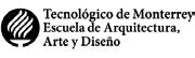
Fotografía de autor desconocido. Obtenida de Real Estate Market & Lifestyle 01
DE QUERÉTARO
OVERVIEW
PANORAMA
QUERÉTARO
QUERÉTARO Y EL CRECIMIENTO DESIGUAL QUERÉTARO
AND UNEVEN GROWTH

Durante los últimos años, Querétaro se ha convertido en uno de los estados con mayor crecimiento poblacional e inmobiliario.
During the last years, Querétaro has become one of the states with the highest population and real estate growth.
El mayor crecimiento se ha dado en la ciudad de Querétaro, capital del estado, con un crecimiento del 47.9% en tan solo 10 años.
The greatest growth has occurred in the city of Querétaro, the state capital, with a growth of 47.9% in just 10 years.
Mapa de elaboración propia
2010 Inhabitants in the state 1,827,900 2020 Inhabitants in the state 2,368,400 +540,500 Inhabitants 2010 Inhabited houses 450,104 2020 Inhabited houses 668,487 +218,383 Inhabited houses 2010 Inhabitants in the city 956,200 2020 Inhabitants in the city 1,414,600 +458,400 Inhabitants 2010 Inhabitants in the state 1,827,900 2020 Inhabitants in the state 2,368,400 +540,500 Inhabitants 2010 Inhabited houses 450,104 2020 Inhabited houses 668,487 +218,383 Inhabited houses 2010 Inhabitants in the city 956,200 2020 Inhabitants in the city 1,414,600 +458,400 Inhabitants
El crecimiento desmedido no sólo se ha dado en la población, también la mancha urbana se ha expandido sin orden, generando más desarrollos inmobiliarios, indus-
y comerciales.
The excessive growth has not only occurred in the population, but also the urban sprawl has expanded without order, generating more real estate, industrial and commercial developments.
Esto ha generado un alza en la demanda de servicios públicos que cada vez es más difícil de satisfacer, y mientras Querétaro ocupa el octavo lugar en México en términos de escasez de agua, se generan obras de infraestructura para seguir sobreexplotando los recursos.
This has generated an increase in the demand for public services that is more difficult to satisfy, and while Querétaro ranks eighth in Mexico in terms of water scarcity, infrastructure works are generated to continue overexploiting the resources.
triales
2010 Inhabitants in the state 1,827,900 2020 Inhabitants in the state 2,368,400 +540,500 Inhabitants 2010 Inhabited houses 450,104 2020 Inhabited houses 668,487 +218,383 Inhabited houses 2010 Inhabitants in the city 956,200 2020 Inhabitants in the city 1,414,600 +458,400 Inhabitants
0 200 400 600 800 1000 CDMX AGUASCALIENTES EDOMEX TLAXCALA GUANAJUATO BAJA CALIFORNIA NUEVO LEÓN QUERÉTARO MORELOS QUINTANA ROO 73 M3 268 M3 396 M3 644 M3 648 M3 827 M3 828 M3 915 M3 920 M3 933 M3
Querétaro,
Querétaro,
Querétaro,
Querétaro,
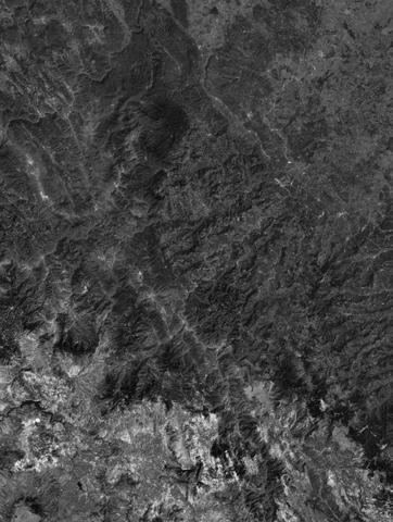
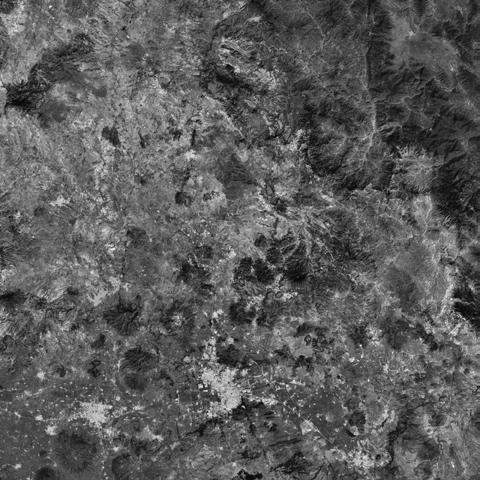
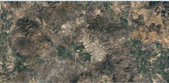
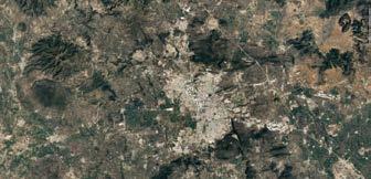
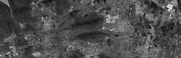
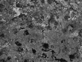
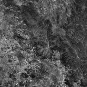
Imágenes
How much water do people receive per year per capita in the driest states?
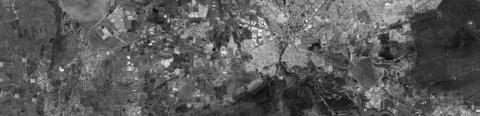
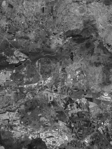
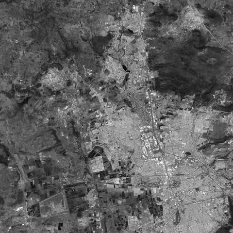
1990
2000
2010
2020
obtenidas de Google Earth Engine
Sin embargo, la escasez no se vive igual para todos. En mayo de 2022 entró en vigor la “Ley que Regula la Prestación de los Servicios de Agua Potable Alcantarillado y Saneamiento del Estado de Querétaro y que deroga diversas disposiciones del Código Urbano del Estado de Querétaro”, la cual permite la privatización y el acaparamiento del agua, ya que le da facultad a los organismos operadores para la prestación del servicio de agua potable, alcantarillado y saneamiento (OPSA) administrar los servicios de agua, dejando de lado la responsabilidad de la Comisión Estatal de Agua (CEA) de administrar el recurso, además de plantear que en tiempos de sequías la CEA puede puede limitar o suspender el servicio, y no habla de las estrategias que tomará el gobierno para garantizar que la población más vulnerable pueda acceder al servicio.
However, scarcity is not experienced the same for everyone. In May 2022, the “Ley que Regula la Prestación de los Servicios de Agua Potable Alcantarillado y Saneamiento del Estado de Querétaro y que deroga diversas disposiciones del Código Urbano del Estado de Querétaro” entered into force, which allows the privatization and hoarding of the water, since it empowers the operating agencies for the provision of the drinking water, sewerage and sanitation service (OPSA) to manage the water services, leaving aside the responsibility of the State Water Commission (CEA) to manage the resource , in addition to stating that in times of drought the CEA can limit or suspend the service, and does not talk about the strategies that the government will take to guarantee that the most vulnerable population can access the service.
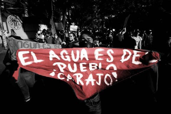 Fotografía de César Gómez obtenida de Pie de Página
En Querétaro existen ya 22 operadoras privadas que regulan el abastecimiento de agua, 16 de ellas relacionadas a prácticas comerciales con inmobiliarias en donde los únicos beneficiados son sus fraccionamientos, complejos industriales y centros comerciales. En su gran mayoría los cuerpos directivos de estas operadoras tienen relación con inmobiliarias que a su vez están relacionadas con otras operadoras, por lo que el control del mercado del agua está centrado solamente en una pequeña élite de la sociedad. Con la aprobación de esta ley se sigue propiciando este crecimiento descontrolado, se apoya la sobreexplotación del recurso, se propicia la acaparación del agua, se generan soluciones que solo benefician a un sector privilegiado de la sociedad, se busca que el agua sea vista únicamente como un recurso económico, además de que esta ley no busca proteger el recurso ni hacer un uso sustentable del mismo, no le pone límites a las operadoras, y no se protege a las comunidades ni pretende hacer mejoras en la infraestructura pública.

In Querétaro there are already 22 private operators that regulate the water supply, 16 of them related to commercial practices with real estate agencies where the only beneficiaries are their housing developments, industrial complexes, and shopping centers. For the most part, the directors of these operators are related to real estate agencies that are in turn related to other operators, so control of the water market is focused only on a small elite of society. With the approval of this law, this uncontrolled growth continues to be promoted, the overexploitation of the resource is supported, the hoarding of water is encouraged, the solutions only benefit a privileged sector of society, it is sought that water is seen only as a resource economic, in addition to the fact that this law does not seek to protect the resource or make a sustainable use of it, it does not set limits on the operators, and it does not protect the communities nor does it intend to make improvements in public infrastructure.
de elaboración propia
Mapa
QUERÉTARO Y LA FALTA DE ESPACIOS PÚBLICOS QUERÉTARO AND THE LACK OF PUBLIC SPACE
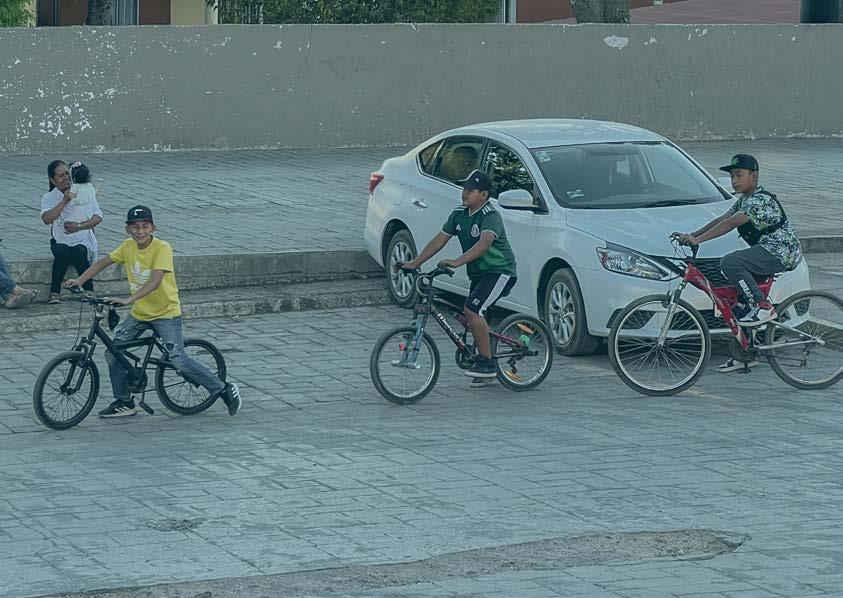
Otro problema al que se enfrenta Querétaro es la falta de accesibilidad del espacio público. Existen comunidades que no cuentan con espacios cercanos que les permitan transitar, socializar, satisfacer sus necesidades de esparcimiento y pasear como personas iguales.
Por otra parte existen los espacios públicos privatizados, en donde el espacio está en control y disposición de unas cuantas personas, o cuentan con señales invisibles que le prohíben el paso a los otros.
Another problem that Querétaro faces is the lack of accessibility of public space. There are communities that do not have nearby spaces that allow them to transit, socialize, satisfy their recreational needs and walk as equals.
On the other hand, there are privatized public spaces, where the space is under the control and disposal of a few people, or they have invisible signs that prohibit others from entering.
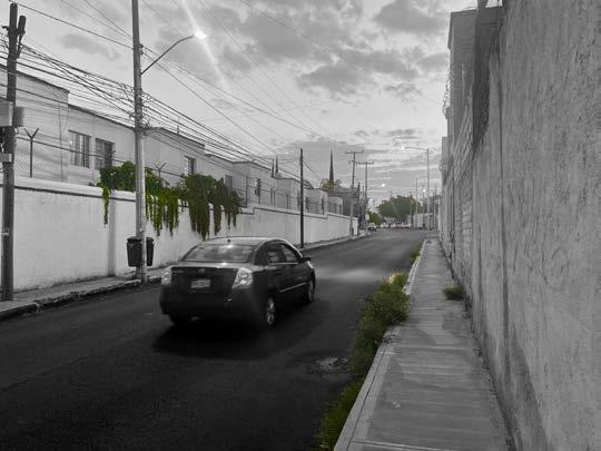 Fotografía de Liliana Olguín

02 ACERCAMIENTO A LAS COMUNIDADES APPROACH TO COMMUNITIES
Fotografía de Santiago Noguera
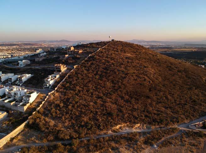
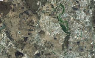
Juriquilla es una localidad ubicada dentro del municipio de Querétaro.

Anteriormente era una zona dedicada a la agricultura, pero a finales de los 80 la zona fue intervenida por constructoras e inversionistas convirtiéndola en un complejo residencial y turístico de nivel socioeconómico alto.
Juriquilla is a neighborhood located within the municipality of Querétaro.

Previously it was an area dedicated to agriculture, but in the late 80’s the area was intervened by construction companies and investors, turning it into a residential and tourist complex of a high socioeconomic
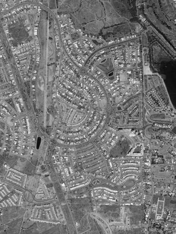
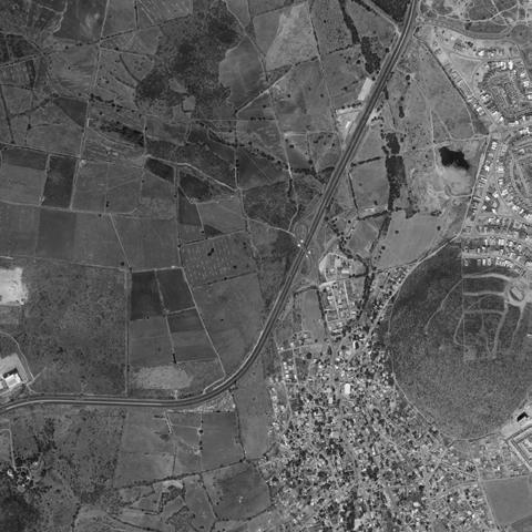
La zona de estudio comprende las comunidades vecinas de Cumbres del Lago, un fraccionamiento privado, y El Nabo, un asentamiento tradicional.
The study area includes the neighboring communities of Cumbres del Lago, a private house developmente, and El Nabo, a traditional settlement.

Mapa de elaboración propia
Mapa de elaboración propia
 Fotografía de Santiago Noguera
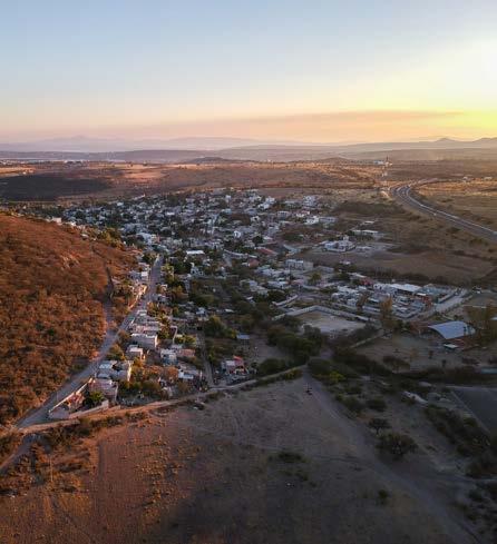
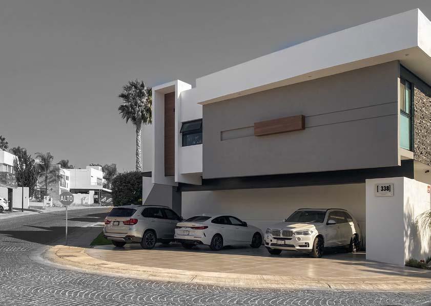
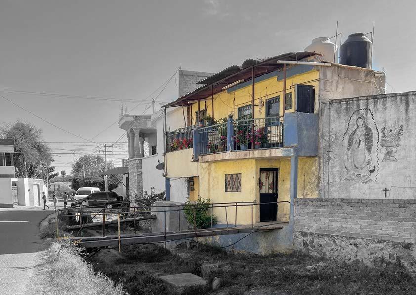
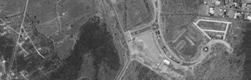
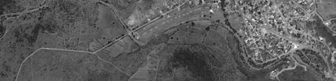
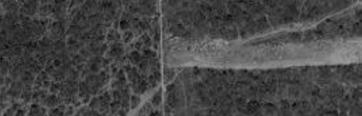
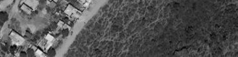
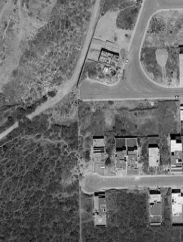
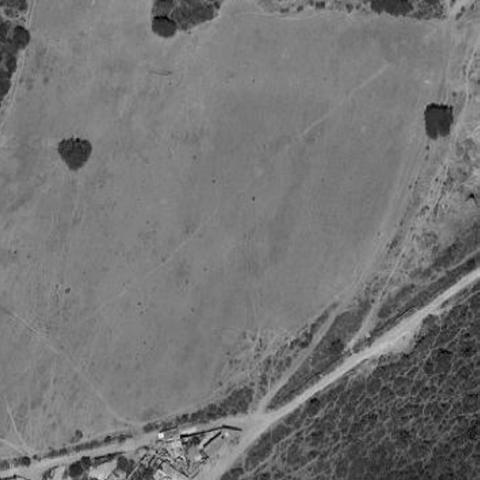
El Nabo es un asentamiento tradicional considerado como zona no urbanizada, que se ha desarrollado gracias a sus habitantes, ya que ellos se han organizado para construir toda la infraestructura que hay actualmente en la comunidad. Predomina la autoconstrucción y la mayoría de las calles son caminos de terracería.
El crecimiento de la mancha urbana alcanzó a El Nabo, quedando como su vecino inmediato Cumbres del Lago, un fraccionamiento privado de nivel socioeconómico alto considerado zona urbanizada, cuya única separación es una barrera física construida. Cumbres del Lago es parte de los desarrollos habitacionales que son abastecidos de agua por operadoras privadas.
El Nabo is a traditional settlement considered as a non-urbanized area, which has developed thanks to its inhabitants, since they have organized themselves to build all the infrastructure that currently exists in the community. Self-construction predominates and most of the streets are dirt roads.
The growth of the urban sprawl reached El Nabo, leaving Cumbres del Lago as its immediate neighbor, a private house development of high socioeconomic level considered an urbanized area, whose only separation is a built physical barrier. Cumbres del Lago is part of the housing developments that are supplied with water by private operators.
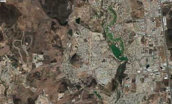
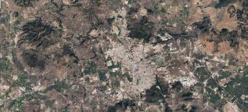
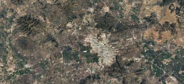
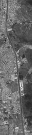
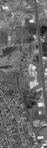
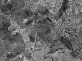
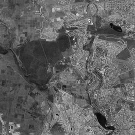
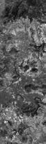
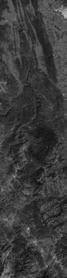
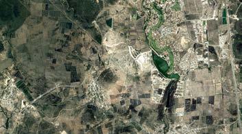
2004 2011
Satellite images of the study area shared by Javier Macías
2022
CUMBRES DEL LAGO
6,343 Habitantes Inhabitants
6,343 Habitantes Inhabitants
2,595 Viviendas
Tipologías de vivienda
Housing typologies
Housing typologies
Households
Households
2,595 Viviendas
Tipologías de vivienda
Habitantes
 Fotografía de Santiago Noguera
EL NABO
3,367 Habitantes Inhabitants
3,367 Habitantes Inhabitants
811 Viviendas
Households
811 Viviendas
Households
Tipologías de vivienda
Housing typologies
Tipologías de vivienda
Housing typologies
Fotografía de Santiago Noguera
HISTORIAS DE VIDA LIFE STORIES
Durante las visitas al sitio, tuvimos la oportunidad de hablar con habitantes de ambas comunidades, y les pedimos que nos contaran cómo es su día a día para conocer las necesidades de la comunidad. During the visits to the site, we had the opportunity to speak with inhabitants of both communities, and we asked them to tell us what their day-to-day is like in order to understand the needs of the community.

PROBLEMAS Y OPORTUNIDADES DETECTADAS
PROBLEMS AND OPPORTUNITIES DETECTED
PROBLEMS
SOCIAL
PHYSICAL
Social lag
Lack of public space
Internally organized communities
Feelings of rejection
Physical barriers
Availability of intervention spaces
Prejudices
Lack of equipment
Relationship of coexistence between communities
Inequality in access to services
Need for recreational spaces
SOCIAL
OPPORTUNITIES
Physical proximity between both communities
PHYSICAL
RESPONDIENDO A LAS NECESIDADES
03
Fotografía de Santiago Noguera
RESPONDING TO THE NEEDS
COURSE VISION


Co-design through strategies that promote climate justice, by adapting the environment of the most vulnerable to face climate change. Promoting the equitable co-existence between El Nabo and Cumbres del Lago, giving way to resilient and water-sensitive communities.


 Collage de visión grupal elaborado por Cielo Cristina López Favela
PROJECT VISION
Adapt the environment to create public space sensitive to water that works as a connector between both communities to promote coexistence .
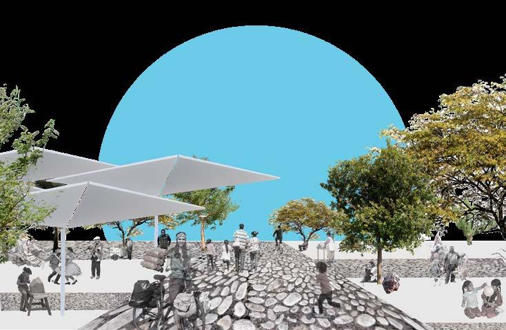 Collage de elaboración propia
ESTRATEGIAS STRATEGIES
PUBLIC CONNECTION SPACE
This project seeks to be a place that connects both communities and serves as a public space sensitive to water.�
ECONOMIC
1. Proponer espacios de usos múltiples
2. Espacios públicos que permitan la apropiación del lugar.
3. Reforzar la seguridad en el espacio público.
4. Proporcionar medios que promuevan el consumo local.
5. Cree espacios que se puedan adaptar a una variedad de necesidades.
6. Sustituir superficies impermeables por permeables.
7. Aprovechar el agua de escorrentía y su flujo natural hacia la infraestructura, ya sea gris, verde o azul.
8. Captar, tratar y reutilizar las aguas pluviales y residuales, con el uso de estrategias basadas en la propia naturaleza.
9. Promover y re-dignificar la vegetación endémica y nativa.
10. Diseñar espacios que sean capaces de retener agua
11. Minimizar la pérdida de agua por evaporación
12. Promover relaciones simbióticas entre ambas comunidades.
13. Garantizar la movilidad accesible
14. Espacios públicos equipados que incentiven la convivencia y la interacción.
ENVIROMENT
1. Propose multiple-use spaces
2. Public spaces that allow the appropiation of the place.
3. Strengthen security in public space.
4. Provide means that promote local consumption.
5. Create spaces that can be adaptable against a variety of necessities.
6. Substitute impermeable surfaces for permeable ones.
7. Leverage the runoff water and its natural flow towards the infrastructure, whether its gray, green or blue.
8. Capture, treat, and reutilize rain and residual water, with the use of strategies based on nature itself.
9. Promote and re-dignify the endemic and native vegetation.
10. Design spaces that are capable of water retainment
11. Minimize water loss due to evaporation
12. Promote symbiotic relationships between both communities.
13. Guarantee accessible mobility
14. Equipped public spaces that incentivise coexistence and interaction.
1 2 3 4 5 6 7 8 9 10 11 12 13 14
SOCIOCULTURAL
POLITICAL
04 ACERCAMIENTO AL SITIO APPROACH TO THE SITE
Fotografía de Fernanda Sánchez
UBICACIÓN DEL SITIO
SITE LOCATION
Identificamos dos locaciones que nos podían servir como conectores entre las comunidades. Ambas locaciones se encontraban en las partes bajas del cerro una al sur y otra al norte.
We identified two locations that could serve as connectors between the communities. Both locations were found in the lower parts of the hill, one to the south and the other to the north.
PROS CONS
- Shortest distance
- Proximity to a freeway
LOCATION 1
- Proximity to secondary school
- Connection with important locations of El Nabo
- Proximity and easy connection with other rural communities
LOCATION 2
- Proximity to the main entrance of El Nabo and Cumbres
- It is located within the community with houses as immediate neighbors

- The wall that divides both communities
- Much longer distance
- Located further from the center of the community
Mapa de elaboración propia
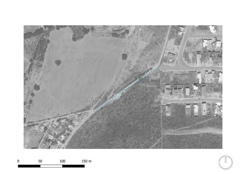
UBICACIÓN DEL PROYECTO PROJECT LOCATION
Decidimos ubicarnos en la parte norte del Nabo, sobre un camino vehicular de terracería preexistente que se identificó como la conexión más corta entre ambas comunidades.
We decided to locate the project in the northern part of El Nabo, on an existing dirt road that was identified as the shortest connection between the two communities.
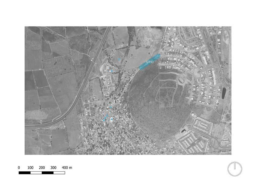
Ese mismo camino es la continuación de una calle que te lleva a la glorieta central de El Nabo y se intersecta con la calle en donde se ubica la Telesecundaria.
The same road is the continuation of a street that takes you to the central roundabout of El Nabo and intersects with the street where the Telesecundaria is located.
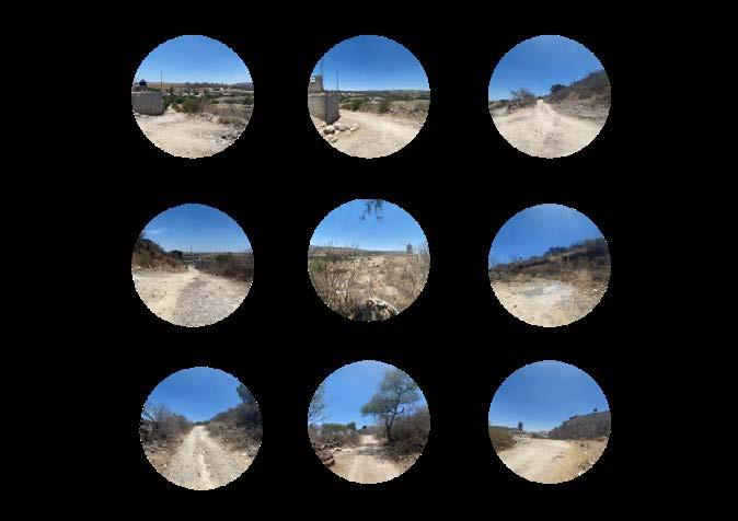
1 2 3 4 5 6 7 8 9
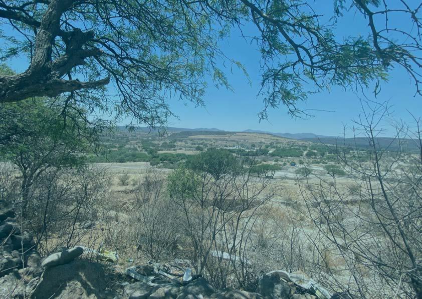
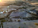
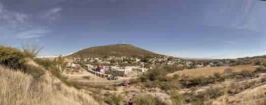
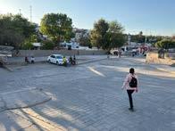
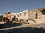
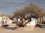
FOTOS DEL SITIO SITE PHOTOS

N S E O
EROSIÓN DEL SUELO PROJECT LOCATION
El sitio se encuentra en cercanía inmediata con una zona que tiene riesgo de erosión, que es un proceso natural en donde se va perdiendo la capa superficial del suelo que proporciona a las plantas el agua y los nutrientes que necesitan.
Este proceso resulta ser más común en terrenos con pendiente, debido a los deslaves producidos por las lluvias.
También afecta a la calidad del agua, ya que esta se contamina con el suelo degradado y los ríos y lagos pueden obstruirse con esa tierra o presentar brotes de algas debido a los nutrientes que el suelo trae consigo.
Por ello será necesario generar estrategias que permitan disminuir la velocidad de este proceso.
The site is in immediate proximity to an area that is at risk of erosion, which is a natural process in which the top layer of soil that provides plants with the water and nutrients they need will be lost.
This process turns out to be more common on sloping due to the landslides produced by the rains.
It also affects the quality of the water, since it is contaminated by degraded soil and rivers and lakes can be block with that soil or present algae blooms due to the nutrients that the soil brings with it.
For this reason, it will be necessary to generate strategies to reduce the speed of this process.
elaboración propia
Mapa de
05 NODO
EJEMPLOS ANÁLOGOS
Para poder generar nuestro proyecto lo primero que hicimos fue analizar ejemplos análogos que nos sirvieran como guía.
To generate our project, the first thing we did was analize analogous examples that would serve as a guide.

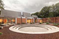
Centro comunitario Pilares
Valentín
Este centro comunitario se encuentra en la Ciudad de México y se construyó con el principal propósito de brindar educación a las mujeres que han abandonado las instituciones educativas formales, además de brindar instalaciones culturales y deportivas. Por ello, dentro de su programa podemos encontrar aulas multiusos, jardines y espacios recreativos. Cuenta con aulas modulables y flexibles que se unen por un andador longitudinal, volviendolo más un pabellón que un edificio.
This community center is located in Mexico City and it was built with the main purpose of providing education to women who have dropped out of formal educational institutions, as well as cultural and sports facilities. Its program includes multipurpose classrooms, gardens and recreational spaces. It has modular and flexible classrooms that are joined by a longitudinal walkway, making it more of a pavilion than a building.
ANALOGOUS EXAMPLES
Centro comunitario Pilares Valentín Gómez Farías a | 911 Mercado Targ Blonie Aleksandra Wasilkowska Architectural Studio HEX-SYS OPEN Architecture Multipurpose rooms 26.54% 76.75 m2 Bathrooms 3.11% 9 m2 Public space 35.22% 101.846 m2 Recreational areas 35.12% 101.565 m2
Gómez Farías a | 911
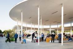
Mercado Targ Blonie
Aleksandra Wasilkowska Architectural Studio

Es la renovación de un espacio destinado al comercio informal para que cumpliera con mejores estándares de infraestructura y salubridad. Combina dos funciones: un mercado y un parque. Se colocaron techos blancos multifuncionales y exhibidores escalonados con tapas de madera para que puedan ser utilizados como asientos cuando el mercado está cerrado. Cuenta con baños, un bar y un área de juegos para niños.
It is the renovation of a space destined for informal commerce so that it complies with better infrastructure and health standards. It combines two functions: a market and a park. Multifunctional white roofs were placed, and tiered displays with wooden tops so that they can be used as seats when the market is closed. It has restrooms, a bar and a children’s play area.
HEX-SYS OPEN Architecture

Es un prototipo de construcción que responde a la necesidad de hacer espacios multipropósito. Es un sistema modular hexagonal que puede ser reacomodado de acuerdo a las necesidades del sitio. Tiene estructura de paraguas invertido de pie sobre una sola columna de canalización con dobles funciones como una chimenea de lluvias. El agua de lluvia se recoge y se utiliza para el riego de jardines.
It is a construction prototype that responds to the need to make multipurpose spaces. It is a hexagonal modular system that can be rearranged according to the needs of the site. It has an inverted umbrella structure standing on a single channeling column with double functions as a rain chimney. Rainwater is collected and used to irrigate gardens.
0 2 6 12 m Bathrooms 10 % 53 m2 Market 63 % 353.97 m2 Recreational areas 27 % 153.64 m2 6 12 m Bathrooms 10 % 53 m2 Market 63 % 353.97 m2 Recreational areas 27 % 153.64 m2
USUARIOS USSERS
Identificamos que enuestro proyecto está destinado para un amplio grupo de población, por lo que decimos seccionar nuestros usuarios en 3 grupos de acuerdo a las actividades, horarios y tiempos de estancia en el sitio. We identify that the project is intended for a broad population group, so we decided to section our users into 3 groups according to the activities, schedules, and times spent on the site.
LOCAL
Ussers: Residents of El Nabo and Cumbres del Lago
TEMPORARY
MOMENTARY
Ussers: Merchants
Ussers: People who go from Nabo to Cumbres del Lago to work.
Schedule: Ages:
Schedule: Ages:
Schedule: Ages:
Make use of the playground and the bike park, attend classes in the multipurpose classrooms, go shopping at the market, eat your food or spend time in the table area, go for a walk, exercise or ride a bike along the trails attend meetings or events at the meeting point, spend time in the park facilities.
Bring their products to sell in the market area, place their stalls within the area.
Use the street as a safe, fast and direct space to move from their community to their work space.
0 - 90 years 8 a.m. - 10 p.m.
18
70 years 9 a.m. - 5 p.m.
-
18
60 years 7 a.m. - 5 p.m.
-
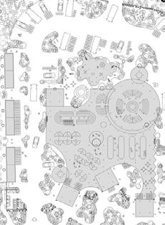
ZONIFICACIÓN
ZONING
Después de analizar los ejemplos análogos, generamos el prgrama que queremos integrar al proyecto, establecimos que además de hacer un corredor para las personas que cruzan entre comunidades, queríamos brindarles espacios públicos de usos flexibles para la realización de diferentes actividades.
After analyzing the analogous examples, we generated the program that we want to integrate into the project, we established that in addition to making a corridor for people who cross between communities, we wanted to provide public spaces with flexible uses to carry out different activities.
Multipurpose space 18% 384 m2 Bathrooms 2 % 38 m2 Recreational areas 59 % 1293 m2 Market 21 % 448 m2

0 50
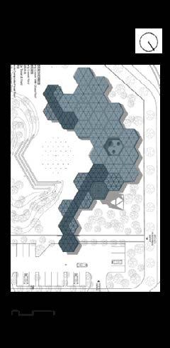
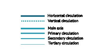
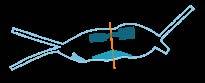
CIRCULACIONES CIRCULATIONS

Basandonos en la topografía del sitio establecimos que el eje rector del proyecto se mantendría con una circulación horizontal para que fuera un trayecto fácil de circular. Mientras que varias de las circulaciones secundarias se volvieron verticales.
Based on the topography of the site, we established that the guiding axis of the project would be maintained with a horizontal circulation so that it would be an easy route to circulate. While several of the secondary circulations became vertical.
0 50
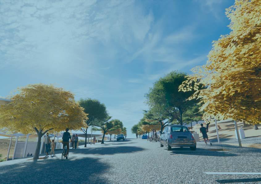
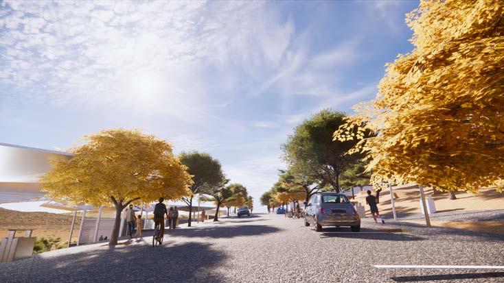
CIRCULACIÓN COMPARTIDA
Nuestro principal eje de circulación está regido por una calle compartida, que tiene la intención de volver a la calle un espacio público más que una via de tránsito vehicular.
Para lograr esto se aplican estrategias que generan una convivencia entre los distintos tipos de tráfico priorizando al peatón y disminuyendo la jerarquía que ocupan los automóviles.
Las estrategias consisten en nivelar todo a una sola plataforma que elimine señalamientos y guarniciones mientras se integran texturas y mobiliario urbano que permitan a los usuarios negociar su paso y estancia en el espacio.
Our main circulation axis is ruled by a shared street, which intends to convert the street into a public space rather than a vehicular transit route.
To achieve this, strategies are applied that generate coexistence between the different types of traffic, prioritizing pedestrians and reducing the hierarchy occupied by cars.
The strategies consist of leveling everything to a single platform that eliminates signs and fittings while integrating textures and urban furniture that allow users to negotiate their passage and stay in the space.
CIRCULATION 2 m 1 m 2 m 2.6 m 3.1 m 1 m 2 m
SHARED

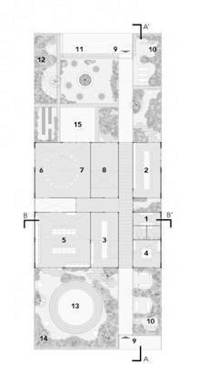
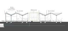
0 10 PLANTA DE PABELLÓN PAVILION PLAN


0 10
ELEVATION
ELEVATION 0 10
ELEVACIÓN LONGITUDINAL LONGITUDINAL
ELEVACIÓN TRANSVERSAL CROSS
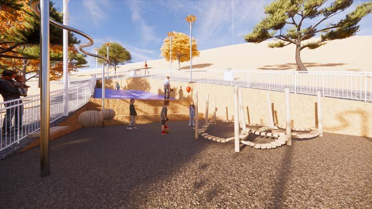
PLANTA DE PLAYGROUND
PLANTA DE BICIPARK


0 10
PLAYGROUND PLAN 0 10
PLAN
BIKEPARK


0 10 SECCIÓN A SECTION A


0 10 SECCIÓN B SECTION B


0 10 SECCIÓN C SECTION C
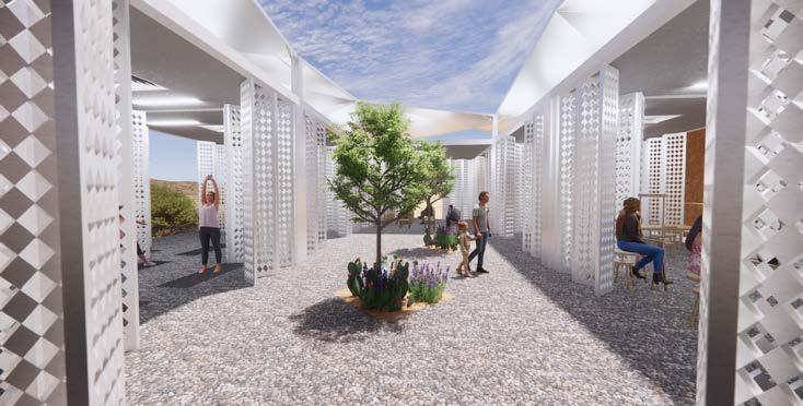
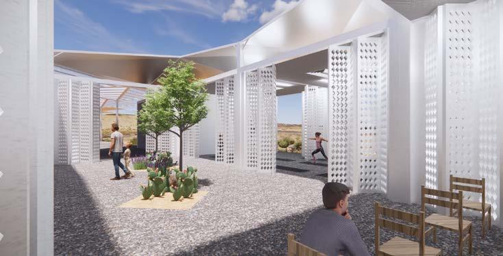
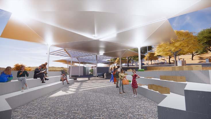
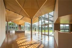
Entre las estrategias que rigen nuestro proyecto es poder crear espacio público que sea adaptable para recibir multiples usuarios realizando multiples activididades. Para ello planteamos espacios adaptables.
El espacio de salones de usos múltiples está compuesto por 7 salones que pueden modularse con puertas de acordeón de acuerdo a las necesidades para tener salones de distintas medidas e incluso convertir todo el edificio en un gran salón. Además estas puertas nos permiten tener un espacio abierto que elimine las barreras e invite a la comunidad a acercarse.
Por otra parte el mobiliario del mercado puede ser utilizado en un horario como tianguis en donde las personas colocan sus productos sobre las repisas, y cuando no está en uso, es un espacio de bancas que puede ser usado para pasar el tiempo, como punto de reunión o anfiteatro.
Among the strategies that guide our project is to be able to create public space that is adaptable to receive multiple users performing multiple activities. For this we propose adaptable spaces.
The multipurpose room space is made up of 7 rooms that can be modulated with accordion doors according to the needs to have rooms of different sizes and even convert the entire building into a large room. In addition, these doors allow us to have an open space that eliminates barriers and invites the community to come closer.
On the other hand, the market furniture can be used during a schedule as a street market where people place their products on the shelves, and when it is not in use, it is a bench space that can be used to pass the time, as a point of meeting or amphitheater.
MULTIPURPOSE PUBLIC SPACE
ESPACIO PÚBLICO MULTIUSOS
limitantes que eliminen las barreras sociales y permitan la apropiación del espacio público.”
“Redefining permeable public spaces, without walls, or limiting conditions that eliminate social barriers and allow the appropriation of space.”
“Redefiniendo espacios públicos permeables, sin muros, ni condiciones
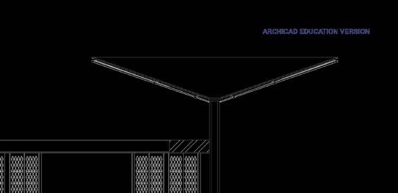
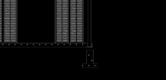
CORTE POR FACHADA
CROSS-SECTIONAL VIEW
DETALLES CONSTRUCTIVOS
CONSTRUCTIVE DETAILS
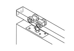
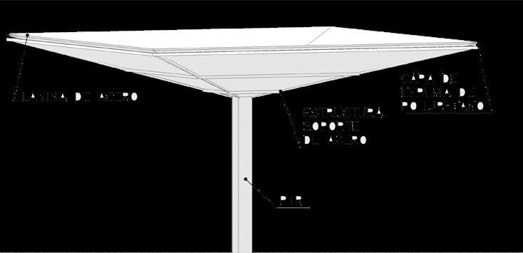
MATERIALES DEL PABELLÓN


MATERIALES DEL PARQUE
 Multytecho panel
Pigmented concrete
Washed concrete
Ventilation grill
White steel PTR
Pigmented concrete
White steel PTR
Perforated steel panel
Multytecho panel
Pigmented concrete
Washed concrete
Ventilation grill
White steel PTR
Pigmented concrete
White steel PTR
Perforated steel panel
Flagstone Natural soil Washed concrete Polyurethane Fine aggregate Tepetate
PAVILION MATERIALS
PARK
MATERIALS
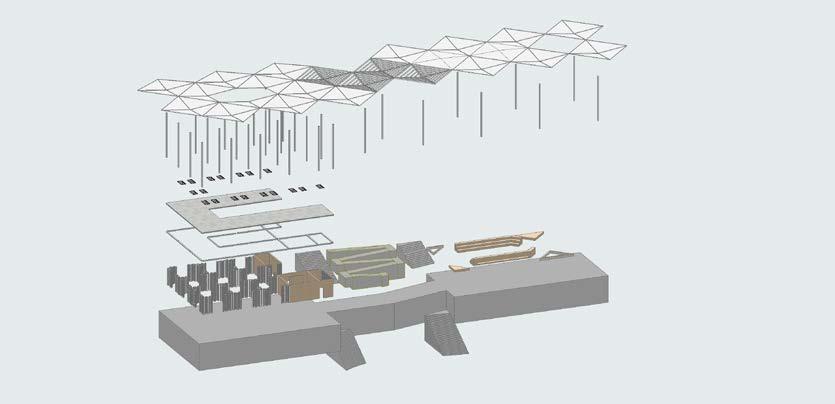
ESPACIOS SENSIBLES AL AGUA SPACES SENSITIVE TO WATER
Uno de los principales objetivos es crear espacios sensibles al agua, que sean adaptables y resilientes, que no comprometan el recurso ni afecten a las comunidades más vulnerables para mantenerse, esto en una intención de justicia climática y social.
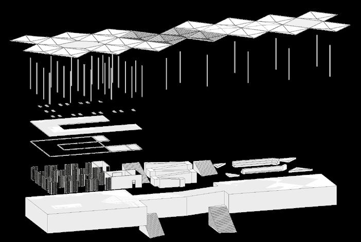
El diseño de los salones se realizó pensando en hacer un sistema de recolección y almacenamiento de agua pluvial. La cubierta con techos en forma de paraguas invertido sirve como embudo para recolectar la precipitación y bajarla por medio de una tubería colocada en la columna hacia un tubo central que dirige el agua a una cisterna para filtrar y almacenar, y después utilizarla para abastecer los baños y regar los jardínes.
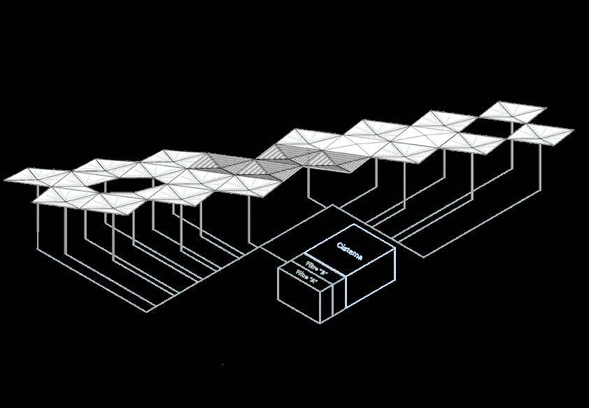
One of the main objectives is to create spaces that are sensitive to water, that are adaptable and resilient, that do not compromise the resource or affect the most vulnerable communities to maintain themselves, this in an intention of climate and social justice.
The design of the pavilion was carried out with the idea of making a rainwater collection and storage system. The roof with inverted umbrella-shaped roofs serves as a funnel to collect precipitation and conduct it through the column towards a central tube that directs the water to a cistern to filter and store, and later use it to supply the bathrooms and irrigate the gardens.
INSTALACIONES Y CRITERIOS BIOCLIMÁTICOS PABELLÓN

INSTALLATIONS AND BIOCLIMATIC CRITERIA PAVILION

INSTALACIONES PARQUE PARK INSTALLATIONS
ESTRATEGIAS DE PREVENCIÓN DE EROSIÓN
Para frenar el proceso de erosión, se generarán distintas estrategias a distintos niveles de acuerdo a la topografía del sitio.
La primera estrategia es colocar barreras protectoras de vegetación nativa para frenar la escorrentía. Al aumentar la densidad de raíces, aumenta la cohesión y el anclaje, por lo tanto aumenta la estabilidad.
Los efectos hidráulicos están relacionados con la forma en que se infiltra el agua de las lluvias. Las plantas reducen el impacto de la gota de lluvia al disminuir su velocidad, y así la precipitación encuentra el suelo con menor impacto y las raíces serán capaces de aumentar la infiltración. Además a mayor cantidad de raíces, mayor capacidad de almacenamiento en las capas del sustrato.

To stop the erosion process, different strategies will be generated at different levels according to the topography of the site.


The first strategy is to place protective barriers of native vegetation to stop runoff. By increasing root density, cohesion and anchorage increase, therefore stability increases.


Hydraulic effects are related to the way in which rainwater infiltrates. Plants reduce the impact of the raindrop by slowing down its speed, and thus the precipitation finds the soil with less impact and the roots will be able to increase infiltration. In addition, the greater the number of roots, the greater the storage capacity in the layers of the substrate.

EROSION
PREVENTION STRATEGIES
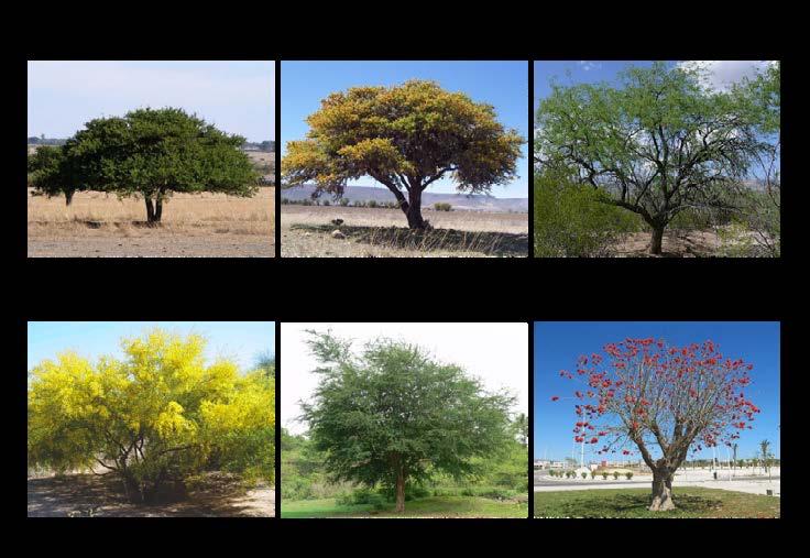
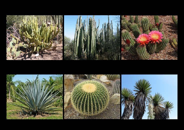
PALETA VEGETAL PLANT PALETTE
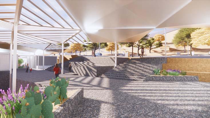
TERRAZAS TERRACES
Otra estrategia a implementar son las terrazas en la parte baja. Nuestro predio se encuentra en un sitio con pendientes abruptas. A mayor intensidad de pendiente, la velocidad que toma el suelo al escurrir es mayor y por lo tanto es mayor la erosión del suelo.
Las terrazas tienen como finalidad disminuir la longitud de la pendiente. Cuando el agua no puede infiltrar, comienza a descender ganando velocidad, antes de que alcance una velocidad erosiva se interpone una terraza que interrumpe su descenso violento.
Another strategy to implement is the terraces in the lower part. Our property is located on a site with steep slopes. The greater the intensity of the slope, the speed that the soil takes when draining is greater and therefore soil erosion is greater.


The terraces are intended to decrease the length of the slope. When the water cannot infiltrate, it begins to descend gaining speed. Before it reaches an erosive speed, a terrace stands in the way that interrupts its violent descent.

REFERENCES