PAISAJES OPORTUNOS TORRE DEL CHAN


Aldo Bianchi Sáenz (A01701690) Teodoro Gómez Mercado (A01067762)
noviembre, 2023
Autores: Aldo Bianchi Sáenz Teodoro Gómez Mercado
Maestros: Arq. Agustín Solórzano Gil Dr. Rubén Garnica Monroy MSc. Urb. MAR. Diana García Cejudo Mto. Arq. Rodrigo Pantoja Calderón
Especialistas:
Andrea Parga (Narrativa Proyectual) Fernanda Peña (Construcción e Instalaciones)
Norma González (Criterios Estructurales) Pedro Mendoza (Arquitectura y costos)
PAISAJES OPORTUNOS
TORRE DEL CHAN
Arquitectura Participativa de Mediana Complejidad AR3011B.601
Aldo Bianchi Sáenz (A01701690) Teodoro Gómez Mercado (A01067762)
Dedicado a todas las personas que nos recuerdan la importancia de detenernos a apreciar la vida
Dedicated to all the people who help us remember the importance of stopping to appreciate life

“La naturaleza se hace paisaje cuando el hombre la enmarca”
Le Corbusier
VISIÓN
El Parque Natural El Charco del Ingenio se rige por 3 objetivos principales: - Preservación - Educación - Investigación
La Torre del Chan trata de reforzar la apreciación, admira ción y respeto al paisaje. Funcionando como un ancla que logre atar las vistas del lugar y reactivar la contemplación activa.
Además de esto, el resultado de la investigación propone buscar una relación SIMBIÓTICA y de CONVIVENCIA entre lo construido y lo natural. Esto propiciará una IDENTIDAD a partir de un CATALIZADOR. En este caso, esta será una propuesta de un Catalizador, que favorezca los objetivos y la visión.
Natural park El Charco del Ingenio is governed by 3 main objectives: - Preservation - Education - Research
The Tower of Chan tries to reinforce the appreciation, admira tion and respect for the landscape. Functioning as an anchor that manages to tie the views of the place and reactivate active contemplation.
In addition to this, the result of the research proposes to look for a SYMBIOTIC and COEXISTENCE relationship between what is built and what is natural. This will propitiate an IDEN TITY from a CATALYST. In this case, this will be a proposal from a Catalyst, which favors the objectives and the vision.
10

11
Collage El Charco del Ingenio Elaboración Propia
Preambulos
El Sitio
El Charco del Ingenio en S.M.A
El Charco del Ingenio, Jardín Botánico y Área Natural Protegida
01 02
27
33
36 38
42 44 46 1.
2.
3.Territorio
4.
5.
6.Infraestructura 7.
9.
10.
11.
1. San Miguel de Allende, Guanajuato 2. Crecimiento urbano en S.M.A. 3. Manifiesto 16 18 23
29 31
35
40
- Condiciones climáticas
Mapa de vistas
Ecosistemas, tráfico actual y centro geométrico
Producción y consumo 8. Simbolismos
Catálogo de vistas
Sitio específico
Especies flora y fauna
Arquitectura Primitiva
1. Caso Análogo: Punta Pite
Manifiesto: Construcción Primitiva
Emplazamiento sendero
Plano de conjunto de sendero
Proyecto Arquitectónico
1. Justificación 2. Casos análogos 3.Torre del Chan 4.Vistas generales en maqueta y en sitio 5. Emplazamiento de Torre del Chan 6. Planta de conjunto de Torre del Chan
Estudio solar y de vientos 8. Programa Necesidades + Arquitectónico 9.Altura y ángulo de la torre 10. Intenciones volumétricas
Exploración formal
Entendiendo la forma y estructura 13. Plantas 14.Alzados 15. Corte perspectivado 16. Funcionamiento de la torre 17.Atmósferas 18.Torre de vistas 19. Maqueta Virtual 20.Anillos y vistas por mirador 21. Corte constructivo 22.Visualizaciones
04 03
122
50 51 54 56 58 120
62 64 69 70 80 82 85 86 88 90 92 94 96 98 100 102 104 105 106 108 110 112
Frase Referencias
2.
3.
4.
5. Modelo
7.
11.
12.

01 Preambulos 1. San Miguel de Allende, Guanajuato 2. Crecimiento urbano en S.M.A. 3. Manifiesto
SAN MIGUEL DE ALLENDE, GUANAJUATO

San Miguel de Allende (S.M.A) es una bella ciudad pinto resca y cosmopolita que forma parte del estado de Gua najuato en México. Sus mágicos caminos empedrados, ca lles y patios arbolados así como su ilustre arquitectura, la cual abarca desde periodo barroco hasta neogótico, fueron el mayor peso para que en 2008 fuera nombrada Patrimonio Mundial de la Humanidad por la UNESCO.


San Miguel de Allende (S.M.A) is a beautiful, picturesque and cos mopolitan city that is part of the state of Guanajuato in Mexico. Its magical cobbled paths, streets and courtyards full of trees as well as its illustrious architecture, which was made from the Baroque to the Neo-Gothic periods, are the most important factors for it to be named a World Heritage Site by UNESCO in 2008.

16
San Miguel de Allende, Gto. Fuente propia
San Miguel de Allende, Gto. Fuente propia
San Miguel de Allende, Gto. Fuente propia
San Miguel de Allende, Gto. Fuente propia

17
Parroquia de San Miguel Arcángel
CRECIMIENTO URBANO DE S.M.A
La población en SMA ha sido un fenómeno que histó ricamente ha ido incrementando y que actualmente sitúa a la ciudad en el puesto número siete a nivel es tatal, situación que va de la mano con el desarrollo urbano visíble a través de los años en el incremento de viviendas particulares habitadas en el territorio.
The population in SMA has been a phenomenon that his torically has been increasing and now places the city in the seventh position at a state level. This situation goes hand in hand with a visible urban development over the years shown by the increment of living houses in the territory.

18
(Garside, s.f.)
HISTÓRICO DEL CRECIMIENTO DE POBLACIÓN 2000 - 2020 San Miguel de Allende, Guanajuato
140,000
105,000
70,000
35,000
134,880
160,383
175,000 2000 2010 2020
40,000
30,000
0
Elaboración Propia con base en INEGI. Censos de Población y Vivienda 2000, 2010, 2020
20,000
VIVIENDAS PARTICULARES HABITADAS, 2000, 2010 Y 2020 San Miguel de Allende, Guanajuato
10,000
25,697
35,397
174,615 0
50,000 2000 2010 2020
44,484
Elaboración Propia con base en INEGI. Censos de Población y Vivienda 2000, 2010, 2020
19


SIMBOLOGÍA
MAPA SAN MIGUEL DE ALLENDE, GTO.


0 1 2 km

22
(Garside, s.f.)
MANIFIESTO
El crecimiento de la urbanización de San Miguel de Allende ha reflejado una gran preocupación con un futuro de riesgo debido al deterioro y afectación en el entorno natural del territorio. Esta intranquilidad recae en el proyecto de conservación y restauración más grande de S.M.A.: El Charco del Ingenio, Jardín Botánico y Área Natural Protegida el cual de acuerdo a la tendencia de crecimiento de la mancha urbana de la ciudad, en un mediano plazo se verá alcanzado y rodeado.
A partir de lo anterior, se manifiesta el interés de cuestio narse la experimentación y la apreciación de las personas en el entorno natural inmersivo. El paisaje es cambiante, reconfortante, emocionante y el poder contemplarlo sin la necesidad de tocarlo, mientras a su vez se comprende el valor que tiene es fundamental en la búsqueda de una concientización social. Su belleza natural, su historia, la intervención humana y la ciudad en el horizonte hacen del Charco del Ingenio un paisaje inmensamente poderoso.
Urbanization´s growth of San Miguel de Allende has reflected a great concern with a risky future due to the deterioration and affectation in the natural environment of the territory.This concern falls on the largest conservation and restoration project of S.M.A.: El Charco del Ingenio, Botanical Garden and Protected Natural Area which, according to the growth trend of the urban sprawl of the city, in the medium term will be reached and surrounded.
Futhermore, the interest in questioning the experimentation and appreciation of people in the immersive landscape is manifested. The landscape is changing, comforting and exciting. Being able to contemplate it without the need to touch it, while at the same time understanding its value, is fundamental in the search for social awareness. Its natural beauty, its his tory, the human intervention and the city on the horizon make Charco del Ingenio an immensely powerful landscape.
23

25 02 El Sitio 1. El Charco del Ingenio en S.M.A 2. El Charco del Ingenio, Jardín Botánico y Área Natural Protegida 3.Territorio - Condiciones climáticas 4. Mapa de vistas 5. Ecosistemas, tráfico actual y centro geométrico 6.Infraestructura 7. Producción y consumo 8. Simbolismos 9. Catálogo de vistas 10. Sitio específico 11. Especies flora y fauna
SIMBOLOGÍA MAPA EL CHARCO EN S.M.A


26 2 km 1 0
EL CHARCO DEL INGENIO EN S.M.A.
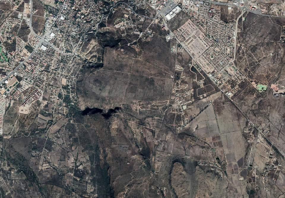
Este mapa brinda una perspectiva clara sobre la lo calización al Noreste del Charco del Ingenio con respecto a la mancha de San Miguel de Allende.
This map provides a clear perspective for the nor theastern location of Charco del Ingenio against to the urban strawl of San Miguel de Allende.
Cañada del Charco del Ingenio (CONABIO, s.f.)

27


28 SIMBOLOGÍA EL CHARCO DEL INGENIO 0 100 200 m
EL CHARCO DEL INGENIO,
Jardín Botánico y Área Natural Protegida

29
Recepción del Charco del Ingenio (Fuente propia)


30 SIMBOLOGÍA MAPA
0 100 200 m
BASE
CONDICIONES CLIMÁTICAS CORRIENTES DE AGUA
Este mapa busca comprender las condiciones climáticas que se presentan en El Charco del Ignenio. Se tienen vientos dominantes del Noreste predominantes durante la ma yor parte del año, así como un asoleamiento que recorre de acuerdo al periodo del año específico. Conocer que los escurrimientos van de presa a presa es indispensable para comprender las condiciones topográficas del Charco.
CONDICIONES CLIMÁTICAS
This map helps to understand the climatic conditions that occur in El Charco del Ignenio, to understand that there are prevai ling northeasterly winds during most of the year, as well as sun path that changes according to the specific period of the year. Knowing that water runoff flows from dam to dam is es sential to understand the topographic conditions of El Charco.

31
Asoleamiento en El Charco del Ingenio (Fuente propia)
NODOS DE VISTAS


32
0 100 200 m
SIMBOLOGÍA MAPA BASE
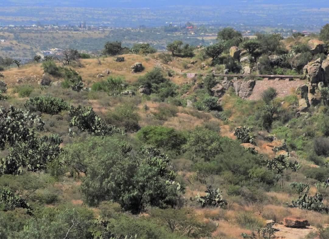
Las vistas del Charco del Ingenio se sobreponen sobre la cañada, siendo uno de los paisajes más in teresantes y curiosamente, el más inaccesible.
MAPA DE VISTAS
The viewpoints of El Charco del Ingenio overlap on the ravine, being one of the most interesting landscapes and, curiously, the most inaccessible.

33
La cañada (Charco del Ingenio, s.f.)
SIMBOLOGÍA MAPA BASE


ECOSISTEMAS RECORRIDOS Y DISTANCIAS TRÁNSITO ACTUAL


MATORRAL MATORRAL
CAÑADA HUMEDAL
34
0 100 200 m
ECOSISTEMAS, TRÁNSITO ACTUAL Y CENTRO GEOMÉTRICO

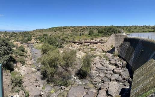
Al contraponer en este mapa los tres ecosistemas del Charco del Ingenio, surge el centro geométrico como punto de intersección entre ellos. De igual forma, al analizar el tránsito actual del sitio se tiene como ha llazgo que para los visitantes únicamente existe una manera de caminar de matorral a matorral: cruzando sobre la cortina de la presa, se esté desbordando o no.
By contrasting the three ecosystems of Charco del Ingenio on this map, the geometric center emerges as a point of intersec tion between them. Similarly, when analyzing the current people walking through the site, we found that there is only one way for visitors to walk from one side to another (south to north): crossing over the structure of the dam, whether it is overflowing or not.
35
Presa desbordada (Fuente propia)
INFRAESTRUCTURA


36
Caminos (Fuente propia)
Torre eléctrica (Fuente propia)
Poste eléctrico (Fuente propia)
Almacenamiento de agua en tinaco (Fuente propia)


37
Museo (Fuente propia)
Anfiteatro (Fuente propia)
Mirador (Fuente propia)
Conservatorio de plantas mexicanas (Fuente propia)


38 PRODUCCIÓN
Y CONSUMO
Milpa (Fuente propia)
Echinocactus grusonn (Fuente propia)
Recepción (Fuente propia)


39
Unidad de Ciencias / Vivero (Fuente propia)
Cafetería (Fuente propia)
Cafetería y recepción (Fuente propia)
SIMBOLISMOS


40
Observatorio Solar (Fuente propia)
Plaza de los Cuatro Vientos (Fuente propia)
Conservatorio de Plantas Mexicanas (Fuente propia)


41
“Una casa para la Luz de las Estrellas” (Fuente propia)
Ruinas de la Hacienda (Fuente propia)
Ruinas del batán (Fuente propia)

1 2


2 6 10 7 11 3 3 7 8 9 10 11 4 5 6
Vista de la Cañada (Fuente propia)
Cañada: Zona de riesgo (Fuente propia)
Vista al humedal desde la cortina (Fuente propia)
Ruinas del Batán (Fuente propia)
Cañada: Zona de riesgo (Fuente propia)
Vista hacia el sur desde la Casa de las Estrellas (Fuente propia)
Axonométrico de sitio específico: cañada próxima


44
Cañada próxima a cortina (Fuente propia) Tubo de La Aurora (Fuente propia)
SITIO
ESPECÍFICO
próxima a cortina de la presa (Elaboración propia)


Cañada


45
Cañada próxima a cortina (Fuente propia)
próxima a cortina (Fuente propia)

46
ESPECIES FLORA Y FAUNA

47


