ST INEZ CREEK
and

People, places
power - transforming livelihoods through participatory planning AAR4525 | Urban Informality
ST INEZ CREEK
People, places and power - transforming livelihoods through participatory planning planning
Published on 8th December 2019
Panaji, Goa India
AAR4525 - Urban Informality Urban Ecological Planning
Department of Architecture and Planning

Faculty of Architecture and Design Norwegian University of Science and Technology
Authors
Hamish Hay, Vårin Maria Lyngstadaas , Aleisha Martul (Group 1)
Ellen Margrethe Romsaas, Michaela Schmidt, Alvira Shrestha, Moses Viveros (Group 2)
iiiii
ABSTRACT
Goa is India’s wealthiest State, and yet the basic needs of some marginalised communities are still not met. Seven MSc students in Urban Ecological Planning (UEP) at the Norwegian University of Science and Technology (NTNU) spent three months applying participatory planning techniques in two communities along the St. Inez Creek, Camrabhat and St. Inez Bandh, and proposed interventions to help them fulfll their potential.
By applying asset and value-based frameworks, the teams gained a deep understanding of the livelihoods of people and households and their dependence on wider environmental, social and economic systems. Both communities are closely connected with the Creek itself, which had experienced serious environmental degradation in the last 10 - 20 years rooted in a failure of governance. Insecurity of tenure, stigma and restricted access to external resources lead to emergent vulnerability to shocks and stresses in both communities, especially fooding. Repeated promises by political entities that would have strengthened community assets have rarely been fulflled.
This study proposes a series of community-driven planning interventions to strengthen the ability of residents and households to acquire and retain
assets, by strengthening social, environmental, physical and political systems. Drawing on inspiration from Bangalore and Delhi, it is proposed a Welfare Association is formed to democratise and devolute decision-making around the Creek. Associated projects would use restorative nature-based solutions, such as bioswales and attenuation ponds, to mitigate fooding, improve the urban fabric and provide wide economic benefts. Finally, communitydriven public realm improvements would help create a sense of place and local ownership of the urban realm. Building on existing creative assets in the community, the phased introduction of pocket parks, rain gardens and an elevated water header tank would form part of a series of tactical urban interventions.
This study is designed as an asset and a tool to advocate for the changes needed to meet the requirements of the United Nations Sustainable Development Goals and achieve a better and more sustainable future for all.
PREFACE
As a yearly tradition, the master students of Urban Ecological Planning (UEP) at the Faculty of Architecture and Design at the Norwegian University of Science and Technology (NTNU) embark on an immersive feldwork during their frst semester. This report is the outcome of a one-semester feldwork in Panaji, India, conducted by the students in collaboration with the School of Planning and Architecture (SPA) Delhi. The feldwork was part of a research project “Smart Sustainable City Regions in India” (SSCRI) fnanced by the Norwegian Centre for International Cooperation in Education (SIU), which included feldwork in Bhopal in 2018 and Pune in 2017.
The diverse backgrounds and nationalities of students participating in the UEP feldwork ensures a multi-perspective view. This year’s 19 feldwork participants are architects, food scientists, engineers, landscape architects and planners, coming from Albania, Australia, Austria, Ecuador, France, Germany, India, Indonesia, Iran, Nepal, New Zealand, Norway, the UK and the USA.
iv
The immersion of the feldwork gives students a real-life practice of the ‘UEP approach’, which focuses on addressing urban complexities from an area-based and participatory point of view, leading to contextual, inclusive and human-driven development processes. Through daily interactions with local communities and relevant stakeholders, students become acquainted with residents and discover the complex realities of these areas, with their specifc assets and challenges. By using a variety of participatory (design) methods, the students work on co-designing strategic proposals with the community and other stakeholders.
Students worked in the colonial Fontainhas area, the central business district and along the St Inez Creek. While the main topic of the course is urban informality in all its forms, this year students addressed topics such as public space, heritage, livability and environmental challenges. Warmly hosted by Imagine Panaji Smart City Development Limited, IPSCDL, students were asked to put their areas and proposals in the perspective of the Smart Cities Mission, the large urban development fund and initiative currently implemented by the Government of India.
As an outcome of their learning process, students prepared three reports to illustrate and refect upon the participatory process through a situational analysis and refection on methods and methodology that informed a problem statement which they tried to address in strategic proposals.
This report sums up the work done by group 1 in the Camrabhat community and group 2 in the St Inez Bandh community.
Hanne Vrebos, Rolee Aranya, Brita Fladvad Nielsen and Peter Andreas Gotsch, feldwork supervisors, NTNU, Department of Architecture and Planning

32
Figure 0.01 - NTNU Urban Ecological Planning class of 2021
ACKNOWLEDGEMENTS
After 12 weeks of making new friends, eating spicy food, learning how to bargain with vendors in the markets and, last but not least, a lot of hard work and long days and nights, we are sitting here today with a fnished report. This would not have been possible without all the help and support from the people below, and many others that we were not able to mention but are ever grateful for their support and participation.
Thank you to our stakeholders, who encompass many diferent people from a wide spectre of back grounds across Panaji, but with the same enthusiasm for our work. Your big hearts, clever minds and deep insights have inspired us from day one. An extra spe cial thanks goes to Vishal Rawlley and Tallulah d’Silva who didn’t lose faith in us from the beginning to the end.
Thank you to our local translator. We would have nev er come this far and dug this deep without your language and human skills.
Thank you to the students at the School of Planning & Architecture - Delhi, for showing us how you engage with communities, work incredibly hard, and giving us a great start with the feldwork.
Thank you to the staf at Imagine Panaji, especially Shusheela and Nikita, for sharing your ofce with us and always helping us when we got stuck on a question. Thank you to the Smart City Fellows, whose theoretical and practical experience has helped us all the way, and for being our friends in a new city far from home.
Thank you to the dear community of Camrabhat who opened up their homes, and participated in our workshops and answered our questions (even if some of them seemed silly sometimes!).
Thank you to the residents of the St. Inez Bandh for welcoming us into their community and sharing their hopes and visions with us.
We are very grateful, and we hope to have formed meaningful connections with many of you.
Finally, a special thank you to our professors at NTNU, Dr. Rolee Aranya, Hanne Vrebos, Dr. Brita Fladvad Nielsen and Dr. Peter Gotsch, for teaching us and guiding us through the process. We would never be where we are today without your academic and personal support. Thank you for believing in us all the way.
ETHICS STATEMENT
Our methods for data collection/ management and reporting, align with the requirements and standards set out by the Norwegian Centre for Research Data (NSD). Participants have been informed of the purpose of our assignment and have been notifed that they may withdraw their participation at any time, for any reason. Data for this assignment has been collected solely for academic purposes and has been stored securely on a password protected Google Drive. Data will be purged from the Google Drive by 30/01/2020. Any data that has been published in our fnal report has been done in a manner that ensures that all participants have been anonymised by removing their names, identifying information, and/ or removing their faces from images (unless we have received their written consent permitting us to publish any identifying images and/ or information in our report).
54
BJP CCP
ABREVIATIONS
Bharatiya Janata Party
Corporation of the City of Panaji Coastal Regulation Zone Corporate Social Responsibility Department for International Development (UK) Gross Domestic Product Goa State Infrastructure Development Corporation Imagine Panaji Smart City Development Limited Member of the Legislative Assembly Memorandum of Understanding Non-Governmental Organisation Norwegian Centre for Research Data Norwegian University of Science and Technology Outline Development Plan Public Works Department
Residents’ Welfare Association School of Planning and Architecture (Delhi) Smart Sustainable City Regions in India Sewage Treatment Plant Norwegian Centre for International Cooperation in Education Urban Ecological Planning Water Resources Department
TABLE OF CONTENTS
INTRODUCTION 09 METHODOLOGY FRAMEWORK 23
GROUP 1 - CAMRABHAT COMMUNITY 28 Methodology 29 Situational Analysis 43 Findings, Identifying Issues and Problem Statement 73 Stakeholders 85
GROUP 2 - ST INEZ BANDH 93 Methodology 95 Situational Analysis 115 Stakeholders 139 Findings and Problem Statement 145
SHARED PROPOSAL 153 Governance 154 Residents Welfare Association 158
PROPOSALS - CAMRABHAT 165 Water Supply and Placemaking 166 Nature Based Solutions for 175 Flooding and Pollution
PROPOSALS - ST INEZ BANDH 183 PARKing Lot 184 Bioswales Systems 192
Joint work
REFLECTION 201 CONCLUSION 207
BIOGRAPHY 210
BIBLIOGRAPHY 212
Joint work Group 1 Group 2
76
CRZ CSR DFID GDP GSIDC IPSCDL MLA MoU NGO NSD NTNU ODP PWD RWA SPA SSCRI STP SUI UEP WRD
INTRODUCTION
As part of the Urban Informality course under the Urban Ecological Planning Programme, we have spent 12 weeks in Panaji, Goa working in multidisciplinary groups to “achieve an advanced understanding of critical issues in complex urban environments through close interaction with local communities and institutions”. We have explored integrated approaches to strategic spatial change, with a specifc focus on participatory, inclusive and developmental planning practices.
As part of our feldwork project we have been investigating the role of planning in people’s livelihoods, and how it can fail to reach marginalised groups in communities. Our wider group focused on the St Inez Creek, a natural asset in Panaji, which has seen mass degradation along its length over the last 15 - 20 years. We have been working in close proximity with local communities and a diverse range of stakeholders to understand the role of the Creek in people’s lives and why it has seen such drastic change.
During our time in Panaji, we have been studying the complexities of the Camrabhat and St. Inez Bandh areas, both socially isolated and marginalised communities located adjacent to the St. Inez Creek. Through participatory planning exercises we have gathered extensive information on community assets and emergent vulnerability which afect their livelihoods. These have been analysed using Carole Rakodi’s Livelihoods Framework and DFID’s Sustainable Livelihood approach. Through these methods, and collaborative design development with the community and local stakeholders, we have created proposals for physical, environmental, and policy interventions in the community. These interventions look at reducing the communities vulnerability and improving asset strategies, alongside addressing the restoration of the Creek through both short and long term interventions.

9 ST INEZ CREEK INTRODUCTION
India is a truly unique, vast country and the world’s largest democracy - with a population of over 1.3 billion people spread across 29 states and seven union territories. (The World Factbook, 2019). The population is also incredibly diverse in terms of religion, culture and language. It’s people speak around 122 major languages and 1599 other languages (Census 2011). In addition, it holds the impressive accolade of being one of the fastest growing economies in the world (Asian Development Bank, 2019).
The State of Goa is located in the Southwestern region of India. With a population of just 1.4 million, it is tiny by Indian standards and yet boasts the highest GDP per capita among all Indian States. It is world renowned for its natural beauty, historical sites, and pristine coastlines that attract over 31 million tourists per annum, which are a major contributor to its economic prosperity (Ministry of Urban Development, Government of India, 2015, p.17).
Goa’s population has experienced rapid growth after the end of Portugese occupation in 1961. During the period from 1960 to 1981, the population increased by 70.8% from 589,997 to 1,007,749 persons. The distribution of population within rural and urban areas has changed distinctively since 1961, when 85% of the population of the state lived in rural areas
+ INDIA PANAJI
compared to 2011 where 62% of the population occupied urban areas.
The State also scores highly across a range of development indicators. The literacy rate in Goa is 88.7%, the 4th highest in India, and it has a very high employment rate. Goa‘s workforce is about 39.5% of the total population of which the majority of 85% is employed for six months or more. With 72.68% of the workers being male there is a signifcant sex diferential among the number of male and female workers in the total workforce. Only 21.92% of females are employed.
Panaji has very few contiguous slums, which is highly unusual for an Indian city, although a signifcant number of people live in slum conditions. The current number of persons in Goa living in slum conditions is 26,247, and this number almost doubled between 2001 and 2011 (Directorate of Planning, Statistics & Evaluation Porvorim - Goa, Economic Survey 2017-2018, p.713).
Panaji is the capital of the State of Goa and is home to around 40,000 people, plus an average foating population of 5,000 - 15,000 on a daily basis. The city serves as the administrative centre for the state and as a major tourist hub for the area. Panaji is designated as a City Corporation (CCP) (Ministry of Urban Development, Government of India, 2015, p.28).
The city is special in India in part due to its unique heritage. As a result of Portuguese colonisation up until 1961, the city is characterised by Portuguese-inspired architecture and a planned grid system that outlines the city centre. An enormous 98% of the city’s population is engaged in the tertiary sector, and the population is expected to grow to 60,000 by 2041. The average household size is 3.9 persons per household and therefore lower than the State average. Most recently, Panaji was selected as one of many Indian cities to be transformed into a “Smart City” under the Smart Cities Mission (Ministry of Urban Development, Government of India, 2015, p.19,28-30).
The CCP area has an approximately 50-50 split between residential and commercial land use. Although the city does not have any ofcially recognized slums, few areas have been identifed with characteristics similar to a slum-like conditions such as a poor quality of
infrastructure and other essential services.
Panaji city is a very well-educated area with a literacy rate of 87% and has numerous educational facilities such as pre-primary, primary, secondary, higher secondary schools and degree colleges (Ministry of Urban Development, Government of India, 2015, p. 30).
The age-sex pyramid for the city, Figure 1.01, shows that 59% of all males and 57% of all females are in the working age group of 20-59 yrs. As of 2001, 34% of all males and 33% of all females were child dependants (age 0-19) while the percentage for aged dependants (above 60) is below 10% for both males and females (Ministry of Urban Development, Government of India, 2015, p. 31).
Figure 1.01 - Age and Sex Pyramid.

1110 ST INEZ CREEK INTRODUCTION ST INEZ CREEK INTRODUCTION
GOA
SMART CITIES MISSION HISTORY OF PANAJI
The Smart Cities Mission was created and introduced under the Bharatiya Janata Party (BJP) administration in 2015, and aims to develop 100 “Smart Cities” across the country to make them more sustainable, resilient, and citizen-centered. The mission recognises that there is no universally recognised defnition for what makes a “Smart City”, and participating parties are encouraged to create initiatives and projects that align with “typical features of comprehensive development” that are outlined in the mission (Smart Cities Mission, 2016).
Panaji, along with 13 other cities, was chosen to participate in the mission during the second round of funding applications. The Imagine Panaji Smart City Development Limited (IPSCDL) is the agency responsible for the creation, implementation, and monitoring of Smart City projects in Panaji (Imagine Panaji, 2016). This organization operates under the mission of:
The State capital of Goa can trace its humble beginnings back to a small fshing village, called “Pahajani” at the time. Following centuries of political and dynastic change, in the 15th century it was transformed into a city of cultural importance with forts, palaces and other large buildings during the rule of Muslim Sultan, Adil Shah. Just a century later the city witnessed another major transition and change in power. 16th century Panaji was now a Portuguese colony, and in the 19th century it was elevated to the status of State Capital - taking this title away from Ela (Old Goa). This process was catalysed by the 1759 Viceroy’s move into the Adil Shah Palace (the Old Secretariat building of current Panaji) as his own residence.
HISTORY OF THE ST INEZ CREEK
“Making the environment and urban infrastructure of the city smart, efcient, and sustainable through smart technological means and active citizen participation so as to enhance the overall quality of life of the citizens of Panaji.” (Imagine Panaji, 2016)
While Goa as a region fourished with a unique local culture during the Portuguese infuence, the 20th century brought about their departure from the city. In 1961 India annexed Goa into the Union, and with it, Panaji. Fast forward into the present and Panaji and holds the administrative and cultural power in the State. Goa as a whole has also transformed into one of India’s tourism hubs, due to its impeccable coastal beauty, engrossing heritage, and free spirited culture. Whilst this has accelerated the development process, it has also left the city facing huge pressures associated with rapid growth. And Panaji, being the central node of Goa, starkly exhibits these social, environmental and cultural imbalances.
The St. Inez Creek, when approached today, is striking in its inaccessibility. It is obscured from view by the urban landscape, largely shunned by communities, and unloved by most of the local population. It is such a degraded feature of the City that it is hidden out of sight and out of mind, a far cry from its prominent place in the urban landscape during the Portuguese colonial period. As we discovered through our feldwork, complex social, political, and environmental changes in just 20 years have transformed the Creek from a community asset into a liability for the city.
The Creek began life as a natural stream in the historic landscape of pre-colonial agricultural irrigation systems - which included man-made bunds (dykes), sluice gates and nallahs (irrigation channels), which created controlled, brackishlike areas known as khazans for the production of fsh and salt-resistant rice (Monteiro, 2019). Such habitats create the raw ingredients for the quintessential Goan Fish Curry, which remains one of the identifable dishes of Goa to this day.
Shortly after the commencement of Portuguese rule and the establishment of Panaji as the colonial capital of Goa, the natural Creek was probably widened to become a fully-fedged tidal channel stretching from agricultural felds west of Taleigao Village to the mouth of the

stream at the Mandovi River, coexisting with other artifcial irrigation channels. Until 20 years ago, the upper reaches of the Creek supported a wide range of fauna and fora including edible fsh, turtles, crocodiles and various birds, whilst the water was typically clear enough to see “all the way to the bottom”. Older residents have consistently spoken of activities such as swimming and fshing that formerly took place.
There are a number of 17th-century bridges along the Creek with a high level of clearance to allow the passage of boats and to aid the ‘fushing’ of the tide. (Figure 1.02)
1312
ST INEZ CREEK INTRODUCTION ST INEZ CREEK INTRODUCTION
Figure 1.02- 17th Century bridge along St Inez Creek.
PRESENT CONDITION OF THE CREEK
In the last 20-30 years, the Creek has transformed from a valued asset for rural communities, to a feature which poses a “tremendous health hazard for the people living in the surrounding area” in particular due to high levels of water pollution and the creation of mosquito breeding grounds (LKS Ingenieria, 2017). There is a clear lack of governance and accountability among government agencies for managing the Creek and enforcing environmental regulations. Theoretically, the Creek falls under Coastal Regulation Zone rules (Royal Haskoning DHV, 2019) which should restrict development adjacent to the Creek, but for political reasons these have not been applied or enforced, which remains a point of resentment and frustration for civil activists in Panaji today.
DRIVERS OF ENVIRONMENTAL DEGREDATION
Whilst neglect by those in power is clearly a primary driver, the reasons for the degradation of the Creek are complex, multifaceted and often opaque. Most of our stakeholders disagree as to the primary causes of pollution. Based on a review of the available literature and frst hand interviews, a summary of some of the main drivers of environmental degradation of the Creek are given in Figure 1.04.
Figure 1.03 Area map of Panaji.
CAUSES PROBLEMS
Figure 1.04 A summary of the primary causes for environmental and social degradation of the St Inez Creek.
PROPOSALS FOR RESTORATION OF THE CREEK
Within the last four years, the Goa State Infrastructure Development Corporation (GSIDC) has commissioned two major studies for the environmental and hydraulic rejuvenation of the Creek (LKS Ingenieria, 2017; Royal Haskoning DHV, 2019). These contain a comprehensive list of engineering solutions, along with proposals for improved governance under a single managing body. There is some evidence of limited community involvement in the development of these proposals, but very little recognition of the livelihoods of those

1514
Build-up of sandbank in the mouth of the Creek
Hardening of the banks of the Creek
Inappropriate bridge construction
Hard-edged development directly adjacent to Creek
Illegal dumping of solid waste
Informal sewage discharge
Restriction of tidal fushing Loss of creekside fora
Stagnation of Creek water
Breeding of mosquitos
Siltation
Loss of ecosystems
Loss of community livelihoods Loss of navigability Seasonal fooding
PANAJI TALEIGAO CAMRABHAT N ST.
INEZ BANDH
Key Panaji Municipal Boundary
Taleigao Village Panchayat Boundary
living adjacent to the Creek. Civil activists who we’ve engaged with have also made their own proposals, but with a far greater focus on community involvement and empowerment (d’ Silva, Tallulah, 2019).
Much of the Creek itself falls under the theoretical ownership of the Comunidade of Taleigao, a historic organisation of collective ownership that derives from the pre-colonial period. The Comunidade, in common with civil activists, are in frequent confict with the Taleigao Village Panchayat and the Corporation of the City of Panaji, who have historically preferred a policy of “structural solutions, using hard engineering approaches [which] doesn’t recognise non-structural and nature based solutions” (Royal Haskoning DHV, 2019). There have been historic proposals for the complete concretisation of the Creek (Kamat, Nandkumar, 2009) which have been rebufed under protest from the community.

ST INEZ BANDH SETTLEMENT
However, as we continue walking along the creek, we come across the settlement that contrasts greatly with the surrounding environment.
with tenure security. This topic will be explored further in the report later.
A dainty bridge, a high rise luxury business hotel, and a busy street with jam-packed parking slots. These are some of the factors that characterise the St. Inez area. The junction which connects the St. Inez Road and the Dr. Braganza Pereira Road looks like a typical commercial and central area. But interestingly, this axis is not even a near representative of its perpendicular. Here runs the namesake St. Inez Creek, which has years of exploitation and degradation clearly on display. Just a short walk along the creek, and we see how diferent it is to the junction near the luxury hotel. An ignored and unmaintained patch of green later, the view quickly reveals the residential blocks. At frst, we come across a complex that visually aligns with the surrounding landscape.
That settlement is the St. Inez Bandh, a dense row of single-storey houses spanning the length of about 260 metres. (Figure 1.06) With a thriving population from both Goa and Karnataka, it has a character and energy that cannot be ignored.


These houses have reportedly stood there for some 50-60 years, much before any of the commercial, residential mid-rises existed. Despite the longstanding presence of this area, this community faces a variety of risks namely
Their adjacency to the Creek was initially what supplemented their lives. (Figure 1.07) Yet now the story has fipped, and their linkage with the creek is exactly what threatens them. While it is apparent that both the creek and the settlement have adverse impacts on each other due to years of mismanagement, they cannot be simply put aside. Hence this complex relation deserves a broader and inclusive approach.
1716 ST INEZ CREEK INTRODUCTION ST INEZ CREEK INTRODUCTION
Figure 1.05 - Inside the St Inez Bandh community.
Figure 1.06 A dense row of single-storey houses in St Inez Bandh.
Figure 1.07 - St Inez Bandh is settled directly alongside the St Inez Creek.
THE CAMRABHAT AREA

Entering Camrabhat today is like stepping into a diferent world, when compared to the surrounding environments. Just 1.5 km from the leafy villas of Campal, the community is socially, economically and environmentally distinct from much of the rest of Panaji and Taleigao. Being the only contiguous ‘slum’ in the City it has been described as “Panjim’s Dharavi” (Team Herald, 2015), in reference to the famous slum and one of the econmic centres of Mumbai.
The story of the development of the area, and the growth of ‘slum-like’ conditions is one of broken political promises and a disconnect between governance and the needs and livelihoods of a community.

The community is a part of the Taleigao Village Panchayat on the very outskirts of the municipal area of Panaji, and today is home to around 300 people. It consists of three distinct areas:

“Formal” single-storey housing;
“Informal” single storey housing; and “Formal” four-storey housing
The area was originally developed as singlestory housing complex for low-skilled employees of the Municipal Administration of the Corporation of the City of Panaji, most likely just after the end of the Portuguese colonial period in 1961. Most of the original settlers migrated from Karnataka State, and the current residents typically descend from these original pioneers. Over time, as these families have grown, further migration has taken place and the settlement has expanded. As a result of this growth households have developed illegal extensions, and an entirely new area of ‘informal’ slum-like housing has developed on a previously open green space with relatively poor living conditions. Despite regular political promises to upgrade the slum or translocate the residents to a nearby site “till date not even a stone has been moved” (Team Herald, 2015) and the quality of the urban landscape has barely improved in the last 17 years.
“In [the] 80s and 90s Camrabhat was a place to live in with open surroundings, playing ground for kids. The area initially had three buildings of municipal quarters besides around 50-odd houses for other ground workers.” (Nandrekar, Suraj, 2016)
The land in Camrabhat is owned by the municipality, and although the people living in the informal settlement today have no legal tenure, they are politically tolerated by the authorities. Most households also have connections to the water and electricity supply network. However, there is nevertheless concern around what would happen if the government were to redevelop the area (Team Herald, 2015) and the Outline Development Plan for Taleigao has designated it as a ‘Commercial Zone’ (Greater
Panaji Planning and Development Authority, 2019). Similarly, in the past 10 years, a number of large colonies have developed in the area and in some cases these appear to encroach into the agricultural land which surrounds Camrabhat. The history of the community has created a unique and highly complex urban patchwork which sustains many strong families, despite some deep rooted problems.
1918
ST INEZ CREEK INTRODUCTION
ST INEZ CREEK INTRODUCTION
Figure 1.09 - Densely built informal housing in the slum area.
Figure 1.10 - Inside the Camrabhat community.
Figure 1.08 - Entrance into Camrabhat over the Creek.
Vision Park II colony not yet constructed, limited number of slum dwellings, bungalows partially constructed, municipal apartments complete.
Expansion of Vision Park II Colony


of
construction of school
further
Construction of Creek Retaining Wall expansion of informal rubbish
further expansion of slum

bungalows
and informal

2120 ST INEZ CREEK INTRODUCTION
Construction of Vision Park II Colony, expansion of slum dwellings and bungalows expanded.
,
, construction
sports area,
expansion of slum dwellings 2002 2010 2016 2019
dumps
dwellings
extensions to
.
Figure 1.11 - Occupation and land use changes in Camrabhat over time.
METHODOLOGY FRAMEWORK
“Bottom-top Relationships”
“Bottom-top relationships”
As we discovered early in our situational analysis, the formal planning system has failed our community. Strengthening horizontal partnerships between communities and amongst higher-level institutions can help to align organisations and groups around common goals.
“Bottom-to relationships”
For our feldwork, we wanted to identify, build on and strengthen the value that already exists in the community - their assets - and advocate for the rights of those whom are most marginalised or disadvantaged.

“Bottom-top relationships”
Our approach to the feldwork was far removed from that of a traditional planning exercise, which has failed our community in the past. We wanted not to “plan for people” but to facilitate a process that will allow people to make better choices and resources “needed to improve their lives and livelihoods”.
23
“Value-based and developmental planning”
“Planner as a facilitator”
Table 2.01 Urban Ecological Planning Principles. SAINT INEZ CREEK METHODOLOGY FRAMEWORK
PROPOSAL
The primary purpose of our feldwork is to “build critical self-awareness of the role of the urban practitioner in challenging environments” (NTNU, 2019). To achieve this we immersed ourselves in a ‘messy’ system that faces complex issues unique to the local environment, but refect common challenges experienced by marginalised communities around the world.
The Urban Ecological Planning course emphasises nine principles that diferentiate it from traditional planning processes (Silwa et al., 2018). Three of these that we felt resonated most with our feldwork are outlined in Table 2.01.
to “highly participatory nature of area-based interventions” (Parker, Elizabeth et al., 2015).
Whilst three months living and working in the feld initially seemed a substantial length of time, in the context of trying to play a part in spatial or social change, it was just a fraction of what is normally allocated for area-based projects. We therefore recognised the need to structure and rationalise our approach to data collection, situational analysis and ideation within this short time period, and manage expectations as to what we could achieve.
To focus our research within the constraints of time and resources allocated to us, we adopted the following research question:
“The purpose of our research is to gain an insight into the lives and livelihoods of some of the most marginalised communities of wider Panaji, appreciate some of the blockers to these communities achieving their potential in the context of wider, complex systems and propose potential planning solutions to alleviate these”
In addition to embracing these principles, we recognised that the people of the community are our primary stakeholders, whose livelihoods are majorly interdependent on wider systemssocial, environmental, political and others. The principles of human-centered design recognise “that the people who face those problems every day are the ones who hold the key to their answer” (IDEO.org, 2015) and therefore participatory processes would form the heart of our research and the key to developing our Problem Statements.
To most efectively fnd solutions for complex communities, it’s arguably best to ideate early and build ‘loops’ into feldwork that allow planners to “tinker and test... fail early and often” (IDEO.org, 2015). For this, we broadly followed the principles of design thinking (Miller, Benjamin, 2017) when defning our methods and approaches to the feldwork:
Empathise - an insight into the needs and desires of the community
Defne - rationalising and comprehending needs and desires, developing problem statements
Ideate - generating ideas
Building community resilience requires commitment to a long term presence, due
Prototype & Test - developing and testing hypothetical solutions
AREA ANALYSIS METHOD
For the frst week of our research, we combined both groups to perform an overall assessment of the area around the St Inez Creek of Panaji, from Campal in the north down to Camrabhat in the south. We performed transect walks with the aim of gaining an initial, personal ‘impression’ of our area, and to start scratching the surface of the communities and livelihoods in our area.
wealthiest neighbourhoods, with wide treelined boulevards, well maintained parks and large old leafy villas; some over 400 years old. Many residents have been there for multiple generations. Moving east across an attractive 17th Century bridge, we enter the area formally known as ‘St Inez’, typifed by busy commercial establishments. The area is very diverse - the multiple examples of large churches, mosques and Hindu temples refecting the diferent communities that live there. We also encounter the frst small-scale settlement adjacent to the St Inez Creek, the St. Inez Bandh. Further down the creek is the Calculo Mall. The Mall attracts middle and upper class visitors from across Panaji, and is the only signifcant mall in the city aimed at a wealthy target market. Moving south, we cross the Creek once again and pass the modern Tonco Sewage Treatment Plant before arriving at the Camrabhat community and the surrounding colonies.
The northernmost end of the St Inez Area consists of the large, well maintained Campal Gardens and the INOX entertainment complex, which both draw people from across Panaji. Campal itself is one of the city’s oldest and
2524 SAINT INEZ CREEK METHODOLOGY FRAMEWORK SAINT INEZ CREEK METHODOLOGY FRAMEWORK
CAMRABHAT
Harnessing nature and human potential for catalysing change in a community

26
METHODOLOGY03
One of the objectives of the Urban Informality Project Course is to immerse ourselves “in a marginalised urban environment”, where livelihoods are at least partially characterised by informality. The Camrabhat community has been consistently described by media reports, and civil activists we subsequently met as Panaji’s “only slum” and “the most marginalised community in Panaji”. Our initial walkthrough revealed mixed but often poor quality housing, a degraded environment, poor rubbish collection facilities and low levels of spoken English. Further discussions revealed malnutrition, and access to skills and education as some of the issues in the community.
However, beyond this we also witnessed a ‘village-like’ atmosphere of outdoor interactions, evidence of festivals and a passion for sports and activities amongst many of the children.
Further investigations have revealed that the community is palpably isolated from the surrounding coloniesdemographically, socially, economically and physically. Whilst no-one in our team had worked in this type of urban environment before, working in Camrabhat presented a clear opportunity to learn from an environment that is very diferent from our home communities and, perhaps, give us an opportunity to build on the positive aspects of an area shunned by much of the city.

29
CAMRABHAT METHODOLOGY
Empathise
Formal meeting with North Goa Planning Department
Formal meeting with Taleigao Sarpanch (village head)
Ideate Prototype
Formal meetings with local activists
meetings
local architect
NGOs
Creek Rejuvenation Seminar
Formal prototyping meetings with local engineer, Imagine Panaji and Smart City fellows Welfare Association Stakeholder Meetings
Test
seminar in DelhiFieldwork Report
Multiple site visits to empathise and build relationships with community
Supporting local activists with existing beautification projects
“Emoji” workshops with community
Art, mapping, transect walks and ideation workshops with children
Desk-based research into the history and demographics of the community Group workshops with SPA Delhi
“Difficulty building trust with local residents”
to gain insights through children”
barriers”
“Sense of hopelessness”
“Are people lying to us?”
Additional “Emoji” work shops with community
Ethnographic observations of different areas of site
Final presentation of proposals to community and stakeholders
Informal and formal prototyping and testing of proposals with community and stakeholders
“People are opening up about negative aspects of area”
“First venture inside informal properties”
insights through translator”
“Huge enthusiasm for first photomontages”
“Sadness on our final site visit! ”
3130 Week 1 3 5 9 11 2413 6 8 10 12 September October November December
Define
&
Final
IMPRESSIONS
“Communication
“Starting
“Deeper
Formal
with
and
Figure 3.01 - Fieldwork timeline.
RESEARCH DESIGN
PARTICIPATORY METHODS AND ETHNOGRAPHY

The core of our research, both for situational analysis and further ideation, relied on six main participatory methods. These were sourced from a broad review of literature, past projects in Urban Ecological Planning and were tested and refned in the feld.
From an early stage we agreed to focus on the community’s assets and understand how these are exploited to support livelihoods, or how their absence or weakness could increase vulnerability. The focus of our proposals would then be to build on these assets to bring longterm benefts.
Assets which we focused on are:
Human capital: Quantity and quality of labour resources, and the ability of the community to access them.
Social capital: Social structures, rules, trust and norms in a society.
Physical capital: Basic infrastructure and productive equipment.
Financial capital: The fnancial resources available for the community. Natural capital: The natural resources or services provided by nature which support peoples livelihoods. Political capital: Access to political and decision-making processes (Adapted from Radoki, Carole, 2002)
Methods that work in one particular community are unlikely to be directly applicable to another, and we quickly found that certain social features of our community created limitations and opportunities for certain methods. In particularly, the low-level of community pride signifcantly limited our ability to take photographs and use them for situational analysis or ideation, due to the risk of building resentment in the community against our presence. However, the low rate of participation of women in the workplace has allowed us to engage them in the daytime, largely free from the infuence of men, and hence gain greater insight into their lives and livelihoods.
At an early stage we became aware that the ‘truth’ in Camrabhat, and the surrounding area, is highly subjective - particularly around the subject of pollution and environmental degradation. Diferent individuals, communities and authorities had strong but often conficting assertions as to the root cause of various emergent aspects and perceived problems in and around the community. We therefore sought to seek a diverse range of views, especially from those whose voices are less likely to be heard in the public sphere, and where possible verify opinions with evidence. Beyond simple research, dispelling misinformation can ultimately be a way of empowering communities to advocate for their rights.
The team used fve diferent types methods (and variations of these) to collect data, help create spaces for participation and progress our stages of design as shown in Figure 3.02.
Participatory
Initially
Informal
Up
Transect
The
Up
These techniques helped us to progress both our fve design stages, and to understand the livelihoods of our community from diferent ethnographic levels. We started with a ‘walk and talk’ approach and informal interviews with the people living in the settlement. We then teased out the feelings and aspirations of community members through diferent exercises - including a drawing exercise, mapping exercise, many guided tours and the “emoji” game.
Moreover, we performed ethnographic observations and wherever possible correlated information about the site through our extensive network of external stakeholders, articles, reports and websites. Finally, through ideation to prototyping and testing the community guided us towards ideas and potential proposals.
Examples of our engagement, mapped around ethnographic levels, are outlined in Table 3.01 on the following page.
3332 CAMRABHAT METHODOLOGY CAMRABHAT METHODOLOGY
Figure 3.02 - Participatory methods used in research. Figure 3.03 - Initial site walk around in Campal area.
MethodsDesign Stages Levels of Ethnographic Research
‘Empathise’, transitioning to all stages Define Empathise, define and ideate Define
to participant as observer Up to observer Up to observer as participant
interviews and observation Formal interviews Community mapping and art
‘emoji’ game
walks Up to observer as participant
to observer as participant Define and ideate
Ethnographic Level

Activities Insights and Outcomes
“Observer”
Presence in the community in particular locations and spaceswater wells, sports grounds, shops, toilets and other public spaces.
How diferent community members use diferent spaces, at diferent times of day. The gender and age split at diferent locations. Body language and the nature of interactions.
“Participant as observer”
Informal discussions with residents, where we explained the purposes and background behind our feldwork. Asking open-ended questions. Occasionally provoking responses“what do you think of this?”
Deeper descriptive insights into livelihoods - including family structure, employment and connections to other parts of the city. Engagement sometimes limited to those who could speak English, and sometimes dominated by men.
“Observer as participant”
Direct engagement in community activities, especially the construction of a ‘foating garden’ in the Creek and an art workshop on the bridge.
Table 3.01 Ethnographic levels adapted from Mayo, Lorin, 2017.
INFORMAL INTERVIEWS AND OBSERVATIONS
Informal interviews formed the core of our feldwork, as they immersed us in the dayto-day livelihoods and lives of the people in Camrabhat. In ethnographic terms, through many of our interactions we moved beyond a simple “observer” towards becoming an “observer as participant” through our direct involvement in community activities, which gave us a deeper insight into more private aspects of the people’s lives. Our primary
Sensitisation and trust-building with community members, including children. Created a sense of ‘investment’ and commitment to the community.

Figure 3.04 - Informal interview with a community leader.
having a 24hr water supply for the livelihoods of women in the community.
technique for this method was simply our presence in the community - sensitising them to us being there, building relationships with individuals and building “empathy” - the frst stage of the design process. Because of the strength of family groups within Camrabhat, we found that talking to one individual could quickly draw in an extended family and give us an insight into their livelihoods as a whole. In many cases, we found that using simple props (such as a pen and paper, or a map) could help to overcome shyness and give new
opportunities for knowledge transfer. In other cases, we identifed ‘gatekeepers’ (including a local civil activist) who was able to give us quicker and more direct access to community activities. Later on in our feldwork, this technique was also employed in the “defne”, “ideate” and “prototyping” design stages. For these, we guided the conversations around specifc issues we had previously identifed and ‘provoked’ community members with ideas to spark a wider conversation (IDEO.org, 2015). For example, when introducing a large proposal for food mitigation we initiated ideation about other solutions to solve the same problem. Moreover, when proposing a water supply scheme we ‘dug deep’ into the implications of
The language barrier, especially amongst adults, was an initial issue when applying this method. In some cases, younger members of a family would act as ‘informal translators’. In other cases, we worked with students from SPA Delhi and the Goa College of Architecture to provide a more formal translation service. We originally hoped to employ a translator from within the community, but all the individuals we approached were unwilling or unable to fulfll the role. It’s possible that there was a social barrier to them supporting us due to our role as ‘outsiders’ in the community, and the suspicion from some individuals.
Figure 3.05 - Informal interviews with a family in the community.
3534
CAMRABHAT METHODOLOGY CAMRABHAT METHODOLOGY
FORMAL SEMI-STRUCTURED INTERVIEWS
Formal interviews were pre-arranged discussions with individuals who have a particular role or relationship with the community. For each discussion we prepared a number of set questions in advance, generally seeking to gain information about the community or its wider context. These were then followed by more open-ended questions to prompt further discussion. These interviews were sometimes the most challenging, as they were often saturated with bias and restricted by the formal or societal role that the particular individual plays.
It was, therefore, vital to place our fndings in the context of the interviewee, and crossreference them against others where possible. These interviews were employed particularly in the “defne” stage when digging deep into particular aspects of the community or the wider context. There were also used during the “prototyping” stage, where we wanted to test the feasibility of our proposals.
Some examples of our formal interviews are given in Table 3.02.
DiscussionInterviewee
We discussed land ownership and proposals for redevelopment of the Camrabhat slum, and gained an insight into the approach of the government authorities towards slum rehabilitation. He could be considered over-optimistic about the prospects for slum rehabilitation, and we had to frame our insights in the knowledge that this individual is elected and prone to promising improvements for the electoral cycle.
We gained some broad insights into the livelihoods of community members, past initiatives in the community, and their successes and failures. Some are still successful (the sports group and the theatre group), whereas others have not been maintained by the community and have disappeared (vegetable garden, foating garden). These individuals were highly sceptical of top-down government policy and approaches from the Panchayat and others, and therefore ofered a diferent perspective on bottom-up community initiatives.
We aimed to gain detailed information on the Outline Development Plan (ODP) for Taleigao, but the individual appeared to be defensive and unwilling to discuss the details of the ODP - especially anything which might imply any shortcomings in his department. We were unable to gather any information on his approach to slum rehabilitation, and our experience was somewhat refective of that with other government representatives.
This local architect was involved in developing previous proposals for slum rehabilitation and relocation to an adjacent site in Camrabhat around 16 years ago. We were able to examine how the slum has changed in the last few decades. It provided an additional example of how governmental and non-governmental organisations frequently promise interventions which are never implemented.
Following focused ideation with our community, we “dug deep” into these ideas through formal interviews with experts. One of these was a local engineer with extensive experience of working with the local government, who gave us guidance on the technical feasibility of these ideas.

3736
Taleigao Sal Panch (the head of the Village Panchayat) Local civil activists Deputy Town Planner
Local Goan architect Independent Engineer
CAMRABHAT METHODOLOGY CAMRABHAT METHODOLOGY
Figure
3.06 - Formal Interview with
Vishal
Rawlley. Table 3.02 - Information gathered through formal interviews.
COMMUNITY MAPPING AND ART

Camrabhat is a complex web of diferent housing typologies, characterised by small winding lanes, unprotected services and informal housing. To an outsider, it can appear bewildering, impenetrable and difcult to rationalise and comprehend. We quickly identifed that fnding internal gatekeepers and guides would be absolutely essential for understanding the livelihoods of the community that lived there.

A civil activist had suggested that children in the community were likely to be the most enthusiastic guides, but any activity would have to be fun and engaging to ensure they maintained interest. We quickly identifed mapping as a fun and engaging activity that sparked conversation and greatly supported our situational analysis. The typical sequence of events was as follows:
4. Ask the children to draw other areas of the community they visit on a regular basissuch as where they play, where they do sports, where they talk to their friends and where they shop or go to school.
5. If possible, ask more sensitive questions such as where they use the toilet, or their opinions about diferent areas.
TRANSECT WALKS
Through our contacts in the community, we were taken on several guided walks by groups of children, both male and female, to identify many of the features from our community mapping. Through the walks, which were especially useful for exploring the ‘informal’ settlement, we were able to record housing typologies, estimate household sizes, identify and observe how people used diferent site features and penetrate parts of the community we could never have entered alone. The presence of large numbers of stray dogs and some apparent suspicion towards outsiders made having a guide absolutely essential in many parts of our community. This technique was particularly supportive of the “defne” stage of our work.
TOWARDS PARTICIPATION- THE ‘EMOJI’ GAME
Interviews “can be highly subjective” (IDEO. org, 2015), and power typically rests in the hands of the interviewer - the power to ask certain questions, the power to interpret what has been said and the power to decide what to do next. Such a process is subject to our individual and theoretical biases, which we inexorably carry as baggage when operating in the feld.
1. Gather a group of children, with the help of a local contact if possible

2. Show an aerial map of the community and point of key orientating features - such as the bridge, shrine etc.
3. Ask the children to point out where they live.
Figure 3.07 - Drawing and beautifcation exercise with the children.
Community mapping allowed us to identify features such as wells, bars and pathways which were new to us. This technique supported us during the “empathise”, “defne” and “ideate” stages.
However, efective participation “involves an inevitable sharing and then transfer of power” (Moser, Caroline, 1989) and means putting the power of decision making and interpretation into the hands of the community. Our other methods had struggled to reveal people’s opinions about
3938 CAMRABHAT METHODOLOGY CAMRABHAT METHODOLOGY
Figure 3.08 Transect walk through the community.
Figure 3.09 - Emoji workshop.
geographical parts of the community, and the “emoji” game was our opportunity to empower the community to identify the most important issues that mattered to them, particularly for the “defne” and “ideate” stages of the design process.

Depending on their level of engagement, we also asked the participants to suggest improvements they would like to see in the community. We found this an insightful way to understand what people liked, and didn’t like and where improvements would be made.
To do this we:
1. Asked each participant where they lived
2. Asked them where they went within the community
3. Asked them to mark areas they most liked
The development of our proposals was guided by the needs and desires of the community. The “emoji” game transferred some power in the community to direct our focus on what really mattered to them.


“I like this place”
love this place” “I don’t like this place”
Shaded areas
Street lights


Places to meet friends
Toilets
Playgrounds
place makes me angry”

Places to play football
Places to play basketball
Shops or market stalls

Places to be creative
Benches or places to sit
Figure 3.10 - Emoji workshop resources.


place makes me scared”
have an idea for this place”
Places to play safely
SAMPLING AND REFLEXIVITY


Figure 3.11 - Children’s ideas generated through emoji workshop.


In order to undertake ethical participatory research, it has been argued that “it is important to pay greater attention to issues of refexivity, positionality and power relations” (Sultana, Farhana, 2007). As previously discussed, every technique we use is ultimately refexive - and subject to our institutional and personal biases.
Sampling, or how to choose to direct our research or source discrete amounts of information in order to infer generalities about the entire community, can have great signifcance for our conclusions and is a consequence of our positionality. From an early stage, we recognised that men were signifcantly overrepresented in our feldwork, as were the very young and the very old. To identify and manage this, we decided to keep an anonymised record of all our interactions classifed by gender, age, or any other personal feature we thought could lead to bias (such as perceived wealth). This would allow us to maintain a quantifed record of engagement, and where necessary we could tailor our engagement to focus on more excluded groups, especially women and girls. It also gave us the opportunity to refect on the validity of our proposed interventions at a later stage.
As shown in Figure 3.12 below (which shows major site visits and workshops for which demographic data was recorded) there was reasonably balanced engagement between males and females. In total, 136 women and girls and 96 men and boys were engaged through these events. Notably, the only male member of the team was out of India during event #3 and #4, which also witnessed a notable drop in the proportion of males engaged.
Figure 3.12 Sampling Demographics.

4140 CAMRABHAT METHODOLOGY CAMRABHAT METHODOLOGY
“I
“This
“This
“I
Places to swim safely Places to play cricket
04
SITUATIONAL ANALYSIS
Households exhibit a range of complex attributes which contribute to their economic, social and physical security. When living in forms of poverty, households experience greater levels of resource deprivation and often struggle to obtain sustainable livelihoods. To understand the complexities of the Camrabhat community, their assets and resources have been analysed through the lens of both the livelihoods framework proposed by Caroline Moser (1998) and DFID (2015), whilst we have developed our own framework to understand how the dynamics of asset accumulation, governance and access to external resources also contributes to vulnerability.
Through this framework this information will be outlined under fve capitals - defned as physical, natural, human, social, and fnancial.
Due to the diversity of family structures, backgrounds and livelihoods within the Camrabhat community it was essential to obtain a thorough understanding of their household strengths, structures and needs under the capitals framework. This helped to illustrate the disparities in their living conditions and provide an understanding of the prevalence of poverty and the sustainability of their livelihoods.

43
CAMRABHAT SITUATIONAL ANALYSIS
GATHERING INFORMATION AND INSIGHT
The information for this analysis has been obtained through a range of participatory methods including informal and formal interviews with community members and key stakeholders in their community, as detailed in our Research Design. General information around the physical and social assets of the community were typically gathered through informal interviews, so we could gain an insight into the community, their livelihoods and how they functioned. To resolve uncertainty or to gain quantitative or more specifc information around human or social capital we tailored our information gathering processes to more formal conversations to gain specifc information on their access to resources and capitals, cross-referencing these if possible. Further information on the infrastructure and governmental systems in place in Panaji were gathered through formal documentation and meetings with government representatives and activists.
informal economies with local on-site stores. Informality is an important factor considered throughout this project, as it infuences the livelihoods of individuals in the community through political, economic, social and physical aspects. The informal nature of individuals in relation to their environment can be understood under a hybrid framework of formal to informal interactions (Ultrock, 2012). In environments where informality exists, there is an evershifting scale “between what is legal and illegal, legitimate and illegitimate, authorized and unauthorized” (Meijer et al., 2019).
livelihoods, due to a lack of sufcient support from the local government in terms of housing, employment and fnances. The governments toleration and in some cases implicit support for the slum dwellings (occasionally through clientelism) could also be described as informal. These aspects of informality in their livelihood structures will be outlined under the ‘capitals’ framework.
Diferent levels of formality and informality are at play in the community, and are entangled in many of their capital assets. This is due to the dynamic nature of the community, which has transformed their site to include formal housing, informal structures and also participating in
In the case of Camrabhat, informality plays a role in many aspects of the residents’ livelihoods, from their occupation of the land, the construction of their dwellings, their local business ventures and relationship to local politics. As identifed by Meijer and Ernste, informality is often unavoidable as it results from the breakdown of formal structures, causing individuals to “undertaking informal processes to continue to sustain their livelihoods” (Altrock, 2012). Furthermore, “insufcient formal planning practices create a need for informal solutions performed by both governmental and non-governmental Stakeholders” (Meijer et al., 2019). These behaviours ares evident in the Camrabhat as the community has had to partake in informal activities to sustain their
Household poverty occurs where the resources under the control of a household are insufcient for achieving a minimum level of welfare, whereas vulnerability refers to “the insecurity of the well-being of communities or individuals in the face of a changing environment”. The community’s ability to access, retain and transform assets afects their level of household poverty, security and vulnerability (Moser, 1998) and thus understanding their base level of access to capital assets is vital for building a minimum level of understanding.
A summary of the community assets (or capitals) and defciencies identifed in Camrabhat are given in Figure 4.01.
4544 CAMRABHAT SITUATIONAL ANALYSIS
CAMRABHAT SITUATIONAL ANALYSIS
HUMAN PHYSICAL


LIVELIHOOD ASSETS
PHYSICAL CAPITAL
The physical capital of the community is defned by their access to basic infrastructure, including shelter, water, energy, sanitation services and transport (Radoki 2002). These assets are the most visible within the community and generally those which more readily communicate or refect poverty levels in households.
Diferent levels of formality and informality are also most communicated through analysing this capital. Considering the large amount of informal housing on the site, the physical capital of the community is relatively strong. The physical capital of the Camrabhat community has been analysed under Housing, Infrastructure, Community facilities, access to energy and transportation.

4746 Some children privately educated Connection to municipal sewerage system Private bathrooms (not slum dwellings) English spoken amongst children Piped water supply system Electricity supply system High private vehicle ownershipPublic shelters and shrines Strong, integrated families Family & friends outside community Some informal local leadership Diverse skill set amongst adultsCommunity pride and sense of ownership Political advocacy and in uence Well connected roads & footpaths Access to public funds from richer individuals Formal & informal sports areas Safe play areas for young children Safe access path to Taleigao Well maintained public realm Community and household assets Missing community and household assets Resilient native ora around Creek Clean, safe water in Creek Effective storage and separation of rubbish Protected agricultural land Fair public investment in community Paid public toilets (Panchayat and society) Organised community events Strong links with adjacent colonies High level of employment Future investment promised by Panchayat Advocacy by civil activists in local area S OCIAL &POLITICAL
ECONOMIC ENVIRONMENTAL
Municipal Bungalows Slum Dwellings Municipal Apartments
SIDDARTH APARTMENTS VISION PARK II COLONY CAMRABHAT COMMUNITY KAMAT COLONY DUPLEX COLONY Semi-abandoned farmland Seasonal cricket areas Café St Inez Road Tonca Circle Caranzalem Circle
TALEIGAO
VILLAGE Figure 4.01 - Assets of the Camrabhat community under the Livelihoods Framework. CAMRABHAT SITUATIONAL ANALYSIS
Communal spaces between the bungalows.


These units are brightly painted with colours chosen by the residents adding a sense of vibrancy and place to the community. (Figure 4.05) Almost all the single story units have had illegal additions added to the front and rear of the existing structures to accommodate growing families - in some cases these are built from concrete, and in others entirely from corrugated iron. (Figure 4.06) The extensions have much lower roof height, with roofs constructed from a thin line of corrugated iron and tied down to internal wooden framing. This makes these roof structures quite vulnerable to extreme weather such as heavy rain and high winds. The interior of these houses are also attractively painted with bright colours, and in some cases families have employed painters to create artwork and patterns on the walls. This indicates a sense of pride and place.

49
Key Government primary school Sports area Community stage Christian shrine Hindu shrine Historic agricultural well Small shop Narkasur construction area Unmanaged rubbish dump Managed toilet Semi-abandoned agricultural land Formal municipal bungalows Slum dwellings Formal municipal apartments Other buildings Seasonal Seasonal managed
by the Panchayat
managed by a Society
BridgeRoad
Path
to Taleigao N Figure 4.03 - Site map of Camrabhat. CAMRABHAT SITUATIONAL ANALYSIS
Figure 4.05 - Colourful exteriors of formal bungalows.
and sleeping area and an empty area in the front used for storing scooters and other items. An informal sitting area is created outside so women can sit and participate in the activities happening in the communal courtyards. (Figure 4.12)
Slum dwellings

The slum dwellings are situated in the middle of the site and have been built sporadically over the last 15-20 years. They occupy land that was originally used as green space between the two established housing blocks. They are occupied by diferent groups of residents; a small Muslim community of 2-3 families, a larger group of frst generation Hindus who migrated from Karnataka, and a small group of Goan families. None of the informal settlement occupants pay rent, as they are occupying the governmentowned land.
Figure 4.08 - Communal facilities are built between slum dwellings

The residents share communal washing rooms that are built into the pathways between the shanties. (Figures 4.08 and 4.09) The interiors of these dwellings are generally attractive and wellmaintained, whilst the physical superstructure itself appears poorly maintained. This leaves them vulnerable to extreme weather events, whilst little efort appears to have been made to make them welcoming and attractive. A lack of investment in the external structure could refect the fact that the families do not have leaseholds (although their properties are tolerated) or the very low pride that the majority of people have in the area. In total, around 500 individuals live in the formal municipal bungalows and the ‘slum’ housing.
Figure 4.06 - Illegal extensions to front of bungalows.
The units are comprised of a washing area in the rear, including a toilet, separate wash area and household water storage tank, a kitchen, living


The ‘slum’ dwellings are constructed using basic materials such as wooden branches, sheets of corrugated iron and tarpaulins. (Figure 4.07) They have thin corrugated iron roofs with television dishes mounted on top and do not have formal doors. Their construction makes them very vulnerable to adverse weather conditions, and does not provide a great level of privacy. Each dwelling is usually comprised of one room in the form of communal living and sleeping arrangement. The room typically includes a kitchen area against one wall, a sofa, TV and mats on the ground for the family to sleep on. (Figure 4.13)
Figure 4.09 Communal washroom facilities.
5150
Figure 4.07 - Informal settlement constructed out of non-durable materials.
CAMRABHAT SITUATIONAL ANALYSIS CAMRABHAT SITUATIONAL ANALYSIS
Structure
Addition
Corrugated iron sheet attached to informal framing structure


Housing blocks
The frst structures built on the site were the multi-storey concrete housing blocks constructed about 60 years ago. They are situated at the back of the site and are home to around 270 people. These are comprised of one bedroom municipal apartments that are directly rented by employees of the municipality, or are (illegally) sub-let to a number of Nepalese families who migrated to the area around 10 years ago. Each family typically pays around 6,000 Rupees a month. Three Muslim families also live in the apartments.
The apartment blocks sit around an internal courtyard used for car parking and an informal children’s play area. They are four storeys high, and include an internal concrete staircase providing internal access to the upper story apartments. Each unit includes 3-4 rooms with a toilet and washing area alongside a kitchen and single bedroom. Most units include furniture including beds, couches and kitchen appliances. Residents have made informal additions to their exterior of their balconies including shades made from corrugated iron, material sheets and tarpaulins, and safety fences. The building is relatively unmaintained and unloved on the outside. (Figure 4.14)
Storage / gathering roomAreas between bungalows used as communal space for children to play and to store vehicles
Makeshift walls built from concrete breezeblocks
Addition
Roof tiles attached to timber framing structure


Main structure made from informal timber framing structure underneath corrugated iron sheets
Living sleeping room with TV
Bathroom
Prayer room Kitchen
Cast concrete walls and floor


Sewage is collected in localised tanks and pumped to STP via onsite pumping station
Figure 4.12 Section of formal bungalow


Reinforced concrete walls and floors


TV Small kitchen counter in the corner
One room for living, sleeping and cooking activities, with families sleeping on mats the ground
Entrance and outdoor seating area constructed as an addition to main structure
Figure 4.13 Section of informal slum dwelling


Bathroom Sewage is collected in localised tanks and pumped to STP via onsite pumping station
Childrens sleeping sectioned off with curtain Kitchen with modern appliances


Living / sleeping room with TV
Outdoor communal area between apartments. Used to park vehicles and as a childrens play area.
4.14 - Section of apartments in multi-storey
5352 CAMRABHAT SITUATIONAL ANALYSIS
Figure 4.10 Multi-story housig blocks located at back of site.
Figure 4.11 - Internal courtyard between multi-storey blocks.
Formal
Informal
Informal
Figure
block
CAMRABHAT SITUATIONAL ANALYSIS CAMRABHAT SITUATIONAL ANALYSIS
Land and Tenure
Due to the interesting intersection of formal and informal settlements within the Camrabhat community, they have a complex relationship with land rights and tenure. The overall site is owned by the municipality and they have legally built the housing blocks and bungalows to be rented to residents. The informal settlement is illegally occupying the land owned by the Municipality. The Municipality was not involved in the establishment of the informal housing block, yet they did not seriously oppose its construction. Through illegal additions to the formal housing structures, and illegal subletting of these properties, aspects of informality also pervade the formal areas of the community.
Although the apartments and bungalows are rented form the municipality, there is still a strong sense of security and ownership in the occupants tenure. The occupants feel able to make illegal additions to these properties, which have not been punished by the municipality, and they are responsible for funding and carrying out their own maintenance to their properties. However, this sense of security is tied to their employment through the municipality and it is not clear if these properties could be retained if they ceased employment.
The tenure of the informal settlement residents is less secure as they are illegally occupying the land owned by the municipality, and the latest Outline Development Plan has marked the area as a commercial zone (Greater Panaji Planning and Development Authority, 2019). This indicates it could undergo redevelopment in the future. However, as the vast majority of residents have been there for 12 years or longer, the residents acquire certain rights and cannot be evicted with ease (Times of India, 2019b).
In the wider community there is a negative connotation towards the informal settlements, and there have been many conversations about moving the residents to more secure housing. This topic has been widely discussed by politicians in each election cycle but nothing has come to fruition to see the plans executed (Team Herald, 2015). This increases the vulnerability of the informal settlements tenure and their connection to the Camrabhat community.
As the majority of the settlement is built over underground power lines and water pipelines, this further increases the vulnerability of their tenure. Due to the complications with rehousing the informal settlement residents, their living situation is tolerated by the municipality and the local Member of Legislative Assembly (MLA) and gives an arguably false sense of security to the residents (Team Herald, 2015).
It is likely they may be relocated in the coming years, but whether this is to new formal housing structures established on the site or elsewhere is difcult to determine.
It is understood that over the years the local MLA has supported the community through money and public assets in exchange for political support, in a relationship akin to clientelism. Many of the shrines and public areas built on the site are considered illegal additions under planning legislation, but these have been supported or funded by the MLA.
Overall, the community can be considered relatively secure in the short-medium term, and none of the community have expressed any fear of eviction. The informal additions to the formal housing blocks and construction of the informal settlement has also been tolerated by the municipality as a solution to the overcrowding of the site, rather than them having to provide further formal housing structures.
INFRASTRUCTURE Sanitation
In 1997, the community at Camrabhat was connected to the Sewage Treatment Plant (STP) at Tonca through newly-laid sewerage and a pumping station. Both the formal bungalows and apartment blocks have toilets and washing areas which are connected to the municipal sewage system. For the apartment blocks these facilities were included in the original construction, while for the bungalows these were added on in informal additions.
It is understood that all sewage produced by residents in these formal housing structure is collected through the municipal sewage system and none of this waste contaminates the site. However, Taleigao’s sewerage has been described as “largely dysfunctional”, and it is possible that it does not always operate as designed (Royal Haskoning DHV, 2019). There is a sewage pumping station in the community which pumps the sewage directly to the Sewage Treatment Plant (STP) at Tonca, and the community do not pay any fees for these services.
As there are no formal toilets within the informal units which has led to open defecation and the direct disposal of sewage on land and in the Creek. In an attempt to address this, two
5554
CAMRABHAT SITUATIONAL ANALYSIS CAMRABHAT SITUATIONAL ANALYSIS
paid public toilets have been built on site for use by the informal settlement residents and these are legally connected into the municipal sewage system. The frst toilet block was constructed by the Taleigao Village Panchayat and located next to the creek beside the central informal rubbish dump. The second public toilet is located inside the informal settlement and was constructed by the Sulabh International Social Service Organisation. (Figure 4.15) Both of these toilets charge a small fee, approximately 2 INR per visit. There are also three tiny informal toilets set up in the settlement, which are reported to be connected to the municipal sewage system, but could in reality be connected to stormwater drains.
However, evidence suggests that the residents don’t regularly use these facilitates and frequently defecate in the open outside their shanties or in other open areas, leaving the waste in the Creek, elsewhere onsite or into the storm water drainage systems. This mostly occurs at night due to safety concerns of using public toilets, with women being particularly afraid to venture from their homes after dark.
Water
Although the site is surrounded by natural surface water sources, they cannot be used due to high levels of solid waste and sewage pollution. Instead the residents rely on water supplied through the municipal water supply system and in two historic wells located in their community. It is understood that all the formal housing structures are legally connected into this water supply, and they all pay regular water bills. Most of the informal slum dwellings also receive piped water inside some of their homes, and also have access to water in the communal washing spaces. None of the residences appear to have water flters so the water must be boiled before it can be consumed.
inside their homes, which are topped up during their water access hours to be used during the disconnected periods. Some of the informal shanties also have barrels, but access to water through the day has been raised as a particular challenge. There have been periods in the past where they have had communal water storage tank, but as the settlement has expanded new informal housing has been prioritised, and the tanks have been moved and damaged such that they are now unusable.
Waste Collection
Waste is collected by the Corporation of the City of Panaji, despite the fact the community is in Taleigao. The community theoretically follows municipality waste collection schedule, with dry and wet waste kept separate and collected on alternative days from the site by waste collection trucks.


sacks, although this system is often not used by residents. Instead many residents dump their waste on the ground beside the bins, or on empty land behind the apartment blocks, creating large rubbish piles. (Figure 4.16)
Figure 4.15 - Public toilets constructed by the Sulabh International Social Service Organisation inside the informal settlement.
Water is supplied by pipes for two hours per day, at alternative times for the diferent housing communities. Most of the apartments and bungalows have small water storage barrels
There are six green wet rubbish bins located in the centre of the community, across from the main public toilets, that are meant to hold the wet waste for all households in the community. It appears there is far more wet waste produced than what can be held in these bins, so the rubbish often spills onto the ground below. Dry waste is also meant to be collected beside the green bins in separate white rubbish
These rubbish piles are often not dealt with and grow to be large dumping areas, with the rubbish being eaten by dogs, cows and goats that frequent the site. Occasionally the community will burn the rubbish piles, leaving large piles of ash. Many residents do not like this but see it as the only solution to deal with the abandoned rubbish.
5756
Figure 4.17 Central rubbish dump location next to Panchayat toilets.
CAMRABHAT SITUATIONAL ANALYSIS CAMRABHAT SITUATIONAL ANALYSIS
Roads and Stormwater Infrastructure
There is one paved road leading up to the site and over the bridge, but as the road enters the site this transforms into a dirt road. The majority of paths throughout the site are dirt paths, although there are some attractive paved areas in the single story formal settlement. This causes mild air pollution throughout the community, especially during the dry season, due to high dust levels in the air.
and contamination issues, although these are completely inefective during the annual foods. These storm water drains lead into the creek and wetlands behind the site. This has contributed to the increase in pollution of the Creek, as solid waste and sewage dumped in the drains is then carried into the Creek.
has built multiple shrines and temples on their site as well as an open public area with a stage. On a day to day basis the shrines are occupied by men associating with the Hindu religion, although they are communally used for religious ceremonies. The main shrine at the entrance to the site is only used by the residents of the bungalows. There is a seperate, more informal shrine inside the slum settlement used by those residents.
weather cricket pitch by the school, but three other sporting areas (a volleyball feld and two cricket pitches) which are only available for use in the dry season. There is also a local park called Palmar Garden located outside the community which the children often use to play.

After the damaging foods occurring in 2014 and 2016, the residents requested for better stormwater management on their site. This was provided by the Member of the Legislative Assembly (MLA) in his 2018 election bid and subsequently there are storm water drains running through the majority of the site and the bridge walls have been raised. The storm water drains are covered with concrete pavers to protect residents from sanitation

Community Facilities

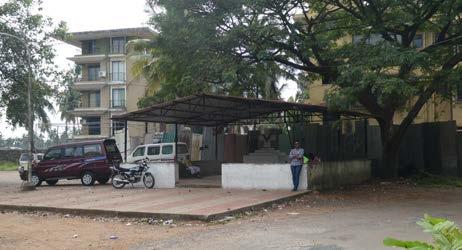
Camrabhat has a diverse range of public facilities. Due to funding from local residents, organisations and the MLA, the community
The public space area with the stage is used as the girls play area and a public gathering space for community events. There is a disparity between access to community facilities for diferent genders - the boys and younger men report playing and socialising in almost all areas of the site, however the girls tend to only play in one area next to the stage. There is one all-
In 2013 the GSIDC completed a Government Primary School on the site. This is a modern, multi-purpose facility including classrooms and an internal gymnasium and is open from 8am - 12pm Monday to Saturday. The school educates children in kindergarten and up to 3rd grade who come from a range of families in the Camrabhat community as well as of-site. The children use the outdoor area surrounding the school building as a play area as well as the concreted sports court next door.
5958
Figure 4.20 - Main Hindu shrine at the entrance to the site
Figure 4.21 - Children play cricket in the alleyways between the bungalows.
Figure 4.18 - Main entrance to the community over the bridge.
Figure 4.19 Informal settlement is built over stormwater infrastructure.
CAMRABHAT SITUATIONAL ANALYSIS CAMRABHAT SITUATIONAL ANALYSIS
Access to Energy and Technology
Both dwellings in the formal and informal settlements are connected to the municipality electrical system, which are tolerated by the authorities. This provides all residents with power to run internal lights, televisions and use some basic kitchen appliances. Many residents also have small decorative lights strung along their exterior walls and roof edges outside which add to the character of the communities and provide some external lights for safety. Throughout the site there are street lights along the main access road which provides some light at night. These are often unmaintained and broken, so there is a lack of sufcient lighting throughout the site at night, although through discussions with residents this was not raised as a concern, including amongst women.
Most residents own smartphones and can access the internet through data plans.
Transportation
There is high vehicle ownership in both the formal and informal settlements. Most immediate families own one form of transportation which is predominantly used by the male family members. The most popular form of vehicle is a scooter, although some families own motorbikes or small cars. Many children also own bicycles and use these to move around the site. Some of the women who work ofsite use the public bus to get to and from work. The closest bus stop is located along St Inez Road, a fve minute walk from the site.
NATURAL CAPITAL
The natural capital of the community is identifed as the land, soil, air, fauna, fora and all aspects of the natural world which bring ecosystems services for the community. Camrabhat is set at the edge of the built-up area of Panaji, on a transition zone with traditional Khazan farming lands which are now largely abandoned.


WELLS
The community has two historic agricultural constructed wells located on site, situated between homes in the informal settlement area. They are mainly used by the residents from the informal settlement to provide washing and drinking water outside the water supply hours. These wells are generally well maintained, and appear to be a natural gathering place for many of the women in the community. The well provides some resilience of supply, but it has been suggested that the groundwater is at risk of contamination from leaking septic tanks outside Camrabhat.

ST INEZ CREEK
The St Inez Creek has historically been an important natural asset to the community, being used for fshing, washing and bathing. Older residents describe fshing for mackerel, sardines, crabs and other ocean-going fsh which used to migrate all the way to the community and were a source of sustenance. Over the years its degradation due to pollution has resulted in the water being unsanitary for human use and consumption, and many edible species of fsh no longer migrate there. The main basin of the Creek is situated at the only vehicular entrance to the site and is the main focal point of the entrance to the community. The Creek has a restricted fow underneath the bridge, creating
6160
Figure 4.24 - Historic well in the community.
Figure
4.22 -
GSID Government Primary School.
Figure 4.23 High car and scooter ownership in the bungalow settlement
CAMRABHAT SITUATIONAL ANALYSIS CAMRABHAT SITUATIONAL ANALYSIS
a secondary basin leading into the neighbouring wetlands.
waste pollution. It is impossible to attribute blame to a single source, and it is likely that a multitude of stakeholders share responsibility for the degradation of the Creek.

“We used to swim in the Creek, if you dropped a coin, you could still see it in the bottom of the creek. Now the creek is dirty and we don’t use it, it has been like that for a long time” - elderly man
FARMLANDS AND WETLANDS
and restricts the fow of surface water across the felds. This doubtless contributes to the growing fooding that the community experiences on an annual basis. During the dry season the felds are used as a cricket pitch for the boys and men in the community.
The agricultural areas are jointly owned by the Communidade and private farmers outside the community, but are largely abandoned and function as wetlands for much of the year.


Figure 4.26 - The Creek alongside the Vision Park Colony leading into the wetlands.

After the establishment of the new Sewage Treatment Plant at Tonca in 2005, many blamed it for a fall in water quality. The same blame is also attributed to the surrounding colonies, who are accused of discharging human waste directly into the Creek due to their septic tanks being under-sized. Observations suggest the community itself is also a big source of solid
The area of the Creek along the adjacent roads is bordered by a concrete retaining wall, which was installed in May 2019 as a method to combat fooding during the rainy season. There was opposition to this from local activists and organisations who identifed the importance of the natural vegetation along the banks of the creek to the ecosystems and natural fltration processes occurring in the Creek. Worryingly, Taleigao Panchayat is proposing a similar level of concretisation along the entire length of the Creek. There are still some natural ecosystems fourishing, and there are regular sightings of fsh, frogs, otters and crocodiles by the residents, but it is clear the health of the Creek has drastically declined over recent years.
“The Creek is the lifeline of the city...we are killing it” - engineer
To the south and east of the community sit large, expansive semi-abandoned farmland which form part of the catchment area of the St Inez Creek. These areas used to function as brakish rice paddy felds when the land was used for agricultural purposes. Due to the low lying nature of the community, these agricultural wetlands are an asset as they help to maintain and attenuate excess water during the rainy season. However, in the last 10 years much of this land has been lost due to colony development, which has reduced the permeability of the area
6362
Figure 4.27 - Rubbish build up along edge of wetlands behind bungalows.
Figure 4.28 - Agricultural wetlands behind Camrabhat.
Figure 4.25 The Creek at the entrance to the community.
CAMRABHAT SITUATIONAL ANALYSIS CAMRABHAT SITUATIONAL ANALYSIS
SOCIAL CAPITAL
The social capital are the interpersonal relations and networks that residents form inside and outside, which are rooted in trust and provide benefts for people’s livelihoods (DFID, 2015).
FAMILY STRUCTURES AND COMMUNITY RELATIONS
There are complex community relationships at play within the Camrabhat community and wider community of Panaj. The Camrabhat community is not homogeneus and can be split into fve diferent population demographics; the original residents who migrated from Karnataka several generations ago renting the single story formal units, the recent Karnataka migrants and local Goan families occupying the informal housing settlement, and the Nepalese migrants and Muslim families who rent units in the multistory formal housing blocks. These diferent populations groups are largely segregated within the site, with the adults having little social interactions with each other, although some of the children do play together.
Religion also plays a part in the segregation of the community as members of the community identify as Hindu, Christian and Muslim. There is mutual acceptance between the Christian and Hindu Muslim populations, but there is little interaction between the groups. The is a very
small Muslim community of 3-6 families and the Muslim children typically attend a separate school.
The families who originally migrated from Karnataka occupying the formal single story units and slum dwellings have large joint family structures. As the families situated in the formal units have been occupying the site for over 40 years, they have many generations of family members living across multiple dwellings. They can include up to 20 family members living across 4-5 dwellings. The recent Karnataka migrant families occupying the slum dwellings have smaller family structures, usually of up to 8 people from 1-2 generations, who all share 1 dwelling. These large family structures mean adults usually only interact with others in the family, restricting social interactions among the wider community. The children are generally not as segregated in their interactions, and often play with children throughout the community and also children from the neighbouring colonies.
Although these two groups have a similar cultural background as they both migrated from Karnataka, they are somewhat segregated based on our informal interviews. The more recent arrivals from Karnataka are looked down upon by the others who have lived in the
community for several generations, due to their poor living conditions in the informal settlement and ‘unsocial’ family structures. It is noted that there are high levels of domestic abuse and general abuse of women occurring in the informal settlement, which is looked down upon by other groups in the community but not dealt with. These frst generation Karnataka migrants also have a more communal family structure, with some men father children from multiple women. Due to this the adults sometimes look after all children within the community rather than those biologically considered their own. This community does not feel overly settled in Camrabhat, and still consider Karnataka home, going back to visit their families multiple times a year.
In both the Karnataka migrant communities it appears there is still much segregation between genders, with girls and boys having diferent roles in the family structures. For the girls it is seen as a privilege to attend school and after school they are expected to stay home and help with housework and cooking. For the boys they are expected to play after school and have no set rules to abide by on the site. This greats further segregation between the genders in the community, with the children only interacting with members of the opposite gender within their families.
The Nepalese migrants feel like outcasts in the community, due to their diference in race and religion. They feel they do not belong in the community or wider city of Panaji, and only see their time residing on the site as temporary.
“We don’t feel at home here, we feel like tourists when we walk through the community” - Nepalese woman
The community has experienced a great deal of exclusion from the wider city of Panaji, both due to their migrant status and standard of their living conditions. Although much of the community has settled on the site over 40 years ago, many of the residents are still not perceived as Goans, and are treated as outcasts in the wider community. It is also well known among the wider community that due to their original cultural ties to Karnataka, they do not conform to the societal norms of Goans and have diferent family and social structures. It appears they are looked down upon by others in society. Interestingly, our interviews suggest there is little interaction between the Camrabhat community and the neighbouring colonies, unless it is for employment purposes.
6564
CAMRABHAT SITUATIONAL ANALYSIS CAMRABHAT SITUATIONAL ANALYSIS
SOCIAL INVESTMENT IN THE COMMUNITY
Local activists and community organisations have identifed the emergent vulnerability and isolation of the Camrabhat community within the wider city of Panaji, and have begun to act to rectify this through involvement with the community.
Local activist Vishall Rawlley has taken great interest in the community and identifed many issues with their living conditions and community interactions which he wishes to address. He has been working with the community for over three years acting to establish strong relationships with a range of community members. He has implemented workshops and activities to generate relationships within the community and further educate the children, including skill building and social interactions through theatre, football and study groups. He also conducts annual summer camps in the community, focused on getting the children to interact with their surrounding natural environment, specifcally the Creek.
He has also seen great potential in trying to reestablish the communities’ relationship with the Creek. Due to its highly polluted nature, the community has a negative relationship to the Creek and a general lack of understanding
towards the importance of maintaining their natural environment. Vishal has tried to regenerate interest in these areas, and educate the community on their importance through establishing a community vegetable patch and a foating garden. (Figure 4.29)
implement these on further banks on the entire length of the Creek. He has also argued against the designation of the Creek as a ‘nallah’ and the lack of designation of the wetlands surrounding the community as agricultural land in the recent Outline Development Plan.
any substantial solutions that address the root causes.
He also advocates on their behalf in local government where decisions are made that might negatively afect the community or their area of the Creek and surrounding natural environment. He has been active in his opposition to the concrete retaining walls established along the river bank and is petitioning for the local municipality to not

Other community organisations such as the Taleigao Village Panchayat, Communidade, Goa Forgiving and the Rotary Club of Panjim have been involved in the community through diferent development initiatives. These have mostly been unsuccessful or not seen to fruition, which has created a false sense of hope and led to distrust of the community in these organisations and their actions. In 2005 the Rotary Club carried out an initial slum redevelopment proposal alongside a local architect. This looked at relocating the informal settlement to the northern area of the site alongside the Creek, which is now occupied by the public toilets. At the time the community was told about the project but little community consultation was undertaken in this initial design proposal. This led to confusion within the community when the Rotary club did not return to their site and the proposal was not seen to fruition. Moreover, the Public Works Department (PWD) does near-annual assessments of the drivers of fooding, but every year has failed to implement
This pattern of unfulflled promises and proposals has been more widely seen through the involvement of municipal organisations and politicians in the community. In each election cycle local politicians often highlight the need to provide further support to the community and address the issues associated with the quality of their living conditions and the security of the informal settlement. For many years the informal settlement residents have been promised upgrades to their current slum dwellings or relocation to another area in the community or in the wider city of Panaji, but nothing has come to fruition. Through these unfulflled promises the community has lost trust in the local government and does not rely on them for assistance.
6766
Figure 4.29 Floating garden implemented by Vishal in the Creek at Camrabhat.
CAMRABHAT SITUATIONAL ANALYSIS CAMRABHAT SITUATIONAL ANALYSIS
HUMAN CAPITAL
Human Capital is defned as the “labour resource available for households” (Radoki, 2002) which can be drawn upon to bring value for the wider household. It considers the skills, knowledge and good health that a household can draw upon to achieve their livelihood objectives (DFID, 2015).
EMPLOYMENT AND SKILLSETS
The rates of employment vary among the diferent cultural groups within the community, due to their ability to access education and skill building resources. Most men in the community undertake some form of employment, while only some women do. The men in the migrant families from Karnataka occupying the bungalows are employed by the municipality, with some residents having employment since migrating to the site over 40 years ago. Women occasionally work as maids in the colonies adjacent to the community. The Nepalese migrants are employed in more ofcial roles in the city of Panaji, with both the men and women undertaking employment. In the informal settlement, most of the men do not have secure jobs and instead they fnd labour jobs on a day to day or weekly basis so their source of income is unstable. The women in these communities typically do not work and tend to stay at home looking after the children, rarely leaving the

community, even for shopping.
The adults of the families from Karnataka appear to have limited education and no professional skills, as they have historically all been employed by the City of Panaji Waste Management Corporation. This continues to limit their employment to work with the Corporation. Some women from these families have small businesses run from their homes in the informal and single story formal settlements. These include sewing and clothing repair services. There are also low levels of education among the men in the informal settlement, although they appear to have a wider skill set as they must undertake various types of employment to make a living.
HEALTH
Due to the open defecation and contamination of human waste on the site and in the creek, the community is exposed to poor sanitary conditions. This does not appear to directly afect their health on a day to day basis, but may lead to severe health related issues in the future. Based on the culture of the families, there are mixed opinions towards the use of local health services. The Nepalese migrants use the local health services in Panaji, especially the free Military and Children’s Hospitals located
in Campal. Other families from the Karnataka migrants do not regularly use the local health services, and instead may choose to attend to the health of their family members in the local temples and churches.
EDUCATING AND INVESTING IN THE FUTURE
The importance placed on children’s education varies between diferent families in the community. The Nepalese migrant families and existing Karnataka migrant families occupying the bungalows view education as important for their children, and invest in sending some of their children to private schools in Dona Paula and Taleigao. Many of these children also attend after school tutoring sessions either run of site or in their community. Some of these children have expressed plans to attend university or train as teachers, but whether this can be fulflled is unknown. Families in the informal settlement send their children to local public schools but are less strict about their attendance, often letting their children make the choice whether or not they attend school. There is no expectation that their children will fnish school but they should take up employment when possible to contribute to the family fnances.
Local community activist Vishal Rawelley has been very interested in investing in the future
of the community. He has set up activities and groups for the children to provide further education and increase their skill sets. He has helped to set up weekly theatre, football and tutoring groups within the community that are tailored towards all children, and has also run workshops and summer camps teaching children about the creek and nature restoration. (Figure 4.30)
6968
Figure 4.30 - Vishal conducting a summer camp with children in Camrabhat.
CAMRABHAT SITUATIONAL ANALYSIS CAMRABHAT SITUATIONAL ANALYSIS
FINANCIAL CAPITAL
Financial resources can be drawn upon by families and communities to support diferent livelihood options - and includes loans and credit, in addition to liquid assets (Radoki, 2002).
LOCAL BUSINESSES AND ECONOMIES
There are several local businesses run in the community which are mostly owned and run by local residents. These include food and goods stores, bars, a mechanics workshop and sewing and clothing repair services. The main food and goods store run on the site is situated opposite the central rubbish dump, and has been run by the same family for over 40 years. Another store selling similar products is run on the site by a couple who live in a diferent community but saw the opportunity to start up a business when the migrants frst moved to the site over 40 years ago. Ofsite vendors from Taleigao visit the community on a daily basis to sell food products such as fsh and vegetables. The quality of these items are varied between the diferent groups in the community, based on what they can aford to purchase. Due to the abundance of food sold in the community, the residents often don’t leave the site to buy food products, but if they do they will purchase these from the Panjim market.

Figure 4.31 - Locally run food and goods strores in the community
Some informal bars have been established in the informal community and are generally only used by these residents. There has also been a mechanics workshop established in the multi-storey housing block which is used by all residents on the site. A clothing repair and sewing business has been set up by the residents in the formal housing units, and is used by their families as well as residents in the informal settlement. Local urban farming is carried out through chickens and goats bred onsite, although some residents feel these are not safe to eat as they consume much of the onsite waste.
“The goats are eating plastic and we are eating the goats, and it is not good for us” - middle aged women
FAMILY INCOME AND SAVINGS
Many families are able to draw on their fnancial assets to invest in private education for their children, as part of an implicit strategy for reducing long-term vulnerability whilst others are able to invest in the community through the establishment of communal shrines. However, a signifcant proportion of the community reportedly don’t have access to bank accounts due to their residency status, which restricts their ability to raise fnance. This is particularly pertinent for residents who have recently migrated from Karnataka. The Nepalese families appear more accepted within the wider community due to their higher incomes, secure jobs and wider position within society, and due to this they are able to have bank accounts.
The family members employed by the municipality earn a low wage and are paid in hand with cash. Due to this they tend to live paycheck to paycheck and do not have any formal savings. Any cash that is saved is generally stored in containers in the kitchen of their homes, or on the body of an adult female family members. Their wealth is also established through the gold and silver jewellery worn by the women in their families. Their inability to be classifed as Goan residents, makes these families very fnancially vulnerable as they
would be unqualifed to receive any formal loans or fnancial support.
As most of the informal settlement residents do not have fxed employment, their fnancial security is highly vulnerable. They fnd small jobs from day to day or week to week so have no reliable income. Most of the women in these communities don’t work and stay at home, often not leaving the site, so the sole income of these families is reliant on male employment.
7170
CAMRABHAT SITUATIONAL ANALYSIS CAMRABHAT SITUATIONAL ANALYSIS
05
FINDINGS, IDENTIFYING ISSUES AND PROBLEM STATEMENT
The information gathered through the participatory exercises illustrated issues afecting the community and the St Inez Creek. To analyse these further we have categorised these fnd ings under two main themes; vulnerability of the community and the environmental degradation of the creek.
through sudden shocks, long-term trends, or seasonal cycles which can increase the risk in the sustainability of their livelihoods and access to assets, creating a sense of uncertainty and declining self-respect (Moser, 1998).
In the context of the community, vulnerability can be understood as the ‘insecurity and sensitivity in the well-being of individuals and households in the face of a changing environment’ and ‘their responsiveness and resilience to risks that they face during such negative changes’ (Moser, 1998).
In the face of climate change, the community is exposed to many environmental changes that may threaten their welfare in terms of their ecological, economic, social and political stability. These threats to their welfare can occur

We found that there were many factors causing vulnerabilities in the community’s livelihood sus tainability and security due to their marginalisation within the wider Panaji community. These were infuenced by the conditions on their site as well as their relationship within the wider city of Panaji, and recognition by their municipality and local government.
The livelihoods of some archetypal ‘personas’ that we’ve identifed in the community are shown in Figure 5.01. These are of course gener alisations, but have been useful for helping us to understand and work with people’s livelihoods in the community.
73
CAMRABHAT FINDINGS, IDENTIFYING ISSUES AND PROBLEM STATEMENTS
Family Employment
Typical personas................................................in the three communities of Camrabhat
WOMAN MUNICIPAL APARTMENT BLOCKS WOMAN SLUM DWELLINGS
“I have a husband and one child. My relatives lives far away in Nepal”
“I work 8am - 4pm each day, my husband works to 5pm. We both work for private businesses.”
“I have a husband and two children, and we moved from Karnataka around 5 years ago. I share parental responsibilities with my neighbour”
“I’m unemployed and stay in the community, my husband works as a casual labourer with an unstable income”
WOMAN MUNICIPAL BUNGALOWS MAN MUNICIPAL BUNGALOWS
Water & sanitation
“We get piped water for 2 hours each morning Each day I fill a -litre water barrel for cooking and washing. We have a toilet inside apartment connect to the sewerage.”
“We get piped water for 2 hours each evening, which I store in a small barrel. I occasionally use the public toilet, but don’t like the slum toilets. Sometimes at night I just go outside the door and clear it later.”
Food Education
“A man delivers fresh vegetables, fish and meat outside the block ”
“We tend to source unfresh vegetables and fish cheaply, which are delivered to the community.”
“ My child goes to private school a few kilometres away.”
“My children go to a government school in Taleigao.”
Home Society
“We have a big bed, and a small bed for my child. The apartment is [illegally] sub-let from a municipal worker. The apartment is in good structural condition.”

“I have lived in Camrabhat for 11 years, but only have friends in the apartments. I don’t like to walk through the other parts of Camrabhat.”
“Eight members of our family all sleep on the oor together ur home is unstable, often ooded and leaks in the monsoon season.”
“We ve lived here for five years, but some look down on us. I occasionally talk to other people in the bungolows who originate from Karnataka”
“
I have husband and three children, but also has a huge extended family - almost everyone is a relative in some way. We’ve been here for three generations.”
“I’m unemployed, but my husband works for the municipality managing waste collections.”
“We get piped water for 2 hours each evening which we store in a large barrel. We have an inside toilet connected to the sewerage system.”
“I go to the market to get fresh vegetables but buy rice and snack at the small local store”
“My children go to a private school in Donna Paula.”
“My family sleeps in the living room on mattresses and sofas. Our home is in good structural condition, but is ooded almost annually.”
“We’re strongly connected with people in the bungalows, and we have some friends in other areas of Panaji. We occasionally meet up with them for picnics on the beach.”
“I have a wife and two children, and my Mum and sister live in same house.”
“I have a wife and two children, my Mum and sister also live in the same house.”
“ We get piped water for 2 hours each evening which my wife stores in a large barrel. We have an inside toilet connected to the sewerage system.”
“I do all the shopping, and go to the market by myself. My wife does all the cooking.”
“I drive my son to private school each day”
“My family sleeps in the living room, with children on the sofa and adults on mattresses on the oor ”
“I ve got lots of friends in different parts of Camrabhat, and we frequently meet in the Christian Shrine to chat in the evenings.”
7574
Figure 5.01 Personas Diagram of community members.
VULNERABILITY ACCESS TO WATER FLOODING
The community exhibits aspects of vulnerability, and residents feel a sense of insecurity and helplessness
Many factors contribute to the vulnerability of the residents in the community, namely their ability to access and maintain livelihood assets, strengthen their housing tenure on site and limit their exposure to damaging natural weather events and other shocks. The community identifes their lack of 24 hour access to clean water and increased exposure to on site fooding as the two factors most afecting their livelihoods. The residents have little power to address these issues themselves, as they require changes in government policies or funding from external sources for better resources on their site.
Limited access to fresh water resources limits the livelihoods and opportunities for many in the community, especially women and girls
Access to water is a major issue afecting all residents in the community, and is something they have wanted to be solved for many years. With many residents there is a misconception of why this issue is occurring, with some blaming themselves and the community for their lack of access to water while others identifying it as a government-controlled issue.

This lack of ability to solve their own issues, and the lack of assistance from the local government and organisations, has resulted in a sense of insecurity and helplessness within the community. In many cases they have lost trust in these organisations to provide help when they are in need or try to better their living conditions in the community.
Although all homes within the formal and informal settlements are connected to the municipal water supply system, they only receive metered access to the water supply within their homes for 2-3 hours per day in the evenings. Some residents in the bungalows and apartments have small water storage barrels inside their washrooms which provide them with further access to water. The residents lack of water access impacts their livelihoods as it dictates how they schedule their day. It restricts the tasks the can carry out in the morning when no water is available, and forces them to clean, wash and cook during a short period in the evening.
Under the Imagine Panaji 24/7 development plan, they aim to implement 24 hour access to water throughout Panaji by 2021. Many locals are sceptical of this, including those residing in the community, based of the lengthy implementation timeline of previous infrastructure redevelopments. For many years locals have asked for permanent on site water storage tanks that would be supplied by Public Works Department (PWD) to provide them with some form of water access on site outside of their controlled water access period. On two occasions these have been provided alongside the informal settlement area, but were then later moved to make way for more housing and appear to have been accidentally destroyed.
Annual fooding is seen as the primary issue facing the community by many residents, and has broad and tragic implications for household assets, including health
Flooding is a constant issue that afects the community during the monsoon seasons. Each year there are approximately 3-5 foods which cause damage to infrastructure in the community and block their access to and from the site. The frequency and spontaneity of the fooding makes the community vulnerable as they are not able to protect their homes from damage. The efects of the fooding increase the vulnerability of the communities livelihoods, damaging their physical and natural assets and restricting the ability to be fnancially stable. As extreme weather events are only becoming more frequent due to climate change, the safety of the community is continuously under threat and their exposure to fooding is ever increasing.
The community is susceptible to foods and their subsequent damage due to its low lying position at the head of the St Inez Creek and basin of the Nagali Hills. Flooding is further afected by the loss of permeable land from development. These restrict the food waters in the monsoon season from naturally fowing into the wetlands behind the community. Due to the large
7776 CAMRABHAT FINDINGS, IDENTIFYING ISSUES AND PROBLEM STATEMENTS CAMRABHAT FINDINGS, IDENTIFYING ISSUES AND PROBLEM STATEMENTS
“A water tank would solve lots of our issueswe’d be able to plan our day in a diferent way!” - Teenage girls from Camrabhat
Figure 5.02 Water meters in bungalow settlement.
concrete wall built into the Vision Park Colony along the edge of the wetlands, food water is directed straight into the community. Due to the decrease in water retaining vegetation along the banks of the Creek, the Creek also rises under heavy rainwater and often spills over the smaller concrete retaining walls around the creek into the community. Downstream from Camrabhat, fows are restricted by extensive siltation and the narrowing of the Creek due to development. Whilst the Creek is up to 30 metres wide at Camrabhat, downstream this drops to just four metres in places. These aspects make the community extremely vulnerable during foods as water enters the site without being attenuated, and remains there as it cannot easily drain away. This causes signifcant damage to the single story bungalows, informal shanties and lower levels of the apartment blocks as well as community buildings on the site. Flooding is also a signifcant health risk, with residents reporting snakes, dengue fever and exposure to open sewage as some of the biggest sources of misery.
In both 2014 and 2017 Panaji was hit by heavy rain causing damaging foods which greatly afected the Camrabhat community. (Figure 5.03 and 5.04) These foods saw over 20 informal dwellings submerged, greatly afecting the livelihoods of the occupants.

During and after the foods, some support and aid was provided by local organisations, such as the Public Works Department (PWD) and Taleigao Panchayat. Afected families were temporarily rehomed in local schools, while work was done to restore their permanent living quarters and clean up the contamination.
Although there is some support for the community when they are afected by the foods, this is only temporary and in many cases does not help restore and secure their livelihoods. Some physical aid is provided for the clean up of their site and rebuilding of homes, but very little fnancial support is provided. Instead the families are reliant on their own funds and support systems which drains their assets further increases their fnancial vulnerability. This is especially evident for the residents of the informal settlement, whose housing structure are particularly vulnerable to damage in foods and who have the least fnancial capital within the community. Many of the foods have damaged their electrical appliances which they then have to rebuy with the little money they have.
to properly address the issue. Each year the PWD carries out a food risk assessment of the community but has yet to implement any substantial solutions to mitigate the issue. After the damaging foods in 2018, the Taleigao Panchayat installed concrete retaining walls along the edge of the Creek inside the community to prevent cars falling of the road and into foodwater. (Figure 5.05) During his 2017 election cycle, the local MLA also implemented an improved stormwater drainage system throughout the site. This was designed to collect stormwater and direct it out into the wetlands behind the site, but does nothing to mitigate the large annual foods.

Government organisations recognise that fooding is an issue increasingly afecting the community and contributing to their vulnerability, but little action has been done

7978
Figure 5.03 - Flooding at the entrance to the community.
Figure 5.04 - Debris built up from the fooding.
Figure 5.05 - Concrete retaining walls estabished along Creek for food mitigation.
CAMRABHAT FINDINGS, IDENTIFYING ISSUES AND PROBLEM STATEMENTS CAMRABHAT FINDINGS, IDENTIFYING ISSUES AND PROBLEM STATEMENTS
DEGRADATION OF THE CREEK COMMUNITY RELATIONSHIP TO THE CREEK
The health of the St Inez Creek has plummeted over the last 15-20 years due to a number of man made and natural factors, as described in our Introduction. The Creek has a very shallow slope running from Camrabhat to the mouth at the Mandovi river. It naturally has a slow water fow which contributes to areas of stagnant water, promoting the growth of weeds and mosquito larvae.
A lack of environmental regulations have allowed development to begin to encroach on the Creek, destroying its natural resilient features and promoting excessive weed growth. The mouth of the Creek has been silting up since 2004, with some residents believing this was done ‘on purpose’ to kill of the Creek. Natural ‘detention basins’ in Panaji have been flled up, e.g. parade ground, swimming poolthis, combined with the blocking of stormwater drains, has increased the risk of fooding. The complex and conficting governance arrangements that have led to the degradation of the Creek are described in the following chapter.
From our participatory feldwork inside and outside Camrabhat, there appears to be a general lack of awareness throughout the community of the role that a healthy natural environment plays in supporting resilient livelihoods - such as mitigating fooding, reducing water-borne disease and improving air quality. There is also a notable absence of motivation to actively project or restore it, which is especially evident with respect to the St Inez Creek and surrounding green spaces in the community. The Creek itself is no longer recognised as an important natural asset for their environment as it was seen in the past. This is likely due to a combination of a lack of education and a sense of powerlessness with regards to pollution. Whilst we haven’t been able to access water testing data, it is highly likely that the Creek has high levels of E.coli, low levels of dissolved oxygen and high turbiditywhich all would suggest a risk to human health.
The natural environment is heavily polluted from organic and inorganic sources. Our feldwork has revealed that open defecation is commonly used by those in the community without access to toilets in their homes, especially at night. The practice signifcantly increases the risk of the spread of infectious diseases such as cholera (WHO, 2019), damages the environment and
is closely linked to high rates of child mortality (WHO/UNICEF, 2014) and is most likely to be one of the sources of organic pollution on land and in the Creek. This runs contrary to the ofcial declaration of the national government that India is ‘open defecation free’ (India Today, 2019).

Some residents see the Creek as an informal rubbish dump area and appear to dispose of their waste in or beside it. Many materials, including plastics, pollute the land as they break down. Some members of the community do recognise this as a health risk, especially as the goats eat much of the plastic waste which in turn are eaten by the community.
Green land has transitioned into informal rubbish dumps, notably where these are not overlooked by housing. There is a perceptible lack of enthusiasm for some initiatives aimed at improving the environment amongst some residents, including the foating garden and vegetable garden which were constructed by local activists. Although these were constructed in collaboration with the community, they were both unmaintained and rapidly fell into disrepair due to a lack of local ownership and anchoring in the community.

8180
CAMRABHAT FINDINGS, IDENTIFYING ISSUES AND PROBLEM STATEMENTS CAMRABHAT FINDINGS, IDENTIFYING ISSUES AND PROBLEM STATEMENTS
Figure 5.07 - Rubbish and algae build up along the Creek in Camrabhat.
Figure 5.06 - Rubbish piles gather along the Creek.
PROBLEM STATEMENT
The key fndings from our community are interconnected and in many cases dependent. Rationalising and responding to some of the identifed problems requires us to recognise dependencies between them, with recognition of the complexity behind them. In light of this, we have developed a single unifed ‘problem statement’ which captures the essence of our situational analysis.
“
Many of the basic needs of the residents of Camrabhat are not met. The community experiences an unreliable and restricted water supply to all properties, the wider environment is degraded and regular fooding ruins the livelihoods of many. A failure of governance, a lack of coordination between responsible agencies, weak internal cohesion and poor external connectivity has created a sense of abandonment, a loss of pride and emergent and sustained vulnerability to shocks and stresses.

8382
” CAMRABHAT FINDINGS, IDENTIFYING ISSUES AND PROBLEM STATEMENTS
CAMRABHAT FINDINGS, IDENTIFYING ISSUES AND PROBLEM STATEMENTS
06STAKEHOLDERS
We have connected with a wide range of stakeholders inside and outside the site, many of whom have been engaged with the community for a long time. Examples of insights that we have gained from individuals and groups are given here.

Figure 6.01 - Engaging with stakeholders in the community.

85
CAMRABHAT STAKEHOLDERS
COMMUNITY MEMBERS
A LOCAL RETIRED ENGINEER
The 62 year old had a wealth of knowledge and opinions about how the Creek used to be very clean and how they used to catch fsh and prawns. He claims that much of the pollution is from the Tonca Sewage Treatment Plant, and that it isn’t operating as reported. He also reports that there is a section of the river next to Calculo Mall which gets easily blocked, as the bridge is simply a series of small pipes.
LOCAL SHOP OWNER
She owns a shop with her husband and commute some distance to their shop each day. They started the shop here because they saw potential since there are few shopping alternatives in the settlement area. They are believed to be renting the land from the municipality. They note the irony of how so many people in settlement are employed in waste collection, but their own community has so much uncollected waste.
FAMILIES IN THE INFORMAL SETTLEMENT

Almost all of the neighbours in the colourful households in the informal settlement of Camrabhat are from the same extended family, and they have expanded the settlement as the wider family has grown. Through informal conversations and spending time in their homes, we have learnt a huge amount about the livelihoods of the community. They tell us about how the boys and girls don’t play together, where they go to school, where they play, wash their clothes, and other details about their everyday life. Most of their interactions are within the family unit, although they do know other people in the community.
ADMINISTRATION & GOVERNMENT NON-GOVERNMENTAL ORGANISATIONS
TALEIGAO VILLAGE PANCHAYAT SARPANCH (HEAD OF THE VILLAGE)
The Village Panchayat is the primary democratic decision-making body which has responsibility for Camrabhat. Through them, we learnt that the agricultural land around Camrabhat is mostly owned by the Communidade and co-owned with cultivators and that after the monsoon season people use the felds to grow caulifower, chilli, beans and lady fngers. The Panchayat is enthusiastic about the idea of retaining walls being constructed along the entire length of the Creek. The Panchayat has ill-defned future plans for public-private redevelopment of the area using reinforced concrete housing, and they do not have any scheme plans or drawings present.
NORTH GOA PLANNING DEPARTMENT
Through the department, we obtained latest Outline Development Plans (Masterplans) for Panaji and Taleigao, which are the source of much dispute with local activists. However, discussions around the nature of the slum and proposals for rehabilitation were tricky, and we struggled to obtain detailed information from them. There was also some disagreement on the role of the Communidade and the Creek.
GOA FORGIVING
The objective of Goa ForGiving is to lift communities around the Creek out of poverty, and so far they have run a number of smaller initiatives and projects. One of these is The Water Adoption Programme, where schools take charge of their local waterway or well, which has been piloted in North Goa for 6 months.
The organisation believes that the degradation of the Creek is primarily an engineering problem, which could be sorted out ‘within two years’, with the biggest issues being the sand bank blocking the mouth of the Creek, the low bridges restricting the fow of the tide and the fact that the CRZ (Coastal Regulation Zone) rules don’t apply, which would restrict development around the Creek. We were told that approximately $10m was previously pledged to restore the creek, but was never forthcoming.
8786 CAMRABHAT STAKEHOLDERS CAMRABHAT STAKEHOLDERS
Figure 6.02 - Children iin the informal settlement.
ACTIVISTS
INTEREST AND INFLUENCE
VISHAL RAWLLEY
Vishal is a civil artist, who has lived in Panaji for the last three years and has had regular contact with the Camrabhat community through informal workshops, and the construction of a vegetable garden and two foating islands for the Creek. He’s been one of our primary gatekeepers for the community, particularly amongst the children, and a vital source of information. He is a previous recipient of the FICA Public Art Grant for engaging communities in preserving the St Inez Creek.
He’s also given us a useful overview of governance in the area, and a dose of healthy scepticism about some of the work of the municipality, Panchayat, Imagine Panaji and others.
TALLULA D’SILVA
Tallula is a local architect who has lived her whole life in Goa, and has been involved in a range of community-based projects in the area. She aims to build participation, collaboration and inclusivity in her work and has connections across Panaji with individuals engaged in similar work. Her enthusiasm and broad network made her an ideal node for supporting the project. She has conducted collaborative workshops with children and stakeholders in the community
who are invested in the restoration of the Creek. She has supported every stage of our project, from situational analysis to ideation and testing.
LOCAL ARCHITECT
A local architect who has worked with the Rotary club of Panjim to create a proposal for rehabilitation of the informal settlement in Camrabhat 15 years ago, primarily the improvement of housing by creating a new development on an adjacent site. This proposal was never taken forward, but gave us vital information into how the community has changed over the past 15 years. He believes that with a relatively small amount of political will, it would be possible to rehabilitate the ‘only slum in Panaji’.
He believes the Creek has been neglected for decades, and has degraded due to pollution from multiple sources. He believes that some of the key governmental organisations in the area aren’t aligning themselves with the needs and desires of people and the community, and that participatory processes haven’t so far been efective. He acknowledges that engagement with citizens can be difcult as it can be hard to persuade people to attend meetings.
Any system of transformation in an area or community is ultimately the result of dynamics between diferent stakeholders. Understanding the relative level of interest and infuence of each stakeholder was vital in the development of our proposals, which is summarised in Figure 6.03.
Each stakeholder has been assessed using the following statement:
“How much interest do each of our stakeholders have in supporting community development and improving livelihoods in Cambrabhat and how much infuence do they have over processes of transformation needed to achieve this?”
There are a number of highly motivated and interested individuals in and around the community, as evidenced by their long-term commitment to activities in the community. However, they have little infuence over long-term change, primarily due to their fractured relationship with government. Many government agencies have the power and resources to make enormous long-term change, but appear to have little interest in actually doing so. This is particularly evident in the regular promises by Taleigao Panchayat to invest in slum upgrades, but the total lack of
evidence that this has been implemented in the last 25 years. Many of the communities have a great interest in improving their community in the long term, especially with regards to addressing safety issues and improving the reliability of the water supply, but they lack the agency to do so. It is noted that there are no identifed individual stakeholders with a high level of interest and infuence, which is manifested in the complex and occasionally conficting governance arrangements around the Creek and the community.
8988
CAMRABHAT STAKEHOLDERS CAMRABHAT STAKEHOLDERS
Interest + In uence Analysis + Strategies
“ ”
How much interest do each of our stakeholders have in supporting community development and improving livelihoods in Camrabhat and how much in uence do they have over processes of transformation needed to achieve this?
NON-GOVERNMENTAL ORGANISATIONS
North Goa Planning Development Authority
GOVERNMENTACTIVISTS COMMUNITY MEMBERS
The usiness for Social Responsibilities framework for stakeholder analysis has been used to help guide strategies for engagement These are broken down into the following categories
To what extent can they contribute to the mission? Do they have the necessary information, expertise or networks?
How legitimate is their claim for involvement?
How willing are they to engage?
How much n en e do they have over other stakeholders?
Public Works Department (PWD)
Taleigao illage Panchayat
Water Resources Department (WRD)
Imagine Panaji
Goa Chamber of Commerce and Industry
Corporation of the City of Panaji
Rotary Club of Panjim
Goa for Giving
Communidade eader
ocal Architect
Tallulah Da Silva
Vishal Rawlley
How necessary is it that they re involved?
Armaldo obo
Families in the Municipal ungalows
Families in the Municipal Apartments
Families in the Slum Dwellings
Analysis has guided how stakeholders will be engaged for the delivery of our proposals
As the holders of budgets and the interpretors of legislation, governmental stakeholders have a huge amount to contribute, and as part of a democratic process they have a legitimate claim for involvement They are often unwilling to engage with non-government actors or participatory processes They have significant n en e over other governmental stakeholders, and for these reasons it s important they’re involved
ocal non-governmental organisations have a good deal to contribute through their large number of members, media presence, ability to raise finance and good connections with government They have some legitimate claim for involvement, although in some cases represent business interests more than communities They are generally willing to engage, and have a significant amount of n en e over other stakeholders, especially some governmental ones It s necessary they are involved in the process Imagine Panaji s status as non-governmental is debatable
ocal activists have an enormous amount to contribute, partly due to their knowledge of the community, but mostly due to their unbounded energy and commitment They have a reasonably legitimate claim for involvement, but without care there is a risk of them focussing on their own needs and projects rather than those of the community They are always willing to engage, and have some n en e over other stakeholders, though not much over governmental ones It is very important they are involved in the process
Communities themselves have the most to contribute, as they have the deepest knowledge of their own communities They have the most legitimate claim to engagement, as they embody the community of Camrabhat They are not always willing to engage due to breakdown of trust with government authorities and others They have a e n n en e over the transformation process internally, but e n en e over higher level governmental stakeholders It is absolutely essential that they are involved and lead the process
9190 Interest In uence
Framework adapted from usiness for Social Responsibility ( usiness for Social Responsibility, )
CAMRABHAT STAKEHOLDERS
ST INEZ BANDH

92
Building on household assets with tactical urbanism to revitalise a community
METHODOLOGY07
For the past twelve weeks we travelled a long and winding road to understand the needs of our community, the wider social and economic relations in the St. Inez area, and governance in Panaji, Goa, and India.

We started to empathise with our area through observations, informal interviews and historical research which helped us to defne our focus areathe St Inez Bandh. We then set up a few participatory methods in collaboration with students from SPA Delhi to help us defne the main issues and needs of the community.
We started foating ideas and prototypes, discussed them with stakeholders and community members, reconsidered and redesigned based on the feedback to ideate our prototypes until we fnally generated the proposals that best met the needs and desires of the St. Inez Bandh community.
95 ST INEZ BANDH | METHODOLOGY
TIMELINE OF FIELDWORK

9796
Exploring the whole St. Inez area all the way from the mouth of the creek in the Mandovi river to the catchment area in Taleigao we witnessed an astonishing diversity of residential, commercial, educational and recreational spaces. We came across the St. Inez Bandh during our very frst walk around but were hesitant to enter the colourful stretch of row houses at frst as it seemed very private and we did not want to be intrusive.

For our second tour in that area we tried to get people’s opinions on the area by asking them what they liked/disliked or what their favourite/ least favourite place in the neighbourhood was. We quickly discovered that in the commercial and educational spaces of the area, people did not have deep opinions about the area as most of them only worked or went to school there. We thought that a residents perspective would provide us with the most insightful opinions about the area. As curiosity took over we went back to the stretch of row houses. Walking down the path in front of the houses, feeling like intruders, a few residents sitting outside their houses welcomed us with prying eyes. We started a brief conversation and instantly got a warm invite to the home of one of the residents. She showed us her house and told us how much they like living in this community even though it is challenging sometimes. She is originally from

Goa and married into the family ten years ago while the family had been living in that house for 50-60 years. They are eight people living on approximately 40m². They have expressed a desire to improve their house but the Bhatkar (landlord) doesn’t allow them to make major changes or vertically extend the houses.
After that visit we were specifcally curious about the relationship between the residents of the row houses and the surrounding neighbourhood which consists of the Taj Vivanta Hotel, the busy St. Inez Road with all its shops and residents living in apartments and gated communities, as well as the connection to the Creek itself. One of the main principles of UEP is to emphasise the importance of including those that are not usually represented in planning processes. Within the St. Inez Bandh we were confdent that we could do just that.
9998
Figure
7.01
Focus area with diferent landmarks.
OUR AREA Figure 7.02 - St. Inez Bandh and neighbouring communities. ST INEZ BANDH | METHODOLOGY ST INEZ BANDH | METHODOLOGY
Discover Define Develop Deliver
MESSSTRUCTURE STRUCTURE
DEFINE VALIDATIONEMPATHIZE IDEATE PROTOTYPE
Community mapping
Informal interviews
Formal interviews Priority voting
Emoji game
Photo morphing Drawing exercise Surveying
Designing prototypes and solutions Group-internal discussions
Formal interviews
Presenting prototype Receiving feedback
THE DOUBLE DIAMOND FRAMEWORK
The methods we used throughout the feldwork can be placed in the Double Diamond design thinking framework as shown in Figure 7.03. This framework has been launched by the Design Council in 2004 and includes the key principles needed to achieve substantial and sustainable change (Design Council, 2019). The two diamonds symbolise the procedure of divergent and convergent thinking. While divergent thinking is the process of exploring, gathering information to understand the issue and taking a wider view, convergent thinking is the process of narrowing down and defning the issue to take focused action. It is a very iterative series of actions as every new information can set you back to the beginning.
Most of our methods ft into the defne phase of this framework since we were set back to that stage several times during the feldwork and then used participatory methods to redefne and clarify our former statements. The design thinking steps empathise, defne, ideate and prototype can be integrated into the Double Diamond framework as shown in the fgure.
101100 Figure 7.03 - Double Diamond Framework
MESS
ST INEZ BANDH | METHODOLOGY ST INEZ BANDH | METHODOLOGY
METHODS
COMMUNITY MAPPING

Our group was assigned to a zone that encompassed a large area surrounding the St. Inez Creek. As outsiders, we wanted to develop a better understanding of the area specifcally with the people that are present in these spaces and how they use them. To accomplish this, our team walked around diferent locations with a map of our zone and asked people to use diferent coloured markers to indicate areas within our zone that they did or didn’t like. Red was used to mark an area that wasn’t liked and green was used to mark an area that was liked. While conducting the exercise, we noticed that participants were not comfortable with saying that they “didn’t like” a specifc area. Most
would say that they liked the city as a whole. We also observed that participants were led to mark areas that were marked from previous participants. From this, we learned that we would have to be mindful in our approach in getting people to share criticisms with us and we would also have to ensure our exercises maintained a sense of anonymity to prevent any responses from being infuenced by others.
Despite this, we were still able to collect data that drew us to an area near the Taj Vivanta hotel as this was an area that received many red markings with trafc and pollution of the St Inez Creek being the main grievances shared by participants in this exercise. This eventually led us to our area of focus, the St. Inez Bandh.
OBSERVATIONS
Observations were also essential in forming our knowledge and familiarity of our area. This method also served as a way of sensitising the community to our presence. Our approaches to observations ranged from simply sitting back and watching life progress to more involved methods like tracking pedestrian and vehicular mobility in a parking lot. However, with the scope of our coursework focusing on participatory research methods, we wanted to make sure that we were taking on a more active role as researchers and facilitators. Our observations were essential in helping us to craft methods and exercises that were mindful
INTERVIEWS

Interviews, whether informal or formal, helped us to establish familiarity and trust with various stakeholders. This allowed us to learn from stakeholders and it also allowed stakeholders to learn more about us, our work, and desired outcome of our coursework. Interviews allowed us to establish a holistic understanding of the area and the various external and internal factors that infuence the quality of life for stakeholders within the area. Another beneft of using interviewing as a research method is that it helped to build our own social capital through the connections that we made with other key stakeholders and gatekeepers. Sometimes the interviewee would share the names and contact information or would share any relevant events that were happening that would be benefcial to us. For example, after speaking with a local architect, they invited us to a public forum that was being hosted later that week about stakeholders interested in rejuvenating and maintaining the St. Inez Creek.
Language was a barrier that appeared multiple times when attempting to conduct interviews. Some of our residents did have an understanding of English but, at times, accents and regional dialects of English caused things to get lost in translation. We did have the beneft
103102
Figure 7.05 Walking through the frst stretch of the St. Inez Bandh. Figure 7.04 - Asking a community member what he likes in this area. ST INEZ BANDH | METHODOLOGY ST INEZ BANDH | METHODOLOGY
of having a Hindi speaking team member and we also benefted greatly from our week of collaboration with the students of SPA Delhi. However, some of our residents, especially the elderly, only spoke the local language which is Konkani. This was a challenge initially but after getting to know some of the residents a little more, residents that spoke both Hindi and Konkani would ofer to translate for us.
INFORMAL INTERVIEWS
Informal interviews were vital towards the development and fortifcation of our social capital. Informal interviews manifested themselves in our feldwork in mediums that ranged from “in-the-moment” chats with local residents to asking pedestrians to participate in an activity or share their views on a particular subject. These informal interviews helped to shape our general understanding of the area and to also identify key stakeholders in the area that would be the most infuential in driving change.
FORMAL INTERVIEWS
Throughout the course of our feldwork, we scheduled and carried out more formal interviews with key stakeholders that ranged from NGO leaders to leaders of local businesses. Before each interview, we met as a group to discuss the outcomes that we would want from each interview and the questions that we could ask to get us to that outcome. The general purpose of these interviews was to gain a better
understanding of the relationship that these stakeholders had with the Creek and the St. Inez Bandh community. During each interview, we had at least two of our group members sitting in with one taking notes and another facilitating the interview.
Afterwards, we would transcribe our interview questions and responses to be shared in our group Google Drive to be available for future reference. The transcriptions would be analysed for certain themes and other key information.

Interviewee
PROPERTY MANAGER TAJ VIVANTA HOTEL
Purpose of Interview


Outcome of Interview
Understand the relationship that this major stakeholder has with the immediate area and Creek. The hotel brand has a vested interest in maintaining the Creek and encouraging its employees to go out and do volunteer work.
TALLULAH D’ SILVA + VISHAL RAWLLEY
Understand the NGOs relationship with the Creek and learn more about current projects.
MEMBER OF GOA FORGIVING
MEMBER OF THE LEGISLATIVE ASSEMBLY - PANAJI

Understand their interactions with the Creek and capture feelings about a resident welfare association (RWA).
Identify the relationship that elected ofcials have with the St Inez Bandh and the surrounding community
SEMINAR ON REJUVENATION OF ST INEZ CREEK GOA CHAMBER OF COMMERCE AND INDUSTRY
Gained a better understanding of the tenure status of the St Inex Bandh and were provided with tips and resources to best execute the RWA idea.
Communication between government and community is fractured and could beneft from greater collaboration.
Build social capital by meeting other stakeholders that have an interest in rejuvenating the Creek. We were introduced to a variety of projects and organisations that are involved in rejuvenation and maintenance of the Creek.
104
Figure 7.06 - Summary of formal interviews. ST INEZ BANDH | METHODOLOGY ST INEZ BANDH | METHODOLOGY
PRIORITY VOTING


107106
We wanted to get a sense for which areas Based on our observations from our Community Mapping exercise, we thought it would be best to have participants slip each coloured sticky Most Problematic Somewhat ProblematicSlightly Problematic Not Problematic Figure 7.07 - Ranking of Areas. A: St. Inez Creek B: Parking Lot D: St. Inez BandhC: Junction Figure 7.08 - Images used in Photo Rankng, Morphing, and Emoji Exercises. ST INEZ BANDH | METHODOLOGY ST INEZ BANDH | METHODOLOGY
EMOJI GAME


We wanted to implement a quantifable method that allowed us to capture feelings about the same four areas that were used in the Priority Voting exercise. For this exercise, we printed out a set of fve emojis that could be used to express diferent feelings.
Love Happy Sad Angry Indiferent


Participants were asked to place the diferent emojis on each of the four photos to express their feelings towards each area. Using the emojis allowed participants to express simplifed or mixed feelings towards a place. And it also allowed us to overcome the language barrier by providing participants with feelings and symbols that they would recognise. We originally intended this exercise to be completed by one person at a time, but when executing this method in the feld, this exercise drew a crowd. This resulted in the participant asking the crowd to participate with them or others waiting their turn would just jump in and start sharing their opinions. We realised that this community tends to work better in groups, so we modifed the execution of the exercise by encouraging people to work together in groups.
We kept count of the diferent emotions that were placed on the pictures throughout the exercise and tallied them up at the end to determine overall feelings towards an area. For some areas like the Creek, most of the emotions that were chosen for this space consisted of “sad” or “angry” emotions signifying that people generally had a negative perception towards this area. Other areas like the parking lot received mixed emotions. Generally “angry” or “indiferent” feelings were placed on this area by adults while “happy” or “love” emojis
were placed on the same area by children. Adults generally had a negative or neutral perception about this space because they just saw it as a space for cars to park whereas children saw this as a space to play.
PHOTO MORPHING

Based on the results from the Emoji Game, we wanted to give participants an opportunity to plan out their ideal space. Whenever we noticed someone place “sad,” “angry,” or “indiferent,” emotions on an area, we would ask them “What would you change in this place if you had the power to do so?”

modifed the execution of this exercise so people could work together in groups.

After participants were done “morphing” the photos, we took a picture to document their changes. We then analysed these photos to determine the changes / interventions that people would like to see in each space. We were able to extract certain themes from each photo. In the Creek area, participants generally wanted to clean up and maintain the Creek so that it could also be used for recreational purposes like fshing or swimming. In the parking lot, people expressed a need for a communal space like a park with more foliage and lighting.
Participants were asked to make changes to the photo by either adding or removing things. We provided them with post-its to draw or write on so that they could then place it on the photograph. Since we expected that some participants might be hesitant to come up with ideas on their own we also had a few pictures of benches, dust bins, street lights, cars, bicycles and trees which they could place on the photos. Like our Photo Morphing exercise, we also

109108
Figure 7.09 - Children participating in exercises.
Figure
7.10 - Emojis used in Photo Morphing Exercise. Figure 7.11 Results from diferent methods. ST INEZ BANDH | METHODOLOGY ST INEZ BANDH | METHODOLOGY
DRAWING EXERCISE
From the “Photo Morphing” exercise, we saw that there was a need for a communal/ play space in this community. The children in this area used a parking lot as a play space. However, there was sometimes tension between the vehicle owners and the children that used this space. Children playing would either get in the way of trafc or vehicle owners would get upset if their vehicles were touched or damaged during play. Based on these observations, we wanted to test a theory that the best intervention for this space would be to make the space more user friendly by creating a park in a portion of the parking lot while also giving residents space to park their cars.

We wanted to give the kids an opportunity to take on the role of Urban Planner by allowing them to design their own playground. We provided them with a blank template of the parking lot and asked them to draw their ideal park. We had around 20 children provide us with drawings for their ideal space.


Unfortunately the outcome was not as we expected. Most of the younger participants either did not understand the purpose of the exercise or were not interested in the guidelines we had set out. Some of the children drew their homes or what they saw in the parking lot. A few actually drew a play-ground and what they would like to see incorporated into a play space. We were able to gather a better understanding about what the kids like to play and how we can incorporate these ideas into a design for a more user friendly play space.
From this exercise, we determined that drawings may not always be the best method to gather input from the younger residents.
Methods like asking children “what games do you like to play?” or simply observing how the children use the parking lot to play would have been more benefcial to gather data on how the space is used and could be planned. Regardless of the outcome, this exercise allowed the children to become more familiar and friendly with us.

111110
Figure 7.12 - Children doing the drawing exercise. Figure 7.13 - Collage of childrens’ drawings. ST INEZ BANDH | METHODOLOGY ST INEZ BANDH | METHODOLOGY
SURVEYING
To gather more general information on the demographics of our site we created a questionnaire for the households. Our questions were designed to collect data on household size, gender and age distribution, education, employment rates, car ownership, and mobile phone ownership. We had originally planned questions to gather information on income per household but determined that the question was a bit too intrusive to ask in the presence of others, so we omitted it from our survey.
We initially had the idea of having residents self report answers by providing them with a QR code that would lead them to an online survey. However, after doing some research on surveying methods and best practices in India, it was determined that we would have the most success and we could avoid potential confusion with this method if we executed this survey in person (Krishnan & Poulose, 2016).
The survey was administered in person and was translated into Hindi as well with the help of one of our group members. We walked through our community and asked residents in various parts of the St. Inez Bandh to participate in our survey. We prefaced each request for participation by indicating that the survey was voluntary and
that participants could skip any questions that they were not comfortable answering.
We were successful in collecting data for the most part but we sensed hesitation in willingness to participate by some of the residents. This was made more apparent when a community member came up to us and asked us why we were going around asking questions and if we were working for the government. We assured them that we were simply doing this as an academic exercise and carried on. From this we determined that it would be best to indicate that we were students carrying out this survey for academic purposes only.

In the end, we gathered about 17 survey responses which out of 55 households in the area, represented a 31% sample size. The results from this survey helped us gain a better understanding of the demographics of our area.
Household Survey ( )
The questions asked in this survey will be used to gather data to gain a general sense of household information for this community for the purpose of academic research. Participation is voluntary and participants can choose to not answer any questions in this form.
4.
1. Including yourself, how many people are living in your household?
Mark only one oval.
1-2 People
3-4 People 5-6 People
7+ People +
2. Next to each age group, write down how many people in your household apply to each age group. ?)
Mark only one oval.
0-5 Years 0- )
6-16 Years17-25 Years )
26-55 Years55+ Years + -

3. Next to each gender identity, write down how many people in your household apply to each gender identity. ?)
Mark only one oval.
Male Female (
Other ( )
113112
Figure 7.14 Conducting our survey. Figure 7.15 - Women in front of their houses at St. Inez Bandh. Figure 7.16 - First 3 Questions of our Household Survey. ST INEZ BANDH | METHODOLOGY ST INEZ BANDH | METHODOLOGY
SITUATIONAL ANALYSIS
There are a multitude of internal and external factors that can make up and infuence a household’s quality of life. There are several models and theories that attempt to break down and organise these factors so that they can be better understood and responded to accordingly. In an efort to obtain a more holistic understanding of the St. Inez Bandh, we applied aspects of the Livelihoods Framework, specifcally, identifying and measuring fve distinct assets and capitals - physical, natural, human, social, and fnancial.

115
GROUP
2SAINT INEZ BANDH | SITUATIONAL ANALYSIS
ST INEZ BANDH | SITUATIONAL ANALYSIS
PHYSICAL CAPITAL
The Livelihoods Approach consists of identifying capabilities and assets, both tangible and intangible, and how they infuence a household’s ability to maintain a certain quality of life and their ability to respond to shocks and stresses (Khanya-aiccd, 2006). The approach compiles these factors to aford one a more thorough understanding of household strengths, structures, and capabilities. Coupled with our participatory research methods, identifying and measuring the various capitals and assets present within the households of the St. Inez Bandh allowed us to draft proposals and initiatives that are mindful of the disparities and structural lapses within this community.
We recognise that the concepts of informality and formality also play a role in shaping the lives of the residents within this area. Informality and formality are just one of the many factors that manifest themselves through a variety of mediums in the St. Inez Bandh. Attempting to defne the concept of “informality” can prove to be a bit difcult as the concept itself is situational and requires context in order to be applicable. However, the basic premise of informality is that it can be thought of as activities that take place in settings not covered by formal institutions. It can also be thought of as activities that supplement, or even complement, formal institutions when they
do not truly capture the needs of participants (Altrock, 2012). These informal institutions can be placed on a continuum that ranges from “tolerated” activities to “illegal” activities.

Within our group, we have a basic understanding of informality as “life fnding a way in response to various challenges and barriers.” Informality ranges widely in our area. It can present itself as “tolerated” activities, like children making a play space in a parking lot, and as “illegal” activities, like development of homes on land that is zoned for recreational use by the city. Recognising how informality manifests itself in the St. Inez Bandh is essential towards gaining a better understanding of the complexities in this community and how, we as planners, can be mindful of this as we draft solutions that address the root causes of these “informalities” and how they themselves can also be a part of the planning process.
The information compiled in this section is a result of the methods implemented in our feld, our observations, and feedback collected from stakeholders in the area.
PHYSICAL CAPITAL ARE THE ASSETS THAT REFER TO BASIC INFRASTRUCTURE AND RESOURCES THAT ALLOW ONE TO MAINTAIN THEIR LIVELIHOOD (CARNEY, 1998, P.7).
storeys. These are typical concrete and brick constructions, with fairly homogenous and plain facades. Each block can be easily accessed through 2 wheelers and 4 wheelers the same, due to wide and mostly vacant streets.
LAND USE AND BUILDING TYPOLOGIES
The St. Inez residential area is surrounded by two major roads intersecting at the St. Inez circle - Dr Braganza Pereira Road running from east to west, and St. Inez Road from north to south. With high trafc movements at most hours of the day, this is easily the busiest junction in our area. With mostly 3-4 storey buildings, the roads are lined with commercial ground foors, and private apartments or ofces on the upper parts. Some buildings also house ofces and restaurants, and in a major stretch of Dr Braganza Pereira road stands the Taj Vivanta hotel. With eight storeys this is the tallest structure in our area.
Once you move away from the St. Inez roadway, you can access the residential area through a grid of secondary roads (6-7 m wide, running perpendicular to St. Inez road). The frst residential typology you would see is the middle-income housing fats that consist of 3-4

Creek
Residential Commercial Mixed use Open space Religious/ School
117116
ST INEZ BANDH | SITUATIONAL ANALYSIS ST INEZ BANDH | SITUATIONAL ANALYSIS
Everything discussed before this translates correctly into the Outline Development Plan 2021 as prepared by the North Goa Planning and Development Authority. Yet, what lies furthest away from the road- the St. Inez Bandh settlement has no trace of residential allocation in the ODP up until the 9th house. Conveniently marked as a recreational green belt, on paper the initial houses don’t exist. Yet when you walk into it, it hits you with it’s distinct character. Strikingly diferent from anything else up until now, these are tiny huts and houses all connected and running alongside the Creek. Catering to lower-income groups, this residential neighbourhood has an identity of its own.

Recreational
Residential Residential Commercial Commercial
We have classifed the built-forms into 4 typology classifcations: High Rise- Hotel , 8 Storeys

Middle Rise - Commercial and

BANDH HOUSING INFRASTRUCTURE
Concentrating on our focus area now, the Bandh settlement can be diferentiated into three diferent blocks. Each has a slightly diferent character to its alleyways, divided by secondary roads in between. While there are variation in sizes, majority of the houses are single storied with approximately 2 -2.2 m ceiling height. An average size of a house is approximately 40-50 sqm (4 - 5 m front, 10 m side), which compactly consists of a common space, sleeping area and kitchen.
The variety of buildings helps distinguish the diferent zones from each other, contributing to making spatial diferences between the people in the area.
These connected houses are made of either laterite stone or typical brick masonry, plastered, painted with colourful facades, and solid concrete fooring. Laterite stone specifcally, is a locally abundant material, with high longevity, and thus they may have been a part of the original construction from 40-50 years ago. The same is also used for the walls bordering the Creek, as they are able to withstand the climate without major deterioration. As for the roofng, the most commonly material used is either traditional Mangalore tiles or corrugated galvanized iron sheets, which make up the inclined roofs.
119118
ST INEZ BANDH | SITUATIONAL ANALYSIS ST INEZ BANDH | SITUATIONAL ANALYSIS
The main built-form is preceded by a small porch shaded by the sloped roofng, and followed by a backyard. This backyard of approximately 4-5 m in length directly opens up into the Creek. More structures can be seen here, with toilet and storage sheds placed adjacent to the Creek wall, with a small pathway in between for access. While the houses themselves have a much more permanent look, these external sheds are clearly temporary in structure with feeble timber, corrugated GI sheets, and plastic tubing holding them up. Based on this construction, it can be assumed that these were added later on.
When asked about the ownership of the properties, the residents are quick to mention that their families have built and maintained the houses themselves through the years. Yet the ownership of the land remains in the reigns of local landlords (Bhatkar). This unstable situation with ownership, combined with a degraded feeling of ownership over their own homes refects on the condition of the buildings. There are maintenance issues that can be seen externally. The roofs have gaps in them, letting in water leakage, hence covered up temporarily with plastic. The plinth is built un-strategically also bringing in regular rainwater fooding. Some porches are stacked with items of all sorts (planks, plastic, paper, old appliances) which are not in use and simply collecting dust and dirt.

Figure 8.04 A
The same situation appears in the backyards. While we did not have the opportunity to enter most of the homes, we could get a general overview of the internal space as well through one of the houses we were invited into. With almost 8 people living in that specifc 40 sq.m. house, the comfort level of individuals were quite compromised. With congestion already being obvious, the lighting and ventilation was also bare minimum. Most of the residents would be seen spending their time in spaces outside the home. Despite the conditions, the family is happy living there, but if given a chance to expand their house (vertically), they would take it without thinking twice.
Figure 8.05 - Floorplan of a typical St. Inez Bandh home.

121120
glimpse of the St. Inez Bandh.
10 m 4 m ST INEZ BANDH | SITUATIONAL ANALYSIS ST INEZ BANDH | SITUATIONAL ANALYSIS
PART
PART
ACCESS AND MOBILITY WITHIN THE BAND
A long stretch of tertiary street connects the whole Bandh settlement with one another. With each secondary road junction, it changes slightly. For the purpose of easy understanding, we will label the 3 street blocks as part A, B and C.

PART A: This frst street caters to houses 1-8. This is the narrowest of the sections, with mere 3-4 m of space in front of the houses. Paved with concrete, it has unmaintained and damaged sections. This particular street is accessed by a step down of 600 mm from main road level. With just one covered drainage line at the end of the street, the step down makes it a regular victim of rainwater fooding. While it is mostly pedestrianised, some two-wheelers do enter it from time to time. This street is more than just an access way for the dwellers. It is a communal space, where kids come out to play, and adults get out to socialise. Lined with tall coconut trees and interjected by broken benches, clothes lines, and tiny shrines, this space may not be the most picturesque but it certainly ties up the community together in an endearing manner.
PART B: Consisting of homes 9-31, this stretch begins of as narrow as 2m, and then broadens up to a 6.5 m pathway. While it starts of unpaved, somewhere along house 22, the concrete surfaces start showing up, but with a certain level of discontinuity. Unlike Part A, this area does not face the rainwater fooding issue as there is a linear drainage channel that runs the length of this section. With a much wider “public space” scope, dwellers here utilise the streets for utility sheds, some for storage, some for bike parking, and some for washing dishes. The entry porches are also much bigger meaning more people are seen outside on their own, or socialising. It was also observed that the houses in this line were bigger than in A, and some even had an upper foor or lofted space above the main foor.
PART C: A communal temple separates part B and C. This stretch is the largest out of the three, with houses 32-55. Unlike the other streets, this one is paved with interlocking pavers, and not just concrete mix. But yet again, there is a lack of continuity and has lots of opportunity for refurbishment. With a 3.5-5 m width, this space again is used for utility and communal interaction. The porches here are smaller in size, and the houses lean towards more modern styles towards the end. There is also a rise in double storeyed houses here.Figure 8.06 - Parts A, B, and C along with the diferent types of homes that make up each area.
123 ST INEZ BANDH | SITUATIONAL ANALYSIS ST INEZ BANDH | SITUATIONAL ANALYSIS
A - SECTION HOUSE 1-8
B - SECTION HOUSE 9-31 PART C - SECTION HOUSE 31-55
TRANSPORTATION
Most of the families own a twowheeler, hence activities like commuting for work does not come up as an issue. A limited few also own four wheelers and use the parking lot nearby.


WATER SUPPLY
The community is connected to the main city supply grid, with taps located outside of their houses. Hence they can be seen washing utensils in the designated spaces in their front or backyards. Upon inquiry, one resident informed us that the water supply lines run beneath their front yards. They have allotted hours of supply, during which some simply collect water from these external taps in jars, and the others have larger external plastic tanks for storage purposes. For example, a household in Part C informed us that they usually get water from 5:30 am to 8:00 am.
This water is not drinkable water, as is the case in the rest of the city. Therefore they either buy bottled water or they boil the water from the

taps before drinking it. While many have stoves inside their houses for heating water. Some households were seen setting up fre pits in front of their homes to boil water for cooking, bathing, and/ or drinking.

SANITATION

As mentioned earlier, the communities have their backyards adjacent to the Creek. This backyard consists of their toilets and storage units. Unfortunately, due to a major gap in the planning and implementation system these toilets are not connected to the city sewage grid. Hence the sewage all fows directly into the Creek. This rather alarming situation has been going on for years now despite it being a major tension point between the residents and the city. After many visits to the site, and interactions with the community, it was evident that the residents were equally worried about the scenario, yet they did not have the capital or resources necessary to address this issue. Every season of elections brings in hope for them, only for it to die down sooner than later.
ideal scenario, the residents should be provided with toilets with full sewage connection, away from the Creek. While this might have seemed like just a foating theory in the past, October of 2019 brought in a new wave of change. Right after Diwali, as we entered the alleys of St. Inez Bandh, we saw freshly constructed toilets in the front yards (Part C, 1 sqm). Much to our surprise, the newly appointed MLA had initiated the project of providing one common toilet per two neighbouring households. Currently, six of them are being made ready for use. While the true success of the project cannot be determined right away, it has certainly generated positive responses from the community. However, some residents lamented the loss of useable space in front of their homes.

The people who don’t have access to personal vehicles are well connected with the bussystem that goes along the St. Inez Road. To reach school children use the school buses which operate independently from the public bus system.
The near proximity and the direct fow of the toilets to the Creek has always been a threat to the natural ecosystem of the Creek. In an
125124 ST INEZ BANDH | SITUATIONAL ANALYSIS ST INEZ BANDH | SITUATIONAL ANALYSIS
Figure
8.07
Bikes and motorised two-wheelers
are common modes of transportation
Figure
8.08 All homes have a water tap.
Figure
8.09 A makeshift toilet in the
back
yard of the homes.
COMMUNAL SPACES

Visit the St. Inez Bandh after 2pm, and you would see kids chatting and playing at various points of the stretch. As for adults, they come out to socialise, but seem to be mostly limited in their own porches or around it.
As for the children, you frst see a bunch of teen boys playing on their smartphones in the northern parking lot (before entering Part A).
Reach the middle of Part A, and a group of younger kids are riding bikes and playing with their kittens. Cross the secondary road between A, and B and a group is playing cricket. Make your way through Part B or C, and more children welcome you while studying, playing together,
and eventually breaking up in giggles as you try and talk to them. Children make any space their own and add life into them.
A small, well-kept Hindu temple stands between Part B and C. Raised in Spring of 2019, and funded by the current elected MLA, the temple steps always host kids enjoying their time together. Built with the intent of adding value to the community, it surely fulflls its part. This is also where major festivals such as Ganesh Chathurti, Dussehra, Diwali etc. are celebrated with prayer oferings to the gods.

ELECTRICITY

Each residence in the Bandh has an individual electrical meter. Each house is well connected to the local power grid and outside of random power outages, residents report a consistent power supply. Appliances in each household consist of televisions, fridges, and air conditioners. Thus they are not technologically challenged as one might assume otherwise.

Few street lamp posts are sprinkled here and there, but the situation can be improved greatly. The posts on the dividing secondary roads also help difuse some light into the Bandh, otherwise, they depend on internal light
from their homes to provide for night hours. While the community does not place additional lighting as a pressing need, we felt that adding more lights could help create a more inviting atmosphere to the whole neighbourhood, and the Creek.
127126 ST INEZ BANDH | SITUATIONAL ANALYSIS ST INEZ BANDH | SITUATIONAL ANALYSIS
Figure 8.10 - The temple is a gathering space. Figure 8.11 All homes are connected to the electrical grid.
NATURAL CAPITAL

LAND, WATER, AND OTHER ENVIRONMENTAL RESOURCES ARE ALL PART OF NATURAL CAPITAL (CARNEY, 1998, P.7). THESE NATURAL RESOURCES PLAY AN IMPORTANT ROLE IN MAINTAINING A HIGH QUALITY OF LIFE FOR THE INHABITANTS OF A SPACE.


CREEK
The St. Inez Creek is one of the biggest opportunities in our area. The Creek is about 5 km in length and has 24 bridges and culverts. It starts in the Camrabhat area and opens up into the Mandovi River. When the Creek was widened in 1829, its purpose was to drain the storm water for Panaji.

Today it is in a severely degraded environmental condition caused by solid waste and sewage being dumped into the Creek. Furthermore the natural tidal fow from the sea into the Creek
has diminished due to sedimentation at the Creek’s mouth.
FLORA & FAUNA
Although the Creek is in a severely degraded position, it is still able to support some aquatic life. Residents told us about catfsh and other small fsh living in the Creek. Snakes, otters and even crocodiles can be found in the catchment area towards the end of the Creek. Furthermore a variety of butterfies and birds can be seen and heard around the waterbody. The protected mangrove-tree can be found near the fre station and other fora such as coconuttrees and water plants appear along the creek. The area is also lush with tall palm trees and other vibrant fowers and plants.
Amongst the diverse fora and fauna of the area is a great amount of physical pollutants that threaten the resiliency of the ecosystem like trash and untreated sewage.

129128 ST INEZ BANDH | SITUATIONAL ANALYSIS ST INEZ BANDH | SITUATIONAL ANALYSIS
Figure 8.14 - The Creek as seen from Dr. Braganza Pereira Road.
Figure
8.12 Pollution and neglect have degraded the creek. Figure 8.13 - A small representation of the ecosystem.
FINANCIAL CAPITAL
FINANCIAL RESOURCES SUCH AS CASH IN HAND, SAVINGS, AND ACCESS TO FINANCIAL PRODUCTS ALL PLAY A ROLE IN ENSURING THAT A FAMILY HAS ACCESS TO CERTAIN RESOURCES AND A SAFETY NET IN THE EVENT OF UNFORESEEN CIRCUMSTANCES THAT SET ONE BACK FINANCIALLY (CARNEY, 1998, P.7).


services that complement nearby businesses like vendors ofering shoe repair services near clothing/ shoe shops.
These businesses all contribute towards the economy through revenue generation and employment opportunities for local residents.
HUMAN CAPITAL COMPRISES OF BOTH QUANTITATIVE AND QUALITATIVE RESOURCES. THE FORMER REFERS TO HOUSEHOLD SIZE AND THE ABILITY/ TIME
LOCAL ECONOMY
The area surrounding the St. Inez Creek is a furry of commercial activity. One can fnd national or locally recognised chains like Baskin Robbins, Taj Vivanta Hotel, Samsung, and various retail banking ceantres sprinkled throughout the area. Alongside these large businesses are numerous locally owned businesses and organisations. Restaurants, tailors, jewelry stores, and stationary shops are just some of the locally owned businesses that one can fnd in this area.
In front of or alongside these business, there are numerous street vendors selling their own products or services. Sometimes these street vendors are in direct competition with neighbouring businesses, such as food or drink vendors situated near restaurants. Other times, these street vendors sell products or
HOUSEHOLD INCOME & ACCESS TO FINANCIAL PRODUCTS

Due to the sensitive nature of the topic, we experienced some difculty in gathering information regarding household income and use of fnancial products. As a result, we had to rely mostly on assumptions made from the information gathered in our household survey to try and understand the fnancial capital and assets of this area.

The information that we gathered from the household survey shows a low level of unemployment, ownership of at least one vehicle, ownership of a mobile phone, and no school age children reported to be working. In addition to this, none of the residents that we talked to were expressing sentiments that would lead us to believe that they were fnancially distressed.
130
ST INEZ BANDH | SITUATIONAL ANALYSIS
17.6 % 5.9 % 64.7 % 14 12 9 8 1-2 People 3-4 People 5-6 People 7 + People 0 - 5 Years 6 - 16 Years 17 - 25 Years 26 - 55 Years 56 + Years Figure 8.15 - Graph depicting age distribution.Figure 8.14 - Graph depicting household size.
55+ years make up the minority age groups. The size of the 17-55 years age group is signifcant because it gives this neighbourhood a large pool of human capital to contribute towards employment and other income-generating activities.
SCHOOL

In this survey, school age children were designated as those that were aged between 5-16 years. For the households that reported having school age children, most children were reported to be enrolled in school. Students were reported to go to a variety of schools in the Panaji area that ranged from the institutions like the Don Bosco Academy to the Goa College.

Children were also more likely than older adults to have a better understanding of English which is a marker that could suggest that the children have been enrolled and have been progressing well through their studies. While India is home to numerous local languages, English is primarily used in business and governmental purposes. Having a good grasp of the English language in India can open up more employment opportunities for citizens.
EMPLOYMENT

In this survey, working adults were designated as those that were aged between 1755 years. Throughout the community, almost all households reported having some or all adults employed in some capacity. Unemployment appeared to be relatively low in this community. From the responses that we gathered, it appeared that no school aged children in this area were working which presents them with a greater opportunity to complete school work uninterrupted.


Based on conversations had with residents held a mixture of jobs that required unskilled or skilled labor. Most of the people we talked to worked for the City Corporation of Panaji in some capacity while others reported working as teachers, seamstresses, or in construction.
HEALTH

We were able to capture a general understanding of the health status of this area based on observations and conversations with the community members. Despite the presence of some risky unsanitary conditions stemming from the polluted Creek and the lack of fush toilets, the health of the community appeared to be generally stable and well. Residents also reported the danger of snakes and viral diseases carried by mosquitoes during the rainy season. The proximity and status of the Creek to this community puts these residents at higher risk of contracting mosquito borne viral diseases. There are a number of clinics and hospitals nearby which present the community members with various options at various price points should they require assistance.

All of them
Some of them
None of them
133132
37.5 % 37.5 % 18.8 % 6.2 % 87.5 % 6.25 % 6.25 % ST INEZ BANDH | SITUATIONAL ANALYSIS ST INEZ BANDH | SITUATIONAL ANALYSIS All of them Some of them None of them Doesn’t apply to me
Figure 8.16 - Households are made up of various generations. Figure 8.17 - Graph depicting children enrolled in school. Figure 8.18 - Graph depicting adult employment per household. Figure 8.18 - Condition of the Creek is detrimental to health.
SOCIAL CAPITAL
RELATIONSHIPS WITHIN FAMILIES, COMMUNITY NETWORKS, POLITICAL TIES, ARE SOME SOCIAL AND POLITICAL RESOURCES THAT MAKE UP THIS CAPITAL (CARNEY, 1998, P.7) . THESE RESOURCES ARE VITAL IN THE PURSUIT OF BUILDING STRONGER COMMUNITY TIES AND FOR SEEKING OUT INDIVIDUAL AND GROUP OPPORTUNITIES TO ACHIEVE COLLECTIVE SUCCESSES.
HOUSEHOLD RELATIONSHIPS
Relationships within the homes appear to be stable and healthy. Most of the residents have expressed generations of families living in the same area as far back as 60 years. Households are quite diverse and tend to house multiple generations at once with children often living with grandparents in the same dwelling or within walking distance. As mentioned earlier, most of our interactions during the day involved the women in the household which typically took on the role of caretaker of the home. This familial structure tends to align with the traditional family structure of India which is characterised as large, patriarchal, multigenerational, and collectivist (Mullaiti, 2019). This structure is said to be a social institution that has remained constant throughout generations and is believed to create families that are strong, resilient, and stable (Mullaiti, 2019).
COMMUNAL RELATIONSHIPS
Relationships and social networks throughout this community appeared to be very fragmented and exclusive. The St. Inez Bandh is primarily made up of people that are originally from Goa and migrants from the state of Karnataka. There is a clear division between these groups as the Goan citizens all live on one side of the Bandh while the Migrants occupy the other half of the area. Citizens in the area report getting along well with everyone in the community but there does not seem to be any meaningful interaction between the groups.
The division is even more pronounced when it comes to analysing the relationships between the greater community and the St. Inez Bandh. When speaking to residents of the housing complexes just outside of the St. Inez Bandh, they would report getting along with community members of the St Inez Bandh but they also reported that they didn’t really interact all that much.
Despite this, relationships with immediate neighbours appear to be very strong. It was common to see people occupying the space outside of their immediate homes and interacting with others. Kids were seen running throughout the space playing with each other and women would congregate outside and share meals or talk to each other as they worked. Men would gather in open spaces to talk or to play card games.

addition to this, it appears that the residents of the St. Inez Bandh have an aversion towards government stakeholders. While administering our household survey, we had to reassure residents that we were only doing this as an academic exercise and were not afliated with a government agency. We also had a resident repeatedly question our presence and rationale as he was not convinced that we were not working for a government agency.
NGO RELATIONSHIPS

GOVERNMENTAL REATIONSHIPS

Residents in this area report that their interactions with government stakeholders are limited to election periods. During these periods, political candidates are known to come through the area and make promises in exchange for their support. In


NGOs like Goa ForGiving and activists like Vishal Rawlley and Tallulah d’ Silva report to be very involved with these communities and the remediation of the creek in general. They report maintaining close relationships with the citizens of this area and regularly include them in activities that range

135134
ST INEZ BANDH | SITUATIONAL ANALYSIS ST INEZ BANDH | SITUATIONAL ANALYSIS
Figure
8.19 -
Men playing cards.
Figure 8.20 - Community meeting.
from simple arts and crafts to something more involved spreading awareness through social media to draw attention to the condition of the Creek.
welfare services like health care and educational support through musical programs.
CASTE
These organisations and activists tend to act as a mediator between the residents of this area and governmental stakeholders. During a meeting at the Goa Chamber of Commerce, Goa ForGiving presented plans to remediate the Creek and how this could beneft residents that live closest to the creek.

In addition to this, there are a number of NGOs near the St. Inez Bandh that provide social
The caste system in India is one of the world’s oldest systems of social hierarchy. A person’s caste is determined by birth. There are diferent levels to the caste system which indicate that person’s social standing and accessibility to certain opportunities. While there have been some eforts to mitigate the infuence of the caste system in Indian society, it still plays a major role and it undoubtedly does so for the people of the St. Inez Bandh. We did not feel comfortable talking about this subject with the residents, but we still wanted to recognise that this is an external factor that infuences the quality of life for people.
As outsiders, it is difcult for us to comprehend and understand the complexities of the caste system in India. We can educate ourselves on the matter by doing research. However, our preconceptions and analysis that are based on ‘western thought’ would not be a fair justifcation of the caste system. Yet, we recognise that it plays a role in Indian society in terms of the educational and career opportunities that one is aforded based on their standing within it.
SITUATIONAL ANALYSIS SUMMARY
Vibrant local economy
High employment rate
Financially stable
Healthy and strong family ties
Strong relationship to immediate neighbours
Passive relationship with overall community

Limited interaction with
with
St. Inez Creek
Aquatic life
Birds and butterfies
Public transport Street connectivity
Brick/concrete houses
Electricity
Accessible
Low trafc
High vehicle ownership
Water supply from grid
Good civil infrastructure
Equal gender distribution
No child-employment
Most kids enrolled in school
Good & stable health conditions
Good english skills among kids
137136
Mangrove trees and other fora
government Workshops
NGO's
Natural CapitalFinancial Capital
Physical Capital Human Capital
Social Capital
ST INEZ BANDH | SITUATIONAL ANALYSIS ST INEZ BANDH | SITUATIONAL ANALYSIS
Figure 8.21 NGOs play a vital role in community development. Figure 8.22 - Existing assets of the St. Inez Bandh Community.
STAKEHOLDERS
A stakeholder is someone that lives, works, or has an interest in a particular area. We have identifed several stakeholders of a more or less important role in the area throughout the course of our feldwork. They all have diferent amounts of power and interests towards the St. Inez Creek with its bordering communities and area. The key stakeholders are mapped in a stakeholder map that illustrates their power and infuence. Power indicates the ability the stakeholder has to change the existing area. Interest is defned as the willingness or desire to participate in that change.
The stakeholders we have identifed have varying levels of power and infuence. By mapping them in a stakeholder map, it creates an understanding of which stakeholders would be the most benefcial to our proposals.

139
GROUP 2 -
SAINT INEZ BANDH
| STAKEHOLDERS ST
INEZ BANDH
| STAKEHOLDERS
BUSINESSES
BANDH COMMUNITY
ST. INEZ BANDH: RESIDENTS
There are around 400 residents in the stretch of row houses situated along the sides of the Creek. As the Creek basically functions as their backyard they are among the ones who are most negatively impacted by the current condition of the Creek. Besides the health hazard they are also stigmatised as the group who resides there illegally and contributes to the pollution the Creek. Hence they have a very high interest in cleaning and upgrading the St. Inez Creek. At the same time, being a marginalised group, their level of power is rather low.
ST. INEZ BANDH: TEACHER


One of the residents we have identifed living in the Bandh is a woman in her mid-thirties who is very well informed about political and legal matters in her neighbourhood. She has become an important source of information for us and shows very high interest in the future concerns of the St. Inez Bandh. Her level of power might be slightly higher than that of other residents.
TAJ VIVANTA
Taj Vivanta is a hotel that directly overlooks the Creek and was built in 2009. By talking to the hotel manager we know that their interest in the nearby area is high which is expressed through the various volunteer opportunities in which their employees participate in. Hotel guests make complaints about the Creek being smelly and an unpleasant view from their hotel rooms. This is an inspiration for the Taj to support the regeneration of the Creek.
Being one of the largest hotel chains in India with properties all over the country, their level of power and infuence is among the highest of all stakeholders in this area.
ST. INEZ ROAD BUSINESSES
The St. Inez Road is a densely populated commercial area with a lot of small shops and vendors at the ground level of the various multistorey buildings. It seems that the physical distance of about 200m and no visual connection between the Creek and the St. Inez Road leads to a rather low interest of the Business owners towards the St. Inez Creek. Collectively, the businesses have a lot of power but appear to have a low interest in being involved.
141140
Imagine PanajiCCP Goa ForGiving
MLA
Taj Vivanta
Tallulah
d’Silva
Vishal
Rawlley
Bandh residents Business owners Teacher Fisherman’s
warf
P o w e r Interest PWD Low High Low High STAKEHOLDER MAP ST INEZ BANDH | STAKEHOLDERS ST INEZ BANDH | STAKEHOLDERS Figure 9.01 - Stakeholder map for our area.
FISHERMAN‘S WHARF
The Fisherman’s Wharf is a popular restaurant located directly at the creek opposite the Taj Vivanta. It has an outside terrace which is currently facing away from the Creek due to the smell and unpleasant conditions of the creek. We assume that they have a high interest in regenerating and beautifying the Creek to increase the value of their property and the ability to ofer “riverside” seating for their guests. A few years ago a pilot project that installed an aerator in the Creek near the restaurant increased the water quality to such a level that the Fisherman’s Wharf was able to ofer outdoor seating facing the Creek. Since the restaurant is a dining and meeting point for tourists and business people it can be assumed that the level of power is less than the Taj Vivanta but at par with that of the businesses along the St. Inez Road.
organisation has run several art workshops with children of the St. Inez Bandh and other communities located along the Creek. Over the last few years it also initiated some clean-up projects where volunteers collected the solid waste from the Creek. These projects were aimed at drawing awareness to the Creek’s condition in order to spur long-term change and interest. The organisations level of power is rather high due to its recognition in society, media, and politics.
TALLULAH D‘SILVA
NON-GOVERNMENT ORGANISATIONS AND ACTIVISTS
GOA FORGIVING
Goa ForGiving is an NGO that is highly interested in protecting and preserving natural habitats to create a better Goa for future generations through community run initiatives. The
Tallulah is a local architect who works with urban designers on community initiatives and promotes traditional building systems and natural building materials. Her EcoLoo, bioremediation systems and the Traveling Dome (outdoor learning experience) are just a few projects that inspire a more sustainable lifestyle. Her overall interest in the environment includes the St. Inez Creek. Her large network of activists and collaborators can be very benefcial to the cause of the Creek.
VISHAL RAWLLEY
Vishal is an architect and moved to Panaji three years ago and is very involved with the Camrabhat community. He is very interested in running community workshops and installing simple natural solutions to improve the value
of the Creek. He constructed a vegetable garden and two foating island gardens for the St.Inez Creek. His level of infuence is somewhat higher than the resident‘s as he holds a lot of knowledge and connections.
overall structure of the departments in Panaji.
PUBLIC WORKS DEPARTMENT (PWD)
GOVERNMENT ORGANISATION
CORPORATION OF THE CITY OF PANAJI (CCP)
The Corporation of the City of Panaji is an institution that caters the city’s civic needs. The CCP has a general interest in developing and upgrading the city‘s infrastructure which afects the St. Inez Creek. The Final City Sanitation Plan from 2015 outlines proposals for a city-wide sanitation network and stormwater management to prevent fooding.
IMAGINE PANAJI
Imagine Panaji Smart City Development Ltd is a government owned company and Special Purpose Vehicle to develop smart urban infrastructure for Panaji.
Imagine Panaji has a high interest in rejuvenating the Creek as this is one of their prioritised projects. Their power is presumably quite high due to their role under the government. They also have the ability to implement projects outside of the
The PWD is entrusted with all the developmental activities like planning, designing, constructing, operating and maintaining all types of construction works in this State of Goa. Part of this responsibility is water supply and sanitation. Therefore they are in a position of high power to make interventions towards the regeneration of the Creek. There are numerous projects that have been proposed but have not been implemented. This could be attributed to projects getting tangled up in bureaucratic processes.
MEMBER OF LEGISLATIVE ASSEMBLY (MLA)


Atanasio Monserrate is the local Member of the Legislative Assembly responsible for Panaji. As his ofce confrmed he is the driving force behind the public toilets that have been installed in the Bandh Community and he also sponsored the Temple in that neighbourhood. As a politician he has the power to authorise and implement projects. His interest in the Creek seems to focus on developing the surrounding area which includes the St. Inez Bandh. His ofce confrmed that this area will be due for redevelopment and residents are supposed to be relocated.
143142
ST INEZ BANDH | STAKEHOLDERS ST INEZ BANDH | STAKEHOLDERS
FINDINGS AND PROBLEM STATEMENT
Based on the methods implemented in the feld, our observations, and the feedback that was gathered from members of the community, we were able to identify three major issues for our area which are environmental degradation of the Creek, lack of communal spaces, and degraded relationships between the St. Inez Bandh and the greater community.

145
GROUP 2
SAINT INEZ BANDH |
FINDINGS
AND
PROBLEM STATEMENT
ST INEZ BANDH | FINDINGS AND PROBLEM STATEMENT
FINDINGS
LACK OF COMMUNAL SPACES
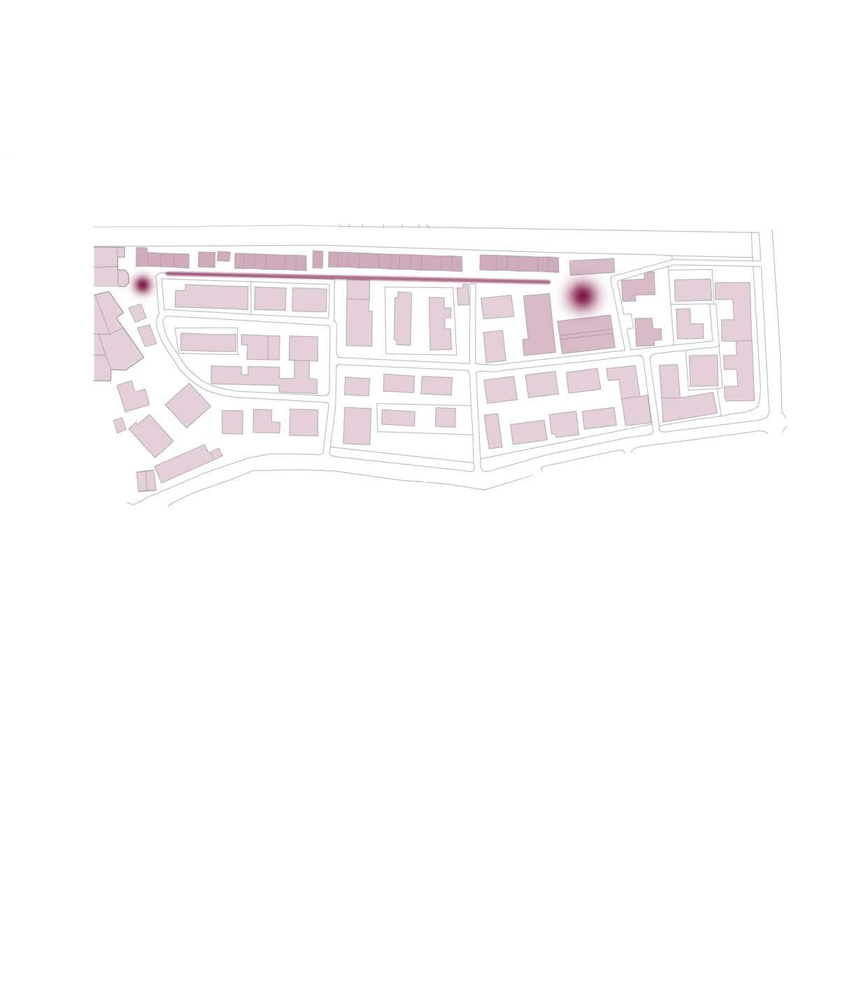
When conducting our community mapping exercise, one of the spaces that received the most positive marks were communal green spaces like the Art Park and the Campal Gardens at the northern end of our zone. Participants mentioned that they would come out of their way to utilise these spaces even if they didn’t live in the immediate area. To us, this demonstrated a high priority for accessible communal spaces in the community.
While speaking to residents of the St. Inez Bandh, we were informed that there were no dedicated play area for the children. Children play in a parking lot at the north end of the Bandh. However, this is a tension point for the residents of the St. Inez Bandh and the residents of the apartment complexes that use this space to park their vehicles. Residents of the apartment complexes have expressed complaints that the children playing in this space will sometimes get in the way of trafc and they are worried about damage being caused to their vehicles.
One resident, who grew up in the Bandh community, expressed very fond memories of how she used to play on the nearby parking lot 15-20 years ago when it was a dedicated play space. To her, it is upsetting that her children
don’t have the beneft of having a play space. This, coupled with responses that we received from our Priority Voting, Emoji Game and Photo Morphing exercises demonstrated the desire for a communal space in this area.
Communal spaces play important roles in communities. They serve as a space for people to use for leisure purposes and most importantly, they create moments for citizens to connect and strengthen their relationships with each other. Communal spaces like parks and community gardens have proven to be important facilitators in bridging gaps diverse groups of citizens. This has been demonstrated by case studies in Denmark where community gardens were introduced to distressed communities and showed success in strengthening social capital by “orchestrating positive meetings between groups of citizens with diferent cultural and ethnic backgrounds and diferent abilities (Agger et al., 2016).” In the case of the St. Inez Bandh, we assumed from observations that the lack of communal spaces plays a role in the isolation of the community within the greater community and city. The addition of communal space has the ability to grant this community the opportunity to have a dedicated play space for children and it can also serve as a space to interact with neighbours from the surrounding community.
146 ST INEZ BANDH | FINDINGS AND PROBLEM STATEMENT
DEGRADED COMMUNAL RELATIONSHIPS
It was easy to speak to the residents of the St. Inez Bandh since most of them could be found just outside of their homes working, relaxing, or chatting with their immediate neighbours. Social capital within the immediate area appeared to be strong but outside of that immediate area, there appeared to be little to no connection with the greater community.
The lack of relationship between the Bandh and the city government was also concerning. Residents shared that the only time they heard from elected ofcials was around election season where prospective candidates would
visit the area to make promises in return for the community’s support. In the most recent election, the locally elected MLA promised to install toilets in the community and he delivered on his promise when construction of the toilets commenced shortly after his election to ofce.
Outside of this, residents shared comments and expressions that suggested an adverse relationship towards government stakeholders. During our last site visit, a home was demolished to make way for public toilets and residents shared concerns that further development would bring the same fate to more homes in the area.

These passive relationships with the greater community and government stakeholders make it easy for the diferent groups to stigmatise each other and it can also lead to communities, like that of the St. Inez Bandh, to not be formally recognised which can jeopardise any sense of belonging and tenure security. During our Photo Morphing exercise, older residents were hesitant to draw changes for their community as they didn’t believe they had any power and hence didn’t see a point in sharing their visions for the neighbourhood. The questionable and insecure tenureship contributes to a degraded sense of belonging and ownership for one’s community.
Empowering citizens to be recognised and actively involved with their neighbours and within governmental processes can help to ensure that their voice is heard and that they are included in decisions that afect their lives.

In the case of the St. Inez Bandh, it could also increase tenure security in the area.
These aforementioned issues are in no way independent of each other. They all interact and infuence each other to a certain extent. While there are other underlying issues and factors that have not been mentioned that also play a role in infuencing the quality of life for residents of the St. Inez Bandh, we believe that addressing the aforementioned issues can empower various stakeholders to push for change within their community.
ENVIRONMENTAL DEGRADATION

Environmental degradation of the creek is an issue that afects the entire city of Panaji, but those that reside closest to the Creek, like the residents of the St. Inez Bandh, are more afected by issues that stem from the poor condition of the Creek. Environmental issues and degradation are more likely to afect marginalised communities. This is a common theme not only in India, but globally as well.
As global climate change persists and worsens, there is a heightened need to address various environmental issues; especially since those
149148 ST INEZ BANDH | FINDINGS AND PROBLEM STATEMENT ST INEZ BANDH | FINDINGS AND PROBLEM STATEMENT
Figure
10.02 - Diagram depicting identifed issues. Figure 10.03 - Entry to parking lot. Figure 10.04 Solid waste in the St. Inez Creek.
issues tend to afect the global poor at greater levels. Unfortunately, some environmental solutions tend to leave out those that are most afected. This theory is termed as “Bourgeois Environmentalism” which has been associated with “directly threatening the survival and other interests of the working class (Bavitskar, 2002).”

One of the aims of UEP is to support and include those that have historically not been included and represented in planning processes.
Through informal interviews and our priority ranking exercise, residents of the St. Inez Bandh have expressed a desire to have the Creek restored and maintained. Unfortunately this is not something that they can do on their own. Besides the obvious issue of pollution, other issues like health concerns and fooding arise from the degraded condition of the creek. Addressing this issue will ultimately contribute to an improved quality of life. Therefore, it is of the utmost importance that this issue is prioritised.
Figure 10.05 A view of St. Inez Bandh, from St. Inez Creek
PROBLEM STATEMENT
Our group formulated the following problem statement to serve as a guiding point for the work that we were doing in this community:
Our group formulated the following problem statement to serve as a guiding point for the work that we were doing in this community:
“Through observations, exercises, and interviews carried out with stakeholders within the St Inez Bandh, it has been demonstrated that this area is struggling with degraded environmental conditions, a lack of communal spaces, and degraded relationships with the greater community. Residents need to feel empowered and have a strong sense of belonging in their community so that these issues can be addressed and the quality of life can be enhanced.”
“Through observations, exercises, and interviews carried out with stakeholders within the St. Inez Bandh, it has been demonstrated that this area is struggling with degraded environmental conditions, a lack of communal spaces, and degraded relationships with the greater community. Residents need to feel empowered and have a strong sense of belonging in their community so that these issues can be addressed and the quality of life can be enhanced.”
This problem statement has helped us to form and test the proposals and interventions that we have outlined in this report.
This problem statement has helped us to form and test the proposals and interventions that we have outlined in this report.
151150
PROBLEM STATEMENT ? ?? ? ? ST INEZ BANDH | FINDINGS AND PROBLEM STATEMENT ST INEZ BANDH | FINDINGS AND PROBLEM STATEMENT
SHARED PROPOSAL


153
ST INEZ CREEK | SHARED PROPOSAL
GOVERNANCE OF ST INEZ CREEK
Governance is defned by the United Nations Development Programme as “the system of values, policies and institutions by which a society manages its economic, political and social afairs through interactions within and among the state, civil society and private sector” (Brown, Alison, 2015). In the case of St Inez Creek, governance is highly diverse, complex, and often conficted with public, private and non-governance actors playing their part. Interactions with internal and external stakeholders as part of the feldwork have
made it clear that groups often are competing due to difering interests in the Creek, and this is a signifcant driver behind its degradation. The Panaji 24/7 Report recognises that multiple agencies are responsible for the Creek, and that “One organisation should accept overall ownership and responsibility” (Royal Haskoning DHV, 2019). A lack of information, distrust and split or unclear responsibilities are emergent features of the system of governance on the Creek.

OWNERSHIP
PRIVATE
Figure 11.01 - Seminar
St Inez
The ownership of the entire length Creek itself traditionally falls under the jurisdiction of the Communidade, a historic organisation of collective ownership that derives from the precolonial period. However, there is legal debate as to whether the national Indian governance system nullifes this, and some members of government consider the State of Goa to be the ‘ultimate’ owner of the Creek. The organisation is therefore in frequent confict with developers who encroach on the Creek, and are currently taking legal action against the government for land development designations they deem inappropriate. The Communidade has to take the role of ‘activist and scrutinist’ with regards to development.
Figure 11.02 -
155154
on the rejuvenation of the
Creek organised by the Chamber of Commerce and Industry.
Governance around the St. Inez Creek. ST INEZ CREEK | SHARED PROPOSAL
CCP & Taleigao Panchayat
Public Works Department
State
Government
North
Goa Planning Authority
State
Pollution Control Board Water Resources Department
Coastal Zone Authority Imagine Panaji Smart City Development Goa for Giving Private Developers Colonies Politicians Activists Communidade Initiates legal challenges for failing to prevent development on Creek Pressure to avoid Coastal Regulation Zone designation Creates Creek Regeneration Report Pressure to reduce barriers to development Sets monitoring priorities away from Creek Policy of concretisation of Creek banks Defines development buffer areas Holds politicians to account + + Informally monitors and reports pollution Communities Pass blame GOVERNMENTAL
NON-GOVERNMENTAL HT E D YNAMICSOF CREEKDEGRADAT I O ...N MTRAPEDSTES E NTALPRIORITIES RESPOND T O STSERETNIDETSEV GOVERNANCE ST INEZ CREEK Failure to monitor pollution
PREVENTING POLLUTION
Many of our stakeholders - both residents and activists - claim that colonies (housing developments) discharge sewage directly into the Creek. The State Pollution Control Board has theoretical responsibility for monitoring and preventing such direct sewage discharges, although the latest water quality samples for the Creek appear to have been taken in 2014 (E R Vikarma S Sawant, 2019). This indicates that their eforts in monitoring are directed elsewhere (most likely under the direction of the State Government) which limits their ability to prevent pollution in the Creek. Activists that we’ve worked closely with have also been in frequent confict with political entities, such as the local Member of the Legislative Assembly (MLA) and Taleigao Panchayat over proposals to concretise the Creek. The Sarpanch (Village Head) of Taleigao has told us that the entire Creek is to be concretised by the Water Resources Department, even though this conficts directly with the aspirations of the Panaji 24/7 (Royal Haskoning DHV, 2019) which emphasise nature-based solutions.
A simplifed diagram of how stakeholder dynamics can lead to the degradation of the St Inez Creek is given in Figure 11.02.
PRESSURE OF DEVELOPMENT
Panaji is a fast growing city, with a thriving tertiary sector and booming population. The Outline Development Plans for Panaji and Taleigao, produced by the North Goa Planning Department, recognise this, with increased allocations for residential and commercial development (Greater Panaji Planning and Development Authority, 2019). This puts land under pressure for development, as evidenced by the colonies that have expanded around Camrabhat in the last fve years. The latest ODP for Panaji includes a fve-metre bufer zone around the Creek which theoretically should limit development and prevent concretisation, if enforced. Some Civil Society activists and national bodies have argued that the Creek should be designated under the Coastal Regulations Zones of the Coastal Zone Authority (Times of India, 2019), which would signifcantly restrict development in a wide bufer zone around the Creek and permit soft edging. However, activists have told us it is ultimately political pressure and the indirect pressure of development which prevents this happening.
Figure 11.03 - A home got removed to make place for public bathrooms, initiated by the MLA

157156
ST INEZ CREEK | SHARED PROPOSAL ST INEZ CREEK | SHARED PROPOSAL
ESTABLISHING A WELFARE ASSOCIATION, OR SIMILAR, TO OPERATE WITH A MANDATE FROM GOVERNMENT TO REHABILITATE AND PRESERVE THE ST. INEZ CREEK WITH A FOCUS ON THE NEEDS OF ADJACENT COMMUNITIES.
WHAT?
A Residents’ Welfare Association (RWA) is a non-governmental, non-proft organisation that is entirely self-fnanced and self-managed. RWAs can be registered under the Societies Registration Act, 1860 (KSR Murthy, 2019) . The
Association would aim to regenerate the Creek as a natural habitat, preserve it, celebrate it through community engagement and focus on meeting the needs of adjacent communities. The Association would be run by its members who elect a board and have voting rights on all decisions made by the RWA concerning the Creek. The Association would have the power to raise funds, directly and through corporate partners, to fund restoration projects and engagement activities. In the long term it can be established as the care-taker of the Creek, with responsibility for decision making delegated to it.
WHY?
One of the biggest issues in regenerating the Creek is the mismanagement between all the authorities and Government Departments involved in actions around the St. Inez Creek. With each of these authorities being responsible for only one small subject concerning the Creek, it is extremely difcult to address issues, draw solutions and make interventions.
A Resident Welfare Association, or similar ‘trust’, can be the solution to this systemic issue. If the RWA takes on the responsibility of the Creek and it‘s mission becomes the regeneration of the Creek, it can have an immense communitydriven impact.
An RWA gives the opportunity to integrate all the stakeholders. Anybody who has an interest in changing and upgrading the creek area is able to join, gain voting rights and take action. The majority of members of the Association will be residents who are negatively afected by the Creek and have a high interest to regenerate the Creek for the sake of their families’ well being. It is important that these residents be supported by stakeholders who hold certain power and are recognised by the wider system of governance, including government departments. Marginalised communities can particularly beneft from being part of a bigger Association which can support their needs.
Figure 11.04 - Bangalore Lake.

CASE STUDY: RESTORATION OF LAKES IN BANGALORE
In recent years, many of Bangalore’s lakes, such as Kaikondrahalli, were “polluted, afected by solid waste dumping, and nearly dry” (Nagendra, 2016) but have since been transformed by local residents. Firstly, they formed ‘lake trusts’, which worked with government and academia to understand the root causes of the degradation of 33 lakes in the city, and “partnered with public authorities to improve the restoration and upkeep of the city’s disappearing and increasingly polluted lakes” (Murphy, 2019). They formed a Memorandum of Understanding (MoU) with the government and were delegated certain decision making powers over the lakes. Through strong and coordinated advocacy with 17 government departments, they have led the social and ecological restoration of the lakes, which have transformed into a “locus of social activity for local residents, and a local biodiversity hotspot”.
159158
RESIDENTS’ WELFARE ASSOCIATION ST INEZ CREEK | SHARED PROPOSAL ST INEZ CREEK | SHARED PROPOSAL
HOW?
In the initial stages, the priority of the Association should be to gather a group of highly committed members from discrete areas of the Creek to agree on a vision and action plan. High-profle initial events, such as Creek ‘clean up’ or participation in the annual Carnival, could help to spark media attention and wider interest from government and other groups. It is likely that individual ‘sub-groups’ along the Creek will have diferent values, and these should also be recognised. For example, many stakeholders in Campal prioritise developing opportunities for outdoor businesses, such as restaurants, to boost the existing tourism sector. However, stakeholders around Camrabhat are more concerned with basic livelihood needs such as food mitigation, sanitation, fshing and children’s education. These should be refected in the mission statements and key performance indicators of each sub-group.
yrs
-
Register society
Promote to possible members
Kick-off event
Concept for activities/workshops
0.52 yrs
Fundraising for workshops and activities
Find possible long-term sponsors Information and education program about the Creek as a natural habitat
Sign MoU with stakeholders
Begin to provide employment for community members
Following registration of the Association as a legal body under Indian law, the group should seek to raise funds and implement projects that show clear early-stage benefts for surrounding communities. The funds could be sourced 2 yrs +
Figure 11.05 Timeline of short-, mid- and long-term interventions
Figure 11.06 - Stakeholder overview

Please see a summary of the wider network of stakeholders in Figure 11.07.
Permanent projects and installations along the Creek
Tourist walking/boating tours
Beautification along the Creek
Maintaining recreational and public
161160
0
0.5
ST INEZ CREEK | SHARED PROPOSAL ST INEZ CREEK | SHARED PROPOSAL
St Inez Creek Welfare Association
Connectedtoexternal

from corporate CSR fnancing schemes (which are signifcant in India), subscriptions, direct fundraising from the community or payments for ecosystems services. The latter is a relatively novel concept, where direct cash transfers are made to avoid pollution and/or mitigate damage. Our stakeholders have recognised all these fundraising methods as holding potential.
Projects should be driven by and refect the needs of communities around the Creek to help build trust and commitment to the Association, using participatory techniques. In the medium to long term, the group should seek to formalise their responsibility for the Creek through MoUs where necessary. In Delhi, the ‘Bhagidari’ scheme ensured that political members of the municipality had weekly meetings with Association representatives, which greatly increased the responsivity of the municipality to community issues. By harnessing the social capital of its members and political connections (especially through Goa ForGiving), the Association should seek to build a similar close relationship with the municipality. In addition to environmental improvements, the Association should seek to generate positive societal outcomes and economic benefts for communities through long-term employment and educational initiatives.


stakeholders and key
RISKS
Discussions with stakeholders have highlighted the risk that powerful individuals can dominate the agendas of such associations. Moreover, sponsorship from large companies can provide an opportunity to upscale projects but raise the risk of ‘corporate capture’. From an early stage, ensuring equal voting rights and defning a strong mission statement can help to ensure power is fairly distributed, especially to community members.
RWA.
163162
Figure 11.07 Potential
partners for the
St Inez Baand Camrabhat Campal St Inez Tonca Communities + Internal Stakeholders + External Stakeholders Goa for Giving Local Architects and Activists Imagine Panaji Smart City Development Ltd Taj Vivanta Local Engineers and Entrapreneaurs Don Bosco College INOX Public Works Department Water Resources Department Corporation of the City of Panaji Taleigao Panchayat Tonca STP Kala Academy St Inez Church Fisherman’s Wharf Goa College of Home Science YMCA Calculo Mall
stakehold ers wi t h M e m o r a n ud sm o f )sUoM(gnidnatsrednU Goa Chamber of Commerce & Industry Figure 11.08 - Stakeholder meeting about the proposed RWA. ST INEZ CREEK | SHARED PROPOSAL ST INEZ CREEK | SHARED PROPOSAL
PROPOSALS CAMRABHAT
Through participatory methods we have codesigned tactical interventions with the community to help improve their livelihoods. They address issues of water supply, fooding and environmental degradation. However, by building on the existing assets of the community they go far beyond this and help foster community cohesion.

165
CAMRABHAT | PROPOSALS
WATER SUPPLY AND PLACEMAKING

PROVIDING THE COMMUNITY WITH A RELIABLE WATER SOURCE AND A VIBRANT COMMUNAL SPACE THROUGH AN INTEGRATED COMMUNITY-CENTRED PLACEMAKING APPROACH
WHAT?
Our participatory feldwork has ‘dug deep’ and discovered the signifcant benefts for residents of a 24 hour water supply system, particularly for women and girls. It has also identifed the social capital generated by women who tend to gather around water points. A visible, locally designed public space adjacent to the Creek, with a decorated header tank at its centre, could help to catalyse the transformation of a neglected part of the community. At such a visible location, it could create an attractive focal point for those entering the site and improve pride and a sense of place in the community.
WHY?
From an early stage, informal interview and site transect walks revealed a low level of on-site potable water storage across the site. Through house visits in the municipal bungalows, apartments and slum dwellings, we learnt that all houses appear to have direct connections to the intermittent water supply system.
However, we saw evidence of only very basic water storage across the site, such as barrels and simple containers within properties which could be used for washing and cooking. Informal interviews showed that it is typically the women in the community who are responsible for flling these. Formal interviews with Imagine Panaji confrmed that the site receives around two hours of piped water supply each day from the Water Resources Department, in common with most areas of Panaji and Taleigao.
Interviews with young women in the community indicated that providing a 24hr supply could transform their livelihoods, which are currently structured around the availability of water for
2hrs in the morning or evening. A 24hr piped supply could open up a range of social and economic opportunities, and it is well recognised in the development sector that “time savings associated with small piped systems and the increased water available... [allow]... women to enhance existing activities and initiate new enterprises” (Van Houweling et al., 2012).
“A water tank would solve lots of our issueswe’d be able to plan our day in a diferent way!” - Teenage girls from Camrabhat
Natural capital in the community is eroded and this is particularly linked to open defecation and poor solid waste management. Through our transect and guided walks, we have observed that illegal solid waste disposal is most acute in areas which are not overlooked by houses or buildings, particularly around hidden areas of the Creek and windowless walls of the apartment. There appears to be an observed correlation between the visibility of spaces and the rate of littering which is refected by academic research (Bateson et al., 2015).
A solution that provides 24hr access to water, and helps to generate and sustain socially productive public spaces, especially for women, could have a positive impact on the community’s livelihoods.
HOW?
Integrating the principles of placemaking
As our end goal was to implement initiatives that responded to the needs of the community, we worked in collaboration with them to defne how they would envision a public shared space, using the principles of placemaking. Placemaking is a human centred design methodology based on the theory of space defned by Canter 1977 and Relph 1976 (De Aguila et al., 2019). It considers place as a combination of materiality, meaning and practises and captures the assets, activities and functions of the community that the public space is built around (Cilliers et al., 2014). In our case, social interaction and water collection were some of the key activities and functions of the community that we wanted to build around, and these in turn help to build internal social capital. Observations indicate that many of the women in the community choose to use outdoor or shared spaces for washing and these turn into natural meeting places. Through a tactical intervention, we could help transform a neglected part of the site into an area that is “made by people doing things according to the meaning they might wish a place to evoke” (Cilliers et al., 2014).
167166
Figure 12.01 A view of the Creek.
CAMRABHAT | PROPOSALS CAMRABHAT | PROPOSALS
PROPOSAL
The proposal is to use a water header tank as a catalyst for wider spatial change. From population of 770 people, assuming a percapita demand of 150 litres/day, a header tank of approximately 115 cumecs could meet the water supply needs of the entire community. It is proposed this is of a standard reinforced concrete construction, and raised at least 5 metres of the ground. Our engagement suggested that only the Water Resources Department (WRD) has the resources and skills for designing and constructing such a large piece of infrastructure.
The run-of water from these outdoor spaces is likely to be contaminated with organics and have a high alkalinity from washing products. Therefore, as part of the wider landscaping around the tank, a run-of water garden down to the Creek would be constructed, within natural fltration using alkaline resistant plants and native species such as Colocasia, Canna Indica and Vertiva Grass. This would be co-designed with close collaboration of local activists and the community, who have experience of using native planting to create green spaces in the area.

The proposal would include an innovative waste centralisation system, which was suggested during a participatory workshop with members of the community, and confrmed during prototyping with civil activists. This would be designed to be in a highly visible and accessible part of the site for municipal waste collection trucks. Children, in particular, would be involved in designing and decorating these to ensure segregation is as clear as possible. Many members of the community work for the municipality in waste collection, segregation and composting, and thus skills in wet and dry waste processing are ready to be harnessed.
It is proposed a small sub-group of the St Inez Creek Welfare Association is formed, with responsibility for maintaining the space and monitoring the performance of the water supply system. This could in turn create opportunities for employment in the community.

169168
Figure 12.03 Children would co-design the green spaces. Figure 12.02 Stakeholder overview. CAMRABHAT | PROPOSALS CAMRABHAT | PROPOSALS
Public washing and bathing area
115 cumec water header tank with opportunity for regular art installations Existing Panchayat public toilet


Drainage garden with native planting of Colocasia, Canna Indica and Vetiver Grass.


Potential pay-per-use safe drinking water dispensing system


Figure 12.04 - Section of water supply and placemaking proposal in Camrabhat.


Public seating and play area Waste collection, separation and composting area
Figure 12.05 - Placemaking


centre of Camrabhat community.

171170
proposal for
12.06 - Section of water runof garden


garden
Potential pay-per-use

Creek.
Form water supply and plac making sub-group within the St Ine Creek elfare ssociation
Coordinate with Imagine Panaji to lobby the ater Resources epartment R to construct an on-site header tank


Memorandum of Understanding

MoU signed with CCP and community to use the land for the header tank and as a community space
Utilise young people for fundraising in and around Camrabhat
enerate media attention ost e tensive co-design wor shops with community hosted by local activists
Construction and commissioning of the header tank through the


Transfer of day-to-day operations to the elfare ssociation
Construction of the community washing areas and public spaces coordinated by local civil activists ost art project on the bridge and tank

PROTOTYPING AND REVISING
Local civil activists explained that our water tank proposal should ft into a wider system of interventions that helps to address problems of solid waste management and unemployment. Following this feedback, we integrated an onsite waste collection and sorting areas as part of the proposal, with the potential for harnessing local skills to sort wet and dry waste on-site. Moreover, they suggested integrating on-site composting to support a vegetable garden, enhancing food security, nutrition and provide sustenance for the goats. The community were extremely supportive of the overall concept, and confdent that both the water tank and outdoor space would be well used. The photomontage of the site appeared to give them pride in a potential opportunity for beautifcation of Camrabhat.
nnual repainting of the tank driven by local children Tank used to advertise local festivals and events
The children (both boys and girls) were enthusiastic about having a well-maintained outdoor space, and suggested they would use it for meeting friends and for playing badminton, football and cricket. They suggested some more formal play options (slides etc.) could be benefcial. However, the mantra from both parties was “any change is good, as long as it actually happens”.
Figure 12.08 - Timeline of short-, mid- and long-term interventions.
173172
2 yrs + 0.52 yrs 00.5 yrs
R
CAMRABHAT | PROPOSALS Drainage
with native planting of Colocasia, Canna Indica and Vetiver Grass. Public washing and bathing area 115 cumec water header tank with opportunity for regular art installations
safe drinking water dispensing system St Inez Creek Figure
between water tank and the
Figure 12.07 - Render of water tank proposal.
Engagement with Smart City Fellows indicated that a commercial drinking water dispenser could be attached to the header tank, could be a viable opportunity to generate on-going revenue from sales. They suggested that such schemes are often successful in poorer rural areas, with the initial capital coming from corporate CSR funds.

RISKS
“Panaji 24/7”, is a project outlining the steps to achieve a 24-hour water supply system (Royal Haskoning DHV, 2019), and there is a risk this scheme could make a header tank unnecessary. Whilst the more optimistic of our stakeholders evision the works will be completed within two years, we feel it will be unlikely to meet the water supply needs of Camrabhat in the medium term and that the community has a right to reliable and safe water in a short time frame.
Our participatory feldwork has raised the risk of any landscaped area becoming re-polluted with solid waste and open defecation. There is a serious chance of this, based on the low levels of pride observed and the past experience of a local activist who created a vegetable garden. Implementation of the landscaped features should take place in a phased approach and be driven, designed, owned and maintained by members of the community.
NATURE BASED SOLUTIONS FOR FLOODING AND POLLUTION

MITIGATING FLOODING AND WATER QUALITY DEGRADATION THROUGH BOLD NATURE-BASED SOLUTIONS IN CAMRABHAT
WHAT?
Bold solutions that work with the natural environment and provide year-round value for surrounding communities could mitigate the tragedy of annual fooding which afects the community at Camrabhat.
It is proposed that large attenuation ponds are built on Communidade land upstream of the community, managed by the Welfare Association for the beneft of people living on the Creek. Flood attenuation ponds can support “aquatic vegetation along their shoreline, which helps enhance treatment processes and has amenity and biodiversity benefts” (CIRIA, 2015). The proposal also has the potential to bring signifcant economic benefts to both the Communidade and community, as well as social and heritage value to the wider Panaji area.
WHY?
The community at Camrabhat have consistently ranked fooding as the most serious issue afecting their livelihoods. By ‘digging deep’ into the issue, our participatory feldwork revealed that their fnancial, physical, social and health assets are vulnerable to foods that occur near-annually. Severance from their place of employment, destruction of electronic goods and dengue fever are just some of the implications. The issue has eroded trust in the wider governmental and political system. As described, the community sits close to the foot of the Nagali hills, and natural and artifcial changes over the past 10 years have created impermeable barriers which direct surface water fows directly into the community. Downstream
175174
Figure 12.10 - Native birdlife in Goa which thrives in wetlands. CAMRABHAT | PROPOSALS CAMRABHAT | PROPOSALS
Figure 12.09 Example of a decorated water tower in Sweden.
fows are severely restricted, and this leads to water pooling. The issue is likely to get worse, as monsoon rainfall becomes more intense and concentrated due to climatic changes


It was clear to the team that the issue required rapid, but sustainable solutions. It would feel unfair to expect the community to wait for Creek-wide solutions such as replacing bridges and culverts, creating green bufer zones and installing green roofs along the length of the Creek, as proposed as part of Panaji 24/7 (Royal Haskoning DHV, 2019). Whilst these may be sustainable, nature-based and provide wider community value, the timescale for benefts to be realised is unlikely to be acceptable. It was clear to the team that the issue required urgent resolution to retain any semblance of trust with the community.
Through informal interviews, residents from all parts of the community place the blame on upstream and downstream colonies for diverting foodwater and restricting downstream fows. However, a formal interview with a local engineer with an understanding of the local context revealed how impermeability of the upstream catchment leads to a loss of water storage. Attenuating and containing the foodwater shortly upstream from the community would be a big part of the solution
for fooding, and would not be dependent on far more complex and costly proposals. Moreover, the land upstream of the community is abandoned for much of the year, and appears to bring little economic beneft for the vast range of cultivators. Options for attenuating foodwater were explored in a prototyping workshop with local activists, and it was agreed that whilst mitigating fooding was a given, any solution would also have to provide social and economic benefts for both the landowner (Communidade) and the community itself.
177176 CAMRABHAT | PROPOSALS CAMRABHAT | PROPOSALS
Figure 12.11 - Native wetland habitat.
Figure 12.12 - Stakeholder overview.
HOW?
Simple rainfall run-of calculations and an assessment of the upstream catchment area (in the absence of detailed hydraulic data) have demonstrated that around 80,000 cumecs (m3) of storage could be sufcient for mitigating fooding in Camrabhat during a typical 3-inch storm in the monsoon season.
It is proposed that two attenuation ponds of around 40,000 cumecs each are constructed in the semi-abandoned agricultural land upstream of Camrabhat. These would be around 400 metres across, with a varying depth of around 0.75 metres. Automated sluice gates of Goan design (which have been in use in Goa for thousands of years, well before the colonial period) would allow water in and out of the attenuation ponds. Local activists have advised us that planting of native Colocasia (elephant ear), Canna Indica and Vetiver grass in and around the attenuation ponds would maximise aeration and the growth of bacteria that break down organic matter. Canna Indica, in particular, is highly resilient to untreated sewage and can absorb excess nutrients which would otherwise lead to eutrophication (Karelia, 2018).
The scheme could have signifcant economic value for the local rural community. Many residents of Camrabhat used to fsh as a source of sustenance, and with careful management of water levels the attenuation ponds could become a valuable source of freshwater fsh, if the community were empowered in techniques on how to manage and cultivate them. The scheme could also have enormous heritage value. With 98% of the population of Panaji working in the tertiary section, knowledge of the bunds (dykes), sluice gates and nalas (irrigation channels) that formed the landscape of Goa for thousands of years is at risk of being lost (India Water Portal, 2019). These features would all form part of the attenuation ponds, and by partnering with organisations such as the Goa Science Centre, knowledge on the construction and management of such features could be passed on to the next generation.
Very early-stage co-design should be undertaken with the community of Camrabhat and the Communidade, with sub-groups such as women and those of religious minorities consulted separately. This would help to ensure the traditional knowledge of the community is pooled to maximise the co-benefts of the scheme. Due to the scale of the scheme, overall construction should be the responsibility of the Public Works Department (PWD). Given that
the PWD appears to have little experience of managing larger social schemes, a Memorandum of Understanding (MoU) should be signed with the St Inez Creek Welfare Association to hand over key decision making power to them, along with other key social institutions in the city. The Communidade would continue to be the owner of the land, and would retain the right to most of the economic benefts of the scheme.
PROTOTYPING AND REVISING
00.5 yrs
Form sub-group within the St Ine Creek elfare ssociation ork with Imagine Panaji to build on previous work to rigorously identify root causes of flooding Raise finance from C I CCP Taleigao Panchayat and elfare ssociation
ost e tensive co-design work shops with community hosted by local activists
Install aeration units in upper St Ine Creek on trial basis
Construction of attenuation ponds by ater Resources epartment
0.52 yrs
Feedback from civil activists demonstrated the critical importance of the ponds providing an economic beneft for the Communidade and the community, and therefore we revised our plan to build-in freshwater rice paddies, fshing and educational opportunities. Feedback from a local engineer highlighted the challenges of the cost of the land and the very fat topography. Depending on negotiations with the Communidade, he explained that if there was a need to purchase land it would likely be more cost-efcient to install deeper attenuation tanks with pumps, and therefore we identifed this as a risk. The community were highly supportive of the proposal - including the opportunities for fshing and leisure. However, they did say that it should not take precedence over improvements within Camrabhat itself, such as construction of a water tank. 2 yrs +
12.13 Timeline of short-, mid- and long-term interventions
Upskill community members for monitoring
ost workshops with young people for planting in and around the attenuation pond
Review performance of aerator units and if necessary re-negotiate funding for maintenance
Continue to monitor and report on flooding and water uality with upskilled community members evelop economic infrastructure around ponds consider additional investments in a visitor centre
179178
Figure
CAMRABHAT | PROPOSALS CAMRABHAT | PROPOSALS
RISKS
There is a risk that the community of Camrabhat does not trust the Public Works Department to deliver the scheme or that it is not a sustainable solution to fooding. Empowering the community to infuence the scheme, combined with engaging education on the drivers of fooding, can help to mitigate the risk of scheme failure. One of our local contacts, an engineer, has informed us that land in the agricultural
area could be valued at upwards of 60,000 rupees / metre squared and that purchasing the required land would be unafordable. Therefore, buy-in of the Communidade to such a scheme is therefore absolutely critical, and they should be empowered to drive it in a direction that brings them more economic beneft than they gain at present. During the dry season, if the environmental base fow from the Nagali hills is too low, then there is a risk of the pond becoming eutrophic.


Traditional
Sediment


Seasonally


Traditional Goan outlet sluice

181180 0.75m 1m Top water level in rainy season Permanent pool
flooded pool with seasonal rice paddies
Goan inlet sluice gate (occasional maintenance)
gate (occasional maintenance)
forbay (occasional dredging) Colcasia, Carna Indica and Vertiver Grass (aeration and biological oxygen demand reduction) Freshwater fish stocks Traditional Goan bund, stone, clay and straw Planting topsoil Clay layer to prevent contaminated ground water infiltration 0.25m Figure 12.15 - Section of atenuation ponds proposal in wetlands.
Figure
12.16 Render
of atenuation ponds proposal in wetlands.
Figure
12.14 - Fields of Taleigao.
PROPOSALS ST INEZ BANDH
Our proposals and initiatives have been drafted to best meet the needs and issues identifed throughout the course of our feld work. Each group has drafted their own proposals as a response to the unique complexities that make up their focus areas.

183
CREATION OF A COMMUNAL SPACE TO PROVIDE RESIDENTS WITH A DEDICATED AREA FOR LEISURE AND SOCIALISATION.
WHAT?
As we have identifed in the area through observations and interviews, there is a lack of communal space in the St. Inez Bandh. Most of the residents in the Bandh like to use the space in front of their homes to socialise and play. However, the introduction of toilets in this space leaves even less room for the aforementioned purposes. This makes it necessary to use other spaces, like the parking lot at the north end of the Bandh, for those activities. According to residents, this parking lot at one point used to be a park. With the state of Goa having one of the highest rates of vehicle ownership in India, it was only natural that vehicle owners would seek out any space available to store their vehicles. Unfortunately, this resulted in the sacrifce of
the space that used to be a communal space. However, children in the area still have a desire to use this space for play. As a result, this has created tensions where diferent stakeholders disagree on how to use the space.

WHY?
As mentioned previously, communal spaces are important facilitators in bridging gaps with diverse groups of citizens. Having dedicated play spaces is also a matter of safety when it comes to children.
The need for a communal space was a consistent theme throughout our methods and observations. The Photo Morphing exercise showed that this space was something people cared about and wanted to see change in. Participants in this exercise added things like benches, lighting, more trees, and children sometimes drew their own playground equipment to add to this space. This resulted in a follow up exercise where we asked kids to plan out their ideal play space through drawings. Again, it was stressed to us that this space could be planned out better in a way that provides residents with a space to park their vehicles but also a space for people to gather.
Residents also shared with us that they liked to use this space for celebrations and festivals. In the weeks leading up to Diwali, we would come across young adults using this space to create molds for their “Narkasur” fgures. These were large, colourful papier-mâché fgures that would be burned during the celebrations.
With all the diferent uses of the space, and the opinions shared from the residents, we
recognized a major opportunity with the parking lot. By creating a communal space, this could provide children with a safe play space and it could also create a space where residents from the diferent housing complexes can gather and socialise. It also provides residents of the St Inez Bandh with an opportunity to be a stakeholder in a project that gives them a greater feeling of ownership over their community.

185184
PARKing LOT Figure 13.01 - Parking lot with children playing ball. Figure 13.02 View on the parking lot from the north end. ST INEZ BANDH | PROPOSALS ST INEZ BANDH | PROPOSALS
HOW?
1. Provision of new parking space : While the concept of a picturesque park sounds appealing, it might not go over well with people who fnd parking there convenient. To understand the usage better, we had conducted an observational exercise to track the mobility which showed that only half of the lot was occupied by vehicles, except on a few instances. While this gave us the idea of limiting the parking space within the park, we also need to take the peak hours into consideration
Looking for an alternative parking space, we noticed that a pocket of space (A) right opposite to the north end of our lot, was currently being used as a garbage dump. If we can clean this space, it can be modifed into a parking space. There are also a handful of abandoned vehicles on the lot which could also be cleared for usable space. This project can be taken up by our social activists with some voluntary help from the residents.
the Bandh, it was evident how they wanted the freedom to spread out and be more comfortable with the space. Hence our next intervention is to evenly segregate the play area (B) from the parking area (C). We can simply achieve this by using easy to move, existing props (potted plants/ benches/ poles/sticks) to create a physical barrier between them.
A hands-on workshop could help determine the best way to divide the space in a manner that’s agreeable to all stakeholders involved. This can be held with the cooperation of the

2. Workshop for fexible division of lot (Short term) : With a better planned parking system in place, people would be more open to changing the physicality of the bigger lot. After our “Drawing Exercise” with the kids of

187186
A B C
Figure 13.03 - Stakeholder overview. Figure 13.04 Proposed short-term plan. ST INEZ BANDH | PROPOSALS ST INEZ BANDH | PROPOSALS
residents, while being facilitated by one of our social activists. This step is short-term, a means to get people comfortable with the idea, and garner constructive feedback. Thus it would be important to have few stakeholders assess the functionality of the changes as constant followups will be essential towards the success of long-term development of the site.
transforming the park half (B) into green space with added infrastructure such as swings, slides, benches, shades, planters. All these changes are grounded by the drawings generated by the kids, and the desire of the adults to have an area to relax at. Stakeholders with access to resources, capital, and a familiarity with governmental processes would be vital to the success of the project at this phase. It would be important to ensure that stakeholders like NGOs / Local Activists are collaborating with stakeholders like Imagine Panaji or the CCP.
Follow-up : Maintenance is a key aspect in implementing the park concept. This would be reliant on the CCP or other government stakeholders providing the resources or capital necessary to maintain the park. Waste bins should be provided, used strictly, and collected timely. Or else the existing situation of careless garbage dumping will continue and disrupt all the eforts.
3. Integrating green surfaces (long term) : After the plan passes certain rounds of improvements, we can move on to more permanent implementations. The current hard ground cover takes away from the value of a communal area. Hence we propose,

If there are signs of success, the greenifcation drive can be continued to more pockets. One possibility is to extend towards the north-west zone,so as to form a pedestrian connection with the green patch along the creek (D- exists currently, but in neglected state).

188
Figure
13.05 Possible solution for a short-term pilot project. Figure 13.06 - Proposed long-term plan. C B A D ST INEZ BANDH | PROPOSALS
00.5 yrs
Public forums to introduce the plan to residents
Clean up the northern pocket for parking space

Conduct hands-on workshop for short term division B
ssess implications of changes and incorporate feedback
FEEDBACK & REVISIONS
0.52 yrs
Formulate the long-term change et funding to add furniture in the area
Include more stakeholders such as local authorities Move garbage out of area through a better waste collectio system

With visuals for both our short-term and longterm proposals in hand, we set out to get some opinions from our residents. The response was largely positive, as kids and adults alike were excited to imagine a space dedicated for their leisure time. It was exciting to see their approval on starting out with the smaller changes, as that meant they understood the process, rather than just focusing on the fnal outcome. Despite the enthusiasm of many, some addressed their concern over their lack of power to actually materialise changes. Being a valid point, we emphasized on how keeping the hands-on workshop fexible would help get support and input from everyone associated.
Some of the younger adults and children expressed concerns over losing play space as they would only have one half of the lot as opposed to the entire lot. While this may have been attributed to the scale of the renderings, we wanted to take these concerns into consideration as well. We thought that looking to the extension of the park into the entire lot would be a feasible solution for this. One of the goals that is part of the City Development Plan for Panaji 2041 is to address the issue of parking throughout the city. Once the city develops a plan for more comprehensive parking throughout the city, there is a greater possibility of extending this park into the entire lot. This would leave room to dedicate more area to this communal space proposal.
RISKS
Being temporary fxes, the short-term plan poses low risks. If at any point there is major confict, the space can easily go back to its current state or can be modifed to appease all stakeholders. More concerns could arise during the long term implementation, as it demands funding as well as skilled labour. Moreover with many stakeholders involved, sudden resistance and contradictions are possible at any stage. Hence it should be important to maintain a unifed vision amongst various stakeholders and to ensure that all residents are involved in the planning process.
+
Change ground surface B dd greenery and utilities for the space

2 yrs
versee parking activities C and remediate initial conflicts valuate the feasibility of e tending communal greens towards the creek
mid- and long-term interventions.
191190
Figure
13.08
Cars parked under the trees in the parking lot.
Figure 13.10 Possible solution for a long-term intervention.
Figure
13.09
- Solid waste in the south end of the parking lot.
Figure 13.07 Timeline short-,
ST INEZ BANDH | PROPOSALS ST INEZ BANDH | PROPOSALS
BIOSWALES SYSTEMS

USE OF GREEN INFRASTRUCTURE TO INTEGRATE AND FACILITATE NATURAL FILTRATION IN THE CREEK.
WHAT?
A prominent natural body such as the St. Inez Creek demands a natural approach. Bioswales are one such natural solution that can help improve and add value to the overall scenario of the Creek and Bandh settlement together. We are proposing to integrate patches of Bioswale Systems adjacent to the Creek, and involve the
Bandh community throughout the small steps leading onto its successful implementation.
Bioswales are basically vegetated green infrastructure in the form of pit gardens. They are widely known to curb stormwater fooding while fltering it out. Structurally, these gardens run in a linear fashion with gradual slope on one or both of its sides. This construct is intended to channel rainwater run-of directly into the pits created in the centre. The gradient of the slope should not be more than 5% (Clark, 2008) so as to control the velocity of water fowing in and
controlling the risk of erosion. Once the water is collected it naturally seeps into the soil and is fltered by the roots of the plant growth. An additional fltration layer added to Bioswales would be of sand/gravel/rock. While this fltered water can be simply left to be absorbed as ground water, in our case it would be benefcial to use it to replenish the Creek.
WHY?
It takes no expert to see that the St. Inez Creek is in a terrible state. Through our initial participatory methods, we started a dialogue with the community about their relationship with the Creek. Being such a salient part of their environment, it was only natural to hear the adults sadly express their helplessness over the poor condition. People shared their vibrant stories of fshing, swimming and boating in the water body just 10-15 years back. Hence it was obvious that this drastic change cannot and should not be ignored. There is a dire need to act on it. Not only to revive the community’s glorious past, but also to prevent a future of worsening health, social and natural environment.
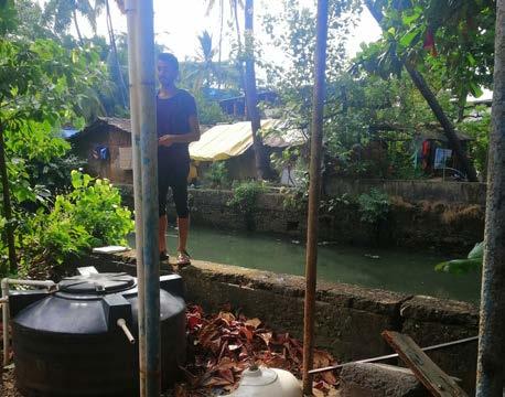
interconnected web of contributors that are all consequently adding up. With our proposal, we are tackling one of the major pollutantsmismanaged storm water.
The paved surfaces of St. Inez Bandh, are impermeable in nature. Meaning, when rainwater comes in, instead of going into the ground it is redirected into the drainage system. Unfortunately when this happens, the run-of collects everything on its way (plastic, paper, leaves, mud, oil, chemicals, etc) and it fnally accumulates in the Creek. If we use Bioswales as a barrier for pollutants, we can efectively use rain-water as a means to continuously infuse the creek with clean water.
Throughout its length, St. Inez Creek passes through various locations. Thus the deterioration process cannot be pinned to one factor. It is an
193192
Figure 13.11 - Diagram of Bioswale.
Figure 13.12 - Backyard looking onto creek.
Gravel Rock Clean water
Sand Plants
Stormwater
ST
INEZ BANDH | PROPOSALS ST INEZ BANDH | PROPOSALS
HOW?
1. Awareness Program: Since integration of Bioswale is a physical intervention, it requires complete support by the residents as much as the authorities. With tenure security already being a sensitive topic, this proposal of utilising their backyards should not come of as a threat. The success of the project relies on ensuring that the targeted group is well aware of the system and its benefts. Once they are convinced that the project is actually taking their betterment into consideration, they can become key players throughout the process.
This can be facilitated by the local community teacher and social activists. While the frst is already a trusted member of the community, the latter is well experienced with technical knowledge to communicate the idea efciently.

2. Backyard Clean-up and Bioswale Construction: We have already discussed the on-going government initiative of relocating the backyard toilets to the front. While this has received both negative and positive responses from the community, it is something that we need to accept and take into account of. The next step would be to now focus on cleaning up the cleared backyard so as to make it suitable
for bioswale construction. Patches of 1m adjacent to the creek should be dug out, flled with fltration layers, vegetated, and connected to outlet pipes into the creek. This involves funding, and technical construction experts and labour. Stakeholders like Imagine Panaji could drive this phase.
3. Permeable Paving Materials : While it is understandable that all surfaces cannot be transformed, it can certainly be done for some portions. And if we look at the St. Inez Bandh, we can see that the pavers in place do need renovation already. Hence it makes perfect sense to utilise this opportunity to introduce permeable materials in the front yards. This will help naturally recharge groundwater, put a control over the erosion in Bioswale, and mitigate fooding in the Creek. Since the backyard runof is being directed into the Bioswale anyways, they may be refurbished with typical pavers.
4. “Adopt a Bioswale” Initiative: For Bioswales to continue working efciently, they should be maintained such that sediments, pollutants and overgrowths/undergrowth does not disrupt their fow. The best way to do this is to involve the community in the task. Since Imagine Panaji, as an organisation has high interest in reviving the Creek, they can use their resources to
195194 Figure 13.13 Stakeholder overview.
ST INEZ BANDH | PROPOSALS ST INEZ BANDH | PROPOSALS
support and introduce schemes such as “Adopt a Bioswale”. The plan is to allow organiations to “sponsor” a stretch of bioswales by providing capital and/ or resources or providing labour to ensure the maintenance of the Bioswales. The Taj Vivanta has expressed that its staf regularly participates in volunteer projects and given the proximity of this stakeholder to the St. Inez Bandh, it could be benefcial for stakeholders like the Taj Vivanta to participate in this initiative.
It is crucial to formulate and get across this idea to the community before the completion of the construction phase. This would help ensure there are no gaps in the system, and there are
actors ready to take responsible charge as soon as the Bioswales are ready to be used.
5. Home Composting Units: While there is a garbage collection system in place, there are gaps in it which allow people to exploit the Creek and dispose their waste into it sometimes. A core strengthening of waste management system is required as a whole. But subsequently something needs to be done to discourage residents to rely on the Creek. Often wet kitchen waste is the most pressing to dispose of due to the smells that they can emit. Hence home composting bins can be a simple savior. The recycling market now has provisions of easy to
Figure 13.14 Rendering of Bioswale proposal.

use bins that are sized appropriately for home uses as well. These bins come at the price of approx Rs. 1000, are odourless due to anaerobic process, and can provide manure in after the frst 4 weeks of collection (TrustBasket, 2017).
The manure generated can then be used to fertilize the Bioswales. If we introduce this concept of “waste as a product” during the construction phase itself, the residents will be more receptive to the whole process. Once again the community teacher, and social activists have to come into play to generate awareness, while Imagine Panaji and private/ public can be core players by providing the initial investment/ management of funding for the bins. To be more economical, the bins may be shared among 2-3 houses.
The rejuvenation of the Creek is certainly not an easy task. But if all associated players put in their parts, it is truly possible to bring forward positive results. The revival of the Creek will beneft everyone at the end of the day. Hence our ideas need to be translated into one common agenda and communicated efectively to the stakeholders through a step by step process. Once the implementation stage is completed, it is vital to follow up and make reforms where necessary
Figure 13.15 Timeline of short-, mid- and long-term interventions.
00.5 yrs
Follow up on the toilet relocation project
Conduct awareness program on Bioswale to gain trust of residents
Start process of clearing the backyards
Technical planning for Bioswale construction phase including design and funding schemes
Planning for pavement renovation
0.52 yrs
Initiate construction of Bioswales and follow up till completion Renovate the pavements but in small phases so as to not disrupt the daily lives of the community Introduce dopt a Bioswale scheme and formulate logistics with engagement of community ome composting units awareness programs with demonstrations and provision of bins
Follow-up on the performance of the working Bioswales
Reforms if needed
2 yrs +
Follow up on the dopt a Bioswale scheme and garner support for further e tension of the program
Further implement Bioswale on the other side of roads and other parts of the Creek if signs of success
197196
ST INEZ BANDH | PROPOSALS ST INEZ BANDH | PROPOSALS
FEEDBACK & REVISIONS
Going back to the community for feedback on our proposals was a core part of our process. It was important that we demonstrated our proposals and gave community members the opportunity to share feedback with us. For us to be able to convey our ideas well, we decided to create visual models of the Bioswale integration. While the future scenarios could help people associate with the prospective location, we opted to make a simple Bioswale prototype. In this case, we created a model that consisted of a cut-up plastic bottle as container and soil, gravel and a plant made up the layers. It took us nine tries before we could mimic the efect to a level, and with that we compiled a time-lapse video to demonstrate how the Bioswale could work.
Entering the community, we had our doubts about whether or not the Bandh residents would understand/agree with our proposals. While the start of the feedback process was a bit dull, we slowly started getting positive responses. As we showcased our proposals, we gave them the option of voting “thumbs down”, “thumbs up” or “not sure” for the proposals. Despite 86% thumbs up, and remaining “not sure” responses, it was also clear that not everyone could grasp the concept completely. To us,
Figure 13.16 - Prototype of a Bioswale.


this emphasised the need for an awareness campaign to ensure that we have the support of the residents by explaining the benefts and features of this system. In response to this, we made an awareness campaign part of our proposal and included stakeholders that could facilitate that. Some residents also showed the concern of child safety during construction and doubts on the possibility of such a change, where we had to highlight their roles as active actors. Other than that, the general outlook was encouraging, as they too saw and agreed with the benefts of the proposal.
RISKS
The construction process is bound to be a time-consuming process, especially since it has to deal with old pipelines. The initial resistance from stakeholders can be mitigated by communicating the universal intent of our project. But keeping them motivated throughout the long operation can prove to be challenging. To prevent this, we would aim to keep the process as transparent as possible, such that everyone is able to check in and track the stage of implementation. Even if it is just in the planning stage, letting people into the conversation helps maintain their trust.
199198
Figure
13.17
- Overview of Bioswale proposal.
ST
INEZ
BANDH | PROPOSALS
ST
INEZ BANDH | PROPOSALS
REFLECTION
Scientifcally speaking refection is the change in direction of waves when the strike the border between two media so that the waves return to the same medium they originated from (Britannica, 2019). Our knowledge, perspectives, actions and opinions towards certain things are like these waves. We came all the way to India, hit the surface of hard facts and will return to where we originate from. But the direction of our knowledge, perspectives, actions and opinions will have changed.
The next section will give a brief insight into our waves, where they came from, which borders they hit and how their direction changed.
201
ST INEZ CREEK | REFLECTION
REFLECTION 1 - WORKING IN A ‘POST TRUTH’ SOCIETY

Our feldwork in Camrabhat was flled with surprises, but was initially dominated by a sense of helplessness and confusion. We appeared to have great difculty collecting and verifying information from inside and outside the community, and found it hard to know who or what to trust. The truth around important subjects such as water, sanitation, ethnicity, family structure, tenure and others appeared to be fexible and ‘up for grabs’. Diferent members of the community appeared to be telling us completely diferent things about the same subject. The same phenomenon occurred when we did formal interviews with people outside the community, especially around important topics such as land ownership and tenure. We learned that, often, people weren’t intentionally lying or obscuring the truth - they simply didn’t have access to information and were just saying something to be polite. A lack of information is surely part of the fabric of disempowerment.
In other cases, a sense of ‘research fatigue’ in the community appeared to make them reluctant to talk about the truth. They might feel that sharing information around aspects of the community of which they were ashamed could reinforce stigma for their friends and family and bring them no beneft. We realised that withholding information, and misinformation, when seen critically and in its wider context, could tell us a huge amount about the attitudes of people about their community.
These insights also led us to be refexive about our role there. The community has been studied so much in the past (by government organisations, the Rotary Club, and other) and promises have been made but almost never fulflled. Do we have any right to be a part of the community when we can’t promise longterm change, but expect them to be willing participants in our academic studies?
REFLECTION 2 - “THERE ISN’T ANYTHING WRONG HERE”

After sensitising ourselves to the community, we started digging deeper into the livelihoods of the people that live there. Initially, each time we asked people about aspects they didn’t like in the community, a typical response would be “everything is fne... there are no problems here”. However, we quickly understood that the almost complete absence of pride in the community could mean that they didn’t want to fully open up about their livelihoods, including the aspects which could be seen as negative. Our response to this was to focus on “value-based and developmental planning” - and to dig deep from a positive, asset-based approach instead. We started asking people about what they had, took a greater interest in positive aspects of their livelihoods, and were subsequently given deeper access to insights about their lives.
REFLECTION 3 - COUNTERING BIAS AND CHANGING PERSPECTIVES
We found that personal and institutional biases played a big role in our early situational analysis, and that we made assumptions about the needs and desires of the community which didn’t refect reality. For example, we initially found it interesting and quite saddening to observe that boys and girls rarely played together, and that girls were restricted to one small area or were totally absent from public spaces. We considered that helping girls fnd more safe places to play could be one of our priorities, and assumed that when they told us that they didn’t play with the boys this was an ‘issue’. However, refecting on our own experience of childhood we realised there were similaritiesand that perhaps, like us, 11 year old girls would rather strengthen their own social networks by chatting in the privacy of their own homes. This, again, led us to challenge how we approached fnding out about people’s livelihoods and perceived issues, and how focussing on their values and perspectives can better help to frame livelihood needs.

203202
ST INEZ CREEK | REFLECTION ST INEZ CREEK | REFLECTION
REFLECTION 4 - WHO IS OUR CLIENT?


Trash, dirt, dust, sweat, pollution – normalcy?
Doing this feldwork in India has defnitely been a time of curiosity, incredulity, acceptance and questioning. Getting invited into a community and learning about their everyday challenges can be very overwhelming and at the same time feeling grateful for the privileges we enjoy. One of the best experiences that I value a lot is how warmly we were welcomed by the community and how engaged especially the children were in our activities. Witnessing laughing children running from one house to the other to collect their friends, women sitting together to prepare dinner and neighbours helping each other out makes me realise that living in a working community can be of higher value than running water and fush toilets.
REFLECTION 5 - OVERCOMING CULTURAL BARRIERS
For me, this feldwork has been a one-of-a-kind educational experience. I defnitely enjoyed the times that we were out in the feld working with the residents. They had a genuine interest in talking with us and sharing their views on ways to improve the quality of life in their community.
REFLECTION 6: BRINGING A COMMUNITY TOGETHER
REFLECTION 7: SMALL INTERACTIONS LEADING TO BIG CHANGE
Facing the end of this feldwork and designing concrete solutions raises the question “Who is our client?”. Is it the University, our community or the Smart City Mission? Wrapping up the proposal it was somewhat challenging to fnd a balance between these three parties which leads to frustration and fnally a sense of resignation as this remains unsolved.
At frst, I was a bit worried that the language and cultural barrier would prevent us from being to capture any meaningful insights. But the genuine interest of the community members and my group’s ability to respond to challenges in the feld really helped us to overcome those challenges. The assistance of our team members from SPA Delhi really helped us to create best practices that would allow us to better work in the feld. Patience and a will to be mentallyfexible are assets that are defnitely necessary for success in this course.
The day we arrived in India, I didn’t really know what to expect for the next three months. I felt I came to Panaji with a blank mind, with a lot to learn. The frst few days of feldwork I was selfconscious and a bit worried about how people would react to be questioned about their lives, from random strangers. To my surprise during these months, people have been more than willing to tell us about their lives. By spending time with the community, I slowly felt their openness, which made me more secure in how I could interact with the people. One time I remember particularly is the day we did the photo morphing exercise, which made the whole community come together, and discuss their living areas. This event was valuable to our feldwork, but it also felt that we brought something back to the community. We have had several moments like this, but the most valuable lesson I’ve learned is to spend time in the area, to get to know the diversity of individuals in an apparent homogeneous space, which will afect how change can get through.
It is amusing to think that we almost never discovered the St. Inez Bandh community, our focus area. We stumbled upon the stretch on a random day of “walk and empathise”, with a bit of hesitation. Now it has become our comfort zone.
This feld work has truly put all our skills to test, because on the real ground, you cannot be prepared for everything. Interacting with real people with real problems always felt like a huge responsibility. While this made us doubt our potential at times, it also made us push harder and try out new things. It still surprises me how well the community women and kids opened up to us; inviting us into their homes as if we were their own people. This certainly gave me and my team the zeal to put in more efort into our work, even when tasks seemed challenging. As we head towards the end, I have accepted that we may not change the face of the place, but have learned the value of small initiations. Hopefully this is something all of us can build on, including the St. Inez Bandh.
205204
ST INEZ CREEK | REFLECTION ST INEZ CREEK | REFLECTION
CONCLUSION
After three months of feldwork the learning process has been long and insightful. In the frst few weeks we focused on the whole Creek and mapped out two areas, Camarabhat and the lower St Inez Creek. These two communities have clear diferences to the rest of the city, with their small homes that contrast greatly with the larger housing complexes that surround them. The systems that govern the livelihoods of people in these two settlements were unfamiliar to many of the people in our groups, but were both fascinating and insightful for us to explore by applying the UEP approaches. We talked to a variety of stakeholders, who invited us into their lives and homes with an openness and friendliness we didn’t initially expect. Despite the barriers and difculties we faced at some points we are grateful for the opportunities that aforded us a better understanding of their needs, and wishes and lives.
The layers we have identifed were conducted through the lenses of participatory and areabased planning, which is one of the many values

207
ST INEZ CREEK | CONCLUSION
that make up UEP. It’s about understanding the broader picture of one designated place, by understanding the people and the systems of the area. We have tried various methods, trying to cover diferent aspects of participation to ensure we were including all groups, including those that aren’t traditionally included in planning processes. This focus has allowed us to uncover aspects of our areas, which traditional top-down approaches in Urban Planning might overlook. For example, during our initial site visits in the Bandh area we arrived with a preconceived mindset that people were unsatisfed with their front yards because of their poor appearance. However, after empathising and digging deeper, we understood improving these areas was a low priority for most people. In Camrabhat, we also assumed in some cases that girls felt excluded by many public spaces, whereas they actually wanted to socialise and chat in each others homes and had little interest being outside. Each time we went to our areas we learned more from the residents, gained new insights, and a better understanding of the complexity of their lives, being more diverse than frst anticipated.
Many of the residents have lived along the riverside for multiple generations. Despite having roots in their areas, these residents typically not recognized by the rest of their
community and are made to live amongst the fringes of society. To some extent their reliance on informal systems has ramifcations for the whole city. For example, their exclusions from the sewerage network can be closely linked to open defecation and pollution of the Creek, which impacts on other communities. This is part of them being forced to use the space in a way that doesn’t seem benefcial for themselves but is in fact driven by a sense of helplessness and insecurity in their environment. We have also learned how informality can impact life in small ways, through everyday interactions. In the St. Inez Bandh, one of the residents gave away his car seats so they could be used by more for seating in a parking lot that also doubled as a communal space.
The level of understanding the two areas haven’t always been a joy, with misinformation and group think making it difcult to correlate and comprehend critical information about our communities. During our stay, we have tried and failed to fully understand how tenure security manifested itself in our areas. Interviewing several stakeholders, we found that information from diferent sources were polar opposites. The same situation arose when trying to understand the water and sanitation system. Analysing these diferent aspects has made it clear that the continuum of formal and
informal contributes to each other and can’t be overlooked and that misinformation contributes to disempowerment. Where some areas might have insecurity in their tenure, other places have secure tenure, but the landlord, might be unreachable due to old laws, and norms.
Another important aspect of our studies in this area are the language barriers. With few residents being able to understand English, there was a need for creative methods in our research. Some of the tools we used to address this barrier were simple, such as feelings in form of smiley faces, photos and body language. Others were a bit more complex, like arranging a translator to be on site with us. These were only some of the methods that helped us to overcome the language barrier.
Over our journey of three months, we’ve begun to understand the uniqueness of these two areas, and the potential of the people that live here. It has shown us how important it is to understand the assets of our communities, before doing interventions, whilst recognising uncertainty.
Our proposals are rooted in and shaped by not just the needs of our communities, but their innate creativity and knowledge of their own solutions. However, in the short time we’ve had,
we recognise that the information we’ve had is not perfect and is subject to our individual and institutional biases. Due to our time limitations we feel the journey of the proposals, and our research, could have been extended to see the full efects of them take shape. We introduced our proposal to our stakeholders with some trepidation - in some ways it was a test to see if we have understood their areas. However, we hope that our proposals, in parts or in their entirety, can be catalysts for change that can contribute to improving the livelihoods of the diverse communities along the St Inez Creek.
Figure 15.01 Children’s drawing of a Narkasur

209208
ST INEZ CREEK | CONCLUSION ST INEZ CREEK | CONCLUSION


211210 BIOGRAPHY ST INEZ CREEK | BIOGRAPHY ST INEZ CREEK | BIOGRAPHY
BIBLIOGRAPHY
Agger, A; Parama, R; Øystein, L2016Sustaining Area-Based Initiatives by Developing Appropriate “Anchors”: The Role of Social Capital Planning Theory and Practice Routledgehttps://doi.org/10.1080/1464935 7.2016.119543543797
Altrock, Uwe , 2012, Conceptualising Informality: Some Thoughts on the Way Towards Generalisaiton, Routledge
“Asian Development Bank, 2019, ADB’s Work in India. [online] Available at: https://www.adb.org/countries/ india/overview [Accessed 30 Oct. 2019].
Bateson, M., Robinson, R., Abayomi-Cole, T., Greenlees, J., O’Connor, A., & Nettle, D., 2015, Watching eyes on potential litter can reduce littering: evidence from two feld experiments
Baviskar, Amita, 2002, The Politcs of the City , https:// www.india-seminar.com/2002/516/516%20amita%20 baviskar.htm [Accessed on 43797]
Brown, Alison, 2015, Planning for Sustainable and Inclusive Cities in the Global South
Business for Social Responsibility, 2012, Back to Basics: How to Make Stakeholder Engagement Meaningful for Your Company
CIRIA, 2015, The SuDS Manual
Clark, Mark, 2008 Florida Field Guide to Low Impact Development: bioswales/vegetated swales fact sheetUniversity of Florida-Program for Resource Efcient Communitieshttp://buildgreen.uf.edu/Fact_
sheet_bioswales_Vegetated_Swales.pdf5th November
2019
D’ Silva, Talula, 2019, Blue Print for St Inez Creek Rejuvenation, http://archtallulahdsilva.blogspot. com/2019/01/blue-print-for-st-inez-creek.html
[Accessed on 3rd November 2019]
D’Silva, Tallulah, 2019, Preps for Summer Camp: Day 1, Blogspot.com, https://missiongreengoa.blogspot. com/2019/04/preps-for-summer-camp-day-1.html
[Accessed 21 Nov. 2019].
Del Aguila, Mark; Ghavampour, Ensiyeh and Brenda Vale., 2019, Theory of Place in Public Space, Urban Planning, p.249-259, https://www.cogitatiopress.com/ urbanplanning/article/view/1978/1978 [Accessed on 24th November 2019]
Design Council, 2019, What is the framework for innovation? Design Council’s evolved Double Diamond, Design Council, https://www.designcouncil.org.uk/ news-opinion/what-framework-innovation-designcouncils-evolved-double-diamond [Accessed on 27th November 2019]
Directorate of Planning, Statistics & Evaluation, Porvorim - Goa, Economic Survey 2017-2018, p.7-13, www.goadpse.gov.in [Accessed on 2nd November 2019]
DFID, 2015, Sustainable Livelihoods Guidance Sheets
Directorate of Planning, Statistics, & Evaluation, 2017, Goa Economy in Figures 2017. Panjim: Swach BharatNital Goem.
Directorate of Planning, Statistics, & Evaluation, 2017, Goa Economy in Figures 2017. Panjim: Swach BharatNital Goem.
E R Vikarma S Sawant, 2019, Presentation: St Inez Creek Rejuvenation
Encyclopaedia Britannica2019 Defnition: Refection Encyclopaedia Britannicahttps://www.britannica.com/ science/refection-physics43797
Fr. Visitaçâo B. Monteiro, 2019, Goan Village Communities
“Government of Goa, Directorate of Planning, Statistics & Evaluation Porvorim - Goa, Economic Survey 2017-2018, p.7-13, www.goadpse.gov.in [Accessed on 2nd November 2019]”
Greater Panaji Planning and Development Authority, 2019, Outline Development Plan 2028 for Taleigao Planning Area
GSIDC, 2014, Construction of Government Primary School at Tonca, Camrabhat in Tiswadi taluka., GSIDC, https://www.gsidcltd.com/project/construction-ofgovernment-primary-school-at-tonca-camrabhat-intiswadi-taluka-2/ [Accessed on 11th November 2019]
Hambdi, Nabeel, 2004, Small Change
IDEO.org, 2015, The Field Guide to Human-Centered Design
Imagine Panaji, 2016, About Smart City. [online] Available at: https://imaginepanaji.com/about-smartcity/ [Accessed 30 Oct. 2019].
India Today, 2019, Rural India is open defecation free, declares PM Modi, https://www.indiatoday.in/india/ story/india-open-defecation-free-pm-modi-gandhijayanti-150-anniversary-1605671-2019-10-02 [Accessed on 14th November 2019]
India Water Portal, 2014, The lost Khazans of Goa, https://www.indiawaterportal.org/articles/lostkhazans-goa [Accessed on 23rd November 2019]
Kamat, Nandkumar, 2009, The Dire Mismanagement Of St Inez Creek-II, http://www.navhindtimes.com/ story.php?story=2009031623 [Accessed on 3rd November 2019]
Karelia, Gopi, 2018, Can A Plant Help Treat Waste Water Naturally And Prevent Untreated Sewage From Polluting Our Water Bodies?, https://swachhindia. ndtv.com/can-plant-help-treat-waste-waternaturally-prevent-untreated-sewage-polluting-waterbodies-11612/ [Accessed on 24th November 2019]
Krishnan, T.N.; Polouse, S. , 2016, Response Rate in Industrial Surveys Conducted in India: Trends and Implicaitons, IIMB Management Review, Science Direct, https://www.sciencedirect.com/science/article/ pii/S0970389616300192 [Accessed on 43797]
KSR Murthy, 2019, Resident Welfare Associations can contribute big to conserve water, Down to Earth , https://www.downtoearth.org.in/blog/water/residentwelfare-associations-can-contribute-big-to-conserve-
213212
ST INEZ CREEK | BIBLIOGRAPHY ST INEZ CREEK | BIBLIOGRAPHY
water-64879 [Accessed on 12th November 2019]
LKS Ingenieria, 2017, Detailed Project ReportHydraulic and Environmental Regeneration of St Inez Creek
Mayo, Lorin, 2017, Ethnography, https://www. youtube.com/watch?v=aOBh8haj4E0 [Accessed on 9th November 2019]
Meijer, Marlies and Huib Ernste, 2019, Broadening the Scope of Spatial Planning: Making a Case for Informality in the Netherlands, Journal of Planning Education and Research, p.1- 14, SAGE
Miller, Benjamin, 2017, What is Design Thinking? , https://medium.com/@bhmiller0712/what-is-designthinking-and-what-are-the-5-stages-associated-with-itd628152cf220 [Accessed on 27th November 2019]
Ministry of Urban Development, 2015, Revised City Development Plan - Panaji 2041, Panaji
Moser, Caroline, 1989, Community Participation in Urban Projects in the Third World, Progress in Planning, Vol. 32, p.71-133
Moser, Caroline, 1998, The Asset Vulnerability
Framework: Reassesing Urban Poverty Reduction Stratergies, World Development, p.1 - 19, Elsevier Science Ltd
Mullaiti, Leela, 2019, Families in India: Beliefs and Realities , Journal of Comparitive Family Studies , University of Toronto Press, https://www.utpjournals. press/doi/abs/10.3138/jcfs.26.1.11 [Accessed on 43797]
Murphy, Ailbhe; Enqvist, Johan P. and Maria Tengö, 2019, Place-making to transform urban social–ecological systems: insights from the stewardship of urban lakes in Bangalore, India, Sustainability Science, p.607-623, Springer, https://link.springer.com/ article/10.1007/s11625-019-00664-1 [Accessed on 24th November 2019]
Nagendra, H, 2016, Restoration of the Kaikondrahalli lake in Bangalore
Nandrekar, Suraj, 2016, Camrabhat– Panjim’s DHARAVI, https://www.heraldgoa.in/Goa/Panjim/ Camrabhat%E2%80%93-Panjim%E2%80%99sDHARAVI/103684 [Accessed on 7th November 2019]
NTNU, 2019, AAR4525 - Urban Informality: Project Course, https://www.ntnu.edu/studies/courses/ AAR4525/2019 [Accessed on 10th November 2019]
Ofce of the Registrar General & Census Commissioner, India, Cenus of India, 2001, http://www. censusindia.gov.in/2011-common/census_data_2001. html [Accessed on 10 November]
Parker, Elizabeth et al., 2015, Humanitarian response to urban crisis
Project for Public Spaces, 2007, What is Placemaking?, https://www.pps.org/article/what-is-placemaking
Radoki, Carole, 2002, A Livelihoods ApproachConceptual Issues and Defnitions
Raya Shankhwalker Architects, 2002, Camarabhat Squatter Rehabilitation Project
Royal Haskoning DHV, 2019, Panaji 24/7 Water Supply and Saint Inez Creek Rejuvenation Project
Silwa et al., 2018, Urban Ecological Planning Principles, value positions and application in practice
Smart Cities Mission, 2016, What is Smart City. [online] Available at: http://smartcities.gov.in/content/ innerpage/what-is-smart-city.php [Accessed 30 Oct. 2019].
Sultana, Farhana, 2007, Refexivity, Positionality and Participatory Ethics: Negotiating Fieldwork Dilemmas in International Research, ACME
Suraj Nandrekar, 2016, Camrabhat– Panjim’s DHARAVI, M/s Herald Publications Pvt Ltd, https://www. heraldgoa.in/Goa/Panjim/Camrabhat%E2%80%93Panjim%E2%80%99s-DHARAVI/103684?fclid=IwAR3FM lOoFjUKvZn-w6ub6YjByS0JASTd37xT8ysBqma1AM88n Jq9CkrugV4 [Accessed on 9th November 2019]
Team Herald , 2017, Six huts gutted in fre at Camra Bhat, M/s Herald Publications Pvt Ltd, https://www. heraldgoa.in/Goa/Six-huts-gutted-in-fre-at-CamraBhat/115670 [Accessed on 9th November 2019]
Team Herald, 2015, Camrabhat slums, a vote bank for politicians?, https://www.heraldgoa.in/Goa/Panjim/ Camrabhat-slums-a-vote-bank-for-politicians/94016. html [Accessed on 7th November 2019]
Team Herald, 2015, GSPCB road map to purify St Inez creek soon, M/s Herald Publications Pvt Ltd,, https:// www.heraldgoa.in/Goa/GSPCB-road-map-to-purify-StInez-creek-soon/89802.html [Accessed 20 Nov. 2019].
The World Factbook., 2019, South Asia: India. [online] Available at: https://www.cia.gov/library/publications/ the-world-factbook/geos/in.html [Accessed 30 Oct. 2019].
Times of India, 2019, Declare St Inez water body as creek: NGT to Goa government, Times of India, https://timesofndia.indiatimes.com/city/goa/declarest-inez-water-body-as-creek-ngt-to-goa-government/ articleshow/71005656.cms [Accessed on 21st November 2019]
Times of India, 2019b, Owners must act within 12 years, Times of India, https://timesofndia.indiatimes.com/ india/owner-must-act-within-12-years-or-squatter-willget-rights-sc/articleshow/70579663.cms [Accessed on 22nd November 2019]
Trust Basket, 2017, https://www.trustbasket.com/ pages/compost-bin-online 15th December 2019
Van Houweling, E.; Hall, R.P.; Sakho Diop, A.; Davis, J. and Seiss, M., 2012, The Role of Productive Water Use in Women’s Livelihoods: Evidence from Rural Senegal, Water Alternatives 5(3): 658-677
WHO, 2019, Fact sheet on environmental sanitation, https://www.who.int/water_sanitation_health/ emergencies/fs3_2/en/ [Accessed on 14th November 2019]
WHO/UNICEF, 2014, Progress on drinking water and sanitation, 2014 Update
215214
ST INEZ CREEK | BIBLIOGRAPHY ST INEZ CREEK | BIBLIOGRAPHY


