Living with Dried Creek
In Parramatta, NSW

UNSW-Waseda Joint Studio 2023 Spring

In Parramatta, NSW

UNSW-Waseda Joint Studio 2023 Spring
The workshop was a joint studio project between Yaguchi Lab of Waseda University and the UNSW UC studio. In this workshop, students were expected to work in small groups focusing on a design of a resilient multi-functional community on 2 selected sites along the waterfront of Parramattta river (Lavender Bay and Parramatta). The sites are models of a water urban community suitable to withstand threats posed by highsea level rise, floods, extreme weather caused by the climate change in the next decades. Ideally the project features will be flexible enough to be adapted or serve as reference to other Australian and Pacific Rim sites.
Waseda students worked from early April through the end of July, receiving weekly feedback from Dr. Tetsuya Yaguchi. In the final presentation, each group proposed the masterplan of their site and received feedback from tutors and guest jurors from UNSW.
The aim of this workshop is to learn urban design processes that could adapt to future threats such as disasters while also improving the current city better. Students will articulate their theme/research question of how water cities can manage the current and future challenges related with the climate change and the high sea level threats. Students are required to plan their future city models by considering these factors below.
• Apr 11: Site Analysis (Region + City + Site Scale) / SWOT
• Apr 18: Vision + Precedent Study / Scale Comp Draft
• May 2: Vision + Precedent Study / Scale Comp Draft
• May 9: Vision + Analysis Presentation
• May 16: Conceptual Framework Diagram
• May 23: Conceptual Framework Plan Development
• May 30: Conceptual Framework Plan Development
• Jun 6: Conceptual Framework Presentation
• Jun 13: Conceptual Architectural Design
• Jun 20: Conceptual Architectural Design
• Jun 27: Conceptual Architectural Design
• Jul 4: Conceptual Architectural Design
• Jul 11: Booklet Design
• Jul 18: Booklet Submittion
• Future built environments that are formed by the destruction/reconstruction of the natural and urban landscape
• The planning and design of communities, habitats suitable for the contemporary and future city
• The influence of eco-urban design approaches and strategies resulting from the global warming and the climate change


Throughout the 19th and 20th centuries, Parramatta continued to grow and evolve. The development of railways in the late 1800s connected the town to Sydney and further facilitated its expansion. Parramatta's urban landscape gradually transformed with the rise of modern architecture and infrastructure.
Today, Parramatta stands as a dynamic and culturally diverse city, becoming the geographic center of the Greater Sydney. Aside from its historical resources, the natural environment around the Parramatta River has attracted particular attention in recent years.


Resources
[1] https://en.wikipedia.org/wiki/Camellia,_New_South_Wales
[2] https://www.dailytelegraph.com.au/
[3] https://www.raywhitecommercial.com/
[4] https://hiparramatta.com/sydney-olympic-park-2/

1.1 Brief Introduction - Resional Scale
1.2 Brief Introduction - Site Scale
1.3 Analysis & Issues
4.1 Gateway District
4.2 Greenland Community District
4.3 Flood Resilient Housing District
4.4 Mixed-Use Core District
4.5 Parramatta Riverside
2.1 Project Vision
2.2 Design Principles & Strategies
3.1 Illustrative Plan
3.2 District Character
3.3 Regenerated Parcels
3.4 Height Control
3.5 Circulation
3.6 Pedestrian Network & Public Transportation
3.7 Green Connection
3.8 Water Management
5.1 Building Guidelines
5.2 Building Height Guidelines
5.3 Architectural Guidelines 5.4 Road Guidelines 6.1 Planning Area
2 Plan
3 Elevation
Parramatta is a vibrant and significant suburb of Sydney, Australia. It is located approximately 24 kilometers (about 15 miles) west of Sydney's central business district (CBD). Parramatta holds historical, cultural, and economic importance to the region.


Parramatta is a diverse and dynamic suburb with a wide range of land use characteristics. Over the years, it has evolved from its historical agricultural roots to become a bustling urban center with various land uses.


Sydney is renowned for its abundant green spaces and public parks, which play a vital role in enhancing the city's overall character and providing residents and visitors with a refreshing urban experience.


1.2.1 Transportation
To the west is Parramatta Station. In addition, some light rails are under construction. Completion of it will improve overall accessibility. People can cycle along the river, but the road is not continuous.


LRT Stop (under construction)


Parramatta is a diverse and dynamic suburb with a wide range of land use characteristics. Over the years, it has evolved from its historical agricultural roots to become a bustling urban center with various land uses.


1.2.3 Open Space & Greenland
Parramatta has some green lands, but many are reserve. Some of them are not accessible. Elizabeth Farm is an important place of historical value.


1.2.4 Dried Creek
Cliff Creek
Clay Cliff Creek, a tributary of the Parramatta River, is usually a dry creek. It is inaccessible as a flood zone.


The Parramatta River is a significant waterway in Sydney, Australia. It is a tidal river that flows approximately 23 kilometers. There are also many creeks. Some creeks in the region have been altered, rerouted, or even covered to accommodate the growing city's infrastructure needs.

Parramatta, being located along the Parramatta River and subject to various creeks and waterways, is susceptible to flood risk.


The land has a predominantly south-to-north downhill slope that drains rainwater into creeks.
There is also a downward slope to the east, so there is a high risk of flooding in the commercial area on the east side.
Stormwater Flow
Watershed 1
Watershed 2
Watershed 3
Watershed 4

1 : 10,000

There is a high flood risk around the Parramatta River and Clay Cliff Creek. The project will provide flood resilience to the district through the planning of new building forms, several green infrastructures, and stormwater storage Parks.

To open Parramatta Riverside and dried creek to the public improves the quality of urban life and also raises awareness of disaster prevention. Maximize water environment through various design approaches, visible, walkable, enjoyable etc…

New pedestrian network is created along the creek and river that circles the entire district. Road planning that reduces through traffic is a value to the local community.

The mixed-use gives vitality to the community and creates a better economic cycle. The Project will also create diverse attractions such as accessible local shopping areas, activity parks around residences, and R&D district.


Along the Parramatta River and Dried Creek, there are five different districts with different characters
A mixed-used(mostly commercial) district transiting from Parramatta CBD with high-rise buildings.
A community with different kinds of parks, activity squares, cultural buildings and public facilities.
A re-generated residential area based on flooding risk.
A pedestrian-friendly commercial area with dried creek pavement in the middle.
Natural Wetland and pedestrian-friendly R&D district, with creative institute and water management center.


Based on the district division above, we decided the parcels in need of regeneration as follows. These parcels are decided based on the existing proper belonging, geography, district characters and the greenland system.
During the selection of these regenerated parcels, we already re-arranged some roads and boundries of the communities and parks, building a basic framework for detailed planning.

Considering the general vision and the design principle of our project, we set a strict height control within our site.
From the map, it’s obvious that, our site consists of two high-rise region as a sub-CBD of Parramatta, and the viewing window to the waterfront area and the creekside parks are widely spared.
High-rise Parcels (Above 60m)
Medium-rise Parcels (20-60m)
Low-rise Parcels (Below 20m)

Based on the design principle of Pedestrain-friendly community, our circulation design is regenerated mainly within two regions.
Along the creekside, several roads are set pedestrain-only. Along the Parramatta River, there is a main avenue straight to the Parramatta Station.
25m R.O.W Boulvard
30m R.O.W Boulvard with LRT
18m R.O.W Local Road
22m R.O.W Entry Road
12m R.O.W Service Road

Based on the design principle of Pedestrain-friendly community, our circulation design is regenerated mainly within two regions.
Along the creekside, several roads are set pedestrain-only. Along the Parramatta River, there is a main avenue straight to the Parramatta Station.


B Parramatta Circulation Bus
Parramatta Entry Bus
Bus Stop
250m Range
LRT Station
400m Range


Now there is a series of existing greenland, full of historic , cultural, and educational buildings here.
We extend the existing inaccessible creekside greenland, to connect a new open space system, with a regenerated water management center, and a skateboard park that could be used both daily and during floods.
This is also the reason why we called our project as ‘Living with Dried Creek’.

Based on the Greenland System, we could figure out that our project is actually based on the creekside and riverside open space. So we set a water management system along the whole creekside area to reduce the flooding risk and improve the living envrionment.
The water management consists of water storage parks, creekside rain water park, and green infrastructures within communities.


Inside the district, we combined commercial, residential and retails together with abundunt pedestrain-friendly open sapce, trying to improve the narrow and poor envrionment here due to the over-density buildings.


By extending the creekside green space, we aimed to create a smooth transition from the noisy CBD region to our quiet community.


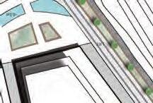
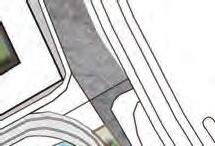


A.Office & Retail zone
B.High density residencial zone
C.Retail zone
D. Culturarl zone : D-1 is a structure which connects the Parramatta station to the city. D-2 is an art/cultural museum along the creek.


4.1.3 Ground Floor Use
A.Restaurants and cafeteria are mainly located on the ground floor
B. (B-1,B-2)Locate parking garages on the grouond floor.
C.To reduce flood damage, the ground floor will be pilotis.
D.(D-2): Pedestrian deck


4.1 Gateway District
4.1.4 Public Transportation
Parkes Street will install wide sidewalks and LRT lines to create a car-free friendly space for people without cars. Carways will be abolished accordingly in these streets.

The streets in Gateway District are designed to create a comfortable shopping/culutural experience around the water environment for pedestrians.


Main Pedestian Circulation
Only Pedestrians Zone


Widen the pedestrian zone and open the creek side for people. On the first floor along the creek, they can enjoy eating and shopping.


Specific Guidelines : Parcel A-2
To reduce Flood Damage, Ground floor should be raised 1m above the GL.


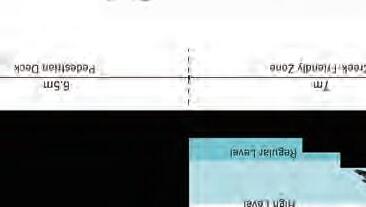


This area has high flood risk, so the ground floor shall be used for less important facilities.

Specific Guidelines :
The buildings may be back up to 5m from the creek for creating private open spaces.
The ground floor should be a parking garage with a minimum ceiling height of 3 m.
Ground floor should be pilotis to reduce flood damage.


Near the Gateway District is a series of greenland, full of historic , cultural, and educational buildings. We extend the existing inaccessible creekside greenland, to connect a new open space system, with a regenerated water management center, and a skateboard park that could be used both daily and during floods.

During daily life (which means a lower level of creek water), the creekside will be used as open space for sports activities. Also. the other side of the creek will be regenerate into forest to improve a more resilient envrionment.

During flooding period, the creekside water park will be filled with floods. The square will become a water storing area, relieving the flooding situation of other places.

4.3.1 Strategy
In this Disrtict, we create two patterns of housing based on the traditional town housing.
The first one is town housing embracing squares that can store water during severe floods.

The other one is linear houses surrounded by pedestrain green parks, next to the newly built commercial district.


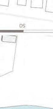


4.3.2 Land Use
A.Build Flood Resilient Housing Type 1 /Town house with water stock(Water Plaza)
B.Build Flood Resilient Housing Type 2/ Mid-rise Condominium


4.3.3 Ground Floor Use
A.Mixed use parking garage : It inclueds water storage space.
B.The ground floor of the condominium is retail zone. It provides people with convenient local shopping.

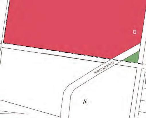


When


When the creek level is high, water is discharged into the Water Plaza. Conversely, when the creek level is low, return water to the creek.

rises, it is used household.
The water in water plaza creates a beautiful view from the townhouses during daily life. When the water level rises, it is used by each household.


Plan a housing complex that reduces flood damage with sustainability through greening and water circulation systems.
Plants will be placed in public spaces and on rooftops to improve water storage functions and create beautiful and comfortable public spaces for residents. When the water level rises, water from the riverside and rainwater from the rooftop will be stored in underground tanks to reduce flood risk.


These will be purified and used as part of the water supply for daily life.


In addition, a public space with a river that continues from the retail area will create love for living in harmony with water.


4.4.1 Strategy
Mixed-Use Core District is the only area that water flows in normal times. Additionally, LRT will penetrate the district in near future. Thus, It has a potential to be attractive, high value spaces, though possess high risk of severe flooding.
To make the best use of its potential, we made high-rise, mixed use parcels with smooth transitions of building heights. By doing this, this district will also work as a buffer zone to quiet community, without distracting solar radiation and viewings.


A: Mid to high rise, stepped residential, potentially with open space in the middle
B: Retail with office tower on top. B-2 also works as transit center, which welcomes people visiting this district by public transportation.
C: Low-rise shopping center.
D: High-rise office towers with luxury residence on top


4.4.3 Ground Floor Use
All Buildings in this district need to have retail on the frontage along the spines and roads that penetrate the district


Most area of this district is covered with pavement that only allows pedestrians to go through.
Shopping center in C-2 is required to create comfortable pathway inside the building in order not to impede the walking experience.

Pedestian Circulation
Pedestrians Zone


North side of the district provide a calm and relaxing experiment by near-water steps.
All pedestrian decks along the creek are equipped with water tanks that improves resiliency to flood disaster.


Specific Guidelines : Parcel B-1, B-2
The buildings must be back up to 4m from the property line and make terrace zone in front of retail shops.
Specific Guidelines: Whole area
In order to cope with possible flood event, Ground floor should be raised 2m above the GL.


4.4.6 Water Environment Design - Section2
At the south side of the district, attractive walkway will be created along the creek. Also, creek itself will be widened in order to cope with flood and to largen the value.


Specific Guidelines : Parcel D-2, D-3
To make a attractive shopping street from creekside centre, walls along creekside connector shall be setbacked and built to 4m from creekside connector
Creekside Connector
Setback min.4m


In Mixed-Use Core District, 3 spines are made to improve circulation and rise districts’ value.
Along with LRT rails, shopping road will be created. Visitor’ s adventure starts from transit center located in the node of this spine and creek.
Attractive and walkable pedestrian road will be created to improve circulation significantly, and to provide open space for visitors and residents to socialize.
A gateway to commercial street from local community. Pedestrians walk from river centre to high-rise office with ground floor retail to seek entertainments.


Mixed-Use Core District Parcel C&D
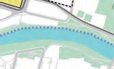
This project transformed a 1-km long invisible, inaccessible and lifeless risky shoreline belt into a verdant, sustainable riverside area by dividing it into 2 zones: Wetland and R&D Area.
A re-established wetland with pond, island, forest and riparian habitats in a previously barren terrain. It also works as part of the riverside pavement system.
A creative and regenerated area with offices, institutes, and water management institutes. Also, there are apartments and parks for employees.

4.5.2 Land Use
A.Retail & Residential zone / Locate retail on the ground
floor and residence above 2nd floor. They will have parking garages on both basement floor and ground.
B.High density & high-rise commercial-office zone / Locate parking garages on the ground floor.
Commercial-office
Residencial
Retail
Open Park

This project transformed a 1-km long invisible, inaccessible and lifeless risky shoreline belt into a verdant, sustainable riverside area by dividing it into 2 zones: Wetland and R&D Area.
Main Pedestian Circulation
Only Pedestrians Zone

A re-established wetland with pond, island, forest and riparian habitats in a previously barren terrain. It also works as part of the riverside pavement system.


A creative and regenerated area with offices, institutes, and water management institutes. Also, there are apartments and parks for employees.

Spare viewing corridor to the wetland
Setback for property line and river
The buildings may be back 1.5m from the property line, and above 2nd floor, it should be back 1.5m to make it less pressure for the streets. For the river, there should be at least 3m to create a platform to view the river.
Spare green space for the creek
For the urban view to the riverside greenland, between the tower buildings in B parcel, there should be at least a distance of 45m to ensure the view window.
To make a image of pedestrian-friendly creekside, there should be open space of at least 40m every 50m.
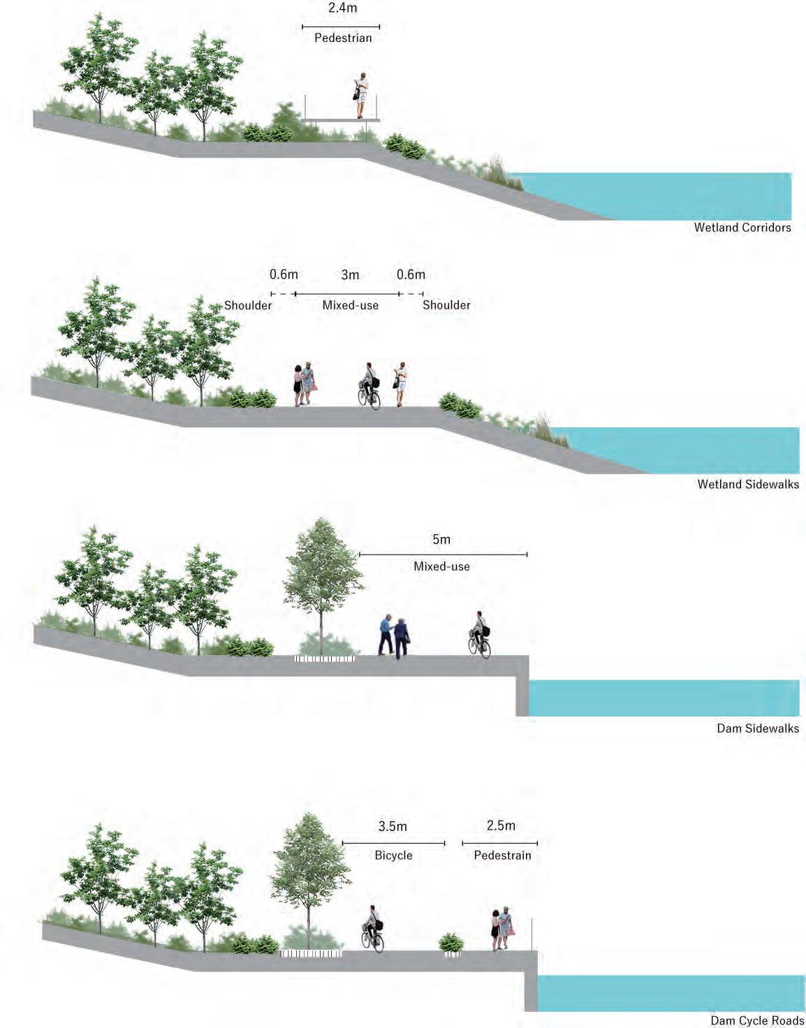
For Wetland Area, there are two kinds of road with less disturbance to the nature.
For R&D Area, there are two kinds of road next to a concrete dam. They will have different roud types.

To encounter with pressures from towers and create vibrant streets, setbacks are set through this chart. Also, all these guideline define built-to line, in order to create a sequence of walls along the street.
Two section - Base Level and Upper Level are set to the buildings with more than 40m high. This guideline aims to clearly separate base floors and towers, and create attractive streets by use of retails or open spaces.
In order to create transition of building height and a community with no sense of overwhelming from tall buildings, parcels adjacent to Flood Resilient District are required to incorporate guidelines below for the buildings built in the area.
Residential buildings that are built in Applicable Parcel which shown in the map are required to follow the height restriction shown on the diagram.
Part of the building which are in contact with property line of R.O.W has a strongest height restriction of 10m.
From there, in every 12m from the property line, there will be a deregulation of 10m until it reaches the maximum height of 40m.




Flood Resilient Houseing District(Ⅲ) boundary
Siteboundary
Applicable Parcel
to 20m.
to 10m
・ Building facades visible from the public realm should be designed with sufficient architectural details to contribute to the building identity
・Comparable and compatible design details should be employed at all segments of the building, including base and upper levels
・Retails need to have facade articulation in a 8m interval

8m Image for facade articulation
・ In order to cope with predictable flood, newly built buildings with risk of flood are required to make its ground floor material flood-proof.
・High-quality, attractive, and durable materials should be used for all buildings. Special attention should be paid at the ground floor level to enhance the pedestrian experience
・Facades of ground level retails facing a public street or open space shall have a minimum transparancy of 75%.
https://library.municode.com/ ok/jenks/codes/code_of_ordi nances?nodeId=COOR_CH16 UNDEOR_ART3BADISPST




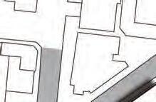
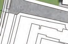
The architectural design site is along the creek shown in the gateway district map. An art museum connected to the back building(retail and office) is planned. It provides a new cultural hub that people can easily visit. It is expected to be used as a rental gallery, and will also serve as a place for interaction.






6.2.1 Ground Floor - Creekside Shopping Zone


The ground floor consists of the shop floor of the high-rise building and the pedestrian deck. People can enjoy shopping and creek side walking.


The second floor consists of the shop floor of the high-rise building and the museum architecture, and the entrance to the museum is connected to the shop floor.


6.2.3 Third Floor - Office & Museam

The third floor consists of the office floor of the high-rise building and the museum.


6.3.1 South Elevation 1 0510m

This creek-shaped architecture leads visiters from the station to the creekside and provide walkable semi-outdoor space extending from the building.
