La Placita de Holyoke
A Conway School Project for the City of Holyoke
By Eva Hogue and Bindu Nicholson
Spring 2023
INDEX
INTRODUCTION
LOCATION & HISTORY
EXISTING CONDITIONS
ENVIRONMENTAL & SOCIAL INJUSTICE ANALYSIS
USE ANALYSIS
TRANSIT CIRCULATION & ACCESS ANALYSIS
SLOPES & DRAINAGE ANALYSIS
VEGETATION & SHADE ANALYSIS
SUMMARY ANALYSIS | DESIGN DIRECTIVES
DESIGN THINKING & STRATEGIES I
DESIGN THINKING & STRATEGIES II
DESIGN ALTERNATIVE: STREETSCAPE
DESIGN ALTERNATIVE: POCKET PARKS
DESIGN ALTERNATIVE: LUSH CITY
FINAL DESIGN OVERVIEW
FINAL DESIGN DETAILS I
FINAL DESIGN DETAILS II
CASE STUDIES I
CASE STUDIES II
PLANT PALETTE I
PLANT PALETTE II
PHASING & TACTICAL URBANISM | COST ESTIMATES
REFERENCES
IMAGE SOURCES
ACKNOWLEDGEMENTS
We extend our gratitude and appreciation to; the Core Team: Aaron Vega, Stephanie Colon, Kayla Rodriguez, Frank Martinez, and Juan Montano; Beyond Walls, Damasco Santiago, Joseph Krupczynski, Jason Comcowich, Terry Gibson, Alan Rice; and Conway faculty, staff, and students for your support and feedback throughout the process of this project.
1 2 3 4 5 6 7 8 9 10 11 12 13 14 15 16 17 18 19 20 21 22 23 24
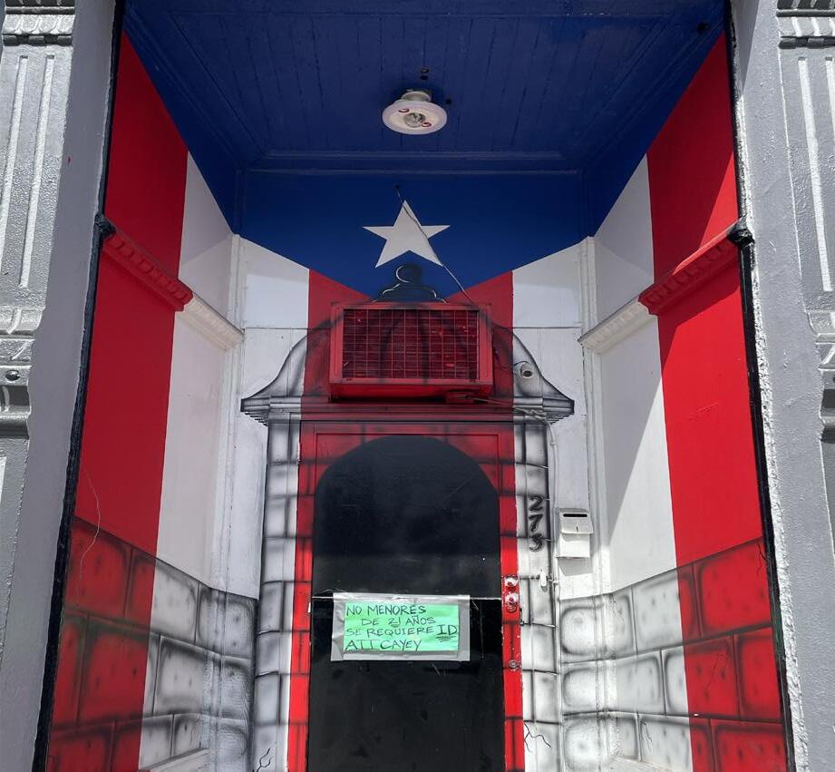
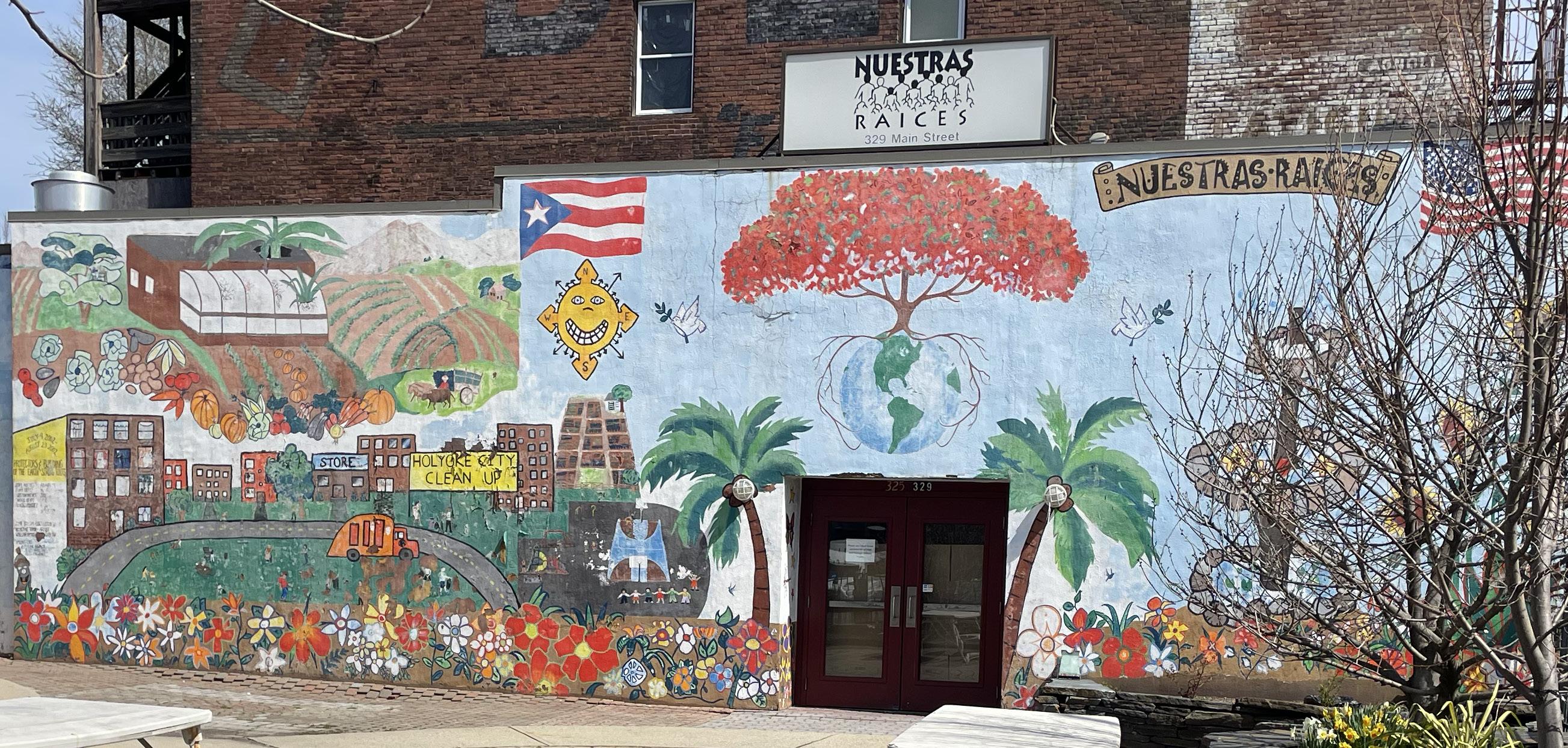
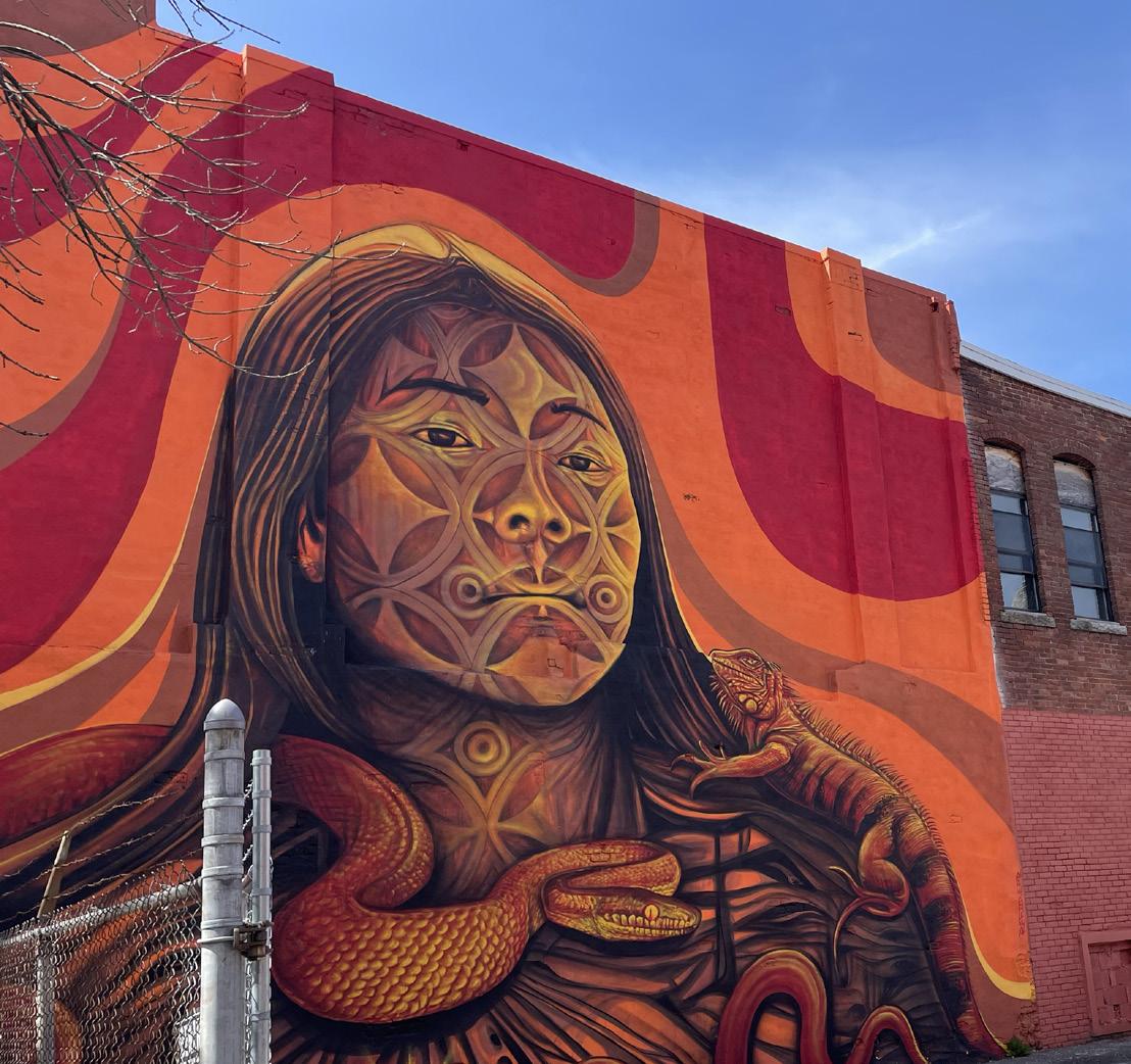
Mural art found throughout the project site.
INTRODUCTION
CORE CLIENT TEAM
GREATER THAN THE SUM OF ITS PARTS
This project proposes a landscape design for a defined area in South Holyoke. However, an existing body of innovative development plans, initiatives, projects, and studies conducted over the last two decades for the City of Holyoke precedes the project. In different ways these undertakings have touched upon the project neighborhood and beyond through making recommendations for neighborhood development and improvement. Some of the endeavors include the South Holyoke Revitalization Strategy (2008), Center City Vision Plan (2009), Urban Tree Assessment (2014), Historic Preservation Plan (2017), The Urban Renewal Plan (2020), Holyoke Tourism Strategy (2020), El Córazon: The Heart of Holyoke (2019), Conway student projects such as Green Streets Guidebook (2014) and Holyoke Innovation District Ideabook (2014), and an ordinance for a future Puerto Rican Cultural District. The latter will be explored below.
PUERTO RICAN CULTURAL DISTRICT

PROJECT MOTIVATIONS AND OVERVIEW

Motivation for this project began when the City of Holyoke, Massachusetts, recognized the popularity of a half-acre municipal parking lot along Main Street in the neighborhood of South Holyoke. During the day, the public parking lot receives an influx of cars as visitors patronize the community organizations and businesses along Main Street. During the weekend the parking lot becomes crowded with people visiting the area for entertainment, food, and cultural festivities, and to socialize in the lot. Representatives of the City and prominent members of the community with strong ties to social organizations and businesses in the project area form the core client team of this project and are interested in the potential to enhance the parking lot for its many users.
The Conway team and core client team expanded the scope of the project to include other spaces in the neighborhood that could be enhanced to bring people outside, provide space for community events, and support community building.


The focus areas for this project include public spaces such as right-of-ways (roads, alleys, and sidewalks) and city-owned parcels. Opportunities for creating welcoming spaces on private land is explored but interventions will require permission from private property owners.


PROJECT GOALS
Four goals for this project emerged from discussions with the core client team and engagement with the community:
ADDRESS PEDESTRIAN COMFORT AND SAFETY PROVIDE SHARED OUTDOOR SPACES FOR GATHERING CENTER THE CULTURAL TRADITIONS AND HERITAGE OF HOLYOKE PUERTO RICANS INCORPORATE GREEN INFRASTRUCTURE IMPROVEMENTS


In the near future, the City of Holyoke hopes to procure an official state designation of the business district along Main Street, from the I-391 underpass to Lyman Street, as the Puerto Rican Cultural District. Holyoke would be the second city in the nation, after Chicago, to have the designation. This designation would “celebrate and make visible the cultural vitality of the city’s significant Latinx population” (Krupczynski et al., 2019), highlight the large Puerto Rican population that lives and works in Holyoke, and encourage development along Main Street to attract more visitors.


According to the Core Client team, this project helps to “kickstart” the designation process by demonstrating to the state of Massachusetts that the City of Holyoke has development plans (the project landscape design) set in place for the district. With the official designation, the City can receive funding, such as grants from Mass Cultural Council, to support further development of the district.

City of Holyoke
1/24 Not for construction. Part of a student project and not based on a legal survey.
Designed By: Eva Hogue & Bindu Nicholson Spring 2023
INTRODUCTION
La Placita de Holyoke
City of Holyoke Planning Department
Stephanie Colon, City of Holyoke Mass in Motion Coordinator
Frank Martinez, Executive Director of Enlace de Familias
Juan Montano, Owner of Fiesta Cafe
Kayla Rodriguez, Operations Manager of Nueva Esperanza
Aaron Vega, Director of Planning and Community Development for the City of Holyoke
The future location of the Puerto Rican Cultural District along Main Street, between I-391 and Lyman Street.
Municipal parking lot during the day, one of the focus areas of the project.
LYMAN ST.
I-391
Green Streets Guidebook; a Conway School project from 2014.
Holyoke's Urban Renewal Plan.
PROJECT AREA
LOCATION & HISTORY
REGIONAL AND NEIGHBORHOOD CONNECTIONS
Holyoke is at the confluence of four major transportation corridors–Interstate 391, Interstate 91, Route 202, and Route 5–connecting it to some of the largest and most densely populated cities in western Massachusetts, including Chicopee, West Springfield, South Hadley, and Easthampton.

The project is located in the neighborhood of South Holyoke near other Center City neighborhoods such as the Downtown and the Flats. The project site abuts the Holyoke Canal system and the Connecticut River runs 0.3 miles east of the site.
PUERTO RICAN HERITAGE
The project area is home to a large population of Puerto Rican people who are proud Holyoke residents with cultural ties to the Island of Puerto Rico. The island of Puerto Rico became a U.S. territory in 1898 which conferred U.S. citizenship to Puerto Ricans. From the 1930s - 1950s, Puerto Rican seasonal laborers moved to Holyoke to work in tobacco fields and factories and also other surrounding Connecticut River Valley farms (Carvalho III, 2022). These new residents settled in the Center City neighborhoods that white mill industry workers had begun leaving after the decline of manufacturing. Today, Holyoke has the largest Puerto Rican population per capita of any U.S. city. Over 50% of Holyoke’s total population is Puerto Rican.

Holyoke Puerto Ricans have experienced a longstanding struggle to have their voices heard in the city of Holyoke. However, over time Holyoke Puerto Rican communities, businesses, and political and cultural representation has grown. In 2021, Holyoke elected its first Latino mayor, Joshua Garcia. Due to frequent travel back and forth from the U.S. and the island, Puerto Rican’s generational connection to the island and culture of Puerto Rico is strong. Markers of Puerto Rican cultural heritage abound throughout the project site.
INDUSTRIAL BOOM TO GATEWAY CITY
The location of the project site embeds it within Holyoke’s industrial past and legacy. Holyoke was the first planned industrial city in the United States. In the late 1800s an extensive canal system–today, a registered national historic landmark–was built in Center City Holyoke to divert and carry waterpower from the Connecticut River to support manufacturing industries and eventually electricity production. Dozens of mills built along the canals produced energy from their water turbines to power the manufacturing of textiles and paper.

Irish, French Canadian, Polish, German, and Scottish immigrants worked in and lived by the mills. Nicknamed “Paper City,” Holyoke’s population and economy grew exponentially and the city became an industrial powerhouse until the 1940s when the U.S. mill industry began to decline.

Today, Holyoke is recognized by the state of Massachusetts as a “Gateway City” because it meets three legal criteria: population between 35,000 and 250,000; median household income below the state median; and a lower percentage than the state average of adults with a college degree (MassDevelopment).
According to MassDevelopment and MassINC, Gateway Cities in Massachusetts had prosperous industrial pasts and were “gateways” to the American dream and economic uplift for residents. However, these cities were unable to recover economically from the loss of manufacturing businesses, resulting in many abandoned industrial buildings, concentrated poverty, and other challenges. Nevertheless, according to MassINC, Gateway Cities have considerable potential for economic development and smart growth– “economically prosperous, socially equitable, and environmentally sustainable” development (Smart Growth America)–because of their infrastructural and institutional assets and diverse and young workforce.
 Designed By: Eva Hogue & Bindu Nicholson
City of Holyoke
2/24 Not for construction. Part of a student project and not based on a legal survey. La Placita de Holyoke LOCATION & HISTORY
Spring 2023
West Springfield Chicopee Holyoke South
Westfield Southampton Easthampton
Major transportation corridors converge near the project site in Holyoke, MA.
Hadley
1907 postcard displaying Holyoke’s middle canal surrounded by paper and textile mills such as the Beebe & Holbrook Paper Mill on the far right.
Mural by artist David Flores depicting a Holyoke license plate with Puerto Rican flags and “Holyoke, Isla del Encanto” (Holyoke, Island of Enchantment) inscribed.
I-91 Route-202 Route-5 LEGEND Project
Zoomed in basemap of project site located in South Holyoke.
I-391
Site
DOWNTOWN
CT RIVER
THE FLATS
SOUTH HOLYOKE
CANAL SYSTEM PROJECT SITE
EXISTING CONDITIONS
PROJECT BOUNDARIES

The 18-acre project site encompasses five city blocks. It is bisected north to south by Main Street, and bounded by Appleton Street to the north and Cabot Street to the south. The western boundary is along Race Street and the eastern boundary is along Crescent and Clemente Street.


STREETSCAPE
The project street corridors typically consist of paved sidewalks, street trees, two-way roads, parallel street parking, crosswalks, alleyways, lights, bike infrastructure, and traffic signs.

Clemente and Crescent Streets meet at a large triangular shaped paved intersection, approximately 160-feet wide at its broadest point.
Part of the second level of the canal runs along Race Street within the project site. The Canal Walk, a promenade with landscaping, decorative paving, fences, benches, and other amenities, starts north of Appleton Street, beyond the project site. According to Friends of the Canal Walk, in the future, the Canal Walk will be completed and continued down south of Appleton Street. Currently, there is no finished sidewalk on the canal side of Race Street.
Colorful banners attached to light poles can be found along Main Street. Spearheaded by El Córazon, a community placemaking project, these banners celebrate the Puerto Rican community and “Hidden Legends.”


OPEN SPACES AND MUNICIPAL PARKING LOT
The open spaces within the site (spaces without buildings), include private and publicly owned empty lots, paved parking lots, and one park. A large municipal parking lot sits at the center of the site and gets frequent use.
Existing Conditions
BUILDINGS
Many mixed-use buildings, businesses, residences, social organizations, and shelters exists within this site. Industrial brick buildings, once used by Holyoke’s mill industry, are located throughout, especially along the canal on Race Street. Today, many of these buildings still serve industrial purposes, or contain a suite of businesses and community resources.

SOUCEY PARK

Soucey Park, a small public park, directly abuts the Racing Mart gas station to the south, a municipal parking lot to the west, and an apartment building to the north. The park is bisected north to south by a tree-lined sidewalk, a table with a built-in chess board, and benches alongside. The southern half of the park has a mulched playspace with a swing set and playground set. The northern half is turfed with three mature trees along the perimeter and a handball court wall painted with a colorful mural.
MURALS
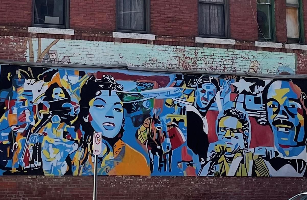
Vibrant murals, many made in collaboration with Beyond Walls, a non-profit placemaking agency that partners with communities to make public art, are located throughout the project site and surrounding area. The murals are representative of the community who frequents this neighborhood. They incorporate Puerto Rican iconography, and some are painted by Puerto Rican artists.
City of Holyoke
3/24 Not for construction. Part of a student project and not based on a legal survey.
Designed By: Eva Hogue & Bindu Nicholson Spring 2023
La Placita de Holyoke
EXISTING CONDITIONS
Paving Buildings LEGEND Turf Water
Main Street and Cabot Street intersection with Racing Mart gas station in the right corner.
Soucey Park playground.
Handball court in Soucey Park with a mural celebrating Puerto Rican heritage.
Alleyway between Race Street and Main Street.
Industrial buildings lining Race Street, with the future location of the extended canal walk along a chain-link fence beside the canal to the right.
MAIN STREET BETTY MEDINA ST. APPLETON ST. CABOT ST. RACE ST. CLEMENTE ST. C R E S C E N T S T . A E
Canal Walk (north of Appleton Street)
B CANAL G D GAS STATION Sidewalks SOUCEY PARK H C MUNICIPAL PARKING LOT
El Córazon Main Street banner with photo of hidden legend Betty Medina.
City-owned parcels Street trees & shrubs F
Mulch & other surface materials
C
D B A E F G H
City-owned municipal parking lot along Main Street.
Empty lot along Race Street.
ENVIRONMENTAL & SOCIAL INJUSTICE
Communities–predominantly high minority and low income–experiencing environmental injustice face disproportionate exposure to pollution and environmental degradation and limited access to green spaces resulting in adverse human health and environmental outcomes.
According to Massachusetts’ Environmental Justice Policy these communities are often “located in densely populated urban neighborhoods, in and around the state's oldest industrial sites” and near “many of the state's contaminated and abandoned sites, regulated facilities, and sources of pollution.” In response to environmental injustice, the Environmental Justice (EJ) movement works toward equal protection from environmental hazards for all people and believes that people have the right to live in a healthy and clean environment.
Massachusetts’ Executive Office of Energy and Environmental Affairs (EEA) uses demographic criteria based on minority, income, and English isolation to determine a community’s potential susceptibility to environmental injustice. Identified communities are called “EJ populations.” According to Massachusetts’ Department of Environmental Protection (MassDEP), the project site lies in an EJ population, meeting all criteria.
Holyoke EJ Populations
ENVIRONMENTAL PROTECTION AGENCY EJSCREEN TOOL
The U.S. Environmental Protection Agency’s (EPA’s) EJScreen tool provides a regularly updated dataset of environmental justice maps. The project site falls within the 80 to 100 percentile range for high exposure to many different types of the EJScreen tool’s environmental indicators such as potential exposure to hazardous waste and proximity to traffic. According to the EPA, while EJScreen data has limitations and should not be interpreted as giving a precise risk assessment, the data is useful for understanding the scope of potential environmental injustices in a community.
REDLINING
U.S. federal government redlining maps created from 1935 to 1940 color coded neighborhoods–using a system largely based off of their racial, ethnic, and class makeup–to designate neighborhoods deemed eligible for government home loans (Nelson). The maps were a part of discriminatory government housing policies. A 1937 redlining map for Holyoke shows the project site between two neighborhoods marked in red. Neighborhoods colored in red, and their nearby communities, were categorized as “hazardous.” The description of Holyoke’s redlining map says that the red areas were “peopled by lower class of mill workers and W.P.A. beneficiaries, many of them of foreign descent and uneducated.” The hazardous grade made it “difficult or impossible for people in certain areas to access mortgage financing and thus become homeowners” (Nelson). These neighborhoods were denied government resource investment, which has had “long-term effects in creating wealth inequalities” (Nelson).

SOCIAL INEQUITIES AND BLIGHT CONDITIONS
During engagement sessions held in May 2023 for this project the community expressed the ways in which social inequity and blight are present within the neighborhood. The most common inequities reported include houselessness, drug activity, unaffordable housing, harassment and racial discrimination, economic disinvestment through extensive loss of businesses, and a lack of youth programs. The community also shared interest in developing better relationships with the Holyoke police and more patrolling of the neighborhood to help reduce crime. The blight conditions mentioned were the project area’s many empty lots and vacant buildings, and observed litter.
LACK OF PUBLIC AMENITIES
There are almost no street benches or public trash cans, which may contribute to some litter observed within the site.
Holyoke Redlining


 Designed By: Eva Hogue & Bindu Nicholson

City of Holyoke
4/24 Not for construction. Part of a student project and not based on a legal survey.
Spring 2023
La Placita de Holyoke
ENVIRONMENTAL & SOCIAL INJUSTICE ANALYSIS
Exposure to toxic air emmisions.
Home Owners' Loan Corporation 1937 redlining designating areas by grade. Exposure to traffic.
Minority Minority, Income, & English Isolation LEGEND Minority & Income Minority, & English Isolation Project Site 95-100 percentile 90-95 percentile LEGEND 80-90 percentile 70-80 percentile Project Site 60-70 percentile 50-60 percentile
The project site is within a EJ community.
A "Best"
LEGEND
B "Still Desirable"
C Definitely Declining
INJUSTICE
D "Hazardous" Project Site ENVIRONMENTAL
Empty lot on Main Street with scattered litter.
ENTERTAINMENT, CULTURAL ENRICHMENT, AND FOOD
There is a flourishing social scene within the project site that reflects the rich Puerto Rican culture within the area. During community engagement sessions in May 2023, the community shared that people visit Thursdays through Sundays to gather along the block of Main Street, between Cabot Street and Betty Medina Street. Festivities often go late into the night. Many people, mostly adults, come from nearby neighborhoods and cities and as far as Connecticut. People arrive at the site by car and some ride on their modified and well-cared for motorcycles and three-wheeled cars.
Many people can be found hanging out in the municipal parking lot, setting up chairs to socialize, people watch, and listen to music. People frequent the two bars within the project site, Cayey Social Club and Ekko Bar and Lounge. Visitors spend time at Fiesta Cafe, a family-friendly restaurant with live music and Puerto Rican food that hosts different events such as salsa dancing and their Sunday Day Party where they often roast pigs. Additionally, during the week the municipal parking lot has a pop-up hot dog stand that many people go to for lunch.
COMMUNITY RESOURCES AND SERVICES

During the weekday visitors primarily come to the neighborhood for the abundant community resources provided by organizations within the area. Some of the community organizations, several with roots back to the early 70’s, 80’s, and 90’s, include: Tapestry Health, a community health clinic; Nueva Esperanza, a community development organization that provides a variety of programs for Latinx residents and businesses; Enlace De Familias, a grassroots non-profit organization that provides food pantry, childcare, adult education classes, and other programming and resources for communities and families; and Nuestras Raíces, a grassroots organization that supports urban agriculture. Additionally, the STEAM building along Race Street which contains many businesses, is home to LightHouse Holyoke, a private school that provides education to 6th to 12th grade students who do not typically thrive in standard public education settings.
Other popular businesses and organizations that people patronize include Racing Mart Fuel gas station, Templo Ebenezer, De La Rosa Funeral Home, and Who’s Next Barbershop. The core client team shared that the funeral home sometimes uses the municipal parking as extra space during services.

 Designed By: Eva Hogue & Bindu Nicholson Spring 2023
COMMUNITY FEEDBACK AND CONCERNS: HOW THE COMMUNITY WANTS TO USE THE SITE
During community engagement sessions, community members shared visions for the future of how the project site is used, as well as spaces they would like to see improvements.


Ideas included interest in kioskos (kiosks) and foodtrucks, more park spaces, gardens, places to exercise, areas to sit, water sprinklers, a stage for the parking lot, more trash cans, and adding more murals. Enlace de Familias has expressed interest in an outdoor space for different group activities that they already hold inside of their building, such as cooking classes or after school daycare.
Some community members shared displeasure with late night happenings, loud motors and music that occur in the area. It was expressed that a parking lot, specifically for motorcyclists, could help concentrate louder activity off of Main Street. Two areas were also noted as “feeling unsafe” for children and uncomfortable for many adults: the alleyway between Race and Main Streets, as well as Soucey Park. According to some community members Soucey Park’s primary users are adults instead of children and there is observed drug activity. A few community members suggested that Soucey Park should be locked up at night. Many community members said they were interested in more family friendly and quieter spaces.
EMPTY LOTS AND OTHER OPEN SPACES
Most of the empty lots, both public and privately owned, are unused by the community. There is one lot along Main Street that is sometimes used as an outdoor church. Additionally, according to the 2020 Holyoke Main Street Corridor Survey, the wide intersection where Clemente and Crescent Street intersect was historically a park, but once it became more industrialized it was paved over (Violette, 2020). Lastly, along Cabot Street, at the southeast edge of the project site (off of the project site boundary) is a community garden run by Nuestras Raices.

City of Holyoke
5/24 Not for construction. Part of a student project and not based on a legal survey.
USE ANALYSIS
La Placita de Holyoke USE
Weekly Fiesta Cafe Sunday day party with a live band, Puerto Rican food, and a whole hog on the pit on Main Street.
Use MAIN ST. BETTY MEDINA ST. APPLETON ST. CABOT ST. RACE ST. CLEMENTE ST. C R E S C E N T S T
ZONING
A STEAM BUILDING B C D MUNICIPAL PARKING LOT DE
The
project site has two primary zoning areas including Highway (vehicle-oriented) Business (BH) and General Industry (IG) which allow a variety of uses.
LA ROSA FUNERAL HOME
GAS STATION SOUCEY PARK TAPESTRY NUESTRAS RAICES FIESTA CAFE ENLACE DE FAMILIAS CAYEY BAR EKKO BAR WHO'S NEXT
non-profits & businesses LEGEND Residences Public parcels Non-profits organizations Empty lots A
TEMPLO EBENEZER
Businesses Mixed-use:
B
Motorcycles on Main Street. In the background, people watch the festivities from chairs in the municipal parking lot.
C
D
Enlace de Familia, a grassroots non-profit organization on Main Street.
Crescent and Clement large paved intersection.
TRANSIT CIRCULATION & ACCESS
MAIN STREET
Main Street is an important thoroughfare within Holyoke, connecting the city to Interstate-391 and the neighboring city of Chicopee, and South Hadley via Route 116. From Monday to Friday, 9 am to 5 pm, many people commute through and visit the project area. Community members, notably parents and grandparents, have said that vehicles move especially fast along Main Street, creating unsafe conditions for pedestrians, especially when crossing the crosswalk in front of Enlace de Familias. Fortunately, in the future a raised speed table will be added to the Main Street and Cabot Street intersection to slow down traffic. Members of the core client team have also reported that many of the street trees on Main Street block sightlines for cars, creating hazardous conditions for drivers. The core team shared that these street trees and others in the neighborhood are not regularly pruned or maintained which they believe create those unsafe conditions.

OTHER
Some of the streets have faded road lines which may create confusing traffic conditions. For example, the large triangular Clemente Street and Crescent Street intersection has no painted street lines or indications for traffic flow.

Cabot Street and Appleton Street also receive a lot of vehicular traffic. However, side streets such as Race, Betty Medina, Clemente, and Crescent Streets are much quieter and have less vehicular traffic which may present an opportunity to increase pedestrian activity.

Transit Circulation & Access


BUSES & BIKES
While most people visit the project site by car, alternative forms of transportation are used. There are five bus stops located throughout the project site. Bicycle infrastructure is sparse, with one dedicated bicycle lane only along Appleton Street and one bike rack. The bike rack is exclusively for an EV-powered bike share program. The lack of bike lanes and racks may discourage people from bicycling through the neighborhood.


City of Holyoke
6/24 Not for construction. Part of a student project and not based on a legal survey. La Placita de Holyoke TRANSIT CIRCULATION & ACCESS ANALYSIS
Designed By: Eva Hogue & Bindu Nicholson Spring 2023
People visiting the project site park their vehicles along the street, within the publicly owned municipal parking lot, and within privately owned parking lots such as the Racing Mart gas station lot.
MAIN ST. BETTY MEDINA ST. APPLETON ST. CABOT ST. RACE ST. CLEMENTE ST. C R E S C E N T S T
ValleyBike rack for EV-bike share program with the municipal parking lot behind. As of summer 2022, these bikes are out of commission.
The neighborhood gas station, Racing Mart, with parking to the right.
Traffic on Main Street intersection reported to be unsafe for pedestrians.
STREETS
PARKING A B C Public parking Private parking LEGEND Bus stops High traffic volume Low traffic volume A B C
SLOPES & DRAINAGE

IMPERVIOUS SURFACES, SLOPE, AND POOLING


90% of the land cover in the site is made up of impervious surfaces, such as concrete and asphalt. Unlike vegetated areas or pavements made out of porous material (pervious surfaces) where water can infiltrate into the ground, water is unable to infiltrate through impervious surfaces. The lack of pervious surfaces (only 10% of land cover, according to QGIS calculations) in the project site results in excess street runoff or water flowing over paved surfaces and going into drains or pooling during rainstorms. According to the United States Environmental Agency (EPA), the water on these concrete and asphalt surfaces is often at a high water temperature, and can be harmful to aquatic wildlife in rivers downstream. Additionally, water in this urban area can pick up pollutants such as gasoline, road salts, and heavy metals, and can be carried into the Connecticut River.

Across the five-block project site, there is a total elevation change of 5 feet, creating a relatively flat area. Most slopes are from 0 to 2%. Pooling of water often occurs in flat areas because there is no slope for the water to flow down. This can eventually cause long-term degradation of asphalt and concrete. Pooling has been observed throughout the site. Much of this pooling can be found along the canal side of Race Street, on Cabot Street, in the municipal parking lot, and in the alleyway between Race and Main Streets. Some of the pavement around the 18 total stormwater drains in the site has eroded over time. This prevents water from traveling into the intended drain because the drains are above the pavement. Additionally, along the northwest corner of Appleton Street, which slopes downward east to west, there has been severe flooding observed under a bridge (beyond the project boundary). The core team shared that when this area floods, cars are often unable to pass though.

A steep, inaccessible slope leads down toward the canal on Race Street. While a fence is a safety measure that stops pedestrians from going to the water, the fence and steep slope also restricts people from being able to enjoy access to the water.


Slope and Drainage
Designed By: Eva Hogue & Bindu Nicholson

COMBINED SEWER OVERFLOW
As of 2023, Holyoke is still on a combined sewer overflow (CSO) system. This means that stormwater and sewage are directed into the same pipes and are treated at a wastewater facility. However, when the CSO system is overwhelmed by water and sewage, rather than going through treatment, it overflows into pipes that pour directly into the Connecticut River. This occasional overflow discharge adds untreated, polluted water into the Connecticut River. According to Veolia Water, the company responsible for Holyoke’s wastewater treatment, Holyoke’s CSO system directly discharges up to 500 million gallons of wastewater annually into the Connecticut River. The City is currently working on separating the CSO. They have entered into an agreement with the EPA to “take remedial action” and create a long-term overflow plan (City of Holyoke).
City of Holyoke
7/24 Not for construction. Part of a student project and not based on a legal survey.
Spring 2023
La Placita de Holyoke
SLOPES & DRAINAGE ANALYSIS
Pooling on the edge of Race Street along the canal. Pooling along the back alleyway between Main and Race Streets.
CSO diagram, adapted from the US EPA.
MAIN ST. BETTY MEDINA ST . APPLETON ST. CABOT ST. RACE ST. CLEMENTE ST. C R E S C E N T S T
2% or less slope LEGEND 2% - 5% slope 5% - 10% slope 10% - 15% slope 15% or greater slope Observed poolingt Slower draining Faster draining Drains CONNECTICUT RIVER TO THE EAST OBSERVED FLOODING UNDER BRIDGE (OFFSITE) DRY WEATHER DOWN SPOUT STORM DRAIN SEWAGE SEWER DAM WET WEATHER COMBINED SEWAGE & STORMWATER OUTFALL PIPE TO RIVER DOWN SPOUT STORM DRAIN DAM SEWER A B C OUTFALL PIPE TO RIVER A B C
View of the steep slope along the unfinished canal walk between Appleton and Betty Medina Streets.
VEGETATION & SHADE
A low amount of vegetative cover–10% of total land cover– a general lack of species diversity, and few designed green spaces exist throughout the site. Large, mature deciduous street trees are the dominant type of vegetation within the project site and most are found along Main Street and the southern half of Cabot Street. The majority of the street trees are in small square tree pits, although some are in elongated pits. Larger tree pits allow more room for trees to grow because tree roots have more available soil volume. On a parcel on Crescent Street owned by Templo Ebenezer, there is a small cluster of trees with an overgrown understory. Race and Spring Street have no street trees. On some of the streets and empty lots there are young, newly planted trees, showing intentional steps taken to increase vegetative cover.

In 2021, the City of Holyoke inventoried the number and type of trees in Holyoke for it's Urban Forest Equity Plan. Within the project site over 40% of the 58 total inventoried street trees are green ash (Fraxinus pennsylvanica). The emerald ash borer, a wood-boring beetle, is a pest of ash trees that has led to the demise of the tree species all over New England. These trees in the project site may need to be replaced if they become infected by the emerald ash borer, which will reduce the already limited tree cover.


Besides street trees, surrounding the gas station, the municipal parking lot, and in other areas of the site are long, mulched-filled beds containing a small selection of evergreen shrubs, and manicured privacy hedges. Vegetation in the empty lots consists of mostly regularly mowed lawn.


PEOPLE & PLANTS
The core client team has shared interests in engaging with neighborhood residents and business owners in discussion about the benefit of trees and other plants as a way of building positive relationships between people and plants and arriving at design interventions that will work for community members.
Vegetation & Shade
As a result of the limited vegetation in the project site, there is a lack of shade throughout the year making the site susceptible to urban heat island effect. Urban heat islands experience hotter temperatures than outlying rural and suburban areas due to lack of vegetation but also other components of densely settled urban environments such as an excess of pavement that absorbs and emits heat from the sun.
The southern half of Soucey Park has no trees, exposing the playground area to intense heat. Hot conditions are present in the frequently visited municipal parking lot which has no shade for people and cars and many of the bus stops lack shade pavilions. Ultimately, consistently hot, sunny areas are less likely to be comfortable spaces for bringing people outside and having events.

City of Holyoke
8/24 Not for construction. Part of a student project and not based on a legal survey. La
Designed By: Eva Hogue & Bindu Nicholson Spring 2023
Placita de Holyoke
VEGETATION & SHADE
ANALYSIS
Street trees on Main Street.
Ornamental shrubs in front of Racing Mart.
This lot is owned by the Ebenezer Assembly of God church. On Sundays, during service, cars are parked in the narrow paved strip. Otherwise, it is vacant.
The southern half of Soucey Park has no shade.
SHADE
MAIN ST. BETTY MEDINA ST. APPLETON ST. CABOT ST. RACE ST. CLEMENTE ST. C R E S C E N T S T .
VEGETATION
LEGEND A B C D A B C D
Street trees & shrubs Shade cast during the summer equinox
SUMMARY ANALYSIS
ASSETS
People are drawn to the project site for the abundance of community resources, like Enlace de Familias; services, like Who’s Next Barber Shop; and entertainment, food, and social destinations that can be found at places like the municipal parking lot and Fiesta Cafe. Puerto Rican culture is represented in many ways in the project site such as through the Puerto Rican people who visit and live in the area, the different cultural activities that occur like salsa dancing and pig roasts, and the presence of cultural iconography including the beautiful murals and El Corazon pole banners highlighting important community members. There are many open spaces such as the municipal parking lot, empty lots, and quiet streets that could be enhanced for public enjoyment.
LEGEND
Street trees & shrubs
Sunny
High traffic volume

Low traffic volume
Pedestrian movement

Observed pooling

Destinations
CONSTRAINTS

Disinvestment and inequity are present within the project site because of the decline of industry in Holyoke, social and environmental injustices, and other challenges. There are many empty lots and abandoned buildings. Speeding vehicles along busy transportation corridors such as Cabot Street, Appleton Street, and especially Main Street, as well as unpruned street trees, and faded road lines create unsafe conditions for pedestrians and vehicles. There is limited bicycle infrastructure. A fence and steep slope along the canal on Race Street impedes access to the water. Flat slopes and impervious surfaces cause water to pool and degrade surfaces. Excess runoff may carry pollutants to the Connecticut River, affecting water quality. Limited vegetation and lots of impervious surfaces create hot conditions that affect pedestrian comfort. The lack of vegetation and green spaces also prevents the community from experiencing the many benefits of trees and other plants, especially in urban environments. Certain spaces like Soucey park and the alleyway between Race and Main Street have been noted as feeling unsafe. Lastly, public amenities like trash cans and benches are sparce in the project site.
Summary Analysis
PROJECT GOALS
ADDRESS PEDESTRIAN COMFORT AND SAFETY PROVIDE SHARED OUTDOOR SPACES FOR GATHERING
CENTER THE CULTURAL TRADITIONS AND HERITAGE OF HOLYOKE PUERTO RICANS
The following design directives suggest ways to address challenges identified through the project analysis and meet the project goals:
USE ANALYSIS
Encourage the activity and vitality that is already present in the project site through enhancing the streetscape and outdoor spaces for the neighborhood community, including the many Puerto Rican residents, and other visitors, children, parents, and families who use the site.
• Incorporate culturally relevant design interventions that highlight Puerto Rican culture. (See sheet 11 for more information)

• Add amenities, such as benches, stages, and electrical outlets

• Explore different options for how empty lots and other open spaces could be transformed into pocket parks, gardens, parklets, urban orchards, gardens, and other enhanced green spaces.
• Create spaces for community businesses and organizations to use such as parklets along the streets.
• Explore where infill development might be appropriate.

• Enhance the municipal parking lot as an intentional place for gathering and versatile use by the community.
• Explore where motorcycle parking could be added.
• Enhance Soucey Park to make it more family friendly, fun, and safe.

• Enhance alleyways to make them inviting and safe places.
CIRCULATION & ACCESS
• Slow down vehicular movement along Main Street by using green infrastructure tools and raised intersections (see page 10 for more information).
• Consider the adoption of a maintenance schedule for pruning street trees to increase safety for vehicles.
• Re-paint the road lines to create clearer traffic guidelines.
• Increase bicycle infrastructure to encourage an environmentally friendly alternative mode of transportation.
VEGETATION AND SHADE
• Increase and diversify vegetation in the streetscape, mulch beds, empty lots, and other areas through adding a variety of trees, shrubs, and other plants that create lush and welcoming green spaces, and have many environmental and health benefits.

• Increase tree canopy and add shade structures or pavilions for shade.
SLOPE AND DRAINAGE
• Reduce impervious surfaces by adding vegetation and porous surfaces throughout the site where appropriate.
• Implement urban stormwater management practices that remove pollutants along the public right-of-ways. (See page 10 for more information)

• Re-grade some of the roads to prevent water from pooling.
• Create access to the canal along Race Street.
INCORPORATE GREEN INFRASTRUCTURE IMPROVEMENTS
 Designed By: Eva Hogue & Bindu Nicholson Spring 2023
SUMMARY ANALYSIS
City of Holyoke
9/24 Not for construction. Part of a student project and not based on a legal survey.
La Placita de Holyoke
DESIGN DIRECTIVES DESIGN DIRECTIVES
MAIN ST. BETTY MEDINA ST. APPLETON ST. CABOT ST. RACE ST. CLEMENTE ST. C R E S C E N T S T .
DESIGN THINKING & STRATEGIES I
SHARED STREETS
Shared Streets involve the creation of a united street corridor space with no curbs to allow for free movement of pedestrians, vehicles, and bicyclists. Common elements include special paving, like interlocking concrete pavers, and street furniture. Some Shared Streets are closed off to cars. The benefits of Shared Streets include an enhanced space for human use, more area for programming, and less crowded sidewalks.
Parks and other green spaces can provide access to nature and beauty, and serve as spaces in which to socialize and to rest. Urbanist Jane Jacobs, recommends that parks are designed in relation to their physical surroundings and are surrounded by buildings that have a mixture of uses because they can support a variety of users.
GREEN INFRASTRUCTURE
Green Infrastructure is the range of practices used to capture, infiltrate, and manage stormwater ideally at the site where the water falls. This can often mean vegetating spaces in a city with trees, shrubs, and other plants along a sidewalk or using soil systems, and porous pavement to infiltrate and capture stormwater, and prevent pooling of water on surfaces (NYC DOT). Bioswales, and other depressed vegetated beds can be constructed along sidewalks in cities to infiltrate stormwater. Cuts into curbs are usually added to allow water to enter these features from the road.
NODES & EDGES
Nodes are dominant features or places in a city. Creating nodes, like a public square, can concentrate activity and bring people to an area. Another city element are edges, like a body of water or planters and benches that help define an area and encourage people to linger in a space (Lynch, 1960). They mark a point of transition into or outside of a space designating a space as special and important.
PARKLETS

Parklets are small parks constructed on top of parallel parking spaces in front of buildings. They often include added amenities such as tables, chairs, and planters. Parklets increase public space and pedestrian activity. They can improve pedestrian safety by narrowing a street, making cars slow down. Parklets are often removed during the winter to retain parking and make it easier for plowing snow.
COMPLETE STREETS
Complete Streets, according to Green Streets Guidebook, are designed to “create safe, convenient, and comfortable access for all users,” of a street through creating zones of use. There are designated spaces for pedestrians, bicyclists, buses, and vehicles. This design concept also incorporates safe pedestrian crossings, traffic calming elements, green spaces, and accessible transit systems.
Bumpouts, a constructed extension of the curb of a sidewalk can contain vegetation help to infiltrate stormwater and because they extend into the street they can be a “visual cue” or a “pinchpoint” for cars to slow down (Town of Millbury).


Porous pavements is an alternative paving material that allows water infiltration into soil and gravel. These surfaces help filter out pollutants in water and can be cost effective compared to traditional drainage systems (EPS). Porous pavers, asphalt, and concrete are options that can be installed in parking lots, roads, and alleys (EPA).
La Placita de Holyoke
Designed By: Eva Hogue & Bindu Nicholson Spring 2023
BENEFITS OF GREEN SPACES
Additional benefits of green infrastructure and increasing green spaces in an urban landscape:


• Increased habitat for pollinators, birds, and other animals.

• Decreased urban heat island effect through cooling the air and proving shade.
• Improved air quality through absorbing atmospheric air pollution .
• Mitigation of the effects of climate change.
• Enhanced well being and mental health through access to nature.
City of Holyoke
10/24 Not for construction. Part of a student project and not based on a legal survey.
DESIGN THINKING
I
& STRATEGIES
PARKS
ACTIVE SIDEWALKS DEDICATED BIKE LANES ACTIVE ROADWAY SAFE CROSSWALKS PLANTING STRIP GREEN SPACES
Raingarden planted in a bioswale within a sidewalk.
WATER FLOWS IN FROM ROADS INTO CURB CUTS
PLANTS, ROCKS & DIRT FILTER & SLOW WATER
WATER ENTERS PERFORATED PIPE & IS ABSORBED INTO THE GROUND, RECHARGING GROUND WATER & REDUCING THE AMOUNT OF WATER GOING INTO WATER BODIES
DESIGN THINKING & STRATEGIES II

CULTURALLY RELEVANT DESIGN
The following design directives for implementing culturally relevant design are taken from Forsyth et al. “Plazas, Streets, and Markets: What Puerto Ricans Bring to Urban Spaces in Northern Climates.” Forsyth et al. studied and outlined the features of urban design in Puerto Rico and compared “the environments that the residents left behind to those that they have come to inhabit in Holyoke.” Their report is written for “non-Puerto Rican landscape architects, neighborhood planners, and urban designers working with Puerto Rican populations.” They emphasize that this design process must involve a “participatory design” which engages Puerto Rican residents more deeply in the design.
• Design plaza-like spaces with large, open central areas.
• When possible, central plaza type public spaces should have a significant connection to community buildings and commercial areas.
• Plaza spaces should contain substantial amounts of paved surfaces that are framed by planting beds.
• Paved surfaces should accommodate a variety of patterns and colors.


• Large canopy trees should be used in the planting beds, creating shade and defining the open spaces.
• Allow for activities and structures that are culturally specific, such as dominoes tables, vending carts, and marketplaces.
• Public spaces should be multi-use and allow for a variety of activities and flexible programming.

• Allow for the use of bright colors and decoration both in open spaces and on structural elements such as buildings and utility poles.
• Allow for the use of cultural symbols related to ethnic identity including depictions in murals.

During the first April core client team meeting, the team shared features of their favorite outdoor gathering spaces in Holyoke, Puerto Rico, and other Latin American countries, like Peru. They admired the community, festivities, multi-generational spaces, art, food, play, music, and socializing occurring in grandma's backyard," "our old neighborhood," "Parque Kennedy" and other cherished spaces.

WICKED PROBLEMS: WHAT CAN LANDSCAPE DESIGN DO?
As described to the Conway team by University of Massachusetts architecture professor and Director of El Corazon, Joseph Krupczynski, this Holyoke neighborhood faces “wicked problems,” due to poverty, homelessness, drug use, and other social and environmental injustices existing. A wicked problem is a difficult to solve problem due to having a “complex and interconnected nature” (Wong, 2022). Wicked problems cannot be solved by one discipline, but require a multi-pronged approach with multidisciplinary collaborators (Krupczynski, 2023).

Landscape design cannot solve the injustices identified within the project area alone, but it can be one tool alongside existing community organizations, government initiatives, community members, and new partnerships and movements working toward addressing systemic injustices in this neighborhood.
Green gentrification is the process of environmental uplift in communities through the creation of green spaces and sustainable infrastructure that can lead to increased housing prices and displacement of residents. In "Retracted: Urban Greening as the Ultimate Urban Environmental Justice Tragedy", Isabelle Anguelovski says that in the process of green gentrification “as formerly degraded neighborhoods get cleaned up and benefit from new environmental goods, they start to become valued again by outside private investors.” Oftentime low-income communities of color experiencing green gentrification will receive an “influx of new, wealthier and often white residents” who may displace original residents (Rigolon et al 1). These new residents “are often the ones who are able to enjoy the new green amenities from which low-income residents and minorities had been historically deprived of and, in many cases, originally fought for” (Anguelovski, 2016).
This planset proposes a design that includes greening of the project site. As a wicked problem, addressing green gentrification may require multiple strategies that involve collaboration with communities, governments, social organizations, and other stakeholders that work toward implementing “anti-displacement and green inclusive policies”, including affordable housing policies (Rigolon, 2019).
 Designed By: Eva Hogue & Bindu Nicholson

City of Holyoke
11/24 Not for construction. Part of a student project and not based on a legal survey.
DESIGN THINKING & STRATEGIES II
Spring 2023
La Placita de Holyoke
DESIGN ALTERNATIVE: STREETSCAPE
ACTIVATE THE OUTDOOR SPACES
"Streetscape" focuses on enhancing the project site’s public right-of-ways which include the street corridors (roads and sidewalks) and the alleyway. In this design the concept of shared streets and complete streets are applied throughout. Race, Main, Appleton, and Cabot Streets are redesigned using the complete streets approach. Each street has a designated zone for vehicles, pedestrians, buses, and cyclists. A dedicated bicycle lane, protected by side parking, encourages bicycling as a sustainable alternative transportation form.


In this design, walkable and enjoyable pedestrian spaces are prioritized. Parklets are added to Main Street as extra public space for eating, resting, and socializing, allowing people to stop and linger more along the streets. These parklets help to slow down traffic by narrowing the road. There are more street trees and planters in front of buildings to soften and bring greenery to the urban landscape, inviting people to slow down to admire the vegetation. This design also shows mixed use development constructed onto the empty lots. The bottom floor of the new buildings could support new business to increase economic activity and allow more opportunities for people to stay in the area to eat and shop. Low income affordable housing for the community could be added to the top floors of the buildings. Spring Street is designed as a shared street, closed off to cars where people can freely use the street as a public space. There are kisokos where people can go down the street eating all the delicious food they want! Solar panels are included in the design on top of the new development and in the parking lot as a renewable source of power and for shade.
DESIGN BENEFITS
• Prioritizing walkable pedestrian spaces for people to enjoy.
• Streets designed to support all types of users.
• Protected, designated bike lanes.
• Parklets expand public space and help slow traffic on Main Street.


• New infill to increase housing and economy.

• Betty Medina Street becomes a destination for public activity and programming.

• Parking lot has PVs for shade and renewable energy.
• Added vegetation


DESIGN DRAWBACKS
• New development is expensive a and involved a lot of embodied energy.
• Closing Betty Medina street to vehicular traffic may be an inconvenience.
• Not all streets may be able to be retrofitted into complete street.
PRECEDENTS
City of Holyoke
12/24 Not for construction. Part of a student project and not based on a legal survey.
Designed By: Eva Hogue & Bindu Nicholson Spring 2023
La Placita de Holyoke
DESIGN ALTERNATIVE: STREETSCAPE
COMPLETE STREET
CLEMENTE AND CRESCENT STREET INTERSECTION
Parklet in San
CA.
alley in San
Puerto
Conceptual design of Betty Medina Street as a shared street lined with kioskos and trees. Other amenities include planters and tables and chairs.
Fransico,
Decorated
Juan,
Rico.
SIDEWALK Complete street on Race Street New infill development Alley New infill development Complete street on Main Street Parking lot w/PVs Soucey Park BIKE LANE PARKLET SIDE PARKING ROAD New vegetation Focus areas LEGEND Infill Parking lot Existing vegetation Closed road MAIN ST. BETTY MEDINA ST. APPLETON ST. CABOT ST. RACE ST. CLEMENTE ST. C R E S C E N T S T "COMPLETE
PARKING
INFILL MIXED-USE PARKLETS
A A' A ' A
Conceptual design of a complete street in the project site with separate zones for pedestrians, bicyclists, and vehicles. The bicycle lane is protected by the parallel parking spaces. Parklets along the street invite pedestrians to relax and socialize.
STREETS" ON RACE, APPLETON, CABOT, MAIN & CLEMENTE STREETS
"SHARED
STREET" ON BETTY MEDINA STREET
LOT WITH SOLAR PANELS
ALONG MAIN STREET
DESIGN ALTERNATIVE: POCKET PARKS
ACTIVATE THE OUTDOOR SPACES


"Pocket Parks" focuses on the outdoor spaces within the project area, redesigning all vacant lots as urban, outdoor, public pocket parks supporting various uses. Outdoor gathering is encouraged within these concentrated “pockets” within the neighborhood. Programming that can take place in a pocket park could include exercising, group gatherings, play areas, gardens, and picnicking. Through community engagement, it was heard that non-profit organizations along Main Street are looking for outdoor spaces to host groups of people. These groups can vary from large groups of children to smaller groups of elderly folks participating in facilitated events. The design of individual pocket parks should provide a mixture of shade and sun for user comfort and accommodate a range of uses. Adding visual art, such as murals, interactive bench art, and decorative gateways, can make a space feel like it has a purpose (Januchta-Szostak).
DESIGN BENEFITS
• Creates outdoor destinations and gathering spaces.
• Concentrates activities off of the busy roads.
• Adds shade to the municipal parking lot to better accommodate gatherings and events.
DESIGN DRAWBACKS

• Less space for new development, as pocket parks occupy vacant lots that could be developed.


• All parks will need maintenance.
PRECEDENTS
Designed By: Eva Hogue & Bindu Nicholson Spring 2023
This design includes a flower and bench lined pathway through an empty lot, connecting Main Street to the alley behind the buildings. People using the space can enjoy looking at a colorful mural while relaxing in the shady corridor. In the evenings, the space is warmly lit by string lights.

CELEBRATE
THE MUNICIPAL PARKING LOT & SOUCEY PARK
The municipal parking lot has shade sails over a portion of the lot and trees along the perimeter to relieve people from the hot sun and pavement. Soucy Park has an added water feature for kids to play in, and the play set has been moved underneath the trees. The space can be used as both a parking lot and a shaded gathering space for events with food trucks.
DESIGN ALTERNATIVE: POCKET PARKS


City of Holyoke
13/24 Not for construction. Part of a student project and not based on a legal survey.
La Placita de Holyoke
The Creative Little Garden is situated between two buildings in New York City.
Painted pedestrian plaza in New York City. The painted asphalt mural brings art to an urban space, and is a visual cue to slow down and enjoy the area.
Interactive, portable seating called 'BeND', designed and fabricated for seating, play, and shade, is an example of functional and creative seating options that can be placed in pocket parks. Collaboration between Beyond Walls and Payette.
The Viola Street Garden, a former empty lot, in West Philadelphia, Pennsylvania.
EMPTY LOT REIMAGINED MAIN STREET BETTY MEDINA ST. APPLETON ST. CABOT ST. RACE ST. CLEMENTE ST. C R E S C E N T S T New vegetation Focus areas LEGEND Existing vegetation Closed road FOUNTAIN SEATING SHADE SAILS SPECIAL PERMEABLE PAVING FOOD TRUCKS POCKET PARKS IN EMPTY LOTS BETTY MEDINA STREET PARTIALLY CLOSED WATER FOUNTAIN ADDED TO SOUCY PARK A ' A A' A Canal Race Street Race Street Exercise Park Alley Pocket park with mural Main Street Betty Medina Street Food trucks at the municipal parking lot and Soucy Park Outdoor seating along Crescent and Clemente Streets intersection
DESIGN ALTERNATIVE: LUSH CITY
“Lush City” takes the concept of vegetating this urban landscape to an extreme. Street trees are added along every street and fill each empty lot. This design seeks to create the feeling of being on a tropical island, by choosing trees that share some visual characteristics with trees native to/or that grow in Puerto Rico, as well as adding water access to the canal. Because trees require maintenance, a street and park tree management plan would need to be established.
In this design, the municipal parking lot has trees between parking spaces to provide shade and to meet the design goal of addressing pedestrian comfort. The trees also intercept stormwater, thereby helping to reduce pooling for events being held in the parking lot, and decreasing the urban heat island effect. The formerly empty lot on Cabot and Clemente Streets is vegetated with a community food forest. Trees are planted along the once vast impervious intersection of Clemente and Crescent Streets as an extension of the sidewalks, to slow down drivers and add an element of intention and curves to the intersection. The canal along Race Street is now a destination, with shade trees along the canal walk for a comfortable stroll on a hot day, and steps down to the canal waterfront.

CLEMENTE AND CRESCENT STREET INTERSECTION
Trees are added to an expanded sidewalk, jutting out into the intersection. Cars would need to slow down to curve around the trees. There is now a feeling of intention when driving onto either Clemente or Crescent Streets from the other.


PRECEDENTS
Designed By: Eva Hogue & Bindu Nicholson Spring 2023
DESIGN BENEFITS
• Trees and other understory vegetation sequester carbon.

• A tree canopy and added vegetation may support and provide forage for pollinators and birds.

• Being around trees can reduce blood pressure, in turn reducing stress and anxiety (Trees for Streets).


• Shade is provided to reduce the urban heat island effect.

• Pooling and flooding is reduced with green infrastructure and stormwater infiltration.


DESIGN DRAWBACKS
• Trees require a lot of maintenance.
• It would take a long time for the canopy to get established.
• Tree installation can be costly upfront.
City of Holyoke
14/24 Not for construction. Part of a student project and not based on a legal survey. La Placita de Holyoke
CITY
DESIGN ALTERNATIVE: LUSH
Tree canopy of Atlanta, Georgia, cited as having the highest percentage of street tree canopy of any city in the nation (Trees Atlanta).
Heritage Park in Holyoke, MA, demonstrating that trees can be maintained in the city if adequate resources are allotted to their care and upkeep.
Tree-lined street in Old San Juan, Puerto Rico. The Urban Food Forest at Brown's Mill in Atlanta, Georgia, on a formerly vacant lot.
HOLYOKE AS A TROPICAL OASIS
MAIN ST. BETTY MEDINA ST. APPLETON ST. CABOT ST. RACE ST. CLEMENTE ST. C R E S C E N T S T . Canal Race Street Urban forest in formerly empty lots Tree covered municipal parking lot Tree lined Clemente and Crescent Streets Existing vegetation LEGEND New vegetation A A ' A A'
FINAL DESIGN: A VISION FOR LA PLACITA DE HOLYOKE
STREET
RACE STREET CLEMENTE
STREET
APPLETON STREET POCKET PARK
COMPLETE STREET WITH BIKE LANES ON RACE STREET
TREE & MEADOW LINED CANAL WALK WITH STEPS TO WATER
VEGETATED BUMP OUTS & PARKLETS ALONG MAIN STREET
The final design embraces the vibrancy and activity of the existing project site through creating enhanced spaces that can accommodate a range of uses for the community members that live, work, and visit the project area.
CHURCH GARDEN
RACE STREET EXERCISE PARK
KIOSKO-LINED PEDESTRIAN ONLY BETTY MEDINA STREET
MOTORCYCLE PARKING LOT ENLACE DE FAMILIAS GATHERING SPACE
MIXED-USE INFILL DEVELOPMENT
COLORFUL, TREE-LINED, PATIO INTERSECTION
MUNICIPAL PARKING LOT PLAZA
COLORFUL ALLEYWAY
SOUCY PARK WATER FOUNTAIN
The heart of the site, the municipal parking lot, is now also a multipurpose plaza that supports public programming and community gatherings. The plaza is linked to other spaces that create a neighborhood destination with opportunities to relax, explore, linger, and play for all. Spaces extending from the plaza include a redesigned Soucey Park with a water play area and Betty Medina Street, a partially closed shared street with kiosks that leads to a newly completed canal walk on Race Street.
The design shows pocket parks, formally empty lots, with a variety of proposed uses, such as for exercise and hosting workshops. Mixed use development is also proposed within empty lots. Increased vegetation throughout the site brings shade, stormwater management, beauty, and access to nature. Vegetated bumpouts and parklets for businesses and organizations create an attractive streetscape that also encourages drivers to slow down. New murals added to buildings and streets to demonstrate care for the neighborhood, draw people to a place, and engage the public with the built landscape.

Added amenities include trash and recycling cans, bus stop pavilions, street furniture, and planters. Embedded throughout the final design, are design interventions that aim to reflect the cultural heritage of the community.

URBAN ORCHARD WITH CASITA
Implementation, maintenance, and management of the final design will require: long term funding; additional community engagement and site analysis; integration with the future Puerto Rican district; the guidance of transportation engineers and other experts; and potential changes in zoning.
Designed By: Eva Hogue & Bindu Nicholson Spring 2023
City of Holyoke
15/24 Not for construction. Part of a student project and not based on a legal survey. La Placita de Holyoke
FINAL DESIGN OVERVIEW
C R E S C E N T S T R E E T CANAL
MAIN STREET BETTY MEDINA STREET APPLETON STREET CABOT
DESIGN DETAILS I

LA PLAZA
Inspired by the many lively central plazas that are in Puerto Rico, the municipal parking lot has been transformed into a plaza-like multi-use space that serves different functions for different people at different times of day. It is an enhanced gathering space for the community and people coming from all over the area for socializing, people watching, playing games, dancing, and more. The entire space has been redesigned with new paving, added vegetation, street furniture, and reorganized parking lines.
The new plaza is still used for its original purpose as a parking lot for people visiting the area for resources, entertainment, and services. The parking lot has been expanded into the public alley right-of-way east of the lot allowing the number of parking spots to remain the same. Vehicles only enter and leave the lot through the Main Street entrance or through the gas station.


On special occasions the plaza can be closed off to parking. An ornate arch with planters at the corner of Betty Medina Street and Main Street creates a welcoming entrance for people walking to the plaza. Colorful, porous concrete paving (same as paving along Betty Medina Street) with intricate patterns covers the surface of the plaza. New trees and other plantings around the perimeter of the plaza help to define the edges of the space. A continuous tree island median with trees such as honey locust, fruitless Kentucky coffeetree, ginkgo, and Princeton elm has been constructed in the middle of the lot. These trees provide shade for lingering pedestrians who may have chairs set up next to their cars on Sunday evenings to watch a concert on the portable 12’x16’ stage set up in the summertime on the northern end of the lot. Added electrical infrastructure makes it easier to set up sound systems and other equipment that needs electricity. Movable seating, created with the community in collaboration with Beyond Walls, provides functional and fun spaces for people to rest.
SOUCEY PARK

BETTY MEDINA STREET
Betty Medina Street is now a pedestrian friendly “shared street.” Colorful porous concrete paving for infiltrating stormwater is installed at grade with the sidewalk, eliminating the curb. The colorful special paving continues through Race Street to the steps down to the canal water and to the municipal parking lot indicating this street corridor as a destination. Betty Medina Street is now closed to throughtraffic between Main and Clemente Streets and is a permanent social space for kiosks that line the street under new street trees. The street is open only to emergency vehicles by lowering six removable bollards. When walking along this now tree-lined street, someone can spend time meandering through the permanent kiosks, buying street food and sitting at the outdoor seating areas.
Soucey Park has been re-designed to integrate better with the parking lot plaza, becoming one united space. The new paving in the plaza extends into the south half of the park’s footprint and has a recessed floor fountain splash pad that provides refreshing water play for kids and adults, especially on hot summer days. The playset with swings is now relocated to the northern half of the park, under the trees so kids can stay in the shade. New picnic tables and benches are added to the park. New street lights are also added to the perimeter of the lot to deter undesired activity during the evening. The entrances to the park are framed by planters and gates that can be locked during the evening.

CANAL WALK
A tree-lined canal walk promenade, inspired by Chicago’s River Walk, is completed along Race Street, and includes 20’-25' wide steps down to the water that widen as they reach the canal’s edge. The canal walk is a continuation of the Holyoke Canal Walk, but modified to accommodate a 8’ wide continuous vegetated strip for trees and a 6’ wide sidewalk along the canal. Educational signs in spanish and english provide information about the trees and green infrastructure. Turf along the sloped portion of the canal is replaced with a meadow of grasses and wildflowers to help infiltrate stormwater. Between the trees and street driving lanes is a 5’ wide south-bound bike lane, and a protective curb. There is a 10’ wide driving lane going south along main street, and another north. On the side of the street with northbound traffic is a parking lane with 5 vegetated bump outs and 20 parallel parking spaces. The bumps-out help infiltrate stormwater and reduce the pooling that has been observed along this street. This 9’ wide parking lane, along with another 6" wide curb, protects a northbound bike-lane and sidewalk for pedestrians.
La Placita de Holyoke
Designed By: Eva Hogue & Bindu Nicholson Spring 2023
City of Holyoke
16/24 Not for construction. Part of a student project and not based on a legal survey.
DESIGN DETAIL I
Parking lot plaza during the day, shaded by vegetated tree bed.
A B C D A B C D COMPLETE STREET ALONG RACE STREET COMPLETED CANAL WALK WITH STAIR ACCESS TO WATER
Children playing in splash pad in Indianapolis, IN.
PEDESTRIAN FRIENDLY SHARED STREET WITH KIOSKS AND SEATING.
MULTIUSE PLAZA SPACE
MAIN ST. RACE ST. BETTY MEDINA STREET Grass and wildflower rain garden Tree lined canal walk 6' wide bike lane Two driving lanes Bike lane Parking lane
SPLASH PAD AT SOUCEY PARK
STREETSCAPE
All of the streets (Cabot, Main, Appleton, Race, Betty Medina, Crescent, and Clemente), many now renamed to reflect the cultural heritage of the community of the Puerto Rican District, are enhanced with lush greenery and amenities. A variety of newly planted street trees, specifically selected to provide colorful interest in spring, summer, and fall and known to be resilient to urban conditions, like hardy banana and honey locust, give the site a tropical island feel, provide shade, intercept rainfall, increase greenery, and enhance wellbeing. Raingardens excavated into the sidewalks and vegetated bumpouts extending off of sidewalks into the street also infiltrate stormwater. Bump outs and raised intersections help to slow down traffic through narrowing the road and shortening the distance of the crosswalk. Trees and other plants are added to existing mulched beds with permission from private parcel owners, like the gas station and private parking lots. Some road lines are repainted to create clearer traffic guidelines and repaved and regraded where necessary to help prevent water pooling. Bus stop pavilions, benches, bike racks, and trash cans/recycle bins are also added.
APPLETON POCKET PARK
The empty lot on Appleton Street next to the STEAM building has been transformed into a pocket park, providing a social and green space for the community and the many users of the STEAM building. The northern wall of the STEAM building has a large mural with a scene reflecting the activity that goes on in the Puerto Rican District, painted by a local Puerto Rican artist. Added amenities include benches to provide an outdoor lunch space for the building tenants and passersby. Along the perimeter of the pocket park, new trees and perennial and shrub beds shade visitors and provide a visual buffer to the busy street.
APPLETON STREET
Seven newly constructed 12 foot-long rain gardens excavated into the sidewalks on the western half of Appleton Street help to capture stormwater and reduce flooding underneath the bridge over the eastern portion of Appleton Street (beyond the project site boundary). The eastern half of the street has been regraded to allow stormwater to infiltrate into the existing tree beds on the northern side of the street.
MAIN STREET
Parklets, replacing two parking spots, have been added in front of Main Street businesses and non-profit organizations like Enlace de Familias to extend their outdoor space and provide areas for sitting and eating. Planters around the edge of the parklets act as a barrier to cars. These parklets, like the vegetated bump outs, jut out into the street and slow vehicular traffic. Planters with perennial flowers soften the front entrances of buildings.
CHURCH POCKET PARK
The empty lot along Crescent Street owned by Templo Ebenezer has been redesigned into a pocket park, which requires permission from the church. The space could be stewarded by church volunteers who visit the garden for relaxation and prayer. Colorful perennial flower beds and wooden benches line the center of the lot.
CLEMENT CRESCENT INTERSECTION
The Clemente/Crescent Street intersection has been re-designed in direct response to the potential increase in activity and visitors that the other project areas may bring, and harkens back to when it used to have a park. The vast asphalt intersection, once an area with little pedestrian activity, one single-family home, and large looming industrial buildings, is now more connected to the neighborhood and social activity. The design shows the three privately-owned vacant parcels along the Clemente/Crescent intersection filled with mixeduse buildings. The northern-most parcel potentially fits a building, with parking in the back, two businesses below, and four affordable housing apartments on the upper two floors. The two lots on the corner of Betty Medina and Crescent Streets potentially fit a building with one small business below, two affordable housing apartments above, and one parking space per apartment in the back.
A gathering space extends from the large industrial building at the corner of the intersection. There is a colorful mural painted on the ground which is bordered by permanent 3’x6’ planters vegetated with small trees and flowers that block vehicular traffic. Tables, chairs, and umbrellas in the space encourage people to linger and enjoy the space. Bump-outs and a large parklet along the sidewalk in the intersection direct traffic to slow down and keep people in the gathering space safe from vehicles.
CABOT URBAN ORCHARD

A flourishing urban orchard parklet replaces the large empty lot on Cabot Street. If the opportunity arises, this privately owned lot could be bought by the City of Holyoke. The orchard provides fresh fruit to the community and encourages sustainable living in the city. Families come to the orchard to not only to harvest fruit but to picnic, barbecue, and build community. A new raised crosswalk connects Nuestra Raices’ community garden to the orchard. A parking lot for visitors is added to the city-owned parcel next to the new orchard. A casita is tucked away into the northeast corner of the lot to provide a covered social space for the community.
MOTORCYCLE PARKING
Designated motorcycle parking is tucked in this city-owned, once vacant lot, between two buildings off of Main Street. Since motorcycles are a common form of transportation to this area of Holyoke, allocating a designated parking lot could help concentrate the activity and provide a social hub for motorcycle enthusiasts. The lot is visible from Main Street.
RACE STREET EXERCISE PARK

An exercise park, in a once empty lot, provides a nice detour from the canal walk. The park has a gate that can be locked in the evenings. If the opportunity arises, this privately owned lot could be bought by the City of Holyoke.
MAIN STREET POCKET PARK
A pocket park off of Main Street provides an outdoor programming space for different community organizations, especially for Enlace de Familias two doors over. Activities that all once occurred inside Enlace de Familias, such as workshops, childcare, and a weekly food pantry, sprawl into this outdoor area when weather permits. There is a 12'x16' stage for events, benches for comfortable seating, garden beds, and murals on both brick walls lining the lot. This lot is gated and locked in the evenings.
ALLEYWAY
The building walls along the alleyway between Main Street and Race Street are painted with bright colors to emulate alleyways in Old San Juan, Puerto Rico and create an inviting and attractive corridor. The pavement is replaced with wheelchair accessible permeable pavers to keep water from pooling. Lighting is added to the alley, making iit safer for pedestrians.
Designed By: Eva Hogue & Bindu Nicholson

City of Holyoke
Spring 2023 17/24 Not for construction. Part of a student project and not based on a legal survey. La Placita de Holyoke DESIGN DETAIL II
DESIGN DETAILS II
PERMEABLE PAVERS BEDDING BASE RESERVOIR SUB-BASE RESERVOIR UNDER-DRAIN A B C D E F G H I J A B C D E F G H I J PERMEABLE PAVER DIAGRAM MAIN ST. APPLETON ST. CABOT ST. RACE ST. CLEMENTE ST. C R E S C E N T S T BETTY MEDINA ST.
CASE STUDIES I

SAN JUAN, PUERTO RICO - PROJECT INSPIRATION
La Placita de Santurce, the namesake of this project, is a popular plaza and social district in San Juan, Puerto Rico. During the day the plaza has a marketplace for local, fresh produce. During the evening Placita de Santurce becomes a hotspot for nightlife activity full of cafes, clubs, restaurants, bars, live music, salsa dancing, and Puerto Rican food, like empanadillas. Locals and tourists alike enjoy the lively social scene and beautiful public street art.
CAMBRIDGE, MA - PLAZAS
“A parking lot for cars transformed into a place for people” (Starlight Square). In 2020, Cambridge, MA, in collaboration with multiple community partners, turned a municipal parking lot into a successful community space. The space called Starlight Square is used for public art, outdoor dining, education, food pantries, church services, outdoor performance, and more. (Gabrilska, 2020)
AMHERST, MA - PARKLETS

Local examples of parklet initiatives and programs can be found in Amherst, Northampton, Somerville, Worcester, and Boston. In 2022, Amherst installed two pilot program parklets featuring ADA accessible outdoor dining areas in their downtown for a restaurant and cafe using grant money from the Regional Economic Development Organization grant program. (BusinessWestStaff, 2022, Merzbach, 2022)
La Placita de Holyoke

WASHINGTON, DC - SHARED STREETS
In 2017, Washington D.C. completed a nine block shared street project in the Wharf District. Considered a success, the curbless streets let “Pedestrians rule” (Chung, 2017) and include street furniture, light poles, bollards, striped paving separating walkways, and a shared middle space (Chung, 2017).


CHICAGO, IL - CANAL WALK
Along the Chicago River, which is a part of an extensive interconnected river and canal system, is the Chicago Riverwalk, a celebrated recreational amenity. A “linear park,” the riverwalk is split into a series of spaces that provide different recreational programs. Several of the spaces allow access or physical connection to the water through steps that lead to the edge. Like the Race Street redesign, the Cove section of the Chicago Riverwalk took inspiration from beach landscapes. (Sasaki)

NORTHAMPTON, MA - STREET CLOSURES
Since 2021, from May to October, Strong Street in Northampton, MA is closed off to cars and serves as a summer-long, block party “pedestrian-only zone.” During “Summer on Strong,” the city provides colorful chairs and tables with shade umbrellas for relaxing and outdoor dining at participating restaurants. People enjoy live music, dance, and shopping. The street is enhanced with an arched entrance, planters, and a brightly painted concrete barrier for cars. (Burnell & Hickey, 2022)
City of Holyoke
18/24 Not for construction. Part of a student project and not based on a legal survey.
CASE STUDIES I
Designed By: Eva Hogue & Bindu Nicholson Spring 2023
CASE STUDIES II
PHILADELPHIA, PA - URBAN ORCHARDS
A leader within the urban orchard movement, the Philadelphia Orchard Project (POP), a 501c3 non-profit formed in 2007, supports 66 orchards across the city. Many of these orchards are in formerly vacant lots, at schools, and in community gardens–primarily in lower income neighborhoods. While community organizations own and tend to the gardens, POP provides training and design assistance for each orchard. (POP)

BRONX, NEW YORK - CASITAS
“A little Puerto Rico in the Bronx.” Beginning in the 1970s, Puerto Rican residents in the South Bronx began building casitas, hand-made one-room structures with large front porches, often installed in reclaimed empty lots turned into community gardens. These unique communal spaces are for recreation and education and house objects of Puerto Rican cultural significance. (Kensinger, 2015)

BALTIMORE, MARYLAND - POCKET PARKS

Gold Street Park, a grant funded pocket park in the Druid Heights neighborhood of Baltimore, Maryland, was completed in 2021, after being designed in collaboration between local community members and landscape architecture students from the University of Maryland. The new pocket park, which was once a vacant lot, is the first phase of a larger project to reinvest in the neighborhood. Enhanced amenities in the park, include a stage, rain garden, meditation space, winding brick sidewalks, and murals, which allow residents to watch musical performances, join outdoor church service, and enjoy art and access to nature. (Binder, 2021)
Designed By: Eva Hogue & Bindu Nicholson
WASHINGTON, DC - GREEN INFRASTRUCTURE
Washington DC’s District Department of Transportation has completed over 20 Green Alley projects, replacing the impervious surfaces in their alleys with pervious concrete, porous asphalt or permeable pavers that infiltrate stormwater (District Department of Transportation).


LANCASTER, PA - GREEN INFRASTRUCTURE
The City of Lancaster, PA, has a combined sewer system, which has led to excess runoff flowing into the Conestoga River during big rainstorms. Since 2011, through their Green It! Lancaster program, the city has implemented 57 city-wide green infrastructure projects, adding rain gardens, porous pavements, tree trenches, and vegetated curb extensions that infiltrate over 36 million gallons of stormwater a year. The Green It Lancaster program also incorporated a range of demonstration projects as examples of the feasibility of green infrastructure. (City of Lancaster, 2014)
DETROIT, MICHIGAN - STREET TREES
In 2011, Detroit, Michigan tried out a tree planting initiative that failed. Approximately 25% of Detroit residents who were eligible for a free street tree request opted for a “no-tree request” between 2011 and 2014. Most of the resistance to street trees stemmed from a negative relationship with street trees. Due to budget cuts in the city’s tree maintenance program, many street trees were no longer being maintained. In 2014, 20,000 street trees were reported to be hazardous or dead, leaving the burden of tree maintenance on residents and community members instead. As of May 3, 2023, the City of Detroit implemented a 'Dead, Dangerous, and Diseased Tree' program, to provide pruning and tree removal free of charge for residents.


City of Holyoke
19/24 Not for construction. Part of a student project and not based on a legal survey.
CASE STUDIES II
Spring 2023
La Placita de Holyoke
PLANT PALETTE I
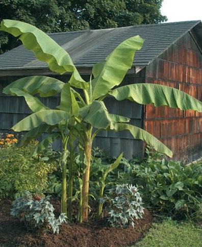

TREES
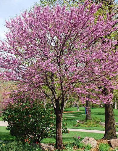
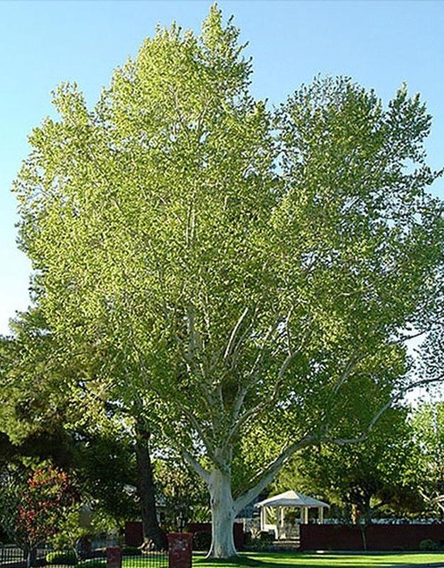

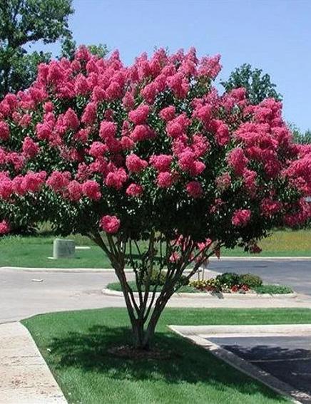

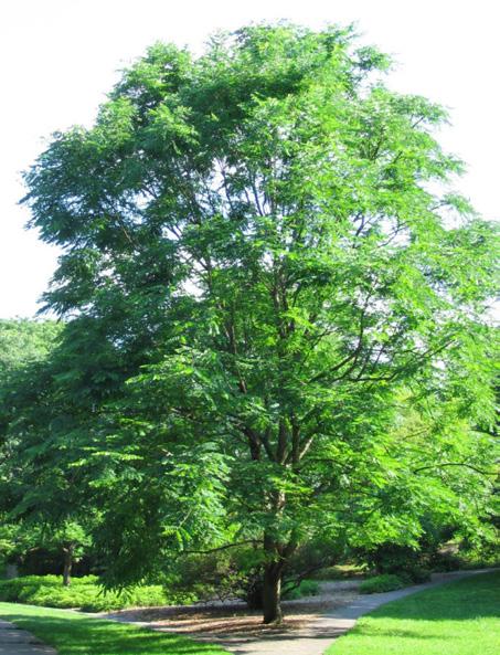
City of Holyoke
20/24 Not for construction. Part of a student project and not based on a legal survey.
PLANT PALETTE I
Designed By: Eva Hogue & Bindu Nicholson Spring 2023
La Placita de Holyoke
Fruitless Kentucky coffeetree Hardy banana
Ginkgo Crapemyrtle
Princeton elm Umbrella marigold
Placement Common name Scientific name Height (ft.) Crown spread Bloom color Bloom time Sun/Shade Salt Tolerance Drought tolerance Overall notes Canal walk + parking lot + street Honeylocust Gleditsia triacanthos var. inermis (thornless) 35-45 20-25 Golden green May-June Full sun Moderate Highly tolerant Single stem, thornless and fruitless, tolerates clay soil, air pollution Canal walk + parking lot + street Fruitless Kentucky coffeetree Gymnocladus dioicus 40-40 20-25 White May-June Full sun High/Moderate Highly tolerant Fruitless, tolerates air pollution Canal walk + parking lot + street Ginkgo Ginkgo biloba 50-80 30-40 Green March-April Full sun Moderate Highly tolerant Male only; fruitless, tolerates clay soil, air pollution Canal walk + parking lot + street Princeton elm Ulmus americana ‘Princeton’ 60-80 40-70 Green, red March-April Full sun High Highly tolerant Tolerates air pollution; good resistance to Dutch Elm Disease Canal walk + street Eastern redbud Cercis canadensis 20-30 25-35 Reddishpurple, rosy-pink March-April Full sun, part shade Low Highly tolerant Tolerates clay soil Canal walk + street American basswood Tilia americana 60-80 30-45 Yellow June-July Full sun, part shade Moderate Highly tolerant Tolerates heat, air pollution; fragrant, attractive to bees Canal walk + street Sassafras Sassafras albidum 30-60 25-40 Greenishyellow April-May Full sun, part shade Highly tolerant Tolerates clay soil; fragrant Canal walk + street Wildfire black gum Nyssa sylvatica ‘Wildfire’ 30-50 20-30 Green, white May-June Full sun, part shade Low Highly tolerant Tolerates clay soil, wet soil Canal walk Compactum tuliptree Liriodendron tulipifera ‘Compactum’ 30-40 15-30 Yellowgreen May-June Full sun Low Tolerant Intolerant of very hot, dry sites; dwarf Canal walk Umbrella magnolia Magnolia tripetala 15-30 15-30 White March-June Part shade Canal walk Dura-heat river birch Betula nigra ‘BNMTF’ 30-40 25-35 Brownishgreen April-May Full sun, part shade Moderate Tolerant Tolerates clay soil, wet soil, air pollution Canal walk American yellowwood Cladrastis kentukea 30-50 40-55 White May-June Full sun Moderate Somewhat tolerant Tolerates alkaline soils, acidic soils, urban conditions; fragrant Canal walk Dawn redwood Metasequoia glyptostroboides 75-100 15-25 No flower N/A Full sun Low Somewhat tolerant Tolerates clay soil, wet soil, air pollution
walk London planetree Platanus x acerifolia 70-100 65-80 Red, yellow April-May Full sun, part shade Moderate Tolerant Tolerates pollution and urban conditions. Canal walk Hardy banana Musa basjoo Canal walk Crapemyrtle Lagerstroemia indica 15-25 15-Jun Pink July-September Full sun Low Highly tolerant Tolerates clay soil, air pollution
London planetree Eastern redbud
Canal
PLANT PALETTE II
Placement Common name Scientific name
Vegetated bump-outs Red-osier dogwood Cornus sericea
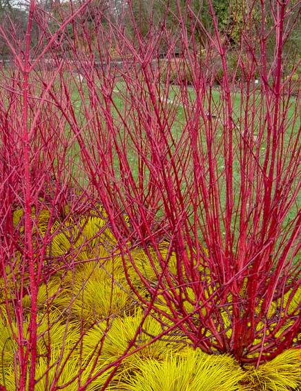
Vegetated bump-outs Bayberry Morella caroliniensis
Vegetated bump-outs Sweetfern Comptonia peregrina
Vegetated bump-outs Bush honeysuckle Diervilla lonicera
Vegetated bump-outs New Jersey tea Ceanothus americanus
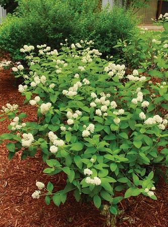
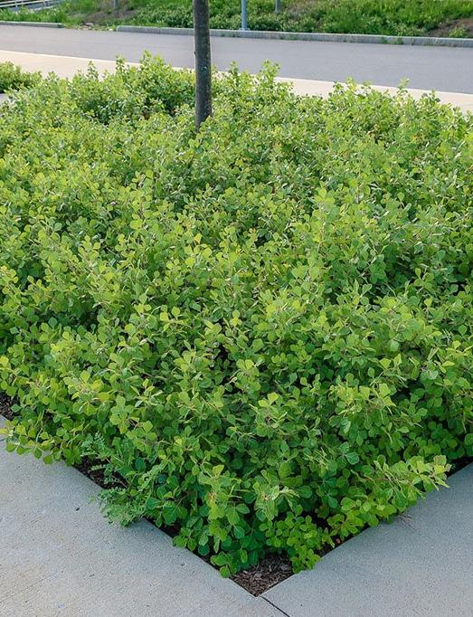
Vegetated bump-outs Fragrant sumac Rhus aromatica
Placement Grass or Herb/Forb Common name Scientific name
Canalside Grass Little bluestem ‘Albany Pine’ Schizachyrium scoparium ‘Albany Pine’
Canalside Grass Virginia wild rye Elymus virginicus
Canalside Grass Creeping red fescue Festuca rubra
Canalside Grass Upland bentgrass Agrostis perennans
Canalside Grass Deertongue grass ‘Tioga’ Dichanthelium clandestinum ‘Tioga’
Canalside Grass Purple lovegrass ‘RI Ecotype’ Eragrostis spectabilis ‘RI Ecotype’
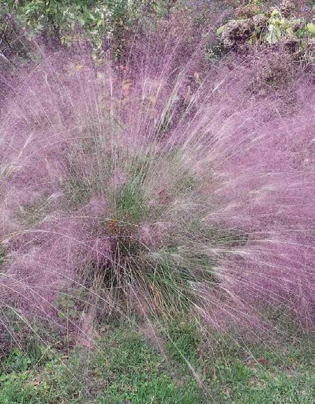
Canalside Herb/Forb Partridge pea Chamaecrista fasciculata
Canalside Herb/Forb Beard-tongue Penstemon digitalis
Canalside Herb/Forb Grey goldenrod Solidago nemoralis
Canalside Herb/Forb Heath aster Aster pilosus
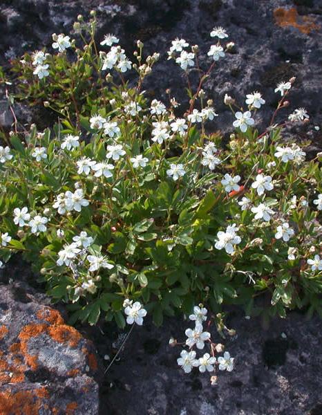
Canalside Herb/Forb Slender mountain mint Pycnanthemum tenuifolium
Canalside Herb/Forb Sundrops Oenothera fruticosa ssp. fruticosa
Canalside Herb/Forb Common yarrow Achillea millefolium
Canalside Herb/Forb Calico aster Aster lateriflorus
Canalside Herb/Forb White goldenrod Solidago bicolor
Canalside Herb/Forb Smooth aster NY ecotype Aster laevis ‘NY Ecotype’
Canalside Grass Cover crop - Grain oats/rye Secale cereale/Avena sativa
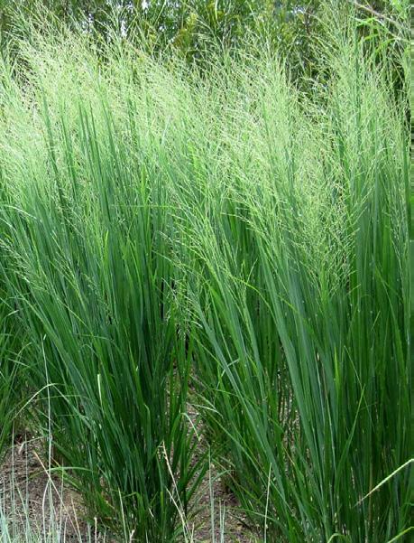
Canalside Grass Canada wild rye Elymus canadensis
Placement Common name Scientific name
Vegetated bump-outs Black-eyed Susan Rudbeckia hirta
Vegetated bump-outs Butterfly milkweed Asclepias tuberosa
Vegetated bump-outs Bellflower Campanula rotundifolia
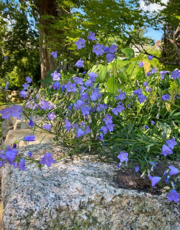
Vegetated bump-outs Flax-leaved bristly aster Lonactis linarifolia
FLOWERS WILDFLOWER & GRASS MIX*
Vegetated bump-outs Blazing star Liatris aspera, L. novaeangliaea, L. spicata
Vegetated bump-outs Sundial lupine Lupinus perennis
Vegetated bump-outs Spotted bee-balm Monarda punctata
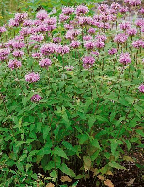
Vegetated bump-outs Purple poppy mallow Callirhoe involucrata
Canalside Grass Switch grass Panicum virgatum
Canalside Herb/Forb Purple coneflower Echinacea purpurea
Canalside Herb/Forb Wild bergamont Monarda fistulosa
Canalside Herb/Forb Common milkweed Asclepias syriaca
Canalside Herb/Forb Roundhead bush clover Lespedeza capitata
Canalside Herb/Forb Black-eyed Susan - VT ecotype Rudbeckia hirta - ‘VT ecotype’
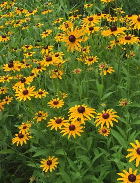
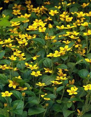
Canalside Herb/Forb Zig Zag aster Aster prenanthoides
Canalside Herb/Forb Early goldenrod Solidago juncea
Canalside Herb/Forb Swamp milkweed Asclepias incarnata
Placement Common name Scientific name

Vegetated bump-outs Pussytoes Antennaria sp.
Vegetated bump-outs Three-toothed cinquefoil Sibbaldiopsis tridentata
Vegetated bump-outs Wild strawberry Fragaria virginiana
Vegetated bump-outs Rock phlox Phlox subulata
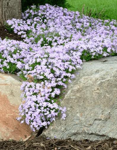
Vegetated bump-outs Green and Gold Chrysogonum virginianum
*Wildflower and grass mix is a compilation of grasses and herbs/forbs from the Massachusetts Department of Transportation Upland Seed Mix list.
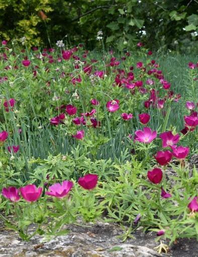
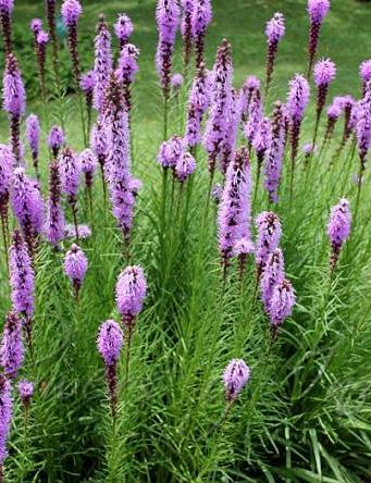
City of Holyoke
21/24 Not for construction. Part of a student project and not based on a legal survey.
Designed By: Eva Hogue & Bindu Nicholson Spring 2023
PLANT PALETTE II
La Placita de Holyoke
New Jersey tea Fragrant sumac Red-osier dogwood
Bellflower Purple poppy mallow Blazing star
Three-toothed cinquefoil Rock phlox Green and gold
Black-eyed Susan Wild bergamont
Northwind upright switchgrass Purple lovegrass
SHRUBS GROUNDCOVERS
PHASING & TACTICAL URBANISM COST ESTIMATES
The City of Holyoke can follow “tactical urbanism” strategies which are “flexible and short-term projects to advance long-term goals related to street safety, public space, and more” to phase-in the final design before permanent reconstruction (Streets Plans Collaborative). This can allow the city to test out temporary and demonstrative changes on the project site to gather public feedback and support. A phasing approach also allows more cost effective and immediate changes to be completed while the city procures permanent funding and political investment.
Tactical urbanism strategies can be employed by governmental actors, non-profits (like Beyond Walls, Nueva Esperanza, Enlace de Familias) individuals, citizen groups, and businesses and they can work in collaboration to “test ideas for public space, pedestrian safety, and economic development” (City of Somerville). Alongside this partnership and collaborative work, according to the Streets Plans Collaborative, a urban planning, design, and research-advocacy firm, success in tactical urbanism and creating community public spaces, requires supporting stewardship of these spaces by community partners. For example, the many community nonprofits within and near the project site could be permitted to steward empty lots and other public spaces and tactical urbanism projects to encourage collective responsibility. See the Streets Plans Collaborative Public Space Stewardship Guide for more information.
The following provides a selected list of tactical urbanism strategies. See the Streets Plans Collaborative Tactical Urbanist's Guide to Materials and Design for more information.

This chart provides the City of Holyoke with a rough low to high estimate for the installation of the final design. Some costs are yet to be determined.
BARRIERS SURFACE TREATMENTS STREET FURNITURE
Barriers: in reclaimed paved spaces, barriers provide a physical obstacle between cars and people. Consider using it for parklets, temporary street closures, traffic calming curb extensions, and pop-out protected bike lanes.
Materials: traffic cones, planters, flexible delineator posts, concrete jersey barrier, parking stops
Spaces: Municipal parking lot, Betty Medina Street, Crescent Clemente intersection, Main Street parklets, Race Street bike lane
Surface Treatments: artistic markings or striping on a paved area to designate and enhance a space. Consider using it for street art, traffic calming curb extensions, and popout protected bike lanes.
Materials: Traffic tape, spray paint/chalk, stencils, pigment polymer cement.
Spaces: Municipal parking lot, Betty Medina Street, alleyway, Crescent Clemente intersection, crosswalks, Race Street bike lane
La Placita de Holyoke


Street Furniture: Furniture for resting, sitting, and eating. Consider working with Beyond Walls to install functional and artistic seating in parklets and other public spaces.
Materials: hay bales, shipping pallets, moveable tables, chairs, and umbrellas
Spaces: Municipal parking lot, Betty Medina Street, Crescent Clemente intersection
DEMOLITION & SITE PREPARATION
SITE IMPROVEMENTS
LANDSCAPING
SITE AMENITIES
Exersise park each 1 $10,000 $35,000 $10,000 $35,000
TOTAL $1,215,210 $2,780,260
PHASING & TACTICAL URBANISM COST ESTIMATES
City of Holyoke
22/24 Not for construction. Part of a student project and not based on a legal survey.
Designed By: Eva Hogue & Bindu Nicholson Spring 2023
Product/Material Unit Quantity Low Cost High Cost Total Low Total High Asphalt removal square foot 5,060 $3 $4.50 $15,180 $22,770 Bumpouts each 33 $2,500 $4,000 $82,500 $99,000 Bioswale linear foot 165 $50 $80 $9,900 $9,900 Porous decorative concrete paving square foot 49,205 $15 $40 $738,075 $1,968,200 Porous asphalt paving square foot 5,060 $8 $14 $40,480 $70,840 Parklet each 4 $10,000 $20,000 $40,000 $80,000 Steps, stone square foot 500 $45 $65 $22,500 $32,500 Removeable bollards each 6 $800 $1,200 $4,800 $7,200 Street trees, 2'' cal. each 100 $850 $1,500 $85,000 $150,000 Shrubs, 1 gal. each 50 $18 $35 $900 $1,750 Herbaceous plants flats 50 $70 $120 3$,500 $6,000 Meadow seeding square foot 12,000 $0.1 $0.15 $1,200 $1,800 Mulch cubic yard 600 $45 $60 $27,000 $36,000 Raingardens square foot 825 $20 $50 $16,500 $41,250 Kioskos each 14 $3,000 $5,000 $42,000 $70,000 Chairs + tables each 18 $1,000 $1,500 $18,000 $18,000 Planters pots each 30 $125 $350 $3,750 $10,500 Street lighting each 5 $1,500 $2,500 $7,500 $10,000
10 $300 $600 $3,000 $6,000
5 $400 $1,000 $2,000 $5,000
$15,000
$7,500
265
1 $10,000 $50,000
Trash recepticles each
Bike racks each
Street cameras each 1 $12,000
$12,000 $15,000 Benches each 15 $500 $1,000
$15,000 Fence, vinyl coating linear foot
$45 $70 $11,925 $18,550 Splash pad fountain each
$10,000 $50,000
REFERENCES
Armory Village Revitalization Project. Bump Outs: An Environmentally- Friendly Solution for Keeping People Safe, www.millburyma.gov/sites/g/files/ vyhlif4706/f/uploads/bump_out_flyer_08.28.20.pdf. Accessed 30 June 2023.
Anguelovski, Isabelle. “Retracted: Urban Greening as the Ultimate Urban Environmental Justice Tragedy?” Planning Theory, vol. 16, no. 1, 2016, https://doi. org/10.1177/1473095216654448.
Binder, Graham. “Striking “Gold” with New Baltimore Park.” Maryland Today, 11 Oct. 2021, today.umd.edu/striking-gold-with-new-baltimore-park. Accessed 26 June 2023.
BusinessWest Staff. ““Parklets” Come to Downtown Amherst.” BusinessWest, 20 May 2022, businesswest.com/blog/parklets-come-to-downtown-amherst/. Accessed 26 June 2023.
Burke, Mike. “Immigrant Sweat Built Paper City.” Digital Collection -"Immigrant Sweat Built Paper City" Article from Sunday Republican Newspaper, 29 Sept. 2002, www.americancenturies.mass.edu/collection/itempage.jsp?itemid=18754&img=0&level=advanced&transcription=1.
Carvalho III, Joseph. The Puerto Ricans of Western Massachusetts: An Interview with Joseph Carvalho III.” Interview by Dennis, David. The New England Journal of History, www.nejh.org/post/the-puerto-ricans-of-western-massachusetts-an-interview-with-joseph-carvalho-iii.
Forsyth et al. “Plazas, Streets, and Markets: What Puerto Ricans Bring to Urban Spaces in Northern Climates,” NACTO, “Cambridge Shared Streets.” National Association of City Transportation Officials, 3 June 2015, nacto.org/case-study/cambridge-shared-streets/. “Canal History.” The Friends of the Canal Walk, Holyoke, MA, friendsofthecanalwalk.weebly.com/canal-history.html. Accessed 6 June 2023.
Checker, Melissa. The Sustainability Myth: Environmental Gentrification and the Politics of Justice. New York University Press, 2021. Christensen, Dusty. “Holyoke Planners Chart How Best to Permit Motorcycle Dealership/Restaurant at Church.” Daily Hampshire Gazette, 28 July 2022, www. gazettenet.com/Holyoke-planners-city-councilors-talk-church-plans-to-convert-to-motorcycle-dealership-47371486.
Chen, Chelsea. “Environmental Justice in Urban Development: The Problem of Green Gentrification.” Environmental Justice in Urban Development: The Problem of Green Gentrification | Environmental Law Institute, 25 Oct. 2021, www.eli.org/vibrant-environment-blog/environmental-justice-urban- development-problem-green-gentrification.
“Chicago Riverwalk.” Sasaki, www.sasaki.com/projects/chicago-riverwalk/.
Chung, Payton. “How Are the Wharf’s Shared Spaces Working Out?” Greater Greater Washington, 28 Nov. 2017, ggwash.org/view/65639/how-are-the- wharfs-shared-spaces-working-out.
City of Somerville. “City’s First Public Parklet Opens on Somerville Ave.” www.somervillema.gov/news/citys-first-public-parklet-opens-somerville-ave. Accessed 29 June 2023.
“City’s First Public Parklet Opens on Somerville Ave.” City of Somerville, www.somervillema.gov/news/citys-first-public-parklet-opens-somerville-ave. Accessed 29 June 2023.
City of Detroit. “Detroit launches Dead, Dangerous, and Diseased Tree Program; new initiative to help residents clean up trees in neighborhoods across the city.” City of Detroit Department of Neighborhoods, 3 May 2023. new-initiative-help-residents-clean-trees#:~:text=The%20City%20of%20Detroit%20today,no%20charge%20to%20the%20resident.https://detroitmi.gov/news/detroit-launches-dead-dangerous-and-diseased-tree-programAccessed 16 June 2023. City of Holyoke. “Sewers, Septic Systems, and Wastewater.” City of Holyoke Public Works. https://www.holyoke.org/dpw-sewer-and-waste-water/ Accessed 19 June 2023.
Cole, Helen V, et al. “Are Green Cities Healthy and Equitable? Unpacking the Relationship between Health, Green Space and Gentrification.” Journal of Epidemiology and Community Health, 2017, https://doi.org/10.1136/jech-2017-209201.
The Conway School. “Green Streets Guidebook.” Issuu, 12 June 2014, issuu.com/conwaydesign/docs/issuu_version.
EPA, www.epa.gov/green-infrastructure/what-green-infrastructure#permeablepavements. Accessed 29 June 2023. EPA, www.epa.gov/ejscreen. Accessed 28 June 2023.
EPA, www.epa.gov/green-infrastructure/reduce-urban-heat-island-effect. Accessed 29 June 2023. Environmental Justice Policy, Article 97, Executive Office of Energy and Environmental Affairs. Forman, Benjamin. 4th ed., vol. 27, Municipal Advocate, 20AD, pp. 14–17, Rebuilding Gateway Cities Is Key to State’s Economic Future. Gabrilska, Meredith. “Cambridge Municipal Parking Lot Transformed into Community Space.” Massachusetts Municipal Association (MMA), 18 Nov. 2020, www.mma.org/cambridge-municipal-parking-lot-transformed-into-community-space/.
“Green Alley Projects.” Ddot, ddot.dc.gov/GreenAlleys. Accessed 29 June 2023. “Greenit! Lancaster.” City of Lancaster, PA, 7 Mar. 2023, www.cityoflancasterpa.gov/stormwater-information/greenit-lancaster/. Gross, Terry. “A “Forgotten History” of How the U.S. Government Segregated America.” NPR, 3 May 2017, www.npr.org/2017/05/03/526655831/a-forgotten- history-of-how-the-u-s-government-segregated-america.
Harty , Patricia. “Holyoke’s Irish Heart: Irish America.” Irish America , 17 Mar. 2023, www.irishamerica.com/2009/06/holyokes-irish-heart/. Herriges, Daniel. “The Key to a Great Public Space? It’s in the Edges.” Strong Towns, 22 June 2020, www.strongtowns.org/journal/2020/6/22/its-in-the-edges. Hester, Randolph T. Design for Ecological Democracy, MIT Press, Cambridge, Mass, 2006, pp. 390–407. “HHE.” Holyoke Has Energy, holyokehasenergy.com/. Accessed 29 June 2023.
Hickey , Olivia. “Northampton Kicks off Summer on Strong Outdoor Dining Experience.” Https://Www.Westernmassnews.Com, 7 May 2022, www. westernmassnews.com/2022/05/07/northampton-kicks-off-summer-strong-outdoor-dining-experience/.
“Holyoke Canal Walk Project Overview” The Friends of the Canal Walk, Holyoke, MA, friendsofthecanalwalk.weebly.com/canal-history.html. Accessed 6 June 2023.
“‘Isla Del Encanto’ Public Art Mural Finally Finds a Home in Holyoke, Massachusetts.” Jackson, Candace. “What Is Redlining?” The New York Times, 17 Aug. 2021, www.nytimes.com/2021/08/17/realestate/what-is-redlining.html.
Januchta-Szostak, Anna. “The Role of Public Visual Art in Urban Space Recognition.” Cognitive Maps. https://www.intechopen.com/chapters/6752 Accessed 22 June 2023.
Jones, Peter Blundell, et al. “Pedestrians and Traffic.” Architecture and Movement: The Dynamic Experience of Buildings and Landscapes, Routledge, London, 2015, pp. 149–155.
Kensinger, Nathan. “Inside the Casitas of the South Bronx’s Community Gardens.” Curbed NY, 1 Oct. 2015, ny.curbed.com/2015/10/1/9915402/inside-the- casitas-of-the-south-bronxs-community-gardens.
Krupczynski, Joseph, et al. 2019, El Corazon: The Heart of Holyoke, https://cuny.manifoldapp.org/api/proxy/ingestion_sources/c710fbb3-4b69-4f97-a6a1- 29bd0fa47414. Accessed 27 June 2023.
Krupczynski, Joseph. Personal interview. 8 June 2023
“La Placita de Santurce.” Discover Puerto Rico, www.discoverpuertorico.com/profile/la-placita-de-santurce/8742. Accessed 29 June 2023. Latino Rebels, 22 Oct. 2014, www.latinorebels.com/2014/10/08/isla-de-encanto-public-art-mural-finally-finds-a-home-in-holyoke-massachusetts/.
“Local Foods, Local Places: Community Action Plan for Holyoke, Massachusetts.” United States Environmental Protection Agency, 2017, www.ams.usda.gov/ sites/default/files/media/LFLPHolyokeMA.pdf.
Lynch, Kenneth. “The City Image and Its Elements.” The Image of the City, MIT Pr., Cambridge, MA, 1979, pp. 46–49.
Maantay, Juliana. “Mapping Environmental Injustices: Pitfalls and Potential of Geographic Information Systems in Assessing Environmental Health and Equity.” Environmental Health Perspectives, vol. 110, no. suppl 2, Apr. 2002, pp. 161–171, ehp.niehs.nih.gov/doi/pdf/10.1289/ehp.02110s2161, https://doi. org/10.1289/ehp.02110s2161.
Marrero , Marcos. “The Alchemy of Gateway City Development: MassDevelopment’s Strategies for Transforming Downtown Neighborhoods.” Mass Development, 22 Jan. 2022, www.massdevelopment.com/news/the-alchemy-of-gateway-city-development/. MassDevelopment. Transformative Development Initiative Building a Culture of Co-Investment in Small Cities.
Merzbach, Scott. “Around Amherst: “Parklets” Add a Little Room to Dine in Downtown Amherst.” Daily Hampshire Gazette, 3 June 2022, www.gazettenet. com/Around-Amherst-46645826. Accessed 26 June 2023.
Michelle.Williams@MassLive.com, Michelle Williams |. “Holyoke Featured in NPR Segment on Puerto Rican Identity.” Masslive, 1 Mar. 2017, www.masslive. com/living/2017/03/holyoke_featured_in_npr_segment_on_puerto_rican_identity.html.
Muro, Mark, et al. MassInc, 2007, Reconnecting Massachusetts Gateway Cities: Lessons Learned and an Agenda for Renewal, https://www.brookings.edu/ wp-content/uploads/2016/06/massgateways.pdf. Accessed 6 June 2023.
NYC Department on Transportation. “Connected Tree Bed | NYC Street Design Manual.” NYC Department of Transportation Street Design Manual, www. nycstreetdesign.info/landscape/connected-tree-bed. Accessed 26 June 2023.
O’Connell, Kim. “A Park with a Heart of Gold | Landscape Architecture Magazine.” Landscape Architecture Magazine, 4 Jan. 2022, landscapearchitecturemagazine.org/2022/01/04/a-park-with-a-heart-of-gold/.
Office of the Mayor, City of Holyoke. “Holyoke, EPA enter into agreement to reduce sewage discharges into Connecticut River”. 23 March 2023. https://www. holyoke.org/holyoke-epa-enter-into-agreement-to-reduce-sewage-discharges-into-connecticut-river/ . Accessed 19 June 2023.
Pereira, Rebeca. “Refreshing the Tradition of Fiestas Patronales with Holyoke Celebration.” Daily Hampshire Gazette, Concord Monitor, 30 July 2022, www. gazettenet.com/Fiestas-Patronales-in-Holyoke-47384407
Plaisance, Mike. “Curious Nature of Zoning Plays out in Holyoke over Former School.” Masslive, 10 June 2016, www.masslive.com/news/2016/06/now_ that_a_cvs_is_out_cemetery.html.
Public Space Stewardship Guide: A Toolkit for Funding Programming and Maintenance, 9 Jan. 2017, https://issuu.com/streetplanscollaborative/docs/task2_ mgmt-guide_final_web.

Rigolon Alessandro. Greening without Gentrification: Learning from Parks-Related Anti-Displacement Strategies Nationwide, 2019. Robert K. Nelson, LaDale Winling, Richard Marciano, Nathan Connolly, et al., “Mapping Inequality,” American Panorama, ed. Robert K. Nelson and Edward L. Ayers, accessed June 17, 2023, https://dsl.richmond.edu/panorama/redlining/
“Smart Growth America.” Smart Growth America, 17 May 2023, smartgrowthamerica.org/.
Taotiadmin. “The Charter of the New Urbanism.” CNU, 6 Dec. 2022, www.cnu.org/who-we-are/charter-new-urbanism.
The Street Plans CollaborativeFollowthis. “Tactical Urbanist’s Guide to Materials and Design v.1.0.” Issuu, 12 Dec. 2016, issuu.com/streetplanscollaborative/ docs/tu-guide_to_materials_and_design_v1.
Trees Atlanta. “Urban Tree Canopy Study.” Atlanta%20has%20the,that%20have%20conducted%20UTC%20Assessments.https://www.treesatlanta.org/resources/urban-tree-canopy-study/#:~:text=At%2047.9%20%25%2C%20 Accessed 22 June 2023.
Trees for Streets. “How Street Trees can Make our Lives Healthier and Happier.” Trees for Cities. https://www.treesforstreets.org/how-street-trees-can-make- our-lives-healthier-and-happier/ Accessed 22 June 2023.
Urban Street Design Guide. Island Press, 2013.
UMass Donahue Institute. Puerto Ricans in Massachusetts: Demographic Profile and Fact Sheet.
University of Vermont. “Study explains why thousands of Detroit residents rejected city's tree planting efforts.” Science X Network, 7 January 2019, https:// phys.org/news/2019-01-thousands-detroit-residents-city-tree.html. Accessed 16 June 2023.
U.S. Environmental Protection Agency | US EPA, Mar. 2021, www.epa.gov/sites/default/files/2021-04/documents/green_streets_design_manual_feb_2021_ web_res_small_508.pdf.
US EPA. “Reduce Urban Heat Island Effect.” US EPA, 22 May 2019, www.epa.gov/green-infrastructure/reduce-urban-heat-island-effect.
Veolia Water. “The Past & Future of Holyoke’s Wastewater.” Holyoke Water Services. https://mywater.veolia.us/sites/default/files/UW_8.5x11_Project_Flyer_ Holyoke_screen.pdf Accessed 19 June 2023.
Violette, Zachary. “Holyoke Main Street Corridor Survey.” Holyoke Has Energy. 30 Sept. 2020. https://holyokehasenergy.com/wp-content/uploads/2020/11/ Holyoke-Main-St-Corridor-Historic-Survey-Final-Report.pdf
Wicked Problems. “Wicked Problems: Problems Worth Solving - Wicked Problem.” Wickedproblems.com, 2019, www.wickedproblems.com/1_wicked_ problems.php.
City of Holyoke
23/24 Not for construction. Part of a student project and not based on a legal survey. La Placita de Holyoke REFERENCES
Designed By: Eva Hogue & Bindu Nicholson Spring 2023
IMAGE SOURCES
Index / Acknowledgements
• Ojitos Lindos” by Bikismo
• Frankie Borrero
• “Father and Baby Moose,” by Bordalo II
• “Yagrumo” by Vero Rivera
• Nuestra Raices
Introduction
• https://www.gazettenet.com/State-Rep-Aaron-Vega-will-not-seek-reelection-in-November-32304453
• https://www.linkedin.com/in/stephanie-colon-378a711a6
• https://nuevaofholyoke.org/our-team/
• https://www.linkedin.com/in/frank-martinez-lopez-792988226?trk=public_profile_samename-profile
• https://www.masslive.com/news/2016/08/patio_opens_at_fiesta_cafe_in.html
• https://holyokehasenergy.com/about-holyoke/plans-and-studies/

Location & History
• https://www.worldmapsonline.com/historic-map-holyoke-ma-1877/
• https://commons.wikimedia.org/wiki/File:Middle_Canal_Postcard,_Holyoke,_Massachusetts_%28c_1907%29.png
Environmental & Social Injustice Analysis
• https://ejscreen.epa.gov/mapper/
• https://dsl.richmond.edu/panorama/redlining/#loc=13/42.206/-72.638&city=holyoke-chicopee-ma&area=D2
Design Thinking and Strategies I
• https://www.pomptonlakes-nj.gov/326/Complete-Streets
• https://potsplantersandmore.com/blog/the-best-planters-for-public-spaces/
• https://www.planetizen.com/news/2018/12/102062-west-hollywood-pilots-pop-walkability-improvements
• https://www.mansionglobal.com/articles/philadelphias-rittenhouse-square-is-all-about-location-community-and-an-iconicpark-01633778084
• http://groveland-fl.gov/558/Tactical-Urbanism
Design Alternative: Streetscape
• https://pacificnurseries.com/parklets-in-san-francisco/
• https://www.nbcnews.com/think/opinion/white-liberals-must-stop-pushing-puerto-rican-statehood-their-own-ncna1247419
Design Alternative: Pocket Parks
• The Creative Little Garden: https://fineartamerica.com/featured/the-creative-little-garden-ed-weidman.html photo credit: Ed Weidman
• Street Art: https://www.brooklynpaper.com/street-art-painter-turns-pedestrian-plaza-into-mural/ photo credit: Stefano Giovannini
• Viola Garden https://metrophiladelphia.com/decades-old-agreement-threatens-community-gardens-in-citys-poorestneighborhoods/ photo credit: Jack Tomczuk
Design Alternative: Lush City
• Alleyway Puerto Rico: https://boricuaonline.com/en/old-san-juan-puerto-rico/
• Atlanta, Georgia Trees: https://www.treesatlanta.org/news/free-trees-for-your-front-yard/ photo by Curbed Atlanta
• Urban Food Forest: https://www.sustenancedesign.com/portfolio/urban-food-forest
• Heritage Park: https://en.wikipedia.org/wiki/Holyoke_Heritage_State_Park
Final Design Details I
• https://archive.curbed.com/2016/8/25/12613140/summer-swimming-pool-fountains-splash-pads-cities
Case Studies I
• https://globaldesigningcities.org/publication/global-street-design-guide/streets/shared-streets/residential-shared-streets/
• https://www.enjoyillinois.com/travel-illinois/10-neighborhoods-to-love-in-chicago/
• https://www.aiany.org/architecture/featured-projects/view/district-wharf/
• https://www.finditcambridge.org/organizations/starlight-square?language=ja
• https://www.discoverpuertorico.com/profile/la-placita-de-santurce/8742
• https://www.thereminder.com/features/page2feature/outdoor-dining-options-grow-with-northamptons-summ/
Case Studies II
• https://detroitmi.gov/news/detroit-launches-dead-dangerous-and-diseased-tree-program-new-initiative-help-residents-cleantrees
• https://www.phillyorchards.org/2020/06/10/philadelphias-food-forests/
• https://landscapearchitecturemagazine.org/2022/01/04/a-park-with-a-heart-of-gold/
• https://ny.curbed.com/2015/10/1/9915402/inside-the-casitas-of-the-south-bronxs-community-gardens
• Greenit! Lancaster.” City of Lancaster, PA, 7 Mar. 2023, www.cityoflancasterpa.gov/stormwater-information/greenit-lancaster/
Plant Palette I
• Eastern redbud: Arbor Day Foundation, photo credit Kerry Wilken https://shop.arborday.org/eastern-redbud
• London planetree: Star Nursery https://www.starnursery.com/product/london-plane-tree
• Umbrella magnolia: North Carolina Extension Gardener Plant Toolbox https://plants.ces.ncsu.edu/plants/magnolia-tripetala/
• Crapemyrtle: Tree Help https://www.treehelp.com/products/crapemyrtle-seeds
• Princeton Elm: Schumachers Nursery http://schumachersnursery.com/nurserystock/elm-american-princeton-2/
• Hardy banana: Logees Plants for Home & Garden https://www.logees.com/hardy-banana-musa-basjoo.html
• Kentucky Coffeetree: Great Plains Nursery https://greatplainsnursery.com/product/kentucky-coffeetree-2/
• Ginkgo: Brighter Blooms https://www.brighterblooms.com/products/ginkgo-tree
Plant Palette II
• Green and Gold: North Carolina Extension Gardener Plant Toolbox https://plants.ces.ncsu.edu/plants/chrysogonumvirginianum/ Photo credit: Tom Potterfield
• New Jersey tea: Missouri Wildflowers Nursery https://mowildflowers-net.3dcartstores.com/New-Jersey-Tea-Ceanothusamericanus_p_426.html
• Fragrant sumac: Garden Tutor https://gardentutor.com/gro-low-fragrant-sumac-rhus-aromatica-gro-low/
• Red-osier dogwood: Wilson Bros Gardens https://www.wilsonbrosgardens.com/cornus-sericea-red-osier-red-twig-dogwood-1gallon.html
• Bellflower: Avant Gardens https://www.avantgardensne.com/product/campanula-rotundifolia-thumbell-blue/
• Purple Poppy Mallow: Blazing Star Gardens https://www.blazingstargardens.com/plants/p/purple-poppy-mallow-callirhoeinvolucrata
• Rock phlox: Platt Hill Nursery https://platthillnursery.com/how-to-incorporate-creeping-phlox-into-your-landscape/
• Three-toothed cinquefoil: Minnesota wildflowers https://www.minnesotawildflowers.info/shrub/three-toothed-cinquefoil photo credit: Peter m. Dziuk
• Purple lovegrass: Outside Pride https://www.outsidepride.com/seed/ornamental-grass/love-grass/love-grass-purple.html
• Wild bergamont: https://www.outsidepride.com/seed/flower-seed/bee-balm/bee-balm.html
• Switchgrass: Hoffman Nursery Inc. https://hoffmannursery.com/assets/files/images/Panicum_Northwind_02.jpg
• Black-eyed susan: Master Gardeners of Northern Virginia https://mgnv.org/plants/native-plants/perennials/rudbeckia-hirta/ photo credit: Elaine Mills
City of Holyoke
24/24 Not for construction. Part of a student project and not based on a legal survey.
Designed By: Eva Hogue & Bindu Nicholson Spring 2023
IMAGE SOURCES
La Placita de Holyoke


 Designed By: Eva Hogue & Bindu Nicholson

 Designed By: Eva Hogue & Bindu Nicholson Spring 2023


 Designed By: Eva Hogue & Bindu Nicholson


