Not for Construction. This document is a student project and not based on a legal survey.
15
Galen Hammitt | Walker Powell | The Conway School
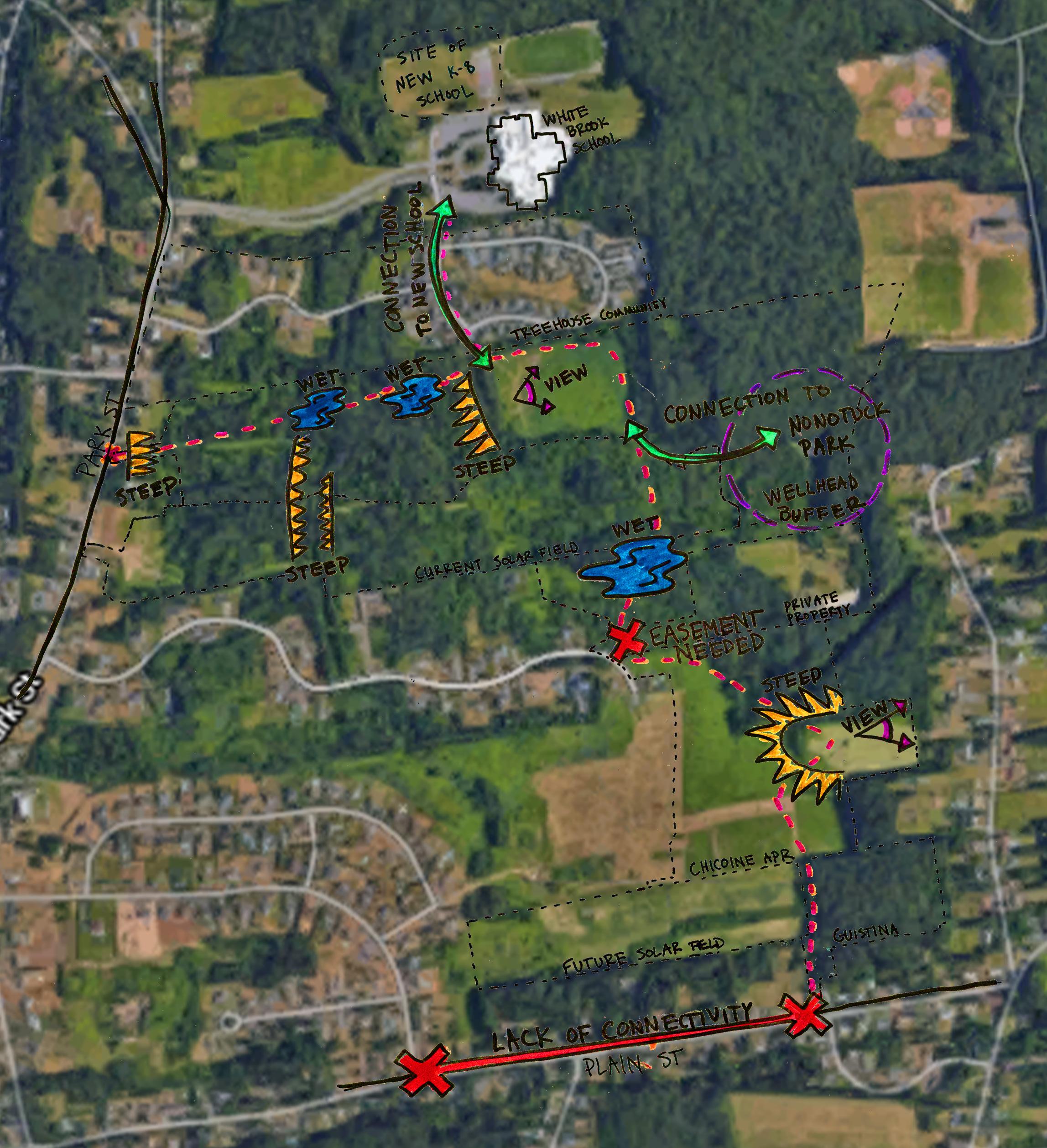
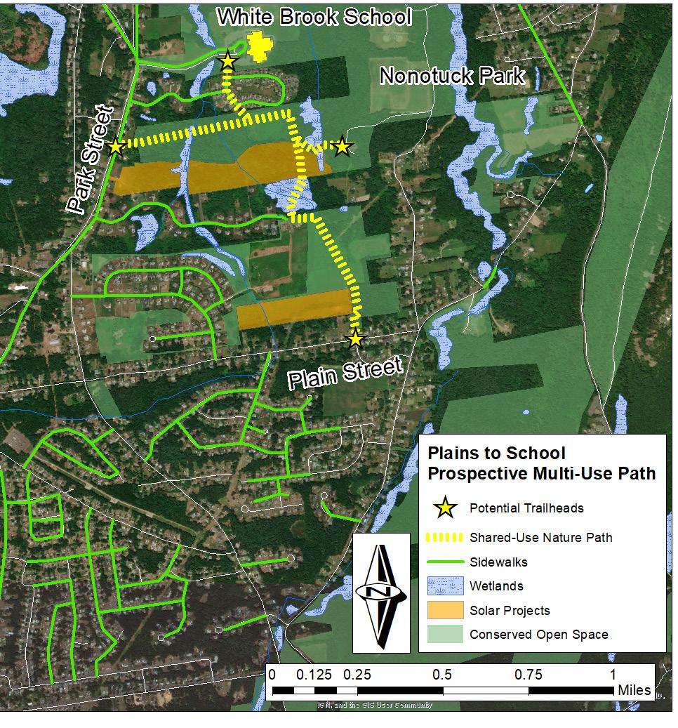
Universal Accessibility. The Shared-Use Nature Path should be constructed according to Architectural Barriers Act standards of accessibility, so all Easthampton residents and visitors can explore the path comfortably. A small parking lot at the Plain Street trailhead would help non-local or less mobile users access the path.
Prepared for the City of Easthampton | Spring 2020
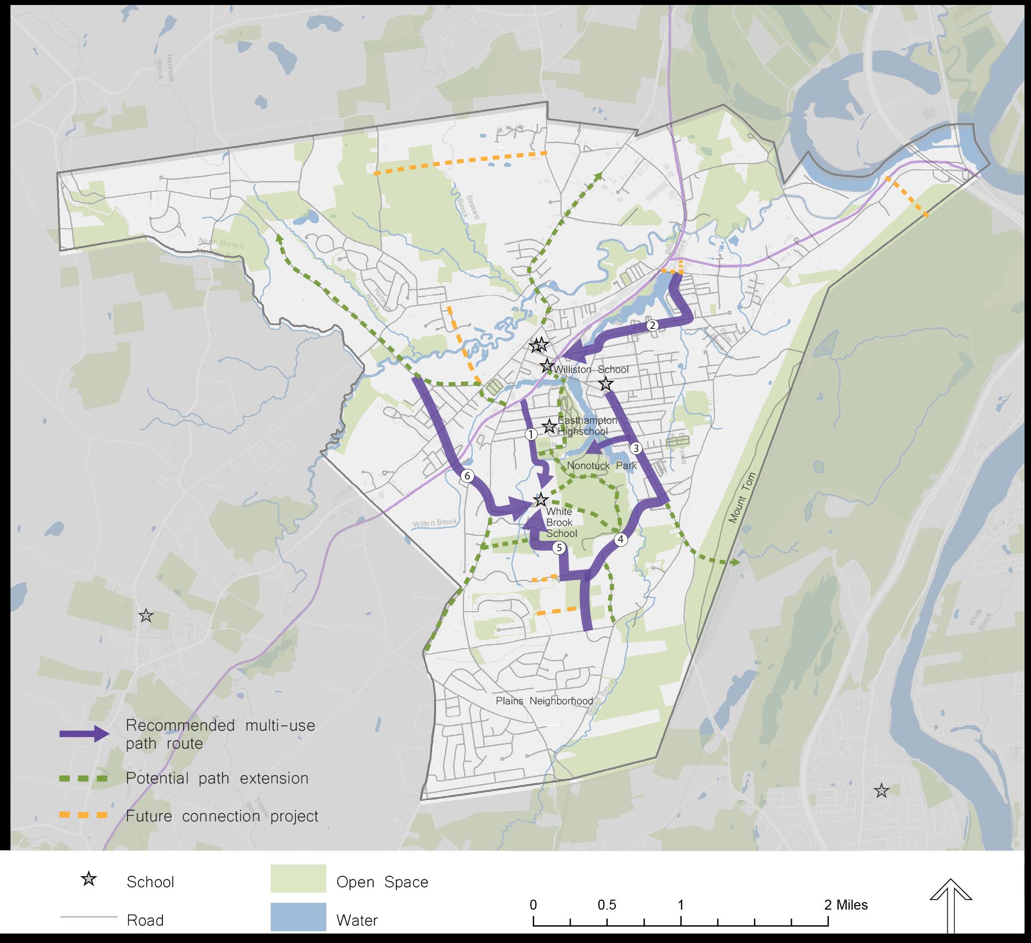
Getting Away from Plain Street Traffic. Residents of the Plains could enjoy a comfortable commute separated from traffic on a two-way side path on the south side of Plain Street within the city right of way. Creating a network of improved pedestrian and bicyclist infrastructure throughout the Plains and Easthampton will reduce dependence on motorized travel and create a more livable city.
Towards a Sustainable Future. Global climate change poses unprecedented challenges for every community on the planet, as well as opportunities for dedicated action to support a high standard of living for all. Easthampton will need to balance the need to conserve natural spaces, develop alternative energy sources, and provide alternative transportation systems in order to chart a course to a livable future.
PLAINS TO SCHOOL: A Shared-Use Path for Easthampton
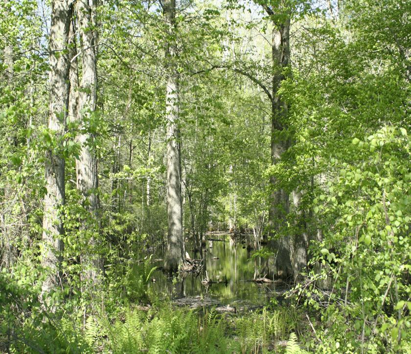
Visiting Easthampton’s Natural Systems. Path users could experience the beauty of two wetland ecosystems up close from the comfort of an elevated boardwalk (Note: Boardwalks should have protective guardrails on both sides). The wetlands of the White Brook area store and clean surface runoff while sequestering atmospheric carbon and providing a rich habitat for local wildlife. Elevated boardwalks allow public passage with minimal impact on these sensitive and valuable natural features.
FINAL DESIGN
FINAL DESIGN - Shared-Use Nature Path


