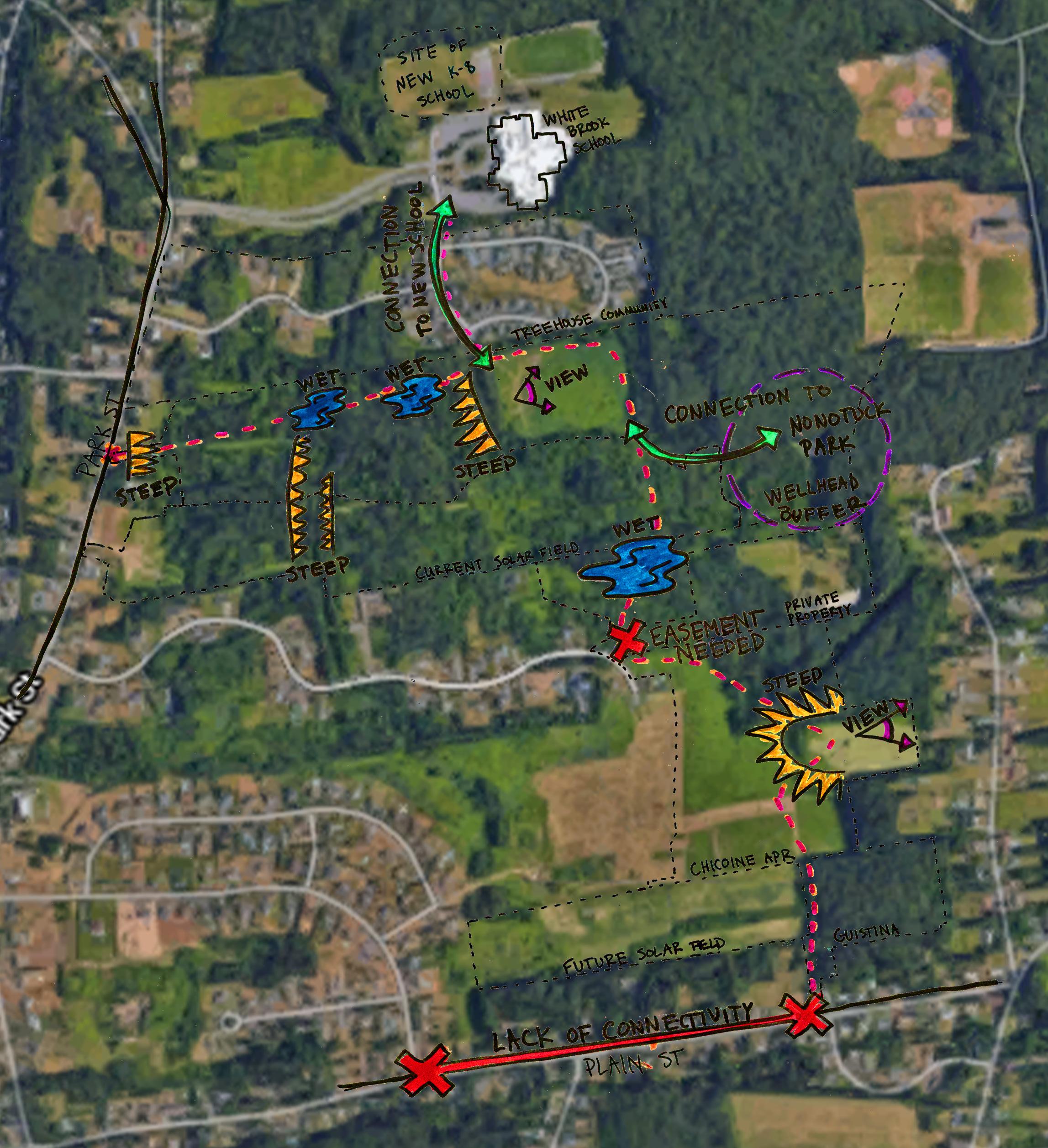
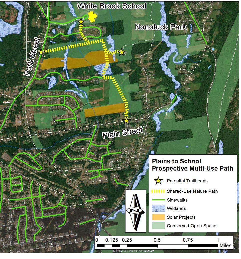
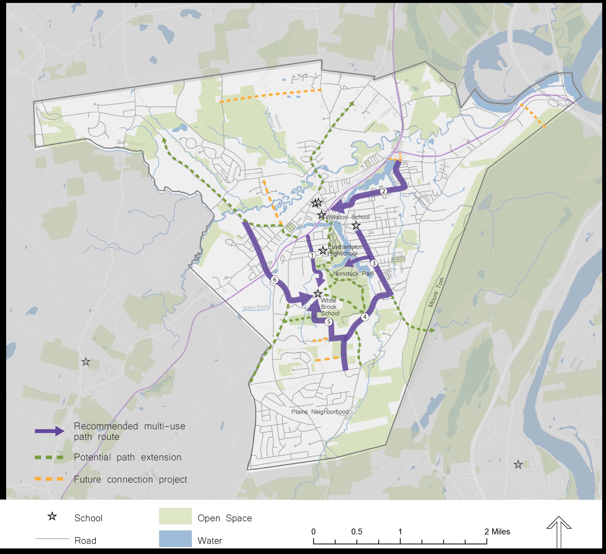
Currently, the only contiguous pedestrian route that connects the Plains to other parts of Easthampton is the sidewalk on Park Street. Residents who don’t feel comfortable walking or cycling alongside cars have very limited options for traveling to and from the Plains without using a car themselves. Creating a new shared-use path away from vehicle traffic will dramatically improve people’s ability to come and go from the Plains without relying on motorized transportation.
Right: yellow numbers indicate the number of times streets in the Plains were reported as unsafe or uncomfortable by survey respondents.
CONNECTIVITY PAGE TITLE
The City of Easthampton aims to improve walking and cycling infrastructure within the Plains. The 2017 Complete Streets Prioritization Plan calls for the construction of new sidewalks on Plain Street, Strong Street, Phelps Street and Pomeroy Street, as well as a bike lane on Line Street and Park Street.`
6
Galen Hammitt | Walker Powell | The Conway School
While most of the secondary streets within the Plains have sidewalks, none of the main roads do except for Park Street and Line Street. There are no designated bike lanes within the Plains. In a survey conducted to gather community feedback on the experience of walking and biking in the Plains, residents reported that the quieter roads with sidewalks are pleasant to use, but the main roads feel unsafe due to the lack of sidewalks, the heavy traffic, and speeding drivers. The roads that were most frequently cited as being unsafe or uncomfortable are Park Street (even though it has a sidewalk), Plain Street, Strong Street, and Hendrick Street.
Prepared for the City of Easthampton | Spring 2020
Pedestrian and Bicyclist Infrastructure
PLAINS TO SCHOOL: A Shared-Use Path for Easthampton
CONNECTIVITY


