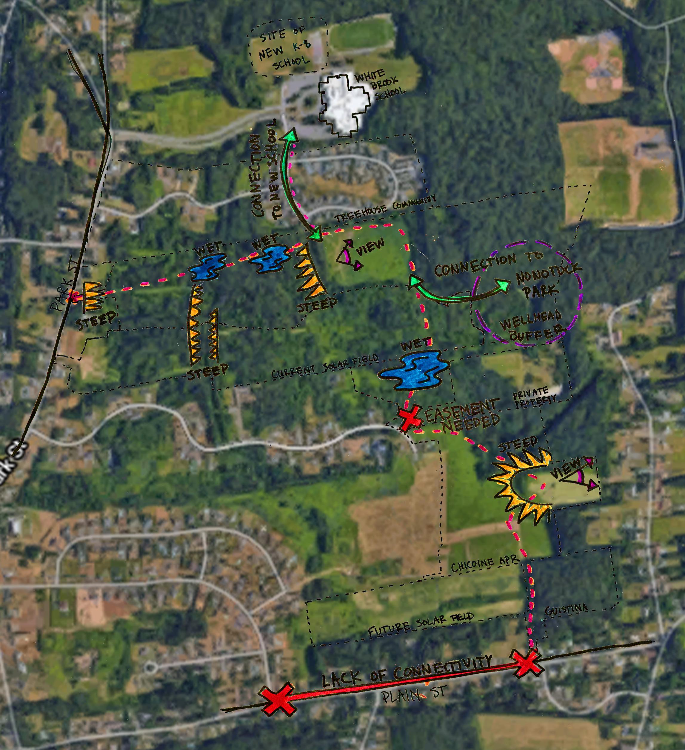
Given the abundance of hydrological features and the constraints of the conserved parcels of land, it is not possible to build a path that completely avoids the hydrological resource protection areas. However, paths can be built through these sensitive natural features using techniques that minimize negative impacts to the local hydrology and ecology. (See sheet 29 for precedents and construction details.)
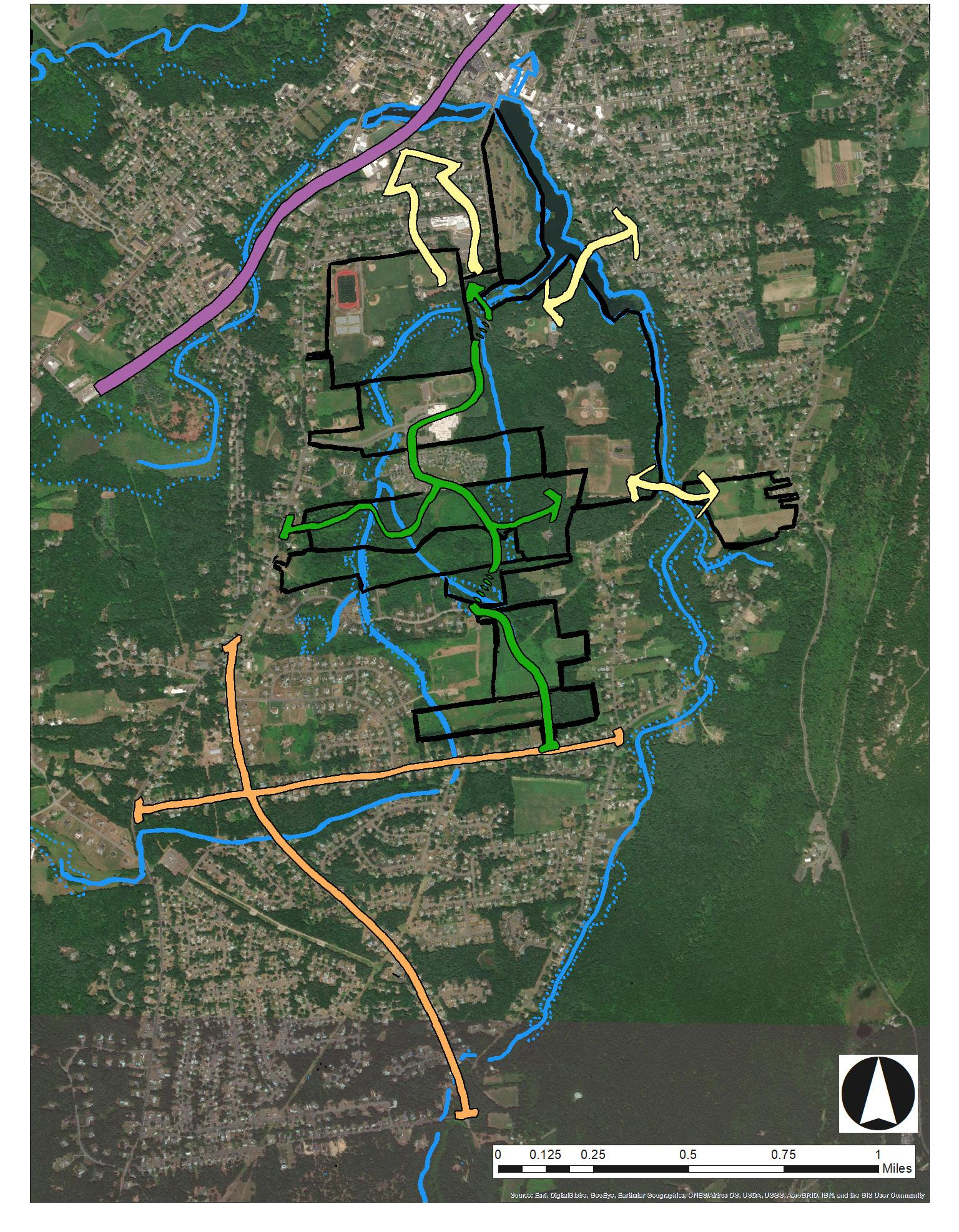
Water from Mount Tom and the highlands west of Easthampton drains through the Manhan River and its tributaries northeast through the city and empties into the Oxbow and the Connecticut River.
HYDROLOGY PAGE TITLE
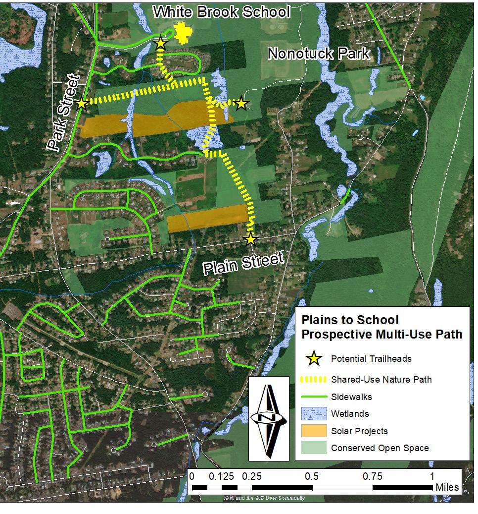
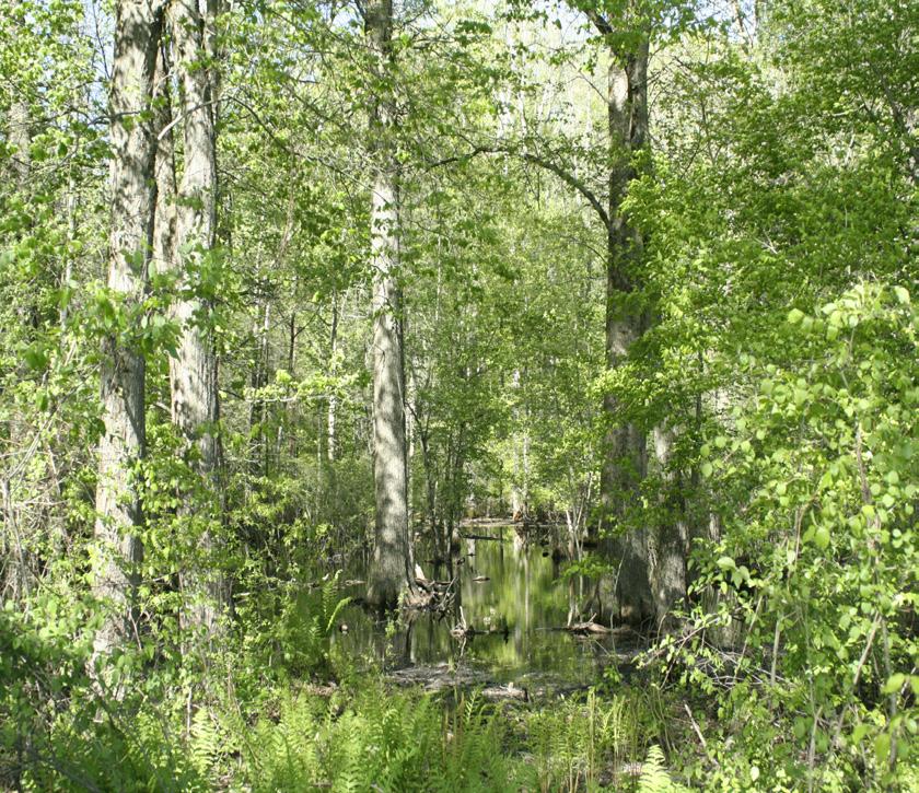
Throughout the White Brook area, wetlands form along the brooks in pockets of poorly drained soil. These important natural features absorb excess water during storms, filter pollutants out of storm water, provide habitat for wildlife and wetland plants, and sequester atmospheric carbon dioxide. Perennial streams and wetlands are regulated under the Wetlands Protection Act, and any development or disturbance within the resource protection area requires permitting and approval from Easthampton’s Conservation Commission. There are likely additional wetlands within the area not identified by this study, which would need to be professionally delineated as part of further planning for any path through this area.
7
Galen Hammitt | Walker Powell | The Conway School
The entirety of Easthampton is located within the watershed of the Manhan River, which drains the land northeast of Mount Tom into the Oxbow and the Connecticut River. White Brook and Broad Brook are tributaries of the Manhan River, which flow through the Plains and northward through the study area before draining into Nashawannuck Pond.
Prepared for the City of Easthampton | Spring 2020
Abundant Streams and Wetlands Impact Path Design
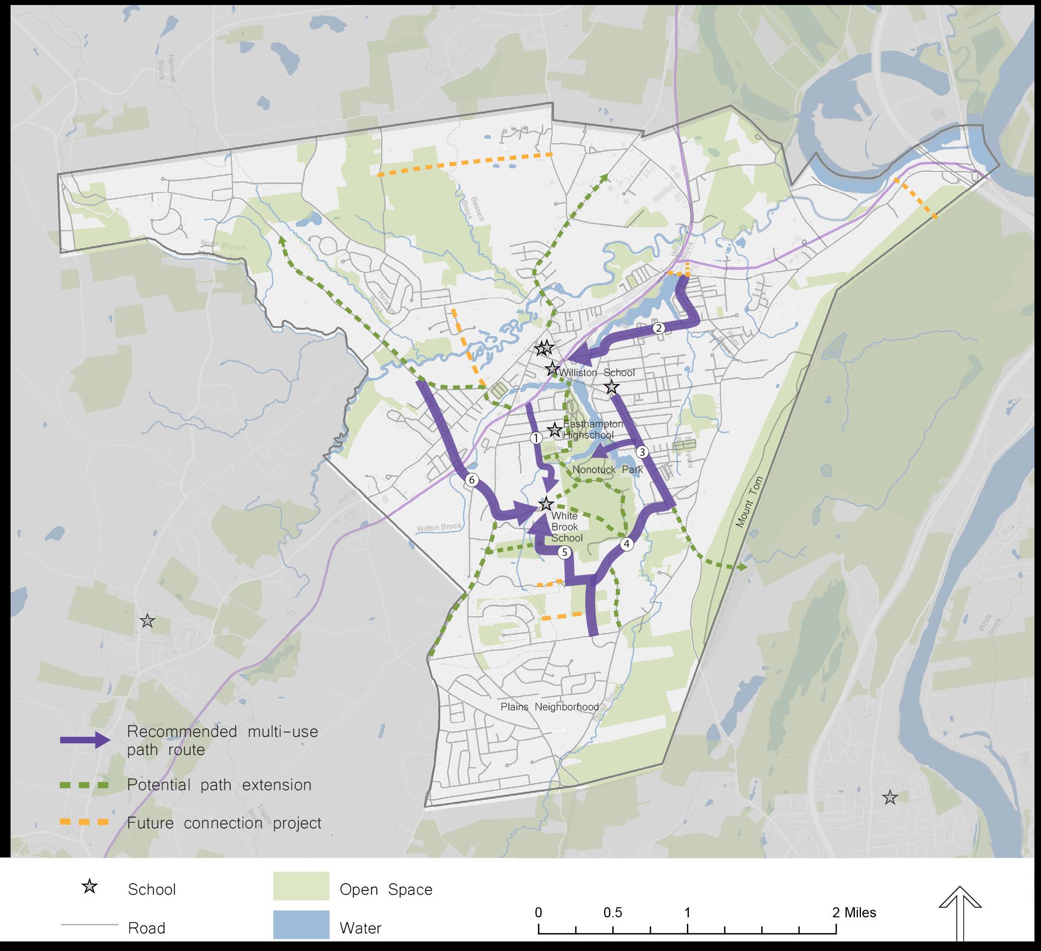
PLAINS TO SCHOOL: A Shared-Use Path for Easthampton
HYDROLOGY