Urban Informality
Urban Ecological Planning 1st emester #1
Urban Ecological Planning
AAR4525 Urban Informality: Project Course
Faculty of Architecture and Design
Department of Architecture and Planning Norwegian University of Science and Technology September - December 2020

Marina Skanche, Rabin Sharma
Rubaid Naskar, Xinyu Zhang
PREFACE
This report is the result of a semester's work conducted by students of a 2-year International Master of Science Program in Urban Ecological Planning (UEP) at the Faculty of Architecture and Design at the Norwegian University of Science and Technology (NTNU) in Trondheim, Norway.
While the traditions of UEP fieldworks date back to the 1980s, this year's project work is much different than everything we have done before. Most of the previous one-semester UEP fieldworks were performed together by the entire class in one or two cities simultaneously in Nepal, India, Uganda and/or Norway and with a maximum of three case neighbourhoods in each city. The sudden outbreak of the COVID-19 pandemic in early 2020 made international mobility close to impossible and ethnographic fieldwork very difficult. We have spent a lot of time discussing adjustments and changes to replicate teaching this semester in such a way that the students get the best learning experience possible and resemble what their forerunners had experienced in previous fieldworks.
Most of the 18 students who finished this challenging semester had to stay in their hometowns located in Bangladesh, China, Ethiopia, Ghana, India, Iran, Nepal and Norway. They were divided into four groups of four or five, where every student was from a different country. Each of them chose their own local case study area close to where they live. Examples of the chosen spaces are road stretches, intersections, parks, public squares and markets. All the communication between students and their supervisors took place digitally. While it is unfortunate that the students could not travel together, their diverse backgrounds and all the corona-related adjustments allowed us to expand the number of case cities from one or two (as in previous fieldworks) to a total of 13 cities on three continents!
4 p a g e
In their project work, students practiced what we call the“Urban Ecological Planning”approach, which focuses on integrated area-based (as opposed to sectorial) situational analysis and proposal making using participatory and strategic planning methods. All students performed regular site visits and engaged with local communities and stakeholders, as much as the COVID-19 protocols allowed. Social distancing and other locally-imposed restrictions forced many of the students to look for and test new ways of collecting field data, for example using mobile applications and social networks. This has been a great learning experience for both the students and teachers.
Through a combination of fieldwork and remote methods, students gained an in-depth understanding of the local contexts, which allowed them to identify opportunities and challenges in their corresponding areas. This kind of in-depth understanding would be impossible to achieve by applying more traditional technocratic and purely quantitative planning methods. In some cases, students rediscovered places they knew very well from a new perspective, and realized how complex urban development can be. Others made strategic partnerships, which will hopefully lead to implementing some of the ideas they developed.
For us in the teaching team it was the first experience of supervising multiple fieldworks without physical interaction with the students. While it was difficult at the beginning, we found good ways to work together and exchange knowledge. This practice of working closely, but from a distance, seems like a very relevant and important ability in the post-COVID19 future. Each of the four student groups was responsible for developing their own report, with four or five case study chapters (one per student). This report sums up the work of the group working in Trondheim (Norway), Lalitpur (Nepal), West Bengal (India), and Shanghai (China). We hope you enjoy reading this document as much as we enjoyed supervising students in their work!
Marcin Sliwa, Cinthia Stecchini, Riny Sharma and Rolee Aranya Fieldwork Supervisors, NTNU, Department of Architecture and Planning
5 p a g e
PREFACE
ACKNOWLEDGEMENTS
The project was conducted in 4 counties, namely Norway, Nepal, India and China. It wouldn't be possible without the coordination of various stakeholders and personalities. We are grateful to the local inhabitants in Trondheim who participated in stakeholder surveying. Thanks to the Miljøpakken Department of Trondheim Kommune and IT-special consultant Egil Rasmussen from Trondheim Byarkiv for answering questions regarding development projects. We are thankful for the support and feedback from the Guthi System and the residents in Bagdole, Lalitpur, Nepal. We are also grateful for the information from the officials of Lalitpur Metropolitan City Office and Ward No.4 Office. We would like to thank the vendors and passers-by of Bagdole for joining interviews. In India, many thanks too, to National Highway Authority of India(NHAI) and Barasat Municipal Body, for the inspiration and resourceful guidance. A special thanks to Soumik Saha, a bachelor student from Barasat College, who helped throughout the whole period. Thanks to the shopkeepers, residents, tourists and working staff in Shanghai Music Valley(SMV), who hel
-ped complete the participatory process with generous attendance. We are particularly indebted to Xiang Zhou for offering information from his research and recommending valuable papers, and Xuyan Zhang, an architecture student from Tongji University, for participating in the design process and providing assessment. Our project would not have been possible without the continuous support and guidance from our supervisor Cinthia Freire Stecchini. Her timely feedback and suggestion pointed our way to go. We are also indebted to Marcin Wojciech Sliwa for his advice in all Friday drop-in meetings. Besides, we could not forget the support from Riny Sharma, Hans Narve Skotte, Rolee Aranya, Peter Andreas Gotsch , Eszter Marklund-Nagy and Brita Fladvad Nielsen.
Finally, we would like to thank all the faculty members of UEP and Department of Architecture and Planning in NTNU, as well as our classmates for their inspiring presentations.
Last but not the least, we would like to thank our friends and families for their continuous help and inspiration throughout the period.
6 p a g e ACKNOWLEDGEMENTS
ABBREVIATIONS
Urban Ecological Planning
Norwegian University of Science and Technology
National Highway Authority of India
Shanghai Music Valley
Sustainable Development Goals
Strengths, Weaknesses, Opportunities and Threats
National Highway
Nepal Government
Shikumen Lane House
Development and Reform Commission
Kilometer
State Highway
Indian Standard Time
Ante Meridian
Post Meridina
7 p a g e ABBREVIATIONS
UEP NTNU NHAI SMV SDGs SWOT NH NG SLH DRC KM SH IST AM PM
TABLE OF CONTENTS
PREFACE 4 ACKNOWLEDGEMENTS 6 ABBREVIATIONS 7 TABLE OF CONTENTS 8 INTRODUCTION 10 Group Members 12 Outline 13 Group Methodological Approaches 14 CASE STUDIES 17 DUEDALEN 17 Context 19 Location 19 History 20 Methods 22 Situation Analysis 24 Use of area 26 Problem Statement 28 Strategic Interventions 30 Comment from Group Members 34
THE BAISNAVDEVI TEMPLE 36 Context 37 Methodology 39 Methods 40 Situational Analysis 42 Problem Statement
Strategic Intervention
Feedbacks of Stakeholders on Proposals 55 Comment from Group Members
NATIONAL HIGHWAY 112 57 Context 58 Geographical Significance
Land Use
History
Historical Time Frame (2006-2019)
Research Interest
8 p a g e
47
51
56
58
59
61
62
63
Methodologies 64 Methods 65 Traffic Counts 66 Challenges & Limitations 66 Situational Analysis 67 Power-Interest Diagram 69 Problem Statement 71 Strategic Intervention 75 Comment from Group Members 77
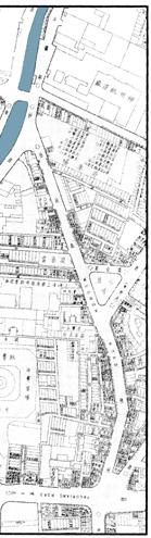
SHANGHAI MUSIC VALLEY 78 Context 79 Location 79 History 80 Lane 82 Land Use 84 Methods 85 Literature Review 86 Observation and Counting 86 Street-walking Workshop 87 SWOT Analysis 87 Stakeholder Analysis 87 Co-design 87 Reflection on Methods 88 Situation Analysis 89 Transportation 89 Commerce 90 User Activity 91 SWOT Analysis 92 Stakeholder Analysis 93 Problem Statement 94 Disappearing Rivers 94 Lacking Meeting Points 94 Excessive Temporary Appropriation 94 Strategic Intervention 95 Hydrophilic Facilities 95 Creating Meeting Points 96 Providing Drying Machines 97 Comment from Group Members 98
CONCLUSION & REFLECTIONS 100 FIGURES 102 REFERENCES 104
TABLE OF CONTENTS 9 p a g e
INTRODUCTION
Case Study Areas
DUEDALEN
(TRONDHEIM, NORWAY)
Duedalen is a quiet urban green area located just outside the city centre of Trondheim in the middle of Norway.

THE BAISNAVDEVI TEMPLE (LALITPUR, NEPAL)
The Baisnavdevi Temple is located in Bagdole Area which lies in Lalitpur Metropolitan City. in Kathmandu Valley of Nepal.

NATIONAL HIGHWAY 112 (WEST BENGAL, INDIA)
National Highway 112 network which starts from the historical city Barasat of North 24 parganas district and ends near to the Petrapole- Bangladesh Boarder.

10 p a g e
SHANGHAI MUSIC VALLEY (SHANGHAI, CHINA)
Shanghai Music Valley is a historic community in pursuit of urban regeneration for now. It is located in Shanghai, one of the largest cities in China

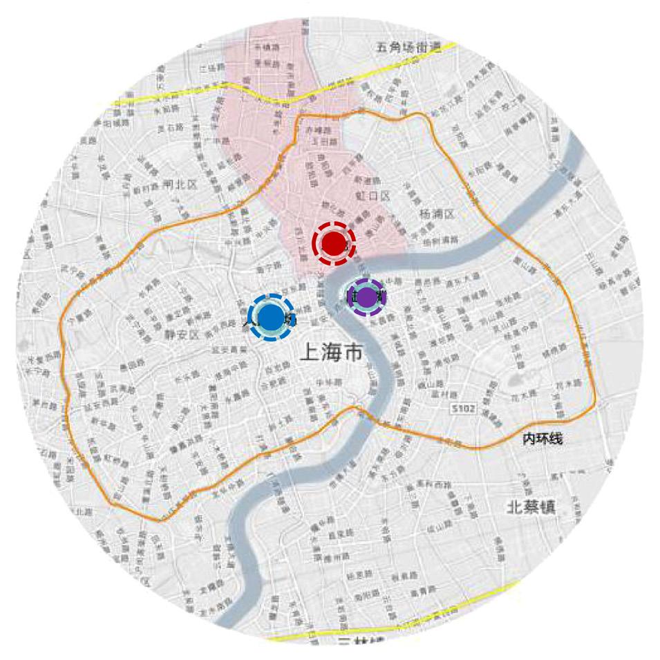
Figure X. World map with case study areas

INTRODUCTION 11 p a g e
e


Group Members
Marina Skanche

From Norway, with a backround inarchitecture at NTNU. Participating inthe UEP program as a one-semestermaster course, to focus further onsustainable development in the fieldof architecture and design.

Rubaid Naskar
Xinyu Zhang


From China, with a background in urban planning. She is enthusiastic about community studies and participatory learning and action.


From Kolkata, India, with a background in Civil Engineering. His research focuses on green environment, climate change and adaptation, cultural prosperity, and sustainable development goals (SDGs).


Rabin Sharma
From Kathmandu, Nepal, with a background in Civil Engineering. He is passionate about planning and sustainability.

12 p a g
Figure 3. Illustration of Group Member Introduction
Outline
This fieldwork report is an outcome of four individual case studies done in four different countries namely Norway, Nepal, India, and China. The report aims at using various participatory methods in the context of the COVID-19 pandemic to understand the challenges of the 4 case study areas to propose proper strategic intervention for them.
Various methods have been used, such as Quantitative and Qualitative Situational Analysis, Stakeholder Analysis, Land Use Analysis, Power-interest Analysis, SWOT Analysis, Risk Assessment, Traffic Counts, Survey tools, and Indepth Interviews with the Stakeholders to understand the situations of the case study areas and identify their problems in a broader perspective. We talked about the common methods we used in this introduction part and then went to the specific methods we used to fit the contexts of our case study areas in-depth in our individual work.
Despite the case studies being mainly individual work, we have been collaborating throughout the project by discussing and commenting on each other's projects, and reflecting upon methods, challenges and our strategic interventions.
INTRODUCTION 13 p a g e
Group Methodological Approaches
In our project case studies, we have used the common methods as follows:
Transect Walk
This method implies to visualize the scenario of our different case studies and their contexts. We conducted transect walks as casual walks around our case study areas to get necessary information. This method is beneficial to our project because it helps the mapping of land use, gathering reflections from the users, and taking varied spaces into consideration effectively to layout the primary outline and take a step forward.
Direct Observation
This method enlightened our individual case studies to be more focused. Direct observation strategy allows us to be in-active in the socio-urban scenario to elaborate it efficiently. In other terms, this method relates to observing the sites in a consecutive manner to get the basic facts, initial ideas and what to do next. We assessed our observation in different timing zones to strengthen our knowledge about the different reactions of users to different spaces based on their activities.
Photography
We used the method of photography to capture the landscape and the contexts of our case study areas in the form of digital image to convey the
Figure 4. Icons for Group Methodological Approaches


14 p a g e
situations and possibilities. Besides, we took some videos which enhanced the representation of our study case areas more eloquently. This method helped us to draw our domains in a more documented manner which could be used for further references and reflections.
Survey
We used different questionnaires among various social groups in our case study areas. This method was used to know about the views and opinions from the different nearby neighborhoods and communities. Based on the different conditions of our research fields, both online and paper survey tools in a necessary questionnaire format were offered to the communities cum stakeholders. The multiple answers and opinions received helped initiate the planning process. Since the stakeholders' potential responsiveness and feedback tended to uphold our case studies, this method was very useful and well-acquainted.
Interview
Interviews helped shape the overall project. Interviewing is a good tool to pioneer the key concepts by adhering the in-depth analysis with respected stakeholders. We took interviews in both formal and informal manners with different people in our project. Depending upon the situation, this method helped us probe into our case study areas, come up with different problem statements and formulate the possible interventions.
g e
Additional methods will be described further in our individual case studies.


INTRODUCTION 15 p a
CASE STUDIES
• DUEDALEN • NATIONAL HIGHWAY 112 • THE BAISNAVDEVI TEMPLE • SHANGHAI MUSIC VALLEY
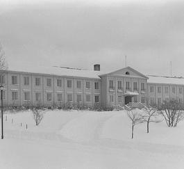
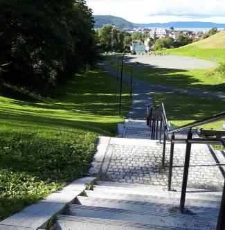
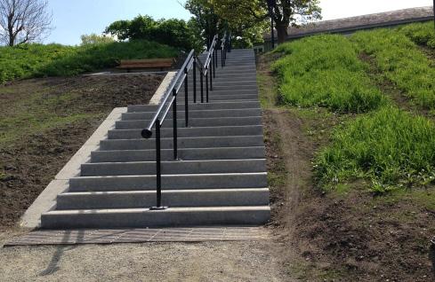
DUEDALEN
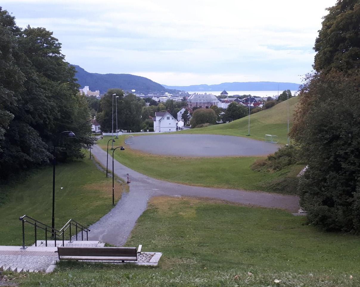
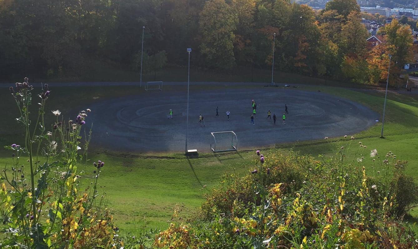
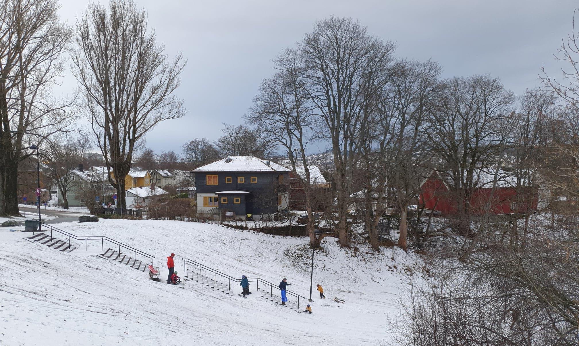
Duedalen is located in the neighbourhood Singsaker, west of the city centre of Trondheim. Today duedalen is a quiet green urban area where people usually just pass through. The area is sometimes used for small football games in summer, and for snow-sliding in winter. Despite its many qualities as an outdoors area, the valley often seems abandoned. I believe that Duedalen has a lot of potential for activation, by inviting people to spend time there.
impressions
2020)
5. Duedalen
(First
August
Figure
18 p a g e
Context Location

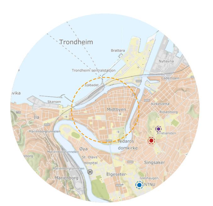

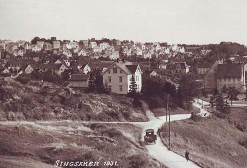
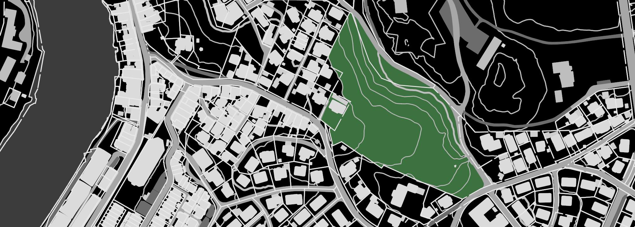
Trondheim is the largest city in the middle of Norway, and has a population of around 200,000 inhabitants. The centre of Trondheim "Midtbyen" has an area of 1 square km, however the Trondheim-city area stretches across diferent districts surrounding the river Nidelva. One of these districts is Singsaker, where Duedalen is located.
Duedalen

Kristiansten fortress
NTNU Gløshaugen
City centre
Figure
Location of
DUEDALEN 19 p a g e
Nidelva
6.
Duedalen
Context
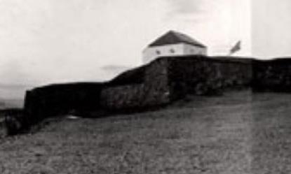
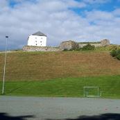
is located in the area Singsaker, below Kristiansten Fortress, which was built in the 1600s.
has a history of being an upper-class area in Trondheim, as the majority of the houses are villas from the late 1800s- early 1900s. The inhabitants varies between families, elder people and students who rent apartments in the area due to the proximity to the NTNU Gløshaugen campus.
20 p a g e Duedalen
Singsaker
History 1 6 8 1 Kristiansten Fortress is built 1 8 8 0 Singsaker Villas, Duedalen to the right (https://www.forsvarsbygg.no) (https://www.strindahistorielag.no) Figure 7. Historical Timeline of Duedalen
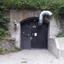
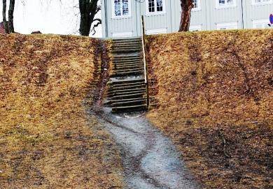
Right across the street
Duedalen,
a summer hotel/
called Singsaker
hillside
northern
War
valley, there
a bomb shelter which was
the
DUEDALEN 21 p a g e
from
There is
student housing-building from the early 1900s
Studenterhjem. In the
in the
part of the
is
built after World
II, in
1950s. Today, Duedalen is mostly used as a pathway and was developed with implementation of a new staircase in 2016 as part of the municipality project ”Miljøpakken” 1 9 4 0 Singsaker student housing 2 0 2 0 1 9 5 3 Duedalen bombshelter (https://digitaltmuseum.no) Miljøpakken development 2 0 1 6 (https://digitaltmuseum.no)
22 p a g e Methods conducted in the different phases of the project Methods Figure 8. Timeline and Methodology Acquaintance • History research • Observation • Photography • Study of geography Analysis • Quantitative and qualitative situation analysis • Strengths, Weaknesses, Opportunities and threats (SWOT) analysis Problem statement • Stakeholder Analysis • Digital + on-site Surveying • Dialogue with municiplaity Proposal • Stakeholder involvement • Feedback from governement stakeholders
Elaboration on the individual methods conducted in the fieldwork, in addition to the common methods mentioned in the section: "Main Methodological Approaches".
Digital + on-site surveying
The surveying of stakeholders had to be conducted digitally as well as on-site, due to the COVID-19-situation. The digital survey gave the stakeholders the opinion to answer on their own terms, when they are available, and it also makes it easier to organize and sort the collected material as statistics could be automatically generated from the survey.
However, an on-site survey, with consideration of safe distance, was conducted to make sure to include bypassers in the project well.
Dialogue with municipality
To get insight in the current use of the area, the Municipal City Archive was contacted to get more info on the property documentation.
In the problem statement/proposal for intervention-phase, the ”Miljøpakken”-department of Trondheim Municipality was contacted to discuss possibility of universal design.
DUEDALEN 23 p a g e
Situation Analysis

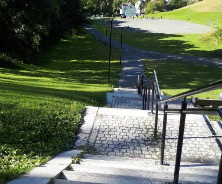
Duedalen lays below Kristiansten Fortress, and is a green area of approximately 20 000 square meters. The area consists of a steep hill in the north, a staircase leading down to the plane area in the south east-part, and a football-court near the west end of the valley. The bombshelter in the hillside in the northern part of the valley, is currently rented by a motorcycle-club.
24 p a g e
Football
court Kristiansten Fortress Staircase Bomb-shelter Situation map 1:5000 Figure 9. Situation Map of Duedalen
Duedalen is mostly used as a pathway and was developed with implementation of a staircase in 2016 as part of the municipality project ”Miljøpakken: Interventions for creating more effective shortcuts to encourage walking or cycling before driving.
The municiplaity has responded that they decided to not make a ramp for wheelchairs due to the hills being used for sliding in winter, but the staircase has a small ramp for pushing bicycles.
club

DUEDALEN 25 p a g e Trondheim municipality Local inhabitants Motorcycle
Bypassers STRENGTHS WEAKNESSES OPORTUNITIES TREATHS • Urban • Green area • Tranquil area • Abandoned • Dark at night • Undeveloped potential • Landslide (1600s) • Dencification • Social gathering • Outdoors activity • Public events • Local business
Stakeholders Power-Interest matrix Sun diagram (01/10) SWOT-analysis Figure 10. Duedalen Before
and
After 2016 Figure 11. Various Diagrams of Duedalen INTEREST
26 p a g e Use of area Changes through the seasons. Figure 12. Duedalen, September 2020
DUEDALEN 27 p a g e Figure 13.
Duedalen, November 2020
Problem Statement
Through the situation analysis of my chosen area, I have identified various aspects based on on-site observations, research of geography, history, and development over the past years. In my analysis, I considered the current use and functions of the area for a SWOT-analysis, and have noted the following qualities:
Strength: Urban Green area. Tranquil, good solar conditions, effective shortcut Weaknesses: Often abandoned, dark at night, underdeveloped potential Opportunities: Outdoors activity, public events, social gathering, local business
Threats: Landslide (1600s), densification of the city
The essential problem statement I want to focus on is: Increasing activity in the valley, while maintaining its qualities as a green urban area, according to the interest of stakeholders.
To map the actual interests of the stakeholders I created a survey to find out who the stakeholders are, what relation they have to the area today, and their opinions when it comes to further development. The survey was performed online, as well as on-site to get a broader variation in stakeholders, whose age spun from 16 to 75 years old. The interview subjects either lived in the area or passed it on their way to work or on jogging trips on a weekly basis. In this problem statement, I will only focus on the sections of the survey related to possible problems and stakeholder interests.
28 p a g e
RESULTS OF SURVEY
The majority of the stakeholders (90%) wants to preserve the nature in the valley, and 60% believes that there is potential for facilitating activities which does not damage the existing nature. As I stated in my SWOT-analysis, densification of the city can be a threat to the green urban areas, and to preserve most of the existing vegetation, large scale building should be avoided. The valley is already used for ball-sports, recreation in the sun, sliding and ice-skating in winter. One of the interview-subjects who lives in the area stated that its forbidden to build in the hillside due to the threat of landslide.
The stakeholders suggested various ideas for what they would like for further development of the valley, including: A better sports-field, activity park, obstacle course, social housing, more tables and benches, seating areas, a kiosk, concert-stage, better maintenance of the terrain (especially on the road which gets muddy). 70% of interview subjects stated that they would visit the valley more often if their ideas for further development were implemented.
The survey confirms many of my initial conclusions from observations of the area, as well as ideas for further planning. I will therefore focus on solutions based on suggestions that require as little physical intervention in terrain/nature as possible to achieve sustainable development.
DUEDALEN 29 p a g e
Strategic Intervention
My strategic intervention at Duedalen in Trondheim is two proposals based on fieldwork studies of the area, and the following problem statement: “How to increase activity in the valley, while maintaining its qualities as a green urban area, according to the interest of stakeholders”
Through observations, SWOT-analysis, research of history, development, and interviews with people in the area, this initial problem statement has corresponded to the interest of the stakeholders. From surveys with residents living in the area, as well as regular users and bypassers, the majority wanted to preserve the qualities of the area without too much physical intervention in the landscape, which should also be avoided due to risk of landslide.
The motorcycle club which uses the bomb-shelter in the mountainside have a rental contract with Trondheim municipality until 2022, which can be renewed before then. According to feedback from residents in the area, they keep mostly to themselves inside the shelter, or on a bench placed outside, and will therefore not affect the strategic intervention. Hopefully, development of the area could make the outdoors area more attractive for them as well.
30 p a g e
In this section of the project, I will present two proposals for spatial intervention which could provide positive development of the area, and hopefully more activity. The solutions are based on stakeholder demands for benches and several suggestions for making an activity park.

These strategic interventions are also designed so they can be used throughout the year, with consideration of the different activities going on there today, depending on the change of seasons.
DUEDALEN 31 p a g e
Situation map 1: 2 000, Location of the two interventions 1 2 Figure 14. Situation map duedalen, with interventions
p a g e
1. Seating through the seasons
Providing benches would meet the demands for seating and could increase the rate of people stopping and spending time in the area, instead of just walking through.
Placing a bench-structure near the football-court in the middle of the valley, could provide seating for watching football-games in summer, and for putting on ice-skates when the court is turned into an ice-rink in the wintertime. Benches could also preserve the grass as an alternative place to sit

32
Figure 15. Collage illustration of seating
2. Outdoors workout
Today the area is often used by joggers as a part of their running route. Especially the staircase in the western part of the valley, which is popular for running exercises.
Implementation of outdoors exercise-equipment such as pullup-bars could potentially bring more people to Duedalen, and facilitate outdoors workout sessions.

DUEDALEN 33 p a g e
Figure 16. Collage illustration of outdoors workout-installations
Comment from Group Members
The fieldwork study of Duedalen has taken into consideration the history and geography of the area as well as the current use today. Through different types of situation analysis and stakeholder mapping, the project has concluded in two proposals for spatial interventions. These proposals have been based on suggestions from relevant stakeholders as well as subjective observations of how the area could be improved.
The final solutions for the area answer to the problem statement of how one can activate the area without doing any major interventions in the existing nature.
From Xinyu Zhang
34 p a g e
35 p a g e DUEDALEN
THE BAISNAVDEVI TEMPLE
There are often some spaces and places in everyone's town where people want to go and be there for a hour or two spending time alone away from a chaotic city noise. Sometimes you go there and realize the space has so much more to give to others which is yet to be realized. Similar is the case of Baisnavdevi Temple which seeks necessary action for its full proper usuage.

36 p a g e
Figure 17. Baisnavdevi Temple Space
Context
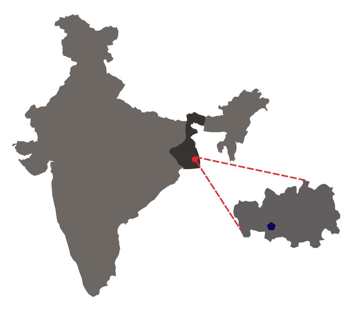
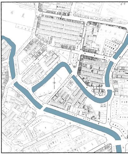
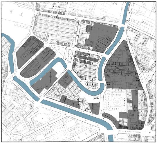
Location :The Bagdole Area falls on the Ward No.4 of Lalitpur Metropolitan City in the Kathmandu Valley of Nepal. Ward No.4 occupies 2.04 km square of the total land of Lalitpur City.
Population: The Lalitpur city has a population of 468,132 while Ward No. 4 has 15,367 (Population Census, 2011).
History and Background : Kathmandu Valley is believed to be inhabited as early as 300 BCE. Various inscriptions of Lichhavis are preserved which dates back to 464 which makes it to believe that the Lichhavis were the first rulers of the Valley. The Shahs were the last rulers of Nepal until the abolition of the monarchy in December 2007.
The Kathmandu Valley has a bowl shape. The central lower part stands at 1425m above sea level while the highest level is at 2732m above sea level. The valley has three different districts Lalitpur, Bhaktapur and Kathmandu which is also the state's capital.
Project Site: The project was conducted around the Baisnavdevi Temple and Kharibot Area of Bagdole. The Baisnavdevi Temple Area is religious site of 2698 sq. m in size. The area has a shrine of Goddess Bainavdevi and numerous cremation spots. The site has lots of greenery spaces which attracts lots of people for leisure activities. The Kharibot Area has spaces which are used by street vendors for conducting various business activities.
These are the area which is used by the general public of Bagdol Area every day. The main reason for choosing these areas for the project is bacause the
p a g e
37
THE BAISNAVDEVI TEMPLE
p

area is not being used to its full potential. If some intervention could be done around the spaces, the whole population of the Bagdol would be benefitted by it.

Nepal

Kathmandu Valley
Baisnavdevi Temple Area, Ward 4, Lalitpur Metropolitan City
e
Main Road Way to Ring Road
Baisnavdevi Temple Area
Food Market Area
Khadya Godown ( Food Storage Area)
Lalitpur Ward 4 Boundary
38
a g
Figure 18. Location Map of Baisnavdevi Temple
Methodology
Situational
39 p a g e THE BAISNAVDEVI TEMPLE
The following work procedure was adopted during the field work period. Methods • Transect Walk • Direct Observation • Taking Photos and Videos • Interview • Online Survey
Analysis • Land Use and Road Ways • COVID-19 Situation • Stakeholder Analysis • Power - Interest Diagram • SWOT Analysis • Risk Assessment Problem Statement • Stakeholder Analysis • Interview Strategic Intervention • Intervention Proposal • Feedbacks from Major Stakeholders Figure 19. Methodological Timeline
Methods
For a better understanding of the particular area and space, it is necessary to get involved with the local people and get to know the area from their perspective. It's through them only we can know if there are any problems associated with the area. So, to know the area of the Bagdole from a deeper perspective I initiated an observation on the area. Initially, there was a strict lockdown of the whole country due to the Covid-19 pandemic; very few people were seen using the different public spaces of the Bagdol Areas. People were discouraged by the Nepal Government (NG) to come out without any essential works (buy food, medicine or go to the hospital) during the day, while it was strictly recommended to go and buy necessary items only during (6 am – 9 am) in the morning. Taking advantage during the morning time, I saw a significant amount of people using the spaces of the Baisnavdevi
Temple Area and the market place which was 80m south of it. I took on the observation for three different times of the day for several days on different areas; I observed that the Baisnavdevi Temple Area was the one where people would come to relax and to worship goddess Bainavdevi at the temple. The observation also kind of helped me to choose the focus area with the problem which later I chose to be the Basinavdevi Temple Area.
I used methods like transect walks, direct observation, taking photos and videos, interviews (formal and informal), online surveys etc. to gather the information on the Bagdole Area. The methods were useful in deciding the focus area for further analyisis.
40 p a g e
Figure 20. Types of Questions Asked in an Online Survey

41 p a g e THE BAISNAVDEVI TEMPLE
Situational Analysis
After getting information about the Bagdole Area through different participatory methods, it made it easy to choose the focus area for further analysis and find out if the area has any problems associated with its usage. I used methods like transect walks, direct observation, interviews (formal and informal), online surveys, etc. These all methods were very useful to gather information about the Bagdol Area also considering the impact of the Covid-19 situation. Through the outcome of the observation and survey I chose my focus area to be Basinavdevi Temple Area for further analysis.
Land Use : Numerous commercial buildings were seen on the areas near Basinavdevi Temple. Most of them had shops on the ground and first floor; residential apartments on the third and subsequent floors. Mostly the commercial buildings were on the sides of the main roads. The buildings on the inner parts of Bagdole Area were mostly residential houses. The temple area is triangular shape which consists of a shrine at one corner and numerous cremation spots at other side. Other spaces are mostly covered with trees and bushes along sides the way to the temple.
Road Ways: The Baisnavdevi temple area is just 600m away from Ring Road at Nakkhudobato and 300m from Ekantakuna. It is accessible with public busses which leave from Langankhel, Lalitpur and Ratnapark, Kathmandu at any time of the day.
42 p a g e


43 p a g e THE BAISNAVDEVI TEMPLE
Figure 21. Land Use Map of Baisnavdevi Temple Area
COVID-19 Situation
The Covid-19 pandemic has hit Nepal very hard. Since the NG had imposed a lockdown of the country it was hard during the initial observation of the site, as people were not allowed to go outside of the house unless it is essential to work (buy foods, medicine, or go to the hospital). Also, there would not be any people on the road or around the temple area (main observation site) due to which a realistic spatial usage/data could not be collected. Mostly, people were allowed to go out from 6 am – 9 am only in the morning. The market area had seen quite people coming there to buy vegetables in the morning. But, both the temple spaces and the market area would become no-man's land during the afternoon and evening due to the strict lockdown to contain the Covid-19 situation in Kathmandu. However, after the lockdown had been lifted by the NG people started coming out and using the space of the temple area. People were seen to maintain strict social distancing and were seen interacting with each other very minimum.
Stakeholder Analysis
Local Governments : The Lalitpur Metropolitan Office and Ward No. 4 Office are responsible to conduct any kind of development work around the area. The budget is allocated from Lalitpur Metropolitan Office to the Ward Office for the development activities to be initiated in the area.
Guthis : Guthis is the Newari Community Social Organization that regulates the social-economic system of the temple and cultural sites in Kathmandu Valley. They are believed to be operating since Lichhavi Period (since 1500 years ago). The organization only consists of Newar community people and is also responsible for many festivals inside the Kathmandu Valley. Any activities concerning the development of the temple areas are conducted by the local government through the Guthis System.
Residents of Bagdole : Residents of the Bagdole Area are also one of the main stakeholders of the Baisnavdevi
44 p a g e
Temple Area. They are the ones who use the spaces and have most of the opinions and ideas how the space can be improved for better.
Users: The other stakeholders are the users of the spaces. These include by-passers, vendors, market owners, etc.

Figure 22. Power-Interest Diagram of Baisnavdevi Temple
Figure 23. SWOT Analysis of Baisnavdevi Temple

45 p a g e THE BAISNAVDEVI TEMPLE
Risk Assessment
Earthquake

In April 2015, Nepal was hit by an earthquake of magnitude 8.1 where 9000 people died and 22000 people were injured ( Wikipedia April 2015 Nepal Earthquake). Many historical sites and residential houses were flattened in the Kathmandu Valley. The scientific researchers say that the city could face other massive earthquakes in the coming years (Source: ETH Zurich) which have instilled fear within the people. So, there is still a potential risk of earthquake and fear of it in the people.
Figure 24. Earthquake
When I talked to people about the tragedy that struck Nepal in 2015 they are still fearful that a similar kind of situation may happen in the future. The traumatic experiences have impacted them so much that their eyes turn into tears when they talk about it (especially the elder people). Seeing the situation, there seem to be a need of general awareness about the Earthquake and what to do or not do during the time. Also, some rules from the government which would allow passing the design of new building only if it complies with the National Building Codes would be feasible in creating safe housing. Similarly, a concept of Retrofit should be considered for every structure which is old and is not based on National Building Codes. This would strengthen the existing structure against any seismic forces in the future and protect the population from mishappenings.
46 p a g e
Problem Statement
Through various methodologies applied to observe and analyze the area, it has been gathered that there are mainly two problems that need to be addressed. The problems are the need for basic physical infrastructures like chairs and benches around the spaces of Baisnavdevi Temple and proper management of wastage of the temple area. The situational analysis shows that the space has got good potential to be used as a space for leisure activities especially for the elderly people who are also the major stakeholders of the area.
Need for Infrastructure to Sit
Since the initial observation phase, one thing that I had frequently noticed was people would come to the temple area to worship Goddess Baisnavdevi in the temple and would just leave the space afterward not using much of the spaces for any time. Some people would be seen just standing around the spaces of the temple, while the joggers would just pass through it. During the daytime, some people would be seen under the tree just lying down and taking rest. So,
I started a questionnaire with the people coming to the temple area especially the elderly and the temple goers.
How often do you come to this area?
Do you use this space for purposes other than coming to the temple?
Do you see any problem associated with the temple area?
What would you change about the space to attract more people ?
Type of questions used in the questionanaire
47 p a g e THE BAISNAVDEVI TEMPLE
Many people during the questionnaire emphasized the need for a proper place to sit and relax.
An adult jogger said that "I come to this area every morning during my jogging as the area is just beside the road, but even though I would love to sit here and just enjoy the atmosphere, I have to leave as there is no place to sit."

Similarly, an elderly man of about 70 who had just visited the temple said, "You see, the place is serene, it has got trees, if a couple of benches would be available there, it would be perfect for elderly folks like me to come and pass time here."

48 p a g e
Figure 25. Temple Spaces Used by Joggers and Bypassers
Lack of Waste Management
Another problem that seems to be prevalent and also visible to people visiting the temple area is the unmanaged wastes. Various wastes from the temple and cremation sites have caused havoc around the space. Wastages from the temple are the kinds of stuff that are used for worship in the temple like flowers, fruits, leaves, etc. These are just thrown into the open spaces of the temple which have destroyed the aesthetic value of the area. Similarly, the wastage from the cremation sites also seems to be in chunks which have added to much destruction of the aesthetic importance of the place.
Also, during the informal interviews with the residents of the Bagdole Area who are also frequent visitors of the Baisnavdevi Temple had concerns about the wastage of the temple as it has not been managed systematically. Many of them even blamed the 'Guthi System' for not taking proper care of the temple and the area.
An elderly resident said, "I want to go there every day as nature and atmosphere is peaceful to sit and relax, but a bad smell comes which makes it inconvenient for me to stay there for a long time."
So, the impact of wastage is seen mostly to the elderly people who are also the regular users of the space around the temple. The problem of unmanaged waste is kind of opposing the users to come there and use the space for any kind of relaxation or leisure activities.
49 p a g e THE BAISNAVDEVI TEMPLE

 Figure 26. Wastages Thrown Rampantly around Temple Space and Cremation Site
50 p a g e
Strategic Intervention
Through participatory methods that were feasible considering the Covid-19 pandemic, I analyzed and discussed the problems with various stakeholders of the Baisnavdevi Temple Area. The major problems were the need for physical infrastructure and lack of waste management. I have proposed two different strategic interventions which will best suit the need of the stakeholders of the Baisnavdevi Temple Area.
Provison of Benches and Chairs
WHAT?
I gathered through various initial observations that the Baisnavdevi Temple Area lacks the physical infrastructures like benches and chairs for the visitors. The temple area has a triangular shape which consists of a shrine at one corner and cremation sites at the other. Other areas are mostly covered with trees and unmanaged bushes As the area is large and has got lots of woods and trees which make the area much peaceful and serene. But, due to a lack of spot to sit the area has not been used for its full potential.
WHY?
During the interviews with the residents and the temple goers, most of them desired to have the spot to sit and relax around the temple area. The elderly people mostly wanted to be there to spend their time by being in a peaceful atmosphere. Keeping chairs and benches will also be helpful to integrate people of different castes around the area as the population from various social groups will be joining the space for recreation. When they come and start using the space every day certainly there will be some form of communal
51 p a g e THE BAISNAVDEVI TEMPLE
a
ownership of the space. So, it will also act as an initiating factor to bridge a gap between different social and caste groups.
HOW?
I have proposed the idea of placing several benches and chairs in the open spaces of Baisnavdevi Temple Area. A donation box will be kept in the temple where the fund will be collected. Similarly, the fee to use the cremation site and the collected money from the temple will be used to make chairs and benches for the spaces. The management of the budget and the placement of the benches and chairs will be done by the Guthi System.

52 p
g e
Figure 27. Benches to Sit for Visitors
Management of Wastes and Overall Area
WHAT?
Since, the start of the observation, the problem of the wastes was visible to me as well as the space users. A proper waste bin around different places and routine cleaning of the areas is most needed to maintain the wastes and serene of the space. The wastage from the temple and the cremation sites can be managed by keeping them at proper bins which later will be collected by garbage collectors.
WHY?
During the interviews, most of the residents of the Bagdole Area had cited the need for proper management of the temple and the wastages around it. They had expressed that if proper waste bins would be placed around different spaces of the area and routine check of the bushes around the area would be done, the space would be much more lively and beautiful. Placement of proper waste bins will maintain the cleanliness around the spaces of the temple area and attract the residents to use the spaces for socializing and conduct different communal activities.
HOW?
I have proposed the idea of placing waste bins around the spaces of the Temple Area. Similarly, the routine check with the busses around the area
53 p a g e THE BAISNAVDEVI TEMPLE
p a g e
shall be done by the Guthi System. For the budget, the collected money from the donation and cremation site fees will be used as an initial phase intervention. In the long run, the Ward Office and the Metropolitan City Office shall facilitate the budget for creating permanent intervention.

54
Figure 28. Waste Bins for Waste Management
Feedbacks of Stakeholders on Proposals
The residents of Bagdole Area who are also the major stakeholders of the Baisnavdevi Temple Area seemed excited when I talked of the intervention proposal. Since, majority of the elderly resident of the Bagdole come to the space of temple very often, they were happy to hear it.
One elderly man of about 75 said, "I am very happy to hear about the intervention. If this could be done, the place would be so much better and we specially the aged folks could spend a quality time around the area."
I also discussed the idea with the member of the Guthi System. He liked the idea and agreed to establish the donation box inside the temple immediately. He also assured me that he will work closely with the residents and talk with the Ward Office Chief and Lalitpur Metropolitan City Officials about the budget for the long term goals. I shared the idea with the Ward Chief briefly on the phone (as I couldn’t visit the office due to Covid-19 pandemic), he said that the plan is good and will help in the execution working closely with the Guthi System. Lastly, the official of the Lalitpur Metropolitan City Office also had positive view on the idea of the intervention when I had a talk with him briefly on the phone. He said that he will coordinate with the Ward Office regarding the matter.
55 p a g e THE BAISNAVDEVI TEMPLE
Comment from Group Members
Considering the COVID-19 pandemic situation in Nepal, it appears that significant work has been executed during the observation phase. The pattern of methodology from observation to situation analysis and further to problem statement and proposal for intervention, gives a good flow to the structure of the report. The analysis has been done with use of relevant and necessary participatory methods to figure out the problem of the case study area. The problem statement has been identified through interviews with the users and residents who are major stakeholders of the Baisnavdevi Temple Area. The strategic intervention proposal of provision of benches and management of waste by placing waste bins around the spaces is an important step that has been taken to improve the environment of the temple area. This will enhance the space and the residents will be able to use it for their leisure activities in a convenient manner. The positive feedback from the major stakeholders confirms that a long-term intervention is also possible with stakeholder involvement.
From Marina Skanche
56 p a g e THE BAISNAVDEVI TEMPLE
NATIONAL HIGHWAY 112
National Highways are the veins of city networking system, draws the realm of urban context and connects the livelihood to social, political and economic movement. In short, National Highway is a major pathway of rural-urban sphere from where people communicating to their work-life activities. Similarly, NH 112 kept into attention which has a high volumetric traffic density. This road is often called ‘Jessore Road’ and previously was named NH 35. This road channel is to be the most important valued asset for the state governance resilience, mainly relies on economic and business residuals. Over a decade, this road network became preciously importance for the urban settlements. However, human centric engagement doubled the front side urban agglomeration rapidly.

Figure 29. National Highway 112 57 p a g e NATIONAL HIGHWAY 112
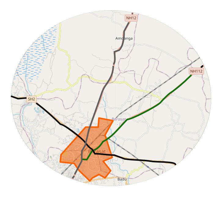
Context Geographical Significance
Barasat city is the municipal city and district head quarter of North 24 Parganas district of West Bengal State of India. In geographical preference, city's total area is 34.06 km2 and total estimated population is 278,235 (8200/km2). Barasat is always known as a major transportion connector for commuting to other parts. While, NH 12- previously known as NH 34 and Krishnagar Road, leading to North Bengal of India via Barasat and also SH 2 (Taki Road) runs to Bashirhat- Hasnabad
through Barasat (Barasat, 2020) . However, these two major highways link to NH 112 which spans over total 59 km (37 miles) and starts from Barasat via Duttapukur, Bamangachi, Guma, Ashoknagar, Habra, Gaighata, Thakurnagar, Sonatikiri, Chandpara, Bangaon and Petrapole ends near Bangladesh Border (Barasat, 2020a) . In Figure 30, the detail mapping and NH 112 has been shown with proper site location.
NH 12 SH2
Bengal
Barasat City Map
NH112
Highway
Location
West
Site
Location
Figure 30. Location Map of National Highway 112 NATIONAL HIGHWAY 112 58 p a g e
Land Use
In the vicinity of NH 112- in the site location, both sides of the roadway are tailored with residential communities. Under this spatial observations, the site location is becoming familiarized with commercialism. In this urban fabric, a supermarket is nearby, while it is a two (2) minutes walking distance. Furthermore, economical fiscals and the popularity of NH 112 turns to more excel with major infrastructures. For instance, a private hospital is at the frontier of this roadway, gives opportunity to take care of health for local residents. In here, nearby, educational institution, pharmaceutical stores, shop owners, and bank etc., strengthened the highway and privileged for commuters.
As discussed, in this basic land use layout plan-provides illustration about settlements happned bothside conrner of NH 112. Mostly, upfronts are occupied by shops, market and other stores etc. Others are settled residential colony.
Figure 32. Basic layout of Land Use plan in radius of Site Location
NATIONAL HIGHWAY 112 59 p a g e
Figure 31. Site Location- Private Hospital

60 p a g e Residential Settlements Private Hospital Commercial building & stores NH 112 Street Roads Primary School Greenery & vegetation Informal shops Figure 33. Land Use plan in the context of NH 112
History
Barasat was established during Mughal period and a historical city. Many ancestors’ footprints were revered in this city’s manifestation. Sankar Chakraborty, chief of King Pratapaditya Ray came to Kolkata from Jessore (present in Bangladesh) via Barasat. Sirajudullah who was the king of Murshidabad district of West Bengal, made his pathway to Kolkata, who travelled through these National Highways- NH 112 (current case study area) and NH 12 via Barasat. Even in histories pages, East India Company of British Emperor used to commute through NH 112 for economical perspective. During that British period, Indigo Dye was a popular industrial substance and merchants business strategy in this City. These merchants tortured the farmers brutally to produce more Indigo dye. Titumir was the first farmer who protested and fought against British Government by constructing a Bamboo Structure as a wall front side of this present highway NH 112. And this place is now pronounced as Titumir Bus Terminus from where most of the buses are commuting towards Kolkata and Bongaon via this road.
Besides, the most venerable face, Ishwar Candra Vidyasagar was the social stakeholder during his time. He efficiently regenerated and reformed this city in his hand. He helped to educate women and empowerment and many more educational initiatives. However, many schools, district health infrastructure, communities etc., were rooted with the upliftment and development of city and NH 112 (Barasat, 2020).
In the light of time frame, since 2006 to 2019, city becomes paved and processed with resettlement of livelihood and industrialism based on the activity onto NH 112. In the pictorial presentation of figure x in 2006, there were lot of vegetations and greenery; followed by in 2011, more developed can be experienced and more land occupied dependent on the possessivity by NH 112. Finally, in the era of 2020, local livelihood, socialism with well-beings and economy are influenced by NH 112 and interrelatedness.
NATIONAL HIGHWAY 112 61 p a g e
Historical Time Frame (2006-2019)
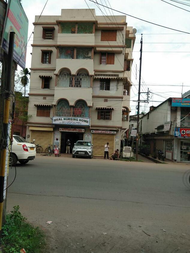
In this map, there was to be less settlements instead of supermarket and private hospital-Ideal Nurisng Home in 2006. These area was under developed in the vicinity of NH 112, and mostly was filled with greenary.
p a g e
This picture is of 2011 of the same location. It can be viewed that this area is more developed with residential communities in both corners, and more commercial blocks.
In 2019, this area is more deveopled and less greenary comperativetively to 2006 and 2011. More settled localhood and road is widened on demand and streets are more visible.
Figure 34. History location from 2006 to 2019, Google Earth Pro


62
Research Interest
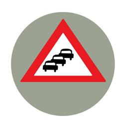
It is therefore come into consideration to keep attention on this roadway to observe the actual scenario in real time condition. If, we investigate the time frame from 2006 to 2019 (See Figure 34), it can clearly be foreseen that how the road spatially got importance based on both side incredulous settlement, which often leads to the more activenesss. NH 112 having higher density of traffics and causal jam and chaosness near to the site location (See Figure 35). Eventually, this road is often dangerous, and many accidental disadvantages happened previously (Subrata Guha and Biswajit Mandal, 2016). Even more, highway authority declared this site as an accidental prone zone and often called "Blackspot"(Road Accidents in India, 2018). Meanwhile, the local people, whoever is living near to the front of this NH 112, are often reluctant to commute or cross the road and might lead to unpredictable consequences. This hinderness provides the realism to make some possible analysis and solution.

NATIONAL HIGHWAY 112 63 p a g e
Figure 35. Site Location for research on NH 112
But, there is an unrealistic bio-hazard called COVID-19 pandemic outbreak hit this highway and total changes occurred regarding vehicular patterns. Which has resulted users to come out with more private cars rather public transports during post-pandemic situation. This repercussion and renderness put more attention to dig into this landmark to identify the problematic in-situation analysis and make further possible solution on behalf of livelihood. So, therefore, this road reaches to the public users with safety with possible regulations concerning COVID-19 protocols. Also, this research gives the opportunity to ideate newly during these difficulties, when COVID-19 contagiousness is a world wide problem. So, as a research cum planner, it is the opportunity and interest too, to provide suitable suggestions and trustworthy relationship towards accessing the road by mitigating the contagiousness.
Methodologies
To achieve the data curation and quality findings, most common methods are often used and in every case study discussed most of them. These are Transect Walking, Direct Observational Approach, Photography and Filming, Surveying tool and In-depth Interview. These are illustrated in Figure 36. However, in this research progression, a new methodology has been culminated which is "Traffic Count" in this NH 112 context.
64 p a g e
Methods
Acquaintance
Proposal
NATIONAL HIGHWAY 112 65 p a g e Different methods were conducted in different periods of work here (Figure 36).
Figure 36. Methodology
• Observation and Counting • Taking Photos and Videos • Street-walking • Individual Interviews Analysis • Quantitative and Qualitative Situation Analysis Problem • Stakeholder Analysis • Individual Interviews
• Feedback Collection on Individual Interviews
Traffic Counts
This method is a guiding tool specially for this project to understand the spatial traffic pattern on this NH 112. To initiate the data, it was requried though to categorize the vehicles like Motor Bikes, Autorichshaws, Bicycles, Trucks, Public transports such as Bus, Taxi, and Cabs and local vehicles e-van/ Tuk-Tuk or Toto respectively. Then, the manual counting being started to quantify the status quo of traffic in some instant time. This tool is often pen and paper based while timing is a prime factor to fix upon before counting.
Challenges & Limitations
• This case study is often challenged and limited by the situation of COVID-19 pandemic and focused on one particular area. During observations, it was almost impossible to stop the road users or car drivers to get their feedback and opinion to reflect on this research work. Because either way, it is risky to get contracted with the virus strain from both sides.
• However, the local police station, traffic guards nor the Barasat Municipality is showing encourage to provide some valuable inputs during this emergency pandemic time.
• Eventually, NH 112 is operated and maintained by NHAI department but due to COVID-19 pandemic, it was far most impossible to reach to their ideas. Thereby, the online resources and ideas from NHAI’s website was not sufficient to. In addition, these main stakeholders neither giving any scheduled appointment to front to front discussion and less interested too in this crisis time. In this para, the respective methods are not enough because there are less number of users interactions and less involvement from localhood. Shopkeepers were initially enthusiastic to participate in this project but shown no response afterwards. Subsequently, amidst COVID-19 obstruction, the previous spatial traffic patterns can not be outlined, and pre-pandemic situational
66 p a g e
analysis is impossible to found in this current case study.
• In contrast, highway should not be interrupted by stipulating the excessive traffic guards or voluntary civic guard engagement, which shows a challenge in this case study. But this case work is mostly related and supporting to local users and communities to make a safe built environment in the periphery of this highway road junction (See Figure 35 - Site Location) and provide possible solution- which is contradictory in manner.

Situational Analysis
This situational analysis is giving more specific information, how this road has been evolved and changes with traffic densities and unmanaged traffic movements over time. The site analysis part will provide better illustration of both side settlements and involvement with highway.
In these pictures, excessive number of traffic movement-both formal and informal transpost during post-COVID-19 pandemic condition
Figure 37. High Traffic Density on NH-112

NATIONAL HIGHWAY 112 67 p a g e
Figure
Site analysis on side of NH 112 and users

In further proceedings, frontside private hospital was contextualized because it constitutes inherently the major traffic activities. The different road users can be observed more frequently (Figure 38).

68 p a g e
38.
footprints
This unflexible traffic congestions reforms informal situation for the road passerby and localhood. And local authority is not enforcing new rules and regulations, which led to weakening the traffic governance policy. In further discussion, people are very reluctant from their experience because no maintenance being served to redevelop these road junction. Highway Authority widened the road so as to use for the footpaths and parking for private vehicles but the situation is overtaken by the informal transports- such as Autorickshaws, toto/tuk-tuk, high-speed motor bikes. As a result, users are bound to using this extra-road widening junction risking their own life, which led to sometimes accidental situations (Depicted in Figure 38 - Site Analysis map with users footprints).
Subsequently, prepandemic and postpandemic stricter restriction ever failed to stop running of informal transportation, which resulted more cases in this urban context. However, step by step unlocking 1, 2, 3, 4 respectively tarnished the whole road pattern substantially. This unprecedented chaotic condition and number of private cars ascribed this road less spaced. In this dilemma, public who have been going to their workspace while social distancing and norms ever pronounced become neglected.
Power-Interest Diagram
In this Power-Interest diagram, most of the important stakeholders have been considered to suffice this situational analysis.
1. NHAI, Barasat Municipality and Traffic police- they have the power to check with decision making approch but no/less interested due to this new COVID-19
2. Private Hospitals and Engineers- They are willing to partcipate and in higher power matix.
3. Shopkeers: They are neither inetrested nor the power
4. Local Resident, Road Users, Teachers, and Students- They are highly interested to see new planning policies but having less power to motivate
NATIONAL HIGHWAY 112 69 p a g e
p a g e

70
Figure 39.
Stakeholder Analysis- Power Interest Diagram
Problem Statement
Microlevel analysis is intensive to visualize the problem of this road network. Nowadays, People feel reluctant to use the public transport rather preferring their own private cars and motor bikes; to be self-safe from this contraction level. Previous situation analysis speculated that this road is now rush during day-time and most of the other times as well. Thus, this junction became risky while crossing the road, may even cause severe accidents since no traffic regulations are being operated. In this regard, observational method supports this case study to filter more accurately how the road is busy; accounting different vehicles at morning and night. Traffic data curation helped to visualize the problems associated with this road. Based on the preliminary data collections, it procures that private cars and bikes are often frequent. In figure 37, it states that Bikes are passing from Site location, stands alone higher by 53%, followed by private cars were accounted by 26.08%, Further to that, preliminary data set- driven only to guess the actual spatial patten of vehicle.
Figure 40. Preliminary Spatial Pattern of Traffic Density- Site 1 (Date 29/09/2020, Time: 10.13-10.25 PM IST)

NATIONAL HIGHWAY 112 71 p a g e
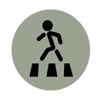
Since, this research bounded on this landmark, problems are very serious while local dwellers are using this road to go their workspace and to the super market nearby. There is a no specific cross-walk nor a supporting channel alike footbridge. Even before, these difficulties are not rectified by the NHAI department. This initial bar diagram represents that Motor bikes and private cars are the main issue, accounting with informal transportTuk-Tuk/ Toto, Auto-Rickshaw etc. So, some repetitive traffic count data further helped to support this case study while traffic data were taken in different periods.
Figure 41. Frequency of traffic density (Date 23/10/2020, Time: 10.55-11.05 AM IST) (Total no of vehicles/ 10 min= 386 nos)
Figure 42. Frequency of traffic density (Date 30/10/2020, Time: 5.45-5.55 PM IST) (Total no of vehicles/ 10 min= 343 nos)


72 p a g e
So, repetitive data curation identifies that road system is busy with more private cars while local toto and autorickshaws are frequent. And the cumulative data showcased that per 10 min interval, it is a higher density of traffic on the road and dangerous for safe access. In order to support this problematic condition, photographic illustrations and qualitative feedback from stakeholders in surveying method are effective too.


This photos are taken during problem statement analysis part and provides illustration about how the road became chaos and irregular movement. In addition, no stringent action taken further.


NATIONAL HIGHWAY 112 73 p a g e
In this section, the online surveying tool helped to visualize the problem statement more clearly being engageded with stakeholers and local people. Through question answer style provided more transparency what came forward.
*Google Survey Report*
*Are you local living near to the private hospital and do you feel safe while crossing the road?*
The response comes from different users including some expertise who are familiar with this roadway. Based on the total 13 response in this surveying method- total 76.9 % are from localhood while 23% are mixed and road users. Most of them seem that this road is risky while crossing or commuting and no more safe at all.
*How often do you use this road and how long does it usually take to crossing?* Whenever they are going to work, school,colleges or nearby shop corners, needed to use the road everyday. More specifically, they use road 5 to 10 times and maximum 15 times in a day. Meanwhile, road crossing takes several minutes based on their perspective which is unbearable and patientless. They said that road is with high traffic and usually takes minimum 5 to 7 minutes to maximum 15 minutes.
*Do you go to the nearest market and that time do you need to cross the road?* They are going to nearest supermarket and pharmaceutical stores almost everyday to buy their daily needs and medicines etc. Almost 92% of local people are needed to cross the highway which is risky though.
*In your view, what is the main problem in this highway?*
The local residents and passersby experince almost everyday the same problem regarding heavy traffic congestion and no maintance at all. They found out that there is a no traffic police to crontrol the situation while road is very busy all day along and risky to cross it, might lead to accidental cause. Apart from these, there are lots of reckless driver hovering all the day.
74 p a g e
Strategic Intervention
So, therefore, quantitative and qualitative analysis provided, to idealize the realm the problem statement to come up with a possible strategic intervention. This study in strategic intervention part is rather microscopic valuing the localhood. One more thing came in light though survey tools that 53% people don’t like to use the public transport during pandemic while 38% neutral response come up who are middle income family. While 7.7% preferred to use the public transport. One thing becomes clear getting response from the road users and localhood is that, they wanted immidiate traffic police recruiment on this site so that stringent action should be taken care of. The road also needs to be well maintained and the derbis and dumped building materials should have to be removed. So that, it will provide some extra spaces for users. Apart from this, road might be considered with one way and frienght cars should not move all the time, requrires some certain boundary.
In depth interview session helped to detail more qualitative analysis. In this part, interviewed a social background’s student- replied, no rules and regulation been ever followed, so immediate traffic police appointing is mandatory. And, due to COVID-19 pandemic nearby police station nor the municipal authority not even eyeing on it. New sign boards are required to installed- “Safe Drive, Safe Live” and “Drive Slowly’’, that will be in notice to every road users. In alternative, necessary crosswalk and signalling system has to be considered.
• Interview with a road user, opened more clarification in the cluster of traffic movement control. Due to COVID-19 pandemic, it has been shown that excessive private vehicles moving around including toto and auto etc. In order to control the

g e

NATIONAL HIGHWAY 112 75 p a
traffic congestion especially during COVID-19 outbreak, it should be imperative to sanitized the public vehicles likely public bus in daily basis. Many families are from middle income family who might not be able to afford to buy the private cars. For instance, in public bus, there is 22 seater space- means 44 persons can sit in but in order to control the contraction of COVID-19 and traffic congestion, it should be available for not more than 20 person. For example, “UBER” cab is offering less fare price during COVID-19, but in the long run, UBER company requires to analyze the fare pattern both for passengers and users. So, more people will then do prefer the taxis. In the reflection of UBER cab, they are following guidelines of COVID-19 strictly to less contraction of COVID-19 strain.
Local community organizer should manage youths, who can be engaged with to control the traffic in voluntary basis from which they would gain more specific knowledge and social inclusion. Under municipality’s consent, community organizer should raise awareness programme to drive slowly and carefully.
So, in nutshell, based on the summative proposal, traffic police or Civic Volunteer should require to appoint in this road junction who can balance the flow of traffic and less traffic jam; by which road would be less crowded and make user safer to cross the road through crosswalk. Apart from, local governance power can influence the public to safely cross the road, alluding better skill facilities and providing some basic knowledge. Most importantly, speed meter device for vehicles should be considered. Last but not the least; spatial pattern can be managed by regulating COVID-19 rules and regulations provided by the National Governments, Barasat Municipality and Local governance.

76 p a g e
Comment from Group Members
National Highway is a major topic in urban fabric. The field report on NH 112 has depicted very clear image how the road is super busy in different timelines and problem associated with road crossing. The whole report is derived in a flow and easy to understandable to the other readers. The original photography illustrates the situational analysis, and it is okay that the case study is limited and challenged amidst COVID-19 pandemic. In the section of problem statement, the traffic counts methods look like a unique idea that has been considered. This new methodology can be attributed in future for similar kind of project. The bar diagram and interviews with stakeholders referred very transparent outcomes what to do in next. These flows maintained too in strategic intervention chapter and quite satisfactory that short time and long-term ideas are well connected. Especially, adhering voluntary engagement is efficient and skilful both for stakeholders and local people.
From Rabin Sharma
NATIONAL HIGHWAY 112 77 p a g e
SHANGHAI MUSIC VALLEY
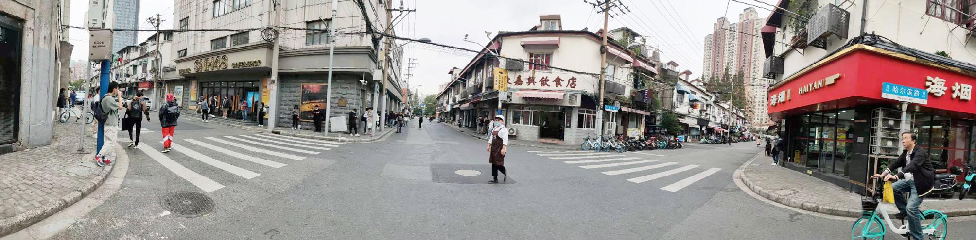
Walking along the rivers in SMV, it feels like alternating between history and modernity with every step. As a historic community in pursuit of urban regeneration, the area is a both harmonious and oppositional blend of the passion and inspiration of modern development and the simple happiness of ordinary life in the past time.
The urban planning of SMV aims for a key cultural and creative industry cluster and a state grade scenic spot exhibiting the unique well-preserved pattern of river system and the characteristic historic buildings (Shanghai, 2012; Hongkou, 2011).

How do residents' lives change here? What do tourists really get? Does SMV need further adjustment? All of the answers demand for in-depth investigation.
Figure 43. Shajinggang River in SMV (Shanghai WOW!, 2019)
78 p a g e
Context
Location
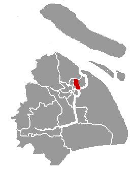
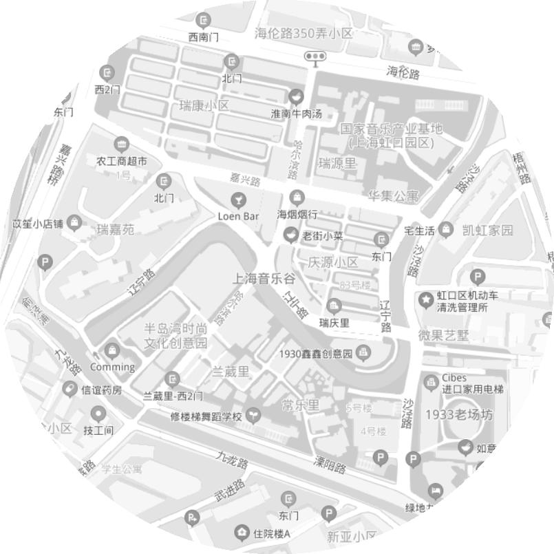
Located in the eastern coast of China (Figure 44) , Shanghai is one of the largest megacities in the world. It has a land area of about 6,340km² and a resident population of about 24.3 million (Baidubaike, 2020). SMV is located in the southern area of Hongkou District, one of the 16 municipal districts of Shanghai, and has a core area covering about 280,000m² (Baidubaike, 2020).

SMV lies in the central urban area and is next to the Bund. It is about 2.9km away from Shanghai People's Square, which is one of the most important city landmarks, and faces Lujiazui across Huangpu River, which is one of the most influential financial centers worldwide.
China
Figure
Shanghai Music Valley
Lujiazui
Shanghai People's Square
Inner Ring Road
Hongkou District
Huangpu River
Location
Shanghai
Hongkou

SHANGHAI MUSIC VALLEY 79 p a g e
44. SMV's
History
The written history of SMV reaches back to 751. This area has been known all along for the once very important Hongkou Port. There was a quite long time that this area built its development upon the port. As Historical Timeline of SMV shows (Figure
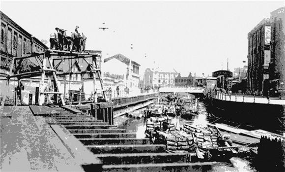
, it was not until 2011, when Shanghai Hongkou District Government financed the construction of musical and cultural industries here, that this area
the present name.
historical evolution of SMV
area
have its ups and downs
in the past time
glories
80 p a g e
45)
got
The
illustrates how an
could
based on the development of conventional industries
and then strived to regenerate its
through emerging industries.
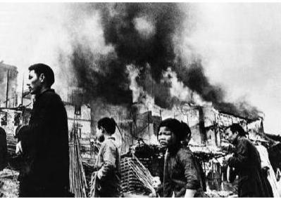
1 8 4 3 Port Opening 1 8 6 3 British and American Leased Territory 1 9 3 2 Japanese Military Occupation 1 9 4 9 Urban Construction Figure 45. Historical Timeline of SMV (Zuo, 2013) (Zuo, 2013)
This area started its rapid growth in 1843 due to the opening of the port, reached the peak of prosperty during the period of colony, and then turned to focus on inland urban construction in 1949 because of port decommission and industrial transformation (Hu, 2013) . During the three periods of urban reconstruction since 1990s, some old buildings here were removed, yet more remained.
the unique well-preserved pattern of river system is untouched.
now, the historical timeline ends with today's SMV. Yet this area has been ready for redevelopment at any time.
SHANGHAI MUSIC VALLEY 81 p a g e 1 9 9 2 Urban Reconstruction Water Demolition Emerging Industries 2 0 2 0 Today's Shanghai Music Valley 2 0 0 6 First Try 2 0 1 1
Especially,
For
(Shanghai WOW!, 2019) (SMV.com, 2019)
Lane
Shikumen Lane House (SLH) - SLH is a specific type of residential building, which blends the characteristics of western construction and traditional Chinese house in the regions to the south of the Yangtze River. It originated during the period of Taiping Rebellion from 1851 to 1864, when the armed conflicts pushed the rich people living in Jiangsu and Zhejiang provinces to move to the leased territories for shelter. The foreign developers took the opportunity to build a large number of houses, and thus designed SLH featuring a combination of both Chinese and Western styles. SLH tended to use a wooden door within a stone framework, and thus was named after it (Baidubaike, 2020). Yet the form is variable (Figure 46).
Lane Neighborhood - The determinant and enclosed architectural arrangements for SLH were adopted to fit for the need of high-density development of residence. Initially, SLHs were built here to meet the living needs of workers from the factories along the rivers. In SMV, many lane neighborhoods remain until now, and still account for a large proportion. Lane neighborhood developed its nature of business-residence symbiosis (Zhou & Kubota, 2018a) to provide commerce in compact living spaces. This form of community commerce has met the comprehensive consumption expectations of the residents for more than one century (Figure 46).
Lane Life - The wars forced extreme high-density living here. It was common to find a family of 5 managing their daily lives in a room of 10m². The kitchen was shared. And this mode of living continues until now. It is quite difficult to speak of privacy under this circumstance. Yet everyone knows all faces, and thus helps establishing a voluntary defensive mechanism. Besides, the hustle and bustle is exactly the charm of lane life (Figure 47).
82 p a g e


SHANGHAI MUSIC VALLEY 83 p a g e
Figure 46. SLH and Lane Neighborhood (Lou & Xue, 2014; Anonymous)
Figure 47. Lane Life (SOHU, 2018)
Land Use
With the development of urban reconstruction and creative and cultural industries,
residents' territory
(Figure
Historic Houses Industrial Construction
1947 Land Use
Historic Houses
Modern Apartment Buildings Industrial Construction
Land Use
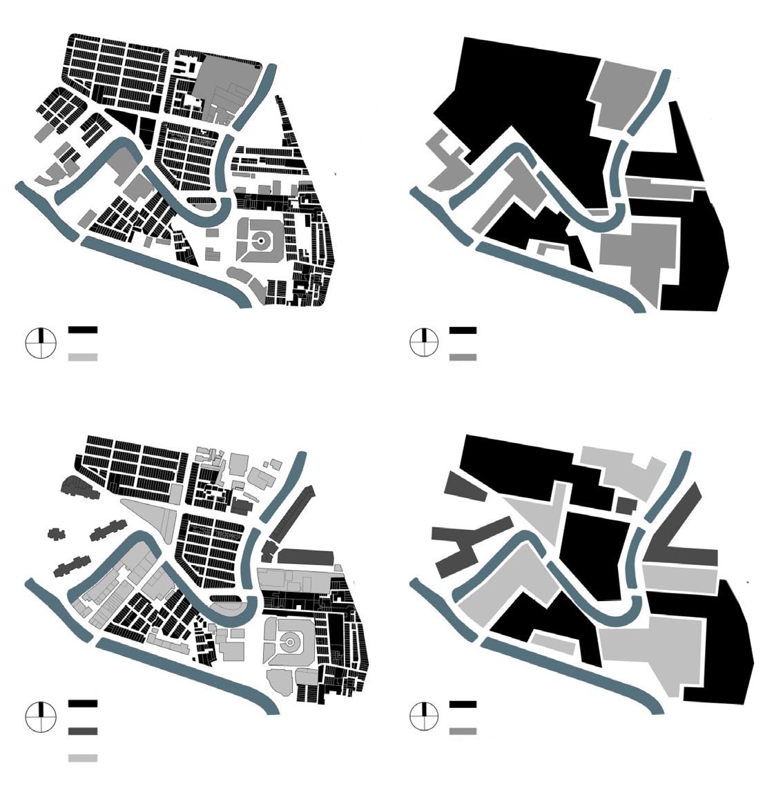
Change of Land Use
Living Land Industrial Land
Spatial Awareness
Living Land Industrial Land
Spatial Awareness
& Kubota,
84 p a g e
the
is shrinking
48).
2020
2020
1947
Figure 48.
in SMV (Zhou
2018b)
Methods
Acquaintance
Problem Statement
SHANGHAI MUSIC VALLEY 85 p a g e Different methods were conducted in different periods of work here (Figure 49).
Figure 49. Methodology in SMV
• Literature Review • Observation and Counting • Photography • Street-walking Workshop • Individual Interview Analysis • Quantitative and Qualitative Situation Analysis • Strengths, Weaknesses, Opportunities and Threats (SWOT) Analysis
• Stakeholder Analysis • Individual Interview Proposal • Co-design • Feedback Collection on Individual Interview
p a g e
Literature Review

A review of relevant documents, plans and laws was conducted to have a basic knowledge of this area. Besides, SMV has attracted much attention of many scholars with different backgrounds from home and abroad. Papers studying the redevelopment, authenticity and social isolation of this area were also read through to have an in-depth understanding of it.
Observation and Counting
A crossroad, where elements of modern boutiques, small businesses and cultural and creative industries all gather together, was chosen as the observation spot to study the general patterns of residents' and tourists' activities (Figure 50). The same method as Xiang Zhou did here (2018b) was used again to validate the data.
86
Figure
50.
Observation Spot in SMV
Street-walking Workshop
People walk on the streets everyday for various reasons, such as, going to school, going to work, shopping and hanging out. Yet in this street-walking workshop (Figure 51) , people were invited to walk on the local streets with a specific purpose of observing the extant built environment. Participants were encouraged to talk freely about what they know about the different places in this area, how they feel about them and how they want to change them.
SWOT Analysis
Figure 51. Route of Street-walking Workshop

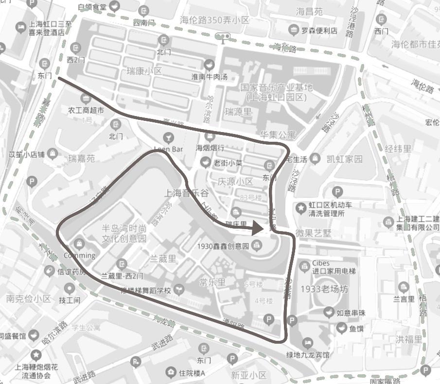
This strategic planning tool pointed the way to go by taking into consideration maximizing the potential of the strengths and opportunities and minimizing the impact of weaknesses and threats.
Stakeholder Analysis
A power-interest diagram of stakeholders was created to categorize them based on their levels of interest and how much power they have to implement influences. Special weight was given to where the two most concerned groups, residents and tourists, were placed. Also, it helps to shelve disputes or potential conflicts and focus on common expectations.
Co-design
Considering the failure to include any residents or tourists directly in the process of making decisions, an architecture student who had experiences in SLH-related design projects was invited to join the design process to avoid subjectivity. Feedbacks were collected then.
87 p a g e SHANGHAI MUSIC VALLEY
Reflection on Methods
The shorthanded and resource-limited situation led to the inapplicability of some methods.
At the very first, a questionnaire aiming for users' personal information and the details of their social activities was handed out. Yet only 7 valid replies were received. So literature review and observation and counting replaced the planned survey to find out about the general patterns of users' activities.
Besides, conducting fieldwork home with a foreign student identity did not help build trust much here in SMV. Neither individuals nor recognized organizations tended to show trust or be helpful. All efforts to organize a focus group were in vain in the end. What's more, the COVID-19 pandemic had a bad effect on getting in touch with people. So individual interview ended up to be the most common method through the whole fieldwork in SMV to gather relevant information and necessary feedbacks. It did not always work well, because the levels of difficulty of different topics and the personal characteristics of interviewees changed over periods. Interviewers' personal abilities to advance discussion, switch topics and create trust had influences on the effectiveness and efficiency of these individual interviews, too. It should also be noticed that there were doubts about whether we played a leading role in all individual interviews and how much our subjectivity exist.
In addition, there was not much direct user inclusion in the stage of making proposals. The lacks of money, hands, time and venue did not allow a map drawing workshop or a model making activity. Finally, it had to be conducted through making proposals first and then implementing adjustments based on the feedbacks got on individual interview.
Still, the ideas of user inclusion and participatory learning and action ran through the whole work. The basic aims of finding out about the potential threats, users' real needs and making practical proposals in the local context have been achieved through these methods.
88 p a g e
Situation Analysis
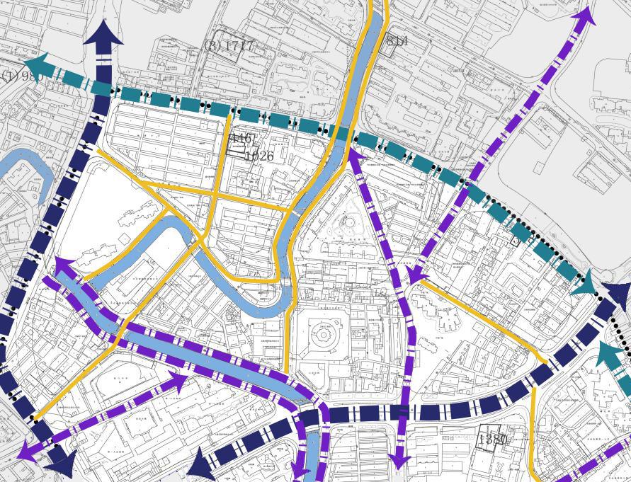
SMV


Figure
89 p a g e
52. Transportation Analysis of SMV Main Road Secondary Road Access Road Internal Road Underground Station Bus Stop Parking Lot
has very good connectivity and accessibility (Figure 52). Transportation SHANGHAI MUSIC VALLEY
Commerce
With the development of tourism, boutiques are gradually replacing the conventional small stores (Figure 53) . The community commerce in lane neighborhood live up to the comprehensive consumption expectations of the residents, and thus safeguard the daily life here. The replacement is an erosion to the local network, which serves basic needs.
Besides, streets, lanes and shops are used as public spaces in lane life. The conventional small stores play an important role of promoting social interaction and thus help reduce social isolation (Zhou & Kubota, 2018b) .
The decrease of the number of conventional small stores here calls for constructing more meeting points.

1947 2016
Necessity Basic Needs


Medium-grade Consumption High-grade Consumption Luxury
Figure 53. Commerce Analysis of SMV (Zhou & Kubota, 2018a)

90 p a g e
User Activity
The local streets serve different user groups on a time basis (Figure 54) .
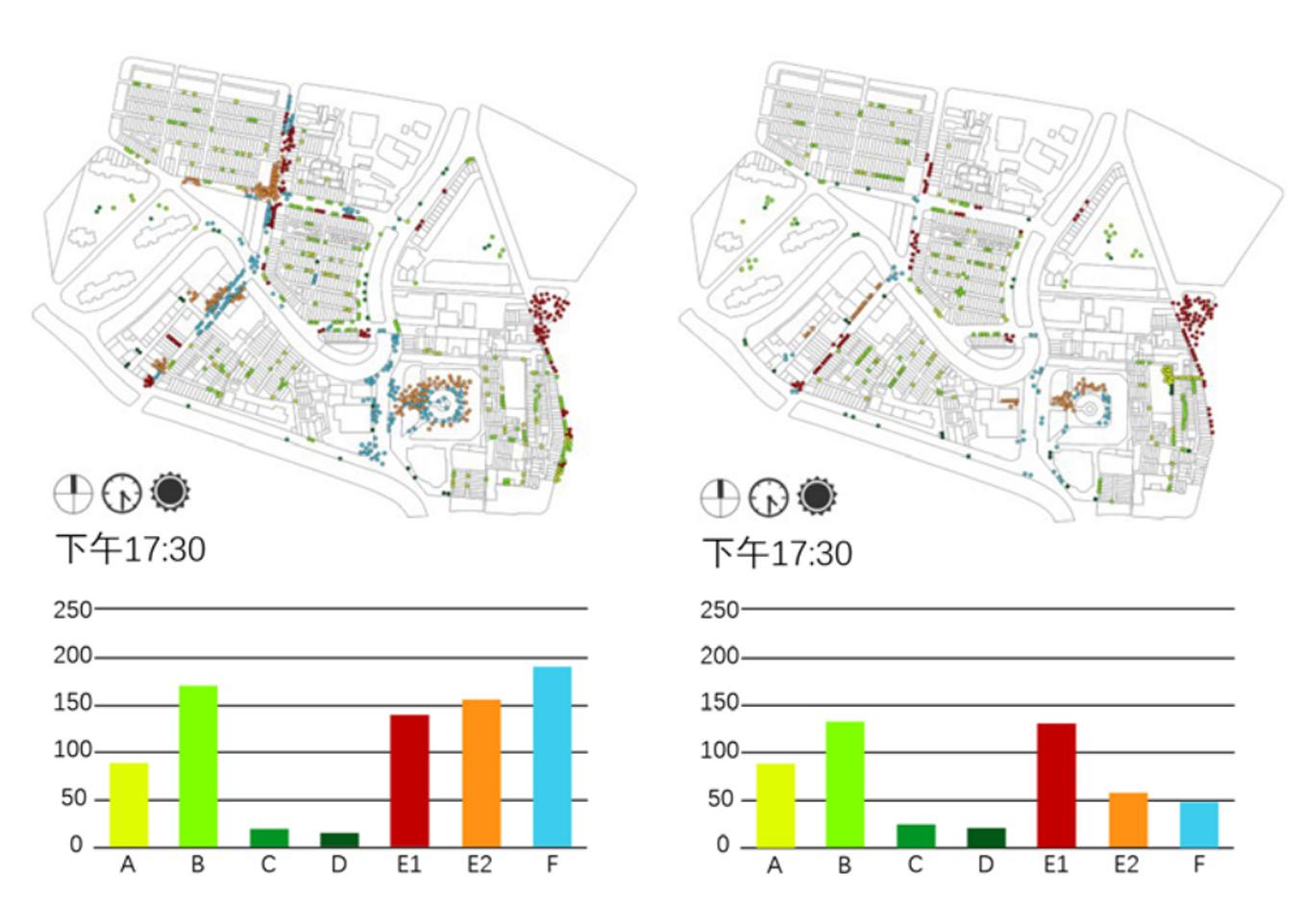
Although they take the full responsibility of serving the tourists, they are still an important part of the residents' daily life. Different groups take dominance of the local streets here in turn. This is validated by both Xiang Zhou's research (2018b) and our observation. So it is noticed that both of their use needs should be taken into consideration.
Weekend Weekday
Household Chatting Recreation
Service
Residents Tourists
Consumption
Figure 54. User Activity Analysis of SMV (Zhou & Kubota, 2018b)
Consumption
91 p a g e SHANGHAI MUSIC VALLEY
Social
Daily
Visiting
Photographing
p a g e
SWOT Analysis
• Location (City Center)
• Accessibility
• Connecticity
• Industrial Heritage
• Cultural Heritage
• Historic Landmarks
• Historic Neighborhoods
• Reputation
This area has been well known worldwide. It has attracted many tourists and scholars from from home and abroad.
• Mixed-functional Land Use
• Prosperous and Diverse Commerce
• Unique Wellpreserved Pattern of River System
Figure 55. SWOT Analysis of SMV

• Social Isolation
Lane neighborhoods, modern apartment buildings and cultural and creative industrial clusters are in fact '3 isolated worlds' (Zhou & Kubota, 2018b).
• Degraded Public Spaces
There are phenomena of temporary appropriation in the streets everywhere.
• Lack of Meeting Points
• Lack of Participation
People tended to be uninterested in public events.
They had their own doubts about the influence.
• Urban Regeneration
• Development of Cultural, Creative and Tourism Industries
This area is aimed to be a key cultural and creative industry cluster and a state grade scenic spot (Shanghai, 2012; Hongkou, 2011).
• Functional Replacement
Some historic houses have been emptied, yet not been shaped to anything else. Their plans of reconstruction are still in suspense (Figure 56).
• COVID-19
There is an overall slump of tourists because of the pandemic. And some shops were closed according to the restrictions of the government.
• Resident Relocation/ Demolition
Although lane life is the most direct and vivid reflection of
the local culture, there is a possibility that the historic houses might be reconstructed for other uses based on the extant redevelopment modes.
The old faces here might disappear. So is the culture.
• Mismanagement
?
Figure 56. Unknown Lanweili
• Failure of Redevelopment Exploration
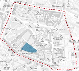
92
Stakeholder Analysis
As a historic community facing redevelopment, the situation here is complicated, and thus many people get included in some form or other. We try to list all stakeholders as follows:
1. visitors(mainly tourists); 2. residents in Lane Neighborhoods (including renters); 3. residents in modern apartment buildings; 4. property managers (mostly cleaners); 5. community administrative staff (grassroots government); 6. district government (Shanghai Hongkou District Government); 7. civilian-run non-enterprise units (still led by government in some degree, not NGO); 8. developers 9. practitioners of cultural and creative industries (mostly officers); 10. studio owners; 11. boutique owners; 12. small business owners; 13. cheap labour (mostly informal employees); 14. idolaters (of SNH48); 15. media (including 'we media'); 16. scholars;
It is noticed that special attention needs to be paid to the tourists and residents, as they are not only the main users, but also the stakeholders who take high interest and yet low power in the mean time.
Interest Visitors
Property Managers
Non-enterprise Units
Community Administrators
DevelopersEmployees
Residents
Scholars
Business Owners Media
District/Municipal Government
Figure 57. Power-interest Diagram of Stakeholders in SMV
Power

93 p a g e SHANGHAI MUSIC VALLEY
94 p a g e
Problem Statement
Disappearing Rivers
Waterfront is one of the most important features of SMV visually, geographically and culturally, based on the local culture of the port and shipping and the unique well-preserved pattern of river system. However, the high walls built along the rivers and the improper construction of riverside trails are pushing people away from the rivers.
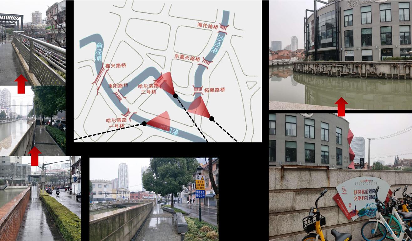
Lacking Meeting Points
Most of the interviewees complained about having no spaces for sitting down and communicating, including tourists, residents and so on. It further exacerbates the problem of social isolation in this historic community (Zhou & Kubota, 2018b).
Excessive Temporary Appropriation
There are excessive phenomena of temporary appropriation in the local streets of SMV. Residents are occupying the public spaces for self uses, and thus decrease their quality. Especially the informal clothes airing everywhere causes tourists' complaints (Figure 59).
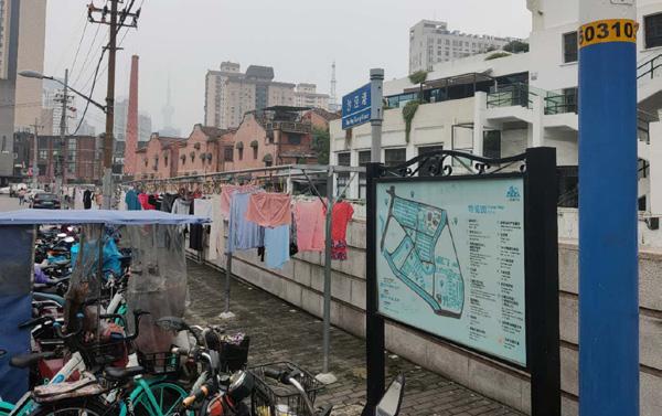 Figure 58. Photography Along the Rivers in SMV
Figure 59. Informal Clothes Airing
Figure 58. Photography Along the Rivers in SMV
Figure 59. Informal Clothes Airing
Strategic Intervention
Hydrophilic Facilities Proposals

The constructed high barrier walls along the rivers block people from getting close to and watching the rivers, while the extant riverside trails neglected proper design and attracted nobody's interest. Both of them should be replaced with well-built hydrophilic facilities, such as a platform to play with water (Figure 60).
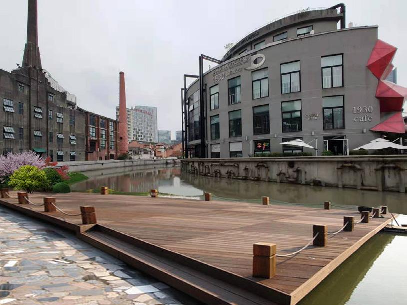
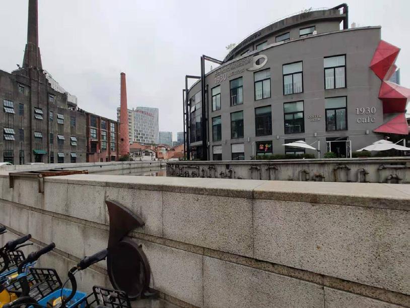
Feedbacks


Most of the interviewees thought of it as a wonderful idea. However, we still got some ridicules for being too idealistic to take the investment into consideration. We tried and failed to get comments from the government finally. Yet it is a common problem that we all should have considered seriously.
Short Term Next to the main entrance and exit of SMV, the marked site (Figure 61) is
95 p a g e SHANGHAI MUSIC VALLEY
Figure 60. Design of a Hydrophilic Platform along Shajinggang River
p a g e
located in the intersection of the routes. As the most important spot where people can enjoy the splendid view of the rivers and watch the 3 main historic buildings in the mean time, it should be reconstructed instantly.

Routes Historic Houses
Entrance and Exit Historic Buildings
Rivers Figure 61. Reconstruction Spot
Long Term Take the extant riverside trails into the consideration of the reconstruction plan without complete demolition. A step-by-step implementation plan should be made to conduct the project in several stages.
Creating Meeting Points Proposals

Encourage the other shopkeepers to copy the extant mode of a coffee shop to cleverly use the concavity of the building, where some simple decorations and several tables and chairs can be put (Figure 62).
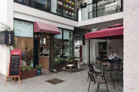
Figure 62. A Decorated Concavity of the Building
Feedbacks
The several interviewed shopkeepers and waiters all commented on the worry about the money invested. Also, there was a worry about the temporary appropriation of the street-facing spaces for a commercial use. They preferred to maintain the facilities if the government would invest to build them.

96
Short Term Add some benches at the intersections and along the streets where people often gather.
Long Term Seriously take creating meeting points into the consideration of the reconstruction of the extant riverside trails. The two things exist side by side and play a part together. It can be the next hot tourist attraction in SMV with clever design.
Providing Drying Machines Proposals

Specific commercial companies can be included to provide quality selfservice laundry. The washing and drying machines can be installed in the extant legal additions (Fugure 63).
Feedbacks
The interviewees tended to say no since they do not want to pay any money for doing their everyday launday. However, a few of them loved this idea to get drying service while they couldn't have private drying machines for some reasons.
Short Term Launch a pilot project; A short term subsidy policy to include more residents.
Long Term The government may use more propaganda to transform the views and ideas of the local residents to enhance their regulations here in SMV.
97 p a g e SHANGHAI MUSIC VALLEY
Figure 63. Laundry Machines in Additions
Comment from Group Members
The report has good graphical representation of its case area with proper designs and pictures. Through In depth analysis, the project shows good insight of the case study area.
This has created solid foundations for identifying the problems which could be solved through the strategic interventions for improving the area which is currently under development. In addition to inclusion of feedback from the stakeholders on the proposals, the report also concludes with suggestions for adjustments of the initial interventions.
Further, it looks that the good participatory methods have been taken into consideration to know the case study area and for further analysis.
From Rubaid Naskar
98 p a g e
99 p a g e SHANGHAI MUSIC VALLEY
CONCLUSION & REFLECTIONS
Through the Urban Ecological Planning course we have gotten the opportunity to work in depth with fieldwork research and stakeholder involvement in planning of possible interventions. As students with different academic backgrounds and fields of study, we have learned new methods and means of studying urban areas. It has been a challenge to work together considering our individual ways of working, as well as geographical distances and time zones. However, the group collaboration has been rewarding as we have learned a lot from our different cultures and how there can be both similarities and differences in our urban structures.
Reflections on Methods
We used methods like transect walks, direct observation, photography and videos, interviews and online surveys to gather information about the case area in our respective countries. Through these methods we got lots of information about the area on a deeper level and it also helped us to select the focus area on our respective sites. Similarly, the Situational Analysis, Stakeholder Analysis, Power- Interest Analysis, SWOT Analysis, Land Use Map helped us to further analyze our case area and find out the problems associated with it. The above methods were useful in the midst of COVID-19 situation as we took the method with necessary precaution and safety. The group discussion and other sessions could not be conducted as the COVID-19 cases were rising in most of our case areas and strict rules were being implemented by the respective government discouraging such actions.
100 p a g e
Reflections on Challenges
The greatest challenge this semester has been working together over the internet, considering the geographical, timely- and technical boundaries we have met throughout the project.
Due to the COVID-19 pandemic, we have not been able to work together physically and focused on one common project. Therefore it has also been difficult to get properly involved in each other's case studies, as the work has been mostly individual. Although the combined project digged deeper with methods like SWOT analysis- and qualitative and quantitative data analysis, individual project report lags due to insufficient data curation in the COVID-19 pandemic situation. It was the project’s obstruction to not get in touch with face to face interaction with users, livelihood or stakeholders to get their opinion and feedback, owing to the risk of COVID 19 contagion. This has led to limitations and further challenges, which forces us to adapt new methodologies to pave the research of case studies. For instance use of digital surveying. It has also been challenging to combine our different projects into one common format, as everyone has different backgrounds and experiences with editing software. However, we have helped each other through the process by dividing tasks based on our individual skills and knowledge.
Reflections on Strategic Interventions
After analyzing problems associated with our respective case areas we proposed various strategic interventions which were feasible and realistic according to our respective case areas. It was interesting to see that the most of ideas of the intervention came from our own major stakeholders on our respective sites. We conclude that the users of the space or area often know best how to improve and enhance their surroundings, and it's up to us as planners to make sure that their opinions are taken into consideration for urban development.
CONCLUSIONS & REFLECTIONS 101 p a g e
FIGURES
Figure 1. Cover, authors’ illustration, Xinyu Zhang, Marina Skanche, Photoshop, 04/12/2020
Figure 2. Map of Case Study Areas, authors’ illustration, Marina Skanche, Photoshop, Indesign, 04/12/2020
Figure 3. Illustration of Group Member Introduction, authors’ illustration, Xinyu Zhang, Photoshop, Indesign, 03/12/2020
Figure 4. Icons for Group Methodological Approaches, Pinterest
Figure 5. Duedalen, Photography by Marina Skanche
Figure 6. Location of Duedalen, Trondheim Municipality maps, Marina Skanche, Photoshop
Figure 7. Historical Timeline of Duedalen: forsvarsbygg.no, Strinda historielag.no, digitaltmuseum.no, Marina Skanche, InDesign.
Figure 8. Timeline and Methodology, Xinyu Zhang, Marina Skanche, Indesign
Figure 9. Situation map of Duedalen, 1:5000 with photos of football court, Kristiansten Fortress, Staircase and Bomb-shelter, Trondheim Municipality map, Marina Skanche
Figure 10. Duedalen before and after 2016, Miljøpakken.no/snarvei/duedalen
Figure 11. Various diagrams of Duedalen: Stakeholders, Power/Interest-matrix, Sun diagram, SWOT-analysis, Marina Skanche
Figure 12: Duedalen, September 2020
Figure 13: Duedalen, November 2020
Figure 14: Situation Map of duedalen, with location of interventions, Trondheim Municipality map, Marina, In Design
Figure 15: Collage Illustration:
Figure 16: Collage Illustration:
Figure 17 . Baisnavdevi Temple Space
Figure 18. Location Map of Baisnavdevi Temple
Figure 19. Methodological Procedure
Figure 20. Types of questions asked on online survey
Figure 21. Land Use Map
Figure 22. Power- Interest Diagram
Figure 23. SWOT Analysis
Figure 24. Earthquake Illustration
Figure 25. Temple Spaces used by Joggers and Bypassers
Figure 26. Wastages thrown rampantly around Temple Space and Cremation Site
Figure 27. Benches to sit for Visitors
Figure 28. Waste Bins for Waste Management
Figure 29: National Highway 112
Figure 30: Location Map
Figure 31: Site Location- Private Hospital
102 p a g e
Figure 32: Land Use plan in the context of NH 112
Figure 32: History location from 2006 to 2019, Google Earth Pro
Figure 33: Site Location for research on NH 112
Figure 34. Timeline and Methodology
Figure 35: High Traffic Density on NH-112
Figure 36: Site analysis on side of NH 112 and users footprints
Figure 37: Stakeholder Analysis- Power Interest Diagram
Fig 38. Preliminary Spatial Pattern of Traffic Density- Site 1 (Date 29/09/2020, Time: 10.13-10.25 PM IST)
Figure 39: Frequency of traffic density (Date 23/10/2020, Time: 10.55-11.05 AM IST) (Total no of vehicles/ 10 min= 386 nos)
Figure 40: Frequency of traffic density (Date 30/10/2020, Time: 5.45-5.55 PM IST) (Total no of vehicles/ 10 min= 343 nos)
Figure 43. Shajinggang River in SMV, Shanghai WOW!, SOHU page
Figure 44. SMV’s Location, authors’ illustration, Xinyu Zhang, Photoshop, Indesign, WPS Office, 26/11/2020
Figure 45. Historical Timeline of SMV, authors’ illustration, Xinyu Zhang, Indesign, Photoshop, WPS Office, 23/11/2020
Figure 46. SLH and Lane Neighborhood, Lou C. & Xue S. & Anonymous
Figure 47. Lane Life, SOHU
Figure 48. Change of Land Use in SMV, Zhou X. & Kubota A.
Figure 49. Methodology in SMV, authors’ illustration, Xinyu Zhang, Indesign, 28/11/2020
Figure 50. Observation Spot in SMV, authors’ illustration, Xinyu Zhang, Photoshop, Indesign, WPS Office, 28/11/2020
Figure 51. Route of Street-walking Workshop, authors’ illustration, Xinyu Zhang, Photoshop, Indesign, WPS Office, 28/11/2020
Figure 52. Transportation Analysis of SMV, authors’ illustration, Xinyu Zhang, Photoshop, Indesign, WPS Office, 28/11/2020
Figure 53. Commerce Analysis of SMV, Zhou X. & Kubota A.
Figure 54. User Activity Analysis of SMV, Zhou X. & Kubota A.
Figure 55. SWOT Analysis of SMV, authors’ illustration, Xinyu Zhang, Indesign, WPS Office, 28/11/2020
Figure 56. Unknown Lanweili, authors’ illustration, Xinyu Zhang, Indesign, WPS Office, 28/11/2020
Figure 57. Power-interest Diagram of Stakeholders in SMV, authors’ illustration, Xinyu Zhang, Indesign, WPS Office, 06/12/2020
Figure 58. Photography Along the Rivers in SMV, authors’ illustration, Xinyu Zhang, WPS Office, 27/11/2020
Figure 59. Informal Clothes Airing, authors’ photo, Xinyu Zhang
Figure 60. Design of a Hydrophilic Platform along Shajinggang River, authors’ illustration, Xinyu Zhang, Photoshop, 16/11/2020
Figure 61. Reconstruction Spot, authors’ illustration, Xinyu Zhang, WPS Office, Indesign, 06/12/2020
Figure 62. Figure X. A Decorated Concavity of the Building, authors’ photo, Xinyu Zhang
Figure 63. Laundry Machines in Additions, authors’ illustration, Xinyu Zhang, WPS Office, 06/12/2020
103 p a g e
FIGURES
p a g
REFERENCES
Barasat,2020. https://en.wikipedia.org/wiki/Barasat (Online Accessed, 5th Dec, 2020)
Barasat, 2020a. https://en.wikipedia.org/wiki/National_Highway_112_(India) (Online Accessed, 5th Dec, 2020)
Openstreet map, https://www.openstreetmap.org/way/22826359#map=13/22.7193/88.4796&layers=N, (Online Accessed, 1st Dec, 2020)
History time location, Google Earth Pro, https://www.google.com/earth/ (Online Accessed, 1st Dec, 2020)
Subrata Guha and Biswajit Mandal, 2016. PROBLEMS OF ROAD TRANSPORT SYSTEM AT BARASAT MUNICIPALITY, WEST BENGAL, Weekly Sci, International Research Journal, Vol (3) 45, pp.1-13
Road Accidents in India, 2018. morth.nic.in
Nepal Population Census, 2011. https://unstats.un.org/unsd/demographic-social/census/documents/Nepal/ Nepal-Census-2011-Vol1.pdf
Shanghai, 2012. The 12th Five Year Plan of Cultural and Creative Industries in Shanghai. Shanghai Municipal Government, [online] Available at: <fgw.sh.gov.cn/resource/0c/0cc07c84e3ee49ef9fe7663b68236e6b/9138e0c4f f040763a91fbe9a14efcb7b.pdf> [Accessed 5 December 2020].
Shanghai, 2012. The 12th Five Year Plan of Cultural and Creative Industries in Shanghai. Shanghai Municipal Government, [online] Available at: <fgw.sh.gov.cn/resource/0c/0cc07c84e3ee49ef9fe7663b68236e6b/9138e0c4f f040763a91fbe9a14efcb7b.pdf> [Accessed 5 December 2020].
104
e
Hongkou, 2011. The Pilot Schemes of Comprehensive Reforms in Finance, Shipping and Service in the North Bund. Hongkou Development and Reform Commission, [online] Available at: <http://www.shhk.gov.cn/shhk/ xwzx/20111110/002004_28d7c36a-4546-4052-a0cc-b6e06def0cdc.ht> [Accessed 5 December 2020].
Shanghai WOW!, 2019. New Discovery of Literature and Art in Devil Capital. SOHU, [online] Available at: <https://www.sohu.com/a/363089262_380622?scm=1002.3e003b.f501c7.0-0> [Accessed 5 December 2020].
Baidubaike, 2020. Shanghai. Baidubaike, [online] Available at: <https://www.baidu.com/ link?url=LwWjXcmNUwUBdh-TvbG5ncZqS9JtOIVsWgBG5n9ncfkhsD0LoM-DIKy1e8HMZTAi7b0leoErmxwOj0P2TbQQ_YnBVBCMWbFdV8UD4DHzZa&wd=&eqid=8b2a0d310002c7dd000000065fcb8869> [Accessed 5 December 2020].
Baidubaike, 2020. Shanghai Music Valley. Baidubaike, [online] Available at: <https://www.baidu.com/ link?url=6PGTjvp90rNUm_TfQnLydxPszC8ppsKjZj_8vrPpNPupzc7V8jqQGxMGUhmQJhD7Pong0q1hF3b3KW5OQ r6Fp225pRyusVCqVP8u35zoWtZNVWbtqI58iCvpW8jGkaMik7AhKYR2uY2JV8qNxJq-d_&wd=&eqid=e2b2086e0 0032c50000000065fcb8a9f> [Accessed 5 December 2020].
Hu, L., 2013. Urban Regeneration Based on Historical and Cultural Value - A Case Study of Hongkou Creek, Shanghai. Urban Regeneration, [online] Available at: <https://max.book118.com/html/2017/1119/140658065. shtm> [Accessed 5 December 2020].
Zuo, X., 2013. Old Shanghai Album - Hongkou in the past. Illustrated History, [online] Available at: <bbs.voc. com.cn/viewthread.php?tid=5642277> [Accessed 5 December 2020].
Baidubaike, 2020. Shikumen. Baidubaike, [online] Available at: <https://www.baidu.com/ link?url=WkZScDnBBjuBrqxo6K-Pjf1oTjdCLi4gtco-jlp5_d4SuJUO9Sov_Yzc5wiXtf6uTlxe2TpFz5Z64rZVwGHKC8k ZVmEZY_JDlgMkGHwh8XfObwcZHZy782Wb2P-G9NeLAWUIW17TXsCfvW50QSbb3TSOfmYFjmYamZPZbOxzNY
D8kmuOISUVt2lbY4KwmLSQhujWQIDAlt4-or2vLcmJNa&wd=&eqid=d178b675000099ac000000065fcbb528> [Accessed 5 December 2020].
p a g e
REFERENCES 105
Zhou X. & Kubota A., 2018a. Mediation, Transportation, Preservation, Reposition and Juxtaposition: The Impact of Rebuilding Shanghai Shikumen Lane Neighborhoods’ Public Consumption Space on Community Space, New Architecture, 000(001), pp.130-134.
Lou, C. & Xue S. 2004. Old Shanghai Shikumen. Shanghai: Tongji University Press.
SOHU, 2018. What is Huangpu?. SOHU, [online] Available at: <https://www.sohu.com/a/259372795_100191055].
Zhou X. & Kubota A., 2018b. Between Family and State: Discussion on the Segmentation and Unification of Daily Living Space within Shanghai Historic Lane Neighborhood, Landscape Architecture, 2018(04), pp.34-40. DOI: 10.14085/j.fjyl.2018.04.0000.07.

