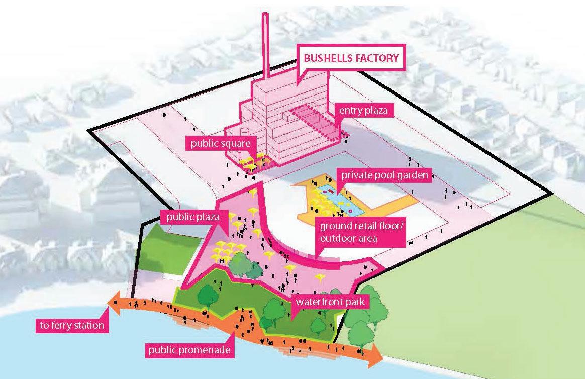
frontage and is linked to the factory by a covered walkway. The security booth / gatehouse is located at the south-eastern corner entry to the site. The balance of the site comprises concrete and bitumen driveways, at-grade bitumen car parks (along the eastern side), and landscaped areas. The layout of the site is characteristic of the 'Factory Garden Movement' with its landscaped waterfront setting. Access and Transport Primary access to the site is from Burwood Road, with secondary vehicle access from Zoeller Street. An existing road reserve connecting Zoeller Street to the foreshore enables pedestrian access to the Exile Bay foreshore, however the remainder of the site is securely fenced. The site is served by the 466 bus which operates every 20 mins. The nearest train station is Burwood Station, approximately 2.5km away which is catered by limited stops / express services. Landscape & Public Domain The existing landscape comprises a mix of native and exotic tree species, with mature screen planting to the site boundaries and within car park areas, and lawn areas adjoining the harbour. There does not appear to have been any particular planting theme for the site. Whilst the subject site has legal frontage to Exile Bay, pedestrian access to the foreshore is publicly available. This foreshore edge is characterised by a 3m high concrete seawall.
2.3 Surrounding Development The suburban context of the site reflects the incremental post-industrial redevelopment of Sydney's waterfront land. The subject site is one of the two remaining industrially zoned sites along the Canada Bay waterfront. Development to the west and south is characterised by one (1) to two (2) storey detached and semi-detached dwellings. Development to the east and south east, known as Pelican Quays, Pelican Point and Philllips Landing, is characterised by townhouses and apartment buildings ranging from three (3) to seven (7) storeys in height. Immediately to the north is the Massey Park Golf Course, a publicly owned golf course and an item of local heritage significance. Bayview Park is located approximately 600m east of the site. Educational facilities located in proximity to the site includes Concord Public School (1km) and Concord High School (1.2km).
22
160 Burwood Road, Concord Bushells Redevelopment - Amended Planning Proposal v5-1 | LFA (Pacific) Pty Ltd


