ADAPTIVE JAKARTA LANDSCAPE STRATEGIES FOR REAL WORLD ISSUES

National University of Singapore | School of Design and Environment | Department of Architecture

LA4702 Master of Landscape Architecture Studio, ‘City’, 13 Jan - 3 May 2020
Bargotra Poornima | Cheng Jing | Carissa Chin Qiwei | Ekta Balubhai Rakholiya | Feng Zihan | Han Cong | Lyu Jiawei | Mamiko Tanaka | Dhuri Ruiee | Shao Zhongran | Wang Haobo | Xiao Xinyan | Zhang Bingqian | Zhang Bingyi | Zhang Yifei | Zhong Yixin | Zhou Xianfeng | Zhou Zuyuan | Lim Wenfa
Tutors: Ervine Lin, Senior Lecturer | Kenya Endo, Lecturer
As a studio product which is not censored, it may contain mistakes or not represent the positions of NUS.
Published by CASA Centre of Advanced Studies in Architecture
Department of Architecture
School of Design and Environment
National University of Singapore
4 Architecture Drive
Singapore 117566
Tel: +65 65163452
Fax: +65 67793078
Copyright © 2020 Ervine Lin and Kenya Endo (ed.)
ISBN: 978-981-14-9850-3
ADAPTIVE JAKARTA studio pays attention to the role of landscape architects in rapidly growing Asian cities; our perspective in identifying urban issues, discovering opportunities through design interventions, and advancing proposed interventions into sustainable strategies for the betterment of the residents. Students were challenged to analyze the socioeconomic drivers of spatial usage and patterns from community-level as well as city-wide geographical context to better understand the complex dynamics of the city as a whole.
This book is a compilation of 19 graduate students’ work in the Landscape Architecture program, who put their hearts and efforts to explore adaptive landscape design interventions for creating multi-functional and culturally sensitive public spaces for enhancing city’s liveability. The first half of the book documents the process of the studio chronologically; group’s site analysis to explain the context and motivation for subsequent design approaches, and ends with design suggestions with concepts and experiential graphics. 19 very diverse design outcomes appear in the second half of the book under the following categories: 1) Waste & Landfill, 2) Wastewater Treatment, 3) Storm -water & Flood Risk Management, 4) River System Reconfiguration, 5) Social & Lifestyle, 6) Community & Open Space, 7) Streetscape and Linear Infrastructure. The book concludes with reflections of the studio. We hope the book will contribute to the deepening of the knowledge-base and an expanding of the potential scope of our profession.
The studio preparation and site visits owe a lot of support from Mr. Brahmastyo Puji from Architecture Sans Frontières, Ms Elisa Sutanudjaja, executive director of Rujak Center for Urban Studies in Jakarta, Ms. Ellisa Evawani, Associate Professor, and Ms Hanifa Wasnadi from the University of Indonesia, and their students from the Department of Architecture, Faculty of Engineering, Ms. Dewi Rezalini from Bogor Agricultural University, Department of Landscape Architecture for sharing her insights of the profession in Indonesia.
Special thanks to guest reviewers, Ms. Dixi Mengote-Quah, Ms. Dorothy Tang, Ms. Lehana Guo, Mr. Ryan Shubin who provided insightful comments to student’s works. Thank you very much.
PREFACE
STUDIO INTRODUCTION 1 CHRONOLOGY 6 PRELIMINARY RESEARCH 17 PROPOSALS 78 REFLECTIONS 378
STUDIO INTRODUCTION
Ervine Lin and Kenya Endo
Course Overview | This studio-based module expands the skill level expected of our students by enlarging their mode of operation to the scale of the city. As the second installment of a four part masterlevel core studio, the students will visit the city of Jakarta, the current capital of Indonesia. There, they will be faced with the realities of an ever growing megalopolis stretched by both environmental as well as socioeconomic challenges. Students will be asked to explore how landscape architecture can potentially alleviate some of the issues to be uncovered over the course of the semester and to suggest socially acceptable, environmentally viable and technically innovative interventions using a landscape approach
Background I Concerns over water scarcity, climate change, and environmental health risks have prompted some Asian cities to invest in river rehabilitation and scholars in recent years have been demonstrating that a change in paradigm in river rehabilitation is possible, providing future scenarios that balance concerns over flooding, water quality, and ecology, with the realities of a rapidly growing megacity like Jakarta, the current capital of Indonesia (Vollmer et al., 2015).
By 2050, an additional 2.5 billion people, resulting in a total of 66 percent of the world’s population, is projected to reside in urban areas with a glaring majority of this increase concentrated in Asia and Africa (United Nations, 2014). This massive urban transition coincides with an unprecedented expansion of builtup land which has resulted in ramifications to the local-regional climate, pollution, water quality and availability, arable land as well as the livelihoods of people in the region (Schneider et al., 2015). Much of this growth occurs in the “mega-deltas cities” which have historically conglomerated people, resources and economic activities, a trend which increasingly places them at risk to environmental hazards (Seto, 2011) and has contributed to rivers and wetlands becoming one of the most threatened ecosystems in the world (Malmqvist and Rundle, 2002; Tockner and Stanford, 2002). One such city is the current capital of Indonesia, Jakarta.
Unfortunately, increasing urbanisation, commercial development and centuries of exploitation and neglect have transformed the rivers in Jakarta, such as the Ciliwung River, into one of the most polluted rivers in the world (E. Satriastanti, 2012). The concurrent anthropogenic factors such as buildup of garbage (Texier, 2008) and the rapid subsidence due to groundwater extraction (Chaussard et al., 2013) have also been attributed to the ever increasing seasonal floods in the city, the latest deadly flood happening in January 2020 (CNA, 2020). The issue of flooding is further exasperated when municipal infrastructure fails to keep pace with urban growth forcing lower-income communities settled along the downstream section of the river to rely on the polluted river for water, sanitation and even recreation (Vollmer and Grêt-Regamey, 2013).
In the past two decades, multiple studies of water management problems and engineering proposals to mitigate flooding have been brought up in Jakarta but none have been successfully implemented (Silver, 2014). One of these proposals is the long standing plan to “normalise” the river channel, a project led by the Ministry of Public Works which includes dredging, expansion and bank reinforcement works that would change both the topography and land use along the riparian corridor. The high cost of land acquisition, sensitivity of aggressive demolition and eviction policies, ironically coupled with the allowance for commercial entities to develop along riverbanks and other
1
green spaces (Steinberg, 2007) have resulted in a fair amount of debate on the validity of the “normalization” process.
Unfortunately, “normalization” is still the strategy which currently has the most momentum and residents of who have been residing along some of the worst hit areas live under the constant threat of eviction and relocation to make way for these river improvement works (The Jakarta Post, 2015). Those who have already gone through it are now physically and psychologically segregated from the water systems that flow through the city. The studio’s starting point is thus exploring means in which landscape orientated solutions might provide an alternative to the alienating approach of “normalization”.
While rapid urbanization is often blamed for the environmental degradation and increasing hazards from natural disasters, the magnetic concentration of people, resources and economic activity in cities can also provide for an opportunity to create mitigation strategies that shift the city towards sustainability (Seto et al., 2010). This concentration of resources has allowed for river and wetland restorations to become an increasingly lucrative enterprise with billions of dollars being spent on restoration works (Nakamura et al., 2006) Seen no longer as merely a recreational or decorative exercise, the practice of river restoration can be viewed as an infrastructural investment in which a multitude of benefits can be obtained, inclusive of flood mitigation (Benedict and McMahon, 2006).
Girot acknowledges this noteworthy endeavor of landscape recovery but challenges practice and discipline to engage with the cultural and environmental dimensions of a site through a combination of physical experience, intuition and scientific research (Girot, 1999). As such, while the situation in Jakarta might appear bleak, the studio seeks to engage with the local populance while bringing to the table a landscape architectural agenda which explores the possibilities of reimagining the water systems in Jakarta such that they play not only an ecological, social and economic role but also one which has the possibility to mitigate environmental factors.
Site I The primary landing site will be a community within Kampung Kedaung Kali Angke in West Jakarta, located along the riverside of Kali Apuran, and close to Cengkareng Drain. Dense single-story housing blocks are surrounded by industrial area and several high-class gated communities, as well as undeveloped open fields (presumably owned by private developers). Due to the river expansion program back in 2014, several houses were evicted, creating new composition of spaces along the river—linear inspection road with spontaneous communal activities, faced by 2 separated neighboring communities. This eviction along the river is a common theme seen along many parts of Jakarta to make way for normalization of the rivers and canals.
The landing site serves as a snapshot for the studio to understand Jakarta’s community-level spatial organization, complexity of social structures, and challenges that a typical community faces toward sustainable living. Simultaneously, students are to investigate surrounding neighborhoods for contextual understanding, as well as to conduct city-scale analysis for identifying how our landing site interrelates with the dynamics of the Jakarta City as a whole.
2
Design Questions | During the course, students will be challenged to develop both spatially and socially compelling design interventions. The studio is designed to answer these questions by using Jakarta as a case study and Kampung Kedaung Kali Angke as a landing site to deploy and demonstrate each student’s design approach(es). Questions students should ask themselves can include but are in no way limited to the following:
• Considering the complexity of the site and the city, what will be the key parameters / priorities?
• Aside from simply pledging areas for green, how can we incentivize local stakeholders to be part of the drivers of your landscape proposal?
• How will students address informality in design, when environmental pressure as well as infra-
• Can landscape architects propose design prototypes that can infuse greater diversity and livability into the urban context?
Learning Objectives and Approaches | For a landscape intervention to be successful, designers need to understand the site in question—from its collective memory to its physical topography. Unfortunately a designer seldom (if ever) belongs to the place in which he or she is asked to operateing) which serve as a theoretical methodology in which to extract as much potential from the site in thus be tasked to perform the following:
1. To step outside their comfort zone into the complexities of metropolitan Jakarta to experience the ground conditions for themselves (landing)
2. Carefully unfold the intricate characteristics of the site through detailed analysis and experiential explorations (grounding)
3. Discover the potential areas in which landscape architecture can be leveraged on to alleviate the
4. Propose ways to restructure elements of the city into a series of resilient outcomes in the form of bespoke spatial and social frameworks (founding)
complex and is only one of the many facets in which students can consider as their intended focus. A nonexhaustive list of potential topics* is suggested below:
• Urban hydrology including city-wide waterways and hydraulic infrastructures, collection of rainwater, ground water extraction, access to portable water, etc.
• Interaction with water (access, behavior, perception etc.), and how they shaped people’s lifestyle.
• Access to greenery (or lack thereof) within the city and the realities of park building in Jakarta.
• Solid waste management and sanitation and the possibilities of reinvigorating a positive human landscape interaction.
• Productive landscapes and their potential role in improving socio-economic divides.
3
Lastly, narrative development will be the overarching skills to be further developed. “Narratives intersect with sites, accumulate as layers of history, organize sequences and inhere in the very materials and processes of the landscape.” (Potteiger and Purinton, 1998)
services) and experience (distinctive and memorable). These challenges are to be developed into opportunities to serve as the foundation of a logical narrative to outline the advantages and necessities of the proposed design.
Studio Structure I
to understand site context, with in-depth input sessions from local experts to identify problems and challenges. Students will be tasked to work in groups for the research phase, and as individuals for the design application phase, according to the requirements of each stage of the studio.
Research Phase
observation & measurements with advanced digital technology, interviews with residents, and collection of maps) to acquire relevant knowledge to serve as the basis of design vision and strategies for all students.
For this initial research phase, students will be grouped into 3 focal scales for their respective site investigation tasks. Refer below for the potential site survey inventory:
1. City scale—Infrastructural network (water, transport), land-use, urban density, history, demography etc.
2. Neighborhood scale—Digital mapping and measurements, typological studies, etc.
3. Site scale—Interview surveys, detail observations on materials and site furnishing, sectional studies etc.
The knowledge / geo-data / maps collected during the site visit must be traceable or be based onvidual design developments at the later stage.
Design Development Phase
The last 7 weeks will be left to focus on design application, which will culminate in a convincing small group projects after discussing with tutors through the course of the semester.
4
Recommended Readings I
‘Adianto et al. - 2014 - The Informal Area Management in Slum Settlement.pdf’ (n.d.).
Adianto, J., Okabe, A. & Ellisa, E. (2014) ‘The Informal Area Management in Slum Settlement’:, 18. Apip, Sagala, S.A.H. & Luo, P. (2015) ‘Overview of Jakarta Water-Related Environmental Challenges’.
Betteridge, B. & Webber, S. (2019) ‘Everyday resilience, reworking, and resistance in North Jakarta’s kampungs:’, Environment and Planning E: Nature and Space.
Bott, L.-M., Ankel, L. & Braun, B. (2019) ‘Adaptive neighborhoods: The interrelation of urban form, social capital, and responses to coastal hazards in Jakarta’, Geoforum, 106, 202–213.
Chaussard, E., Amelung, F., Abidin, H. & Hong, S.-H. (2013) ‘Sinking cities in Indonesia: ALOS PALSAR detects rapid subsidence due to groundwater and gas extraction’, Remote Sensing of Environment, 128, 150–161.
nacular: Politics, Semiotics and Representation, Cham: Springer International Publishing,13–30.
tion and urban image’, Space and Polity, 23, 265–282.
Girot, C. (1999) ‘Chapter 3: Four Trace Concepts in Landscape Architecture’, in Corner, J. (ed.) Recovering landscape: essays in contemporary landscape architecture, New York: PrincetonArchitectural Press, 58–67.
Guinness, P. (2019) ‘Managing Risk in Uncertain Times’, Ethnos, 0, 1–12.
Hellman, J. (2018) ‘How to Prove You are Not a Squatter: Appropriating Space and Marking Presence in Jakarta’, in Cabannes, Y., Douglass, M., and Padawangi, R. (eds) Cities in Asia by and for the People, Amsterdam University Press, 41–68.
‘Jakarta Waterscape: From Structuring Water to 21st Century Hybrid Nature? by arysari - issuu’ (n.d.). Available at: https://issuu.com/arysay/docs/nakhara (accessed January 2020).
Lin, E., Shaad, K. & Girot, C. (2016) ‘Developing river rehabilitation scenarios by integrating landscape and hydrodynamic modeling for the Ciliwung River in Jakarta, Indonesia’, Sustainable Cities and Society, 20, 180–198. -
ing Cities’, The State of Environmental Migration 2015 – A review of 2014, 18.
Ninsalam, Y. & Rekittke, J. (2016) ‘Landscape architectural foot soldier operations’, Sustainable Cities and Society, 20, 158–167.
The lock-in of infrastructural solutions’, Environment and Planning C: Politics and Space, 37, 1102–1125.
Potteiger, M., Purinton, J. (2002) ‘Landscape Narratives’, Theory in Landscape Architecture, edited
Prescott, M.F. & Ninsalam, Y. (2016) ‘The synthesis of environmental and socio-cultural information in the ecological design of urban riverine landscapes’, Sustainable Cities and Society, 20, 222–236.
Rekittke, J., Paar, P., Lin, E. & Ninsalam, Y. (2013) ‘Digital reconnaissance’, Journal of Landscape Architecture, 8, 74– 81.
-
-
5
CHRONOLOGY
Jan
6
13th
- 3rd May 2020
The studio started off with the orientation of studio “Adaptive Jakarta” by tutors, followed by an introduction to the entire semester’s schedule.

For the initial research phase, students were grouped into 3 focal scales; ‘City scale’, ‘Neighborhood scale’, and ‘Site scale’, for their respective site investigation tasks.
20-30 Jan- Preliminary Site Analysis Sharing and Field Trip Preparation
The three groups presented and shared their initial analysis, and the major topics are below.
1.City scale—Infrastructural network, land-use, urban density, history, demography.
2. Neighborhood scale—Digital mapping and measurements, typological studies, etc.


3. Site scale—Interview surveys, detailed observations on material, sectional studies, etc.
For field trip preparation, students received safety instructions from Mr. S. Ravindran (NUS Office of Safety, Health & Environment), and were also trained how to fly a drone for survey.
13 Jan
7
01 Feb - Field Trip Start - Fly into Jakarta

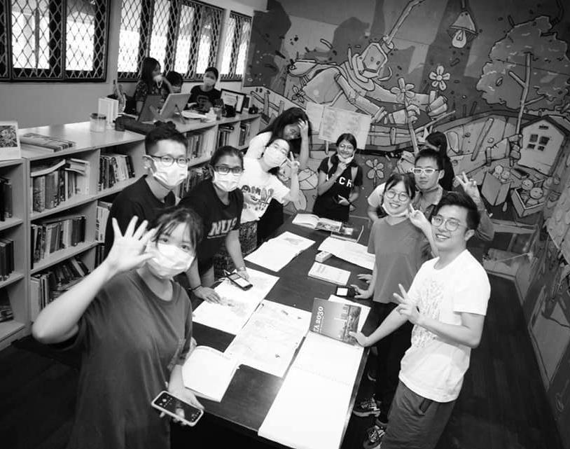
02 Feb - Kickoff Session with Seminars and Site visit with All Universitas Indonesia, Architecture Sans Frontières Indonesia, and the Bogor Agricultural University. Students and tutors visited to the site, Kampung Keduang Kali Angke, alongside students from UI.


8

9


10


11


12
Each group conducted site surveys with tutors and UI students. At night, students prepared for the interim sharing session at the hotel.


3-6 Feb - Full Day Onsite Surveys
7 Feb - Wrap-up Session
At Rujak Urban Design Center, each group made a presentation. Guest reviewers included local collaborators, community members.


13
8 Feb - Field Trip End: Fly-out from Jakarta

10 Feb -2 Mar - Design Vision Consultation by Individual

In preparation for the upcoming mid-review, each student had a series of personal consultations with our tutors, which included site and issue selection, analysis, and design approach.

14
Three guest reviewers were invited for the Mid Review; Ms. Dixi Mengote-Quah (Urban Planner / Hydro-engineer), Ms. Lehana Guo (Landscape Architect), Mr. Ryan Shubin (Landscape Architect). The reviewers provided constructive advice in diverse aspects regarding the research, analysis, issue selection, and design approaches.
9 Mar - Mid Review
16 Mar- 17 Apr - Design
Development
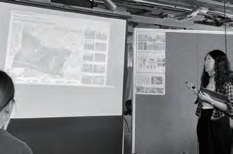
Students focused on design application, which culminated in a convincing design solution for the discussing with our tutors through online meetings.


15
Due to the Covid-19 pandemic, final review was conducted online with pre-recorded presentation.

Ms. Dixi Mengote-Quah (Urban Planner, Hydro-engineer), Ms. Dorothy Tang (Landscape architect, Research),
Ms. Lehana Guo (Landscape architect), Mr. Ryan Shubin (Landscape architect) reviewed student work remotely.

24 Apr - Final Review
Session
4 May - Last Studio
16
PRELIMINARY RESEARCH Adaptive Jakarta CITY SCALE 18 NEIGHBORHOOD SCALE 36 CITE SCALE 52 17
CITY SCALE - HISTORY

Historical Maps
Analysis:
- Course of Ciliwung river changed due to canalization after floods in 1621
- The canal system caused the river to lose its current, and deposit large amounts of sediment
Batavia Old Town
Poor living conditions in this walled town, causing diseases like malaria – eventually leading to the destruction of the wall in 18th century. Currently known as Kota Tua Jakarta (“Jakarta Old Town”) with some of the old buildings still preserved.
Historical Land Use Maps

Jakarta Urban Area, 1985Jakarta Urban Area, 1993
Analysis
- Preference of industrial areas along the bay due to port industries
- Mostly residential with mixed buildings along the river – showing that industries/ commercial buildings depend on the river
18
Five Phases of Dutch Water Management

CITY SCALE - HISTORY
Flood History in Jakarta
Source: Octavianti, T. & Charles, K. (2019) ‘The evolution of Jakarta’s flood policy over the past 400 years: The lock-in of infrastructural solutions’, Environment and Planning C: Politics and Space, 37, 1102–1125.
Flood History & Important Policy/Decisions in Jakarta, Indonesia
Source: Octavianti, T. & Charles, K. (2019) ‘The evolution of Jakarta’s flood policy over the past 400 years: The lock-in of infrastructural solutions’, Environment and Planning C: Politics and Space, 37, 1102–1125.

19
CITY SCALE - LAND USE
Built-up Areas & Land Use History
Rapid urbanization and population growth is the main reason for the emergence of informal settlements in Jakarta.
The massive urbanization contributed to the shortage of land supply and high land values. As a result, more than 25% of agricultural uses have been converted into industrial, commercial, or residential uses to meet the growing demand for land.
Limited green space in Jakarta
Decreased from:
27.6% in Master Plan – 1965 to 1985
26.1% in Spatial Plan – 1985 to 2005
13.94% in Spatial Plan – 2000 to 2010


Currently Jakarta has only 9% of green area (10, 008 hectares) from the original amount of 29% (33,467 hectares)
https://www.ncbi.nlm.nih.gov/pmc/articles/PMC5684097/
Land use changes through time

1965- Mostly commercial concentrated in the central, with residential bordering the mixed used developments.
1985- Increase in residential areas, and mixed used remain along the rivers.
2009- Most well-planned settlements concentrated in West and North Jakarta
2030 (Future) - Introduction of “Green Residential Areas” in South Jakarta, and an overall increase in green areas, especially along the rivers.
1965 2009 2030 Future 1985
1970 1990 1980 2000
Source: Jakarta Capital City Government
20
Credit: Rujak Center for Urban Studies
CITY SCALE - LAND USE
Land Use Map - 2009
MAP OF LAND USE 2009
EXPLANATION
REGIONAL REGULATION OF JAKARTA


RIVER/CANAL PROVINCIAL BORDER
MUNICIPAL/REGENCY BORDER
SUBDISTRICT BORDER
MANGROVE FOREST
OPEN SPACE/PARK/CEMETERY
GOVERNMENTAL AREA
WELL-PLANNED SETTLEMENT SETTLEMENT OFFICE/TRADING/SERVICE
Source: ‘Regional
POND/RESERVOIR/SWAMP
Spatial Plan Jakarta 2030’ NO HEAD OF HEAD OF
CAPITAL CITY NUMBER 1 YEAR 2012 138 ATTACHMENT Æ N WE ! ! ! ! ! ! ! ! ! ! ! ! ! ! ! ! ! ! ! ! ! ! ! ! !! ! ! Kanal BanjirTimur K a l C i liwung KaliSunter Ka l i Grogol KaliPesangg ah an CakungDrain KanalBanji rBarat CengkarengDrain SaluranMooke vaart Ka G r o ol KaliCiliwung KanalBanjirBarat KaliSunter Kali Ciliwung KaliGrogol KaliCiliwung KaliSunter CakungDrain PROVINSIBANTEN PROVINSIJAWABARAT MuaraAngke MuaraKarang TELUKJAKARTA JAKARTAUTARA JAKARTATIMUR JAKARTAPUSAT JAKARTABARAT JAKARTASELATAN KOJA SENEN TEBET GAMBIR CAKUNG TAMBORA MENTENG MAKASAR CIRACAS PALMERAH MATRAMAN PANCORAN CILANDAK CIPAYUNG CILINCING KALIDERES KEMAYORAN KEMBANGAN SETIABUDI JAGAKARSA PADEMANGAN TAMANSARI CENGKARENG JOHARBARU JATINEGARA PASARREBO PENJARINGAN SAWAHBESAR KEBONJERUK PULOGADUNG TANAHABANG DURENSAWIT KRAMATJATI PESANGGRAHAN PASARMINGGU TANJUNGPRIOK KELAPAGADING CEMPAKAPUTIH KEBAYORANBARU KEBAYORANLAMA MAMPANGPRAPATAN GROGOLPETAMBURAN P.Cipir P.Onrus P.Kelor P.Bidadari 107°0'0"E 107°0'0"E 106°55'0"E 106°55'0"E 106°50'0"E 106°50'0"E 106°45'0"E 106°45'0"E 106°40'0"E 106°40'0"E 6°5'0"S 6°5'0"S 6°10'0"S 6°10'0"S 6°15'0"S 6°15'0"S 6°20'0"S 6°20'0"S 685000 685000 690000 690000 695000 695000 700000 700000 705000 705000 710000 710000 715000 715000 720000 720000 9295000 9295000 9300000 9300000 9305000 9305000 9310000 9310000 9315000 9315000 9320000 9320000 9325000 9325000 9330000 9330000 9335000 9335000 SEA UTILIZATION EXPLANATION SOURCE: - Land use - Updating ATTACHMENT I REGIONAL REGULATION OF JAKARTA CAPITAL CITY NUMBER 1 YEAR 2012 CONCERNING REGIONAL SPATIAL PLAN 2030 Æ N S WE Projection : ............................ Universal Transverse Mercator Grid System : ............................ Grid Geogra & Meter Datum & Zona UTM : ............................ WGS-84, 48 South JAKARTA CAPITAL CITY GOVERNMENT ! PROVINSIJAWABARAT 107°0'0"E 6°5'0"S 6°10'0"S 6°15'0"S 9305000 9310000 9315000 9320000 9325000 9330000 9335000 0 2.5 5 7.5 10 KM FIGURE 2 MAP OF LAND USE 2009 RIVER/CANAL PROVINCIAL BORDER MUNICIPAL/REGENCY BORDER SUBDISTRICT BORDER MANGROVE FOREST OPEN SPACE/PARK/CEMETERY GOVERNMENTAL AREA WELL-PLANNED SETTLEMENT SETTLEMENT OFFICE/TRADING/SERVICE AGRICULTURE INDUSTRIAL AND WAREHOUSING POND/RESERVOIR/SWAMP SOCIAL FACILITY TRANSPORTATION INFRASTRUCTURE (HARBOR/AIRPORT) IDLE LAND SEA UTILIZATION EXPLANATION ATTACHMENT I REGIONAL REGULATION OF JAKARTA CAPITAL CITY NUMBER 1 YEAR 2012 CONCERNING REGIONAL SPATIAL PLAN 2030 Æ N S WE Projection : ............................ Universal Transverse Mercator Grid System : ............................ Grid Geogra & Meter Datum & Zona UTM : ............................ WGS-84, 48 South JAKARTA CAPITAL CITY GOVERNMENT ! ! ! ! ! ! ! ! !! Kan l BanjirTimur g KaliSunter CakungDrain KanalBanji rBarat Ka G o g ol KanalBanjirBarat KaliSunter Kali Ciliwung KaliGrogol KaliCiliwung KaliSunter CakungDrain PROVINSIJAWABARAT TELUKJAKARTA JAKARTAUTARA JAKARTATIMUR JAKARTAPUSAT JAKARTASELATAN KOJA SENEN TEBET GAMBIR CAKUNG TAMBORA MENTENG PALMERAH MATRAMAN PANCORAN CILINCING KEMAYORAN SETIABUDI PADEMANGAN TAMANSARI JOHARBARU JATINEGARA SAWAHBESAR PULOGADUNG TANAHABANG DURENSAWIT TANJUNGPRIOK KELAPAGADING CEMPAKAPUTIH KEBAYORANBARU MAMPANGPRAPATAN GROGOLPETAMBURAN 107°0'0"E 106°55'0"E 106°50'0"E 6°5'0"S 6°10'0"S 6°15'0"S 700000 705000 710000 715000 720000 9310000 9315000 9320000 9325000 9330000 9335000 0 2.5 5 7.5 10 KM
FIGURE 2
AGRICULTURE INDUSTRIAL AND WAREHOUSING
SOCIAL FACILITY
TRANSPORTATION INFRASTRUCTURE (HARBOR/AIRPORT)
SEA UTILIZATION 21
CITY SCALE - DEMOGRAPHICS
Population Density

Kodya Jakarta
Barat Population : 2,281,945 People
Density : 18,338 people/km2
Total Population : 10.8 Million as of 2019
Total City Area in Jakarta : 4,384 km2
Kodya Jakarta
Utara Population : 1,645,659 People
Density : 11,756 people/km2
Kodya Jakarta
Pusat Population : 902,973 People
Density : 17,239 people/km2
Kodya Jakarta
Selatan Population : 2,062,232 People
Density : 13,363 people/km2
2010 Population Census DKI Jarkata Province : https://sp2010.bps.go.id/index.php/site?id=31&wilayah=DKI-Jakarta
Ethnic Groups:

Kodya Jakarta
Timur Population : 2,693,896 People
Density : 14,745 people/km2

Religion:

Javanese NativeJakarta/BetawiSundanese Chinese BatakMinangkabau Malays
World Population Review : http://worldpopulationreview.com/world-cities/jakarta-population/
NORTH WEST CENTRAL SOUTH EAST Buddhism Catholic Protestant Hinduism Islam Confuciansim
22
8 Districts :
-Highest Concentration of small-scale industries
-Rich cultural landmarks suchs as Jakarta’s Chinatown and Dutch Colonials
CITY SCALE - DEMOGRAPHICS

Social Division
6 Districts :



-Large & medium scale industries

-Trading Port
-Primary Tourist Hot Spot
8 Districts :
-Admistrative & Political Centre

-Distinct Landmarks and monuments

10 Districts :
-Originally planned as ‘Satellite City’ (Suburbs)

-Central Business District
- Upscale shopping malls and recreational areas

- Residential areas

10 Districts :


-Several Industrial sectors

-Cultural - Based Recreational Area
2010 Population Census DKI Jarkata Province : https://sp2010.bps.go.id/index.php/site?id=31&wilayah=DKI-Jakarta
World Population Review : http://worldpopulationreview.com/world-cities/jakarta-population/

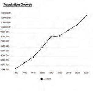
NORTH WEST CENTRAL SOUTH EAST 1950 1960 1970 1980 1990 2000 2010 2020 2030 Jakarta Male Female Population Growth: Gender Distribution: 23
CITY SCALE - CONNECTIVITY Road Classification


Compared with Singapore, Jakarta has similar trunk road density, and even higher road density when the calculation take all roads into consideration. However, large amounts of private cars make the traffic much more crowded than Singapore.
Road
 Singapore Trunk Road
Density
Density High High High High Low Low Low Low
Trunk Road Secondary Road Residence Road
Singapore All Road Density
Jakarta Trunk Road Density
0 5 20KM 10 0 5 20KM 10 0 5 20KM 10 0 5 20KM 10 0 5 20KM 10 24
Jakarta All Road Density
CITY SCALE - CONNECTIVITY
Transportation Layers
Railway System
The construction of the railway system help alleviate the traffic congestion, but it is not widely finished in the whole city area.
Other Transportation Methods
Large number of sidewalks are shown on the map, but they are scattered in several area. Disconnection of the sidewalks lead to a horrible walking experience.

Important Transportation Hubs
Central Jakarta has a better public transportation service compared with other areas of the city.


Railway Line High Speed Way Bus Stations Ferry Terminal Railway Station Railway Main Bus Stops Sidewalk Taxi Stations Railway Stations 0 5 20KM 10 0 5 20KM 10 0 5 20KM 10 25
CITY SCALE - HYDROLOGY

Base map


26
Flood Canals ("Banjir Kanal") in Jakarta (2012)
CITY SCALE - HYDROLOGY Waterway system
West Flood Canal | Banjir Kanal Barat(1919)
1918: Batavia city plan
1919: Constructed
1973: In the 1973 master plan, a system of canals was planned to cut to the flow of water in West Jakarta.
1979: Because of the 1979 flood, government revised the West Flood Canal plan by the construction of the Cengkareng drainage system.
East Flood Canal | Banjir Kanal Timur(2002)
1918: First launched by the Dutch engineer Van der Beer
1973: The EFC design was finished
2002: Construction began(but delayed due to problems in clearing the area)
2013: During the 2013 flood the East Flood Canal was still not connected to the Ciliwung River.
Source: https://en.wikipedia.org/wiki/Jakarta_Flood_Canal
Future: Try to connect the Ciliwung River and the East Flood Canal through a tunnel.
Master plan development of Eastern Flood Canal, Jakarta, Indonesia
1965 Establishment of Jakarta flood prevention project by the central government (‘Kopro Banjir’)
1969-1998 General Suharto’s New Order Government in power
1973
1974 Water Law No. 11
1991-1993
1996 Severe flood inundated almost all Jakarta’s land area, especially in North and East Jakarta
Master Plan I (Master Plan of Flood Control and Drainage System for Jakarta) (NEDECO, 1973)
Master Plan II
New study about Jakarta flood was conducted by central government in collaboration with The Netherlands government
1997 Master Plan III
1998 Fall of Suharto’s regime
1999 Decentralization Law 22/1999 and Fiscal Equalization Law 25/1999
2002 Severe flood hits Jakarta. It was recorded that disastrous floods affected 10,000 ha of Jakarta’s built-up area
2003
2004 New Water Law No. 7. First direct election
2007 Another devastating flood hits Jakarta; one of the worst floods ever experienced
Eastern Flood Canal plan is integrated with the spatial planning of Jakarta 2010

Master Plan IV
Kick-off of flood canal construction by President Megawati Soekarno Putri
Plan and construction of flood infrastructure under the authority of the Ministry of Public Works (MPW)
Water resources and other governmental functions consolidated to central government
Master Plan I produced by the Department of Public Works and Electricity (central) in collaboration with the Netherlands Engineering consultant, NEDECO
According to this law, the flood control infrastructure project was fully funded and implemented by the central government (MPW)
The collaboration between the Department of Public Works and the Japan International Consultant produced a new master plan (revision of previous master plan)
The ‘Jakarta Flood Control Advisory Mission (JFCAM) by NEDECO’(1996) produced a new study about floods in Jakarta and an alternative design of the Eastern Flood Canal
The collaboration between Department of Public Works and Japan International Consultant produced a new master plan
The transformation from centralization to decentralization is initiated
Change of institutional arrangement in water sectors. Provincial government has autonomous power in regulation and policy related to water and flood management
More stakeholders involved in developing the Master Plan IV. MoU between central government and provincial government to implement Eastern Flood Canal signed
Central government increased its commitment to accelerate the completion of the Eastern Flood Canal by allocating more budget than before
Resource: Evaluating Jakarta’s flood defence governance: the impact of political and institutional reforms Imelda Simanjuntak, Niki Frantzeskaki, Bert Enserink and Wim Ravesteijn
Flood project in Jakarta
The coastal areas of northern Jakarta are the most susceptible to flooding. By 2100, the simulated maps of inundation show a large increase in inundated areas, both under low and high water level scenarios


Map of coastal flood (2009-2100)

National level events East canal events
Year
Description
and damage exposure estimation: a case study for Jakarta
Coastal inundation
27
CITY SCALE - HYDROLOGY
Floods in Jakarta
Map of Isohyet on February in Jakarta(1996,2002,2007)
Flood prone area in Jakarta
Function of flood prone area in Jakarta:
1.Very high
2.High potential flood area - Central and Southern Jakarta


3.Low potential flood area - Southeast Jakarta - steep slope
Conclusion:
Actual prone area in the north, west and east of Jakarta lowland both in beach ridge, coastal alluvial plain and alluvial plain. Flood potential area on the slope is found flat and steep at alluvial fan, alluvial plain, beach ridge, and coastal alluvial plain in Jakarta.
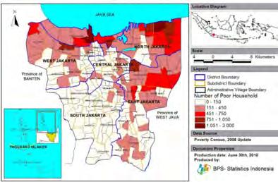
Flood and Poverty
50 year flood return period
Number of poor households in Jakarta map (2008)
The flood hazard map showing inundation depth and extend for the following return periods: 1, 2, 5, 10, 25, 50 & 100 years.
In Jakarta, household income and the type of houses they live in also determine the impact of flooding on them. Most villages are located in the North of Jakarta (including our site)
Flood risk assessment for delta mega-cities: a case study of Jakarta Jakarta Climate Adaptation Tools (JCAT)

 Source: The pattern of spatial flood disaster region in DKI Jakarta, M P Tambunan 2017 IOP Conf. Ser.: Earth Environ. Sci. 56 012014
2002 & 2007 flooding area Very high potential flood area 2002 & 2007 flooding area Very high potential flood area
Source: The pattern of spatial flood disaster region in DKI Jakarta, M P Tambunan 2017 IOP Conf. Ser.: Earth Environ. Sci. 56 012014
potential flood area – Northern Jakarta
28
CITY SCALE - HYDROLOGY
Land subsidence
Resource: https://www.bbc.com/news/world-asia-44636934
Pollution
Water sewerage system
Only 4% of Jakarta has access to sewerage, with 96% or over 9.2 million people, with no wastewater management or treatment systems.
Water quality
Spatial distribution of Jakarta water quality A) Average value of BOD; B) Trend Z value of BOD; C) Average value of DO; D) Trend Z value of DO; E) Average value of TSS; F) Trend Z value of TSS during the studying period.


BOD: Biological Oxygen Demand

Upper stream: low average values of BOD
Downstream and middle stream: high average values of BOD
DO:Dissolved oxygen
The average value of DO decreased from upstream to downstream
The central district showing high DO values
-REASON: the result of rapid urbanization in Jakarta which increased housing development in the upper and middle streams.


TSS: Total suspended solids
Most stations have low average values of TSS
The central and eastern districts that have high average values of TSS.
-REASON: result from construction and wastewater due to high population density and urbanization.


Quality standard of water in Singapore
Items of Analysis range
BOD <10 mg L-1
Dissolved oxygen >2mg L-1
Total Suspended Solids <200 mg L-1
RED CIRCLE means this station meets the standard value of Singapore. BOD: Only few of the water catchment meet the standard of BOD (<10 mg L-1).
DO: About half of the stations’ water quality of DO higher than 2 mg L-1
TSS: Only two station have high level of TSS (larger than 200 mg L-1)
Source: https://journals.plos.org/plosone/article?id=10.1371/journal.pone.0219009
JAKARTA SEWERAGE SYSTEM (JSS)
29
CITY SCALE - JAKARTA SITE VISIT

Places/Sites Visited
In the next few pages, the sections are divided into small, medium & large sized waterways for a better understanding on the conditions of these different types.
City Scale - Site Visit Strategy
During our site visit to Jakarta, the city scale group ventured out further from just the landing site - in order to get a better understanding of other parts of Jakarta, especially the kampungs.
The main aim was to study these different areas in relation to the waterways and its surrounding condition, which we can later study through a comparative study. This was done through a series of sections cut through these areas.


 DAY 01 - Central Jakarta, Cikini & Manggarai DAY 03 - Angke River, Moonkevart Drain
DAY 02 - Waduk Pluit, Kampung Akuarium & Tongkol
30
Map showing areas visited
CITY SCALE - JAKARTA SITE VISIT Section Studies


 Kampung Cikini
Manggarai Stream
31
Small Sized Waterway
CITY SCALE - JAKARTA SITE VISIT Section Studies
Medium Sized Waterway


Kampung Tongkol
Kedaung Kali Angke (Site location)

North of neighbourhood (Apuran River)
East of neighbourhood
32
Large Sized Waterway

Kedaung Kali Angke (Site Location)
CITY SCALE - JAKARTA SITE VISIT Section Studies


South of neighbourhood (Mookenvart Drain)


West of neighbourhood (Cengkareng Drain)
East of neighbourhood (Pesing River)
Apuran River (Further down south from site, towards a more natural edge condition)
33
CITY SCALE - JAKARTA SITE VISIT Comparison Studies

Waterway Typology Comparison - According to Size
Kampung Comparison

34
CITY SCALE - JAKARTA SITE VISIT
Waterway Study & Timeline of Change

Initial idea study looking at examples in Singapore as well as Jakarta
Greening up concretised canal edges Allocation of pedestrian pathways & public spaces

Floating platforms across canals (Accessibility)
Flexibility of space
Looking at changes that can be made in parts through a phasing strategy
35


MULTIPY USE IN THE STREETSCAPE 0.8m 5 m 5 m 1.2m 0.8-1.2m transport 5m——+Wedding, Basketball, evening market 1.5m——Selling, 10m——Traffi 36
NEIGHBORHOOD SCALE LAND USE
1.5m——Selling, chatting, hanging clothes


MATERIAL

BUILDING DENSITY


Legend 10 m 10 m 1.5 m 1.5 m
FLOODING 2 m 2.5 m 2-2.5 m
2.5m——+Planting, baby caring, daily activities ( cooking, washing), playing 10m——Traffic, selling, parking
37
Some daily activities moved to the outside spontaneously.People spent almost all of their time at the small space they occupied informally in front of their building
NEIBOURHOOD SCALE
ZOOM-IN ANALYSIS


Issue area identification


N
LEGENDS
Most worthy-hitten
Mediun worthy-hitten


Least worthy-hitten
East side
East side elevation
LEGENDS
East side elevation
Clip A Clip B


A B C D 38


Clip C ZOOM-IN ANALYSIS Clip D LEGENDS 39
Activity analysis
NEIBOURHOOD SCALE
NEIGHBORHOOD GREENERY
Softscape

Hardscape
Green Open Spaces in Neighborhood


 Kampung Greenery
Underutilized Space Roadside Greenery Gate Community Greenery
Riverbank Greenery Urban Park
40
SOLID WASTE
Garbage Truck Spots in Jakarta
Trash Generation spots in Jakarta


Solid Waste Disposal Process


Source:https://jakartasatu.jakarta.go.id/portal/apps/webappviewer/index.html?id=ee9940006aae4a268716c11abf64565b

Process 1:
The residents usually just put the trash in front of the door, or hang on the trees or wall, waiting for wagons to collect them.
Process 2:
The trash collected by compant or government. The rack picker need to pay for the plastic and paper that collected from the garbage concentration center.
Process 3:
The garbage can be collected by company or government by trucks.
Process 4:
Some of the garbage can be recycled, while some can be treated in landfill.
Solid Waste Collection Point on Riverbank
 1. Wagon & garbage truck
2. Underutilized area for garbage
3. Garbage dump
4. Garbage concentration centre
41
NEIBOURHOOD SCALE
WASTE WATER
Waste water facility map


Waste water treatment concept
Got water from PDAM, the residents need to pay for the water, the water collected from PDAM can be used for washing clothes, flashing toilet, etc. If the residents cannot afford to buy. clean water from water store, they can boil the water. Laundry water can be transferred directly into the drainage from the pipes
Toilet water are transferred into the septic tank to deposit, all of the water treatment are physical treatment

 Septic tank concept
Bisnis, Jakarta – Local GovernmentOwned Water Utility (PDAM)
Water pumps Water gates
42
ROAD
Road classification


Road density


Building density

0 - 954.7526042 954.7526043 - 1 909. 505208 1, 909. 505209 - 2, 864.257813 2, 864.257814 - 3, 819.010417 3, 819.010418 - 4, 773.763021 4, 773.763022 - 5, 728.515625 5, 728.515626 - 6, 683.268229 6, 683.268223 - 7, 638.020833 7, 638.020834 - 8, 592.773438 0 - 15,925,504 15,925,504.01 - 31,851,008 31,851,008.01 - 47,776,512 47,776,512.01 - 63,702,016 63,702,016.01 - 79,627,520 79,627,520.01 - 95,553,024 95,553,024.01 - 111,478,528 111,478,528.1 - 127,404,032 127,404,032.1 - 143,329,536 43


WATER POLLUTION industry greenery river water flow pump station water gate main pipe river garbage filtering blue pipe N 0m150m300m NEIBOURHOOD SCALE 44
WATER SYSTEMS
ACTIVITY MAPPING


Legend
Football court
Non-sheltered restpoint
Sheltered restpoint
Biker restpoint
Poultry cages
Rubbish point
Plastic collection
Mass garbage collection


Groundcable installation
Fruit stalls
Food stalls/Kiosks
Fishing
Playground
Lawn maintenance

Flower stall/Gardening

FLOODING
Jakarta floods update on January 2, 2020
Jakarta floods update on January 3, 2020
Jakarta floods update on January 4, 2020
45
EDGE CONDITIONS NEIBOURHOOD SCALE


46


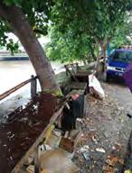
47
EDGE CONDITIONS NEIBOURHOOD SCALE
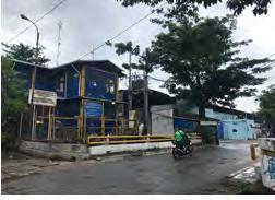


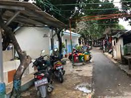


48
Water supply - pipe connections to individual households.
Waste water have smaller channels that connect to pipe draining to the river.

Solid waste disposal - waste segregation bins recently installed for a cluster of houses. Internal connections were low lying narrow pathways that flooded easily.

Households have internal toilets that connected to septic tanks.
Residents claim no interactive connection with the river.Affected by flood easily.
SETTLEMENTS AROUND THE EDGE


 Brief study of the settlements around the water bodies to observe their way of living and understand their interactions with water.
49
1.Kampung Muk
NEIBOURHOOD SCALE
SETTLEMENTS AROUND EDGES
Water supply - pipe connections to individual households.
Waste water have smaller channels that connect to pipe draining to the river.
Solid waste disposal - collected at the edge of the street, badly managed.
Connected through two wide roads and smaller alleys connecting through..
Some households have their own attached toilets- mostly external
People use the riverfront inherently for day to day recreational activities.
Low lying area between the main road and the railway line.
Water supply through pipes and ground water as well.
Waste water have smaller channels that connect to pipe draining to the river.
Solid waste disposal - poorly managed gathered along the river edge.
Internal connections network of narrow alleys with drains on one side.
Households have external toilets that connect to septic tanks.
Residents have distinct plantations along the river
Water supply - pipe connections to individual households.
structure.
Solid waste disposal - neat towards the riverfront, haphazard internally.
Internal connections are very narrow pathways that connect the wide main road to the railway tracks side.
Households have external and public toilets that connected to septic tanks.


Residents actively engage with the riverfront, with makeshift space creation.
 2.
3.
4.
50
Water supply via pipeline
Waste water systems poorly managed with resultant substandard living conditions. Solid waste disposal with no system in place- all over the settlement.


Internal connections were low lying narrow pathways that flooded easily. Settlement has multiple, old as well as newly built well maintained public toilets.
River edge treated as the backyard. Low lying settlement between the railway line and main road affected by flood badly.
Water supply - pipe connections to individual households.
Waste water have smaller channels that connect to pipe draining to the river.
Solid waste disposal - every house collects waste and puts in a cart that govt. Vans clear from. Internal connections complex network of narrow lanes with intermittent rain.
Households have shared toilets.
Residents have absolutely no positive connection to the river. Affected by flood easily.
Water supply - pipe connections to individual households.
Waste water channels are wide that connect to pipe draining into the river.
Solid waste disposal - waste segregation bins recently installed for a cluster of houses.

Internal connections are well laid network of wide lanes.
Households have internal toilets that connected to the drain.
Residents seem completely oblivious and ignorant of the river.Not very badly affected by flood.
Pradesh
5.
6.
51
7.(GATED COMMUNITY)
SITE SCALE - GENERAL INTRODUCTION
Site location

History of the area
In 1973, the then Governor Ali Sadikin moved the Ambon community a dutch-formed armies to Kedaung-Kali Angke area.Kampung Ambon is also known for its drug-dealing activities, and often seen police bust-up throughout the years. The rise of the drug-related problems started after the monetary crisis in 1998.

In 1990, the village experienced population growth and began to be taxed. the village at that time was included in RT 13 and RT 14 and moved from Kelurahan Kapuk to Kelurahan Kedaung Kali Angke.

Floods occurred 3 times, in 2002, 2007, and 2012.
Evictions occurred in late 2014 and early 2015. in 2014 evictions of houses that intersect with Kali. and in 2015 demolished houses along Kali and normalized Kali.

At the end of 2017, people submitted an objection letter, which contained a reduction in river widening and river-equivalent roads to be 10 meters and 5 meters.
In 2020, The people of kampung applied for land certification, although it was rejected because the land was claimed by PT Sarana Jaya, but the land claim was incorrect. Then the people start to put forward a supply of clean water that was responded well by the national water supply company.
Source: https://www.satumaluku.id/2019/10/31/riwayat-kampung-ambon-jejak-orang-maluku-di-belantara-jakarta/, https://www.antaranews.com/berita/453756/shenynda-perempuan-pemberani-dari-kampung-ambon, Mrs. Ratu Nisa

52


53
SITE SCALE - GENERAL INTRODUCTION Organization Pattern of Provincial Government
SITE SCALE - GENERAL INTRODUCTION


RT & RW Distrubtion

Source:https://www.atrbpn.go.id/Peta-Bidang-Tanah
Land own by residents(certificate)
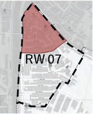
Lands own by government
Informal settlement
Unlisted land
Land ownership map
54
LEGEND
SITE SCALE - GENERAL INTRODUCTION

Landuse map of the site

MIX USE BUILDING
(Usually 1st floor commercial area and upper floors residential area)

SCHOOL (Primary school & Kintergarten)
MOSQUE
OFFICE
(One is a law office and the other is the RW office)

WATER & GAS SHOP
(Also sell other things)
HOME FACTORT (Sewing clothes)
RESIDENTIAL HOUSES
OPEN AREA
PUMPING STATION
FOOD BAR
55
SITE SCALE - ROAD AND DRAINAGE Road hierarchy and drainage system


Width ≈ 5 m 1
Width ≈ 2 m Length ≈ 50 m
Length ≈ 2 3 4
m Bridge 3 Bridge 4


Width ≈ 1 m
Length ≈ 9 m
8 >6 m 5~6 m 2.5~5 m < 2 m 56
Width ≈ 2 m Length ≈ 9 m
Bridges Bridge 1
Original length: 2 m Bridge 2
SITE SCALE - ROAD AND DRAINAGE Road material


57
mud and gravel concrete asphalt
SITE SCALE - ROAD AND DRAINAGE


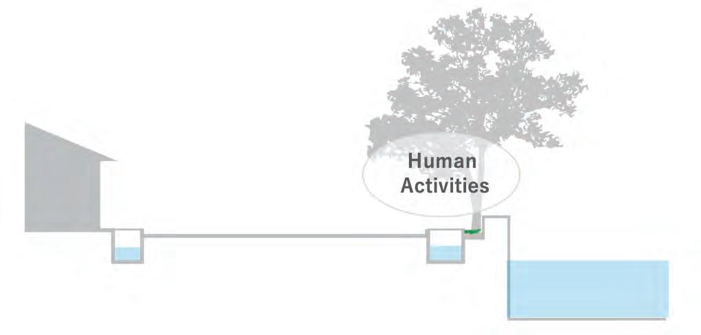
Drainage flow
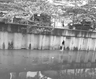
Pipes from bankside households

58
Main drain
waterlogging

SITE SCALE - ROAD AND DRAINAGE Drainage cover


Fireproofing?
 Stuck by garbage
Concrete cover (width 60-70 cm)
59
SITE SCALE - ROAD AND DRAINAGE
Road Classification - Priamry Road
Charcteristic
The primary road is running from north to south along the Chengkareng River.
The roads has two car lanes and narrow pedestrian spaces. People are gathering under the trees along the river.
On the river bank, the night market selling clothes and toys is held on weekends
Pros and Cons
Crossing the road is dangerous because of the heavy traffic and motorbikes running fast. Hawkers and parking cars are one of the reasons of traffic jam.

60
SITE SCALE - ROAD AND DRAINAGE
Road Classification - Secondary Road

Charcteristic
The secondary road is branched from the primary road. This is a two-lane road without a dividing strip. The street in the north side of our site is lined with some private shops. Crossing the road is dangerous because of the heavy traffic. Outsiders often snatch on the road.
Pros and Cons

61
SITE SCALE - ROAD AND DRAINAGE
Road Classification - Secondary Road (Unpaved)
Charcteristic
The secondary road is running east-west along the Kali Aprun canal. The surface consists of some materials, including scattered garbages which affect the walkability. The width of the roads varies because of property line not defined.

Pros and Cons
It is hard to walk on the mudy road after heavy rain.
The unpaved condition restrains the road traffic. The unpaved condition allows residents to use the roads flexible.

62
SITE SCALE - ROAD AND DRAINAGE Road Classification - Teritary Road
 Charcteristic
The tertiary road is typical in the residential areas. Each street has its own characteristics, such as good greenery, gathering hawkers, and dogs. The boundaries between housing sites and roads are relatively clear.
Pros and Cons
The environment became worse due to the dirty river and the poor sanitation in Kampong. Children can play relatively safely on the road because of minimal traffic in the area.

63
SITE SCALE - ROAD AND DRAINAGE
Road Classification - Teritary Road in Kampong

Charcteristic
The teritary road in Kampong is narrow. The road is filled with the signs of living, such as many laundries and shelves being full of stuffs, scattered sandals, and so on.

There are many houses and some stores facing the streets.
Pros and Cons
The riding motorbike on the narrow road is dangerous. The sanitation is a little bit poor. There is a lively atmosphere.
64
SITE SCALE - ROAD AND DRAINAGE Road Classification - Alley
Charcteristic

There are many alleys which are not shown on the map in the Kampong area. Some of them are outside, and the others are semi-outdoor spaces. There are some furnitures or stores on the semi-outdoor alleys.

Pros and Cons
The alleys prompt the human circulation in the area. The allyes improve both the air flow of the inner streets and the visability.
65
SITE SCALE - HOUSES AND INFRASTRUCTURES
Radius of infrastructure

SHOPS
MIX USE BUILDING
(Usually 1st floor commercial area and upper floors residential area)
RADIUS OF SHOP SERVICE

WATER & GAS SHOP(Also sell other things)
RADIUS OF WATER SERVICE
•12 groceries
•15 commercial mix houses
•1 water station
•4 water store
•The small shops along the riverside are more compact and are all commercial mixed houses, while an individual shop/greocery is more common inside .
•There are fewer stores in the southeast part
66
Self management

Limited variety (snacks…)
Main Customer: children

SITE
Distribution
SCALE - HOUSES AND INFRASTRUCTURES
67
SITE SCALE - HOUSES AND INFRASTRUCTURES
Building Stories Analysis

1-storey Building 2-storey Building 3-storey Building Unknown 68
SITE SCALE - HOUSES AND INFRASTRUCTURES
Building Entrance Analysis


Entrance
The rental houses have been seperated into many single houses, the buildings have many entrance.
The houses of upper middle class have two or more entrances. One is vehicle entrance and the others are people entrance.
69
The mix use building has a lateral entrance for shop and a front entrance for residential.
SITE SCALE - LIFE AND LIVING


Flora typoogy in kampung

basically are roadside plangting, using planting beds and yards
Planting base map
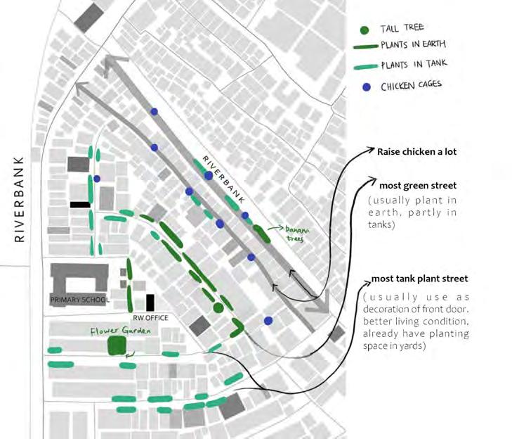
70
SITE SCALE - LIFE AND LIVING Activities in kampung in kampung


71
Activity distribution map
SITE SCALE - LIFE AND LIVING
Three types of Household

Type 1 Around the Primary street edge as upper middle class families
Type 2 Around the Secondary street edge as medium or lower middle class families

Type 3 Around tiny lanes as informal settlement

Jalan Kapuk Pulo cross-section
Informal characteristics
Around this street edge:

- upper middle class families
- small wood workshops areas also can be found
- tiny wood cottages at river bank to raise hen
- Plantation being taken care by neighbours
72
SITE SCALE - LIFE AND LIVING
Type 1 House characteristics & Relationship with Street
Activities on Street
Public Zone
Strong walls, less spillover of spaces, Two lane vehicular movement on roads


Semi-Private Zone
Cloth drying, parking, Sitting, Storage, Household stuff, vegetation
Private Zone
Main living spaces (Living room, Kitchen, Bed rooms, etc.)
Public Zone
73
Semi- Private Zone
SITE SCALE - LIFE AND LIVING
Type 2 House characteristics & Relationship with Street

Activities on Street
Public Zone
Perforated walls, Permiable access to roads and street, two lane veghicular movement

Semi-Private Zone
Cloth drying, parking, Sitting, Storage, Household stuff, vegetation
Private Zone
Main living spaces (Living room, Kitchen, Bed rooms, etc.)
Semi- Private Zone
74
Public Zone
SITE SCALE - LIFE AND LIVING
Type 3 House characteristics & Relationship with Street

Activities on Street
Public Zone
Strong walls, but more spillover of spaces

Semi-Private Zone
Cloth drying, parking, Sitting, Storage, Household stuff, vegetation
Private Zone
Main living spaces (Living room, Kitchen, Bed rooms, etc.)
Semi- Private Zone
75
Public Zone
SITE SCALE - LIFE AND LIVING

Social Dynamics
Interview
Interview Conclusions
People along Kali Apuran feel more connected to the people on the other side of the Kali than the people who lives within the legal housing blocks. (similar background, informal settlements, economy, etc.)
The relationship between the people from both sides of Kali Apuran started to deteriorate after the expansion of Kali Apuran. (defining new territory, administrative division, boundary)
The people of the kampung are relatively independent, and do not really engaged in their daily activities. (lack of engagement with each other)
The inspection road becomes a backyard for the people. (shows the importance and quality of the road as public space)
The anxiety not only stems from the issue of eviction, but also some tensions between people of the kampung and a certain group.

76
SITE SCALE - LIFE AND LIVING
Social Dynamics
Resident’s Wishlist [Translation from “list Usulan Warga” (inhabitants proposal list) ]
KAMPUNG MISSIONS
Creating and sustaining the greening of the kampung
RECENT ACTIVITIES OF THE LOCAL PEOPLE
Gardening to fulfil their need(s) Installing pots
WHAT LOCAL PEOPLE NEED
1. Location: on the edge of the road & above the roadDrainage (P) 2. Gardening equipment (P)3. Hydroponic planting medium (P) 4. Gardening training (NP) 5. Packing and distributing training (NP)
Having a market that can be managed and improved independently by the local people
Night market that held in certain day(s)
Selling the daily need, such as egg,etc
1. Location: on the road (temporarily) (P)
2. Tents (P)
3. Initial modal (NP)
4. Organization (NP)
5. Good(s) to sell (P)
6. Entrepreneur training (NP)
Creating an integrated security system that could empower the local people of Kampung
Kali Apuran
Having “Bank Sampah” (Garbage Bank) as a place for garbage management by the local people themselves
Siskamling (a routine security check in kampung) Portal installation
1. Portal (on 7 points in the area) (P)2. CCTV (on 10 points in the area) (P)
3. Security equipment (HT) (P)
4. Fire extinguisher (on 6 points in the area) (P)
5. Hydrant (P)
6. Ambulance (P)
7. Siskamling team ( 4 persons/ RT) (NP)
8.Mitigation training (NP)
Garbage transportation to the neighborhood landfill
Garbage management division
1. Garbage management from each house (garbage sorting) (NP)
2. Training for garbage management and garbage decrease (NP)
3. 3R trash bin (P)
Empowering and sustaining the river by making fish karamba and holding public event, such as Public fishing (P) = Physical
= Non-Physical
River cleaning
Constructing pedestrian bridge from iron
Fishing in “17 Agustus” celebration
1. Dredging for river sedimentation (P)
2. Mural making on sheet pile (P) 3. Bridge for pedestrian and vehicle (2 units)( P)
4. Existing bridge repairing (1 unit)(P)
77
(NP)
PROPOSALS
1) Waste & Landfill
LANDFILL RECOVERY
ZHANG Bingyi
80 - 99
GARBAGESCAPE
Carissa Chin Qiwei
100 - 109
REIMAGINING THE WASTE FLUX OF JAKARTA
ZHOU Zuyuan
110 - 161
2) Wastewater Treatment
TREASURING WASTEWATER
LYU Jiawei
162 - 173
From Risk to Utilization
ZHOU Xianfeng
174 - 191
3) Stormwater & Flood Risk Management
GREEN INFRASTRUCTURE FOR SRORMWATER MANAGEMENT
HAN Cong
192 - 215
LIVE WITH WATER
XIAO Xinyan
216 - 239
4) River System Reconfiguration
REBIRTH RIVER
FENG Zihan
240 - 257
5) Social & Lifestyle
HOME AGAIN ZHANG Bingqian 258 - 291
BEYOND THE [ D E ] FENCE Ekta Rakholiya 292 - 307
6) Community & Open Space
RECONFIGURATION OF RIVERSIDE COMMUNITY OPEN SPACE CHENG Jing 308 - 315
REGENERATION OF THE VERNACULAR WATER LANDSCAPE TANAKA Mamiko
316 - 327
SPACES IN AND BETWEEN SHAO Zhongran 328 - 343
7) Streetscape and Linear Infrastructure
VIBRANT STREETS Poornima Bargotra 344 - 359
LIVABLE RIVERSPACE LIM Wenfa 360 - 377

80
Jakarta, the capital of Indonesia, with a population of more than 10 million, faces a huge solid waste problem. The landfill is a serious urban problem in Jakarta, it will not only pollute the environment but also bring about people social, psychological and health problems. However, at present the Jakarta government only has preliminary measures for massive landfill (such as Bantar Gebang, which will be closed in 2021), but not for the informal scattered small landfills around Jakarta. Therefore, how to solve the problem of these scattered landfills will become a vital part of urban development.
This program will start from the Kampung Kedung kali angke landfill, discussing how to recover of contaminated landfill site, making it becomes an urban park with ecological and recreational functions for kampung residents; and putting forward the new way of waste management, provide a new prototype of recovering over 200 landfills in Jakarta.
The design will cover four design strategies, including garbage classification, water system recovery, vegetation recovery and soil recovery. Through some technologies, most garbage will be able to recycle in the landfill. Biodegradable can be used for composting; recyclable waste will become reusable materials, such as plastic tiles, recycled paper furniture, and construction waste will become structures. After covering with clay, nonrecyclable waste can reshape the terrain of landfill. Moreover, we can also achieve the water environment reconstruction and restoration of soil through the vegetation recovery and leachate treatment.
Taking five years as a phase, the site will gradually transform into usable urban green space through three phases.
PHASE I (0-5 YEAR):
Over the first five-year period, recover Greenland landfill and open Kampung landfill to the public to deal with the waste. Technical supports such as Waste bank, Trashpresso, leachate treatment system technology will be established for further use.
PHASE II (5-10 YEAR):
For 5-10 year, the critical restoration areas will become the west side of Kampung Landfill. Greenland landfill will gradually become an eco-park to introduce some species inside. The mature soil contains the seeds of some native species can be used in other areas to help build soil structures.
PHASE III (10-20 YEAR):
The landfill thoroughly into urban green space available to the public-a eco-park after 10 to 20 years. Relevant waste management systems continue to be used (including recyclables and biodegradable waste can still be disposed of on-site). However, after the landfill is full, nonrecyclable waste will be transported to the intermediate treatment facility zone in north Jakarta.
In short, waste reuse, garbage management, soil restoration and ecological restoration are combined to form a new method of landfill recovery, which can transform the rest of the scattered landfills in Jakarta.
LANDFILL RECOVERY
81
ZHANG Bingyi
JAKATA LANDFILL ANALYSIS


As one of the city's major problems, the issue of the landfills in Jakarta has inevitably and large impact on residents' lives and the environment.With the exception of Bantar Gebang (which is one of Indonesia's main landfills), Jakarta's landfills are small, scattered and mostly located in residential areas (especially in Kampung), making it inconvenient for the government to build effective solutions to manage them.
Due to the low economic development, high housing density and planning unbalance reasons, west Jakarta district has the highest density in the whole city. The problems associated with this are that of Environmental, Health, and socio-economic Impacts.In order to improve the urban environment, how to solve the problem of garbage dump in Jakarta has become a problem to be discussed in this design.

Landfill distribution
Landfill and waterway
Landfill density
Landfill area classification


Landfill canal drain river stream landfill Jakarta Jakarta <0.1 <0.5 <1 <5 <40 Jakarta 82
Landfill location
Near buildings, more common in kampungs


Most common type. Usually link to a large or small green land

Landfill function small, usually dense Can be a big one
Soil pollution
Soil pollution

Landfill classifivation
Problem

In the green land near the river or reservoir (a road or linear Greenland between two side).
Some even serve as the riverbank (linear shape)


Water pollution

Abandoned space and landscape destroy Landscape destroy Waste overflow
Air pollution

Ecosystem destroy
Ecosystem destroy Waste overflow
residential
residential
waterbody Inside residential area Inside green land Near waterbody
JAKATA LANDFILL ANALYSIS Jakarta green land green land+waterbody residential
+ greenland
+ waterbody
Picture 83
SITE ANALYSIS


Landfill type
House type

Drainage | site condition

residential church mosque school contour0.1m drainage runoff confluence kindergarden community office fire station residential + greenland greenland residential + waterbody ¯ 00 .6 1.2 0.3K ilometers ¯ 00 .6 1.2 0.3K ilometers 84
DESIGN VISION
The vegetation and soil restoration and surrounding environment (especially water) recovery of Landfill, develop a new waste management during the improving process, as an example for Jakarta small landfill reform project in the future.
Design strategy
GARBAGE CLASSIFICATION
Waste management and Waste separation controlled by technological tools (Biodegradable and nonbiodegradable)
WATERSTSTEM RECOVERY | LEACHATE TREATMENT
Leachate treatment and drainage naturalization
VEGETATION RECOVERY
Provide a capping that is deep and as favorable to root growth as is necessary to achieve desired plant performance
SOIL RECOVERY
Soil remodeling to provide the foundation for the transformation into ecological green space.
residential + waterbody greenland + waterbody greenland + residential residential

85
FLOW CHART
In the flow chart we can see some details about the design strategies.

Garbage classification will include waste management and waste separation controlled by technological tools. Garbage will be roughly divided into biodegradable and non-biodegradable. In order to save the limited landfill space, each household will be encouraged to use bokashi tank to deal with the biodegradable waste. After composting process, the product will be sent to composting pond for soil recovery. Non-biodegradable waste will be send into waste bank and divided into recyclable waste and non-recyclable waste. Through some technologies like trashpresso, recyclable waste will become reusable materials, such as plastic tiles, recycled paper furniture, and construction waste will become structures. After covering with clay, non-recyclable waste can be used to reshape the terrain of landfill.
Leachate is the main course of soil pollution and water pollution, and will also influence the vegetation growth. After collecting and purifying, leachate water will flow into drainage.
In this process, the plant plays more of a role in treating leachate, which cannot be separated from the soil.
86


Waste reuse calculation Leachate device calculation 87
FLOW CHART


88
TIME LINE Current situation


TIME LINE Phase I 89


90
TIME LINE Phase II


TIME LINE Phase
91
III
TIME LINE

compost is used for greenland landfill soil improvement
compost is used for west kampung landfill soil improvement
compost is used for east kampung landfill soil improvement
compost is used for agriculture
15-20 YEAR 10-15 YEAR 8-10 YEAR 6-8 YEAR 3-5 YEAR 0-3 YEAR HABITAT
ATE | water WASTE
LEACH-
water bank woodland grassland aquatic waterfront forest agriculture
nonrecycable waste recycable waste biodegradable waste
92
woodland grassland waterbank
aquatic agriculture

waterfront forest
waste line

waste path
leachate pipe
leachate pond
Anaerobic biofilter
leachate line

water flow surface runoff
0.5contour line
forest trail
edge walkway waste bank
servey path volunteer center
main path shops
wooden path wall recovery area
Trashpesso
EXPLODED VIEW
shelter landfill 93
Phase II

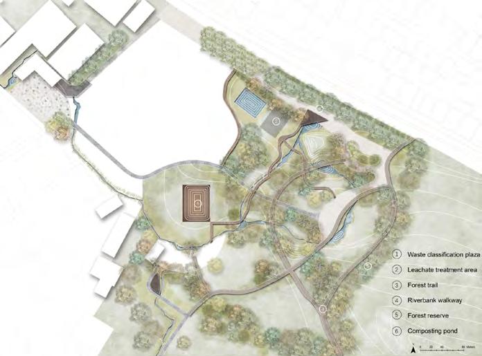
PLAN Phase I
94
Lagerstroemia speciosa
Garcinia cambogia
Barringtonia acutangula
Lagerstroemia indica
Diospyros celebica
Pouteria obovata
Kopsia arborea Blume


Elateriospermum tapos

Dipterocarpus baudii
Magnolia vrieseana
Baccaurea tetrandra


Baccaurea sumatrana

Lithocarpus kostermansii
Lithocarpus platycarpus
PLAN Phase III
glass pavement pavement pavement soil soil soil clay clay clay solid waste solid waste solid waste
95
Entrance plaza

Agriculture area

PERSPECTIVE
96


PERSPECTIVE Children playground Forest trail 97

BIRDVIEW 98

99

100
Leveraging waste as a new medium that transforms Jakarta wasteland into public parks and urban developments
The sheer magnitude of solid waste has always been a pressing environmental problem in many urban areas particularly in Jakarta. Despite the multitude of issues to minimise solid waste, the continuous flow of waste is still unceasing. These informal wastelands scattered in Jakarta naturally become the “malignant tumour” of the city environment. Taking the example of an existing informal wasteland located at Kampung Kedaung Kali Angke, the purpose of the Garbagescape leverages on the current and continuous waste problem. The intent is to change people’s perception of how wasteland can be transformed into while injecting programmes that engages people associating with the wasteland. This study aims to utilise the continuous flow of solid waste extracted from the existing site. Through the compression and stacking of solid waste bales, it creates and forms new topographic landform that acts as a structural foundation, opening up existing wasteland area for potential parkland and urban developments. The objective of this project is to alter people’s subjective opinion on waste landscape in transforming it into a new development plot in Jakarta.
This project develops and constructs through a timeline approach :
1. Solid Waste Bales Compaction (Daily)
Application of compacting residual waste assists in minimising land area and volume of waste produced. The compressed waste thus creates individual components known as solid waste bale.
2. Clearing of Existing Landfill (1 Year)
Clearing of existing waste from the wasteland by transporting loose solid waste into waste compressor machines. Upon compression, these individual waste bales will be transported back to the wasteland site, representing as a structural element that can be stacked to create new landforms.
3. Fabricating topographic levels and landforms (5 – 10 Years)
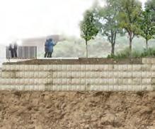
Stacking of solid waste bales act as structural foundation with exploration of new topographic landform. This process tackles the current issue of flooding in Jakarta by elevating the ground level to 5m in height as a flood protection barrier during storm events, creating potential land uses - parkland and urban developments.
4. Bioplastic film protection (1 Year)
With the solid waste bales stack to a desired height, an impermeable bioplastic film protection is required to be capped around the waste bales that prevent any form of methane gases or leachate leakage from sipping though the waste bales into new surface grounds. Excessive toxic gases and leachate will be channelled through a gas well header and drainage pipe for proper means of disposal or recycling accordingly.
5. Potential parkland and urban developments for Jakarta wasteland (5-10 Years)
Using the parkland and urban development as a starting point for future planned development for wastelands in Jakarta, the construction process defers depending on individual land use requirements. Specifically for parklands, varying of soil depth layer for new vegetation, including hardscapes (paving), will be constructed above the bioplastic film. Demarcation of urban developments will require piling foundations made before any stacking of solid waste bales with a pile cap that sets the ground foundation of any structural development.
GARBAGESCAPE :
101
Carissa Chin Qiwei
ISSUE

A man-made disaster
Jakarta Solid Waste Management System Improvement Report: https://www.jica.go.jp/ english/our_work/evaluation/oda_loan/post/2003/pdf/2-14_full.pdf
OVERVIEW OF WASTE IN JAKARTA
Volume of waste materials


By 2021 Bantar Gebang landfill will reach its maximum capacity. If the situation continues, there would not have sufficient land space to contain the waste.
Volume of waste disposed

102
103


Waste Materials Landfill Waste Material Categorisation 59% Recyclable 21%


19% Potential Materials saved from landfill

Taking the example of an existing informal wasteland located at Kampung Kedaung Kali, in the west region of Jakarta


Others 1% Scrap Metal 1% Scrap Glass 2% Wood planks 7% Scrap Plastic 13% Scrap Papers 21% Site Kampung Kedaung Kali Angke Kedaung Kali Angke Neighbourhood Organic Waste 55% Non- Compostable 1% Compostable Non- Recyclable
LANDFILL OBSERVATIONS AND CHARACTERISTICS SITE SELECTION An informal wasteland
EXISTING CONDITIONS
Components found in a wasteland
SOLID WASTE COMPRESSOR PROCESS


Existing and new waste piles

SOLID WASTE BALES PRODUCTION DATA


Site specific - Kampung Kedaung Kali Angke

New Waste Pile Existing Pile Dumping waste into solid waste compressor Loose Waste Particles Per Day 23,750 Solid Waste Bales 4 Solid Waste Bales 120 Solid Waste Bales 1440 Solid Waste Bales 4750m3 Total amount of Solid bales required to cover existing waste volume in the informal wasteland Kampung Kedaung Kali Angke Loose Waste Volume Per Month Per Year Compression of Waste Solid Waste Bale Produced 800mm (L) x 400mm (W) x 600mm (H) Food Waste Sorted Recyclables NonRecyclables 104
CONCEPT
Solid waste bales
Urban Developments
Public Park
Soild Waste Bales
film capped on top of solid waste
Proposed Road /For government officials and wagons for waste disposal or collection


Community Garden
Vegetative Swales
An overview of the solidwaste bales are being stacked up while transitioning to a public park at the background and eventually having urban developments built upon the waste for a 25 year projection

PROPOSED CONCEPT Process
Bioplastic
105
Waste Compressor Machines


Sorting and Recycling Bins
Pedestrian Path (1.5m)
Asphaltic Road - 2 way (5.0m)


Vegetative Swale


Detention Pond


Exposed Display of Soild Waste Bales

Look- Out Deck - view of solid waste bales


Park Entrance (Ramp)
Solid waste Bales mounds - sculptural element

Food Waste composting area
Community Garden
Open Lawn - For large events

Soccer Field - Sporting activities
Nature Play Area
Undulating Path
Seating Area
Piling Foundation (future urban developements)


Proposed Residential Development

Expansion of land developmentContinuous Solid Waste bile


2m
2m
5m
Pathway
5m
Section AA’
05 10 30m LEGEND
MASTERPLAN
Flood Line
Planting Buffer
Road Swale Look-out Deck Planting Buffer
PathwayPathway
Flood Protection Barrier Parkland Community Farming
Pathway Pathway
Circulation Production Water Education Park Activities Developments
* 2m
1 1 2 2 3 3 4 5 5 6 6 7 7 8 8 9 9 10 11 12 13 14 15 16 17 18 19 20 A Solid 106
Flood Line Prediction by 2025.





Seating Open Lawn/ Soccer Field Piling Foundation Continous Solid Waste Bales serves as new building material for other future planned developments Waste Bales Urban Developments 4 10 11 12 13 14 15 16 17 18 19 20 A’ 107
PROJECT TIMELINE
0 - 25 years and beyond
Existing Wasteland Grids set up for placement of solid waste bales
(b) Estimated total amount of existing waste into solid waste bales
Total : 23,750 Bales
stacking of existing loose waste into compacted soild waste bales
2m Flood Line by 2025
(a) Solid waste compaction machines
Compacted solid waste lays as base foundation of wasteland
Materials Sorting Area
New Roadway for wagons and location of compaction machines
1
Waste Bales Produced Per Year: 1,440 Bales
Estimated amount of soild waste bales per year
Residential/ Commercial Developments
Pile capped, setting ground foundations for urban developments
Topographic fabrication of solid waste bales up to 5m in height (Flood Protection)



Daily continous waste bales extended to other land areas
Parkland constructed inclusive of landscape design elements
additional new waste to be accounted for
2 YEAR
Parkland Urban Development
Piling Foundation
Bioplastic film capped on soild waste bales to prevent toxic liquid and gases
Approved Soil Mix capped above bioplastic film
Demarcation of parkland and future urban developments

YEAR
0
YEAR
YEAR
YEAR 12 YEAR 15 YEAR 25 YEAR >
YEAR
YEAR
1
3
10
11
108
Min
DETAILING OF
SOILD
WASTE
BALES
Typical Design Components
Concrete Cast In-situ
Reinforce concrete slab to Engr’s Detail
Width Varies
200mm thk
Graded granite aggregate
Well compacted Sub grade material
Tree Root Ball
Approved Soil Mixture
Compacted Sub-grade material
Set root ball on firmly packed soil
Well compacted Sub grade material (Hardcore)
800mm (L) X 400mm (W) X 600mm (H) Solid Waste Bale
150mm thk Compacted gravel mix
Sandy loam soil
200mm thk
Well compacted Sub grade material (Hardcore)
Typical Detail : Tree Planting


Scale 1:25
TYPICALDETAILING
300mm (L)
Typical Detail : Concrete Pavers


Scale 1:25
Bioplastic film
800mm (L) X 400mm (W) X
600mm (H) Solid Waste Bale
150mm thk Compacted gravel mix
Sandy loam soil
200mm thk
Graded granite aggregate
Well compacted Sub grade material (Hardcore)
(H)
1200mm
Short sharpen wood stakes
Geotextile (Coconut Mesh) fastened with short wood stakes (1000mm spacing) Planting of grass always below the mesh


Approved Soil Mixture
Well compacted Sub grade
Bioplastic film
800mm (L) X 400mm (W) X 600mm (H) Solid Waste Bale
200mm thk
Graded granite aggregate
Well compacted Sub grade material (Hardcore)
Typical Detail : Slope Stabilisation

109
Width of pile foundation to Engr’s details


Typical Detail : Pile Foundation


Scale 1:25
Concrete Cast In-situ
Reinforcing steel bars
To Engr’s details
Waterproofing Liner


Reinforced concrete slab
To Engr’s details


200mm thk
Graded granite aggregate
Well compacted Sub grade material (Hardcore)
Bioplastic film
800mm (L) X 400mm (W) X
600mm (H) Solid Waste Bale
150mm thk Compacted
gravel mix Sandy loam soil
200mm thk
Graded granite aggregate
Well compacted Sub grade material (Hardcore)
Reinforced concrete ground beam to Engr’s details


Graded granite aggregate 1500mm (H)
150mm thk Compacted gravel mix Sandy loam soil
Scale 1:25

110
REIMAGINING THE WASTE FLUX OF JAKARTA —RESILIENCE BEHIND THE WASTE HIERARCHY OF METROPOLIS
Zhou Zuyuan
Narrative:
The project is located in West Jakarta. After assessing the current situation, the issues I summarized are as follows:
-Insufficient waste collection frequency
-Environmental issues caused by insufficient solid waste treatment
-The mixture of waste from the source
-Limited space for temporary waste storage points
-incomplete solid waste treatment system in neighborhood site(mainly collection system)
However, beyond the problems mentioned above, the site still has great potential. In the first place, 65% of the waste generated is organic. if organic waste is treated effectively, the amount of solid waste transferred to the landfill can be largely reduced. In addition, a large amount of underutilized green land in the neighborhood site. Most of them are now used as temporary storage for solid waste. If these green spaces are upgraded and used effectively, their potential will be greatly stimulated.
The project with the vision to treat the waste from the source and tackle the waste problems from the source. Targeting the issues identified, the strategies are set up:
-Waste separation from the source.
-Utilize the underutilized green space for centralized composting facilities.
-Neighborhood-based composting
The above steps build a new garbage system comprised of several decentralized composting facilities as well as micro compost units scatted in the neighborhood.
System:
-Micro-level compost system(Little composting system contains waste separation, collection, composting and recycling, implement in the RT boundary)
-Centralized composting facilities (Large composting system with 3 categories facilities: small size facility, medium-size facility, large size facility. The facilities are categorized according to the size of the facilities and the equipment they have.)
Through a rough estimation, if we assume that the centralized system has 50 large facilities, medium-sized facilities are small size facilities. And in the micro-scale, each unit can cover one RT, the system can process 50% of total waste and 85% of organic waste. In this way, the amount of waste transferred to the landfill can be largely reduced, the status of solid waste will be effectively alleviated.
The ongoing consequences of waste will continue to impact the life of the local people in ways that cannot be ameliorated or erased. The proposed system can be connected to several functions that may engage the public with landscapes of waste as a way to reveal the unconfined impacts of the waste system to improve the living environment and increase economic benefits.
111


Boats collecting the rubbish in the river Trucks collecting the rubbish Underutilized greenland use as temporary solid waste concentration center Landfill Wagon
Secondary Primary Landfill site Transfer statio N 0510 20 km 112
CURRENT SITUATION OF JAKARTA SOLID WASTE Current situation
Current waste stream in JABODETABEK
WASTE
SOLID WASTE
Landfill and waste treatement facilities in Jakarta
Intermediate Treatment Facility (ITF)
TPST = Integrated Final Treatment Plant
ITF = Intermediate Treatment Facility
PDUK = Composting Center
IPAL = Sewerage Treatment
TPST BL Gebang
SEWERAGE
Composting Center
Intergrated Final Treatment Plant
Sewerage Treatment Facility
Upgrading from Transfer Station to ITF
On Process
Upgrading from Transfer Station to ITF Operating Operating Operating
On Process Operating
Source: Japan International Cooperation Agency, ( 2012, November), Master plan for establishing metropolitan priority area for investment and industry in jaboderabek area in the republic of indonesia
 IPAL Duri Kosambi
ITF Marunda
SPA Sunter
IPAL Pialogebang
ITF/PDLIK Calcung
Sunter
Cakung Bantargebang Duri Kosambi Ciangir
Pulo Gebang Marunda Cakung
113
FACILITY LOCATION STATUS
EXISTING CYCLE OF SOLID WASTE
Existing Solid waste flow in Jakarta

114
Existing collection system


Collection source
Collected by agencies, directly transfered to the landfill. (E.g. Market Agency, Public Works Agency, Cleansing Agency or private means.)
Storing waste in waste bin, plastic bag or cardboard boxes in front of the house. The solid waste is collected by wagons or trucks, and transfered to a temporary disposal site area before transport to the landfill afterwards.

Transportation
From temporary disposal sites (or from solid waste generators for the direct system), collected waste is disposed of in the landfill located at Bantar Gebang. The types of vehicles are usually wagons and trucks.

Residential Commercial Office Wagons Trucks Market Street Park 1hour25min Bantar
Jakarta 115
Gebang Jakarta landfill
EXISTING CYCLE OF SOLID WASTE
Existing Solid waste flow in Jakarta

116
Existing solid waste treatment


1. Compacting
Solid waste is compacted using physical means, to ease the transport process to the landfill
The compacting station is located in Cakung-Cilincing Sub District in North Jakarta

2. Incineration
There are about 21 small-scale incinerators in operation indifferent sub-districts, each with a capacity of about 150 kg/houe and operation 8 hours per day.

The remaining ash is either transported to landfill of transformed to a kind of bricks.
CHALLENGES:
(1) Can not be operated on a daily basis
(2) Technical information is lacking
117
EXISTING CYCLE OF SOLID WASTE
Existing Solid waste flow in Jakarta

118
Existing solid waste treatment


3. Composting
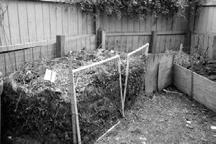
The idea of composting is to reduce the waste quantity going to landfilling. In principle, the composting system comprises a centralized sorting system, and thereafter composting of the organic waste. Remaining waste is either burned in the incinerator or transferred to the landfill.
CHALLENGES:
(1) Lack of community participation
(2) Lack of supporting vehicles for 3R (reduce, reuse, recycle)
(3) Over capacity in Zero Waste part
4. Landfill
There is only one landfill in Jakarta. It is located in Bantar Gebang.

CHALLENGES:
(1) It has exceeded its design capacity
(2) Ordor, smoke and disease problems that caused by poor control of its operation.
119
EXISTING CYCLE OF SOLID WASTE
Existing Solid waste flow in Jakarta

120
Existing solid waste treatment


5. Recycling
Most of the recycled materials are collected at the generation point.
Cycle of recycling
121
ISSUES AND CHALLENGES IN THE WHOLE FLOW


1. Not suitable collection


Issues and challenges - collection
Some waste is burnt at temporary transfer points, creating smoke and ordour impacts on surroumding areas, causing local flooding during the rainy season, as well as pollution of rivers and coastal waters


 Neighborhood have too much waste waiting for collection
Limited space avaliability for tmporary/ secondary storage points
122
2. Not suitable treatment
Issues and challenges - Incineration


The enviornmental problems caused by incineration

Issues and challenges - people
Low awareness of some community members of the environmental problems (e.g. flooding and health risks) caused by illegal dumping

Issues and challenges - landfill


1. Landfill is overcapacity.
2. Surface and groundwater contamination by waste exudate

3. Ordor, smoke and disease problems caused by poor control of the operation of the landfil


Issues and challenges - recycle
The mixture of waste reduces the possibility of recoverng material, as well as lowering significantly the commercial value or price received due to high contamination of material intended for recycling
123
ISSUES AND CHALLENGES IN NEIGHBORHOOD SITE


Existing situation in neighborhood site


Underutilized green space used for storage of garbage
Underutilized green space used for storage of garbage
Road Building
Garbage damp Bin
concentrate
as landfi 124
Garbage
Greenland


Industrial Commercial Greenery Residential concentrate center landfill
125
Only collection system……
ISSUES AFTER COMPARISON


Too much pressure on the later process


Food leftovers, expired food, fruit peels and cores, plants, and TCM herbs
Paper, plastic, glass, scrap metal, fabrics.


All other non-recyclable solid waste.

Batteries, light tubes, medicines, paint and its containers.


NEIGHBORHOOD JAKARTA
126
SYSTEM IS INCOMPLETE
Too much pressure on transportation later process……make the situation worse More waste waiting for collection cause not frequent collection, more ordor and noise cause waste treatment facilities are too far…


Existing issues related to the incomplete system


ISSUES
ISSUES
ISSUES


NEIGHBORHOOD SCALE JAKARTA SCALE ?
Neighborhood have too much waste waiting for collection
Limited space avaliability for tmporary/ secondary storage points
Creating smoke and ordour, local flooding,pollution of rivers and coastal waters
AND CHALLENGES - COLLECTION
3. Ordor, smoke and disease problems caused by poor control of the operation of the landfil
2. Surface and groundwater contamination by waste exudate
1. Landfill is overcapacity.
AND CHALLENGES - LANDFILL
The mixture of waste reduces the possibility of recoverng material, as well as lowering significantly the commercial value or price received due to high contamination of material intended for recycling
127
AND CHALLENGES - RECYCLE




Potential map 0.33 Miles N POTENTIALS Industrial Greenery 128
Solid waste composition


What is Organic Waste?


Organic waste is any material that is biodegradable and comes from either a plant or an animal. Biodegradable waste is organic material that can be broken into carbon dioxide, methane or simple organic molecules. Examples of organic waste include green waste, food waste, food-soiled paper, non-hazardous wood waste, green waste, and landscape and pruning waste.

generation rate Households Markets Commercials Industrials Parks Food scraps Food scraps ashes Street sweeping Food scraps landscape trimmings Food scraps Glass Metals Metals Dusts Household hazardous Household hazardous Paper Paper Paper Housekeeping Cardboard Cardboard Packaging Packaging Plastic Plastic Plastic Textiles Textiles Yard wastesWood Wood LeavesLeather
Organic waste takes up the most Industrial Commercial Greenery Residential
129
STRATEGIES TARGETED TO ISSUES AND POTENTIALS


Strategy 1: Upgrade the greenland
Tactic 1: Neighborhood-based composting, utilize the underutilized green space for centralized composting facilities.


Tactic 2: Combine composting facilities with other functions. E.g. parks, urban farm, which can form a sustainable cycle


130
Strategy 2: Upgrade the neiborhood


Tactic 1: Waste separation from the source.


Biodegradable trash

Sanitary trash


Recyclable trash

Tactic 2: Compost units scatted in the neighborhood.


131
STRATEGIES ANALYSIS_UPGRADE THE GREENLAND


00.060.110.22 0.33 0.44 Miles N Greenland typology Flow in site simulation Before Secondary collection line Greenland Temporary concentration center Main collection line Residential Underutilized Industrial Greenland Composting Temporary center Main Secondary 132


Residential green space Underutilized green space Industrial green space
for greenland After Greenland Composting cycle Temporary concentration center Main collection line Secondary collection line Before After 133
Flow
STRATEGIES ANALYSIS_UPGRADE THE NEIGHBORHOOD


Residential typology 00.060.110.22 0.33 0.44 Miles N Collection line inside the gated community Greenland Residential areas Temporary concentration center Collection line in Kampung Greenland Residential areas
in site
Before Kampung Greenland Gated community Kampung Collection line Temporary concentration Collection line 134
Flow
simulation
Source : Residential areas


To: Solid waste treatment facilities


Source: Organic waste from residential areas
The compost generated can be used to the residential areas
areas Kampung B Greenland community Kampung A line inside the gated community concentration center line in Kampung After Flow for greenland Before Food leftovers, expired food, fruit peels and cores, plants, and TCM herbs Paper, plastic, glass, scrap metal, fabrics. All other non-recyclable solid waste. Batteries, light tubes, medicines, paint and its containers.
After
Units scatted in the neighborhood
135
NEIGHBORHOOD SCALE
Vision of the solid waste cycle


VISION 136
NEIGHBORHOOD SCALE
Direction


Neighborhood scale





JAKARTA SCALE
Jakarta scale


137
HOW TO OPERATE_UNITS
Site selection_RT & RW boundary


Basic units

Buckets Bio bins Wagons Plastic shredding machine
00.060.110.22 0.33 0.44 Miles N 176 20 18 16 22 37 11 25 40 42 68 263 275 123 167 188 191 198 21 42 108 84 48 52 60 41 47 4738 73 63 5 210 123 166 91 20 12 95 90 73 454 201 108 52 56 84 80 87 70 32 21 28 48 7 96 108 94 128 155 27 18 93 83 41 138
Flow in boundary simulation





Micro flow


Some may connect to the schools or gardens to have some educational functions.


The dry waste in blue bins which primarily contains plastic is collected once a week and then shredded into granules by a plastic shredding machine. These granules are used in road construction.

The wet waste is trasferred to the terrace of the appartment where the bio bin system has been set up. Every day the waste is turned over by the workers and the old waste is covered by the new to curb ordor. The capacity of the bio bins is about 0.07 tonnes per day.

machine Miles Compost bins
00.020.040.09 0.13 0.17 Miles N 176households 2 units RT boundary Mix-used Mosque School Shops Collection line in Kampung Office Residential Factory Water & Gas shop 57 units in total 54 94 38 27 40 53 47 57 9 RW boundary RT boundary RT , neighborhood unit, 10-20 houses or households RW, community unit, 5-10 RT 41 the number of households
buckets: For biodegradable waste
Green
Once a week Daily Red buckets: For Sanitary waste 12 litrs 6 litrs 12 litrs Blue buckets: For plastic
biodegradable
for sanitary waste
for plastic Recycling facilities 139
Line for
waste Line
Line
HOW TO OPERATE_CENTRALIZED FACILITY


Suitable site for centralized facilities


Solid waste generation parameters
When acquiring a disposal site, the land area must be large enough to accommodate waste produced by 1000 people over period of at least 20-30 years. It has been documented that 1000 people would require 1 acre of land per annum (USEPA1971). This requirement is considered appropriate especially for developing countries where a higher proportion of waste generated is organic and easily be decomposed.
Kedaung Kali Angke:
Population: 36, 821
Area: 3.00 km²


Density: 12, 257/km²


Generation rate: 0.7kg/day
Disposal site area required: 148, 892m²


Waste generation: 25, 774.7 kg


Organic waste generation: 16, 753.6 kg

27225m² 9075m² 62500m² 1600m² 1900m² 1720m² 1840m² 980m² 1100m² 1300m² 1820m² 2720m² 1900m² 32400m² 2100m² 00.060.110.22 0.33 0.44 Miles N
140





12100m² 1600m² 1800m² 1900m² 2100m² Total: 164080m² Industrial Commercial Greenery Best site Not suitable Residential Elevation Slope Reclassify 3016 -46 >15° Suitable <15° Unsuitable Residential area Distance Reclassify 100m 800m Residential Buildings Waterbody Distance Reclassify 0m 800m Waterbody Suitable Suitable Unsuitable Unsuitable Road Distance Reclassify 0m 1200m Road Road trucks can access Suitable Unsuitable Weighted overlay Suitable Unsuitable 0120240480 720 960 m N 141
HOW TO OPERATE_CENTRALIZED FACILITY
Composting concept

Functions required

Biosolids mixer In-vessel compost building Curing building Screening building space for windrows
Storage 142
Compostable solid waste


Percentage of activity area required inside a compost plant
Maturing boxes
Office, toilets, wash room, equipment storage


Reception, sorting, screening and packaging areas
Compost boxes

Store for finished compost
Store for recyclables


Storage building Park
Commercials Food scraps Paper Cardboard Industrials ashes Food scraps Housekeeping Packaging Parks Street sweeping landscape trimmings Packaging Households Food scraps Paper Cardboard Textiles Yard wastesWood Markets Food scraps Paper Plastic Textiles Wood Leaves Leather 143
HOW TO OPERATE_CENTRALIZED FACILITY


Medium size


Mid-sized compost systems are appropriate for small institutions including schools, hospitals and nursing homes and commercial establishments such as grocery stores, hotels, business with cafeterias and restaurants. The capacity of a mid-sized system ranges from 5 tonnes per day of food scrap.

Residential ground Windrows Ground Grass Windrows
area
area
product
Screening
Staging
Finished
In-vessel area 144
Curing area of Windrows


composting


Large size


Centralized composting can range from 10 tonnes organic waste per day. They are on a significantly larger scale, environmental, social and techinical considerations.


Finished

Screening area



Curing area


 Urban farm
Park
145
product
HOW TO OPERATE_CENTRALIZED FACILITY


Small size
Overall distridution


Finished product
Small size


The capacity of small size facility is about 2 tonnes of solid waste per day. They can be connected to houseyard, school, community garden, etc.


Large size composting facility
Medium size composting facility

Small size composting facility


Ground Grass In-vessel composting area
Mixing area
146
WHERE TO GO


Urban farm Commercial Houseyard Street Residential Park School Community garden 147
HIERARCHY OF NEWLY BUILT SYSTEM


1740m² Micro scale Small size Waste separation Finished products In-vessel compost


The capacity of the bio bins is about 0.07 tonnes per day.

Community garden 148
Shredding

scale actual size capacity Workers 170 in total Workers25in total 1337 pounds in total 880 pounds in total 60 bags/ day in total 36 bags/ day in total 15,000,000 Rp 9,000,000 Rp Supervisors 2 in total Supervisors 2 in total functions facility
finacial work
Community garden School Houseyard
2 tonnes of organic waste per day. 2m² School Commercial Bio bins Compost bins
The capacity of a


Centralized


can range from 10 tonnes of organic waste per day.


Workers 80 in total Workers 40in total 1430 pounds in total 3040 pounds in total 60 bags/ day in total 140 bags/ day in total 16,250,000 Rp 35,000,000 Rp Supervisors 3 in total Supervisors 2 in total 5586m² 13838m²
mid-sized
School Commercial Urban farm Park
system ranges from 5 tonnes per day of food scrap.
composting
Medium size Large size Finished products Curing area Screening area Office Staging area Windrows Finished products Curing area Mixing area In-vessel composting Screening area Office Staging area Windrows Community garden 149
ADDING FUNCTIONS


Morphology Facility: Large Surrounding context Other function Large size Component Urban farm in Jakarta Urban farm nearby Commercial Industrial Green Residential 00.060.110.22 0.33 0.44 Miles N 150
Houseyard
Facility: Small
Morphology
Surrounding context
Other function
Site condition
Morphology


Commercial Commercial Industrial Industrial Green Green Residential Residential 151


Facility: Small


Surrounding context


Other function


Small size School
Small size
ADDING FUNCTIONS


Morphology
Morphology


Facility: Medium
Other function Site condition Component Commercial Industrial Green Residential
Surrounding context
Community garden
Medium size
Site
Component
Park Surrounding Other 152
Facility: Medium
condition
Medium size
Medium size
Facility: Medium
Other function
Other function


Site condition

Morphology


Surrounding context
When the composting facilities cooperate with more functions, they may have more possibilities. For example, urban farms, parks, community gardens… The compostable waste such as food scrap, yard waste, landscape trimmings can be transferred into compost through composting facilities, and the compost generated can also be used in the source greenery.

Surrounding context


Component Commercial Industrial Green Residential
Park Community garden
Commercial Industrial Green Residential 153
OVERALL SYSTEM


154


155
PROPOSED FLOW DIAGRAM
Proposed flow

156
Previous flow
Source & market of trash


The newly built system of composting facilities


Often collected by the Market Agency, Public Works Agency and Cleansing Agency. Some are by private means. Mixed solid waste is sorted; organic solid waste is composted and certain recyclable products are recycled. Remaining waste is either burned in the incinerator or transferred to the landfill. Food leftovers, expired food, fruit peels and cores, plants, and TCM herbs Paper, plastic, glass, scrap metal, fabrics. All other non-recyclable solid waste. Batteries, light tubes, medicines, paint and its containers. JAKARTA
SCALE
157
PERSPECTIVE
Overall perspective
Source: school, commercial areas, residential areas, green lands. But the compost generated can aso be used in the source


Zoom-in perspective


Source and micro scale

Composting station can be catogarized into three types: large size, medium-size and small size


Micro scale system

centralized composting facilities


Centralized composting system


Composting station catogarized into three types: large size, medium-size and small size
Composting

later process

Incineration


Due to the system, the waste to be the landfill reduced.
Recycling center
 Trash separation
Park
Commercial areas Bio bins Wagons
The compost generated can aso be used in the source
Micro scale
system Centralized composting system
Trash separation Commercial areas Bio bins Urban farm Wagons School Park Composting station
station
can be
158
the decentralized the amount of solid be transferred into can be largely


Source: school, commercial areas, residential areas, green lands. But the compost generated can aso be used in the source


Due to the decentralized system, the amount of solid waste to be transferred into the landfill can be largely reduced.


The compost generated can aso be used in the source

Commercial
Urban farm
School
Later process
Landfill
Incineration Recycling center Landfill 159
JAKARTA SCALE VISION
There are a number of dominant variables influcing current waste management issues in Jakarta, which can be identified but not limited to the following:


Factors related


Site selection process


In summary
6500 tons of waste per day


Generation rate: 0.7kg per day


8 million people
So in total the system can process 3142.7 tonnes of trash per day, which takes up nearly 50% of the waste generated per day. In Jakarta, 55% of waste generated are organic waste, which means nearly 85% of the organic waste can be processed

Roads trucks can access Distance Reclassify tertiary sencondary primary jakarta boundary Suitable Notsuitable Suitable Notsuitable Suitable Notsuitable Suitable Notsuitable 0 4 8 2 Kilometers tertiary sencondary primary truck jakarta boundary Tertiary Secondary Primary Truck Residential areas Waterways 93 -55 0 miles 62000 miles Population density Roads trucks can access density Green land Farm Forest Grass Meadow Nature reserve Orchard Park Scrub 0° 90° 0 miles 61000 miles 0 miles 69000 miles Residential areas Waterways Dem Distance Distance Slop Reclassify Reclassify Reclassify Jakarta
160
Prediction of the system in Jakarta scale _ centralized
Large facility: cover 12958 people per day
Medium-size facility: cover 6478 people per day
Small size facility: cover 2857 people per day
So if have 50 large size facility, 50 medium-size facility, and 50 small size facility, roughlt can process 1114 tonnes of waste per day can generate 90 tonnes of compost per day
Prediction of the system in Jakarta scale _ micro
There are about 28, 981 RTs and 2, 544 RWs in Jakarta
However, in a large city such as Jakarta, as there is a constant population influx, in many cases a RT (neighborhood associations) contain as many as 100-150 households

So, 28, 981 RTs need 28, 981 units to process the trash
Can process 2028.7 tonnes of trash per day
Can generate 305 tonnes of compost per day
Estimation about the capacity of the system
Centralized system
Suitable site for centralized facilities
28, 981 units Micro scale Capacity Amount of facilities Compost can generate 2028.7 tonnes/day 305 tonnes/day 1114 tonnes/day 150 ( just estimate, according to availability of land) 90 tonnes/day Compost can generateWaste can process Proportion of organic waste in Jakarta Proportion of total waste in Jakarta 395 tonnes/day3142.7 tonnes/day 85% 50% Item Newly built system
161

162
LANDSCAPE APPROACH ON DOMESTIC WASTEWATER TREATMENT AND THE FEASIBILITY OF LARGE-SCALE APPLICATIONS BASED ON THE CALCULATION
Lyu Jiawei
Abstract: the increasingly severe problem of domestic wastewater pollution in Jakarta impact people’s life. This project intends to minimize the water pollution and the dependency on the urban water supply by using natural-based approaches. Moreover, providing a feasible method for largescale applications based on the mathematical calculation.
Nearly 75 percent of the rivers in Jakarta are heavily polluted, of which the primary pollution source is domestic wastewater. Situated in Kedaung Kali Angke, the neighborhood, especially in the kampung, faces a severe problem of water insecurity due to the lack of public washing and toilet facility and some infrastructure related to the water supply, drainage, and sewage systems. Besides, the high cost of domestic water is hard to undertake by low-income workers.
This project intends to minimize the water pollution and the dependency on the urban water supply by using natural-based approaches. The overall goal is to achieve the recycling of the wastewater and provide a feasible method for large- scale applications. Some wastewater parameters can be gotten like the area of required wetlands per capita, and the proportion of total green space needs to be used as wetlands in sites through calculation. The wastewater treatment system combines the anaerobic treatment and constructed wetlands, which consider the value of sewage purification and landscape characteristic.
On the site scale, this design is taking one green space, in the middle of the Kedaung Kali Angke neighborhood, surrounded by the kampung and low-middle class residentials as an example to demonstrate this wastewater treatment system. Based on the calculation, 43% of the site green space needs to be used as wetlands for sewage treatment. There are three steps for sewage treatment. Firstly, the wastewater collected by the septic tank for settlement. Next, through the anaerobic pond and wetlands, the BOD (biochemical oxygen demand) and pathogens are removed mostly. Lastly, the purified water flows to the retention pond and holding tank for daily residential usage and some parts of purified water for agricultural irrigation and aquaculture meanwhile.
As for the large scale application, the same sewage treatment system and mathematical calculations are used in conjunction with the 2030 planning. On the neighborhood scale, the green open space amount in the neighborhood is sufficient for domestic wastewater treatment through calculation. However, there is necessary to relocate it properly as an even distribution to cover the wastewater of the whole neighborhood residential area.
On the city scale, through calculating the required wetlands area for sewage treatment in each district and the proportion of the wetlands area to total available green space, the feasibility and potential of the plan can be evaluated. From the data collected and calculated, at present, the required wetlands area accounts for 75% of the existing available parks in Jakarta, which is super high and low feasible. While in 2030, from the government planning, the greening rate targeted at 30% so that the green open space will increase significantly to 196 km². The required wetlands area for domestic wastewater treatment only accounts for 7% of the entire green open space. Therefore, the feasibility of this approach is much higher.
TREASURING WASTEWATER
163
PRELIMINARY ANALYSIS OF WASTEWATER


Drink 25% Bath 15% Washing 25% Cooking&Cleaning 35% Average Houshold Water Usage Drink Bath Washing Cooking&Cleaning Septic Tank Black Water Drinking Water Drainage PDAM Drinking and Cooking Toilet Flushing Gardening/ Others House Cleaning Bath and Shower Hand Basin Kitchen/ Dishwashing Laundry 25%3%17%11% Domestic Water Comsumption for Grey Water= 56% 10%27%1% 6% Domestic Water Treatment Domestic Water Supply and Discharge System Pollution Issue in Jakarta Average household water usage Domestic Water Comsumption 0 10 20 30 40 50 60 70 Directly sewage(No septic tank) Septic tank with sewage Communal toilets Septic tanks no sewage Other on-site sanitation Open defecation Urban wastewater and septage flow in Jakarta 0 10 20 30 40 50 60 Domestic(Household) Livestock Agriculture Industry Hotel Hosptial Solid Waste Small Scale Industry Pollution Sources in 5 Rivers in Jakarta Source: United nations industrial development organization research data. Diagram by Jiawei. Water pollution Heavy polluted Moderate polluted Slightly polluted Meet the standard Heavy polluted Moderate polluted Slightly polluted Meet the standard 4% 96% Sewage treatment rate Septage and wastewater safely disposed Septage and wastewater unsafely disposed Water Pollution Pollution Sources in 5 Rivers in Jakarta Sewage Treatment Rate Urban Wastewater and Septage Flow in Jakarta Grey Water 164
Design Calculation
DESIGN VISION AND CALCULATION

Design Vision


Wasterwater Treatment System

S= Q(lnCo lnCe)
Subsurface Flow Constructed Wetland
S= Q(lnCo lnCe)


×1.01����−20
q: average sewage volume per person per day


Co: influent BOD concentration (mg/L)


Ce: effluent BOD concentration (mg/L)
V: wetland volume
Q: total sewage flow

n: porosity of constructed wetland bed substrate
N: the population of a certain region
T: the temperature of domestic sewage of wetlands at temperature T d: aquifer depth (m)
Anaerobic Pond

Daily Water Consumption Influent / Effluent BOD Concentration Area of Required Wetlands 164 Litre/Per captia 200 Mg/L 30 Mg/L 0.043 km² 41000 People 2.61 km² 43% 6724 m³/Day 0.1 km² 1.06 m² Neighborhood Population *predict Neighborhood Area Proportion of Wetlands in Green Space Total Sewage Flow Neighborhood Green Space Area Area of Required Wetlands Per Captia Septic Tank Public Toilet Washing Facility Anaerobic Pond Subsurface Wetlands Pond Fish Pond Farm Residentials Holding Tank Influent Effluent Food Production Effluent
K×d×n
K= K20
Q= q N 1000 Parameters:
Flowrate
Volume=
× Detention time Area of Pond= V / depth
Wasterwater Parameters
K×d×n K=
1000
V×p Q Water
Time:
K20 × 1 01���� 20 Q= q N
t =
Retention
Q: total sewage flow K: biochemical reaction rate constant S: area of subsurface flow constructed wetland 165
SITE DESIGN PLAN


Proportion of Required Wetlands Area to Landuse in 2030


Residential Industry Public Service & Office RoadsGreen Space Wetlands Other Green Space 37% 3.5% 11% 15% 33.5% 57% 43% Roads Residentials Industry Green Space
Site Location and Service Scope Site Wastewater Flow Plan Design Site Neighborhood Green Space Service Scope Boundary Public Washing and Toilet Facility Anaerobic Pond Wastewater Pipeline Tranport Community Boundary Pipeline Zone (200 meters radius) Truck Transport Zone Service Scope Boundary 166
Perspective Section


Site Area: 9400m² (Green Space+Public Service Area) Site Elevation Difference: 7m Wetlands Area: 4042m² Each Wetland Depth: 0.5m Anaerobic Pond Volume: 1415m³ Anaerobic Pond Area: 235Vm² Anaerobic Pond Depth: 6m Sewage Treatment Capacity: 620m³/d Water Retention Time: 2.28days Service Radius: 300m Service Population: 3800 people Service Households: 950 ·Design Information Influent Septic Tank Anaerobic Pond Subsurface Flow Wetlands Fish Pond Monitor Outflow Settlement Pond Holding Tank Farm SITE
SITE DESIGN Master Plan
167


After Detail Before Inlet Effluent Outlet Slope1% Wet Well Small Gravel Aquatic Plant Wateright Membrane or Clay 200m 35m Rendering-Farm 168
SITE SECTION AND RENDERING
Rendering-Pond


Typical Landscape Fabric Pin Filtration Slopetame SedimentationPlant Uptake Boardwalk Wetland 50m
Location A A' 169
Original 2030 Green Open Space Plan


Medium House Zone Low Kdb Vertical Housing Zone Flat House Zone Green Space New Residential
1 2 3 4 5 6 7 8 9 10 11 12 13 14 15 16 17 18 19 20 21 22 23 26 27 28 29 24 25
NEIGHBORHOOD SCALE
Residential Plan in 2030
170


NEIGHBORHOOD SCALE Green Space for Wastewater Treatment Other Green Space Residentials Service Scope Roads Wetlands Service Scope in Neighborhood Design Intervention in Green Space Planning 28 29 1&2&4 3&6 5 7 8 9&10&11&12 13 14&15 16&17 20 21 18&19&22&24 &25&26&27 23 171
CITY SCALE--BASED ON EXSITING CONDITION


Jakarta Adminsitrative Districts Existing Jakarta Green Open Space


Area of Constructed Wetlands Required for Treatment of Sewage Generated by the Population in Each District of Jakarta City


Sources: OCHA, BNPB, BPS
Green Space City/ regency Population Sewage Flow (10,000 m³/d) Area of required Wetlands (km²) Area of the district (km²) Proportion in the district South Jakarta 2164070 35.5 2.29 141.27 1.62% East Jakarta 2817994 46.2 2.99 188.03 1.59% Central Jakarta 910381 14.9 0.97 48.13 2% West Jakarta 2430410 39.9 2.58 129.54 1.99% North Jakarta 1729444 28.3 1.83 146.66 1.35% 164.8 10.66 653.63 1.63% Amount
Required Wetlands Area Proportion 图表标题 1 2 图表标题 1 2 35% Required Wetlands Area Required Wetlands Area The Rest of Existing Green Space Area The Rest of Existing Park Area 65% 75% 25%
Types of Green Public Open Space City/ regency Population Sewage Flow (10,000 m³/d) Area of required Wetlands (km²) Area of the district (km²) South Jakarta 2164070 35.5 2.29 141.27 East Jakarta 2817994 46.2 2.99 188.03 Central Jakarta 910381 14.9 0.97 48.13 West Jakarta 2430410 39.9 2.58 129.54 North Jakarta 1729444 28.3 1.83 146.66 164.8 10.66 653.63 No. Type Area(km²) Percentage(%) 1Park 14.08 2.13 2Green line 7.86 1.19 3Cemetery 6.31 0.95 4City Forest 2.54 0.38 30.81 4.65 Amount Amount Sources: Forestry Agency 172
Different
Jakarta Green Open Space in 2030 Plan
CITY SCALE IN 2030
Area of Constructed Wetlands Required in 2030
The Green Open Space in Jakarta 2030 plan targeted at 30% of the Province area.


It's 196km²
The Required Wetlands Area is 13.83km²
It only account for 7% to GOS 2030.
There is great potential for this Natural-based approach to treat wastewater in 2030 Jakarta!!!

Sources: JAKARTA, CAPITAL CITY GOVERNMENT City/ regency Population Sewage Flow (10,000 m³/d) Area of required Wetlands (km²) Area of the district (km²) Proportion in the district South Jakarta 2825299 46.3 2.99 141.27 2.12% East Jakarta 3012500 49.4 3.19 188.03 1.69% Central Jakarta 1150181 18.9 1.84 48.13 3.82% West Jakarta 3162500 51.9 3.35 129.54 2.58% North Jakarta 2325000 38.1 2.46 146.66 1.67% 204.6 13.83 653.63 2.11% Amount Population Prediction Source: SP 2000, SP 2010 (BPS DKI Jakarta) –www.jakarta.bps.go.id
图表标题 1 2 Required Wetlands Area The Rest of Green Space Area in 2030 7% 93%
173

174
Located in west Jakarta, Kampung Kedaung Kali Angke suffers from serious water pollution and scarcity of clean water. According to the investigation, the current stormwater system is a “one-way flow” system where stormwater runoff goes straight into canals. There is no system to clean, to harvest and to store for heavy storms, which results in water pollution and scarcity of clean water.
This project aims to create a new ecological and sustainable stormwater “circular flow” system to filter, harvest and recycle rainwater in Kendaung Kali Angke. The proposal selects three open sites of different sizes focusing at the south-western corner of Kampung Kedaung Kali Angke for design interventions. The three sites are chosen from three perspectives: public, community and household, with different new stormwater treatment systems.
Site 1: Public habitat
(Total open space area: 9ha; Water storage capacity: 48000m3)
A new wetland water treatment system is established in this area to increase diversity, improve water quality and provide wildlife habitats. The treatment wetland will perform its ecological function differently in each season. For dry season, wetlands store clean water filtered by complex systems for agricultural irrigation. For rainy season, wetlands provide space for stormwater runoff to gather and mitigate the effects of pollution.
Site 2: Community mixed-use
(Total open space area: 2ha; Water storage capacity: 6750m3)
The rainwater collected from the roof of the factories is filtered through a complex stormwater treatment system to obtain clean water. Clean water is then pumped to the households and factories. In the meanwhile, stormwater runoff from the roads will be collected and diverted to a newly designed terraced raingarden, with the treated water being harvested for storage, irrigation and community-use.
Site 3: Local household
(Total open space area: 0.3ha; Water storage capacity: 840m3)
A model of shared water shop is proposed in this site. The rainwater is collected from individual households through the water pipe, and it is filtered and treated in the shared water shop to access clean water for household-use. The small raingarden is used to clean and filter stormwater runoff from roads naturally.
Additionally, a green corridor is built to connect the three sites and the surrounding communities so that people can interact with nature and enjoy recreation spaces. Depending on the size of the sites, the project can be applied to other parts of Kendaung Kali Angke as a model to address the issue of water pollution and provide clean water.
FROM RISK TO UTILIZATION
ZHOU Xianfeng 175
Annual Climate


Water & Green System


BACKGROUND
industry greenery river water flow pump station water gate main pipe river garbage filtering blue pipe
Average precipitation(mm) Average rainy days JanFebMarAprMayJunJulAugSepOctNovDec Sep Oct 29.9℃ 30.3℃ 31.5℃ 32.5℃32.5℃ 31.4℃ 32.3℃32.0℃ 33.0℃32.7℃ 31.3℃ 32.0℃ 24.2℃ 24.3℃ 25.2℃25.1℃ 25.4℃ 24.8℃ 25.1℃24.9℃ 25.5℃25.5℃ 24.9℃ 24.9℃ precipitation(mm) rainy days max temp(℃ ) min temp(℃ ) water quality monitoring station water Location N 0m150m300m 176
ISSUE | POORLY MANAGED STORMWATER RUNOFF


Water pollution

What caused pollution ?
Stormwater running over roofs, driveways, roads and lawns will pick up pollutants such as oil, fertilizers, pesticides, dirt/sediment, trash, and animal waste. These pollutants “hitch a ride” with the stormwater and flow untreated into local streams, polluting the waters(surface water, groundwater).
Stagnant water + Scarcity of clean water


Water Supply
Groundwater pumps

Water tank

80% of groundwater in shallow wells is contaminated with pathogens


industry greenery river river-water flow drainage-water flow main drainage water quality monitoring station pump station water gate main pipe blue pipe topography N 0m125m250m stagnant water countor-1m
N 0m100m200m
Stormwater runs off roofs, driveways and lawns, large volumes quickly gather in the impermeable pavement, resulting in stagnant water and flooding.
177
ISSUE CONCLUSION


According to the investigation, the current stormwater system is a “one-way flow” system where stormwater runoff goes straight into canals. There is no system to clean, to harvest and to store for heavy storms, which results in water pollution and scarcity of clean water.


dry season rainy season Land use N 0m125m250m
OF URBAN INFRASTRUCTURE government commerce industry residence river greenery agriculture train track train station Issues broken recreation facilities water pollution stagnant water scarcity of clean water Poorly managed stormwater runoff Lack of urban infrastructure lack of leisure space limited toilet/ parking area Activity
ISSUE | LACK
178
Water system


STORMWATER MANAGEMENT STRATEGY


Water harvesting
The strategy is to add drainage and pipes to better connect the water from the site to the river, and to design a reasonable flow direction according to the topography so that the water can flow naturally into the rain gardens and wetlands. The roof can be well used to collect rainwater and filter it to get clean water.


Year 0
Year 5
Year 10
polluted water barren farmland
wetlands gradually formed
wetland treatment system to filter, harvest and recycle rainwater

industry water storage river water flow new water flow new main drainage main drainage pump station water gate main pipe new main pipe farmland
wetland wetland
N 0m100m200m
roof harvesting system main drainage water storage river water flow new water flow new main drainage pump station water gate main pipe N 0m100m200m
179
MASTERPLAN
The project is to reframe the conventional wastewater treatment of rainwater instead as a new stormwater “circular flow” system to filter, harvest and recycle rainwater.


| Public Habitat
N 0m75m150m 180
Site1
wetland treatment system
system
factory-household rainwater system + terraced raingarden


shared water shop rainwater system + raingarden
 Site2 | Community Mixed-use
Site3 | Local Household
181
A green corridor is built to connect the three sites and the surrounding communities so that people can interact with nature and enjoy recreation spaces.
SYSTEM ANALYSIS


Road System Land Use
& Water System Topography Road System Land Use Greenery & Water System Topography 182
Greenery
Total open space area: 9ha


Wetland treatment area: 12000m2

water storage pond
Water storage pond area: 16000m2

depth: 3m
capacity: 48000m3
1. Wetland water treatment system: Increases diversity, improve water quality and provide wildlife habitats


2. The treatment wetland will perform its ecological function differently in each seasons.

Dry season: Wetlands store clean water filtered by complex systems for agricultural irrigation.
Rainy season: Wetlands provide space for stormwater runoff to gather and mitigate the effects of flooding and pollution.
B C C' B' A' A SITE 1 | PUBLIC HABITAT
Section A-A' Wetland treatment system
0m5m
Section C-C'
0m5m 0m5m 183
Section B-B'

Playground PERSPECTIVE 1 184
Farmland

185
Wetland Corridor + Viewing platform
Total open space area: 2ha

Raingarden area: 3600m2


Water storage pond area: 2700m2


depth: 2.5m
capacity: 6750m3
The rainwater collected from the roof of the factories is filtered through a complex stormwater treatment system to obtain clean water. Clean water is then pumped to the households and factories. Then, stormwater runoff from the roads will be collected and diverted to a newly designed terraced raingarden, with the treated water being harvested for storage, irrigation and community-use.
PERSPECTIVE 2
A A' B' B
2 |
roof rainwater harvesting system water storage pond
SITE
COMMUNITY MIXED-USE
Terraced raingarden
Water storage pond
186
20 litres minimum requirement litres for drinking, eating, basic sanitation
50 litres minimum requirement litres for drinking, cooking, basic sanitation, laundry, bathing
Calculation of Potential Rainwater Supply (Roof rainwater harvesting)


Harvested Water (L) = Catchment Area (m 2 ) X Rainfall Depth (mm) X 0.623
Conversion Factor
27334000L/year = 17114000L/year (for factory) +
560 persons X 50 litres/capita/day X 365 (for household)
27334000L/year = 25000m2 X 1755mm X 0.623 Estimate
 Factory-Household Rainwater System
households Average 4 persons pre household - 560 persons
140
0m5m
0m5m
Section A-A'
187
Section B-B'
Total open space area: 0.3ha

Raingarden area: 255m2

Water storage pond area: 420m2
depth: 2m
capacity:840m3
PERSPECTIVE 3
water storage pond
The small raingarden is used to clean and filter stormwater runoff from roads naturally.
 Raingarden
Shared water shop SITE 3 | LOCAL HOUSEHOLD
roof rainwater harvesting system
B B' A' A
188
Playground
The rainwater is collected from individual households through the water pipes, and it is filtered and treated in the shared water shop to access clean water for household-use.

20 litres minimum requirement litres for drinking, eating, basic sanitation
50 litres minimum requirement litres for drinking, cooking, basic sanitation, laundry, bathing
Calculation of Potential Rainwater Supply (Roof rainwater harvesting)


Estimate 135 households
Average 4 persons pre household
540 persons
Harvested Water (L) = Catchment Area (m 2 ) X Rainfall Depth (mm) X 0.623
Conversion Factor
7106800L/year = 6500m 2 X 1755mm X 0.623
36 litres/capita/day
 1. Shared Water Shop Rainwater System
2. Individual Household Rainwater System
Section B-B'
0m5m
189
Section A-A'
0m5m
APPLICATION


Depending on the size of the sites, the project can be applied to other parts of Kendaung Kali Angke as a model to address the issue of water pollution and provide clean water.


 Type 1 | Public Habitat
shared water shop rainwater system + raingarden
Type 2 | Community Mixed-use factory-household rainwater system + terraced raingarden
N 0m125m250m
Type 3 | Local Household wetland treatment system
Step1 classification
Type 1 Type 2
Type 3
190
Step2 application
191

192
GREEN INFRASTRUCTURE FOR SRORMWATER MANAGEMENT
Frequent and severe flooding disaster has plagued Jakarta, Indonesia, for years. This site which called Kampung Keduang Kali Angke is a dense community of West Jakarta, the condition of a large number of impervious hardscape area resulted in that the infiltration rate is low, shabby unsound drainage system fail to discharge stormwater timely, these problems have made it had frequent flooding in the site.
This project design is divided into three main strategies of green infrastructure management to delay and reduce the peak runoff to alleviate even solve flooding problems in the site.
The first strategy is to redesign the drainage system and waterflow direction to collect and convey stormwater and discharge it to two main canals in the site, deducing the concentrated catchment area as the proposal water storage spaces. Than connect the existing drainage facilities along the streets with the water storage spaces to complete overall drainage system including primary drainage network, secondary drainage network, tertiary drainage network and new confluence point. The aim is to slow down the speed of waterflow discharged into the canals in the site.
The second strategy is to design rainwater harvesting facilities, with rainwater collecting barrels to collect rainwater from rooftop and building surface, and use the rainwater filter barrels to filter it for water reuse, such as daily housing use and garden irrigation. And the rainwater harvesting facilities will be placed around the buildings within the radius of the catchment area.
Lastely, the third strategy is to improve the water storage capacity by selecting the concentrated catchment area in the site according to the catchment analysis. Six different nodes will be designed as the potential water storage spaces that contain detailed bio-retention and detention facilities, such as community rain gardens and ecological detention ponds. The average area of these nodes is 466m2. The goal is to improve the storage capacity of the whole site through these shared pocket spaces. It also can be a pleasant feature that makes space for nature in an urban environment.
Through these kinds of measurements, the aim is to create a proper site with thorough waterflow system and strong water capacity, so that it can make the site be flood-resistent, minimize the potential environmental impacts on stormwater runoff and provides a safe, resilient and comfortable living environment for local Kampung residents to promote social interaction among community members.
193
Han Cong
Province
City
District Kampung RW RT
Division of region under village. One RW consists of several RT.


Division of region under RT. One RT consists of several households.
 12km
12km
0 200m 100 Location
Central Jakarta
Cengkareng West
194
Kampung Kedaung Kali Angke
Jakarta City Jakarta
BACKGROUND
Major Floods Events in Jakarta's History
Flood in 1996
Cause: The capacity of river is smaller than the incoming water's runoff, caused by the high conversion of area around the waterbodies into settlement function, sedimentation, and illegal waste disposal
Inundation Area: n/a
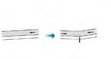

Inundation Point: 90
Rainfall Intensity: 288.7 mm
Evacuee: 544,000
2002 2007 2013 2020
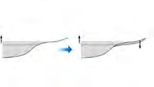
Cause: Vast buildings and settlements has led to the decresing of land absorption ability as well as narrowing the canal in downstream area.
Inundation Area: 330km2
Inundation Point: 160
Rainfall Intensity: 361.7mm
Evacuee: 380,000
Cause: Beside the poor drainage system, flood was preceded by heavy rain.

Inundation Area: 400km2
Inundation Point: 70
Rainfall Intensity: 401.5mm
Evacuee: 398,000
Cause: Because of the heavy rain and waterways clogged with garbage and other kinds of debris
Inundation Area: >400km2


Inundation Point: 109
Rainfall Intensity: 1230.7mm
Evacuee: >100,000
Cause: Climate change
Rainfall Intensity: 400mm2
Evacuee: 36,000
Average Rainfall Intensity during Major Floods
Souece: <The ecolution of risk and vulnerability in Greater Jakarta: contesting government policy in dealing with a megacity's exposure to flooding> by Jonatan A. Lassa, Saut Sagala AHK, BMKG <Study on the risk and impacts of land subsidence in Jakarta> by Irwan Gumilar
1996 2002 50 0 100 150 200 250 300 350 400 2007 2008 2013 2015 2016 2019
Rainfall intensity(mm / day) Flooded area (without subsidence) Flooded area (with subsidence) Coastal flooded area (without subsidence) Coastal flooded area (with subsidence) Water flow (without subsidence) Water flow (with subsidence) subsidence subsidence subsidence mean sea levelmean sea level
2000 2050 SLR 2025 SLR+ 2050 SLR+ Subsidence Temporal and Spatial Variations of Land Subsidence Flooded Area deeper than 1.0m
195
ISSUE BEING TACKLED Interview With Local Residents
"The height of flood can be 0.4m in our house."
"We go upstairs when it is flooding."
GARBAGE FLOATING ON THE CANAL
"The canal has been widen several times from 2m to 9m."

"We throw waste directly, no recycled garbage bins here."
FREQUENT FLOODING
Sometimes the sewer has been stuck with the garbage.
WATERLOGGING
KAMPUNG RESIDENTIAL BUILDING
196


Land Subsidence Flood Area Flood Evolution Subsidence (metres) Shallow -5 0 Deeper 1977 1997 2007 2017 2020 1977 1997 2007 2017 2020
ISSUE BEING TACKLED
197
Souece: ABC news<Sinking towards disaster> by Mark Doman, David Lipson and Ari Wu Bandung Institute of Technology OCHA<Jaakarta Floods: Inundated Area Periodic Overview>
ANALYSIS RELATING TO THE ISSUE
Typology Analysis


Primary Road Secondary Teritiary Alley Shops Mixed-use building School Mosque Office Water&gas bar Home factory Residencial Open area Pumping station Food bar 0m25m 100m 50m 198


Road Typology Analysis Vhicle Lanes Double Two-way Vhicle Lanes Double Two-way Vhicle Lane Single Two-way Pedestrain Canal Canal Parking Mixed Residential Greenery Greenery Front Yard Garden Pedestrain D Pedestrain DrainageDrainageAlley Alley Pedestrain Pedestrain Greenery Greenery Greenery Residential Comercial Residential Building Pedestrain Pedestrain Pedestrain Vhicle Lane Single Two-way Vhicle Lane Single Two-way Vhicle Lane Single Two-way Residential Building Residential Building Residential Building Residential Building Residential Building Residential Building Residential Building Residential Building Residential Building Residential Property Wall Property Wall Property Wall Property Wall Street Vendor Category 01 Primary Category 02 Secondary Category 03 Secondary Category 04 Category 05 Teritiary Category 06 Category 07 Alley Category 08 Alley ANALYSIS
THE ISSUE 199
RELATING TO
ANALYSIS RELATING TO THE ISSUE

Topography Analysis

Higher elevation around the site, and the center of the site is sunken, which is one of the main reasons why it is frequently flooded in the Kampung area.

High High Low Flooding 0.0m 1.0m 2.0m 3.0m 4.0m 5.0m 6.0m 7.0m 8.0m Flat area 0m25m 100m 50m
200
Main Canal Flow


Drainage Flow

Surface Flow

Confluence Point
ANALYSIS RELATING TO THE ISSUE
The fragmentized drainage pattern (caused by the vertical spontaneous building developments) can not supprt the natural stormwater cycle.

Aged utilities for drainage are not adequate for the current usage.

0m25m 100m 50m Waterflow Analysis
201
ANALYSIS RELATING TO THE ISSUE


Pavement Analysis


Mud and Gravel Cement Asphalt 0m25m 100m 50m Mud and GravelCement Asphalt 202
ANALYSIS RELATING TO THE ISSUE
Hardscape and Softscape Analysis


The more impervious the surface, the more runoff there will be.
The impervious paving percentage of the Kampung Kedaung Kali Angke is very high.

100m 25% shallow infiltration 21% shallow infiltration 20% shallow infiltration 10% shallow infiltration 25% deep infiltration 21% deep infiltration 15% deep infiltration 5% deep infiltration 10% runoff 40% evapotranspiration 20% runoff 30% runoff 55% runoff 38% evapotranspiration 35% evapotranspiration 30% evapotranspiration Natural Ground Cover 10%-20%
35%-50%
75%-100%
Impervious Surface
Impervious Surface
Impervious Surface
203


MASTER PLAN 01 02 03 04 05 06 204
Existing Index

STRATEGY 01 RESEDIGN THE DRAINAGE SYSTEM
Calculate the stormwater runoff according to the formula, than select the concentrated catchment area in the site as the water storage space according to the water catchment analysis, so as to improve the storage capacity. of the site.


Calculation Progress


Ψ----Runoff
F---- Catchment Area (hm2)




Take the peak rainfall(377mm) in recent years, 377mm=37.7dm
1L=1dm3


1m3 =1000dm3
1hm2=1x10⁴m2


1hm2=1000dmx1000dm=1x10⁶dm3
Then 1hm2 site with runoff coefficient of 1, the stormwater runoff of 1s is, Qs=37.7x10⁶dm3=3.77x10⁴m3


Proposal Water Storage Space
Proposal Index
Proposal Water Storage Space
Node Area: 233.68m2 Water Storage Volume: 1402.08m³ Area: 4397.21m2 Retention Rate: 90% Runoff: 14919.73L/S Rooftop Area: 2251.28m2 Building Number: 2 Floor-area Ratio: 51% Hardscpe Retention Rate: 50% Softscape Retention Rate: 40% Runoff: 2834.26L/S Building Number: 2 Proposal Softscape Area: 233.68m2 Water Retention Volume:1402.08m3 Area: 7808.8m2 Retention Rate: 90% Runoff: 26495.25L/S Rooftop Area: 4483.26m2 Building Number: 55 Floor-area Ratio: 56% Hardscpe Retention Rate: 50% Softscape Retention Rate: 40% Runoff: 2624.28L/S Building Number: 55 Proposal Softscape Area: 437.38m2 Water Retention Volume: 2624.28m3 Area: 6188.89m2 Retention Rate: 90% Runoff: 26495.25L/S Rooftop Area: 2893.45m2 Building Number: 33 Floor-area Ratio: 43% Hardscpe Retention Rate: 50% Softscape Retention Rate: 40% Runoff: 1867.54L/S Building Number: 33 Proposal Softscape Area: 151.16m2 Water Retention Volume: 906.96m3 Area: 7846.99m2 Retention Rate: 90% Runoff: 26624.84L/S Rooftop Area: 4234.76m2 Building Number: 40 Hardscpe Retention Rate: 50% Softscape Retention Rate: 40% Runoff: 6668.31L/S Building Number: 40 Proposal Softscape Area: 373.32m2 Water Retention Volume: 2239.92m3 Area: 3466.29m2 Retention Rate: 90% Runoff: 15169.63L/S Rooftop Area: 1442.99m2 Building Number: 34 Floor-area Ratio: 43% Hardscpe Retention Rate: 50% Softscape Retention Rate: 40% Runoff: 5102.47L/S Building Number: 21 Proposal Softscape Area: 1604.95m2 Water Retention Volume:5102.47m3 Area: 4857.29m2 Retention Rate: 90% Runoff: 11761.12L/S Rooftop Area: 2711.58m2 Building Number: 33 Floor-area Ratio: 72% Hardscpe Retention Rate: 50% Softscape Retention Rate: 40% Runoff: 1272.49L/S Building Number: 33 Proposal Softscape Area: 398.25m2 Water Retention Volume: 2389.5m3 Area: 3761.05m2 Retention Rate: 90% Runoff: 12761.24L/S Rooftop Area: 2711.58m2 Building Number: 21 Floor-area Ratio: 36% Hardscpe Retention Rate: 50% Softscape Retention Rate: 40% Runoff: 4835.21L/S Building Number: 21 Proposal Softscape Area: 183.06m2 Water Retention Volume:1098.36m3 Area: 3125.96m2 Retention Rate: 90% Runoff: 8209.97L/S Rooftop Area: 1342.82m2 Building Number: 5 Floor-area Ratio: 51% Hardscpe Retention Rate: 50% Softscape Retention Rate: 40% Runoff: 3089.04L/S Building Number: 5 Proposal Softscape Area: 514.84m2 Water Retention Volume: 3089.04m3 Area: 4426.54m2 Retention Rate: 90% Runoff: 15019.25L/S Rooftop Area: 2062.88m2 Building Number: 18 Floor-area Ratio: 63% Hardscpe Retention Rate: 50% Softscape Retention Rate: 40% Runoff: 4351.66L/S Building Number: 18 Proposal Softscape Area: 275.44m2 Water Retention Volume: 1652.64m3 Node Area: 1318.45m2 Water Storage Volume: 7910.67m³ Node Area: 285.47m2 Water Storage Volume: 1427.48m³ Node Area: 286.53m2 Water Storage Volume: 1719.53 m³ Node Area: 409.04m2 Water Storage Volume: 2351.49m³ Node Area: 263.72m2 Water Storage Volume: 1685.09m³
Calculation
Mud and Gravel Pavers Building Surface, Rooftop and Cement pavers Asphalt Pavers Cement Pavers S=0.439562hm2 Ψ=0.50 S=0.2598283hm2 Ψ=0.95 S=0.383881hm2 Ψ=0.40 S=0.636402hm2 Ψ=0.65
Stormwater
Formula: Qs=ΨqF
According to the
Runoff
(L/S)
Qs----Stormwater Runoff
Coefficient
q----Rainfall Intensity (L/(s*hm2))
205
STRATEGY 01 RESEDIGN THE DRAINAGE SYSTEM


Porous Pavers Pedestrain Space Porous Concrete Vehicular Space Povous Pavers Entrance Space
Rain
Bioretention
Primary Canal
Garden
Swale
Porous
Pedestrain
Porous Pavers Pedestrain Space Rain Barrel Grasscrete Car parking Space Drainage
Porous Asphalt Vehicular Space Terrace Rain Garden Children Wood Play A B A'
Treated water and overflow leading to waterway
Pavers
Space
RW Office
B'
Priamry Road Next To The Main Canal Sextion A-A'
Sextion B-B'
206
Teriary Road next to the RW Building
STRATEGY 01 RESEDIGN THE DRAINAGE SYSTEM


Street between the Residential Buildings
 Porous Pavers Pedestrain & Motorbike Mixed
Bioretention Swale
Rain Barrel
Rain Barrel Drainage
Planting
Bioretention
Porous Pavers Pedestrain Space
Tanks
Swale
Rain Barrel
C C'
Rain Barrel Drainage Grasscrete Carparking Space Porous Asphalt Vehicular Space
Narrow Alley Space
Sextion C-C'
D D' 207
Sextion D-D'
STRATEGY 02 RAINWATER HARVESTING FACILITY
Rainwater Harvesting Facilities Distribution Diagram
Rainwater Harvesting and Recycling Diagram
Rainwater
Downspout
Rainwater filter: retain the particles and impurities
Water pump
Laundry
Bath
The second strategy is to design rainwater harvesting facilities, with rainwater collecting barrels to collect rainwater from rooftop and building surface, and use the rainwater filter barrels to filter it for water reuse, such as daily housing use and garden irrigation. And the rainwater harvesting facilities will be placed around the buildings within the radius of the catchment area.


Spigot
Waerflow direction
Toilet Kitchen
Specialized water barrel: for rainwater storage
Water sourese: government water or groundwater
Pea gravel (12.5cm)
Coarse gravel (6cm)
Fine sand (2cm)
Coarse gravel (3cm)
Charcoal (3cm)
The filtered water can be used for daily usage, toilet flushing, garden irrigation, emergency drinking water and fire fighting.

Coarse gravel (12.5cm)
Pea gravel (25cm)
Large rock (25cm)
Common water tank
Pipe for common water tank Pipe for rainwater facility
Rainwater Filter Barrel Section
208
Rainwater harvesting facility to community groups and house-owners.
Due to the need for nodes design at the catchment area, it is necessary to demolish the buildings at A and B and increase the height of the buildings at C to accommodate the former residents living at A and B.


WATER STORAGE
Drainage System Existing Building Distribution Proposal Building Distribution Proposal Drainage System Covered Drainage Network Partial Drainage Network Coinfluence Point Primary Drainage Network Secondary Drainage Network Partial Drainage Direction Coinfluence Point Bioretention Nodes 1-storey Building 2-storey Building 3-storey Building Unknown 1-storey Building 2-storey Building 3-storey Building 6-storey Building Unknown
STRATEGY 03 IMPROVE
CAPACITY Existing
209
STRATEGY 01 IMPROVE WATER STORAGE CAPACITY


A B' A' Floating Green Isand Ecological Detention Pond Wonderful Wetlands Marsh Lands Rain Garden Exploration Potoon Advanture Platform Riverbank Biorentation Swale Carparking Grassconcret Secondary Canal 1 2 3 4 1 6 2 7 3 8 4 9 5 10 5 6 10 9 8 7 Riverbank Detention Detention Secondary Canal Floating Green Isand Porous Gravel Path Exploration Potoon Vehicle Lane Porous Gravel Path Vehicle Lanes Drainage Marsh Lands
Section A-A'
Detention Pond Rain Garden Detention Pond with Marsh LandsPorous Pavers Floating Green Isand Porous Gravel Path Advanture Platform Exploration Potoon Drainage Vehicle Lanes 210
Section B-B'


1 1 1 2 2 2 3 3 4 4 5 5 6 10 11 9 8 7 Porous Gravel Path Ecological Creek Vegetated Swale Children Wood Play Hedgerow Porous Gravel Entrance Central Wetland Ecological Dentation Pond Crosswalk Pier Picnic Dock Multiple-use Sand Filter Vegetated Swale Porous Gravel Path Riverbank Biorentation Swale Carparking Grassconcret Secondary Canal C C' D D' 1 1 6 2 2 7 3 3 8 4 4 9 5 5 10 11 Porous Pavers Porous Gravel Path Ecological Creek Vegetated Swale Lawn Area Porous Gravel Path Vehicle LanesDrainage Porous Gravel Path Section C-C' Section D-D' Ecological Dentation Pond Crosswalk Porous Gravel Path Vegetated Swale Central WetlandCentral Wetland Ecological Detention Pond Picnic Dock Drainage Porous Gravel Entrance Porous Gravel Entrance Multiple-use Sand Filter 211
STRATEGY 03 IMPROVE WATER STORAGE CAPACITY
STRATEGY 03 IMPROVE WATER STORAGE CAPACITY


1 8 2 9 3 4 5 6 7 10 12 11 13 14 Rain Garden Perching Logs Hopping Stems Wood Slide Colorful Plastic Sand Filter Flower Bed PorousLeisure Platform Adventure Playground Biorentation Swale Educational Creek Children Wood Play Terrace Rain Garden Hedgerow 1 2 3 4 5 6 10 11 12 13 14 9 8 7 F E' Terrace Rain Garden Children Wood Play Drainage Bioretention Swale Porous Gravel Path Bioretention Drainage Porous Gravel Path Educational Creek Hedgerow Vehicle Lane Educational Creek Rain Garden Wood SlideDrainage Perching Logs Porous Pavers Advanture Platform Fine SandColorful Plastic Hedgerow Primary School Hedgerow 212
STRATEGY 03 IMPROVE WATER STORAGE CAPACITY


Biorentation swales for narrow spaces Rain Garden for wide spaces


Curb beyond Curb cut
Paving Gravel base
Soil mixture
50% Sand, 30% Topsoil,
Reinforced concrete
Perforated pipe connecting
Gravel pipe bed
Gravel base
Biorentation Swales Cross Section
Curb cut
Concrete curb
Overflow catchment
Soil mixture 50% Sand, 30% Topsoil,
Gravel pipe bed
Perforated pipe connecting
Reinforced concrete
Gravel base
Biorentation Swales Long Section
Conveyance Element


Detention Element
Sedimentation
Filtration
Biological Uptake
Overflow inlet
Treated water and overflow
Extended detention zone
Functional vegetation supports
Extended detention
Filter layer (sandy loam)


Drainage layer (fine Transition layer
Perforated subsoil Geotexile layer
Detention Element
Sedimentation
Filtration
Biological Uptake
Outer or Higher Zone
Middle Zone Normal soil
Middle Zone Plants (A little drier but still tolerates fluctuating water levels)
Costus woodsonii Maas (Red Button Ginger)
Ilex cymosa Blume (Marsh Holly)
Neolitsea cassia (L.) Kosterm (Shore Laurel)
Cenchrus purpurascens Thunb. (Swamp Foxtail)
Crytosperma merkusii (Hassk.) Schott (Swamp Taro)
Vaccinium corymbosum 'Bluecrop' (Highbush Blueberry)
Physostegia virginiana 'Alba' (Obedient Plant)
Lithocarpus lucidus (Roxb.) Rehd. (Shining Oak)
200-300mm
Lowest Zone Filter Media
Lowest Zone Plants
Middle Zone
(Specious adapted to standing and fluctuating water levels)
Crinum 'Menehune' (Red Swanp Lily)
Centratherum punctatum (Brazil Button Flower)
Ipomoea aquatica Forssk (Water Convolvulus)
Cephalanthus occidentalis (Buttonbush)
Chrysopogen zizanioiders (L.) Roberty (Vetivergrass)
Thalia geniculata L. (Swamp Lily)
Eupatorium spp. (Joe-pye Weed)
Asclepias incarnata (Swamp Milkweed)
Outer or Higher Zone
Outer or Higher Zone Plants (Species adapted to drier conditions)
Galphimia glauca Lav. (Shower of Gold)
Ipomoea pes-caprae (Beach morning glory)
Acrostichum aureum L. (Leather Fern)
Pinus merkusii (Two-needled Pine)
Barringtonia acutangula (L.) Gaetn. (Wild Almond)
Barringtonia racemosa (Freshwater Mangrove)
Avicennia alba (Api Api)
Taxodium distichum (L.) Rich. (Swamp Cypress)
Plant are essential for facilitating the effective removal of nutrients and stormwater pollutants, removing water through evapotransipration, creating pathways for infiltration and helping to stavilize soil.
213

 Secondary Canal Marsh Land Floating Green Island Advanture PlatformRain Garden
Exploration PotoonPorous Gravel Path Ecological Detention PondWetland
VISION Vision 01 Vision 02
Riverbank Bioretention Swale
Picnic Dock
Ecological Detention Pond Wetland
Secondary Canal
214
Multiple-use Sand Filter Porous Gravel Entrance Porous Gravel Path Crosswalk Pier


VISION Vision 03
Bird View
Terrace Rain Garden
Children Wood Play
Educational CreekBioretention Swale
215
Ecological Hodgerow

216
LIVE WITH WATER
Jakarta has become increasingly vulnerable due to various conflicts, and recent heavy rains have even caused major disruptions. Therefore, this plan will assess that where are the most vulnerable points, and then relieve the pressure caused by the storm water through a series of landscape strategies, such securing green space for water absorption, and redesign evacuation system. The goal is allowing people to have safer choices when facing heavy rains or floods based on the truth that they have already gotten used to water.
217
XIAO Xinyan
LIVE WITH WATER
A METHODOLOGY TO UTILIZE OPEN-SPACE FOR FLOOD DISASTER MITIGATION

218

219
LIVE WITH WATER
A METHODOLOGY TO UTILIZE OPEN-SPACE FOR FLOOD DISASTER MITIGATION

220

221
LIVE WITH WATER
A METHODOLOGY TO UTILIZE OPEN-SPACE FOR FLOOD DISASTER MITIGATION

222
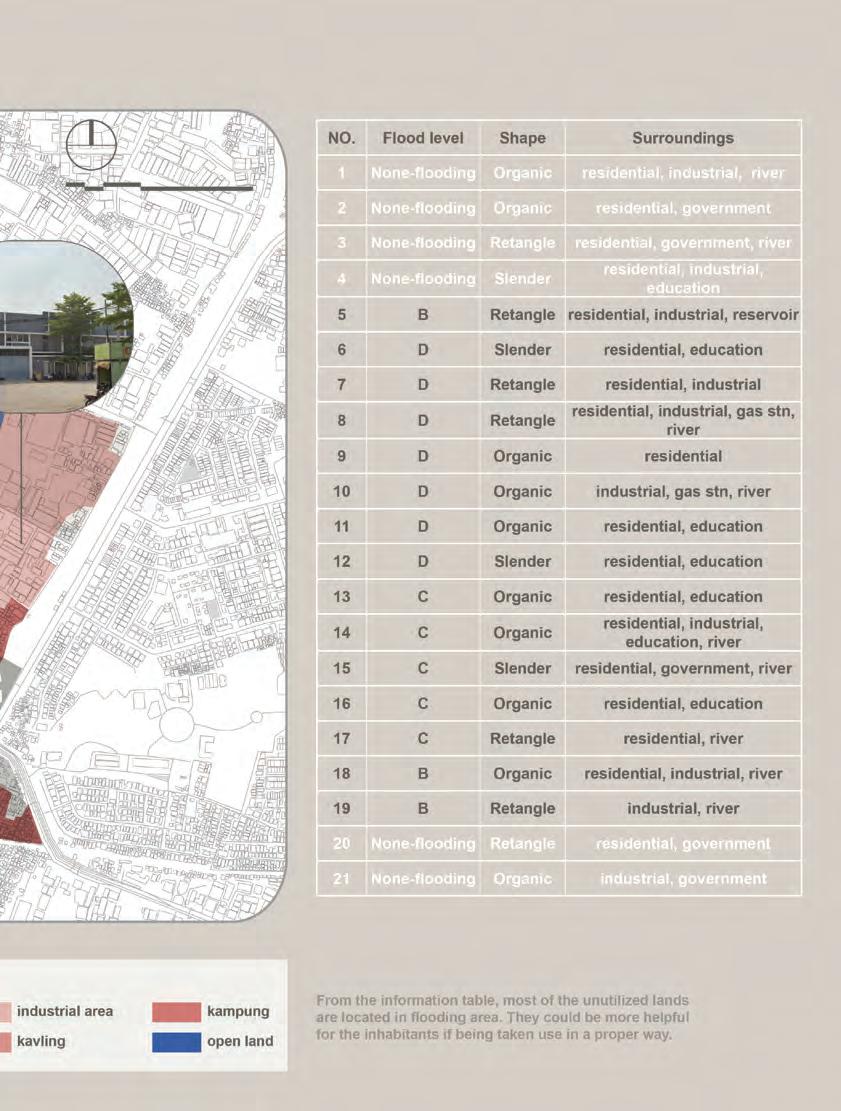
223
LIVE WITH WATER
A METHODOLOGY TO UTILIZE OPEN-SPACE FOR FLOOD DISASTER MITIGATION

224

225
LIVE WITH WATER
A METHODOLOGY TO UTILIZE OPEN-SPACE FOR FLOOD DISASTER MITIGATION

226

227
LIVE WITH WATER
A METHODOLOGY TO UTILIZE OPEN-SPACE FOR FLOOD DISASTER MITIGATION

228

229

A
UTILIZE OPEN-SPACE
FLOOD
02040 100m 230
LIVE WITH WATER
METHODOLOGY TO
FOR
DISASTER MITIGATION

231
LIVE WITH WATER
A METHODOLOGY TO UTILIZE OPEN-SPACE FOR FLOOD DISASTER MITIGATION

232

233
LIVE WITH WATER
A METHODOLOGY TO UTILIZE OPEN-SPACE FOR FLOOD DISASTER MITIGATION

234

235
LIVE WITH WATER
A METHODOLOGY TO UTILIZE OPEN-SPACE FOR FLOOD DISASTER MITIGATION

236

237
LIVE WITH WATER
A METHODOLOGY TO UTILIZE OPEN-SPACE FOR FLOOD DISASTER MITIGATION

238

239





240
LANDSCAPE DESIGN FOR RIVER RESTORATION BASED ON SEDIMENT COLLECTION AND MANAGING IN CANGKARENG DRAIN, JAKARTA BARAT
FENG Zihan
(Abstract: The flooding problem is an ongoing challenge in Jakarta. The design aims to solve the damage of sediment deposition to drainage function in the river and Create an adaptable river landscape to challenge irregular changes in water levels.)
Since the start of the rainy season ten years ago, heavy rains in Jakarta have caused Many people became homeless and lost a lot of property. In recent years, 40 percent of the city to fall below sea level and the ground to keep sinking, due to geographical reasons and overexploitation of groundwater. All of these factors caused serious flooding. The design site, Cangkareng Drain, is an important link in the drainage facilities of Jakarta Barat. The surrounding area is very densely populated with residents and factories. In case of a flood, the damage will be devastating. In contrast to the government’s plan to widen the river, The design focuses on how to maintain the current channel width, using natural segregation to separate and remove sediment to achieve or exceed the carrying capacity of the widening channel plan. Firstly, I plan to divert the river into vacant land, meandering its flow path. Secondly, three sedimentation zones are set at the beginning of the designed channel. Regarding the sedimentation strategy of sediments, I did some simulation analysis. The result shows that there have some difference in flow rates on both sides of the curved channel, the clear water will be discharged from the outer channel which has faster water velocity, while the sediment will be deposited on the inner side and eventually deposited in the sediment pool. After a period of time, the sediment will be excavated on the inner side of the channel through manual intervention to reduce the problem of excessive sediment in the water.
At the same time, the design also provides much needed public space, like fitness track and a museum for the use of the surrounding residents. The peninsula on the east side is designed to be work well together with flooding, and can partially replenish the shallow groundwater pumped out by people.
It is known that the flooding issue in Jakarta has been affecting the society and environment in many ways and wouldn’t be completely solved in the near future. So I want to bring realistic and effective changes to the surroundings. And hopefully, it turns out to be sustainable.
REBIRTH RIVER _
241
ISSUE BACKGROUND


35-40% of channel capacity is lost due to sediment deposition
upstrem
soilerosionfarmingactivitiesdownstrem
6500-7000 t

of garbage are produced in the river every day, the main source of which is household garbage


30-70 cm of water depth on municipal roads during flood season
12 centimetres of land is sinking every year in Jakarta, especially in northern parts of the city
RIVER PROBLEM LOCATION
More than 60 percent of Jakarta's residents depend on groundwater.This provides nearly two-thirds of the city’s water consumption, around 630 million cubic metres out of 1 billion m3/year.
shallowgroundwater

source:http://theconversation.com/why-the-rich-in-jakarta-have-better-access-to-water-than-the-poor-its-not-the-piped-network-91658 https://www.bbc.com/news/world-asia-49481090

NATURAL REVETMENT (DAMAGED): Revetments,lackingprotectionfromnaturalvegetation,arevulnerabletofloodingandareamajor sourceofsedimentindownstreamwaterways

FARMING SPACE: Thelackofvegetationsurroundingthenaturaland unreinforcedchannel,adjacenttotheurbanfarmland system,isoneofthereasonswhythechannelcarriesa lotofsedimentduringtherainyseason


GARBAGE: Theubiquitousgarbageiscarrieddownstreambythe river,causingseriouschannelcongestion.During periodsofcontinuousrainfall,evenseverefloodingcan occur
WATER POLLUTION: Uncontrolleddischargeofdomesticsewageand industrialwastewaterleadstoeutrophicationofwater bodyandseriousbedhardening.Atpresent,theriver carryingcapacityisfarlowerthanthedesignedlevel


20% 50% 10% 20%
01 03 04
02
Water Gate Legend: Potential Erosion Area Water Tower Pump House River Site Location
242


POTENTIAL FLOODING AREASPOTENTIAL FLOODING AREAS ‘SINKING RIVER’: Thephenomenonthatthewaterlevelofthemain channelishigherthanthatoftheinlandriverdueto sedimentdeposition PUMP STATION: Pumpsarrangedatthejunctionofinlandandexternal rivers,whichareresponsiblefortheflooddischarge functionofinlandrivers REINFORCED CHANNEL: ThepartofariverwhereBankshavebeenstakedand reinforcedbyconcrete FRESHWATER PUMP STATION: Groundwaterextractedbywaterpumpsisthemain sourceofurbandomesticwater Water Gate Legends: Pump House River Reinforced River (with embankment) Sinking River (water level below main channel) Site Location WWWRIVER WWWRIVER WWWRIVER 20,000 People/km2 Longsettledhere Datasource:http://www.gscloud.cn/wps 4%-5% landbeingusedforlandscape purposes Site elevation data 390mm Averageannualrainfall 157.9 Days Averageannualrainfalldays 243

0:00 janfebmaraprmayjun 3:00 6:00 9:00 12:00 503mm 18:00 15:00 21:00 2005 1800 6.5m 100mm 200mm 300mm 400mm 500mm 8m 20,000 2007200920112013201520172019 Water hightide lowtide contains Datasource:https://zh.tideschart.com/Indonesia/Jakarta/ Effects of tides on changes in river water levels Average annual rainfall (2016-2019) Sediment record Datasource:https://www.bbc.com/news/world-asia-49481090 unhealthy now lost ±0.5 2.1km2 contains Catchment BACKGROUND
244
DATA
unhealthyriverbed nowcontains20,000tsilt lost35%-40%designcapacity
5.5m
Waterleveldifference contains114,000m3water
48mm
30% +114,000m3
Riversedimentation ±0.5M 2.1km2 contains2,000,000m3water 600,000m3water714,000m3water needbeconsidered Catchmentarea
Datasource:https://zh.weatherspark.com/
julaugsepoctnovdec
6.5m
Athighwaterlevels,thereis almostnoextraroomforthe rivertowithstandflooding 5m Whenthewaterlevelislow,the rivercanflownormallyandhas gooddrainageperformance 245
Normally,riversflowatextremely lowrates
CURRENT RIVER SECTION CURRENT RIVER SECTION


1 2 3 4 5 6 320m DAM ROADROAD ROADROAD PARK ROADROAD ROAD ROAD ROAD RIVERDIRECTION ROAD ROAD ROAD ROAD ROAD PARK DAMstructure Pumpstations Planriverwidthlimit Datasource:https://jakartasatu.jakarta.go.id/portal/apps/webappviewer/index.html?id=ee9940006aae4a268716c11abf64565b 620m 960m 54m Jakarta river widening project 61m 4m 3m 1310m 1660m 0m
existingriver designstrategiesdesignprocess sedimentdistribution sedimentdistribution seperate the sediment & water Change to bend channel straight channel sedimentdistribution 01 reroute river & collect the sediment 02 Creating water bufferzone +40~60%watercapacity replenishgroundwater Creating sediment pools 30% sedimentpool1 sedimentpool2 sedimentpool3 Periodic clearing of sediment 25%20% 25% designedriverchannel flooding discharge tunnel 246
WATER MODEL SIMULATION


1 1 5 10 15 20 25 1510152025303540455055 1 1 5 10 15 20 25 1510152025303540455055 1 1 5 10 15 20 25 1510152025303540455055 1 1 5 10 15 20 25 1510152025303540455055 1 1 5 10 15 20 25 1 5 10 15 20 25 510152025303540455055(10m) (10m) 1510152025303540455055 1 1 5 10 15 20 25 1 5 10 15 20 25 510152025303540455055(10m) (10m) 1510152025303540455055 1 1 5 10 15 20 25 1 5 10 15 20 25 510152025303540455055(10m) (10m) 1510152025303540455055 1 1 5 10 15 20 25 1 5 10 15 20 25 510152025303540455055(10m) (10m) 1510152025303540455055 Velocity.(simulation time:335s) Shear Stress Excess.(simulation time:335s) Velocity.(simulation time:51s) Shear Stress Excess.(simulation time:51s) Velocity.(simulation time:362s) Shear Stress Excess.(simulation Velocity.(simulation time:177s) Shear Stress Excess.(simulation
247
Velocity.(simulation time:362s)


Shear Stress Excess.(simulation time:362s)


Velocity.(simulation time:177s)


Shear Stress Excess.(simulation time:177s)


1 1 5 10 15 20 25 1 5 10 15 20 25 510152025303540455055(10m) (10m) 1510152025303540455055 1 1 5 10 15 20 25 1 5 10 15 20 25 510152025303540455055(10m) (10m) 1510152025303540455055 1 1 5 10 15 20 25 1 5 10 15 20 25 510152025303540455055(10m) (10m) 1510152025303540455055 1 1 5 10 15 20 25 1 5 10 15 20 25 510152025303540455055(10m) (10m) 1510152025303540455055 1 5 10 15 20 25 510152025303540455055(10m) (10m) 1 5 10 15 20 25 510152025303540455055(10m) (10m) 1 5 10 15 20 25 510152025303540455055(10m) (10m) 1 5 10 15 20 25 510152025303540455055(10m) (10m)
1 1 5 10 15 20 25 1 5 10 15 20 25 510152025303540455055(10m) (10m) 1510152025303540455055 1 1 5 10 15 20 25 1 5 10 15 20 25 510152025303540455055(10m) (10m) 1510152025303540455055 1 1 5 10 15 20 25 1 5 10 15 20 25 510152025303540455055(10m) (10m) 1510152025303540455055 1 1 5 10 15 20 25 1 5 10 15 20 25 510152025303540455055(10m) (10m) 1510152025303540455055 1 5 10 15 20 25 510152025303540455055(10m) (10m) 1510152025303540455055 1 5 10 15 20 25 510152025303540455055(10m) (10m) 1510152025303540455055 1 5 10 15 20 25 510152025303540455055(10m) (10m) 1510152025303540455055 1 5 10 15 20 25 510152025303540455055(10m) (10m) 1510152025303540455055 Velocity.(simulation time:362s) Shear Stress Excess.(simulation time:362s) Velocity.(simulation time:177s) Shear Stress Excess.(simulation time:177s) 248
WATER MODEL SIMULATION
General river section
General river section- (wetland part)
1 2 4 5 6 7 8 9 10 11 12 13 14 15 16 17 18 19 20 21 22 23 24 25 26 3 Riversections Riverbasinlength Wetlandchannelsections 150m 300m 450m 0m 0m 50m 100m 150m 200m 250m 300m 350m 0m 50m 100m 150m 200m 250m 300m 350m 0m 100m 200m 350m 500m 600m 750m 900m 1050m 1250m 650m sedimentdistribution legend: waterbody 750m 850m 1000m 1150m Waterdirection Waterdirection Scale:1:1000 Scale:1:600 Waterdirection 0m 250m 300m 350m 200m 50m 100m 150m Reduce water impact Natural sedimentation speed up the flow Ordinary water-levelFlooding season 1 2 3 4 5 6 7 8 9 10 11 12 13 14 15 16 17 18 19 20 21 22 23 24 25 26 1 2 4 5 6 7 8 9 10 11 12 13 14 15 16 17 18 19 20 21 22 23 24 25 26 3 Riversections Riverbasinlength Wetlandchannelsections 150m 300m 450m 0m 0m 50m 100m 150m 200m 250m 300m 350m 0m 50m 100m 150m 200m 250m 300m 350m 0m 100m 200m 350m 500m 600m 750m 900m 1050m 1250m 650m sedimentdistribution legend: waterbody 750m 850m 1000m 1150m Waterdirection Waterdirection Scale:1:1000 Scale:1:600 Waterdirection 0m 250m 300m 350m 200m 50m 100m 150m Reduce water impact Natural sedimentation speed up the flow Ordinary water-levelFlooding season 1 2 3 4 5 6 7 8 9 10 11 12 13 14 15 16 17 18 19 20 21 22 23 24 25 26
249


1 2 3 4 5 6 7 8 9 10 11 12 13 14 15 16 17 18 21 22 28 29 30 31 33
250
Masterplan of Jakarta Cengkareng Drain Park (Ordinary water-level)


N 19 20 23 24 25 26 27 32 01.Outletofdrainagetunnel 02.Northwestentranceofthepark 03.Westentrancemanagementhouse 04.Circularfitnesstrack01 05.Southwestentranceofthepark 06.Viewingwalkway 07.Sedimentdepositpool01 08.Sedimentdepositpool02 09.Sedimentdepositpool03 10.Museumofwaterconservation 11.Hydrophilicwoodenplankroad 12.Viewingwoodendeck 13.Carpark 14.Landscapebridge 15.Ornamentalflowerplantingarea 16.Centralforest 17.Wetland 18.Tidalwetlands 19.Protectedsecondaryforest 20.Circularfitnessrunway02 21.Thebotanicalgarden 22.Civicsquare 23.Ecologicalartificialislands 24.Segregationgreenbelt 25.Eastentranceofthepark 26.NortheastPedestrianentrance 27.Southentranceofthepark 28.Northentrancemanagementhouse 29.Flooddischargeundergroundtunnel 30.Flooddischargetunnelentrance 31.Inletofsedimentarychannel 32.Protectedsecondaryforest 33.Wetlandwalkway 0234692m 251
CONSTRUCTION PLANNING


Site construction sequence


forth stage(2year later)
third stage(1.5year later)
third stage(1.5year later)
first stage
first stage: transfer the sediment nearby
Node perspective(sediment pool)


second stage(1 year later)
first stage


sedimentpool
sediment
252


sedimenttreatmenthouse
sedimentpool building run ways wooden walkpath inner road contour lines & r iverbase outside roadnet park layout 253
pedestrainbridge rainforcedriverwall
Masterplan of Jakarta Cengkareng Drain Park (Flooding season)


1 2 3 4 5 6 7 8 9 10 11 12 13 14 15 16 17 18 21 22 28 29 30 31 33
254


N 19 20 23 24 25 26 27 32 01.Outletofdrainagetunnel 02.Northwestentranceofthepark 03.Westentrancemanagementhouse 04.Circularfitnesstrack01 05.Southwestentranceofthepark 06.Viewingwalkway 07.Sedimentdepositpool01 08.Sedimentdepositpool02 09.Sedimentdepositpool03 10.Museumofwaterconservation 11.Hydrophilicwoodenplankroad 12.Viewingwoodendeck 13.Carpark 14.Landscapebridge 15.Ornamentalflowerplantingarea 16.Centralforest 17.Wetland 18.Tidalwetlands 19.Protectedsecondaryforest 20.Circularfitnessrunway02 21.Thebotanicalgarden 22.Civicsquare 23.Ecologicalartificialislands 24.Segregationgreenbelt 25.Eastentranceofthepark 26.NortheastPedestrianentrance 27.Southentranceofthepark 28.Northentrancemanagementhouse 29.Flooddischargeundergroundtunnel 30.Flooddischargetunnelentrance 31.Inletofsedimentarychannel 32.Protectedsecondaryforest 33.Wetlandwalkway 0234692m 255
a-a’section


freshwatercreek
b-b’section

sedimentpool


Reinforcedriverbase




Open
freshwatercreek
 forest
excavator
ornamentalflpwerplantingarea floodingdischargetunnel
woodenplatform
256


carpark wildingisland Openexercisespace forest 0m 100m 200m 350m 500m 600m 750m 900m 1050m a b a’ b’ 1250m Waterdirection 257

258
ZHANG Bingqian
The site is located in the northwest of Jakarta, adjacent to Kali Canal. It is a kampung with a history of more than 60 years.
The study found that the Kali River has been widened in 2015, resulting in the forced demolition of more than 300 families in the surrounding area and moved to the new residential community along Daan Mogot Street, nearly 7km away. Since many residents were unwilling to be demolished and did not want to move to new tall buildings, this issue intensified the conflict between the government and residents, leaving the remaining people still living by the Kali River without a sense of belonging. At the same time, in Jakarta’s 2030 plan, the road along the Kali River will be rebuilt and widened to become a secondary road, which means their home will face demolition as well. Therefore, it is inevitable for them to leave, and, Jakarta ’s violent resistance to relocation shows that new living conditions must be carefully considered. This project aims to provide a new living environment that can provide them with the sense of belonging. The new residence will enable them to adapt to the high-rise building and participate in social production, resulting them treating it as home rather than a temporary residence. Through field investigation, it is found that in kampung, people manage themselves through the RT and RW system, which is one of the reasons why they do not want to move. Secondly, their income comes from each other, only a few people are factory workers, more than 40% of the households are engaged in informal sales activities like street vendors. In addition, it has many outdoor activities. And Kali River as their public area has become part of their daily lives. This design will reconsider people ’s resettlement issues, making the site close to the river, and create different landscapes by introducing water from the river into residential and agricultural area. For better agricultural production, it is determined the most suitable cultivated land through sunshine analysis. And rivers introduced will provide the irrigation. In terms of living environment, the river will flow along each building to give people the familiar feeling of still living on the banks of the river. After satisfying self-sufficiency, they can obtain the sense of ownership and belonging again. At the same time, using farming activities as a catalyst can enhance sense of community, financial support, education, and branding.
HOME AGAIN
259
LANDUSE MAP Location of the Kedaung Kali Angke


The site is located in the northwest of Jakarta, adjacent to Kali Canal. It is a kampung with a history of more than 60 years.


Landuse of the Kedaung Kali Angke
The kampung village consists of the school, shops, family industries, kindergarten, and the mosque.
260


Kampung map near Kali River 2015 Kali River Expansion 322 families Kali Canal 2014-2015 Daan Mogot 7.2Km Building Relocation Route 139 families Kali Canal 2019-2030 Relocation Condition 461 families Kali Canal 2015-2030 Resettlement Family Kampung 2030 City Plan: Road Expansion RELOCATION HISTORY MAP LOCATIONS IN MEMORY From 2015 (in history) to 2020(in the future) Open spaces in kampung 261
RIPARIAN SPACE ACTIVITIES
Kali River bank is the main open space
Kali River is not only the landscape unit, but also the open space for residents. People gather along the river to interact with each other.


RIPARIAN SPACE ACTIVITIES


Kali River bank is the main open space
 Kali River
Kampung resident
262


 Sewer
Pipe Pipe
Waste water tank
Waste water tank
Water tank
Hawker resident
Kampung
KAMPUNG SOCIAL DISTANCE Activities in kampung
263
Residents use the water tank as daily life water use. and there is the underground tank used as wastewater storage.
ACTIVITIES IN KAMPUNG


Hawker’s route connects the important places.


play

community


 1.LOSS OF PUBLIC SPACE
2.CHANGE OF LIFE NEAR RIVER
3.LOSS OF
playground chatting corner flexible space
with water houses along river fishing
neighbours shops
Legend Text (Minimum 5pt) XX XX XX 264
ISSUES IN RELOCATION


From Kampung places to Highrise building


Compared with the rich activities in the kampung, the new settlement will meet the needs of people to communicate, and also affects the income of the shop.

OF
NEIGHBOURHOOD RELATIONSHIP
neighbours community
4.LOSS OF PRODUCTION MODE
shopkeeper gas&water vegetable selling industry workers
265
APPLY KAMPUNG NEEDS TO RESETTLEMENT


Combine the needs of kampung with the space in new residential area
This design combines the characteristics and activities of the kampung with a new way of living to provide suitable sites for future development of residents, hoping to provide a more suitable environment.
Demands of Kampung Residents


Production methods


Organize

Farming
Production Trade Festival
Sell Activity Management
Legend Text (Minimum 5pt) XX XX XX
266


Farmland Market Open ground Living Building Space needs Role Legend Text (Minimum 5pt) XX XX XX MANAGEMENT SYSTEM Sub Heading - 10pt (Sentence Case) 267
DESIGN IDEAS


Agricultural and Residential Integration System


Using the farming production not only produce the vegetable and fruits, but also the increase of waste and pollution.
SECTION OF DESIGN

Shade arrangement

268
SUNSHINE


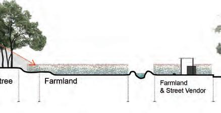


SUNSHINE ANALYSIS
1. OrdinaryResidentialArea Buildingsononeside Diverselivingspace ChangingBuildingOrientation
2.
E W 105° 120° 135° 150° 165° S -165° -150° -135° -120° -105° -75° -60° -45° -30° -15° N 15° 30° 45° 60° 75° 12 East -75° -60° -45° -30° -15° North 15° 30° 45° 60° 75° West 105° 120° 135° 150° 165° South -165° -150° -135° -120° -105° 11 h 10 h 8 h 9 h 7 h 6 h 5 h 4 h 3 h 2 h 1 h 0 h 11 h 10 h 8 h 9 h 7 h 6 h 5 h 4 h 3 h 2 h 1 h 0 h 8 h 9 h 7 h 6 h 5 h 4 h 3 h 2 h 1 h 0 h Start Time: 12/22 6:00:00 End Time : 6/22 18:00:00 LAT: -6°-8'-44" LON: 106°45'17" Step 5. 22/12 Winter Solstice 22/06 Summer Solstice
Step
Step
Step 3. Step 4.
ANALYSIS
TRACK ANALYSIS
of buildings from 22/12 to 22/06 269
SUN
by changing the location
MASTER PLAN along Kali River


Body Text - 8pt font size, 11pt leading space (Sentence Case)

22 1 8 12 13 18 2 3 4 14 21 1F 8F 8F 8F 8F
New Road
JI. Kristal
c. Kampung Area
d. Master plan of site
a. Kali River
20 1F
b. Kampung area
Kali River
270
The ne site will be along the Kali river and equiped with the basic needs of the residents.


Road 1 2 3 4 5 6 7 8 9 10 11 12 13 14 15 16 17 18 19 20 21 22 20 10 19 15 5 16 9 6 7 17 11 Building 1 Residential Area Open Space Building 2 Building 3 Building 4 Building 5 Building 6 Building 7 Planting beds for Building Pond with Rain garden Open Space for Building Planting Garden Parking lot
Space Market Community Center
School
Research Center
Tree
Tree
Land
Vendor
Treatment N 01025 50M 2F 3F 8F 8F 8F 1F River New Road New Road
Open
Primary
Farming
Fruit
Fruit
Farming
Street
Sewage
e. legend
Legend Site Seletion Origin New Site LOCATION new site selection
A. Location of the new site B.
271
AERIAL VIEW
show three-dimensional structure of the site


From the aerial view, the layout helps to make the maximum of the sunshine area for planting. Besides, it produce the shade, partial shade and patial sunshine area.

272
Aerial view direction


view also from the Kali river

273
SUNSHINE LAYOUT


Produce area from shade to sunshine


 The distribution of the farming land is a tributary of Kali River.
Planting beds for each building Parking lot
274
Different open spaces along the river.


river. FARMLAND DISTRIBUTION OPEN SPACE Relatively fair division scheme Restore kampung life Open Space Center of Community Ponds/Open space for Community Planting Garden for Public 275
PLANTING PLAN
Different planting methods

276
Farming perspectives


Visiting perspectives



Living perspectives


PLANTING LANDSCAPE
277
DETAIL DESIGN


Farming land

Each building with a unit of farmland system


Drainage bank


Use wood and rock to build the sewage system along the farmland.


278
Use old paper ... to build the division of each land.


Vision position


RECYCLEING Slope
279






view 280
PERSPECTIVES Farmers
FARMING ROUTE


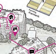

Farming related activities


Farming activities are the main activities in this land and it contributes to the whole landscape, by planting and manage the lands.

281
Visitors’ view





PERSPECTIVES
282


283
VISITORS’ ROUTE Visiting related activities
PERSPECTIVES


Residents view


From community center to the sewage treatment station


284






285
RESIDENTS’ ROUTE Living related activities
People have different roles in the site, and the will meet at each public spaces, such as research center, market and community center.


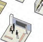


ACTIVITIES 1 1 2 3 4 5 6 8 7 9 7 1 1 2 2 2 3 3 3 4 4 4 5 5 5 6 6 6 7 7 7 8 8 1 2 3 4 5 7 1 6 3 2 4 8 5 6 7 Home Roof Planting Planting beds Farming -Building -Open space -Farmland Farming -Farmland Making food -1st floor Resting -Farmland Street -RoadsideVendor Take lessons -1stMeetingsfloor -1stMeetingsfloor -Building Home -Building Parking -Parking lot Having lesson Working -Outside Meals Farmer/Vendor Residents Visitors Research center Research center -Community center -OpenPlantingspace Resting -Riverside Resting -Riverside -OpenVisitingspace Order -HomeOnline -FarmWanderingland Order vegetables from this area Online
286
Community center
The visions from day to night shows that the market and community center produce the ideal open space for the residence.


PERSPECTIVE 1
287

288
Farmland and research center
The wok on the land will lead to the unique landscape in the urban area.

PERSPECTIVE 2
289

290
The residential area can support itself by producing food and experience of farming activities.

PERSPECTIVE 3 Market
291

292
Deterring crime & Building communities around river Apuran
Ekta Rakholiya
The project concern start from very personal experiences during site visit regarding theft and presence of rehab centers. Through further studies, it is found that Indonesia was formally a transit country for drugs, with much of its supply coming from Europe and other parts of Asia.1 But During the last five years, the domestic manufacture of crystal math has increased and is predicted that Indonesia will soon rival Europe as a provider for the world’s MDMA consumption.2 This indicates high presence of organized crime and certainly unfolding prominently in Jakarta.
Looking further into the issue, it is found that usually young adults of age group 15 to 35 tend to engage in such organized crime. Most of them are either unemployed youth or migrant workers. Digging deeper into what motivates them to engage in the drug trade, three major factors are found
:
1. Quick money making - hence helps to achieve financial independence,
2. Strong sense of Community and brotherhood - as they are often unwelcomed lone migrants in the Urban centers3
3. Addiction
Hence, the project aim is to create systems that not only deter crime but make a gradual transition towards healthier transformation of the society. This is done through three major strategies largely borrowed from theory “Defensible spaces : Crime prevention through Environmental Design (CPTED) ”. This is achieved through three major strategies.
1. System Creations : To create cohesive society environment through job creation and social activities ;
2. Land use appropriation: To develop mix landuse and carefully re-laying road network to decrease the blind spots ;
3. On the ground : By transforming four different zones along the stretch of rive as per the immediate neighbourhood context.
Drug trade is not just an urban problem but a “Landscape issue” as well. When the cities act as breeding ground for drug trade - in the backdrop, large mass of rural land is transformed to cultivate the plants used for these stimulants. I believe, the solution to this also lies in Urban landscapes reforms. The proposed design interventions make an attempt to act as a circuit breaker for smuggling issues in urban centers by creating better opportunities for social well being and financial independence of the people engaged in this risky industry
As the title suggests, the quest is to explore the idea of “Fence”; the notion of boundary and [de] fence i.e. the idea of “un-fencing” with the aim of “defence” against crime. Responding to the rapidly rising organized crime in Jakarta (especially the drug trade & narcotics addiction), this project aims to transform the four different zones around the portion of river Kali Apuran into a vibrant space that not only act as a programmatic defense against existing crime, but also provide opportunity to achieve social well-being and financial Independence, hence making a move towards a better tomorrow. On a broader spectrum, the proposal tend to touch upon defense against rising economic inequality and flood issues as well.
BEYOND THE [ D E ] FENCE
293
SITE EXPERIENCE
& CRIME IN JAKARTA
Further study into crime issues in Jakarta
Everyday// During daily site visits,

Hidden indicators// “Stop Narcotics” signage around neighbourhood areas indicating presnce of narcotics and rehabe centers.

Out of bound zones// The area which we were denied to visit. Apparently, it is breeding ground for drug dealers and the dealing tend to happen in empty streets of formal settlement.
Crime issues and inequality in Jakarta// Drastic change in safety during day and night


Mapping Illicit trade// Data is accessed through seizures, law enforcement data and cross comparision with parallel legal markets
 Day 1// First day - first hour on site, team member’s phone got snatched Day 3// One of the team member received offer for the substance trade.
UI students protect us as bodygaurds. Few member at front & few walking behind the whole group.
Source// OECD task force on countering Illicit trade 294
As the title suggests, the quest is to explore the idea of “Fence”; the notion of boundary and [de] fence i.e. the idea of “un-fencing” with the aim of “defence” against crime. Responding to the rapidly rising organized crime in Jakarta (especially the drug trade & narcotics addiction), this project aims to transform the four different zones around the portion of river Kali Apuran into a vibrant space that not only act as a programmatic defense against existing crime, but also provide opportunity to achieve social well-being and financial Independence, hence making a move towards a better tomorrow. On a broader spectrum, the proposal tend to touch upon defense against rising economic inequality and flood issues as well.


OVERVIEW OF THE ISSUE sdsf
295
PROGRAMMATIC VISION

Beyond the [de]fence

296


297
PROGRAMMATIC VISION AND EXISTING LANDUSE sdsf

298
PROPOSED LANDUSE

sdsf 299
ZONE 1 // BRIDGING THE GAP

300

sdsf 301

2 // TENDING
302
ZONE
THE LAND

sdsf 303

304
ZONE 3 // RECREATING OPPORTUNITIES

sdsf 305

ZONE 4 // SHARED SPACES 306

sdsf 307


308
Written by CHENG Jing
Abstract
By reconfiguring the land use to add and design green space, and increase the human activity function, to assume the role of communication and connection. Finally connecting that separates the density community.
The river, North of Kali Angke, now is sandwiched between factories and residential areas. The hard revetment leads to poor water sensitivity with the monotonous landscape, lack of connection road, and vegetation. The land use around the riverbank, in addition to residential areas and factories, there are large areas of undeveloped land and landfills. The utilization rate of these areas is extremely low. Meanwhile, residential areas are densely populated and closed with a severe lack of open space.
From what has been discussed above, there is insufficient space for daily activities and communication of the residents, resulting in the disconnection between the communities. Under Jakarta’s 2030 Masterplan, factories around the river will be turned into green trading and office areas. The closure of factories and the addition of residential areas have created new opportunities for riverbanks. But the government plan simply widens the river and increases the number of residential areas, leaving little to the landscape imagination. The main purpose of the project is to modify the government’s 2030 Masterplan with the existing land use to increase the riparian space and community open space. All this space will take on the role of community connection after landscape modification.
The first step is to the reconfiguration of the riparian and community open space by analyzing the government plans and existing site conditions. For the riparian corridor, where there are already dense residential areas, the hard revetment shall be retained to maintain the existing residential space. In the middle section of the river, the two banks are undeveloped areas and factories, according to the runoff direction the south bank is selected as the segments suitable part of the river to widen and enrich the landscape. For the planned green space, increase the available green space by selecting the unused space in the new green office area.
In summary, according to the revised planning, riparian expansion and the site condition increase the available green space. As the amount of green space increases, a green space system is formed, connecting the communities. Then, according to the new green space system, a landscape bridge is built on both sides of the riverside green space to connect the two sides and form a new pedestrian system. The road system and pedestrian system based on the new planned green space system also play the role of connecting the community. These green spaces will assume the responsibility for urban parks, playgrounds, and other activities of the residents. As the volume of residents’ activity and communication increases, the connectivity of the community will increase, ultimately eliminating the community disconnection.
RECONFIGURATION OF
OPEN
RIVERSIDE COMMUNITY
SPACE
309
RECONFIGURATION OF RIVERSIDE COMMUNITY OPEN SPACE BASEMAP


Satellite image

Building density

High density residential area in the west part of the river
Human flow&Disconnection
Vehical flow
SECTION
Existing Waterfront spatial change and disconnection


ISSUE
Community
Disconnection
Lack of public space
Monotonous
riparian landscape
310
RECONFIGURATION OF RIVERSIDE COMMUNITY OPEN SPACE

Existing landuse

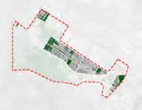

LANDUSE
Government MASTERPLAN OF JAKARDA


Blocked community, undeveloped area, and industry
Revised plan
Community inner green space
Water flow
Decide the location about widening the river
Unused spcae
Adequate green space
Connection system
Community surrounding green space increased
Limitation Building Residential Flat Water Industry Greenspace Service building Education
Pedestrain Vehical Building Green Space Water Industry
µ 0 300 150 Meters
311

1 2 3 4 312

MASTERPLAN 5 6 313


1 2 5 6 PERSPECTIVE
Intersection of two river
Introduce the water into community
Water sensitive platform
Meandering walkway
Connection of the two riverside park
3 4 314
Stepped water sensitive platform


AERIAL
Before Narrow、Monotonous and HardscaopeWiden、Monotonous and HardscaopeWiden、Multiple and Softscaope Government After 315
SECTION
VIEW

316
REGENERATION OF THE VERNACULAR WATER LANDSCAPE
Each city or region has a historical process that is continuous from its inception to the present. By discovering the modern meaning and illuminating it, we can find clues to create unique values. Based on this belief, I proposed regeneration of the vernacular water landscape in Jakarta. After independence, Jakarta has been transforming for over 60 years. Through urban development, water has slowly evaporated from the mental map of the city’s residents. The industrial transformation and the change in lifestyle create a distance between people and water. At the same time, the change of land use and complex roads covered by asphalt weaken the presence of water from the topography. As a result, water culture has been altered to be a frustrating issue. Additionally, the current water management ways cause social and environmental problems while keeping the water away from humans.
Therefore, based on the historical analysis, the interview, and the current land use, I proposed a floodable park and new types of agricultural communities with new water flow which would flow from west to north in the site. Both programs would create opportunities to appreciate water in life while managing flooding. In addition, in the intersection area, all people, including who belongs to different types of communities, could build an interactive relationship between themselves. That would enhance the sustainability and resilience on the site.
From the satellite map of 2004, I extracted the previous paddy field pattern. The pattern color suggests the subtle height difference and possibility of flood. I used this pattern for the master plan to rekindle historical connection. In order, I designed the topography, water flow, zoning, and land use by using it.
In short, expanding the project based on the historical analysis in each site, water would penetrate lifestyle and topography like the vein. That would create a more sustainable and resilient society in Jakarta .
317
TANAKA Mamiko
ANALYSIS
Issue and Background
Nowadays, water culture has been altered to be a frustrating issue. People disconnect with water physically and mentally. However, due to frequency, people perceived floods in the delta areas as natural and normal. Primary industries such as agriculture and fisheries, were operated based on natural cycles including floods.

Issue Disconnection with Water
1. Negative images for water and rivers

2. Missing opportunities to appreciate water in life
3. Physical distances from river and oceans

Background Geographical Condition

318
ANALYSIS
City Scale Analysis
Historically, people used to be living with water in Jakarta. During the colonial era, the offensive approach towards nature and water brought from Dutch implemented.The Ciliwung River was diverted through a network of irrigation channels, spilling into the agriculture areas. After independence,

Used to be Living with Water
Transition of Water Management Way
Jayakarta
The Javanese kingdoms avoided low lands.
Colonial Era Canal System

1.Overflowed water from the hinterland to prevent upstream flooding.

2.Transported goods to inland area by small ships and boats

1.Provided the city with water when the flow of the Cilliwung river coud fall.
Challenged controlling flood while actively utilizing water
After Independence River Normalization
1. Widen the river and the roads.
3. Evict the Kampong residents
Keep the water away from humans
2. Cover the riverbank by concrete
 Wetland
Development 319
Paddy Fields and Aerable Lands Urban
ANALYSIS
Neighbourhood Scale Analysis


From the previous satellite maps, I analyzed the transistion of greenery and water on the site. Continuous housing development has eliminated the rich greenery and create distance from water.


Current Land Use and Human Circulation 2004 2012 2018 2010 Transition of Greenery and Water Mosaic of Land Cover River Normalization(West) Residential Development Loss of Paddy Field Residential Development River Normalization(West) Creation of new types of Greenery Gated Community Main Flow Gated Community Flow Residential Flow Kampong Flow Land Use Legend Human Circulation Kampong Other Residential Industries Others Under Planning 1) Kampong Relocation 3) Zoning Map 2014 2) Casa Jardin Residence Expansion 320
ANALYSIS Design Concept
Through the agricultural process, all types of residents could appreciate nature and water. That would promote sustainability by local consumption of what is produced locally. In the urban floodable park, people could enjoy water activites and feel relaxed along the river. The park would serve as flood control eservoir. That would enhance the resilience on the site.
Urban Floodable Park and Urban Agricultural Communities
Other Residential Area
Kampong
Sustainable and Resilience
Rain
Gated Community Area
Urban Agricultural Communities
Agricultural Process
Cultivate
Blessings of Nature
Floodable Park
Urban Floodable Park
Activity List
Observe and Touch Nature
Enjoy Sports and Exercise
Feel
Growth Cycle and Harvest Calendor


Harvest Process Eat Sell Consume
CENKARENGReservoiur DRAIN
Farm Pond
Garden
Pond
Paddy Field, Wetland Treatment
Relocation Area Intersection Area
Refreshed and Communicate Rambutan
Bean Vegetable JanFebMarAprMayJuneJulyAugSepOctNovDec Year Around First Crop Second Crop Third Crop Paddy Field Fruit Chili PlantingMid SeasonHarvest CabbageTomatoRed Onion CarrotOnion CucumbersBean Petai BayamCorianderPapricaCassava Ginger ZucchiniPeanuts Sweet Potato Corn SalakJeruk BaliKesemekMelonMangoDurianBananaOrange Walking Fishing Natural Song Chinese Cabbage Mustard Green Eco Education Orchard Field Paddy Field Jogging Sitting Vendor Meditation CyclingFootsal Badminton Catch Fish Catch Insects Watch Birds Take Photos × 321
Soy
MASTER PLAN AND DESIGN STRATEGY

Succeed Previous Paddy Field Pattern
From the satellite map of 2004, I extracted the previous paddy field pattern. The pattern color suggests the subtle height difference and possibility of flood. I used this pattern for the master plan to rekindle historical connection.
322
Intersection Area




3.0 ~ 3.9 Gated Commuity Fish Pond Wetland Paddy Field Agricultural Field Orchard Lawn Residential Others Kampong 1.0 ~ 1.9 Innundation Innundation(flood) Non Innundation Kampong Other Residential Gated Community Public 0 ~ 0.9 -1.0 ~ -0.1 Reservoir Main Waterway Sub Waterway -2.0 ~ -1.1 Farm Pond ~ -2.1 Treatment Pond 2.0 ~ 2.9 Other ResidenctialPark Elevation(m) Area Land Use Plot Water Flow Non-Innundation Innundation(Flood) Park Area Innundation(Usual) Residential Area
Topography Water Flow Zoning Land Use 0 20 50 100 (m) 323
Satellite Map 2004


Vegetable Field (Gated Community) Community Center Farm Pond Orchard C Garbage Dump Pocket Park Community Garden Paddy Field Community Plaza Promnade Gate Rest Area and Work Hut Work Hut Management Office Parking Space (motorcycle) Primary Sedimentation Tank Secondary Sedimentation Tank Final Sedimentation Tank Morning market is opened on the weekend. Food vendors are gathering every day. Restaurant and Shop Residents consume the agricultural product loccally at the restraunt and the shop. Community Center All types of residents interact with each other. A Harvest festival and the wedding ceremonies are held on the front lawn. The pond serves as a boundary. This terrace is close to the water surface. Park Center This building serves as a local information center and rest area. Riverside Terrace Along the main street of the gated community, trees, including the exsiting ones, are lined up. Paddy Field Paddy Field Paddy Field Orchard Edible Garden Market Square Play Field Factory workers come to buy lunch from the opposite bank. Canoe Deck This terrace is close to the water surface. Purification Pond Riverside Terrace Community Park This is a park for residents of the gated communities. Farm Pond Farm Pond Farm Pond Farm Pond Farm Pond Riverside Walk Park Pavillion People can learn about the history the site and the natural environment and flooding. Rest Area and Work Hut Fish Pond Rain Garden The pond serves as a boundary. Waterway Line of Trees Small Pond Public Sanitary Wash Space and Dry Field C C� A A� 324
Intersection Area Section


INTERSECTION AREA PLAN AND SECTION Edible Garden Treatment Pond Promenade Play Ground Wetland Lawn Field Paddy Field Outside Kitchen Wash Space and Dry Field Promenade Floodable Park Section Kampong Area Section A B A’ B’ C’ Wetland Riverside Terrace Riverside Board of environment Stepping Stones Canoe Deck B B� 325
PERSPECTIVE
Orchard handing down the memory of the land
At the center of the intersection area, I proposed the orchar area. Fruits attract both people and wild animals, and some trees have a long harvesting cycle. The orchard would become a place to handing down the memory of the land.

326
Urban floodable park enhancing the resilience on the site. PERSPECTIVE
People would get in touch with nature and water.
The riverbed and wetland would enhance flood resilience.


327


328
SPACES IN AND BETWEEN: A LANDSCAPE APPROACH FOR A COHESIVE MIXED CLASS COMMUNITY
Shao Zhongran
A settlement started to thrive in the northeast corner of nowadays Kedaung Kali Angke since the 1980s as the city of Jakarta sprawled. However, the community gradually split up as the public space encroached by the houses when the population boosted. The situation got even worsened after the government expanded the canal Kali Apuran in the year 2014. People feel disconnected with others living on the other side of the canal, and the tension between different classes is soaring. This proposal aims to provide an alternative for those settlements with familiar challenges through three strategies.
The first imperative is inserting public spaces functionally into the community. According to the study of residents’ behavior pattern, people live in different parts of the site have their own preference for the public space. The ones living along the canal reckon on a re-connection with another side. Most lower-class families in the kampung have to share water and sanitary facilities with others while such space is currently disorganized, so they prefer more space with infrastructures among the kampungs. The higher-class families have larger private living space, in comparison, they show more interest in space with unique features like fitness, entertainment, and meditation. Tiny unutilized spaces are supposed to turn to venues to bring the community together through this strategy.
In the second strategy, the existing road networks are renovated to improve connections between public spaces created. Partially uncovered drainage, undecorated front door area, lack of street greenery, and monotone paving styles make the existing road system a dull space for the residents. To transform the roads into an authentic zone for living and extend people’s range of movement, different types of roads are given their own identities by reforming the sections and adding road infrastructures. The paving varies in specific segments to indicate the public spaces surrounding. Also, the roads present motorists and drivers with a succession of both physical and visual restraints designed to encourage slow driving which also make it friendly to pedestrians.
The third strategy is about reforming buildings and structures. The RW office and the mosque are the buildings tend to have the greatest impact upon the community in the village. Extending the function of the RW office into a community center and making a physical upgrade of both can help create hotspots in the village. What’s more, to boost the north-south connection in the village and highlight the two public buildings, a 1-storey high footbridge is proposed between them, with a roof garden and roof platform along the route.
By creating the system of patches-network-hotspots, the proposal integrates the kampung village to a livable place as well as a cohesive community for people with different backgrounds in a regional context.
329
SITE LOCATION


Jakarta, Indonesia
CRITICAL ISSUE AND VISION

- People along Kali Apuran feel more connected to the people on the other side than the people who lives in housing blocks of higher class.

- The relationship between classes deteriorated after the expansion of the canal in 2014.
- The people in the kampung are relatively independent, and do not really engaged in community activities of the region.
 Expansion of canal Kali Apuran
2014
Houses along the canal were demolished, families moved away.
Informal settlements crowded along the canal, residents were united.
2m 10m
Cengkareng Drain
SDN elementary school
RW Office
Mosque
Motorcycle parking shed
canal canal
Cengkareng, West JakartaNorthwest of Keduang Kali Angke Area: 5.1 ha
330
Upper-middle class house

Private
3 household types

Lower-middle class houseInformal settlements


Private sanitary facilities; Don’t have much space for courtyards;
lack of cohesion in mixed-class area
higher-middle class

lower-middle class
informal settlement (kampung)
People share public sanitary facilities; Blocks divided by alleys; highest population density


Unite people beyond both physical and socio-economic barriers
public living space range of movement
Area of 3 household
Quantity
52.6% 60.1% 8.8% 7.2% 38.6% 32.7%
types
of houses
Current Vision
sanitary facilities; big private courtyard fenced.
331
SITE ANALYSIS

Unutilized space
tiny and sporadic
Floor level
1 floor
2 floor
3 floor
Land use
residential shop + residential shop
school
water & gas shop
home factory
mosque
pumping station
office
Accessbility
car and motorcycle allowed motorcycle allowed
Road hierarchy
primary (>6 m)
secondary (5-6 m)
tertiary (3-5 m)

alley (1-2.5 m)
Drainage
covered
uncovered/partially covered
Road material
mud and gravel
cement
asphalt
Type of activity
Space requirements
Chatting & relaxing Washing
Fitness
Entertaining Children’s
332
public living space in the kampung 12 pm 9 pm

BEHAVIOR ANALYSIS
bank of the canal RW office mosqueelementary school vehicular roadskampung alley
chat, laundrychat, play along the canalchat prayplay, vendorchildren playingchat, play
relaxing Washing Fitness Entertaining Children’s area activity requirements
333
STRATEGY PROPOSAL
1. Inserting public spaces


2. Improving road connections


Network
3. Reforming buildings and structure
Patches facilitate connect
connect improve
Hotspot
334
MASTER PLAN

FL-1 rubber paving, mixed colour
FL-2 stone floor, irregular
FL-3 polywood lumber
FL-4 concrete drainage tile, grey
FL-5 grass paving blocks
FL-6 ashlar brick floor, dark tone
FL-7 stretcher bond tile, mixed red
FL-8 herringbone tile, mixed grey
FL-9 cobblestone, beige
FL-10 running bond stone, pink tone
335
STRATEGY 1- PATCHES: INSERTING PUBLIC SPACES


Public living spaces among the kampung
Public living space I


Public living space II
Public living space III

336
Tiny unutilized spaces are sporadically transformed into venues to bring the community together according to the study upon residents’ behavior pattern.
Among higher-middle & lower-middle class houses

Sunken platform
Around the elementary school
Fitness area

Public living space II
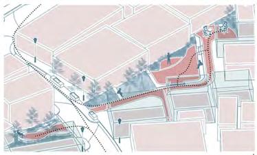


337
STRATEGY 2- NETWORK: IMPROVING ROAD CONNECTIONS


no entry for cars cars allowed before after
Jl. Zamrud II
338
Jl. Zambrud
Roads are given identities by reforming the sections and adding road infrastructures. Varying road paving and programs present motorists and drivers with a succession of both physical and visual restraints designed to encourage slow driving which also make guidance for pedestrians to nearby public spaces.

 Jl. Badar
339
Jl. Badar
STRATEGY 3- HOTSPOTS: REFORMING BUILDINGS AND STRUCTURE

Making physical upgrades of the mosque and extending the functionality of the RW (Rukun Warga, the division of regions under the Village) office into a community center can help unite all residents. To boost the north-south connection and highlight the two buildings having the greatest impact upon the community, a 1-storey high footbridge is proposed between them with a platform and a roof garden along the route.

public living space
roof garden scaffolding
mosque
community center (RW Office)
340
PATCH - NETWORK - HOTSPOT


 Color spectrum & Section
341
Aerial view

342

343

344
A Street-led Approach to an Improved Communal Fabric
Poornima Bargotra
In most kampungs, the street is a channel of movement, a communication space, a place of social and commercial encounters, and most of all, the only public space available. It has a symbolic value, holding an importance as a ceremonial space in the neighbourhood. They tend to be multifunctional and multi-layered instead of clearly zoned areas of uses and types, further resonating the vibrancy of these shared streets.
The chosen site is located in Kedaung Kali Angke, a neighbourhood situated in the North West part of the dense city of Jakarta, Indonesia. With an area of 3.1ha and about 250 households, it comprises of diverse housing and road typologies. Through the adoption of multiple strategies, the aim of this project is to leverage the dynamic nature of the streets as natural conduits of the kampung, and reinvigorate the overall neighbourhood and kampung fabric through a “bang for the buck” approach. It is to look at streets as not just a physical entity for mobility and connectivity, but also as the familiar public realm where social, cultural and economic activities thrive efficiently.
The first strategy is to redefine the streets by looking at how the residents tend to use the space. It is done by studying the current human activities and chalking out possible scenarios for new layers of active programming accordingly – by the use of various placemaking tools focusing on recreational, educational, economic and cultural necessities. These tools are designed with keeping the existing essence of multi-functionality in mind. This overall approach will also act as “social equalisers” which will bring households together, and further enable and provide space for activities while maintaining the integrity of the existing socio-economic conditions.
The second strategy is to re-imagine new road typologies by proposing effective changes to the existing that can be prioritised according to the level of intervention and improvement, thus determining the cost factor. A mix of various approaches- comprising of road widening, tactical redefinition of road directionality and typology are set out to enhance the streetscape in terms of a planning standpoint. Road and green infrastructure tools are used – for example, introducing rain gardens, vegetated swales and permeable paving strategically.
The third strategy is to formalise certain parts of the streets to create designated activity zones by studying the present typology of building uses, their locations and conditions. This approach will ensure that the parts of the streets selected for improvement are actually the ones that are likely to generate the highest impact on the optimisation of the land use - where the residents benefit not just socially, but also economically by now allowing space for commercial activities.
By carrying out the above strategies and the various tools - the design envisions a street led approach to an improved communal fabric, while also trying to achieve the most impact out of the least invasive and costly interventions. The proposal can also become a possible model that can be adaptable to other similar sites.
VIBRANT STREETS
345
BACKGROUND
Streets as an opportunity for improvement
Shared Streets - A linear connection that facilitates multiple activities


Importance of Streets
A framework
Why streets?
In most kampungs, the street is a channel of movement, a communication space, a place of social and commercial encounters, and most of all, the only public space available. It has a symbolic value, holding an importance as a ceremonial space in the neighbourhood. They tend to be multi-functional and multi-layered instead of clearly zoned areas of uses and types, further resonating the vibrancy of these shared streets.
STREET AS A GATHERING PLACE STREET AS PLAYGROUND STREET AS COMMUNITY GARDEN STREET AS WEDDING VENUE 346
PRESENT ACTIVITY ANALYSIS
Classifying activities in the stsreets of Jakarta Kampungs


Activity Framework
These activities happen along roads and streets, depending on their size and proximity to areas such as mosques, schools or even the waterfront. After studying these existing activities, three main design strategies come in to play.
347
SITE LOCATION
Kampung Kedaung Kali Angke
Housing types in site: Informal settlements
- 1-2 storey semi-permanent housing


- Direct connection to the streets
- Houses usually divided by alleyways


- Sharing of facilities
Lower middle class housing
- Gated houses with no open space
- Spill out as a semi private space (usually for gardening)


Upper middle class housing
Gated houses w/ developed road infrastructure
Selected site data:


250+ households
Total Area: 3.1ha
Population: 1000 (approx.) River edge condition on West & South side
- Gated houses with courtyard
- Lined along the main road, close to school & convenience stores
NEIGHBORHOOD
Kedaung Kali Angke, West Jakarta
ApuranRiver
Jakarta, Indonesia CITY
Showing general road density and road structure

low density high density

Mookenvart Drain
Bound by drains & rivers on all four sides
Design concept & strategies
Neighbourhood scale data:


Total Area of neighbourhood: 261 hectares


Total Population: 36100


With 10 RW’s (Division of regions under the village)
The chosen site is located in Kedaung Kali Angke, a neighbourhood situated in the North West part of the dense city of Jakarta.
STRATEGY 01:
Chalk out new activities by studying existing activities
Thinking: Introduce placemaking tools focusing on recreational, educational, economic and cultural necessities.
STRATEGY 02:
Re-imagine new road typologies by proposing effective changes to the existing.

Thinking: Road widening, tactical redefinition of road directionality & infrastructure improvement


STRATEGY 03:
Formalize parts of the streets to create designated activity zones by studying the present typology of building uses.


Thinking: Connecting these buildings to the streets through paving change, delineation strategies and appropriate placemaking introduction.

WEST SOUTH EAST NORTH
CENTRAL
Cengkareng Drain Pesing River
Along Apuran
Primary school
Mosque
Shopfront Shopfront
Shopfront
348
Along Cengkareng
Analysis - existing road typology


ROAD & BUILDING USES STUDY
roadside planting recreation area
cengkareng drain 50m wide
Primary Road
buildings cut off due to expansion spontaneous vegetation mud road
7.0m apuran river 10m wide


Secondary Road
Analysis - existing building uses


Economic impact: Opportunity for shop-front decks


Tertiary Road
potted plants


3.0-6.0m
back of house facing the alley
Alleyways
Strategy: Using the existing building uses to study where certain insertions can be made - where the residents benefit not just socially, but also economically by now allowing space for commercial activities.
Educational & economic impact: Opportunity for street vendors & schoolyards
Cultural impact: Opportunity for mosque plazas

Primary School & Kindergarten Shops (Convenience Stores)
Mixed Used (Including warungs)
Mosque Office (RW & Law Office)
Water & Gas Shop
Open Space
Residential

0.9-1.5m
7.5m
2.5m
Jl. Kristal
Jl. Biduri Bulan
Jl. Zamrud Jl. Kapuk Pulo Cengkareng Drain
Cengkareng Drain ApuranRiver ApuranRiver
Jl. Mustika
Jl.ZamrudII
Jl.KaliApuran Jl.Zambrud
349
STRATEGY 01
Chalk out new activities by studying existing activities

350
The first strategy is to redefine the streets by looking at how the residents tend to use the space It is done by studying the current human activities and chalking out possible scenarios for new layers of active programming accordingly – by the use of various placemaking tools focusing on recreational, educational, economic and cultural necessities.

351
STRATEGY 02
Re-imagine new road typologies by proposing changes to the existing
One of the strategies is to re-imagine new road typologies by proposing effective changes to the existing roads. A mix of various approaches- Giving more space for pedestrian on roads by the tactical redefinition of road directionality and typology are set out to enhance the streetscape in terms of a planning standpoint. Road and green infrastructure tools are used – for example, introducing rain gardens, sidewalks and permeable paving strategically.
More space for public -Swales
-Community Gardens
-Pathways
Current Road Typology


Existing roads
Road directionality
Proposed Road Typology
Re-imagined road typology by reducing width and re-configuring road directionality


Green/public space gained due to narrowing of roads
Newly introduced communal public streets
Road directionality
6m 3m
Reducing road widths
Change in directionality accordingly
Converting primary roads along waterway to pedestrianized communal streets
Reducing tertiary roads to one way, giving more space for public space
Benefits of re-configuration of road typology:
Increase in public space: 45%
352
Break-outs


For larger root space
GREEN INFRASTRUCTURE TOOLS


Stormwater Planter
For roadside greenery

Permeable Paver


To be used in alleyways, parking lots & newly introduced sidewalks


Covered tree trench

For tertiary roads with minimal space


Rain Garden
For planting areas along the river

Permeable Asphalt
To be used in primary roads
Rain Garden

Permeable concrete
Stormwater Planter


Grasscrete permeable pavers for parking areas

Permeable asphalt

Permeable Concrete


To be used in tertiary roads & event areas (colored concrete)


Cengkareng Drain
Permeable Pavers

Crossings
Chicanes
To slow traffic
Speed table & Crossings

For safe pedestrian access
Bump-outs
To delineate parking areas
Speed bump & Water table

To slow traffic & direct water
 Example - Application of the tools
Other Street Tools
353
MASTER PLAN

By carrying out the different strategies and the various tools - the design envisions a street led approach to an improved communal fabric, while also trying to achieve the most impact out of the least invasive and costly interventions – but still respecting the existing activities. The design plan highlights these various interventions.


 Primary School
Mosque
Shopfront Shopfront
Shopfront Mosque Govt Office
Cengkareng Walk
Streets
50m 20100 354
Apuran Multi-Functional Scape
Formalizing sections of streets according to existing building uses


Along Tertiary road (Jl. Badar) near primary school
Along proposed communal street & existing primary road (Jl. Zamrud)


Along Kali Apuran (primary road) converted into a communal street with alleyway connections
*Refer to masterplan on left for location of these sections
STRATEGY 03
Section AA’*
Section BB’*
Section CC’*
0 5m 0 5m 0 5m 355
ESSENCE OF MULTI-FUNCTIONALITY


As the road along Cengkareng drain is now transformed into a fully pedestrianised zone, the design envisions to be multi-functional throughout the length of the street, with change in paving and placemaking playing a major role. Tools such as fishing pavilions, waterfront steps and picnic areas are proposed – paying homage to how people already use this space.


1 3 3 2 4 5 6 7 8 9 11 8m 3m 2m 1 2 3 4
1. Existing Road (7.0m)
2. Proposed parking area
3. Existing roadside greenery
4. Street front steps
5. Flexible schoolyard
6. Waterfront seating
7. Fishing pavilion
8. Lookout deck
9. Picnic area
10. Bike path - 3.0m (integrated with existing covered drain)
11. Waterfront steps
1. Weekend market deck
2. Flexible schoolyard as an extension to the market (multi-functional space)
3. Weekend fish market
4. Weekend picnic
10 356
Flexible area with permeable paving & floor markings that can be changed accordingly


FLEXIBLE SCHOOLYARD


PLAYING GATHERING LEARNING


WATERFRONT STEPS

Steps bringing people closer to the waterfront
Lighting & way-finding integration

PICNIC AREA Complexity
Lightweight low cost tensile structure


FISH MARKET

Space for temporary structures


Complexity
MARKET DECK
Complexity
Activity Spatial Elements Location Age Group FISHING FISHING RELAXING RELAXING SEATING RIVERFRONT GATHERING GATHERING PLAYING GATHERING SPECIAL PAVING
Activity
Elements Location Age Group SEATING COMMUNAL STREET GATHERING GATHERING SPECIAL PAVING
Complexity
Complexity
Spatial
Activity
Location Age Group RECYCLED MATERIAL TEMP. PAVILION VENDING VENDING
Spatial Elements
RIVERFRONT
GATHERING GATHERING
Activity
Elements Location Age Group
Spatial
PAVILION RIVERFRONT SELLING SELLING SEATING
Activity Spatial Elements Location Age Group RELAXING RELAXING RELAXING SEATING RIVERFRONT GATHERING GATHERING COMMUNAL STREET LIGHTING WAYFINDING
BUSKING
FISHING 357
ARTIST’S IMPRESSION

Bringing the elements together
By carrying out the design strategies, the design envisions to improve streets but still staying true to the basic essence of these streets - which comprises of the existing human activities. The artist’s impression here shows how some of these placemaking tools and elements come together - with a design derived from the people and designed for the people.

358

359

360
Observation shows that activities conducted along the streetscape of Kedaung Kali Angke were disorganized. These disordered activities mismatch the way how public space should be designed and how people are using it. Fishing being one of those common activities along the streetscape was, in fact, a supplementary food source for the locals. Despite knowing that the rivers are polluted, some local continues to fish for food while some treated it as a form of leisure. According to research, water quality would gradually improve by 2026 due to the implementation of processing household wastewater before pumping into the rivers started in 2019. Therefore, it is highly encouraged to put this implementation into good use by concurrently reinvigorate the aquatic habitat of the river. This would benefit the supplementary food source and as well provides ecological values/hotspots to the region. As such, the project focuses on fishing as the design driver and aquatic habitat creation to inform the spatial design. The project also envisioned to enable human access to above the river’s space through integration with the process of aquatic habitat creation.
Cengkareng river is chosen as the foundational river as most of the activities can be found clustering there. Elevated decks will be implemented as integration to the aquatic habitat to create elevated space for activities such as kiosk market, fishing, and other community events. The spatial designs will be driven by the creation of aquatic habitat in 3 intervention segments. In the first segment, to mimic a calm aquatic environment that will improve the fish population, half of the existing park will be merged with the river into a wetland park. This wetland park not only filters but also reduces the flow of water. The wetland park will also serve as an attraction to attract users with its openness and access to clean water to conduct a wider range of outdoor activities. In the second segment, the second half of the existing park will be integrated with the elevated kiosk market to provide seating space for users. The vertical supporting structure of the elevated decks will be attached with artificial aquatic habitat modules made from recycled materials to create a favorable environment for fishes to mingles and refuge. While this artificial habitat module primarily functions are to mimic the aquatic environment, they also trap solid wastes and can be easily removed and maintained. In the last segment, elevated fishing space will be extended to the mid-river to enhance fishing productivity. Fishing rod holders, benches, and wider spaces will be installed to enhances the fishing experience. Series of sponge vegetations will also be introduced to provide foods and hiding spots for fishes while distanced exposed water surfaces away from the riverbank to prevent unintended fishing activity.
From this project, the idea of using the river’s space to create new spaces for activities and therefore reorganize an otherwise disordered streetscape can be applied to other similar contexts in Jakarta.
LIVABLE RIVERSPACE
361
Lim Wenfa
SITE ANALYSIS


Street Activities Map


Project Location


Legend
Football court
Non-sheltered restpoint

Sheltered restpoint
Biker restpoint
Poultry cages
Rubbish point
Plastic collection
Mass garbage collection

Groundcable installation
Fruit stalls
Food stalls/Kiosks
Fishing
Playground
Lawn maintenance
Flower stall/Gardening
Ownership Map
Legend

Land owned by residents
Land owned by government

Unlisted land

Context
Neighbourhood Scale
362
PROJECT FOCUS

Fishing, despite knowing that the fish they eat was contaminated by polluted water. “The fish doesn’t taste good anymore, we eat it because we have to fill our stomachs with food.”
Channel NewsAsia (CNA), 2018
The government developed the Jakarta Sewerage System (JSS) to process household waste water before pumped into rivers. The system is expected to reduce pollution in Jakarta’s 13 rivers. The construction can begin in 2020. The project is set to finish in 2026.


The Jakarta Post, 2018
PROJECT VISION
Reinvigorate Aquatic Habitat
Enabling

Fishing Activity
Fishing despite raining
Fishing along riverbank Fishes caught are kept in tank Net fishing
Fishing as the design driver Aquatic habitat creation informs spatial design
363
human access to above river’s space
CHOSEN SITE CONTEXT


Preschool
Playground
Plant stalls
Before
364
More activity spaces created
DESIGN PROCESSES
Expansion of green area
Opens to water bodies
Expansion of waterspace

More accessibility

365

MASTERPLAN 366
DESIGN PROCESSES


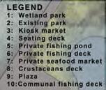

FOCUS AREA
367
WETLAND PARK

A calm aquatic environment that will improve fish population, half of the existing park will be merged with the river into a wetland park. This wetland park not only filter but also reduces flow of water. The wetland park will also serve as an attraction to attracts users with its openness and access to clean water to conduct a wider range of outdoor activities.
SECTION A-A

368


Before 369
KIOSK MARKET & AQUATIC HABITAT CREATION

Second half of the existing park will be integrated with the elevated kiosk market to provide seating space for users. Vertical supporting structure of the elevated decks will be attached with artificial aquatic habitat modules made from recycled materials to create a favourable environment for fishes to mingles and refuge. While this artificial habitat modules primarily functions are to mimic the aquatic environment, they also trap solid wastes and can be easily removed and maintained.
SECTION B-B

370
Series of sponge vegetations will also be introduced to provide foods and hiding spots for fishes while distanced exposed water surface away from the riverbank to prevent unintended fishing activity.


Before
371
KIOSK MARKET & AQUATIC HABITAT CREATION

Aquatic habitat devices
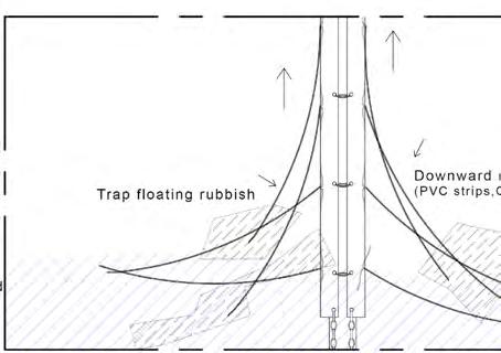
 Detail 1
372
Detail 2


373
KIOSK MARKET & AQUATIC HABITAT CREATION


Aquatic habitat modules
Detail 3
Detail 4
374


CONSTRUCTION DETAIL Aquatic habitat devices No screw/nut Habitat friendly joinery 375
FISHING DECK & CRUSTACEANS HABITAT CREATION
Elevated fishing space will be extended to the mid river to enhance fishing productivity. Fishing rod holders, benches and wider spaces will be installed to enhances fishing experience.


SECTION C-C

376


Detail 5
Detail 5 377
Aquatic habitat modules
REFLECTIONS
378
We had the opportunity to visit Jakarta and work alongside UI students, which was a fruitful collaboration. Studying about the local community was eye opening and I was immediately intrigued by how people use the limited outdoor spaces (in the dense setting of the settlements) and make it their own. This led my project - to design for the community but by investigating impact out of the least invasive and costly interventions. I began to dive a lot into the socio-economic dynamics of the kampung and the multi-functional aspect of spaces. Throughout the process, I learnt to be self-critical, and focus on my rational
my time management and prioritization. Excited to use the knowledge gained and see what the next studio has in store!
The studio offered me different perspectives on designing an adaptive landscape for Jakarta. Throughout this
get to experience the living conditions within the kampung community, neighbourhood conditions as well as venturing out to other parts of Jakarta. This experience opens up opportunities where I can explore various possible design solutions which can better serve the people living in Jakarta. As my project focus on solid waste, I’ve gained waste production and am excited to apply the knowledge gained from this studio in the upcoming studios as well. Overall, this studio taught me to be analytical throughout the whole design process, to be bold in exploring new landscape design ideas and self-critical on my project work.
Chin Qiwei


This semester is an unforgettable one. First of all, I have never been to Jakarta, a big city with chaos and complexity. every day. The city is full of crises as well as opportunities. In addition, the studio course later became an online type because of the pandemic, and our project quickly entered the stage of personal design. This is a big challenge for everyone. We need to communicate the details of the plan with the teacher through video. I have to say it improves the ability to think alone. Finally, I tried large-scale urban shortcomings. I hope I can make progress next time.
 Bargotra Poornima
379
Carissa
Cheng Jing
This studio provided an opportunity to explore potentials of Landscape architecture to solve complex level city challenges. This was the first time for me to explore a complex city like Jakarta and confronting issues related to crime. While working on it, I realized that almost every city has those pockets and alleys where these negative activities breed and Landscape design strategy can really provide a solution for transition towards improving the neighbourhood. Though the final design outcome was greatly affected by COVID situation, I am extremely grateful for the guidance from Ervine and Kenya. I feel that this semester I learned a lot at the level of system thinking and social dynamics that shapes the spatial use in public places.
I really enjoy the process of the field trip, and the whole experience is very hard, interesting, and even unforgettable. The studio this semester enabled me to complete the design of a river from the perspective of the city-scale. It was a crazy design in a sense because I diverted the river. But it was for this reason that I was driven to study the nature of the river in-depth, to do various simulations to verify my conjecture. I believe that through this studio, I will have a deeper understanding of the laws of the natural river system than before, which also makes me pay more attention to the landscape benefits brought by the whole site design, and make better design decisions in future works.

In the studio this semester, I decided to choose the topic of flooding management that I have never been exposed to, which was very complex and difficult for me. I had a lot of thinking, searched a lot of data and tried to make the runoff calculation. There were many mistakes and shortcomings in the final results, however, for myself, I harvest and achieved pretty much. This was the most complete design process I have ever made. In the further study, I will try to challenge other landscape issues and improve my design ability.

 Ekta Balubhai Rakholiya
Feng Zihan
380
Han Cong
This semester had been a roller-coaster of emotional and stress which I have never experience in any of my pervious studios for the past 4years in NUS. The studio started with a comfortable pace of researching and site visiting and eventually expedited by the second half of the semester. Being naturally slow and lost in thought, I was stuck with my design thinking and couldn’t narrate and convince myself what exactly I wanted to do. Eventually I dropped a few initial explorations and things started geting clearer at last. I wished I could start on the final focus “river ecology” earlier so that I could strengthen my argument and really go deep into it. Nevertheless, I really enjoyed this semester as we get to experiences the kampung’s culture of Jakarta!
This semester, I learned a lot about design logical thinking and large-scale design principle. In a preliminary field trip, we went to Jakarta, where I gained the local situation, culture, city life and made new friends. What an unforgettable journey! During my design process, my design topic is wastewater, and I met some problems like professional theoretical knowledge, which involves engineering. It’s a big challenge for me. Fortunately, my tutors gave me a lot of useful suggestions and encouragement. They help me combing design logic and drawing revision. During this pandemic period, our normal face-to-face course cannot continue, but our tutors try their best to improve class quality. Thanks for their efforts! I hope I can study harder and learn more next semester.


I want to thank Ervine and Kenya for guiding and supporting me. I’m glad I made it through, although I could not work out the details. This project was a great opportunity for me to think about how to build an interactive relationship between humans and water deeply. I realized that referring to historical things is my fundamental design approach. Overall, through this semester, I have enhanced both my perspective and designing skills.
 Lim Wenfa
Lyu Jiawei
381
Mamiko Tanaka
This project has been an exciting one to work on, although the semester through the onset and prime of the pandemic was quite challenging. It helped me learn and experiment with the limitations of the scope of my profession. I liked that we were not given a specific site, and our instincts or interests were made to guide us to it. Jakarta was a very good site with lots to learn from and a web of complex challenges.The design process however, was interrupted due to current situation and changing restrictions. With a shift in work patterns and consultations i think i struggled to handle the changing ways of things working. Its been an unconventional journey full of anxiety and ambiguity, and we were lucky to have very understanding and supportive tutors to guide us through.

This semester is quite special for us due to the COVID-19, but luckily we have made great progress. For me, the biggest challenge is keeping amending my design strategies to make them convincing and then defending my ideas of specific design proposals. This process was hard but turned out to be fruitful. It helps me have a better understanding of logical level in landscape design. I want to give thanks to Ervine and Kenya for putting much effort into their work under this situation. Also, I appreciate the company of our UI friends during our field research in Indonesia.

Compared with last studio designing for ecology, this semester I developed much more skills in designing the landscape infrastructure. Identifying the issues and developing the concept is a very resourceful experience, especially when lots of practical situations are considered. For the project itself, I find blue and green matrix can be large and complicated systems, and it requires hierarchical thinking to classify the major function systems inside the matrix, which will help me develop a more reasonable and convincing design idea. Other important knowledge I learnt is about landscape details. Landscape details can be abundant, so I should consider carefully before zooming into the most relative details.
 Ruiee Vithal Dhuri
Shao Zhongran
382
Wang Haobo
Generally I really enjoyed this semester’s studio. I felt happy that my work could started with a macro methodology analysis then the design was developed step by step based on the analysis. The entire process helped to make my design become more reasonable. Apart from that, climate changes and flooding are the topics I always want to touch and explore, thus I’m satisfied I could do relevant design in real world and got the chance to do field trip in a totally unfamiliar context, which was challenging but interesting. This experience gave me a lot of surprise and more importantly, let me deal with conflicts in a complicated culture. Hopefully I could dig more in this field in the future.
The studio is very close to the real project. We actually went to Jakarta. It is very useful to start from surveying the kampungs and end up with thoughtful designing. It is based on a very good understanding of the site. Among all stuff, the investigation with students in Jakarta has played a very good role in communication. We did it with them and we became good friends. My project is a sensitive topic, but our teachers do not evade it, but encourages me to follow the idea to design in depth. This is an unforgettable journey.
This project gave me a chance to touch on issues like garbage dump that I had never touched before. This semester I learned how to think systematically about the design and completion of the whole project in terms of the timeline, how to integrate the landscape with technology tools, and how to sort the garbage and leachate. I am so grateful for the help and guidance Ervine and Kenya gave me.


 Xiao Xinyan
Zhang Bingqian
383
Zhang Bingyi
I am quite grateful for the guidance from Ervine and Kenya. I think I have a better understanding of design after this Studio through the process of landing (Experience the complex ground conditions of Jakarta), grounding (Detailed analysis and experiential explorations), finding (Discover the potential areas), founding (Propose ways to restructure elements of the city). I learned more targeted analysis and derived my design based on analysis and observation.

During our field trip to Jakarta in this semester, I have experienced and learned a lot from this city. It was my first time to take an in-depth conversation to kampong residents, which was quite fresh to me. Meanwhile, it was an excellent opportunity to meet and study with UI students! Apart from that, the crime topic was a big challenge for me as well. Luckily, when I came across a lot of pitfalls during the whole process, thanks to Ervine and Kenya, gave many helpful suggestions to me and led me to the right direction finally. One pity thing is that on account of the epidemic situation, the face-to-face courses have reduced. However, I appreciated all the efforts we have made and happy with my improvement in logical thinking.
This semester’s studio gives me a brand new experience. The in-depth research in Jakarta made me feel the responsibility as a landscape architect and what I should do to change this situation. In this project, I mainly focus on stormwater management and how to bring new life experience to Jakarta through water. After the detailed analysis, the main issue is obtained and the new design strategy is established. Therefore, I am quite grateful for the guidance from Ervine and Kenya, so that my project can be presented step by step. Compared to last semester, I feel that I have made great progress, although there are still some areas that need to be improved.

 Zhang Yifei
Zhong Yixin
384
Zhou Xianfeng
Editors:
ZHANG Yifei
ZHANG Bingqian
WANG Haobo
SHAO Zhongran
FENG Zihan
TANAKA Mamiko
Copyright © 2020 Ervine Lin and Kenya Endo (ed.)
ISBN: 978-981-14-9850-3
385


 Singapore Trunk Road


 Source: The pattern of spatial flood disaster region in DKI Jakarta, M P Tambunan 2017 IOP Conf. Ser.: Earth Environ. Sci. 56 012014


 DAY 01 - Central Jakarta, Cikini & Manggarai DAY 03 - Angke River, Moonkevart Drain
DAY 02 - Waduk Pluit, Kampung Akuarium & Tongkol


 Kampung Cikini
Manggarai Stream


 Kampung Greenery
Underutilized Space Roadside Greenery Gate Community Greenery
Riverbank Greenery Urban Park


 1. Wagon & garbage truck
2. Underutilized area for garbage
3. Garbage dump
4. Garbage concentration centre


 Septic tank concept
Bisnis, Jakarta – Local GovernmentOwned Water Utility (PDAM)
Water pumps Water gates


 Brief study of the settlements around the water bodies to observe their way of living and understand their interactions with water.


 2.
3.
4.


 Stuck by garbage
Concrete cover (width 60-70 cm)


 Charcteristic


 IPAL Duri Kosambi
ITF Marunda
SPA Sunter
IPAL Pialogebang
ITF/PDLIK Calcung


 Neighborhood have too much waste waiting for collection


 Urban farm
Park


 Trash separation


 Site2 | Community Mixed-use
Site3 | Local Household


 Factory-Household Rainwater System


 Raingarden


 1. Shared Water Shop Rainwater System
2. Individual Household Rainwater System
Section B-B'


 Type 1 | Public Habitat
shared water shop rainwater system + raingarden
Type 2 | Community Mixed-use factory-household rainwater system + terraced raingarden


 12km
12km


 Porous Pavers Pedestrain & Motorbike Mixed
Bioretention Swale
Rain Barrel
Rain Barrel Drainage


 Secondary Canal Marsh Land Floating Green Island Advanture PlatformRain Garden
Exploration PotoonPorous Gravel Path Ecological Detention PondWetland


 forest
excavator
ornamentalflpwerplantingarea floodingdischargetunnel
woodenplatform


 Kali River
Kampung resident


 Sewer
Pipe Pipe
Waste water tank
Waste water tank
Water tank


 1.LOSS OF PUBLIC SPACE
2.CHANGE OF LIFE NEAR RIVER
3.LOSS OF


 The distribution of the farming land is a tributary of Kali River.
Planting beds for each building Parking lot


 Day 1// First day - first hour on site, team member’s phone got snatched Day 3// One of the team member received offer for the substance trade.
UI students protect us as bodygaurds. Few member at front & few walking behind the whole group.


 Wetland


 Expansion of canal Kali Apuran
2014
Houses along the canal were demolished, families moved away.
Informal settlements crowded along the canal, residents were united.
2m 10m
Cengkareng Drain
SDN elementary school
RW Office
Mosque
Motorcycle parking shed
canal canal
Cengkareng, West JakartaNorthwest of Keduang Kali Angke Area: 5.1 ha


 Jl. Badar


 Color spectrum & Section


 Example - Application of the tools


 Primary School
Mosque
Shopfront Shopfront
Shopfront Mosque Govt Office
Cengkareng Walk


 Detail 1


 Bargotra Poornima


 Ekta Balubhai Rakholiya
Feng Zihan


 Lim Wenfa
Lyu Jiawei


 Ruiee Vithal Dhuri
Shao Zhongran


 Xiao Xinyan
Zhang Bingqian


 Zhang Yifei
Zhong Yixin
