DOWNTOWN AND EL CAMINO REAL SPECIFIC PLAN

DRAFT - DECEMBER, 2022


DOWNTOWN AND EL CAMINO REAL SPECIFIC PLAN
DRAFT - DECEMBER, 2022
DRAFT - DECEMBER, 2022
Anne E. Oliva, Mayor
Gina Papan, Vice Mayor
Anders Fung
Ann Schneider
Reuben D. Holober
Jean Joh, Chair
Maureen Davis, Vice Chair
Alan Wong
Catherine Quigg
Christopher Del Nagro City Manager
Thomas C. Williams
Bruce Barron, Fire Chief, Central County Fire Department
Mackenzie Brady, Recreation Director
Harry Burrowes, Acting City Engineer
Joan L. Cassman, City Attorney
Craig Centis, Interim Public Works Director
Michael N. Conneran, Assistant City Attorney
Christina Corpus, Chief of Police Services, San Mateo County Sheriff’s Office Millbrae Bureau
Nestor Guevara, Associate Planner/ Project Manager
Keyvan Irannejad, Chief Building Official
Roscoe Mata, Planning Manager
Andrea Pappajohn, Environmental Programs Manager
Ellis F. Raskin, Attorney
Christine Reed, Battalion Chief/ Fire Marshal, Central County Fire Department
Darcy Smith, Community Development Director
Mike Sung, Finance Director
Elaine Tran, City Clerk
WRT, LLC (Planning, Urban Design + Landscape Architecture)
Mintier Harnish, General Plan Lead
Bottomley Associates (Urban Design)
Kittelson & Associates, Inc. (Transportation Planning)
West Yost (Infrastructure)
Applied Development Economics (Market Analysis and Financing)
a.
b.
c.
d.
e.
b.
b.
c.
a.
b.
a.
b.
c.
The Downtown and El Camino Real Specific Plan establishes a vision for the downtown district and the El Camino Real corridor, providing overarching policy framework and design standards in order to achieve that vision. The purpose of the Plan is to enhance the quality of life by providing a road-map for future growth that emphasizes transit-oriented, mixeduse development that provides a mix of housing, restaurants, general commercial, hotels, offices, and entertainment uses.
The Downtown and El Camino Real Specific Plan presents an opportunity for Millbrae to transform the city’s primary areas of business and commerce into vibrant and connected mixed-use centers of cultural and economic activity. This Specific Plan focuses on the area that will undergo the majority of change and development in the city over the next couple of decades. The overall objective of the Downtown and El Camino Real Specific Plan is to enhance quality of life by providing a road map for future growth and investment to create an exciting place for people to live, work, shop, and visit. This plan emphasizes transitoriented, mixed-use development to provide a purposeful mix of housing, restaurants, retail, hotels, offices, and entertainment uses.
Consistent with Government Code Section 65450, the Downtown and El Camino Real Specific Plan establishes the vision for the El Camino Real corridor and downtown district, and provides the overarching policy framework and development regulations that are necessary to achieve the plan’s vision.

 El Camino Real, Millbrae
Broadway, Downtown Millbrae
El Camino Real, Millbrae
Broadway, Downtown Millbrae
The City prepared the Downtown and El Camino Real Specific Plan concurrently with the 2040 General Plan. The Active Transportation Plan (ATP) was adopted by the City Council on October 12, 2021. This section describes the relationship between the Downtown and El Camino Real Specific Plan and other plans that supported its development and also have a role in guiding development in the Plan Area.

The 2040 General Plan is the overarching document that provides the policy framework that will guide citywide growth and development over the next 20 years. California State Law requires that every city adopt a general plan “for the physical development of the city and any land outside its boundaries that bears relation to its planning” (California Government Code Section 65300). A general plan serves as the jurisdiction’s “constitution” or “blueprint” for future decisions concerning a variety of issues, including land use, health and safety, and resource conservation. All specific plans, subdivisions, public
works projects, and zoning decisions must be consistent with the local jurisdiction’s general plan.
In accordance with Government Code Section 65454, the City prepared the Downtown and El Camino Real Specific Plan concurrently with the 2040 General Plan to ensure consistency. The 2040 General Plan provides the broad goals and policies for downtown and the El Camino Real corridor, whereas the Specific Plan provides a focused analysis on the area and more specific policies and development standards related to land use, urban design, and circulation and parking.


The Downtown and El Camino Real Specific Plan builds upon and complements the Millbrae Station Area Specific Plan (MSASP), which the City adopted in 2016 to establish land use regulations and development standards, design guidelines, and streetscape standards for the Station Area. The MSASP is located in the southeastern corner of the city, adjacent to the city of Burlingame to the south; El Camino Real and Broadway to the west; and Victoria Avenue, the City’s Public Works storage, and Highline Canal to the north. The MSASP was adopted in February 2016, and is an update of the original 1998 plan. The goal of the MSASP is to guide the creation of Millbrae’s new economic center, including vibrant, diverse, and transitoriented developments in and around the Intermodal Station.


While the Downtown and El Camino Real Specific Plan is located outside of the MSASP planning area, the two plans share a common border along the southeastern portion of the Downtown and El Camino Real Specific Plan.


The Broadway and El Camino Real Streetscape Plan was prepared in conjunction with and is provided as an appendix to the Downtown and El Camino Real Specific Pan . The Streetscape Plan recommends improvements to the El Camino Real and Broadway corridors within the Specific Plan Area. The Streetscape Plan defines potential changes to roadway layout and function, including roadway geometry, number of travel lanes, bicycle facilities, transit and multimodal facilities, sidewalk width; and improvements to the design character of the corridors, including pavement materials, furnishings, lighting, planting, wayfinding and public art. Additionally, the Streetscape Plan describes green-infrastructure opportunities consistent with the City’s Green Infrastructure Plan. Both plans are intended to compliment and be consistent with one another.


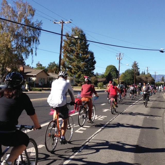
The Active Transportation Plan (ATP) is the citywide bicycle and pedestrian master plan that will enhance circulation and connectivity. The ATP was adopted by the City Council on October 12, 2021. The purpose of the ATP is to assess the needs of pedestrians and cyclists in Millbrae; identify improvements to infrastructure and programs; ensure eligibility for certain transportation funding sources; and coordinate pedestrian and bicycle local actions and regional projects. The Downtown and El Camino Real Specific Plan weaves the recommendations from the ATP into this plan as they relate to the Plan Area.


The Grand Boulevard Initiative is a regional collaborative of 19 cities, counties, and local and regional agencies, to improve the El Camino Real corridor from northern Daly City to central San Jose. The vision of the Grand Boulevard Initiative is to transform El Camino Real into a more walkable, transit- and
bicycle-friendly boulevard with mixed-use development. The Grand Boulevard Initiative Task Force, with representation from the City of Millbrae, adopted the Grand Boulevard Multimodal Transportation Corridor Plan on September 15, 2010. The Plan contains multimodal access strategies, street design guidelines, and prototypes for development along the corridor.
Plan Bay Area is an integrated longrange transportation, land housing plan for the San Francisco Bay Area that was jointly prepared by the Metropolitan Transportation Commission (MTC) and the Association of Bay Area Governments (ABAG). Plan Bay Area 2050 is a 30year plan that provides a blueprint for Bay Area growth that is affordable, connected, diverse, healthy and vibrant for all residents through 2050 and beyond. The Plan encompasses 35 strategies to improve housing, the economy, transportation, and the environment across the Bay Area’s nine counties (Alameda, Contra Costa, Marin, Napa, San Francisco, San Mateo, Santa Clara, Solano, and Sonoma). MTC and ABAG adopted Plan Bay Area 2050 in October 2021, which is an update of the original 2017 plan.
Plan Bay Area is a result of the California Sustainable Communities and Climate Protection Act of 2008 (SB 375), which requires each of the state’s 18 Metropolitan Planning Organizations (MPOs) to prepare a sustainable communities strategy (SCS) that integrates planning for transportation, land use, and housing with the goal of reducing greenhouse gas emissions. Plan Bay Area 2050 highlights focus areas for future housing and jobs growth, referred to as Growth Geographies. These geographies are identified for growth either by local jurisdictions or because of their proximity to transit or access to opportunity. Four types of Growth Geographies analyzed in Plan Bay Area 2050 are:
• Priority Development Areas (PDAs): Areas generally near existing job centers or frequent transit that are locally identified for housing and job growth.
• Priority Production Areas (PPAs): Locally identifiable places for job growth in middle-wage industries such as manufacturing, logistics, or other similar trades. An area must be zoned for industrial use or have a predominantly industrial use to be a PPA.
• Transit Rich Areas (TRAs): Areas near rail, ferry or frequent bus
service that were not already identified as PDAs. These are areas where at least 50 percent of the area is within ½ mile of either an existing rail station or ferry terminal (with bus or rail service), a bus stop with peak service frequency of 15 minutes or less, or a planned rail station or planned ferry terminal (with bus or rail service).
• High-Resource Areas (HRAs): State-identified places with wellresourced schools and access to jobs and open space, among other advantages, that may have historically rejected more housing growth. This designation only includes places that meet a baseline transit service threshold of bus service with peak headways of 30 minutes or better.
MTC and ABAG designated the boundary of the Millbrae PDA, which includes El Camino Real and the downtown area. While Plan Bay Area does not regulate development, the Millbrae PDA is eligible for transportation funds through MTC and ABAG that support and encourage residential and commercial development within the PDA.
The City began preparing the Downtown and El Camino Real Specific Plan alongside the 2040 General Plan Update and Active Transportation Plan through a combination of technical analysis and public input. The City designed each step of the process to ensure the planning team gathered feedback from residents, business and property owners, decision-makers, and other stakeholders. This section describes the public outreach process.
MARCH 15, 2016
The City Council and Planning Commission held a Joint Study Session to kick-off the planning process and learn more about the need for and purpose of the Downtown and El Camino Real Specific Plan, key steps in the process, and the outreach program.
The Consultants conducted interviews with key stakeholders to learn about major issues and opportunities in Millbrae.
APRIL 11, 2016
Over 65 people attended the first Community Workshop. During the workshop participants learned about the Downtown and El Camino Real Specific Plan, General Plan, and Active Transportation Plan; discussed their views on the community’s major assets, issues, and opportunities; and shared their vision for the future of the city.
SEPTEMBER 6, 2016
The City Council and Planning Commission held a Joint Study Session on the draft vision and guiding principles that were used to guide the planning process. The City Council and Planning Commission also reviewed and discussed the Phase I Public Input Summary: Issues and Opportunities and Existing Conditions Report, which covers community engagement from March and April 2016.
MARCH TO
APRIL, 2016
Stakeholders Meeting
APRIL, 2016
Community Workshop
SEPTEMBER, 2016 City Council and Planning Commision Joint Study ession
NOVEMBER, 2016
Community Workshop
Series to Shape the Future of Downtown and El Camino Real
FEBRUARY, 2017
Study Session to review Community Workshop Series results
MARCH, 2017
Study session to provide direction on the preparation of the Downtown and El Camino Real Specific Plan
JUNE, 2021
Study Session to review Community Workshop Series results
DECEMBER, 2021
Study Session
SEPTEMBER, 2021
Study Session
MARCH, 2022
Study Session
The City hosted the Community Workshop Series to Shape the Future of Downtown and El Camino Real. The workshop series brought residents, business owners, and the project team together to explore options and provide “real time” input as the work unfolded for the Specific Plan.


The project team kicked off the workshop series at the Chetcuti Room with a presentation to the community. The presentation included:
• an overview of the project,
• a summary of the outreach and project milestones completed to date,
• an initial site assessment of the Plan Area,
• a description of market conditions in Millbrae, and
• an overview of the workshop series and forthcoming activities.
More than 60 community members attended this session.
The project team conducted a walking tour of the Plan Area, which began and ended at the Project Headquarters set up at 439 Broadway, a storefront space in downtown, to maximize visibility and accessibility of the process. About 40 community members participated in the tour. During the walking tour, participants examined the positive and negative attributes of downtown, the Station Area, and the El Camino Real corridor.
The visioning session was held at the Project Headquarters, and approximately 50 people attended. The goal of this session was to encourage the community to visualize and articulate the changes they would like to see in the Plan Area. The session was organized around two exercises. The first exercise focused on describing an ideal experience in the Plan Area. The second activity was a visual preference exercise in which community members identified select images of design ideas that they would like to see implemented in the Plan Area.
Project Headquarters in a stroefront space downtownThe project team held a concepts exploration session at the Project Headquarters, and nearly 40 community members attended. The session included a brief presentation on land development economics and financial feasibility. The project team then introduced the evening’s exercise, a “board game” in which each team was given an aerial plan of the Plan Area (the “game board”) and asked to create a conceptual land use plan using “game cards” marked with specific land use colors and areas, streetscape elements, symbols related to pedestrian safety, and special land uses. The cards also had a plus or minus sign to indicate land uses or infrastructure improvements where capital investment is required from the City versus land uses that could bring economic growth.
November 7, 2016
The project team concluded the workshop series with a final presentation in the Chetcuti Room and nearly 80 people attended. The project team brought together the six design concepts developed by the community during the concepts exploration session and translated them into two preliminary land use concepts. The project team also provided a summary of the various events and public input received.
The Planning Commission held a study session to review the results of the Community Workshop Series and to discuss proposed concepts for the Downtown and El Camino Real Specific Plan.


The City Council held a study session to provide direction on the preparation of the Downtown and El Camino Real Specific Plan. The City Council reviewed the results of the Community Workshop Series and provided direction on the Planning Commission’s recommendations.
The City Council and Planning Commission held a Joint Study Session to discuss the Downtown and El Camino Real Specific Plan. The purpose of the study session was to kick-off the relaunch of the Specific Plan Update effort since the effort was largely stopped in 2019 due to a need for revisions to the project scope and budget.

The City Council and Planning Commission held a Joint Study Session to discuss the Downtown and El Camino Real Specific Plan and Housing Element Opportunity Sites Analysis. The study session was more informational and was centered around the topics of land use designations and development criteria including maximum building heights, floor area ratios, and residential densities.
The City Council and Planning Commission held a Joint Study Session to discuss the Downtown and El Camino Real Specific Plan, with a focus on the Broadway and El Camino Real Streetscape Plan. The City Council and Planning Commission provided comments to staff and the Specific Plan consulting team.
The City Council and Planning Commission held a Joint Study Session to review the Draft Downtown and El Camino Real Specific Plan. The City Council and Planning Commission provided comments to staff and the Specific Plan consulting team.
 Day 4: Wrap-up presentation on final day of the community workshop series
The Downtown and El Camino Real Specific Plan is organized to be used by all interested parties, including prospective developers and local decision makers.
This chapter describes the purpose and overall objective of the specific plan, outlines the relationship to other regulatory documents, and illustrates the public participatory process.
This chapter describes the project setting on a regional and local level, identifies the significant planning boundaries, outlines the existing land uses, and describes the existing character of the Plan Area.
This chapter presents the vision and guiding principles for development within the Plan Area.
This chapter begins to set the stage for the following chapters by identifying the overall planning concept for the Plan Area, including a conceptual planning diagram, and identifying three conceptual planning frameworks for the Plan Area: Land Use and Urban Design, Streetscape and Public Realm, and Circulation.
This chapter establishes the physical urban form and framework through associated development regulations and urban design guidelines of the Plan Area. This chapter also outlines the permitted and non-permitted uses for each of the land uses designations.
This chapter describes circulation and parking within the Plan Area, with an emphasis on improvements to bicycle and pedestrian connectivity.
It highlights the major improvements proposed to the street design and character of Broadway and El Camino Real. This chapter is complemented by the Broadway and El Camino Real Streetscape Plan that provides detailed recommendation to streetscape improvements.
This chapter provides a highlevel summary of infrastructure improvements serving the Plan Area, including wet utilities, and solid waste disposal.
This chapter describes the regulatory framework that will be used to implement the Downtown and El Camino Real Specific Plan, and recommends development phasing, financing, and implementation responsibilities.
APPENDIX A : BROADWAY AND EL CAMINO REAL STREETSCAPE PLAN
APPENDIX B : INFRASTRUCTURE REPORT
APPENDIX C: PARKING REQUIREMENTS
APPENDIX D: AIRPORT LAND USE COMPATIBILITY PLAN CONSISTENCY
For community members who would like to learn more about this plan and the purpose, Chapter 2 would be a good stating point to gain a better understanding of the local context. Chapter 3 begins to outline the vision and key strategies for the next 10 to 15 years in the Downtown and El Camino Real Specific Plan Area and Chapter 4 describes the plan concepts you would expect to see applied to the Plan Area as an effort to support the vision and policies.
Property owners or developers who are interested in building within the Plan Area should become familiar with the planning framework as described in detail in Chapter 4. Development applications and project designs shall
be consistent with the development standards and guidelines (Chapter 5), as well as the relevant guidance for circulation and parking (Chapter 6), and infrastructure improvements (Chapter 7) and streetscape and public realm design (Appendix A: Broadway & El Camino Real Streetscape Plan).
If you work for the City of Millbrae or are a City official, you will be responsible for guiding future development in the Plan Area to be consistent with regulatory framework as well as support the vision, goals, and policies outlined in this document. The implementation chapter (Chapter 8) provides specific tasks and responsibilities for implementing the Plan.
This section describes the existing conditions within the Downtown and El Camino Real Specific Plan boundary. It covers demographics, existing land uses and zoning, ownership patterns, site character, and connectivity and safety challenges.
Millbrae is a 3.25 square mile city located on the San Francisco Peninsula, approximately 15 miles south of central San Francisco, and approximately 30 miles north of San Jose via Highway 101. Figure 2.1 shows Millbrae’s location within the region.
Millbrae is bordered by the San Francisco International Airport (SFO), San Bruno to the northwest, Burlingame to the southeast, and the San Andreas Lake and Interstate 280 to the west.

Millbrae is home to an inter-modal transit station linking the Airport to San Francisco and East Bay via BART and to the Peninsula and the South Bay via Caltrain. In addition, Millbrae can be accessed by vehicle via Interstate 280 and Highway 101, which is the primary north-south route, as well as El Camino Real (Highway 82) providing a regional connection through the city.

The City received a grant from Caltrans to prepare this Specific Plan for the Millbrae Priority Development Area. Priority Development Areas (PDAs) are areas identified by the Association of Bay Area Governments (ABAG) and the Metropolitan Transportation Commission (MTC) with the potential to accommodate growth as a part of the Bay Area’s regional land use and transportation plan, Plan Bay Area. For the purposes of this Specific Plan, the City of Millbrae created the Downtown and El Camino Real Specific Plan boundary (Plan Area), which includes the PDA, but encompasses a slightly larger area (see Figure 2.2).
The Plan Area is exceptional because it is near the Inter-modal Station, which is the largest inter-modal terminal west of the Mississippi. The station serves BART, Caltrain, SamTrans, and is a proposed station for the California High-Speed Rail. The station also connects to the San Francisco International Airport (SFO). The City adopted the Millbrae Station Area Specific Plan (MSASP) in 2016 and is in the process of developing a high-amenity, dense, urban center in the Station Area, as guided by
the MSASP. No amendments are proposed to the MSASP as part of the adoption of this Specific Plan. Each Specific Plan will be a standalone policy document.
The Plan Area spans El Camino Real (State Route 82), a key corridor for the Peninsula that stretches from Daly City to San Jose. El Camino Real has three traffic lanes in each direction that has created a challenging environment for pedestrians and cyclists. This regional linkage is at the heart of the Plan Area and presents the opportunity to create a local and regional destination that fosters a stronger city identity, public safety, and economic investment.
The Plan Area also encompasses downtown, which spans from Victoria Avenue to the south and Meadow Glen Avenue to the north. The Downtown core, between Victoria Avenue and Taylor Boulevard, is characterized by small storefronts and restaurants, many of which are locallyowned. Downtown also includes large, national retailers and grocery stores.
PDAs are areas within existing communities that cities and counties throughout the Bay Area have identified as future infill development
opportunity areas for new housing, jobs, and community amenities. These areas have high-quality public transit access and are near job centers, shopping districts, and other services. PDAs are created and planned by local governments, which nominate eligible areas to ABAG. MTC and ABAG designated the boundary of the Millbrae PDA, which includes El Camino Real and the downtown area. Concentrating higher density growth in the PDA takes advantage of transit resources and reduces use of personal vehicles, and minimizes traffic impacts in communities and development pressure on open space and agricultural lands.
Millbrae City Limits
Downtown and El Camino Real Speci c Plan Boundary
PDA Boundary
MSASP Boundary
The Plan Area encompasses approximately 97 net acres and contains a wide variety of land uses, as shown in Figure 2.3 and Table 2.1. The downtown district is defined as the area between Magnolia Street and El Camino Real, bound by Victoria Avenue to the south and Meadow Glen Avenue to the north. Downtown is characterized by small-format commercial uses along Broadway, with occasional residential uses. The two blocks between Taylor Boulevard and Meadow Glen Avenue contain larger blocks with major retailers, including Safeway, Trader Joe’s and Living Spaces.
The Plan Area is also home to many of the City’s civic facilities. The San Francisco Public Utilities Commission (PUC) has a large facility located east of El Camino Real. There is a U.S. Post Office in the eastern portion of downtown. There are also City-owned parking lots for public use.
Table 2.1 shows existing land uses in the Plan Area. There are several apartments, duplexes, and triplexes on Broadway, between Victoria Avenue and Murchison Drive, that are within walking distance
to grocery stores and other retail locations. The majority of uses along El Camino Real are commercial and mixed-use with residential above ground floor commercial. There is a concentration of multifamily and mixed-use developments along the southern end of El Camino Real past Victoria Avenue. East of Magnolia Avenue, Palmito Drive, and El Camino Real, there is single family residential bordering the Plan Area.
The site character of the Plan Area varies between each sub-area: downtown, and El Camino Real. Downtown, between Victoria Avenue and Taylor Boulevard has a consistent built edge of one- to three-story buildings. This segment of downtown, which stops two blocks north of Taylor Boulevard, has a cohesive character and identity with palm trees punctuating street corners. The blocks between Taylor Boulevard and Meadow Glen Avenue have buildings with large footprints, many of which lack articulation and overall architectural character. These blocks also have surface parking lots resulting in poor street definition and pedestrian experience.


The El Camino Real corridor exhibits a discontinuous frontage because of the prevalence of underutilized parcels, contrasting building setbacks, and surface parking lots interfacing with the street. A few blocks contain mature trees in the medians and along the sidewalks that add definition to the street and make it more pedestrian-friendly. However, the lack of consistent street trees and defined landscape lessens the visual quality of the corridor.


 El Camino Real between Meadow Glen Avenue and Mateo Avenue
Broadway between La Cruz Avenue and Hillcrest Boulevard
View at Broadway and Taylor Avenue looking North
Frontage street on El Camino Real
Existing Safeway store on El Camino Real
El Camino Real between Meadow Glen Avenue and Mateo Avenue
Broadway between La Cruz Avenue and Hillcrest Boulevard
View at Broadway and Taylor Avenue looking North
Frontage street on El Camino Real
Existing Safeway store on El Camino Real
Active Street Frontage Key Cross Town Connector
Clear Street Definition
Frontage Street
Millbrae City Limits Downtown and El Camino Real Specific Plan Boundary
El Camino Real Surface Parking
Median Street Trees
Landmark
Lack of Street Definition
Figure 2.5 illustrates the level of accessibility challenges at major intersections in the Plan Area in relation to pedestrian crossings at those intersections. El Camino Real, for example, is a high conflict zone. Similarly, Hillcrest Boulevard, the other east-west connector street that passes through downtown, and Millbrae Avenue, a major east-west connector from the Station Area to residential neighborhoods, are also high-conflicts zones with pedestrian crossings on three sides.
Connectivity between the neighborhoods to the east of El Camino Real compared to the west is limited to three streets: Millbrae Avenue, Hillcrest Avenue and Center Street. Meadow Glen Avenue, a major street that runs east-west, stops at El Camino Real and does not provide access to the east side of the corridor. There are several other segments along El Camino Real with reportedly high numbers of collisions and inadequate pedestrian crossings, which add to the challenges of east-
west connectivity and lack of access to downtown. In addition, many of the sidewalks along El Camino Real and in downtown are challenging for pedestrians because there are areas where the concrete has lifted or is cracked.

The two activity nodes, the Intermodal Station and downtown, do not have direct access to each other. Without a defined and safe pedestrian path, people are either discouraged from going to downtown from the Station Area or forced to take a circuitous path.
 Discontinuous pedestrian crossings on El Camino Real
Pedestrian Crossings on El Camino Real High Conflict Zone
Medium Conflict Zone Low Conflict Zone
As shown in Figure 2.6, the community has many opportunity sites for future redevelopment. A parcel is identified as an opportunity site if the building footprint is considerably less than the potential development that the parcel can accommodate based on the allowable floor area ratio (FAR). Surface parking lots are a prime example of underutilized development, which occur frequently along El Camino Real and Broadway.

Because of the parcel size and location, many of these sites are prime opportunities for the community to realize the potential of these central corridors.
 A City-owned parking lot located between El Camino Real and Broadway, and La Cruz and Victoria Avenues to the North and South
NOTE:
These opportunity sites are included for illustrative purposes only. The forthcoming Housing Element will include a separate inventory of suitable sites (as defined by California Housing Element Law) identified for residential development to meet the city’s regional housing needs by income level during the Housing Element planning period from 2023-2031.
This section describes the Vision, Goals, and the Policy framework for implementing the vision for the Downtown and El Camino Real Specific Plan Area. The Specific Plan Vision is aligned with the vision and guiding principles set forth in the General Plan.
DISCLAIMER: This image is for representation purposes only. It is a conceptual massing model, not a final built-out model.

The Specific Plan Area that includes the downtown along Broadway Avenue as well as the El Camino Real corridor is the economic heart of Millbrae. The Specific Plan Area represents a tremendous opportunity for the City of Millbrae to address future needs in housing, diversified economy, multi-modal transportation choices, expanded community
amenities, and sustainable living. As the Specific Plan Area encompasses downtown, it offers a prime opportunity to create a strong sense of place and identity for Millbrae. The Specific Plan seeks to set forth a long-range vision that leverages the opportunities and aligns with the City’s General Plan Guiding Principles. The Plan outlines policies to ensure
Over the next 20 years, the Downtown and El Camino Real Specific Plan Area will be a series of livable and vibrant districts, each with a unique character and an active public life. The Plan Area will offer a mix of regionally- and locally-serving uses, range of housing choices, small and large office spaces, retail, cultural amenities, and entertainment. The Plan Area will prioritize access to transit, state-of-the-art mobility choices, and safe, comfortable, and inviting streets for residents and visitors of all ages.
the Guiding Principles are met by maximizing the development potential of vacant and underutilized parcels, and planning for well-scaled higher density development balanced with adequate community amenities, and mobility choices.
The Vision Statement for the Downtown and El Camino Real Specific Plan is an outcome of the
multi-day community engagement process focused on the Specific Plan Area, and the Visioning Workshop for the General Plan Update.
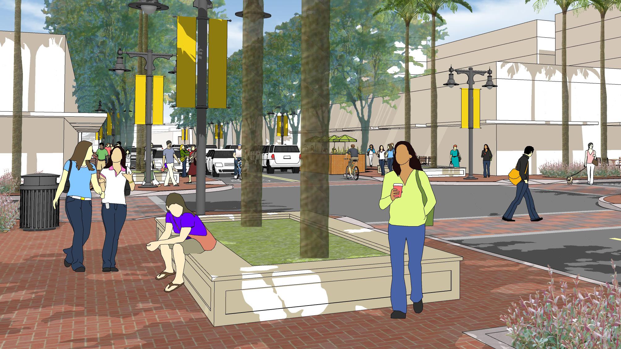
The Plan Area envisions a variety of safe and well-designed public spaces such as plazas, parklets, paseos, courtyards for social gatherings, festivals, and civic events connected to each other with a well-developed pedestrian network.
The Plan Area will boast of buildings with highquality architecture, durable materials, and highperforming building systems.
Promote the revitalization of El Camino Real into a “grand boulevard” that creates a welcoming gateway into Millbrae.
Improve pedestrian and bicycle mobility and enhance the streetscape along the corridor to create an inviting pedestrian environment. Encourage transit-oriented, residential, and mixed-use developments along El Camino Real that create an exciting place for people to live, work, shop, and play.

Cultivate a vibrant downtown. Create a physical space and the infrastructure to captivate a mix of businesses that serve the range of resident needs and attract visitors. Foster investment in public spaces that elevates downtown as an urban village thriving with community activity.
Preserve and enhance neighborhoods. Support the preservation and broadening of the existing housing stock, while encouraging innovative housing types and preserving bay views.


Provide a safe and complete transportation network that meets the needs of all users.
Focus on smart, safe, and seamless transportation improvements that reduce traffic, encourage walkability and bikeability, and increase accessibility between neighborhoods, downtown, and the intermodal station.
Enhance Millbrae’s character and reputation by creating vibrant places that bring community members together and draw visitors from the region.


Encourage Millbrae to remain an inclusive urban community with strong civic pride by improving and creating new public gathering spaces through public art, local landmarks, safety measures, and park or plaza improvements.

Nurture a sustainable urban environment.
Encourage walking, biking, and public transportation and reduce automobile dependence, noise, and harmful air pollutants. Strive to achieve Zero Waste and expanded electrical infrastructure, tertiary wastewater treatment, and urban forest. Promote the efficient use of natural resources including water, energy, and land, to reduce impacts on regional watersheds.
Provide all residents with excellent, equitable, and efficient city services. Protect the health and safety of residents and support a high-quality living environment by maintaining infrastructure, services, and programs that meet the needs of the community. Support increased use of technology to improve the equitable, transparent, and timely delivery of City services.
Promote a robust local economy. Foster economic growth by cultivating a diversity of businesses based on innovation, technology, and local entrepreneurship that provide highpaying jobs and increase the tax base. Emphasize the highest and best use of land for economic development, business retention, entrepreneurship, and growth in life sciences, retail, local services, other technology sectors.
Promote a healthy community. Encourage healthy lifestyles for all residents and visitors by increasing opportunities for physical activity, availability of nutritious foods, quality education, realistic living wages, access to affordable healthcare and childcare, options for affordable housing, clean air and water, and a safe environment that promotes walking and biking.
Increase and expand recreation opportunities.

Encourage active living by elevating recreation programming for persons of all ages and abilities, enhance parks and recreation facilities, and improve bike and pedestrian connections throughout the City and into neighboring cities.

The Goals and Policies set forth in this Specific Plan work in parallel with the 2040 General Plan. Many of the policies in the 2040 General Plan are applicable to the Plan Area. These documents collectively establish the policy framework for the community to realize its vision for the downtown and El Camino Real corridor.
Goal: A goal is a statement that describes, in general terms, a desired future condition or “end” state. Goals describe ideal future conditions for a topic and are intentionally general and broad. All future developments and improvements within the Plan Area will strive to achieve the goals to support the vision of the Specific Plan.
A Policy is a regulatory statement that guides a specific course of action for a decision-maker to achieve a desired goal. All future developments and
improvements within the Plan Area will be consistent with the policies.
Goal: Cultivate a pedestrianoriented, mixed-use environment in the downtown and along El Camino Real that supports vibrant commercial activity, maximizes transit use, enhances quality of life, and is well-scaled with surrounding neighborhoods.
** Downtown is generally defined as Broadway Avenue between Meadow Glen and Victoria Avenues including the parcels fronting El Camino Real with frontage streets.
The City shall support high quality infill development that provides a rich
mix of businesses, housing types, and community-serving uses and encourage public transit, walking, and biking.
The City shall encourage vertical mixed-use development with active ground floor uses, and residential and office uses on the upper floors.
The City shall prioritize higher density and intensity development along El Camino Real and establish a multimodal complete street, lined with a diverse mix of uses that are context sensitive and includes an attractive streetscape design that creates an inviting pedestrian environment and a positive city image.
The City shall encourage a mix of small- scale, infill development with community gathering places that serves residents and attracts more
pedestrian traffic, while enhancing the charming character of downtown.
The City shall consider opportunities to incorporate a mix of businesses that includes locally owned businesses as well as larger, anchor retailers.
The City shall establish a “community anchor” on the northern end of downtown to draw pedestrian traffic from the inter-modal Station along El Camino Real and through downtown. The community anchor will support large format development such as specialty retail, hospitality, entertainment venues, meeting facilities, and outdoor public space such as a park or plaza.
The City shall establish a neighborhood anchor on the northern end of El Camino Real to provide a compact concentration
of neighborhood-serving uses, including retail, a grocery store, cafes, restaurants, entertainment, and small offices. The neighborhood anchor should include small public spaces, such as a courtyards or parklets.
The City shall encourage property owners to collaborate to the extent feasible, coordinate development of their parcels to facilitate an integrated development project that advances the community’s goals for downtown and El Camino Real to be a destination for residents and visitors.
The public improvements needed in the Specific Plan Area, which include mobility improvements, water distribution system capacity, and sewer collection system capacity, shall be funded by the City’s development impact fee program, and other supplemental funding sources noted in the accompanying Financing Plan.
The City shall improve the alley between Broadway and El Camino Real from Taylor Boulevard to Victoria
Avenue to make it a visually attractive and vibrant space for people and businesses. Improvements may include an alley name, wayfinding signage, pavement improvements, landscaping, and public art. The City shall consider reviewing its development standards to allow for businesses and housing to front on the alley and consider implementing an Innovative Alley Toolkit for property owners, organizations, and businesses to use.
The City shall encourage the renovation and upgrading of existing office space and promote development of new smaller office spaces along El Camino Real to support local jobs and increase the tax base.
The City shall consider all applicable Federal statutes (including 49 U.S.C. 47107), Federal regulations (including 14 Code of Federal Regulations 77 et seq.), the Federal Aviation Administration (FAA) Airport Compliance Manual, FAA Advisory Circulars, other forms of
written guidance, and State law with respect to criteria related to land use safety and airspace protection when evaluating development applications within the Airport Influence Area of the San Francisco International Airport and Mills-Peninsula Medical Center helipad.
The City shall regulate land uses and building height within the Airport Influence Area of the San Francisco International Airport in compliance with SFO critical aeronautical surfaces (SFO ALUCP Exhs. IV-17 & IV-18) and receive a Determination of No Hazard from the FAA, in accordance with Airport Land Use Commission guidelines to assure safety of aircraft, persons, and property near the Airport. For avoidance of doubt, the lower of the two heights identified by the ALUCP and the FAA shall be the controlling maximum height.
The City shall require development projects within the Airport Influence Area designated in the Airport Land Use Compatibility Plan of the San
Francisco International Airport to comply with all applicable Federal statutes (including 49 U.S.C. 47107), Federal regulations (including 14 Code of Federal Regulations 77 et seq.), the FAA’s Airport Compliance Manual, FAA Advisory Circulars, other forms of written guidance, and State law with respect to criteria related to land use safety and airspace protection. Cranes and other equipment used to construct the building are also required to comply with all FAA federal statutes.
The City shall ensure that all future land use actions and/or associated development conforms to the relevant height, aircraft noise, and safety policies and compatibility criteria contained in the most recently adopted version of the Airport Land Use Compatibility Plan for the Environs of San Francisco International Airport.
Goal: Create districts with a distinct character that is well designed and creates a sense of place while being sensitive to surroundings.
UD-1:
The City shall support opportunities that transform El Camino Real into a livable corridor with enhanced streetscape design, street planting and buildings with high-quality architectural design, well-articulated facades and high-quality materials.
UD-2:
The City shall enhance the downtown experience for residents and visitors by building on downtown’s fine-grain fabric and quaint character, enhance the streetscape design, incorporate wayfinding, offer an outdoor dining experience, and incorporate social gathering spaces.
UD-3:
Require projects to orient entrances and frontages toward major roads, intersections, and public spaces.
neighborhoods by establishing objective development standards for building setbacks, upper floor stepbacks, building massing, and articulation.
UD-4:
The City shall require buildings along Broadway Avenue and El Camino Real to maximize street-activating retail and non-retail ground floor uses to create a vibrant and active street environment.
The City shall encourage new development to complement the character of nearby historic structures.
the provision of inclusionary affordable housing designated as deed restricted for very low, low, and moderate income households in conjunction with new development projects. They also establish requirements for affordable housing in-lieu fees for certain projects.
UD-5:
The City shall require new development to be integrated within the existing fabric of the surrounding neighborhoods to contribute to a cohesive community, by including well-scaled buildings, compatible programming, pedestrian connections and public spaces.
Goal: Encourage a wide range of affordable and accessible housing near transit.
UD-6:
The City shall ensure new development has an appropriate transition in scale between highdensity, mixed-uwse development along El Camino Real and adjacent
The City shall require new residential development to comply with Millbrae Municipal Code Article XXXIII. Affordable Housing On-Site and InLieu Fee Requirements and associated City Council Resolutions. These regulations establish requirements for
The City shall require new commercial development to comply with Millbrae Municipal Code Article XXXIV. Affordable Housing Commercial Linkage Impact Fee and associated City Council Resolutions. These regulations establish requirements for an affordable housing commercial linkage impact fee applicable to new commercial development projects to address the impacts of their projects on the demand for affordable housing by contributing to the supply of housing for households with extremely low, very low, low, and moderate incomes.
The City shall encourage developers to provide relocation assistance to residents who are displaced by the
redevelopment of their residence, including active support finding a new place of residence and the right of first return in the new development.
Goal: Enhance the sense of place in downtown and on El Camino Real to attract economic investment, improve quality of life, and promote the city as a desirable place to live.
The City shall improve and maintain the cleanliness of downtown, including but not limited to, controlling litter, providing additional trash receptacles, and increasing frequency of waste pickup and street cleaning.
The City shall support the development of consistent branding
features in downtown and along El Camino Real that define Millbrae’s image.
The City shall support festivals and events in downtown that draw residents, attract visitors, benefit local businesses, and evoke civic pride.
Goal: Provide a safe and wellconnected circulation network that promotes transportation mode choices, reduces vehicle traffic, and promotes healthy lifestyles.
The City shall encourage new development to use innovative parking solutions to decrease visibility of parking from El Camino Real and lower development costs while providing adequate parking.
These parking solutions may include reduced parking ratio requirements for key land-uses accessible to transit, mechanical and automated parking or shared parking, and/or use of car elevators instead of ramps.
The City shall consider implementing parallel parking on Broadway (Consistent with the recommendations of the Downtown and El Camino Real Streetscape Plan) to allow for increased sidewalk widths, subject to further study of parking provisions for adjacent businesses.
The City shall encourage structured, underground, or tuck-under parking in new development, and discourage new or expanded surface parking lots. Encourage shared parking facilities especially in downtown.
The City shall establish a new Parking In-Lieu Fee for the Specific Plan Area, and those funds generated for enhancement of parking.
The City shall prepare and implement a parking management strategy for the Priority Development Area (PDA) that considers the use of all available tools, including parking enforcement, to address parking issues within the PDA plan areas.
The City shall continue to explore new methods to prevent or reduce parking encroachment from commercial areas into existing neighborhoods (Example, through parking restrictions, resident permits etc.).
The City shall consider active parking management to expand downtown parking supply, including parking reservation systems, parking meters in public parking lots, wayfinding, digital real-time parking availability signs, priced parking, and potential parking structures and partnerships with new developments to provide parking available to the public.
The City shall implement smart parking meters in the Specific Plan Area that accept multiple forms of payment (credit cards and coins) and is accessible by a mobile app that allow users to locate available spaces and receive alerts when the meter is about to expire.
The City shall create an accessible circulation network, consistent with the Americans with Disabilities Act (ADA), that provides safe and accessible paths of travel for persons with disabilities between the intermodal Station, El Camino Real, and downtown.
The City shall provide wayfinding signage, consistent with the Streetscape Plan, along El Camino Real and in downtown, particularly at major intersections.
The City shall work with Caltrans to implement the Streetscape Plan and improve pedestrian crossings on El Camino Real to increase the predictability and visibility of pedestrians by providing complete sidewalk coverage, signal controlled crosswalks, minimizing the intersection footprint, reducing pedestrian crossing distances, shortening traffic signal cycle lengths, and using high-visibility treatments. These improvements shall focus on the intersection crossings along El Camino Real, and at Millbrae Avenue and the U.S. Highway 101 onramps.
The City shall work with Caltrans to add separated bicycle lanes on El Camino Real to increase cyclist safety, enhance connectivity, reduce automobile reliance, and encourage active lifestyle choices.
The City shall add and maintain bicycle routes along Magnolia Avenue
and Hemlock Avenue to provide lower volume and lower speed route alternatives to El Camino Real.
The City shall require new development to provide safe and secure bicycle parking facilities, such as bike lockers, bike storage rooms at ground level, and bike racks that allow for proper two-point locking.
The City shall work with partner agencies to encourage improvements to bus stops and addition of amenities along El Camino Real (e.g., shelters, trash receptacles, Wi-Fi) that encourage transit use, contribute to sense of place, and improve the public realm.
The City shall provide micro-mobility options such as bike and scooter shares, and design the streetscape and public plazas to accommodate docking stations, bike parking, etc.
The City shall incorporate elements along El Camino Real that provide multi-use curb lanes which accommodate a variety of curb uses such as on-street parking, ride-share pick-up/drop-off, loading, parklets, micro-mobility docking stations, etc.
Plan Area employers, property managers, and housing providers shall prepare Transportation Demand Management (TDM) Plans that include measures to increase the number of residents and employees walking, biking, using transit, or ridesharing (using carpools and vanpools) as commute modes and to reduce vehicle congestion. Where future projects have the potential to impact facilities under the Congestion Management Plan, the TDM Plan shall meet the current City/ County Association of Governments of San Mateo County (C/CAG) requirements to reduce the number of trips on the Congestion Management Plan roadway network and be approved by both the City and C/CAG. TDM Plans shall achieve at least a 20
percent reduction in trip generation, and the Plan shall include provisions for monitoring, enforcement, and assessment of financial penalties for non-compliance.
Goal: Establish a pedestrianoriented public realm that includes a network of public open spaces that are connected by safe pedestrian paths.
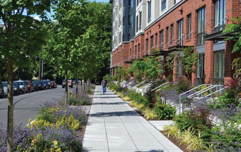
The City shall enhance the public realm to promote an engaging, safe, and comfortable pedestrian experience. Improvements should include the addition of plazas, parklets, outdoor seating, consistent street planting and other landscape elements, wide sidewalks, sidewalk furniture, and public art.
The City shall provide a network of public open spaces, including outdoor plazas, parks, and parklets, that is connected by pedestrian walkways and paths.
The City shall require open spaces and parks to incorporate sustainability measures, such as including native plant species and drought tolerant plants that require minimal irrigation, permeable paving, solar-powered lighting, and other similar features.
The City shall continue to require new residential development to pay the City’s Development Impact Fee for Park Acquisition and Facilities and Recreation Services. The purpose of the Park Acquisition and Facilities Fee is to acquire new parkland and to fund park facilities required to serve new development in the City to maintain the General Plan standard of three acres of improved parkland per 1,000
residents. The Recreation Services fee is to fund new development’s share of planned new recreation facilities or improvements to existing recreation facilities.
The City shall incorporate more public art downtown and at major gateways to the City on El Camino Real, including sculptures and murals. Provide opportunities for “art for the public” that is fitting and relevant to the context. Establish a new public art ordinance and in-lieu fee to facilitate art in the Specific Plan Area.
The City shall continue to require all residential subdivisions to dedicate land, pay a fee in lieu thereof, or both, at the option of the City, for park or recreational purposes, according to the most recent adopted standards and impact fees.
Goal: Encourage sustainable development at all scales that
includes buildings, public realm, private open space, and transportation and mobility infrastructure.
The City shall advance the goals of the Green Infrastructure Plan adopted in 2019 by implementing green infrastructure projects in the Specific Plan Area.
The City shall continue to require new development to comply with the City’s sustainable reach standards beyond the California Building Standards Code, which serve the purpose to reduce greenhouse gas emissions consistent with the City’s Climate Action Plan. They provide for various sustainable building features, including increased energy efficiency, use of renewable energy sources, and electric vehicle charging station expansion through increased requirements for building electrification, electric vehicle infrastructure, and non-residential solar photovoltaic systems.
Building on the community vision and the General Plan Guiding Principles, the Downtown and El Camino Real Specific Plan establishes a planning framework for guiding the character of infill development, streetscape and public realm improvements, prioritization of transportation improvements to support future growth, and placemaking strategies to create a strong sense of place.
This chapter discusses the plan frameworks below, which inform the standards and guidelines described in Chapter 5.
1. Land Use and Urban Design Framework
2. Public Realm and Streetscape Framework
3. Circulation Framework
The Land Use and Urban Design Framework serves as the foundation for creating a vibrant downtown district along Broadway which will attract-both-residents and visitors; and for transforming El Camino Real into a grand boulevard lined with shade trees, wide sidewalks, and a rich mix of uses that support economic vitality, active mobility, and a thriving social life.
The framework identifies four districts with a distinctive character lent by the mix of land uses, intensity of development and emphasis of ground floor programming. The four districts, listed below, are cohesively tied together by the Streetscape and Public Space Framework and the Circulation Framework.
1. Downtown District

2. Community Anchor
3. North El Camino Real Neighborhood
4. Neighborhood Anchor
The Land Use and Urban Design Framework recognizes the future Station Area as a regional anchor.
The Millbrae Station Area Specific Plan (MSASP, adopted in 2016)
envisions mixed-used transit-oriented development that encourages a 24/7 environment with a high-quality public realm and regionally serving high intensity uses such as hotel, offices, large format retail and high-density residential at the inter-modal transit hub, connecting Millbrae with the San Francisco Peninsula, the East Bay, and the San Francisco International Airport (SFO).
The four districts identified by the Land Use and Urban Design Framework will function synergistically with the station area to create an active and vibrant living environment within the Specific Plan area.
An artist’s impression of a Grand Boulevard - Boulevard St. Germaine Credits: Rens Gallery, Inc., NYC
Key Transportation & Streetscape Enhancements Key Connectors


The Downtown District is bookended by the station area to the south and the Community Anchor to the north. This district will have carefully curated infill development that has a distinctly different character than the two anchor districts that flank it on either side.
The Specific Plan seeks to build on the existing fine-grain fabric of the Downtown core and envisions it as a walkable district for shopping, dining, entertaining, gathering, working, and living, thus establishing it as a vibrant activity hub offering a unique experience.
It will have diverse uses ranging from restaurants, small shops, community serving retail, community gathering and small event spaces, small offices, and residences on the upper floors to support daytime and evening activity. While Broadway will continue to serve as the spine of the downtown district, the perpendicular streets between Victoria Avenue and Meadow Glen will have active uses on the ground floor including shopping, dining, and entertainment.
The Specific Plan proposes streetscape enhancements to create a

cohesive, clean, and vibrant downtown district that defines Millbrae’s unique identity and brand in the region. Proposed improvements include wider sidewalks with street planting, landscaping, outdoor dining, lighting, furnishings, paving, gateway elements, and public art. The Plan envisions a network of outdoor public spaces such as small parks, plazas, paseos and parklets integrated with active ground floor programming, that encourage spontaneous social interaction and bring the community together. Additionally, the plan proposes using streets, and public and private parking lots for temporary programming such as farmer’s market, pop-up music events, street fairs, performing arts festivals, etc.
The downtown district will serve as a place for the community to come together, fostering the idea of a downtown for all ages. Improved circulation focusing on pedestrian linkages and crossing improvements at El Camino Real and clear pedestrian connections to the Inter-modal Station will draw pedestrian traffic from the Station Area and El Camino Real to the downtown.
 Well-scaled mixed-use development with active ground floor use will contribute to a livable and active downtown district
DISCLAIMER: This image is for representation purposes only. It is a conceptual massing model, not a final built-out model.

The Community Anchor is envisioned as a destination that will draw people from the station area, through the Downtown District. It will complement the Downtown District with uses that expand the Downtown experience but need a larger footprint than what downtown can offer. A mix of uses that will give this district a unique identity includes: large format specialty retail, grocery stores, lifestyle stores, medium to high density residential, a hotel, and multi-purpose facility for meetings, conferences and community events. High-density uses will be complemented with high quality public realm design and publicly accessible open spaces.
The character of the overall district will simultaneously respond to El Camino Real and to Broadway for the parcels that front those respective streets. There will be clearly defined and safe pedestrian circulation paths that connect this district with the adjacent streets.

 Community Anchor district offers opportunity for large floor plate development with highquality public space

The North El Camino Real Neighborhood, just north of the Community Anchor, will be a predominantly residential district with ground floor retail at key intersections. This area serves as a transition zone between the Community Anchor and the Neighborhood Anchor.
The western side of El Camino Real lends itself to fine grain low- to medium-intensity infill development, such as townhomes and five to seven story multifamily residential that is compatible with adjacent singlefamily residential neighborhoods.
The eastern side of El Camino Real can accommodate larger footprints and is suitable for high-intensity development, such as hotels, mixeduse residential, or limited office commercial. Active ground floor uses such as small offices and other neighborhood-serving uses including co-working spaces, a fitness use, and eating and drinking establishments are appropriate for this district.

The Neighborhood Anchor is a compact concentration of neighborhood-serving uses such as retail, eating and drinking establishments, fitness uses, studios, small offices, and other neighborhood services. In the future, the district will build on the existing character, with some dense residential uses planned to complement the commercial areas. Small public spaces in the form of courtyards, parklets, and widened sidewalks will encourage more pedestrian activity and provide community gathering space for nearby neighborhoods.
 Small infill and mixed-use development with good public realm design will create a strong neighborhood anchor, which will serve as a “gateway” at the northern boundary of Millbrae
DISCLAIMER: This image is for representation purposes only. It is a conceptual massing model, not a final built-out model.
 FIGURE 4.4: RENDERING OF POTENTIAL FUTURE CONDITIONS AT NORTH EL CAMINO REAL
Well-designed streetscape and public realm are key contributors to a strong sense of place and economic development in a community, as they attract private investment and future residents, workers, and visitors. The Specific Plan proposes a network of a variety of public open spaces that are connected with safe pedestrian paths along the key circulation routes and key connector streets. The types of public spaces envisioned are downtown plaza, parklets, paseos, mews, and courtyards. The Plan Area will have a well-designed, cohesive streetscape with functional and safe street furniture, lighting, signage, consistent street planting, and other landscape elements that create a unique identity for downtown Millbrae and for El Camino Real.
A plaza in the heart of Downtown would be a vibrant public place that offers the community a space for social gathering and temporary programming such as outdoor music,

art fairs, food festivals, etc. It will also serve as a place for downtown employees, shoppers, and visitors to take a break, enjoy an outdoor lunch, and other passive recreational activities. It will showcase Millbrae’s unique spirit and be the pride of the community.
Downtown and the Community Anchor districts provide the most opportunity for including paseos to serve as pedestrian linkages between various uses, improving walkability. Paseos will also serve as outdoor dining spaces and hang-out spots, protected from the elements. Features such as public art, interesting lighting and creative landscape can enliven the paseos and create a unique experience. Paseos introduced between El Camino Real and Broadway Avenue will create additional pedestrian connectivity to downtown drawing more foot traffic to support downtown businesses.

Pedestrian Priority Route
Pedestrian Linkages
Parklets
Existing Open Space
Parkway
Downtown Alley PedestrianPriority Routes
Downtown-focus Streetscape Improvements
El Camino Real MultiModal Complete Street
El Camino Real Promenade “Grand Boulevard”
Millbrae City Limits
Downtown and El Camino Real Specific Plan Boundary
MSASP

There is an opportunity to introduce parklets along Broadway and along El Camino Real on blocks with frontage street. They will typically replace up to two on-street parking spaces. Parklets are well-suited in mixed-use zones in front of cafes, restaurants, and small-format retail. They will help activate the street and support businesses by providing outdoor areas for commercial, retail, and restaurantcentric programming.
Temporary programming is a great way to activate public spaces. It also allows for a variety of programming without the need for permanent infrastructure. Possible temporary programs include:
• Weekly Farmers Market
• Millbrae Art and Wine Festival
• Millbrae Cultural Celebration
• Performing Arts Festivals
• Pop-up Events
• Street Fairs/Maker Faires
Streets are an integral part of the public realm that serve multiple functions. Therefore, design of the street right-of-way and a cohesive design of streetscape elements is vital to creating a sense of place and sense of community.

The Millbrae Streetscape Plan (Appendix A) is an accompanying document to the Specific Plan that defines potential changes to the roadway layout and function, including roadway geometry, number of travel lanes, bicycle facilities, transit and multimodal facilities, sidewalk width; and improvements to the design character of the corridors, including pavement materials, furnishings, lighting, planting, wayfinding and public art. Additionally, the Streetscape Plan describes greeninfrastructure opportunities.
As a conceptual plan, it will guide the next steps of the design and implementation process. Given the significance of the proposed changes to El Camino Real, the plan describes a potential phasing strategy for that corridor.


El Camino Real, Broadway, and Millbrae Avenue are the primary vehicular circulation paths within the Plan Area. The Specific Plan identifies them as key transportation and streetscape enhancement projects. El Camino Real is envisioned as a multi-modal complete street with a modified configuration to accommodate separated bike lanes in each direction, as well as improved sidewalks and crossings for pedestrian safety. Millbrae Avenue will also have new bike lanes and shared bicycle and pedestrian paths that connect with the Bay Trail. Broadway Avenue, as the main downtown street, is envisioned to have an enhanced streetscape, reconfigured on-street parking, and parklets for outdoor cafés or other recreational uses.
El Camino Real will be a multi-modal corridor with well-managed traffic flow that provides a safe environment for pedestrians, cyclists, and transit riders. The corridor will have a mix of new development, including multifamily residential, offices, hotels, conference/ meeting spaces, cultural amenities, retail, and restaurants that create a human-scaled environment. It will be
a vibrant district with active ground floor uses, safe sidewalks, highquality public realm, an enhanced streetscape, and a cohesive built form. Transportation improvements within the Plan Area will support the needs of the youngest to the oldest community members, by offering multi-modal transportation choices. The ease of connectivity between

existing neighborhoods, Downtown, the El Camino Real corridor, and the Station Area will be a distinguishing characteristic of Millbrae. The city will exemplify a high quality of life and ensures safety for all.
The Streetscape Plan (Appendix A) details improvements to El Camino Real and Broadway.
Millbrae City Limits
Downtown and El Camino Real Specific Plan Boundary
Regional Connector Street
Streetscape Enhancements
Poten�al Pedestrian Connectors
Bicycle Facili�esExis�ng
Bike Facili�es - Proposed
Refer to the ATP
Under Study
Enhanced Signal Crossings
Enhanced Interchange Crossings
High- Visibility Crossings
This chapter sets forth land use regulations, development standards and guidelines to ensure that all future development and public space are in alignment with the vision and goals of the Specific Plan. The land use regulations along with objective development standards and design guidelines, establish a clear regulatory framework for reviewing future development applications, public space improvements, and prioritizing capital improvement projects.
The regulations and standards in this section ensure that future development is compatible with the existing scale and character of adjacent development and are contributing to overall placemaking. While the development standards regulate the form and intensity of future development, there is flexibility in the corresponding land uses to provide the ability to respond to changing market demands.
The following land use designations allow for a wide variety of uses to create mixed use districts within the Plan Area. They describe the appropriate mix of uses to achieve the intended character in each district. The Land Use designations along with development standards will be the primary tool for regulating the form and character of future development. The Specific Plan proposes five land use designations.
The purpose of the Downtown Mixed-use designation is to maintain the existing economic base of the downtown while enhancing vibrancy of the downtown district by encouraging diversity of businesses and longer hours of activity.
Key characteristics of the Downtown Mixed-use designation are described below:
• Active ground floor uses, predominantly retail as well as non-retail uses such as banks, fitness uses, eating and drinking establishments, personal service uses, gallery space, entertainment or community gathering space may be allowed.
• Vertical mixed-use development with residential and office uses on upper floors to encourage increased customer base for the restaurant and retail businesses as well as after-hours activity that residential uses bring.
• Building Heights: Maximum building heights allowed range from 55’ on parcels fronting Broadway Avenue; and maximum of 85’ on parcels fronting El Camino Real.
• Minimum ground floor height of 14’ from finished floor to finished ceiling.
The purpose of this designation is to create opportunity for higher intensity development along El Camino Real corridor on parcels of varying sizes. The Corridor mixed use will take advantage of proximity to the intermodal stations and multi-modal complete street that El Camino Real is envisioned to be by allowing a mix of uses along the corridor.
Key characteristics of the Corridor
Mixed-use designation are described below:
• Vertical mixed-use development will include residential, office, hotel, meeting rooms, small convention
facility, lifestyle stores, specialty large format retail, entertainment, and cultural facility.
• Commercial preference area indicates parcels where commercial use is required either (1) if currently developed with commercial space to retain the same square footage of commercial space if redeveloped or (2) if vacant or occupied by non-commercial uses, the majority of the square footage in the new development project must be commercial. This serves to take advantage of the larger parcel sizes and to complement uses in the downtown. Hotels are strongly encouraged, with the tallest heights of 125’ on these sites.
• All new development in the Commercial Preference Area shall comply with the following requirements: (1) if currently developed with commercial space to retain the same square footage of commercial space if redeveloped or (2) if vacant or occupied by non-commercial uses, the majority of the square footage in the new
Downtown Mixed Use
Corridor Mixed Use
Neighborhood
Commercial Mixed Use
Residential Focused Mixed Use
Residential*
Commercial Preference Area
* General Plan Land Use Designations apply
4 5
Millbrae City Limits
Downtown and El Camino Real Specific Plan Boundary
Runway Protection Zone-Object Free Area
SFO Safety Compatibility Zones 1 Inner Approach/Departure Zone 2
Inner Turning Zone 3
Outer Approach/Departure Zone
Sideline Zones
development project must be commercial.
• Ground floor should have uses such as restaurants, cafes, retail, small offices, maker spaces, grocery stores, entrance lobbies, galleries, fitness centers, and community centers that contribute to a lively street environment.
• Building Heights: Maximum building heights allowed range from 65’ fronting Broadway Avenue and the railroad; 85’ fronting El Camino Real and 125’ on larger parcels such as 900 to 1100 El Camino Real.
• Minimum ground floor height of 14’ from finished floor to finished ceiling.
Purpose
The Residential Focused Mixed-use designation focuses on medium to high-density multi-family residential use to allow a variety of multi-family residential typology such as town homes, stacked flats, senior housing, live-work units, co-living, etc. with high quality shared amenities. This designation allows commercial uses on the ground floor to create opportunity for neighborhood scale
and local businesses, and to provide space for community-serving uses.
Key characteristics of the Residential Mixed-use designation are described below:
• Vertical mixed-use development is encouraged with residential on upper floors while allowing for nonresidential uses on the ground floor.
• Ground floor may include uses such as cafes, neighborhood serving retail, community gathering space, galleries, professional offices, co-working spaces, small meeting rooms, community kitchens, maker spaces, serviceoriented businesses, and residential stoops that contribute to a lively street environment.
• Building Heights: Maximum building heights allowed, range from 55’ on parcels adjacent to existing single-family neighborhoods to 85’ along El Camino Real.
• Minimum ground floor height of 15’ from finished floor to finished ceiling for non-residential uses.
The Neighborhood Commercial Mixed-use designation intends to strengthen the neighborhood-serving function of the Neighborhood Anchor district by concentrating small offices for service-oriented businesses, retail, restaurants, live-work units and some residential use on the upper floors.
Key characteristics of the Neighborhood Commercial Mixed-use designation are described below:
• Vertical mixed-use development with small offices, live-work units, or residential use on upper floors
• Ground floor may include uses such as cafes, neighborhood serving retail, community gathering space, galleries, co-working spaces, maker spaces, serviceoriented businesses, commercial kitchens.
• Building Heights: Maximum building height allowed is 55’
• Minimum ground floor height of 15’ from finished floor to finished ceiling;
The Residential designation includes parcels that will remain unchanged as there is less potential for redevelopment and the preservation of existing scale and character is preferred due to adjacent context. This designation complies with the Residential designation of General Plan 2040.
The Specific Plan Development Program is an estimate of development that would occur in the Plan Area over a 20-year planning period. It is the basis for the Plan’s environmental analysis and infrastructure capacity analysis. Since there are many factors that will influence the implementation of the Plan, it is challenging to project the exact amount of development that will occur during the planning period. Therefore, the Specific Plan Development Program does not assume one hundred percent buildout at the increased capacity allowed for by The Plan. Instead, it assumes percent likelihood of redevelopment
of parcels. Factors that will influence redevelopment of parcels include:
• Physical condition of existing buildings on parcels;
• Parcel Ownership - contiguous parcels under the same ownership are considered to have a higher likelihood of redevelopment. While smaller parcels under multiple ownership that requires parcel assembly are considered to have a lower likelihood of redevelopment;
• The physical size and configuration of developable parcels influencing feasibility of a project;
• Response to adjacent land use/ development context;
• Projected market demand, for various land uses including residential, retail, commercial, offices, restaurants, etc.
Table 5.1 does not represent a development cap restricting buildout beyond these assumptions, but rather the amount of likely development studied for the purpose of environmental analysis and infrastructure demand projections. If this program is exceeded for any specific land use during Plan build-out, additional environmental and/or infrastructure analysis may be required.
Table 5.2 indicates the land uses that are permitted, conditionally permitted, and prohibited within each land use designation. All permitted and conditionally permitted land uses shall be compatible with the policies of the SFO ALUCP, as detailed in Appendix D. If a specific land use or activity is not defined in Table 5.2, the Community Development Director
shall assign the land use or activity to a use type that is substantially similar in character. Use types not listed in the table or not substantially similar to the uses below are prohibited unless the Community Development Director makes a written determination that an unlisted proposed use is substantially equivalent to a permitted or conditionally listed use and is permitted if all of the following findings can be made:
1. The use is no greater in density or intensity than other permitted uses in the applicable zoning district;
2. The use is compatible with permitted or conditionally permitted uses in the applicable zoning district;
3. The use will be consistent with the purpose and intent of the applicable zoning district and Specific Plan;
4. The use is consistent with applicable goals and policies of the General Plan and Specific Plan; and
5. The use will not be detrimental to the public health, safety, or welfare.
When the Community Development Director determines that a proposed use is equivalent to a permitted or conditionally permitted listed use, the proposed use shall be treated in the
same manner as the listed use with respect to development standards., permits required (including the need for conditional use permit or any other planning entitlement), and all applicable requirements of the Zoning Code.
• Permitted by right (P)
• Conditional Use Permit Required (C)
• Not Allowed (-)
• Permitted when part of a Mixeduse Structure (*)
Existing Legal Nonconforming Uses. Where a use is classified as a “conditional use” under this chapter and exists as a permitted use at the date of the adoption of this chapter, it shall be considered a legal use, without further action of the Planning Commission or City Council.
Land Use Designations
RFMU: Residential Focused Mixed Use
NCMU: Neighborhood Commercial Mixed Use
DMU: Downtown Mixed Use
CMU: Commercial Mixed Use
P : Permitted by right
C : Conditional Use Permit Required
- : Not Allowed
* : Permitted when part of a Mixed-use Structure
1a
Theaters, meeting halls, conference centers, and other places of assembly seating more than 300 people are prohibited in SFO Safety Compatibility Zone 2.
1b Large child day care centers, which are commercial facilities defined in accordance with Health and Safety Code, Section 1596.70, et seq., and licensed to serve 15 or more children, including noncommercial employer-sponsored centers, are prohibited in SFO Safety Compatibility Zones 2. Large child day care centers are prohibited in SFO Safety Compatibility Zones 3.
1c Light Industrial facilities in Safety Compatibility Zone 2 of ALUCP shall not include hazardous uses as defined by the SFO ALUCP, Policy SP-3 on pages IV-33 and IV-34.
1d Utility services in Safety Compatibility Zones 2, or 3 of ALUCP shall not include critical public utilities that, if disabled by an aircraft accident, could lead to public safety or health emergencies. These critical public utilities include electrical power generation plants, electrical substations, wastewater treatment plants, and public water treatment facilities.
2 Public Electric Vehicle Charging Stations are not permitted as a primary use, but projects may integrate them with a public parking.
General Notes:
• Any use that requires a Conditional Use Permit (C) shall require Planning Commission approval, subject to appeal to the City Council.
• Any use that requires an Administrative Permit (C) shall require Community Development Director approval, subject to appeal to the Planning Commission.
• An asterisk (*) indicates that the use is allowed only when it is part of a mixed-use building.
• A double asterisk (**) indicates that the use is allowed only when it is on the ground floor of a mixed-use building
• A triple asterisk (***) indicates the use is only permitted within 1000 feet from another establishment of the same use listed.
• Projects within SFO Safety Compatibility Zones 2, and 3 must comply with the ALUCP policies and criteria as described in Policy SP-2, Safety Compatibility Land Use Criteria; Table IV-2, Safety Compatibility Criteria; and Policy SP-3, Hazardous Uses (see pages IV-27 through IV-34 of the SFO ALUCP, November 2012, or the latest adopted ALUCP).
• All permitted and conditionally permitted land uses shall be compatible with the policies of the SFO ALUCP, as detailed in Appendix D.
The Specific Plan uses a combination of development standards and guidelines to establish the baseline for the desired quality of future development that the City seeks to achieve. Standards are a set of mandatory rules that new development is required to follow. They shape the overall urban form by regulating lot coverage, building placement, size, height, and massing through objective and measurable rules. (Per State law, an objective standard is one that involves no personal or subjective judgment by a public official and is verifiable by reference to criteria known to both the applicant and the reviewer). Guidelines are not mandatory rules but are encouraged to achieve elements of good design that are not measurable or easily defined, but are essential to creating the overall character, aesthetics and experience of a place.
The standards and guidelines are intended to:
• Encourage redevelopment of vacant and underutilized parcels to accommodate future growth; encourage economic development
and achieve state mandated Regional Housing Needs Allocation (RHNA) goals.
• Ensure compatibility with existing development
• Encourage transformation of El Camino Real Corridor from an auto-dominated corridor to a humane, pedestrian-friendly street with safe and easy connections to the downtown and to the intermodal station
• Achieve design of architecturally interesting and appropriately scaled buildings to produce high-quality living and working environments that contribute to creating vibrant and active urban districts.
• Create high-quality public spaces and streetscape for safe and attractive pedestrian experience to support a thriving social life.
• Build community recognition by creating a unique experience for residents and visitors through welldesigned buildings, public spaces, events, programs and multi-modal mobility choices.
• Provide staff a set of objective criteria to evaluate projects
during the design review and approval process, and to provide of design tools they can share with applicants that will help achieve the quality of development desired by the Millbrae community.
These standards and guidelines will complement other regulatory tools such as Millbrae’s General Plan 2040, Municipal Zoning Code, city-wide Objective Development Standards for Multi-family Residential, and the Active Transportation Plan for mobility improvements. Additionally, prevailing state laws and regulations will be applicable to future development in the Plan Area.
This section addresses the following standards and guidelines numbered as DSG-x:
• DSG-1 Development Intensity, Density and Height
• DSG-2 Building Setbacks
• DSG-3 Massing and Modulation
• DSG-4 Active Frontage
• DSG-5 Off-Street Vehicular Parking
• DSG-6 Loading Access
• DSG-7 Public Realm Design
• DSG-8 Open Space in Private Realm
• DSG-9 Public Art
Development Standards are numbered as DS-x.x and Guidelines numbered as G-x.x
Development intensity and building height are defining features in establishing the overall character, aesthetics, and experience of a place. The Downtown and El Camino Real Specific Plan uses, Floor Area Ratio (FAR), residential densities and building height to regulate the building envelope.
Floor Area Ratio (FAR) determines the total amount of built sq. ft. on a parcel. It is the ratio of gross floor area
of all buildings and structures to total area of the parcel. The gross floor area will be calculated as defined in the City’s Zoning Code. Development in the Plan Area shall not exceed the allowable FAR. See Table 5.3 for allowable FAR for each land use designation.
The FAR for each land use designation is defined as a range to account for a wide range of parcel sizes. The FAR is determined based on the purpose each land use designation seeks to achieve and the feasibility of development within the maximum allowed building heights. For example, the Specific Plan prioritizes blocks within half a mile of the transit station and larger blocks along El Camino Real, for higher intensity development. Therefore the Corridor Mixed Use designation allows higher FAR.
Density is defined as the ratio of total number of dwelling units to the size of a parcel (net lot area). It is conventionally defined as total dwelling units per acre (Du/Ac).
Density of a multi-family residential development depends on the average unit size built. The density (Du/Ac) of a development will be higher if the average unit size is 800 sq. ft. than if the average unit size is 1200 sq. ft.
The Specific Plan establishes a range of possible density that can
be achieved within the allowable maximum FAR and building height limits established in The Plan. See Table 5.3 for the density range for each land use designation.
The Specific Plan assumes an average unit size of 900 sq. ft. to calculate the density, which is consistent with current Bay Area market conditions.
Maximum allowable building heights work together with development intensity standards to regulate the urban form. The majority of existing buildings in the Plan Area are quite low. The Specific Plan Vision, and the proposed land uses are expected to result in a significantly high projected growth and economic development. Additionally the Plan Area offers many opportunity sites to fulfill the RHNA (Regional Housing Needs Allocation) goals. Increasing allowable building heights in the Plan Area will create optimal conditions for accommodating projected growth.
Key factors that inform density and height limits established for the Plan Area are:
• Parcel size and realistic estimation of the amount of development that can be accommodated on the parcel;
• Amount of parking that can be accommodated on the parcel to fulfill associated parking requirement;
• Height and scale of adjacent buildings and neighborhoods;
• Width and scale of adjacent streets;
• Desired character and intent of each land use designation;
• Proximity to historic buildings;
• Proximity to the inter-modal station;
• Fulfillment of RHNA goals;
• Feasibility of construction type;
• Financial feasibility of the development;
• Flexibility to accommodate evolving construction and parking technology that sometimes needs taller floor to ceiling heights (for example modular construction or mechanical stacked parking);
• Nature of development proposals submitted to the City in the past year.
• The Plan Area is located within the San Francisco International Airport (SFO) environs. Therefore, development within the Plan Area is subject to height limits imposed by the Federal Aviation Administration (FAA) for operations at SFO and the San Francisco
Airport Land Use Compatibility Plan. All development projects shall be consistent with the SFO Airport Land Use Compatibility Plan (ALUCP). For avoidance of doubt, the lower of the two heights identified by the ALUCP and the FAA shall be the controlling maximum height.
Fig 5.2 shows the maximum allowed building heights in the Plan Area.
Height (of a Building or Structure)
The measurement of the greatest vertical distance above the exterior finished grade to the highest point of the building immediately above, exclusive of antennas, chimneys, and roof equipment. The height of such antennas, chimney, roof equipment, or other rooftop structures shall be no more than otherwise permitted by the California Building Code. The height of a stepped or terraced building is the height of the tallest segment of the building. Height is measured using the height definition above. The Plan Area is located within the San Francisco International Airport (SFO) environs. Therefore, development within the Plan Area is subject to height limits imposed by the Federal Aviation Administration (FAA) for runways at SFO and the San Francisco Airport Land Use Compatibility Plan. All development projects shall be consistent with the SFO Airport Land Use Compatibility Plan (ALUCP). The ALUCP measures height based on Mean Sea Level (MSL) – not based on the distance above exterior finished grade. The lower of the two standards shall apply.
The SFO ALUCP describes critical airspace surfaces in terms of height
above MSL. In order to be consistent with the SFO ALUCP, specific development projects must adhere to the maximum allowable heights in the ALUCP, as stated in MSL. Developers of proposed projects must take into consideration the current grade of the site in relation to MSL in addition to the Above Ground Level (AGL) heights of proposed structures to determine compliance with the ALUCP height limits. Developers of proposed projects shall provide the height of additional objects (towers, antennas, solar equipment, air conditioners, elevator equipment enclosures, etc.) extending above the main building roof. These objects will be considered in airport land use compatibility airspace evaluations per Section 4.5.2 of the SFO Airport Land Use Compatibility Plan.
Developers of proposed projects should be notified at the earliest opportunity to file Form 7460-1, Notice of Proposed Construction or Alteration, with the FAA for any proposed project that would exceed the FAA notification heights.
Projects shall comply with the ALUCP Sections 4.5.4 and 4.5.5 as may be amended.
Downtown Mixed Use (DMU)
• Maintain the existing economic base of the downtown while enhancing vibrancy of the downtown district by encouraging diversity of businesses and longer hours of activity.
3.5
• Create opportunity for higher intensity development along El Camino Real corridor on parcels of varying sizes.
• 25 to 50 Du/Ac on parcels fronting Broadway Ave.
• 70 to 110 Du/Ac on parcels fronting ECR
Corridor Mixed Use (CMU)
• Take advantage of proximity to the inter-modal stations and multi-modal complete street that El Camino Real is envisioned to be by allowing a mix of uses along the corridor.
3.5 70 to 130 Du/Ac
Residential Focused Mixed Use (RFMU)
• Focuses on medium to high-density multi-family residential use to allow of a variety of multi-family residential typology such as apartments, stacked flats, senior housing, live-work units, co-living, etc. with high quality shared amenities
• Allows commercial uses on the ground floor to create opportunity for neighborhood scale and local businesses, and to provide space for community serving uses.
Neighborhood Commercial Mixed Use (NCMU)
Residential
• Allows small offices for service-oriented businesses, along with retail, to strengthen its neighborhood serving function, within the Neighborhood Anchor district with residential use on upper floors.
• Unchanged. Defined in General Plan 2040
2.5 60 to 80 Du/Ac
2.5 80 Du/Ac
Refer to General Plan and Zoning Code
Refer to General Plan and Zoning Code
Maximum building height is 65’ up to minimum of 60’ from property line on parcels adjacent to the railroad and single family neighborhood to the east.
(Note: All heights must be compatible with the SFO ALUCP)
Maximum building height is 55’ up to minimum of 30’ from property line on parcels adjacent to single family homes.
*Note: Heights governed by MSASP. Included here for reference.
A ratio of street width to building height, where the street width (or distance between building facades across the street) is twice as wide as the heights of buildings on either side of the street (2:1) is considered as optimal for the following reasons:
• The buildings provide a sense of comfortable enclosure without blocking view of the sky from the street or from all floors of the building;
• Allows penetration of daylight to the ground plane and to the interior spaces of the buildings.
In urban settings, the optimal ratio is not always achievable due to other factors that determine building heights. In such instances, providing setbacks from the front property line and stepping back upper floors of the building is required to achieve the ratio. Streetscape elements such as trees, street lighting, vertical signage, etc. help to provide more definition to the streets.
Fig 5.3 illustrates two conditions along Broadway Avenue. The first crosssection is a condition where there is an existing building 40’ tall on one side of the street and a proposed building across the street at the
maximum allowed height of 55’. In both conditions, buildings over 40’ tall challenge the ratio of 2:1. Therefore, an objective standard is established in this Plan requiring that floors above 40’ height are stepped at least six feet from the building wall directly below.
Fig 5.4 illustrates cross-sections along El Camino Real at two segments. On the southern segment of ECR with frontage streets on the west side, the distance between property lines is 155’. In this segment, the ratio is achieved with buildings at the maximum allowed height of 85’ on either side of the street when built to property line. But in the northern segment of ECR without frontage street the distance between property line across the street is 120’. In this condition, the optimal ratio cannot be achieved if 85’ tall buildings on either side are built to property line. It is therefore, an established objective standard that in this segment the buildings on one side of the street are set back from the property line, and floors above 65’ height are stepped at least six feet from the building wall directly below.
Since this segment of ECR is expected to have predominantly multi-family residential, the setback from the property line also creates space for stoops and landscaping for privacy, as well as the required on-site
stormwater treatment and/or retention facilities.
Broadway - with existing building on one side and proposed maximum height on the other side.
Broadway - with buildings at proposed maximum heights on both sides.
ECR NORTH WITHOUT FRONTAGE STREET
DS-1.1: All new development in the Plan Area shall comply with the maximum allowed building heights illustrated in Fig. 5.2.
• The Specific Plan proposes taller heights on parcels along El Camino Real for appropriately scaling buildings to the width of El Camino Real and to allow for higher intensity development on the corridor. The Plan proposes to step down heights of buildings or portions of buildings fronting Broadway Avenue, and on along the eastern edge of the Plan Area.
DS-1.2: In mixed-use buildings with non-residential ground floor uses, minimum ground floor height from finished floor to finished ceiling shall be 14’.
• Recommended height of nonresidential ground floor is 18’-20’ to allow for high quality retail/ restaurants/office spaces and stacked parking behind active frontage.
• In buildings with residential use on the ground floor, the plinth shall be raised above street level by a minimum of 3’ and maximum of 4’ for providing privacy in ground floor units.
(*Raising the plinth above 5’ creates a blank facade at the pedestrian level, which is not desirable for creating an active street environment).
DS-1.3: Roof mounted equipment, solar panels, etc. shall be excluded from building height calculations, but shall be fully screened from view.
DS-1.4: Rooftop elements that may need to exceed maximum building height shall not exceed 15’ beyond the maximum height limit. Heights, including rooftop elements, must be compatible with the SFO ALUCP and must receive a Determination of No Hazard from the FAA.
DS-1.5: Architectural elements used for articulating building corners shall not exceed more than 10’ above maximum building height limit, subject to the maximum heights in the San Francisco International Airport Land Use Compatibility Plan.
G-1.1: Buildings should be designed to provide adequate light, air and privacy for residential units in the project as well as on adjacent properties by providing a separation of minimum 15’ between buildings. Windows on building facades facing each other,
should be offset to maximize privacy or located above eye-level.
G-1.2: Balconies should be avoided on facades that overlook backyards and single family homes.
G-1.3: Conducting shadow studies is strongly recommended during project design, to minimize shadows on adjacent lots and buildings, especially where taller buildings are adjacent to existing low-rise buildings.
G-1.4: If the adjacent property contains historic resources, the new development should be sensitive to it by maintaining consistency of proportions of architectural elements, facade articulations, and eaves and rooflines.
• The 45 to 60 foot height limit is consistent with Type V construction (wood frame and wood frame over Type I podium, with the lowest construction costs). It can accommodate 4 to 5 stories tall residential building or 3 to 4 stories tall commercial building.
• The 65 to 85 foot height limit allows for Type III modified (wood frame over Type I podium) can typically accommodate 6 stories residential building or 5 stories commercial building.
• Type I (concrete frame, where the top habitable floor level is less than 75 feet above grade, meaning fire ladders can reach them). The shift to Type I if the building is taller than eight stories typically requires additional fire safety measures, including electronic fire alarm signalization system. Type I (where the top habitable floor level is more than 75 feet above grade) is the most expensive construction type and represents the greatest jump in construction costs.
New buildings built across the street from existing single-family neighborhoods shall not exceed the building height derived by drawing a line at 45 degree angle starting 10’ from the building face.
Fig 5.5 illustrates this condition on parcels fronting El Camino Real with single family neighborhoods to the east.
New buildings on parcels between El Camino Real and Broadway, shall step down in height facing Broadway to create appropriate transition to existing development and to maintain an optimal street width to building height ratio on Broadway.
Fig 5.6 illustrates this condition.
Placement and orientation of building on a parcel strongly influences how a development interacts with the public realm and the experience it creates on the public street by creating an appropriately scaled enclosure and active frontage. One method to achieve this intent is to regulate building setbacks from the property line. Building setbacks provide a transition between the building face and the sidewalk which can be used for outdoor restaurant seating, outdoor shopping area for retail, stoops for residential buildings, landscaped plaza or other activating uses.
The Specific Plan establishes minimum and maximum setback requirements for the Plan Area to allow for flexibility in responding to specific site conditions.
The Downtown Mixed Use area is envisioned to have a tight-knit, finegrain fabric. Therefore none to minimal setback from property line is required. Similary, El Camino Real is envisioned to be a corridor with wide sidewalks with robust planting and streetscape elements. Therefore on all parcels fronting El Camino Real, except those that are along the frontage street
are required to provide a minimum setback of 5 feet from front property line to allow for active frontage including outdoor spill-over area for ground floor uses, stoops, building entrances, landscaping, public art, plazas, outdoor seating and other public realm improvement that will contribute to the overall streetscape design.
Objective: To achieve an active frontage that contributes positively to the street experience.
DS-2.1: New development shall comply with setback requirement summarized in Table 5.4
DS-2.2: Setbacks from streets shall be treated consistent with sidewalks with materials, landscaping and furnishings that either match or complement the elements recommended in Appendix A: Broadway and El Camino Real Streetscape Plan.
DS-2.3: Locating automobile parking, mechanical equipment or storage units shall not be permitted in front setback zones. Where these features are unavoidable due to site constraints such as parcel size, access, circulation, and building code requirements,
these elements shall be adequately screened from public view using screening elements.
DS-2.4: All mechanical equipment needed to be placed within any of the setback zones shall be screened using screening elements such as planting or screen walls made of materials consistent with the quality and material palette used in the rest of the project.
DS-2.5 Where feasible and approved by the utility agency, transformers installed in setback areas and public right-of-way shall be underground.
DS-2.6: Projections for balconies or bay windows at or above the second floor shall not project more than 3 feet into the setback zones.
DS-2.7: Canopies, awnings, lighting or signage at the ground floor shall not project more than 3 feet in to the setback zones; and shall have a minimum vertical clearance of 9’ from the grade level.
G-2.1: Where possible, providing a public paseo in side setback zones is strongly encouraged, especially on parcels between El Camino Real and Broadway, to maximize the number of pedestrian connections to downtown.
G-2.2: On parcels with active ground floor uses outdoor dining or publicly accessible landscaped plazas in side setback areas will be allowed.
Downtown Mixed Use (DMU)Broadway frontage
Downtown Mixed Use (DMU)ECR frontage
Corridor Mixed Use (CMU)Broadway frontage
• 0’ (built to property line)
• 0’ (built to property line)
• Min. 0‘
• Max. 10‘ if active frontage and public realm enhancements are provided.
Corridor Mixed Use (CMU) - ECR frontage
**Parcels fronting both Broadway and ECR shall comply with front setbacks for both street frontages.
• Min. 5‘ from front property line at ground floor for active frontage and public realm enhancements. Upper stories can be built to property line.
• Max. 10‘
Residential Focused Mixed Use (RFMU) - Broadway frontage
• Min. 5‘ from front property line for active frontage and public realm enhancements
• Max. 10‘
Residential Focused Mixed Use (RFMU) - ECR frontage
**Parcels fronting both Broadway and ECR shall comply with front setbacks for both street frontages.
Neighborhood Commercial Mixed Use (NCMU)
Residential
• Min. 5‘ from front property line at ground floor for active frontage and public realm enhancements. Upper stories can be built to property line.
• Max. 10‘
• 0‘ (built to property line)
• No. Min. or max requirement
• Min. 5‘
• Max. 10‘
• No minimum required. Max. 6‘.
• 0‘ setback from side streets for corner lots.
• No minimum required.
• 0‘ setback from side streets for corner lots.
• No minimum required.
• Min. 10’
• Min. 10‘ for parcels less than 150’ deep.
• Min 20’ for parcels more than 150’ deep
• Min. 5‘
• Max. 10‘
• Min. 15’ on parcels east of ECR
• 5‘ setback from side streets for corner lots
• Min. 5‘ for buildings up to 45’ height
• Min. 10‘ for buildings over 45’ height
• 5’ setback from side streets for corner lots
• Min. 5‘ for buildings up to 45’ height
• Min. 10‘ for buildings over 45’ height
• 5‘ setback from side streets for corner lots
• Min. 5‘ for buildings up to 45’ height
• Min. 10‘ for buildings over 45’ height
• 5‘ setback from side streets for corner lots
• No. Min. or max requirement
• Unchanged. Must comply with the Zoning Code and General Plan 2040.
• No minimum required.
• 0‘ setback from side streets for corner lots.
Building massing, modulation of form and facade articulation all help to break the monotony of a continuous building edge and to create a visually rich street environment. Especially in larger buildings they help to break down the mass and create a transition that is appropriately scaled to the street or adjacent buildings. The modulation can occur both vertically and horizontally in a building by creating visual breaks in continuous length of a facade.
DS-3.1: Horizontal breaks Buildings
taller than four stories shall have a horizontal break to clearly distinguish the ground floor from upper floors. The distinction can be made by recessing the ground floor, stepping back floors above the ground floor, using different materials or architectural features such as arcades, columns, and window designs.
DS-3.2: Stepbacks
Buildings taller than 65 feet shall have a minimum 6 feet deep step-back for stories above 65 feet.
DS-3.3: Vertical breaks
• Buildings longer than 125 feet shall incorporate at least one break in the vertical plane by way of recesses or projections along the length of the facade.
• Buildings longer than 250 feet shall have a vertical break occurring at no more than every 125 feet.
• Vertical breaks by way of recesses or projections should be at least 15 feet wide and 5 feet deep.
DS-3.4: Solar Access
• Building form design should take into consideration access to sunlight and air to adjacent buildings, and on- and off-site public spaces.
DS-3.5: Buildings along primary circulation routes such as Broadway, Millbrae Avenue, and El Camino Real, shall be articulated to create a rhythm and variety to achieve a fine-grained urban fabric.
DS-3.6: Irrespective of the length and height of the building, facades facing public streets or a public space shall incorporate architectural treatments such as windows, balconies and terraces, roof articulation, overhangs, and shallow projections and recesses to create a visually rich street-wall with light and shadow play.
FIG 5.7: MASSING AND MODULATION


Building corners are important architectural elements that can serve as landmark features and placemaking elements. Therefore, building corners at street intersections should be emphasized by incorporating architectural elements along with active ground floor use that animates the street corner.


DS-3.7: Buildings at intersections of El Camino Real and Millbrae Avenue, Victoria Avenue, Hillcrest Boulevard, Taylor and Meadow Glen Avenues shall have architectural treatments that emphasize the corners and create a landmark feature. Corner treatments may include primary building entrances, projecting or recessed balconies, articulated window details, change in building materials, projections, setbacks and differentiation in building height.
Fenestration is the arrangement, proportioning and design of windows. Windows help to articulate a facade, and lend it a distinctive character by way of their design and materials used.
DS-3.8: Building facades fronting public streets or public spaces shall have windows covering a minimum of sixty percent of the facade area. Windows shall not have
reflective material and shall be wellproportioned to the building size, well-detailed, and recessed to achieve articulation of the façade for creating visual interest. They should also ensure adequate light and air to the building interiors.
DS-3.9: Windows shall be designed to reveal the thickness/depth of the facade wall. They shall be recessed by at least 4“ from the face of the wall.
DS-3.10: Windows should be authentic to the use of space behind them, such as residential, commercial office, cultural uses, etc. For example designing windows for an office building or a retail floor to look like residential building windows, would not be aesthetically appropriate and will look pastiche.
DS-3.11: Windows should be wellproportioned, and operable where appropriate.
DS-3.12: Windows should be grouped to establish a rhythm across the façade.
DS-3.13: Curtain wall systems should be designed with modulating features appropriate to the material and technology in use.
Articulation of building corners.Design of the ground floor of a building is one of the most important placemaking elements, since it is the interface that is experienced the most at the street level. Therefore a ground floor design that is engaging and visually attractive is important for a vibrant street environment.
DS-3.14: In mixed-use buildings, minimum height of ground floor with non-residential uses shall be 14 feet measured from finished floor to finished ceiling.
Ground floor heights of 18 feet to 20 feet is strongly encouraged to accommodate high-quality retail spaces or loft-style residential with vertically stacked parking behind.


DS-3.15: Ground floors of mixed-use, commercial or cultural use buildings shall be at sidewalk level or no more than 2 feet above sidewalk level
DS-3.16: Ground floors of residential buildings shall be elevated above the sidewalk level to provide adequate privacy, but no more than 4 feet. When elevated by 4 feet above sidewalk level, stoops, balconies, building entrances and landscaping should be provided on the façade to create an active frontage along the streets.
Building frontages that contribute to the vibrancy of street life by engaging with pedestrians either with ground floor programming, design of the facade, indoor-outdoor connection through transparent facades or by creating visual interest with art, lighting or other elements, are considered as active frontage. Thus active frontage is a combination of active ground floor uses and architectural features.
Active ground floor uses are those that promote an active pedestrian environment on the ground floor of buildings. These uses can include restaurants, cafes, retail stores, small offices, maker spaces, grocery stores, entrance lobbies, galleries, fitness centers, community centers, and privately owned public spaces.
When ground floors of buildings are occupied by residential uses, then architectural elements such as stoops, bay windows, building entrances, lobbies, landscaped patios, outdoor seating, planting and street furnishings, can encourage more “eyes on the street” and create an engaging pedestrian street environment. Refer to Table 5.2 for list of active ground floor uses.

DS-4.1: All new development shall have an active frontage for a minimum of 50% of the length of the building.
DS-4.2: All new development along El Camino Real, with nonresidential ground floor use, shall have a minimum of 50% of the linear ground floor facade as transparent to contribute to street activation.
DS-4.3: All new development along Broadway Avenue, with nonresidential ground floor use, shall have a minimum of 75% of the linear ground floor wall transparent to contribute to street activation. Buildings with residential use on the ground floor should have at least 50% of the linear ground floor wall transparent. Clear or translucent windows fulfill this requirement. Dark tinted window films, screens, reflective glass, and similar materials that are not visually transparent shall not be allowed.
DS-4.4: Shopfronts shall have primary entrances along Broadway.
 Type 2 Active Ground Floor Use: Non-retail or food and beverage establishments
Millbrae City Limits Downtown and El Camino Real Specific
Downtown Mixed Use
Corridor Mixed Use
Neighborhood
Commercial Mixed Use
Residential Focused Mixed Use
Residential*
Commercial Preference Area
Active Ground Floor Uses Frontage Zone
* General Plan Land Use Designations apply
G-4.1: Buildings should maintain a consistent and well-articulated frontage along El Camino Real and Broadway, with primary building entrances located on these streets. Balconies and bay windows are encouraged.
G-4.2: Building Entrances: should be well-designed, appropriatelyscaled, easy to find, and serve as a special architectural feature.

G-4.3: Ground floor façades: Where ground facades are not transparent, architectural features such as building entrances, porches, stoops, and bay windows should be used, to activate the street.
G-4.4: Porches, stoops, overhangs, bay windows, and balconies are encouraged to animate the streetscape and provide humanscaled articulation to the building façade. They should be integrated in the overall design of the building and landscape.
G-4.5: Blank Façades: Blank walls without windows, doors, or other visually transparent elements are strongly discouraged along Broadway. They must be minimized on El Camino Real. When they need to occur they shall not be more than
50 feet long and should have visually interesting features such as murals, art installations, or landscape treatments.
G-4.6: A frontage where a portion of the façade is set back to create an entry plaza or outdoor dining area is encouraged.
G-4.7: Buildings with the ground floor set back to accommodate outdoor dining, should design the outdoor space consistent with the overall building design as well as outside public realm.

G-4.8: Awnings are encouraged but should not obstruct or prevent the placement of street trees or other improvements within the public rightof-way. Canopies and awnings, on the ground floor should occur at regular intervals to identify shopfronts or mark entries and lobbies. Canopies and awnings within a single block should be of consistent design and projection depth, and serve as an accent to the building design.
G-4.9: Signage: Wayfinding and building signage if designed well, can add visual interest to the street environment. Signage should complement building design in the choice of materials, colors, scale, lettering, and lighting, and enhance the public realm.
Inviting and well-lit building entrances create an interesting visual experience for pedestrians.Where blank facades are inevitable murals are an effective activation technique. Residential stoops and setbacks create an opportunity for spontaneous street activation.


The Specific Plan sets vehicular parking maximums by use, but no minimums. Refer Appendix C: Parking Requirements, for detailed parking standards.
DS-5.1: All new development shall comply will the parking requirements in Appendix C: Parking Requirements.
DS-5.2: Surface parking lots shall not front on Broadway and El Camino Real.
DS-5.3: Entrances to both surface parking and parking garages shall be prohibited on Broadway and El Camino Real, unless no other street access is feasible.
DS-5.4: Parking podiums and garages shall be wrapped with active uses on the ground floor, especially those fronting Broadway and El Camino Real.
DS-5.5: Garage entries shall be maximum of 26 feet wide.
DS-5.6: Parking garage entrances shall be designed to minimize visual disruption of the overall built
environment, by recessing them from the main building line and tastefully integrating them in the overall building design.
DS-5.7: All new development shall provide bicycle and scooter parking spaces in addition to vehicular parking, to encourage and support active transportation.
DS-5.8: Bicycle and scooter parking shall be separated from car parking and shall be located on the ground floor, in high-visibility area such as building entrances with clear signage.
DS-5.9: All development within the Plan Area shall provide EV charging stations in parking garages or parking lots, and shall comply with Millbrae Zoning Code standards.
G-5.1: For mixed use projects, it is strongly encouraged to consider sharing parking facilities between uses, as different uses have different peak-time needs for parking.
G-5.2: Portions of ground floor facade that are not wrapped with an active use, should employ other creative techniques to treat the facade to make it visually interesting and engaging from the street. Those could include murals, green walls, metal screens,
landscaping, rich building materials and lighting.
Loading areas and access are necessary and important aspects to consider during site planning. It is important to locate them appropriately to minimize conflict with other circulation paths.
DS-6.1: Loading docks and service access shall not be located on Broadway and El Camino Real.
DS-6.2: Loading docks and service access sh be located at the back of the building.
DS-6.3: Driveways shall be located such that they minimize conflict with pedestrian circulation paths.
Successful placemaking strategies rely on two key components - design of “private realm” and design of “public realm”. The private realm is comprised of buildings and associated development which is addressed earlier in this chapter by way of objective design standards and guidelines. The public realm consists primarily of publicly-owned street rights-of-way and other publicly accessible open spaces such as parks, plazas, squares, parklets, sidewalks, and alleys. The Specific Plan envisions a vibrant downtown with spaces for the community to gather and create collective memories; and an El Camino Real corridor transformed into a grand boulevard - a lively complete street with shade trees and bustling with activity. The Plan envisions a network of enhanced streets and alleys that connect the downtown with El Camino Real and the station area.
Guided by the policies and the Public Space Framework in this Specific Plan, Appendix A: Broadway and El Camino Real Streetscape Plan, provides guidance on design and implementation of the Broadway and El Camino Real streetscapes including roadway geometry and improvements


to the design character of pavement materials, furnishings, lighting, planting, wayfinding and public art. The public realm design guidelines described in this section, complement the design recommendations proposed in the Broadway and El Camino Real Streetscape Plan, and design guidelines for Open Space in Private Realm described later in this chapter. The public realm design guidelines are intended for use by staff and city agencies when implementing capital improvement projects. The guidelines prioritize creating a cohesive, attractive, and comfortable pedestrian environment that encourages a thriving social life and creates a sense of place.
DS-7.1: Sidewalk Zones. Sidewalks along El Camino Real, Broadway Avenue, and connecting streets between Meadow Glen Avenue and Millbrae Avenue should be designed to have three clear zones - Frontage Zone, Pedestrian Zone, and Public amenity Zone. These zones are conceptual and their dimensions may vary depending on the sidewalk width. Sidewalks with a minimum width of 14’ are better able to delineate the three zones, with a pedestrian zone of at least 6’. Narrower sidewalks are more challenging to work with.
1. Frontage Zone: Immediately adjacent to the building frontage which serves as a transition area and offers opportunity to incorporate outdoor seating, dining, landscaping, signage and building entrance elements. Features such as awnings, window treatments, entrance canopies, stairs and stoops should not extend beyond the Frontage Zone, and should provide adequate vertical clearance for pedestrian safety and visibility.
2. Pedestrian Zone: The middle zone should be dedicated for pedestrian movement, and should be clear of any encumbrances or encroachments. Where possible, a pedestrian zone should be 50% of the overall sidewalk width, or a minimum of 6’ wide (whichever is greater).
3. Public Amenity Zone: This is the outermost zone along the curb and should accommodate street planting including street trees, lighting, furnishings, way-finding signage, parking meters, bike stands or curb-side pick-up/dropoff activity.

they can function as shared-use spaces accommodating pedestrian circulation or secondary access to retail and restaurant uses. Aesthetic enhancements to the alleys can greatly improve pedestrian comfort.
• Trash receptacles should be clearly organized within the parcels and brought into the alley only for trash pick-up purposes.
• Loading and service areas opening onto the alley should be screened and gated for security and be clear of the right-of-way.
• Adequate lighting should be installed in the alleys for safety.
• Aesthetic improvements such as attractive and durable paving materials, landscaping, color or murals is strongly recommended.
A downtown plaza will serve as an important social gathering space for the community.

min. 6’ or 50% of sidewalk width(whichever is greater)
The alleys in downtown primarily provide service access to the businesses. But in some locations,
• The plaza should be designed for flexible use, serving multiple functions of passive recreation, urban retreat, and venue for temporary programs such as outdoor music and festivals.
• The design of the plaza should take into consideration adjacent
streetscape, landscaping, and design of adjacent buildings.
• The plaza should be provided with necessary infrastructure such as electrical connections, drainage, water supply, and lighting to support outdoor programming such as food trucks, music events, etc.
• The plaza should be located such that it receives adequate sunlight most of the year and is screened from strong winds.
• Installation of public art is strongly recommended.
• If the plaza is surrounded by buildings, then ground floors of the buildings should be oriented towards the plaza for activation.
• Enhanced pedestrian crossings should be introduced along el Camino Real to include elements such as clearly marked crosswalks, pedestrian beacons, pedestrian signals, and lighting as appropriate.
• Minimizing crossing distance is strongly recommended, by using features such as sidewalk bulbouts or pedestrian refuge areas at the median (see Broadway and El Camino Real Streetscape Plan).
DS-7.5: Streetscape Elements should not obscure visibility of retail storefronts, way-finding signage, and illumination from street lights.
DS-7.6: Curb-side loading and unloading access for businesses should be clearly marked with curb colors and signs.
DS-7.7: Landscaping
Landscape enhancements and street tree planting should follow recommendations made in Appendix A: Broadway and El Camino Real Streetscape Plan.
DS-7.8:Green Infrastructure
The Design of all publicly accessible spaces, including plazas, paseos, and streets, should maximize opportunities to integrate green infrastructure as recommended in Appendix A: Broadway and El Camino Real Streetscape Plan.


Access to open space is critical for community health and well-being. In addition to public open space, open space in private development will be necessary to serve the increased number for residents and employees in the Plan Area. The purpose of the open space and landscaping standards is to ensure that with growth in population over the next twenty years, the community is adequately served with open space amenities, by augmenting public open spaces with open spaces in private development.
Open Space in private development may have varying degrees of public access. Some open spaces may be accessible only to residents or employees occupying the building, while some open spaces may be fully accessible to public.
Types of private open spaces for common use include roof gardens, roof-top amenities, playgrounds, community rooms, etc.
Privately owned public spaces include forecourts in front of the building, courtyards, paseos, ground floor lobbies and atriums.
DS-8.1: Private open spaces for common use shall be easily accessible to all inhabitants of the building.
DS-8.2: Private open spaces for common use shall have good access to light and air. There should be enough “eyes” on the space by orienting as many balconies and windows towards the common open space.
DS-8.3: Both private and publicly accessible open spaces shall be designed for safety with ample lighting and other security measures as relevant.
DS-8.4: Privately owned publicly accessible open spaces shall be visible and directly accessible from public streets, with clear signage.
DS-8.5: Open Spaces should be designed for universal access and should be provided with comfortable seating, shade, access to daylight and air, and landscaping.
DS-8.6: Open Spaces should be designed with sustainable best practices such as the use of recycled materials, drought tolerant planting, storm-water management systems, etc.
DS-8.7: Publicly accessible open space provided in all new
development shall comply with City of Millbrae’s Parkland dedication requirements.
G-8.1: Design of all outdoor open spaces should take into consideration wind patterns and provide adequate screening from winds where needed.
G-8.2: Design of all outdoor open spaces should ensure solar access for at least 6 hours a day.
G-8.3: Permanent and/or temporary programming in publicly accessible outdoor spaces is strongly recommended to activate the space and create a sense of community. The programming can include farmer’s markets, fairs, art and food festivals, live performances and concerts. The public space design should consider provision of power outlets, adequate lighting and movable outdoor furniture to support such programming.
G-8.4: Building frontages adjacent to outdoor public spaces should be designed with good facade articulation and good quality building materials.
(a) The open space requirements of this district are in addition to park requirements resulting related to a subdivision map. Open space required by this section is intended to be for the use and enjoyment of the residents of the development.
(b) Each dwelling unit shall be provided with the following:
(1) Not less than eighty (80) sq. ft. per dwelling unit of private usable open space directly accessible to each unit provided that no single creditable private usable open space shall be less than seventy-five (75) sq. ft. or have a dimension of at least six (6) feet in each direction, or
(2) 150 percent of the private usable open space requirement in common usable open spaces provided that no creditable common usable open space shall be less than 300 sq. ft. with a dimension not less than fifteen (15) feet in each direction, or
(3) A proportional combination of both of the above.


The community has expressed a strong desire to integrate public art in to the Plan Area. Public Art creates visual interest in the public realm, serves as landmarks, expresses community character and reflects community culture. Public Art can take the form of sculptures, murals, interactive installations or window displays. The Millbrae Cultural Arts Advisory Committee will serve as the advisory body for all public art proposed in the Plan Area.
DS-9.1: Public Art should be integrated in the design of public spaces from the concept stage to ensure that its location on site does not conflict with pedestrian and vehicular circulation paths and access; and to ensure aesthetic integration of the art work with the design of the space.


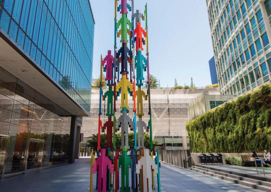
DS-9.2: All new development shall be required to provide public art, in compliance with the new public art ordinance and in-lieu fee to facilitate art in the Specific Plan Area.
DS-9.3: Public Art shall be located in areas of high-visibility and universal accessibility, and where possible, combined with mobility features such as bike racks.
 Examples of public art in private development.
This chapter describes circulation and parking within the Plan Area, with an emphasis on improvements to bicycle and pedestrian connectivity. This Specific Plan proposes improvements to El Camino Real and Broadway for enhancing the streetscape to create a pedestrian-oriented environment that encourages multi-modal travel. The Plan was developed alongside the Active Transportation Plan, which provides greater detail on improvements for citywide bicycle and pedestrian mobility. A separate Streetscape Plan details changes to these two important city corridors.
The recommended roadway network for the plan area is made up of three types of facilities.
Millbrae Avenue and El Camino Real both provide regional access and connections to and from the Plan Area. Millbrae Avenue provides connections to U.S. Highway 101 on the east side of the Plan Area and Interstate 280 to the west. El Camino Real links the Peninsula communities along the east side of San Mateo County, extending from Daly City to the north and San Jose to the south. These roadways are important regional travel corridors that need to balance a diversity of road users and land uses. Designing these connectors to efficiently operate for motor vehicles and transit service while providing safe, convenient, and connected accommodations for walking, biking, and crossings is a key focus for these roadways.
Broadway and El Camino Real between Millbrae Avenue and Meadow Glen Avenue are the two primary commercial corridors within the Plan Area and the city of Millbrae, and are the heart of local economic and social activity. Additionally, these roadway corridors serve a broad range of users from drivers using El Camino Real for regional connections to pedestrians accessing shopping and services. Under the Specific Plan, these two corridors have been identified for key streetscape enhancements to reorient the roadways from emphasizing motor vehicle operations to enhancing the transit, walking and biking environment with improvements, including wider sidewalks, street trees, curb extensions, enhanced bus stops, and sidewalk dining areas to provide a more appealing environment that invites people to walk, shop, and congregate in these central districts of the city.
The majority of the roadways within the Plan Area primarily serve local traffic. These roadways are currently designed to encourage slow-moving traffic through short blocks and narrow lanes. Some of these roadways, such as Magnolia Avenue and Hemlock Avenue, are recommended as key bikeway facilities. Aside from signing and striping improvements along these corridors to identify them as bike routes, these corridors will operate similarly to all other local roadways within the city. Improvements to these roadways should be focused on maintenance, speed management, and enhancing the local character of the neighborhoods.
As new transit-oriented development occurs on the west side of the Intermodal Station, these projects should accommodate the extension of California Drive to meet Victoria Avenue at El Camino Real and connect with Hemlock Avenue. Given
the proximity to the Intermodal Station, the extension should be developed to provide quality facilities for people walking, biking, driving, or taking transit to or from the Station Area.
MTC and ABAG identified the Millbrae Priority Development Area for future growth based on its accessibility to the Inter-modal Station and to highfrequency transit service along El Camino Real. As shown in Figure 6.2 (Transit Service), transit in the plan area is focused on El Camino Real and regional connections from U.S. Highway 101 and Old Bayshore Highway via Millbrae Avenue. Maintaining transit service along these two corridors is of primary importance. In the case of El Camino Real, transit stop improvements are proposed in concert with the streetscape enhancements. These include in-lane bus stops and transit islands to reduce boarding and alighting times, as well as transit signal priority to ensure that buses along the El Camino Real and Millbrae Avenue corridors are given
priority when waiting for a signal. Concurrent with the effort to improve the streetscape for pedestrians, providing improved bus stop waiting areas with shelters and benches will contribute to the sense of place along El Camino Real and make transit use more comfortable.


In line with the City’s 2040 General Plan and Active Transportation Plan, a number of design concepts have been developed for key street improvements within the Plan Area. These concepts focus on transforming the streets and crossings within the Plan Area to better support livable places and multi-modal access. The recently adopted Active Transportation Plan prioritizes three corridors: Broadway and El Camino Real between Millbrae Avenue and Meadow Glen Avenue, and Millbrae Avenue, for enhancing the public realm and walking experience, improving connectivity, and creating a vibrant walking and shopping environment. This chapter provides an overview of improvements to these three corridors.

The Broadway and El Camino Real Streetscape Plan (Appendix A) provides details on streetscape improvements to Broadway and El Camino Real.

• Sidewalk widening
• Bulb outs for safer pedestrian crossings
• Median refuge
• Enhanced greening the downtown
Each of these concepts is described briefly below. For improvements recommended on other streets, please refer to city of Millbrae’s Active Transportation Plan, 2021.
El Camino Real (State Route 82, a State highway under Caltrans jurisdiction) currently has three lanes in each direction with high traffic speeds and volume. The improvement concept for El Camino Real reflects the objectives of the Grand Boulevard Initiative, which focuses on making the corridor more comfortable for all road users from motorists and bus riders to bicyclists and pedestrians.
A key element of the Specific Plan is implementing comfortable bike routes for both experienced and novice bicyclists. For more experienced cyclists, a protected bike lane (Class IV facility) is proposed along El Camino Real, which provides a higher-speed route, but will still require navigating a number of high-traffic-volume intersections. The ATP proposes parallel on lower traffic roads.
In addition to pedestrian and bicycleoriented improvements, entrances and exits for frontage roads along the west side of El Camino Real (State Route 82, a State highway under Caltrans jurisdiction) should be reconfigured to allow for direct access to and from El Camino Real, rather than from side streets. This will make intersections safer by reducing the number of potential conflict points for motorists, pedestrians, and bicyclists. It also allows for shorter crossing distances for pedestrians crossing El Camino Real, as the existing frontage road driveways are replaced with large curb extensions, street trees, landscaping and other amenities can be added to provide a more comfortable walking and shopping environment. Finally, this adjustment also allows for in-lane bus stops with transit islands to be provided along the corridor, allowing a comfortable and efficient place for passenger boarding and alighting. Throughout the corridor, wider sidewalks shall be provided as new development occurs.

The first phase (if needed) of the northern zone without frontage roads maintains an even 12’ through-lanes in both directions and a widened 12’ turn-
lane in the Northbound direction from the existing 11’.
• On-street parking is eliminated from both sides of the street.
• A 5’-wide Class II bike lane with a 2’ buffer is added to both directions.
• The median is maintained in its current location, however the 6’-wide median is extended to provide a pedestrian refuge at the crosswalks. The median could be reconstructed during Phase 1 or Phase 2.
• Existing large trees in the median could be protected and additional median trees would be planted.
• In Phase 1, bus stops are within the sidewalks such that the bus crosses into the bike lanes to load and unload.

In the second phase, Phase 1 improvements are maintained and one travel lane is removed from each direction, allowing the following improvements:
• The sidewalks are widened from 8’ to 10’.
• Parking is reintroduced to the street.
• The bike lanes are Class IV protected, with 6’-wide lanes and 3’ buffers. The bike lanes continue between the sidewalks and the bus
Proposed improvements on El Camino Real (No frontage)stops. At the bus stop locations, the bike lanes are raised to the sidewalk and bus platform level to provide accessible route between the sidewalk and bus platform.
• Street trees are proposed for both sides of the street, at approximately 30’ spacing.
• Bus-boarding platforms are aligned with the parking lane and bike buffer, allowing for a 10’ width. A minimum width of 10’ is required for bus shelters which are located on the bus-boarding platforms.
The design concept for Broadway focuses on creating a more walkable environment and sense of place, with increased interaction between the stores and serviceoriented businesses and people walking throughout the district. Recommendations include widening the existing sidewalk to create space for sidewalk dining, parklets, and landscaping. This enhanced streetscape would support a “park once” environment where drivers are more likely to walk rather than drive and re-park their vehicles to visit multiple destinations.

Existing angled parking would need to be reconfigured to parallel parking to accommodate sidewalk widening, reducing the supply of on-street parking. However, the experience of nearby Burlingame indicates that the effect of the trade-off on local businesses will be very positive. The wider sidewalk allows for canopy street trees, pedestrian-oriented lighting, a landscaped buffer to separate pedestrians and shoppers from the street, curb extensions to shorten crossing distances across side streets, and comfortable side-by-side or bi-directional pedestrian travel on the sidewalk.

With implementation of the Specific Plan, there will be a significant addition of retail, restaurants, commercial office, residential and other uses that will increase the need for parking. Proximity to an intermodal station is a major benefit to the Plan Area, which helps reduce daily auto trips to commute in and out of Millbrae. It also serves as a viable transportation mode for visitors from other cities in the region. Additionally, the Millbrae Active Transportation Plan (2021) has outlined a clear set of guidelines and priority projects to create a safer and comfortable bicyclist and pedestrian environment for residents, employee and visitors which will further reduce the dependency on automobile for necessary trips. With these measures and regional transport infrastructure in place, the Specific Plan proposes a Plan Area-wide parking strategy that includes recommendation for:

1. Expanding capacity of city-owned parking lots;
2. Exploring a shared parking arrangement on both city-owned and privately land;
 Proposed streetscape Improvements on Broadway
Proposed streetscape Improvements on Broadway
Proposed streetscape Improvements on Broadway
3.
4.
5.
6.
City of Millbrae owns five parking lots in the downtown district at:
• 238 Broadway
• 446 Broadway
• Parking lots on the 200 and 400 blocks of El Camino Real
• 300 Magnolia
Currently these parking lots offer a cumulative of approximately 160 parking spaces which serve the businesses in the downtown and on El Camino Real. The city-owned parking lots can continue to serve the same function, and expand their capacity by using new parking technology such as vertically stacked parking stalls that are operated mechanically.
The City may offer city-owned parking lots for private development in return for provision of public parking integrated with the development. The city should consider establishing an Incentives Program to developers who are willing to build shared parking structures that offer some parking spaces for public use.
The Specific Plan strongly recommends that a Parking Management Plan be conducted to identify projected parking demand in the Plan Area.
The Specific Plan recommends that the City require private developers to put in place a Travel Demand Management Plan to minimize parking need within their development by providing shuttle connections to the inter-modal station and other transit options, providing parking for bikes
and scooters, providing facilities for ride shares and bike/scooter docking stations.
Micro-mobility has gained popularity in recent times as a viable mode of transportation among different agegroups. It provides much needed first and last mile connection to local and regional transit networks to further reduce car-dependence. Prioritizing micro-mobility in the Plan Area and city-wide, will improve access to the inter-modal station, regional transit lines on El Camino Real and jobs and services in downtown and El Camino Real. The Specific Plan recommendations on this topic include:
• Integrating micro-mobility in streetscape design and in public spaces
• Requiring developments over 80 units or over 100,000 s.ft. to integrate micro-mobility docking stations in the development.
Ride-shares are a viable and sustainable alternative to single occupancy vehicles and minimize the need for car-ownership. Rising popularity of ride-shares indicates a strong need for curbside management and provision of dedicated pick-up/drop-off zones on public parking lots to minimize conflicts with pedestrian and vehicular circulation in street right-of-way. Similarly, integrating car-share stations within public and private parking facilities is strongly encouraged.
The Specific Plan includes development standards in Appendix C: Parking Standards for off-street vehicular parking to ensure that there is an adequate amount of parking provided as part of private development for automobiles as well as non-auto transportation such as bicycles and scooters to encourage reduced use of automobiles and minimize traffic impacts.
• Public parking facilities shall have stalls fitted with EV charging stations.
• Public parking facilities, public plazas and parks shall be fitted with bike and scooter parking to encourage active transportation.
• Parking lots should be designed to minimize heat island effect and surface water run-off by using pervious paving material and effective storm-water management system.

This section has been adopted from the Millbrae Station Area Specific Plan (MSASP) in order to maintain consistency between the Station Area and the Downtown and El Camino Real Specific Plan Area. Transportation Demand Management (TDM) strategies and measures can be used to encourage future employees, residents, and visitors to the Millbrae Station area to walk, bicycle, use public transportation, carpool, or use other alternatives to driving alone when traveling to and from the Plan Area.
The following TDM strategies incorporate design, infrastructure, and BART- or Caltrain-specific actions and should be incorporated into early stages of Plan Area development.
7. Amenities help reduce the number of trips an employee needs to make during the day and may include the following. These uses should be provided only if no existing or planned similar uses are within 400 feet of the building.
• A cafeteria
• Grab-and-go meals
• Fitness facility
• Coffee bar
• General store
• ATM
• Barbershop
• Sport courts
• Banking
• Dry cleaning
8. Passenger loading zones near the main entries to buildings are convenient for carpools and vanpools dropping off passengers. Building designs can also dedicate a location to casual carpooling.
Integrating micro-mobility infrastructure, such as docking stations for shared bike and scooters, in public realm design will encourage active transportation and provide first and last mile connectivity to regional transit.
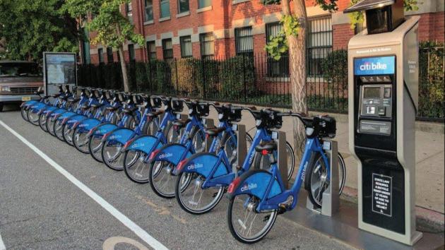 Stormwater management system in parking lots
9. Reduced building setbacks allow buildings to be located closer to pedestrian and transit facilities, which improve the pedestrian experience and encourage walking.
1. Car share can be available for errands or meetings for employees who bike, walk, use transit, or use carpools or vanpools. This reduces concerns and inconvenience of not having a vehicle during the day. Car share parking spaces should be located in centralized locations and on-street to provide high visibility.
2. Last-mile connections can be provided through autonomous vehicles or pedi-cabs to get a group of people from a transit stop to an employer location. This eliminates the barrier or last-mile transportation for people who want to use transit.
1. Bike share programs, either internal to the Plan Area or coordinated with Bay Area Bike Share, provide a first/last mile option for commuters, as well as for short trips throughout the day.
2. Electric bicycle charging stations. Electric bicycle charging stations should be encouraged in new development. Electric bicycles can be used for longer trips than standard bicycles.
The City of Millbrae requires all new development within the Specific Plan Area that generates more than 50 daily trips , or as required by C/ CAG or by California Environmental Quality Act (CEQA), to prepare and implement a Transportation Demand Management (TDM) to reduce peak single-occupancy vehicle trips and encourage use of transit, walking, and biking as transportation modes. These strategies can significantly enhance mobility for people accessing the Plan Area and will require close coordination among multiple agencies, including SamTrans, C/CAG, San Mateo County, and Caltrans. These TDM strategies will be most effective when they are provided for all user groups in the Plan Area, including residents, employees, and visitors.
TDM measures include providing subsidized transit passes, incentivizing non-vehicle transit modes and carpooling, parking pricing, car sharing,
and participating in car-sharing programs. The measures identified in Table 7-2 are based on the current best practices for TDM programs. They should be regularly evaluated to ensure the widest range of options is available to reduce the number of single occupancy vehicle trips.
Each development project subject to the TDM requirement will include an on-site TDM coordinator that will manage and promote TDM programs and oversee monitoring to determine program effectiveness. A TDM coordinator provides information via flyers, posters, e-mail, and educational programs regarding non-auto access and circulation options. The TDM coordinator’s role may also include actively marketing alternative mode use, administering a neighborhood ride-matching program, and overseeing a Guaranteed Ride Home program (working with a local taxi service or rental car agency). A TDM coordinator could also help implement or support the following parking and vehicle management strategies described in this section.
The project applicant shall submit annual reports to the City describing the specific TDM measures that are being implemented, the number of employees on-site, and the success of the measures expressed in AM and PM peak hour vehicle trips generated by the project. The report shall be prepared by an independent Cityapproved transportation planning/ engineering firm.
This chapter provides a broad overview of the utility infrastructure required to serve the Plan Area. For a complete analysis, refer to the Infrastructure Report provided in Appendix B of this document. With the implementation of the Specific Plan, increased demands on utility infrastructure systems and public services will occur.
The Specific Plan Area includes the Millbrae Priority Development Area (PDA), an area within the City that has been identified as a future infill development opportunity area. The Specific Plan Area encompasses a slightly larger area than the PDA and excludes the area within the adopted Millbrae Station Area Specific Plan (MSASP). The Specific Plan Area includes the El Camino Real (State Route 82) corridor, which spans from Victoria Avenue to the south and the City limits to the north. The Specific Plan Area also encompasses the City’s Downtown, which spans from Victoria Avenue to the south to Meadow Glen Avenue to the north. Many residential areas surrounding these commercial corridors are also included. It is anticipated that there will be an intensification of land use within the Specific Plan Area, with more mixeduse type development and higherdensity residential development.
The report identifies the potential impacts of the planned land use in the Specific Plan Area on the City’s water, sewer collection, and storm drainage infrastructure. The Infrastructure Report provides a capital improvement plan identifying recommended water, sewer and stormwater infrastructure needed for the Specific Plan Area,
along with planning-level costs. This report was used to develop a financial plan and development impact fees for water, sewer collection and stormwater systems within the Specific Plan Area, contained in Chapter 8: Implementation.
Per the City’s Official Zoning Map (October 2009), the land use within the Specific Plan Area ranges from existing commercial, residential (single family and multi-family) and office to parcels for planned development. The Specific Plan Environmental Impact Report (EIR) includes an existing conditions baseline. The existing baseline includes existing conditions plus seven ‘Pipeline Projects’ that are either approved development projects or development projects that have been submitted for City review at the time that the Notice of Preparation for the EIR was published (December 3, 2021).
While the land uses within the Specific Plan Area are not expected to significantly change, uses are anticipated to intensify, with more mixed-use projects and higher-density residential projects. The following
land use intensification is expected as follows:
• General Commercial – 310,007 square feet (SF)
• Office Area – 154,576 SF
• Restaurant – 171,024 SF
• Hotel – 332,659 SF (460 units)
• Residential (Multi-Family) –2,815,893 SF (3,130 dwelling units)
To estimate water demands and sewer flows, sewer generation rates from the City’s 2015 Water Supply Assessment (WSA) were applied to the estimated building square footages and units. The 2015 WSA provides sewer generation rates and multiplies those by 1.15 to estimate water use. Subsequent evidence has shown that the restaurant sewer generation rate, 2.78 gallons per day per square foot (gpd/SF), was higher than the amount actually used by restaurants. The City provided West Yost with 2019 water consumption data for existing restaurants within the Specific Plan Area to estimate a new restaurant water use factor and sewer generation factor with more recent data. The updated sewer generation rate for restaurants was estimated to be 0.3 gpd/SF, a significant decrease from the previous sewer generation rate.
Including the Pipeline Projects, the existing water use within the Specific
Plan Area is approximately 0.5 mgd (average day demand) and 1.0 mgd (maximum day demand). The existing average dry weather sewer flow is 0.47 mgd, including Pipeline Projects. For the Specific Plan Area, water demand and sewer flows were estimated to be as follows:
• Water Demand
• Average day demand: 0.7 mgd
• Maximum day demand: 1.4 mgd
• Sewer Flow
• Average dry weather flow: 0.6 mgd
These estimates are total demands and sewer flows estimated for the Specific Plan Area at build out.
The City’s water distribution system is divided into four major pressure zones and includes approximately 75 linear miles of pipeline. The water system is supplied by five turnouts from the San Francisco Public Utilities Commission’s (SFPUC) Regional Water System. The Specific Plan Area is located in the City’s Pressure Zone (Zone) 4, which serves the lower
elevation areas by the San Francisco Bay. Zone 4 is supplied by four SFPUC turnouts, located on Murchison Drive, El Camino Real at Victoria Avenue, Magnolia Avenue and Green Hills Drive. The turnout at El Camino Real and Victoria Avenue has the highest capacity and serves the Specific Plan Area from the south. The Specific Plan Area is served by pipelines that range from 6-inch diameter to 12-inch diameter, with the majority of the area served by 8-inch diameter and 10-inch diameter pipe.
The City’s InfoWater hydraulic model was used to summarize the existing system conditions within the Specific Plan Area and to evaluate the ability of the existing system to meet the Specific Plan demands at buildout conditions while meeting the City’s water performance criteria.
Hydraulic analysis found that existing infrastructure, while adequately sized at the time of its construction, does not meet modern day fire flow standards due to velocity and pressure constraints. Therefore, new water pipelines will be needed to provide adequate fire flow for the Specific Plan Area. Approximately 10,650 feet of new
12-inch diameter pipeline and 2,000 feet of new 10-inch diameter pipeline will be needed with a total estimated capital cost of $7.64 million.
Millbrae’s existing gravity collection system is comprised of approximately 55 miles of gravity sewers, ranging in size from 6-inch to 36-inch diameter. Collection system flows are delivered to the Millbrae Water Pollution Control Plant (WPCP), located on the northeast corner of U.S. Highway 101 and Millbrae Avenue.
The City is in the process of upgrading the capacity in its sanitary sewer collection system. Effective November 15, 2010, the City entered into a Consent Decree with San Francisco Baykeeper, the purpose of which is to reduce Sanitary Sewer Overflows (SSOs) in the City’s sanitary sewer collection system. In compliance with the Consent Decree, the City developed a program to reduce the risk of SSOs occurring in its collection system in three ways:
• Comprehensively inspecting the collection system to identify and correct defects;
• Enhancing collection system preventative maintenance activities; and
• Providing hydraulic capacity to convey and treat Peak Wet Weather Flows (PWWF).
The City’s Capacity Assurance Report, completed in 2012, developed a capital improvement program (CIP) that, upon its implementation, would provide this necessary capacity within the collection system by increasing selected gravity main sizes, by increasing pump station capacity, and by providing wet weather storage to equalize PWWF.
The City’s Wet Weather Alternatives Analysis, finalized in 2014, updated this initial CIP by providing an alternative CIP that met capacity requirements through the reduction of PWWF values in addition to more limited increases in infrastructure capacity. This alternative CIP does not require wet weather storage. The long-term reduction of rain-dependent infiltration and inflow (RDII) and therefore PWWF through rehabilitation, repair, and replacement was judged to be a more sustainable and cost-effective use of resources than only facility capacity increases combined with
the construction of wet weather storage. Although the Consent Decree has lapsed, the City is continuing to implement improvements required under the decree.
Because intensification of land use in the Specific Plan Area will impact the sanitary sewer flows from the Downtown area to the WPCF, the collection system analysis evaluated whether the PWWF reduction and facility size increases recommended by the Wet Weather Alternatives
Analysis CIP and MSASP, that the City is currently implementing, continue to provide sufficient capacity in the collection system, or whether the Specific Plan necessitates further capacity enhancements.
Two evaluations were performed to analyze the impacts of the Specific Plan Area on the collection system: a hydraulic evaluation of the collection system; and an evaluation of offsite RDII reductions needed to mitigate increased collection system flows. It is the City’s policy that capacity restrictions be mitigated with RDII reductions rather than infrastructure capacity increases where feasible and economical. An evaluation of
RDII reductions and sewer capacity improvements determined that capacity improvements along El Camino Real and adjacent to the Highline Canal in concert with RDII reductions in the Broadway and Madrone subbasins is more cost effective than including RDII reductions in additional basins while minimizing capacity improvements along El Camino Real and adjacent to the Highline Canal.
A hydraulic model of the City’s collection system was used to evaluate the impacts of sanitary sewer flows generated by the development. Peak wet weather flows (PWWF) were estimated using projected water demands to estimate average dry weather flow (ADWF) contributions to the system, and standard hydrologic methods to estimate PWWF from ADWF. A hydraulic analysis was performed to determine whether any additional capital improvements beyond those identified in the Wet Weather Alternatives Analysis and the MSASP analysis would be needed to account for the additional PWWF generated in the Specific Plan Area that would contribute to sanitary sewer overflows. This analysis predicts sewer system overflows (SSOs) in the gravity mains along the Highline Canal and in El Camino Real. Accordingly, to mitigate potential future SSOs,
gravity main improvements are recommended along Meadow Glen Avenue, El Camino Real and adjacent to Highline Canal. The estimated cost of the gravity main improvements is $6.2 million.
The Wet Weather Alternatives Analysis and MSASP analysis identified RDII reduction projects that would be needed to eliminate the need for wet weather storage at the Millbrae WPCP. Those studies prioritized basins and sub-basins within the City’s collection system where rehabilitation, repair, and/or replacement of sewer mains and laterals would need to be implemented to reduce RDII sufficiently to eliminate the need for wet weather storage at the WPCP. The Specific Plan Area will generate wastewater flows that would require wet weather storage at the WPCP, unless RDII projects are implemented within the City’s system to offset flows generated from the Specific Plan Area. The Wet Weather Alternatives Study and the MSASP analysis identified RDII projects for ten sewer sub-basins within the City. Five additional subbasins would require RDII projects to offset increased peak wet weather flows resulting from development of the Specific Plan Area. These are the Broadway sub-basin 3, and the Madrone sub-basin 6. Improvements for each sub-basin include manhole
rehabilitation, upper and lower lateral replacements and rehabilitation of 8-inch mains, with a total estimated capital cost of $18.0 million.
Total sewer improvement costs to address capacity needs and RDII reduction are $24.2 million.
The City’s stormwater generally drains east/southeast out of the hills into the flatter regions of the City and, ultimately, out to the San Francisco Bay (Bay) south of the San Francisco International Airport (Airport). There are six major watersheds contained within the City: Northern Lomita Canal Watershed, Southern Lomita Canal Watershed, Central Millbrae Watershed, Millbrae Station Area Specific Plan (MSASP) Watershed, Murchison Drive Watershed, and Mills Estates Watershed. The Specific Plan Area is contained within all watersheds except for the Mills Estates Watershed and the MSASP. The City’s drainage system consists of a network of 21 miles of storm drains, three (3) pump stations, and approximately three miles of open creeks and ditches
that route storm runoff through the City to the Bay.
The City works to maintain stormwater drainage system functionality by enforcing Water Quality, Hydromodification Management, Source Control, Green Infrastructure (GI), Trash Capture, and City Improvement Standards. These standards are required to be met by private development, including parcels within the Specific Plan Area.
Existing City land use was compared with the Specific Plan land use to determine the change in impervious surface area. Review of the data determined that the change in impervious areas is minimal, as the existing land use is fully built-out. Overall there is a net decrease of 2.16 acres of impervious area over all the watersheds.
The Specific Plan will address sea level rise. While the Specific Plan does not make sea level rise worse, measures can be required during development that minimize the impact of flooding. The City direction focuses on addressing the Mid-Level Scenario, which dictates planning for a combination of a one percent annual chance flood (100-year) and 3.3 feet of sea level rise. According to a comparison of climate models by ‘Our Coast, Our Future’ (OCOF),
these amounts of sea level rise could be seen between the years 2070 and 2100. The one percent annual chance base flood elevation is 10.0 feet NAVD88 consistent with the Federal Emergency Management Agency (FEMA). This results in a sea level rise elevation of 13.3 feet NAVD88 which would affect parcels within the Specific Plan Area east of the El Camino Real and south of Center Street and parcels within the MSASP.
The Specific Plan Area development will not increase flows to the storm drainage system. Not only is there a slight decrease in associated impervious surfaces, but the City Improvement Standards require post-development peak flows and velocities be less than or equal to the pre-development peak flows and velocities. Developers will need to meet requirements enforced by the City of Millbrae for Water Quality, Hydro-modification Management, GI, Trash Control, and City Improvement Standards. Many of the parcels within the Specific Plan Area could qualify to have reduced LID treatment requirements based on smart growth, high density, or transit-oriented development criteria. This reduction in
LID is granted at the City’s discretion and can be rejected in favor of full LID compliance. Consistent with the San Mateo Countywide Water Pollution Prevention Program, it is suggested that the City requires full or expanded LID treatment for all developments.
The City should draft Sea Level Rise Standards that require developers to design for increasing Bay water levels. The Sea Level Rise Standards would require local mitigation strategies to protect parcels below 13.3 feet NAVD88 that are subject to flooding. The Sea Level Rise Standards could also give flexibility to developers to pay into regional mitigation strategies such as flood walls and sea walls. The City should draft Sea Level Rise Standards for drainage facilities to address internal flooding, after the addition of sea walls and tidal gates. Current open channel design standards require free-board in the 100-year storm which produce excessively large pumping capacities during conditions of sea level rise. Flexibility of design criteria to address sea level rise may allow for smaller pumping capacity and some depth of allowable surface flooding. This design criteria flexibility would greatly reduce project costs while meeting the City’s safety objectives.
While the preceding sections of the Downtown and El Camino Real Specific Plan provide the regulatory framework for Millbrae to realize its vision for the city’s Downtown and transit corridor, this section of the plan focuses on implementation measures. Implementation of this Specific Plan requires persistent action by numerous parties including residents, elected and appointed City officials, City staff, property owners, the development community, and other partners. This section provides direction on specific actions to achieve the vision and policies of the Downtown and El Camino Real Specific Plan. It also describes potential funding mechanisms and financing tools that could be used to implement needed improvements.
Starting in the 1970s and for decades after, many communities took a “bricks and mortar” approach to downtown revitalization. We have learned that there are certain physical fundamentals to making downtowns work – attractive storefronts, wide sidewalks, shade and texture from landscape, and good lighting. This is what has become to be known as the “hardware” of place. The basic premise behind the bricks and mortar approach to revitalization is that with new and improved hardware, struggling business districts would be attractive again, gain renewed economic relevance, and attract new shoppers and workers.
The City is strategically intensifying the mixed-use and commercial districts through this Specific Plan and the MSASP. This Specific Plan is a foundational step in this process because it establishes the allowable land uses and development standards to ensure projects within the Plan Area advance the community’s cohesive vision for the built environment. Hardware is only part of the answer. Without an enduring, and well-funded commitment to “software,” the shiny
newness of hardware will quickly fade and the revitalization will not be sustainable. In financing terms, this is the difference between capital funding and funding for maintenance and organizational capacity.
In communities where successful development has evolved and grown over time, it’s because investments in hardware have been balanced with a corresponding mechanism to fund and continually update the “software.” Software includes such basics as ensuring the improvements are kept clean and patrons feel safe in the neighborhood. As foot traffic improves, there is a need to pick up trash and other debris more frequently, maintain plants and trees, and steam clean the sidewalks. More street furnishing, lighting, and other public amenities are needed with more pedestrian activity. Because public works departments in most communities cannot adequately fund their downtown’s needs sufficiently, Business Improvement Districts (BIDs) have risen as a critical tool for revitalizing downtowns. BIDs bring the kind of focused and more intensive attention to the needs and unique issues of downtowns and main streets.
Successful BIDs evolve to go beyond the basics of “clean and safe.” Taking a cue from successful shopping malls and large retail centers, BIDs step in to provide a holistic view of the retail mix, helping to strategize and find tenants that will be synergistic – rather than competitive – with existing businesses. They also take on the role of programming, funding, and operating events and campaigns that draw new patrons and build brand and identity for the downtown while keeping it fresh and interesting. Crowds attract crowds, and vibrant commercial districts require a combination of active uses with engaging frontages and continual “foot traffic” – shoppers, people walking home or to work, and people eating at sidewalk cafes or strolling down the main street. The financing plan below also identifies other potential funding sources for operations and maintenance, such as Community Facilities Districts and Landscape and Lighting Districts. City staff could operate these programs if a BID is not present, but it is always best to include merchants in a successful downtown program.
As demographics continue to shift, Millbrae is ideally positioned to have
a great downtown for young and old residents and visitors. It has incredible “bones” because of Broadway. The size of its buildings and storefronts, and the walkable length and varied architecture of downtown streets, provide a great platform for long-term success.
Street improvements made two decades ago have endured, providing a sense of identity without looking dated. Broadway already has much of the hardware needed for long-term success. However, the district lacks an individual or entity that can curate the tenant mix, manage the cleanliness and sense of vitality of the street, and bring both vision and focus to the collective sum of all the businesses in downtown. There is a need to fill the gaps in many of the existing storefronts or vacant lots. This cannot be done ad hoc. Many of the policies in this Specific Plan address infill and mixed-use development to fill the holes in the urban fabric. Additional policies begin to lay the groundwork for an entity that act as the “vision keeper” or “software developer” for downtown Millbrae.

Implementation of the Downtown and El Camino Real Specific Plan will require action by several different City departments working in partnership with the community and private sector. Table 8.1 contains a summary of the actions, responsible department or public agency, and the time frames for completion.

Action
Planning Zoning and Financing Strategies
1. Study City-Owned Properties
Conduct a study of opportunities for development of City-owned properties.
2. Business Improvement District
Work with downtown business owners to encourage the formation of a Business Improvement District to evaluate, manage, and curate downtown programming, improvements, and maintenance.
3. Community Benefits Program
Conduct a study to evaluate the feasibility of a Community Benefits Program to require projects within the Specific Plan area to provide public benefits in exchange for project approval or building concessions, such as a greater height limits or density/intensity allowance. The study will consider the following public benefits: provision of new affordable and special needs housing, upgrades to City infrastructure, publicly-accessible parking, publiclyaccessible open space or recreation centers, contributions to community facilities (beyond required Development Impact Fees) and other types of improvements that improve quality of life and advance implementation of the Specific Plan.
Placemaking Strategies
4. Active Programming
Endorse active programming and events in the downtown, such as festivals, community races, parades, fairs, and block parties.
5. Branding and Wayfinding Program
Develop a Branding and Wayfinding Program to establish the type and location of improvements, including wayfinding signage along El Camino Real and in Downtown and the Station Area, particularly at major intersections, that is geared toward all travel modes.
Streetscape, Bicycle, and Pedestrian Improvements
6. Bicycle Routes on Magnolia and Hemlocks Avenues
Install shared bicycle routes (Class III facilities) along the entire stretch of Magnolia and Hemlock Avenues within City limits. Conduct study to determine how the Hemlock Avenue bike route may be connected to the California Drive extension.
City Department or Public Agency
Time frame
Community Development 2023-2025
Community Development 2023-2024
Community Development 2024-2025
Community Development Ongoing
Community Development;
Public Works
2024-2026
Public Works 2023-2025
Action
Streetscape, Bicycle, and Pedestrian Improvements
7. Coordination with Caltrans on Improvements to El Camino Real Work with Caltrans on pedestrian, bicycle, and streetscape improvements along El Camino Real including the following:
Pedestrian Crossings
Coordinate with Caltrans to improve pedestrian crossings on El Camino Real consistent with the Circulation Concept (Figure -2). These pedestrian crossings include:
Multi-lane uncontrolled crossing enhancements:
El Camino Real & Santa Helena Avenue
Signalized intersection crossing improvements:
El Camino Real & Hillcrest Avenue
El Camino Real & Millwood Avenue
El Camino Real & Santa Inez Avenue
El Camino Real & Silva Avenue
El Camino Real & Victoria Avenue
El Camino Real & Murchison Avenue
Class IV Bicycle Lane
Coordinate with Caltrans and neighboring jurisdictions to develop a separated bicycle lane (Class IV facility) by replacing existing underutilized curbside parking and reconfiguring the existing frontage roads along El Camino Real.
Landscaping and Other Streetscape Improvements
Coordinate with Caltrans to provide improvements that enhance the public realm along El Camino Real, including landscaping, canopy street trees, sidewalk furniture, and pedestrian-oriented lighting.
8. Frontage Road Improvements
Reconfigure entrances and exits for frontage roads along the west side of El Camino Real to allow for direct access to and from El Camino Real, rather than from side streets.
9. Parallel Parking and Widen Sidewalks on Broadway
Redesign Broadway to have parallel parking and widened sidewalks that create space for sidewalk dining, parklets, canopy street trees, pedestrian-oriented lighting, and landscaping.
Public Works 2023-2032
Public Works 2024-2032
Public Works 2025-2032
Action
10. ADA Accessible Network
Conduct a study to identify barriers and plan improvements to address accessibility for persons with disabilities between the Intermodal Station, El Camino Real, and downtown, consistent with the Americans with Disabilities Act (ADA).
11. Bus Stops
Coordinate with SamTrans to improve bus stops along El Camino Real to provide each stop with an attractive shelter and trash receptacle.
Parking
12. Parking Management Plan
Prepare a Parking Management Plan to identify opportunities to manage parking serving the City’s destinations including the management of on-street parking as well as identifying and prioritizing locations for potential off-street parking structures or shared parking between differing uses.
Parks and Public Spaces
13. Downtown Plaza
Develop a downtown plaza that offers the community a smaller, more intimate space for social gathering.
14. Parklet Program
Create a clear and streamlined process for businesses along Broadway to add parklets.
15. Expand Outdoor Seating Downtown
Work with the business community to expand outdoor seating options downtown following the widening of sidewalks on Broadway.
16. Activate Alley
Explore options for improving the alley between Broadway and El Camino Real from Taylor Boulevard to Victoria Avenue. Consider implementing the following improvements: alley name, wayfinding signage, pavement improvements, landscaping, lighting, and public art.
There are a variety of mechanisms used to fund capital improvements. This section describes potential approaches to funding necessary public improvements identified in this Specific Plan. In some cases multiple sources may be needed to pay for specific projects.
General Fund revenues include property tax, sales tax, transient occupancy tax, and other revenues that are primarily used to pay for ongoing municipal services and operations. There are no restrictions on the types of capital projects that can be funded with General Fund revenues.
Development Impact Fees (DIF) are fees adopted by the City Council based on the provisions set forth in California Government Code Section 66000-66025 (Mitigation Fee Act as established by Assembly Bill 1600 in 1987). These fees are assessed upon new development projects to fully
or partially offset the costs of public capital facilities and infrastructure that is needed to serve new demand created by development projects. The City prepared the required nexus studies to document the appropriate Development Impact Fees that can be charged by the City. Fees collected under the Mitigation Fee Act are to be collected for capital facility and infrastructure improvements only, used to fund facility needs created by new development rather than existing deficiencies, and the fees are to be based on a rational nexus between new development and the costs of the capital facilities and infrastructure needed to accommodate such development as documented in the nexus studies.
The City adopted Citywide Development Impact Fees in June 2020, which include six types of Development Impact Fees: a library fee, a general government facilities fee, a recreation services fee, a public safety fee, a park acquisition and facilities fee, and a mobility fee. The City also has Development Impact Fees specifically for the development in the Millbrae Station Area Specific
Plan plan area. This fee was first established in 2000 and updated in 2017.
Some of the mobility improvements identified in the Active Transportation Plan (adopted in October 2021) are not included in the Citywide DIF, as that fee was prepared prior to plan adoption. In addition, the water and sewer system improvements required to implement the Specific Plan will require the establishment of new Development Impact Fees for those capital facilities and infrastructure. Finally, the level of development included in the Specific Plan requires calculation of a new impact fee nexus for Library, General Government and Police facilities, as discussed in the section on Improvement Costs and Funding Sources below. (Note: Evaluation of fire facilities impact fees are pending completion of planning studies underway by the Central County Fire District as of May 2022).
As a condition of approval for development projects, the City can
require developers to directly fund the construction of public improvements because the project will affect existing residents and increase the demand on existing public infrastructure. The City can also offer project concessions or incentives, such as increased densities or height limits, in exchange for developments that contribute a community benefit.
Individuals and businesses can cooperate to create special assessment districts in which they tax themselves or collect fees in order to fund specific benefits, such as landscaping, infrastructure improvements, and parking facilities.
A Mello-Roos Community Facilities District (CFD) is a financing tool that can be used by the City or through creation of a special district to raise money. The CFD requires two-thirds of voter approval to assess a special tax
on property owners within the district to fund infrastructure improvements and services within the district. The CFD secures the taxes through a continuing lien, which is levied annually against the property owners within the district.
Business owners can create a business improvement district (BID). BIDs are a community development tool, in which its members self-impose an additional tax to fund projects within the district’s boundaries. The BID would establish district boundaries and assess funding to address a range of issues including streetscape improvements, litter, and programming as decided upon collectively by members of the BID.
The BID can develop a financing strategy, such as assessing a tax on members based on parcel size or a flat per parcel basis. The BID can hire staff members and establish an advisory board with leaders from key businesses, developers, elected and appointed City officials, and members of the community.
The Millbrae City Council demonstrated support of a downtown BID by adopting a Resolution in
2014 to support business owners in forming the BID. The downtown BID can address numerous issues including maintaining cleanliness of downtown public spaces, investing in improvements that contribute to the district’s sense of place such as sidewalk furniture and public art, and hosting festivals or events to draw patrons to the area to support businesses, invoke civic pride, and cultivate the area’s sense of place.
On January 1, 2015, Governor Jerry Brown signed SB 628 Enhanced Infrastructure Financing Districts (EIFDs) into law, which allows for a separate government entity to be created by a city or county within a defined area to finance infrastructure projects with community-wide benefits. When formed through a Joint Powers Authority (JPA), an EIFD can be established without voter approval. However, voter approval is needed to issue bonds. EIFDs can finance public infrastructure projects, as well as private child care centers, affordable housing and parking facilities. The primary source of funding for an EIFD is property tax increment, meaning
that the local government would need to agree to forego future property taxes that would otherwise go to the General Fund.
Local governments may form a Landscaping and Lighting District to finance elements such as the landscaping and lighting public areas (e.g. parks and plazas). As a form of benefit assessment, it is based on the concept of assessing only those properties that benefit from improvements financed, either directly, or indirectly through increased property values.
Local governments may form a special district to finance parking-related activities, including acquisition of land for parking facilities, construction of parking lots and garages, funding of operating costs, and issuance of bonds to fund similar activities. The majority of affected property owners must vote in favor of the district formation. A possible approach to funding is imposition of a parking in-lieu fee, whereby developers pay the fee instead of providing on-site
parking, thereby reducing the cost of development and potentially increasing the efficient use of development sites. Policies in this Specific Plan support the further study of this fee in the plan area.
The One Bay Area Grant (OBAG) Program provides grants for local streets and roads preservation, bicycle and pedestrian improvements, and streetscape improvements. At least 70 percent of OBAG funds must be spent in Priority Development Areas (PDAs); as a PDA, the Downtown and El Camino Real Specific Plan Area would be eligible for this funding. The City/ County Association of Governments of San Mateo County (C/CAG) administers the OBAG capital grant program in San Mateo County.
In addition to the OBAG Program, State and regional agencies periodically offer other competitive grants for pedestrian, bicycle, streetscape, road, and other transportation-related improvements. These programs change over time depending on funding availability.
Recent examples include the California Department of Transportation’s (Caltrans) Safe Routes to School program; the Transportation Fund for Clean Air program, administered jointly by the Bay Area Air Quality Management District (BAAQMD) and C/CAG; the San Mateo County Intelligent Transportation System (ITS) and Smart Corridors Program, administered by C/CAG; and the San Mateo County Measure A Bicycle and Pedestrian Program: Grants for bicycle and pedestrian facilities in San Mateo County, administered by San Mateo County Transportation Authority (SMCTA).
Other funds include the State gas tax and San Mateo County’s $10 Vehicle Registration Fee (Measure M), a portion of which is allocated based on population and road miles to cities and the County of San Mateo and can be used for congestion mitigation and stormwater pollution mitigation programs, including projects such as road restriping, signal timing/coordination, signage, and street runoff treatment. Most local governments use state gas tax funds for ongoing street maintenance, which may limit the availability of these funds for major capital improvements.
The public improvements needed to implement the Specific Plan fall mainly into three categories: 1) mobility improvements, including bikeways, pedestrian access and related streetscape improvements, 2) water distribution system capacity, and 3) sewer collection system capacity. In addition, the level of growth included in the Specific Plan would necessitate higher service levels for certain other facilities than those currently incorporated in the City’s development impact fee program. Each of these facility categories is addressed below. The analysis concludes with a summary of total revenue to be generated by development in the Specific Plan from both new and existing development impact fees.
It should be noted that the City also charges Affordable Housing In-Lieu (Fractional) Fees for residential development projects and Commercial Linkage Impact Fees for commercial development projects, which are not addressed in this analysis. These were adopted in July 2021.
The 2020 Citywide Development Impact Fee Nexus Study included mobility improvements identified in the draft Active Transportation Plan (ATP). The Final ATP (October 2021) includes $17.9 million in bikeways and pedestrian improvements located within the specific plan area (Table 2). Under the Specific Plan, new development represents 30 percent of the buildout service population for Millbrae, compared to 20 percent in the existing City Mobility Fee. In addition, the Final ATP includes about ten percent higher total improvements costs than in the 2020 Nexus Study. With these adjustments, the recommended DT & ECR Specific Plan Development Impact Fees would be 59 percent higher than the City’s existing fee. With full buildout of the Specific Plan, the recommended fees would generate nearly all of the funds needed to implement the mobility improvements located in the Specific Plan area (see bottom of Table 8.2).
Source: ADE Inc., based on Final Active Transportation Plan, October 2021 and City Fee Schedule effective July 2021.
The City currently has no Development Impact Fees for water and sewer service. The City does charge Utility Capital Facility Fees but these are intended to fund investments in the existing water and sewer systems. The Downtown and El Camino Real Specific Plan Infrastructure Report (Infrastructure Report) indicates that additional demand from buildout of the Specific Plan increases total 2035 maximum day water demand within the specific plan area by 0.6 mgd above the previous projection of 1.2 MGD. New Development Impact Fees are needed to fund improvements to meet this increment of additional demand. Similarly for the sewer system, the Infrastructure Report has
identified additional improvements needed to serve the increment of growth associated with the specific plan. New fees would be needed to fund the additional improvements.
The recommended water system improvements include installation of 11,650 linear feet of 10” and 12” pipes, replacing existing smaller diameter pipes, and the construction of a pipeline intertie. The total cost of these improvements is estimated at $7,640,000.
Table 8.3 shows the nexus analysis for impact fees to cover this amount. The design criterion is Maximum Day Demand in gallons per minute (gpm).
ADE used the water demand factors in the Infrastructure Report to allocate total demand to each detailed land use. The improvement costs are then allocated based on the share of total demand from each land use. The fees are calculated on the basis of residential units, hotel rooms and 1,000 sq. ft. of the other non-residential land uses.
The sewer system improvements needed to accommodate Specific Plan growth include gravity main capacity improvements and measures to reduce rain dependent infiltration and inflow (RDII). The costs for these improvements are shown below.
Gravity Main Capacity Increases: $ 6,167,000
RDII Reduction Measures: $18,025,000
Total $24,200,000 (rounded)
Table 8.4 shows the nexus analysis to distribute these costs into impact fees by land use. The approach is similar to the water analysis, using the sewer generation rates to allocate Total Average Day Demand to each land use and calculating fees based on residential unit, hotel rooms and 1,000 sq. ft. of other non-residential land uses.
The existing City library is at capacity serving the existing City population and new growth in the DT & ECR Specific Plan area will impact the need for expansion of library services. The service standard is one square foot of library space, and associated books and furnishings, per capita. The cost per capita is estimated at $489.22. The updated development impact fees based on the service standard are shown below (per unit for residential, per 1,000 sq. ft. for non-residential, except per room for hotels).
Source: ADE Inc.
Residential (MF) $1,052
Office $147
General Commercial $95
Hotel Room $29
Police
The growth in the Specific Plan area will impact demand for police services. Millbrae currently (May 2022) has a police standard of 0.65 sworn officers per 1,000 population. The addition of new police officers and any associated administrative support staff with the growth in City population anticipated by the Specific Plan will require an expansion of the office space devoted to the Police Department. Based on the current ratio of space to sworn personnel, the cost of meeting this
standard is $173.23 per capita. The resulting development impact fees are shown below (per unit for residential, per 1,000 sq. ft. for non-residential, except per room for hotels). Note that in the City’s Development Impact Fee Structure, these fees are combined with fees for fire facilities, which are under review. The fees shown below include the full public safety impact fee and the new police component of the fee.
The growth in the Specific Plan area will increase the City’s population and number of businesses, which will then require increases in City staff, which will require the expansion of City Hall and other facilities that house the staff. In addition, the number of City vehicles and City-owned parking lots will need to increase. The City currently (May 2022) houses 35.5 full time equivalent employees in City Hall at a ratio of 395 sq. ft. per employee. City Hall is at capacity and will need to be expanded, or additional facilities secured as additional City staff are added due to growth. The cost to address the building expansion need is $205.53 per capita of service population growth. The 2020 nexus study also identifies approximately $7.0 million in City vehicles, parking lots and public works facilities that would be impacted by future growth. The total per capita cost for these improvements plus the City Hall expansion is $471.20. The resulting development impact fees are shown below (per unit for residential, per 1,000 sq. ft. for non-residential, except per room for hotels).
Table 8.5 summarizes the total estimated revenue that build-out of the Specific Plan would generate, based on the new recommended impact fees discussed above as well as existing City fees for other facilities as appropriate. The total revenue is $166.8 million, most of which is generated by the residential development.
The main capital facility and infrastructure improvements needed to implement the Specific Plan to serve new development can all be funded wholly or in part by Developerment Impact Fees. For the mobility improvements which have a portion of the demand created by existing conditions and development, other funding sources will need to be secured to complete the projects. In addition, a number of federal, state and regional grant programs could potentially fund a portion of these improvements.
$608
REVENUE FROM BUILD-OUT OF THE DOWNTOWN AND EL CAMINO REAL SPECIFIC PLAN
Source: ADE, Inc. Note: Administration fees were adjusted to 5% of the total to account for new recommended fee levels.
The glossary includes planning terminology used in this Specific Plan. For other definitions not included here, refer to Millbrae Municipal Code Chapter 10.05 (Zoning) Article II (Definitions)Section 10.05.0200 (Definitions).
A use that promotes an active pedestrian environment on the ground floor of a commercial or mixed-use building. Active Uses are defined in Table 5.2 of the Specific Plan.
Alley
A public or private right-of-way which affords secondary means of access to abutting properties.
Block
All property fronting upon one side of a street, between intersecting streets, or between a street and a railroad right-of-way, waterway, dead-end street or unsubdivided land.
A building consisting solely of two dwelling units.
A building or portion thereof designed and used exclusively for residential occupancy, and which at a minimum contains one kitchen, bathroom facilities, and sleeping quarters.
The gross floor area divided by the net site area.
The total horizontal area of all floors of all buildings on a site, as measured to the outside surface of all exterior walls.
The measurement of the greatest vertical distance above the exterior finished grade to the highest point of the building immediately above, exclusive of antennas, chimneys and roof equipment. The height of a stepped or terraced building is the height of the tallest segment of the building.
A space within a building permitted for joint use for both nonresidential and residential purposes where the residential use of the space is clearly secondary or accessory to the principal use as a place of business, the residential space is directly accessible from the nonresidential space, and the residential space is occupied by a person(s) working within the nonresidential space. The covenants, conditions and restrictions (CC&Rs) for specific projects will
define the parameters under which live/work units will operate.
The percentage of the gross lot area covered by all building footprints. Lot coverage does not include any open projections such as decks, balconies, and eaves; however, carports are included.
A land development that contains a combination of non-residential and residential uses (typically including residential mixed with commercial, office, and/or institutional).
A building or portion thereof, designed and constructed as four or more individual dwelling units.
The total horizontal area of a legal lot which:
1. Includes the cumulative area of all easements up to a maximum of ten percent of gross lot area;
2. Excludes all other easement area; and
3. Excludes all portions of the site not included above, with slopes greater than thirty percent.
Publicly accessible lands which are vacant of any structures and are primarily maintained in their natural condition, but may also include pathways, landscaping, benches, and other recreational improvements.
An improved but primarily unobstructed area containing landscaping, including walkways and benches, recreational facilities such as open fields, hiking trails, basketball courts, baseball fields, soccer fields, and playgrounds, and may also include recreational buildings or structures.
Any accessible, usable, permanently surfaced area for vehicle parking that is not located on a public street, alley, or other public right-of-way.
1. “Covered parking space” means a parking space in a garage, carport, or parking structure.
2. “Uncovered parking space” means any parking space that is not a covered parking space.
Any facility designed and constructed for the primary purpose of parking automobiles not intended for sale or long-term storage, and that serves adjacent uses.
Land dedicated to public use for pedestrian and vehicular travel and which may also or exclusively accommodate public and/or private utilities.
A commercial establishment engaged in selling goods within a building directly to customers.
The distance by which any structure is horizontally separated from a lot line of the lot upon which it is located.
A building designed and used exclusively for residential occupancy by one family.
A portion of a building included between the surface of a floor and the surface of the floor or roof immediately above, including any attic having an interior height of seven feet and six inches over at least fifty percent of its floor area.
A building facade is considered “transparent” when it provides a high degree of visibility of interior spaces. Building materials that are clear or translucent can be used to create a transparent facade. Transparent facades on the ground floors of commercial or mixed-use building that provide visibility of interior space from the street create an active street environment.
Triplex
A building consisting solely of three dwelling units.
The conduct of an activity or the performance of a function or operation on the premises.

APPENDIX A TO THE DOWNTOWN AND EL CAMINO REAL SPECIFIC PLAN
DRAFT - DECEMBER, 2022
APPENDIX A TO THE DOWNTOWN AND EL CAMINO REAL SPECIFIC PLAN
DRAFT - DECEMBER, 2022
1. Introduction
a. Project Scope and Purpose
b. Project Background
c. Project Vision and Objectives
d. Project Overview
2. Existing Conditions
a. Streetscape Condition
b. Community Character
3. Design Concept
a. Design Overview
b. Roadway Function
c. Furnishings and Pavement
d. Planting
e. Green Infrastructure
f. Mobility Character
g. Wayfinding and Public Art
a. Phasing Strategy
b. Caltrans Project Development Process
This Streetscape Plan recommends improvements to the El Camino Real and Broadway corridors within the study area. Together, these corridors comprise the heart of Millbrae’s commercial district, with Broadway serving as the city’s “Main Street” and El Camino Real serving as the main north-south vehicular thoroughfare. The Streetscape Plan was developed in conjunction with the Downtown and El Camino Real Specific Plan, referred to as DT & ECR Specific Plan. The Specific Plan sets a plan for the overall urban design of the Plan Area including land use, building form, public space and street right-of-way. It provides guidance and planning framework, and implementation tools for accommodating future growth and public improvements in the Plan Area.
The Streetscape Plan defines potential changes to the roadway layout and function, including roadway geometry, number of travel lanes, bicycle facilities, transit and multimodal facilities, sidewalk width; and improvements to the design character of the corridors, including pavement materials, furnishings, lighting,
planting, wayfinding and public art. Additionally, the Streetscape Plan describes green-infrastructure opportunities consistent with the City’s Green Infrastructure Plan.
This document will guide the next steps of the design and
implementation process. Given the significance of the proposed changes to El Camino Real, the plan describes a potential phasing strategy for that corridor.
The design process subsequent to adoption of this plan would
typically include the development of Preliminary Design documents and CEQA documentation, applications for grant funding and allocation of City funds, and final design and construction documentation. El Camino Real improvements are also subject to Caltrans approval.
The Downtown and El Camino Real Specific Plan (DT&ECR Specific Plan) establishes the future for the Downtown district and the El Camino corridor, providing overarching policy framework and design standards in order to achieve that vision. The DT&ECR Specific Plan provides a road map for future growth, prioritizing transit-oriented mixed-use development, complemented by highquality public spaces and streetscape design that reinforce downtown Millbrae as a destination for residents and visitors; and transforms El Camino Real from an auto-oriented corridor to a multi-modal complete street that is livable, vibrant and attractive. It includes vision, policies and a set of standards that regulate land uses, urban form and public realm.
The following chapters of the Specific Plan provide relevant references for the Streetscape Plan:
This chapter presents the vision, guiding principles and policies for development within the Plan Area.
This chapter identifies the overall planning concept for the Plan Area, including a conceptual planning diagram, and identifying three conceptual planning frameworks for the Plan Area: Urban Design, Public Space, and Circulation.
This chapter establishes the physical urban form through associated development regulations and urban design guidelines of the Plan Area. This chapter also outlines the permitted and non-permitted uses for each of the land uses designations, and guidelines for public space improvements.
Chapter
Circulation and Parking
This chapter describes circulation and parking within the Plan Area, with an emphasis on improvements to bicycle and pedestrian connectivity; and includes concepts for right-ofway design of El Camino Real and Broadway.
Chapter 8: Implementation
This chapter describes the regulatory framework that will be used to implement the Downtown and El Camino Real Specific Plan, and recommends development and public improvements phasing, financing, and implementation responsibilities.
Over the next 20 years, the DT&ECR Specific Plan Area will be a series of livable and vibrant districts, each with a unique character and an active public life. The Plan Area will offer a mix of regionally and locally serving uses, range of housing choices, small and large office spaces, retail, cultural amenities, and entertainment. The Plan Area will prioritize access
to transit, state-of the art mobility choices, and safe, comfortable, and inviting streetscape for residents and visitors of all ages.
The Plan Area envisions a variety of safe and well-designed public spaces such as plazas, pocket parks, paseos to courtyards for social gatherings, festivals, and civic events connected to each other with a bike-ped network. The Plan Area will boast of high-quality buildings with good architecture, durable materials, and high-performing building systems.
Goal: Create districts with distinct character, connected with a network of public spaces and active mobility infrastructure.
UD-1: El Camino Real Experience. Transform El Camino Real into a safe and livable corridor with enhanced streetscape design, street planting and buildings with good architectural
design, well-articulated facades and high-quality materials.
UD-2: Downtown Experience. Creating a unique experience in the downtown for residents and visitors by building on downtown’s fine-grain fabric and quant character, enhancing streetscape design, wayfinding, offering an outdoor dining experience, and social gathering spaces.
Goal: To enhance Downtown and El Camino Real sense of place to attract economic investment, improve quality of life, and promote the city as a desirable place to live.
CIP-1: Street Cleanliness. Improve and maintain the cleanliness of Downtown, including controlling litter, providing additional trash receptacles, and increasing frequency of waste pickup.
CIP-2: Consistent Branding Features. Support the development of consistent branding features in Downtown and along El Camino Real that define Millbrae’s image.
CIP-3: Festivals and Events. Support festivals and events in Downtown that draw residents, attract visitors, benefit local businesses, and evoke civic pride.
Goal: To provide a safe and wellconnected circulation network that promotes transportation mode choices, reduces vehicle traffic, and promotes healthy lifestyles.
CP-2: Parallel Parking on Broadway. Redesign Broadway to include parallel parking and widened sidewalks.
CP-5: Wayfinding Signage. Provide wayfinding signage along El Camino Real and in Downtown and the Station Area, particularly at major intersections.
CP-6: Pedestrian Crossings. Work with Caltrans to improve pedestrian crossings on El Camino Real to increase the predictability and visibility of pedestrians by providing complete sidewalk coverage, signal controlled crosswalks, minimizing the intersection footprint, reducing pedestrian crossing distances, shortening traffic signal cycle lengths, and using high-visibility treatments. These improvements shall focus on the intersection crossings along El Camino Real, and at Millbrae Avenue and the U.S. Highway 101 onramps.
CP-7: Bicycle Lanes on El Camino Real. Work with Caltrans to add separated bicycle lanes on El Camino Real to increase cyclist safety, enhance
connectivity, reduce automobile reliance, and encourage active lifestyle choices.
CP-9: Bus Stops. Work with partner agencies to encourage improvements to bus stops and addition of amenities along El Camino Real (e.g., shelters, trash receptacles) that encourage transit use, contribute to sense of place, and improve the public realm.
CP-10: Micro-mobility. Provide micro-mobility options such as bike and scooter shares, and design streetscape to accommodate docking stations, bike parking, etc.
Goal: To establish a pedestrianoriented public realm that includes a network of public open spaces that are connected by safe pedestrian paths.
OS-1: Pedestrian-Oriented Public Realm. Enhance the public realm to promote an engaging, safe, and comfortable pedestrian experience. Improvements should include the addition of plazas, parklets, outdoor seating, consistent street planting and other landscape elements, wide sidewalks, sidewalk furniture, and public art.
OS-2: Network of Public Open Spaces. Provide a network of public open spaces, including outdoor plazas,
parks, and parklets, that is connected by safe pedestrian paths.
OS-3: Sustainable Open Space and Parks. Require open spaces and parks to incorporate sustainability measures, such as including native plant species and drought tolerant plants that require minimal irrigation, permeable paving, solar-powered lighting, and other similar features.
OS-5: Public Art. Incorporate more public art Downtown and at major gateways to the City on El Camino Real, including sculptures and murals. Provide opportunities for “art for the public” that is fitting and relevant to the context. Establish a new public art ordinance and in-lieu fee to facilitate art in the Specific Plan Area.
The Millbrae Active Transportation Plan, adopted by the City Council on October 12, 2021, provides a citywide vision for walking and biking improvements. The plan emphasizes developing low-stress facilities that will allow people of all ages and abilities to comfortably walk or bike to destinations within the City and provide regional connections to neighboring cities and regional destinations. For the two facilities considered in the Streetscape Plan, the ATP includes the following recommendations:
Class IV separated bike lanes extending the length of El Camino Real (State Route 82) within the city limits. The plan also recommends an enhanced streetscape from Millbrae Avenue to Meadow Glen Avenue to support an environment that provides a more pleasant walking experience. The recommended enhancements include providing a buffer between the street and sidewalk, wide sidewalks, high-visibility crosswalks and curb extensions to shorten crossings, reallocating space for outdoor dining spaces, and evaluating changes to Frontage Road. In addition to
these recommendations, the ATP also recommends improvements to signalized intersections to improve the experience for people walking and biking along or across El Camino Real.
Similar to El Camino Real, the ATP recommends an enhanced streetscape from Millbrae Avenue to Meadow Glen Avenue to support an environment that provides a more pleasant walking experience. The recommended enhancements include providing a buffer between the street and sidewalk, wide sidewalks, high-visibility crosswalks and curb extensions to shorten crossings, and reallocating space for outdoor dining spaces. In addition to these recommendations, the ATP also recommends a number of uncontrolled pedestrian crossing enhancements to facilitate walking and biking along and to Broadway from the surrounding neighborhoods.
The El Camino Real Roadway Renewal covers a three-mile section of El Camino extending from East Santa Inez Avenue in San Mateo through Burlingame and ending at Millbrae Avenue in Millbrae. Caltrans has
undertaken the study to evaluate potential multimodal improvements along the corridor including enhancing visibility at intersections, relocating utilities, rehabilitating the roadway surface, improving drainage, and a potential road diet, while preserving the unique character of El Camino Real. The study has completed its draft environmental document and will move into the project design phase in 2022.
El Camino Real is a State highway under Caltrans jurisdiction (State Route 82). This will require any improvements along El Camino Real to proceed through the Caltrans project development process. Caltrans acknowledges and supports the Streetscape Plan’s objectives related to accessibility, connectivity, increasing transit mode share as well as pedestrian and bicycle mode share. These objectives align with Caltrans’ Strategic Plan goals and objectives.
As the Lead Agency, the City of Millbrae is responsible for all project mitigation, including any needed improvements to the State
Transportation Network (STN). The project’s fair share contribution, financing, scheduling, implementation responsibilities and lead agency monitoring should be fully discussed for all proposed mitigation measures.
If any Caltrans facilities are impacted by the project, those facilities must meet American Disabilities Act (ADA) Standards after project completion. As well, the project must maintain bicycle and pedestrian access during construction. These access considerations support Caltrans’ equity mission to provide a safe, sustainable, and equitable transportation network for all users.
In 2006, Caltrans and the CCAG signed a memorandum of understanding (MOU) requiring that the number of through lanes be maintained on El Camino Real to allow for future traffic increases and a potential dedicated lane for bus rapid transit. Recently, cities in San Mateo County have begun discussions about revising the MOU to allow for a lane reduction. Cities throughout the county will need to dedicate resources to continuing this discussion and providing the necessary analysis. City
of Millbrae will continue to work with Caltrans and CCAG to potentially allow for the reduction in the number of through lanes as described in this Streetscape Plan.
The 2010 Grand Boulevard Multimodal Transportation Corridor Plan was developed by nineteen cities, San Mateo and Santa Clara counties, the VTA, MTC, Caltrans, the San Mateo County Transit District, and other public agencies, to “guide the transformation of El Camino Real into a pedestrian and transit-friendly, highperforming multimodal arterial.” This Streetscape Plan is consistent with the goals and guidelines of the Grand Boulevard plan.
Regional Connector Street
Streetscape Enhancements
Poten�al Pedestrian Connectors
Bicycle Facili�esExis�ng
Bike Facili�es - Proposed
Refer to the ATP
Under Study
Enhanced Signal Crossings
Enhanced Interchange Crossings
High- Visibility Crossings
Downtown Mixed Use
Corridor Mixed Use
Neighborhood
Commercial Mixed Use
Residential Focused Mixed Use
Residential*
Commercial Preference Area
* General Plan Land Use Designations apply
4 5
Millbrae City Limits
Downtown and El Camino Real Specific Plan Boundary
Runway Protection Zone-Object Free Area
SFO Safety Compatibility Zones 1 Inner Approach/Departure Zone 2 Inner Turning Zone 3
Outer Approach/Departure Zone
Sideline Zones
The streetscapes within the plan area will support the broader goals of creating a lively, pedestrian-oriented downtown. The streetscapes will support higher density mixed-use developments by providing a generous public realm where multiple activities can take place, including gathering, commerce, multi-modal transit and active transportation.
Broadway will continue to function as Millbrae’s main commercial corridor, better supporting commercial activities with wider sidewalks. El Camino Real will be transformed into a grand boulevard lined with shade trees and bustling with activity. The streetscapes’ materials – paving, furnishings, lighting and planting – will create an identifiable sense of place, signifying to visitors and residents that they have arrived in a unique city.

Improve pedestrian and bicycle safety
• Safer crossings
• Protected bike lanes (on El Camino Real)
• Traffic-calming measures
Accommodate multi-modal transit
• Walking, biking, buses, and micromobility
Create an identifiable character
• Welcoming gateway, international destination
• Cohesive design and planting palette representing the distinctive character of Millbrae and a timeless quality
• Robust tree canopy for enhanced pedestrian comfort
Establish a dynamic and varied pedestrian experience
• Support adjacent commercial and residential land uses
• Support street activation
Integrate green infrastructure
• State-of-the-art stormwater management to included bioretention areas and subsurface infiltration zones
• Maximize soil volume to support large and long-lived tree
The Broadway corridor is a two-lane street with angled parking on both sides. The streetscape was improved with the installation of bulbouts at the intersections, raised planters containing the now iconic palm trees, brick paving in the crosswalks and pedestrian-level light fixtures at the intersections.

Despite those improvements, the streetscape is deficient in several ways: Given the right-of-way of 66 feet, the current configuration of the parking and travel lanes does not meet standard widths for angled parking. The sidewalks are too narrow to accommodate sidewalk seating. The mid-block lighting is provided only by vehicular level “cobra-head” light fixtures. The pavement and furnishings are due for replacement.
The Streetscape Plan recommends improvements to Broadway from Meadow Glen Avenue to Millbrae Avenue, including:
1. Widened sidewalks and narrowed curb-to-curb width
2. Replacement of angled parking with parallel parking
3. Replacement of sidewalk pavement with enhanced pavement
4. Retention of the existing palm trees and enlarging the raised planters

5. Additional street trees
6. Pedestrian-level pole-mounted light fixtures
7. New street furnishings including benches, bike racks, and trash and recycling receptacles


The El Camino Real corridor study area comprises two distinct zones:
(1) the southern portion from Millbrae Avenue to Taylor Boulevard, which has a frontage road on the western side of the street; and (2) the northern portion from Taylor Boulevard to the North city limit, which does not have a frontage road. Throughout the study area, El Camino Real is a 6-lane street (3 lanes in each direction), with a median and left-turn lanes in the center of the roadway. The roadway is automobile-dominated with minimal pedestrian facilities including narrow sidewalks, long crossing distances at the crosswalks, inadequate or nonexistent median refuges, and striped crosswalks only on one side of the intersections.
The vision for El Camino Real is a pedestrian-friendly, multimodal, green boulevard. Ultimately, this plan recommends a vehicular-lane reduction from 6 to 4 lanes (2 in each direction) in order to improve pedestrian and bicycle safety. The plan describes two implementation phases, with the first phase maintaining the 6 vehicular lanes.

The recommended improvements for El Camino Real include:
1. Reduction in the number of travel lanes from 6 to 4 (where supported by Caltrans-required traffic studies)
2. Addition of bicycle lanes (protected or buffered Class 2 bike lanes, depending on location)
3. Sidewalk widening in certain locations
4. Additional tree planting, widened planted medians, and other green infrastructure improvements

5. Enhancements to the pedestrian realm including improved pavement, furnishings, and lighting


Broadway is a small-scale retail corridor with one vehicular travel lane in each direction and angled parking on both sides. The existing parking and vehicular lane widths are sub-standard, making it difficult and potentially hazardous to drive, bicycle, and to exit parking stalls, especially for larger vehicles such as accessible vans. The sidewalks are 7 feet wide, which is inadequate to accommodate all but the smallest sidewalk seating where there are building setbacks. Parklets for outdoor dining have been installed in the parking lanes in several locations. Bulbouts at the intersections shorten the pedestrian crossing distances.
The cast-in-place concrete sidewalks are aging plain gray concrete and have been patched in many places. The crosswalks are constructed of brick paving. The asphalt in the roadway is in fair-to-poor condition.
There are no public seating or bike racks; street furnishings are limited to trash and recycling receptacles which were recently installed. The raised planters at the intersections are used for informal seating.


The intersection bulbouts are enhanced with raised planters containing tall Washingtonia, which are the corridor’s most distinguishing element. Between the intersections, street trees are sparse.


Light is provided by vehicular-height “cobra-head” fixtures at 200 feet spacing, except at the intersections where decorative, teardrop-style pedestrian-level light fixtures have been installed.

The El Camino Real corridor study area comprises two distinct zones:
(1) The southern portion from Millbrae Avenue to Taylor Boulevard, which has a frontage road on the western side of the street; and (2) the northern portion from Taylor Boulevard to the North city limit, which does not have a frontage road. Throughout the study area, El Camino Real is a 6-lane street (3) lanes in each direction), with a median and left-turn lanes in the center of the roadway. There is parallel parking on both sides of the street, except at the frontage road where there is angled parking on the west side of the frontage road and parallel parking on the east side.
The configuration of the frontage road, with access from the side streets, creates an unsafe condition as pedestrians and vehicles have to negotiate multiple vehicular movements and points of conflict.


The sidewalks are generally 8 feet wide, with clear widths as little as 4 feet. The cast-in-place concrete lackluster and has been patched significantly over the years.
There is no public seating except at the bus stops. Trash receptacles are associated with the bus stops (see photos). These furnishings do not contribute positively to the character of the street environment. There are no bicycle racks.


At La Cruz Ave. and Chadbourne Ave. blocks, large Eucalyptus trees provide gateway experiences and are large enough to provide a sense of scale to the wide roadway. Except for these trees, the corridor is sparsely planted with undersized trees. Many of the medians contain redwoods that are in poor health. On the west side of the Hillcrest Ave. intersection, small groups of tall palm trees continue the theme from the Broadway intersections.
Lighting
Lighting on El Camion Real is limited to tall, vehicular-oriented “cobra-head” fixtures spaced at 120’.
The streetscape design is influenced by the existing architectural character of the downtown and the surrounding historic residential neighborhood, while also anticipating that future developments will take on a more contemporary architectural style still in keeping with Millbrae’s existing architectural context.
The architecture is Spanish Revival and Mediterranean style characterized by warm-tone stucco and red-claytile roofs. Lush street-tree planting, primarily London plane trees with large canopies, often meeting above the road, provides dappled shade.


The downtown is characterized by eclectic architecture, including Spanish Revival and Mediterranean style buildings, but also including modernist and post-modern buildings. The character of downtown can be expected to change as infill development is implemented per the Downtown and El Camino Real Specific Plan.
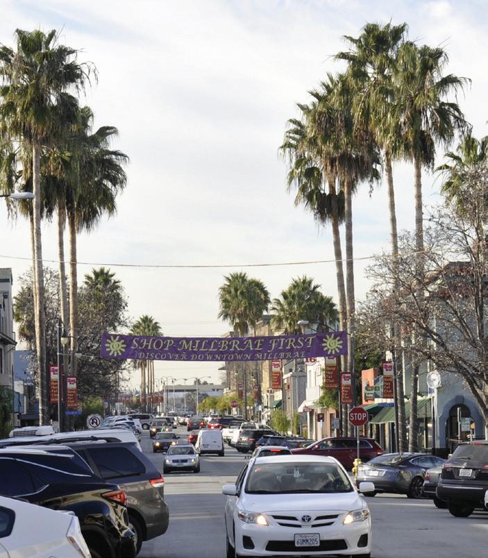


Broadway has a consistent built edge defined by one to two story buildings housing small format ground-floor retail with occasional residential use above. For the most part, the buildings along Broadway are built to property line and form a continuous street wall. The fairly articulated buildings facades and variation in the small storefronts create a fine grain fabric along the street that is visually interesting. The glass storefronts and window displays allow for a visual connection with the interior of the stores and make the pedestrian experience interesting.
Palm trees occur at the intersections and set a striking visual rhythm. Due to the existing streetscape design including enhanced sidewalks, bulbouts and raised planters containing the palm trees. Broadway has a cohesive character and identity that can be built upon with future improvements.


El Camino Real El Camino Real (SR-82) is a major six-lane arterial road which carries a high volume of traffic during peak time. The corridor feels wide, with few street trees and relatively low buildings. The corridor is auto-dominated with wide pedestrian crossings, narrow sidewalks, and almost no pedestrian amenities.
The frontage road provides a protected area that serves the ground floor businesses and also provides an opportunity for enhanced landscape treatment and outdoor seating. This frontage-road zone takes on a small-scale, interesting architectural character similar to Broadway and can be considered part of the downtown commercial core.

The large median trees portions of the corridor are striking and provide a notable gateway experience to the downtown portion of El Camino Real from both the north and south.


This plan responds to existing conditions and anticipates future development by creating distinct character zones that respond to the scale of the streets and the built form and land uses along the streets, described in the following pages.
The Promenade character zone covers the downtown portion of El Camino Real, from Millbrae Avenue to Meadow Glen Avenue. This zone is the “grand boulevard” of Millbrae, with active frontages supported by ample sidewalks, large, tall-canopy trees, civic transit infrastructure, and wide sidewalk spaces. Specific activity zones would be highlighted with

design features such as special paving and furnishings. The scale of the street and the future scale of the buildings are large, and the streetscape should be a grand gesture that celebrates both the human scale as well as a larger-scale experience.


Broadway and the El Camino Real Frontage Road zone are the heart of Millbrae’s commercial district. The scale and character of these streets is small and pedestrian oriented. People using these streets will benefit from a high level of craft and attention to detail, such as special

paving materials, investment in street furnishings, and pedestrianscale lighting. Street trees in this zone would be medium sized with seasonal interest such as flowers or fall colors. The existing palm trees at the intersections would be maintained. This character should extend to the cross streets in the core of the commercial district: Taylor Blvd., Hillcrest Blvd., La Cruz Ave., and Victoria Ave.
The Parkway character zone of El Camino Real extends from Meadow Glen Ave. to the northern city limit. On Broadway, the Parkway zone extends from Victoria Ave. to Millbrae Ave. The land uses in this zone are primarily residential and include fewer active ground-floor frontages. The design
of this zone emphasizes more lush planting, including trees with lower canopies to provide more privacy for residential buildings and planting strips along the street edge. The sidewalks offer fewer amenities than the Interactive Urban and Promenade zones, and the paving and furnishings design is simpler.

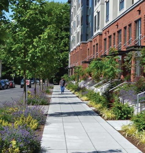


The alley running parallel to Broadway and El Camino Real from Taylor Blvd to Victoria Avenue is primarily a serviceaccess road. However, as a prominent feature of the downtown, it should be considered an opportunity for enhanced connectivity, beautification and increased safety. Blank walls along the alley, especially near the intersections, are opportunities for public art. The paving should be improved, including paving unpaved
areas that are not viable as planting areas. To save costs, pavement improvements could be concentrated near the intersections. At the intersections, the crosswalks should be raised across the alley entrances, with driveway-type vehicular access into the alleys. This would improve accessibility, pedestrian safety, and the sense of pedestrian orientation in the downtown. And enhanced lighting throughout the alley would improve the sense of safety.
The design concept for Broadway prioritizes creating a strong sense of place and identity, and creating a vibrant walkable environment by encouraging pedestrian interaction with ground floor active uses.
Broadway will continue to function as a two-lane street, but the angled parking will be replaced with parallel parking to allow for widening the sidewalks from 8’ to 13’. the widened sidewalks will create room for street planting with canopy trees, landscaping, and outdoor dining. The enhanced streetscape would support a “park once” environment where drivers are more likely to walk rather than drive and re-park their vehicles to visit multiple destinations, by including pedestrian-friendly design elements such as street furnishings like lighting, seating, curb extensions to shorten crossing distances at intersections, and enhance pedestrian crossings.
Bicycle lanes are not planned for Broadway, and there is not a bus route on Broadway. Signalization and stop-controlled intersections will remain as they currently are, and corner bulb-outs will retain their current configuration. In case the bulb-outs need reconstruction for public realm improvements, the design and dimensions will be subject to specifications and approval of the fire department.


BROADWAY: FINAL VISION
Existing palm trees and enlarged raised planter
Existing enhanced crosswalk paving to remain


New street trees
Widened sidewalk Parallel parking Pedestrian-level streetlights
Parallel parking Existing palm trees and enlarged raised planter
Existing enhanced crosswalk paving to remain


New street trees Widened sidewalk Pedestrian-level streetlights


Widened sidewalk
New street trees
Existing palm trees and enlarged raised planter
Existing enhanced crosswalk paving to remain
Pedestrian-level streetlights
The El Camino Real study area comprises two distinct zones. The southern frontage-road zone, from Millbrae Avenue to Taylor Boulevard; and the northern zone without a frontage road, from Taylor Boulevard to the North city limit. The proposed functional improvements for each of these zones are described below.
This section describes the ultimate vision for El Camino Real, which requires a reduction in the number of lanes from three through-lanes in each direction to two. In the event that the lane reduction cannot be implemented initially, Chapter 4 describes a strategy for phased implementation.
Vehicular Lane
Travel lanes are reduced from three in each direction to two in each direction, with left-turn pockets where necessary.
The frontage-road entrances and exits are relocated from their current configuration off of the side streets to entering and exiting directly onto El Camino Real. This reduces pedestrianvehicle conflicts and provides the opportunity to create generous plazas and planting areas at the corners.
The eastern row of parallel parking stalls is eliminated from the frontage road and the frontage-road median divider is relocated westward. The
angled parking on the west side of the frontage road is converted to parallel parking.
Parallel parking on the east side of El Camino Real is repositioned to create a protected bike lane. An alternative for further study would be to maintain a multi-use curb lane on the east side of El Camino Real, accommodating parking, parklets, micromobility hubs (bicycle and scooter share stations), and drop-off zones. This may be preferable if there is an increased number of active ground floor uses in the future. This would require a Class II buffered bike lane rather than a Class IV protected bike lane.
Lane widths are reduced from 12’-6” through lanes and 11’ left-turn lanes to 12’ through-lanes and 12’ left-turn lanes (per the request of Millbrae Fire Department, the left turn lanes are 12’ wide. This exceeds Caltrans minimum standard width of 11’).
The center median is relocated slightly westward, and the median noses are lengthened and widened to 6’ to provide a median refuge at the crossings, allowing for a pedestal for a push-button-activated pedestrian signal phase, per Caltrans standards.
The southbound bike lane is a 8’-wide Class I lane (potentially allowing for two-lane bicycle traffic), separated from the vehicular lane by a 10’-wide planted median.
The eastern, northbound bike lane is a 6’-wide Class IV protected bike lane with a 4’ buffer.
At bus stops, the bike lanes continue between the bus-stop platform and the sidewalk. The bike lanes are raised to the sidewalk and bus platform level to provide accessible route between the sidewalk and bus platform.
The eastern and western sidewalks are widened from 8’ to 15’, including a 4’-wide zone for tree planting. These widths would be within the public right-of-way. During sidewalk
extension, the design and dimensions of traffic calming features, i.e., bulbouts will be subject to specifications and approval of the fire department.
Street trees are proposed for the sidewalks and in the new medians, at approximately 30’ on-center spacing. The center-median trees would be unevenly spaced in informal groupings (see the Planting section below). Large existing trees could be maintained within the slightly realigned medians.
Bus stops are aligned with the parking lane in the northbound direction and the bike-lane buffer median in the southbound direction. The bus stops are proposed to be raised bus-stop islands allowing the bike lane to be located between the bus stop and the sidewalk, preventing conflicts between bicycles and buses and avoiding the need for bicyclists to exit the bike lane and enter the travel lane to pass buses at the bus stops.
The northbound bus-boarding platforms are aligned with the parking lane and bike buffer, allowing for a
10’ width. The southbound bus-stop islands are 10’ wide. A minimum width of 10’ is required for bus shelters which are located on the bus-boarding platforms.
The northbound bus stops are located on the far side of the intersection, which improves bus operations. The southbound bus stops are proposed to be located on the near side of the intersection. This reduces conflicts between buses and vehicles entering the frontage road.
Multi-use lane
Bus stop island
Widened sidewalk with street trees
Pedestrian streetlights along sidewalks
New median with street trees/ stormwater-management planting area
Expanded bike buffer with pedestrian refuge islands

Vehicular streetlights in medians
10’ min. turn lanes per Caltrans
11’ min. through lanes per Caltrans California Highway Design Manual, 7th Edition.
Median refuge
Vehicular streetlights in medians
Reconfigured frontage road entrance and exit
Bus stop island New median with street trees/ storm-water management planting area

Expanded bike buffer with pedestrian refuge islands
Widened sidewalk with street trees
Pedestrian streetlights along sidewalks
Widened sidewalk with street trees
New median with street trees/stormwater management planting area
Pedestrianlevel streetlights
Bus stop island
Reconfigured frontage road entrance and exit
Expanded bike buffer with pedestrian refuge islands
Median refuge

Widened sidewalks provide the opportunity to activate the public realm with cafe seating and public street furnishings. A five-foot-wide path of travel should be maintained by segregating uses into zones as shown below. A sidewalk seating zone should be established along

the building frontage, with a publicfurnishing zone aligned with the street trees, streetlights, and planting areas. Extended bulb-outs and refuge islands at interesctions provide additonal space for public-furnishing zones.
Bicycle infrastructure should be designed for safety, including highvisitbility markings and bollards so that bicyclists, pedestrans and drivers can see the bicycle facilities in all light conditions. Safety features include white striping on the pavement and raised curbs, reflective bollards,
raised wheel stops, green bike-lane markings, and white pedestriancrossing markings where paths of travel cross the bicycle facilities as well as the vehicular lanes.

Vehicular Lane
Configuration
Travel lanes are reduced from three in each direction to two in each direction, with left-turn pockets where necessary.
Parking
Parallel parking is provided on both sides of the street.
Bicycle Facilities
The bike lanes are Class IV protected, with 6’-wide lanes and 3’ buffers. The bike lanes continue between the sidewalks and the bus stops. The bike lanes are raised to the sidewalk and bus platform level to provide accessible route between the sidewalk and bus platform.
The sidewalks are widened from 8’ to 10’.
Median
The median is maintained in its current location, however 6’-wide median noses are extended to provide pedestrian refuges at the crosswalks.
Street Trees
Street trees are proposed for both sides of the street, at approximately 30’ on-center spacing. Existing large trees in the median could be protected and additional median trees would be planted. The median trees would be unevenly spaced in informal groupings (see the Planting section below). ). Final selection of street trees will be subject to City approval.
Bus-boarding platforms are aligned with the parking lane and bike buffer, allowing for a 13’ width. Bus shelters are located on the bus-boarding platforms.
Pedestrian-level streetlights


10’ min. turn lanes per Caltrans 11’ min. through lanes per Caltrans California Highway Design Manual, 7th Edition.

Vehicular-level streetlights in medians
Protected bike lanes Bus-stop islands with bus shelters


Pedestrian refuge islands
Widened sidewalks with street trees
Pedestrian-level streetlights along sidewalks
Widened sidewalks with street trees
Pedestrian-level streetlights along sidewalks
Vehicular-level streetlights in medians
Protected bike lanes

On-street parking Bus-stop islands with bus shelters


Widened sidewalk with street trees
Bus stop island
Expanded bike buffer with pedestrian refuge islands


Existing palm trees and raised planter to remain
Existing enhanced crosswalk paving to remain
Parallel parking
The character of Millbrae’s downtown should be compatible with the surrounding neighborhoods, giving a sense of unity to the city. Still, the streetscape design should be compatible with the eclectic range of existing architecture and anticipated future buildings. To this end, this plan proposes a palette of materials and furnishings that draws from historical forms and colors while also expressing current materials and methods of fabrication. The goal is a “timeless” quality to the design that is neither historical nor futuristic. This palette is especially focused on the downtown area including Broadway and the frontage road along El Camino Real, while the rest of El Camino Real would take on a more modern design character.
This plan indicates the design intent by presenting multiple options for all of the materials and furnishings. Specification of the actual products would occur during the design process.


Broadway & ECR Northern Rd

For the Downtown zone, the proposed furnishings vocabulary is made up of neither historical replicas nor modernist or contemporary fixtures. The furnishings reference traditional
forms, while the detailing is simple and compatible with a newer design language, materials and methods of fabrication. A dark, warm color such as bronze is recommended for the metal components of the furnishings.

For El Camino Real (aside from the frontage road), the proposed furnishings vocabulary is more contemporary.
In both zones, bike racks can provide an opportunity to incorporate craft and artful design. Instead of simple tubular
steel, bike racks with intersecting forms should be installed. Care should be taken that the bike racks function well for a variety of bicycle sizes and bike-lock types.


Benches should include center armrests to prevent sleeping.

The proposed pavement palette stresses materials and colors that are inspired by the Spanish Revival and Mediterranean architectural styles. Brick or brick-colored unit pavers are proposed for the sidewalks in the


Downtown zone (Broadway and the El Camino Real Frontage Road). A lower-cost alternative is to limit unit paving to the 4’-wide tree-planting and furnishings zone adjacent to the curb. These materials should also be used to highlight important nodes along El Camino Real. The majority of the El

Camino Real sidewalks are proposed to be warm-toned cast-in-place concrete, with an exposed aggregate finish and tooled control joints.


Similar to the furnishings palette, the lighting fixtures in the Downtown zone should bridge the traditional and modern design styles, referencing traditional forms while having simple details and being constructed of modern materials. For El Camino Real

(aside from the frontage road area) the lighting fixtures would be more contemporary. The light fixtures should be the same, or similar, color as the furnishings.
On Broadway, the existing vehicularscale cobra-head fixtures should be replaced with pedestrian-level polemounted fixtures (+/- 16’ high), spaced
approximately 60-feet on-center. The El Camino Real Frontage Road should be lit by the same fixtures.
On El Camino Real, pedestrian-level fixtures should be placed along the corridor at approximately 60 feet on-center, with additional vehicularheight fixtures at wider spacing, approximately 120 feet on-center

(depending on the photometrics). The pedestrian-height and vehicularheight fixtures can be mounted on single poles, depending on the fixture type selected.


In addition to the functional streetlights described above, artful lighting elements could be incorporated throughout the
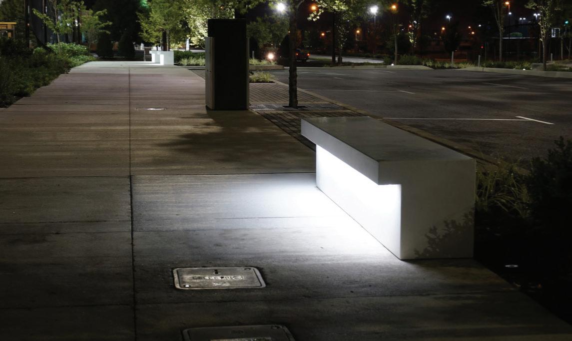
Downtown. These may include seasonal lighting suspended from trees; innovative lighting incorporated into street furniture, planter walls, and other site elements; lighting of public art; lighting associated with parklets; and special lighting at paseos and alleys.


This page is left intentionally blank
The planting concept reflects the Character Zones described above, with the following tree types associated with each zone.
El Camino Real Promenade Zone:
High and broad canopy trees, providing a large-scale statement and shade
El Camino Real and Broadway
Parkway Zones:
Shade trees with dense, lush canopies and low branching to provide privacy screening for residential buildings
El Camino Real Medians:
Large specimen species in informal groupings along the corridor
Broadway and El Camino Real
Frontage Road Interactive Urban
Zones:
Existing palm trees at intersections
Medium-sized shade trees with seasonal interest
SHADE
Real Promenade Zone):
High and broad canopy trees, providing a large-scale statement and shade.
Real and Broadway Parkway Zones):
Shade trees with dense, lush canopies and low branching to provide privacy screening for the residential frontages of the mixed-use buildings.


Real Medians):
The medians would be planted with large specimen species in informal groupings along the corridor. Existing large trees should be assessed for
health and longevity; hazardous trees should be removed and replaced with simlar, large species.


Urban Zones):
The existing palm trees at the intersections should be preserved.
The street trees between the intersections would be medium-sized shade trees with seasonal interest (flowers and/or fall color). Valii consullerei pat, Catuspicie diisquam


Retain the existing signature palm trees. Enlarge the raised planters to provide more root zone and repair the irrigation and electrical systems.


The following tables provide recommendations for each type of tree described above. Other species with these characteristics may be considered during the design process. Trees should
be selected based on compatibility with the soil conditions and climate, including consideration for climate change and the increased likelihood of drought.
Prunus
Tristaniopsis
Zelkova
flowers; standard species only. ‘Elegant’ variety NOT recommended. Formerly known as Tristania laurina; slow grower – less than 6” annually; pollinators.
color; small, kidney bean-shaped drupes that measure around ¼” in diameter and ripen in the fall.
The City of Millbrae adopted its Green Infrastructure Plan in 2019 to define and support green infrastructure goals and policies. Consistent with the Green Infrastrcture Plan, this Streetscape Plan describes specific opportunities to implement green infrastructure.
For the purposes of this plan, the term “green infrastructure” refers to design elements that achieve two sustainable-design objectives. First, the streetscapes provide opportunities to treat stormwater, improving water quality and reducing the quantity and slowing the rate at which it is released into natural systems (creeks and the bay). Second, the streets should be designed to support large, long-lived trees to provide shade, improve air quality, and provide habitat.
The following types of green infrastructure should be considered for Broadway and El Camino Real. The opportunities to install green infrastructure are significantly greater on El Camino Real than on Broadway. Broadway would allow for minimal stormwater-management planting areas, but is a good candidate for permeable and suspended pavement.
If stormwater treatment is not required by code, the streetscape designs should nonetheless endeavor to exceed the requirements. In some cases (notably with suspended pavement, see below), stormwatertreatment and tree health can be achieved together with the same technology. Multiple-benefit greeninfrastructure elements should be prioritized, as their cost of can be more easily justified even if they are not required by code.
The most common stormwatermanagement green infrastructure is the bioretention planting area, described in the San Mateo Countywide Water Pollution Prevention Program’s C.3 Stormwater Technical Guidance manual. To treat a stormwater management area, these features need to be only 4% of the watershed area, so they can fit within narrow medians and planted bulb-
out areas. Bioretention planting areas would be appropriate on El Camino Real in the proposed frontage-road median and in planted bulbouts throughout the corridor.
All of the multi-purpose curb lanes throughout the study area are candidates for the installation of permeable unit pavers or permeable cast-in-place concrete. The permeable pavement could drain into a
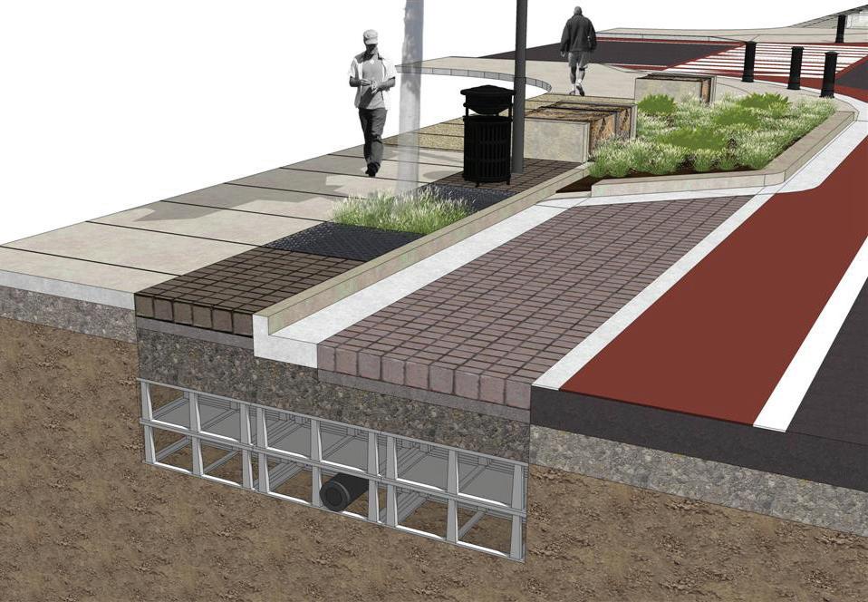
permeable aggregate base course, or into a suspended pavement system.
As described below, under “Tree Health,” the most common application of suspended pavement is to provide soil volume for tree health. However, if incorporated into the storm-drainage system, suspended pavement has been shown to be a highly effective stormwater-treatment feature; a suspended-pavement system planted with trees can be equally effective as a bioretention planting area (cite study).
POTENTIAL BIORETENTION PLANTING AREAS - EL CAMINO REAL NO-FRONTAGE-ROAD ZONE

POTENTIAL BIORETENTION PLANTING AREAS - EL CAMINO REAL FRONTAGE-ROAD ZONE

The success of the El Camino Real corridor design is especially dependent on the establishment of large trees. The existing Eucalyptus trees in the medians and along the sidewalk between Meadow Glen Ave. and Mateo Ave. indicate that the climate and the existing soil can support very large street trees. However, these trees may be approaching the end of their lifespans and should be assessed by an arborist. The large existing trees are also an exception along the corridor. Most of the trees along the corridor have not grown to their potential sizes, and are in poor health, most likely due to inadequate soil volumes in paved areas. Furthermore, there is a layer of pavement approximately 3’ below the current surface that was not removed when El Camino Real was reconstructed. This layer of pavement has prohibited tree growth and shortened the trees’ lifespans. This subsurface pavement should be removed when the proposed project is constructed.
Providing adequate soil volume is one of the critical factors determining the size, health and longevity of trees. Within a paved urban environment, it is essentially impossible to provide trees with the optimum soil volume and, given the low precipitation rates and drought conditions of the region, the required soil volumes will generally be higher than published estimates of necessary soil volumes that are based on studies in wetter climates. The best approach is simply to provide as much soil volume as possible.
The simplest and least costly way to provide additional soil volume is to enlarge the tree well. In narrow sidewalks, rectangular tree wells can significantly increase the well size while minimizing the constraint to the sidewalk width. A custom tree-grate frame can provide a 9’-long x 3’-wide tree well, using three 3’ tree-grate panAels or leaving the center square open for planting. However, any increase to the tree-well size will still
provide the tree with only a small fraction of the ideal soil volume.
Continuous root trenches along the tree-planting strip greatly increase the soil volume by linking the tree wells along the length of the sidewalk and allowing tree roots to share the available volume. If these are planted tree strips, which could be appropriate adjacent to residential buildings, the soil can be uncompacted planting soil. If the root trench is along a highlyused parking lane, decomposed granite or unit pavers could be installed over minimally compacted soil, however these areas would need maintenance over time as the soil is likely to settle. For a more stable paved root trench, suspended pavement or structural soil could be installed (see below).
Suspended pavement systems, such as Silva Cell and Strata Vault, provide the highest volume of planting soil volume under pavement, with approximately 90% of the system’s
volume available for planting soil. When compared on a cost-per-soilvolume basis, these systems can be economically competitive with structural soil, even though they are significantly more expensive on a total volume basis. This is because a much smaller volume of suspended pavement provides an equal amount of planting soil. Furthermore, suspended pavement can be used as a stormwater-treatment solution as well as providing soil volume for trees.
Structural soil is a relatively low-cost approach to providing planting soil under pavement, however the planting soil volume is only approximately 20% of the total volume of the structural soil.

Design to support a wide range of mobility modes should be an integral part of place-making, not an afterthought. Mobility infrastructure, such as bicycle facilities, bus shelters, and scooter-share and bike-share stations, can be designed to fit seamlessly into the overall design concept described above. In the Downtown zone (Broadway and along the El Camino Real Frontage Road), these elements can take on the “traditional/modern” character, while on El Camino Real, they can take on the contemporary character. Paving materials at the bus stops and micromobility hubs should be the same as the adjacent sidewalks, so that these areas are experienced as part of the overall streetscape environment.


The City’s existing wayfinding standards should be used to enhance wayfinding and character throughout the study area. In addition to these signs and entry monuments, there are opportunities for large-scale public art to heighten the gateway experience at key locations (see diagram).

Public art in the medians should be large-scale and legible to people in vehicles as well as pedestrians. The separate pieces of art could be by one artist, with a unified theme, or by different artists. Sightlines and required clearances for pedestrian and vehicular safety would need to be maintained. If implemented, the art elements could take the place of the median gateway monument signage. If monument signs and art elements are implemented in the medians, care should be taken so these don’t conflict.


The ultimate vision for El Camino Real requires a reduction in the number of lanes from three through-lanes in each direction to two. This section describes an option for phased implementation if the lane reduction cannot be implemented initially. The potential first phase retains three lanes in each direction while implementing improvements that would remain in place through the second, lanereduction phase.
At El Camino Real & Center St
At first phase, lane widths are reduced from 12’-6” through lanes and 11’ left-turn lanes to 12’ through-lanes southbound, and 11’ though-lanes northbound with 10’ left-turn lanes.
Northbound lane widths and southbound left-turn lane width do not meet Fire Department requirements and would require Caltrans approval.
Parallel parking is eliminated from the east side of the frontage road and the frontage-road median divider is relocated westward. The angled parking on the west side of the frontage road may be replaced with parallel parking during Phase 1 to allow for widening of the sidewalk. A multi-use lane is maintained on the east side of the roadway, accommodating parking, parklets, micromobility hubs (bicycle and
scooter share stations), and drop-off zones.
The center median is relocated slightly westward, and the median noses are lengthened and widened to 6’ to provide a median refuge at the crossings, allowing for a pedestal for a push-button-activated pedestrian signal phase, per Caltrans standards.
5’-wide Class II bicycle lanes with 3’-wide buffers are provided in the northbound and southbound directions.
The sidewalks on the east side remain their current width of 8’. The sidewalks on the west side may remain their current width of 11’, or may be widened to 15’ if the angled parking is converted to parallel.
Street trees are proposed for the west-side sidewalk, in planter islands within the multi-use lane on the east side (with three parking stalls between each), and in the new medians. Large existing trees could be maintained within the slightly realigned medians.
The frontage-road entrances and exits are relocated from their current configuration off of the side streets to entering and exiting directly onto El Camino Real. This reduces pedestrianvehicle conflicts and provides the opportunity to create generous plazas and planting areas at the corners.
Northbound bus stops are proposed to be raised bus-stop islands allowing the bike lane to be located between the bus stop and the sidewalk, preventing conflicts between bicycles and buses and avoiding the need for bicyclists to exit the bike lane and enter the travel lane to pass buses at the bus stops. The bus-stop islands are a minimum of 8’ wide, as required for accessibility. The bus shelters are located on the sidewalks. It may be possible to increase the bus-stop island width to 10’, which would allow for the shelters to be placed on the island.
Southbound bus stops are proposed to be located on the near side of the intersection, in extended bulb-outs. In Phase 1, the bus would cross the bike lane to reach the bus stops.
EL CAMINO REAL FRONTAGE-ROAD ZONE PHASE 1 PLAN
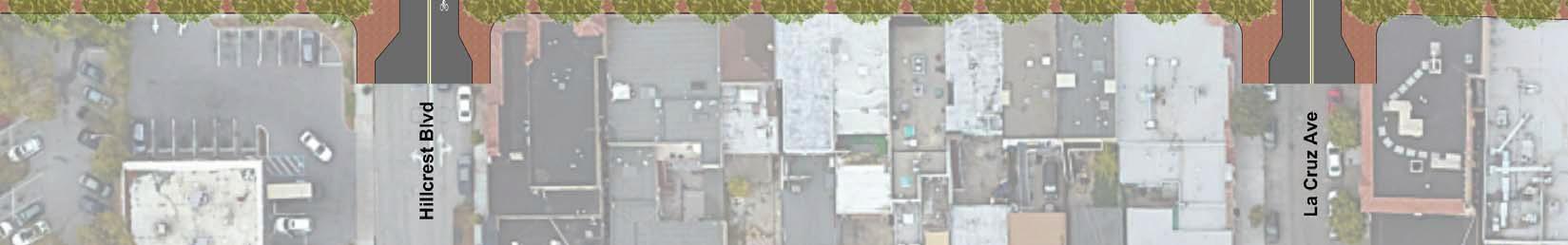
EL CAMINO REAL FRONTAGE-ROAD ZONE PHASE 1 SECTION
10’ min. turn lanes per Caltrans
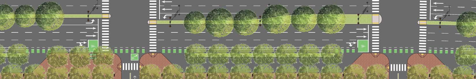
11’ min. through lanes per Caltrans California Highway Design Manual, 7th Edition.

Lane Widths
The first phase of the northern zone without frontage roads maintains an even 12’ through-lanes in both directions and a widened 12’ turn-lane in the Northbound direction from the existing 11’.
In order to provide a bike lane in each direction while maintaining three travel lanes, left-turn lanes, and a median refuge for pedestrians, on-street parking must be eliminated from both sides of the street. A parking-management plan should be developed to analyze impacts and determine mitigations.
A 5’-wide Class II bike lane with a 2’ buffer is added to both directions.
The median is maintained in its current location, however the 6’-wide median is extended to provide a pedestrian refuge at the crosswalks. The median could be reconstructed during Phase 1 or Phase 2.
Existing large trees in the median could be protected and additional median trees would be planted.
In Phase 1, bus stops are within the sidewalks such that the bus crosses into the bike lanes to load and unload.
NORTHERN EL CAMINO REAL NO-FRONTAGE-ROAD ZONE PHASE 1 PLAN

NORTHERN EL CAMINO REAL NO-FRONTAGE-ROAD ZONE PHASE 1 SECTION
10’ min. turn lanes per Caltrans 11’ min. through lanes per Caltrans California Highway Design Manual, 7th Edition.


El Camino Real is a State highway under Caltrans jurisdiction (State Route 82). This will require any improvements along El Camino Real to proceed through the Caltrans project development process. The Caltrans project development process consists of four primary stages: Project Initiation, Project Approval and Environmental Documentation (PA&ED), Project Design, and Construction. This process establishes the Caltrans approach to moving a project from the conceptual stage (as represented in the ATP and Streetscape Plan) into a project that is ready to be implemented. The stages of the project development process are each briefly described below:
The PID process documents the project scope and allows funds to be programmed for future phases. As part of the PID, if the project is locally sponsored, a Project Study Report (PSR) or Project Study Report-Project Development Support (PSR-PDS) is developed that includes a Preliminary Environmental Assessment Report (PEAR), Traffic Engineering Performance Assessment (TEPA), and Storm Water Data Report (SWDR). In addition, a risk register, design scoping, and conceptual cost estimates are prepared. This stage of the process programs funding for the PA&ED phase. If improvements are less than $3 million and the project is non-complex/non-controversial, a project can apply to go through the streamlined Permit Engineering Evaluation Report (PEER) or Encroachment Permit processes. This stage of the process typically ranges from 9 to 18 months in length.
The PA&ED stage of the Caltrans project development process documents the alternatives under consideration including supporting engineering reports and discloses environmental impacts and mitigation measures. This stage includes more detailed study to determine design exceptions, more detailed cost estimating, advanced planning studies for structures, preliminary geotechnical studies, a Traffic Operations Analysis Report (TOAR), and preliminary drainage report. Right-of-way impacts and engineering features of the alternatives are identified and a preferred alternative is established and approved including any necessary design exceptions. In addition, required environmental documentation (CEQA/NEPA) is finalized with a Project Mitigation and Monitoring Plan (MMP). Caltrans is typically the lead agency for CEQA/NEPA and environmental documentation is prepared through Caltrans unless improvements extend
beyond the Caltrans system. This stage of the process typically ranges from 18 to 36 months in length.
During the project design phase Plans, Specifications, and Estimates (PS&E) are prepared to design the improvements consistent with Caltrans Standards, identify supplemental technical specifications, and estimate quantities and values for all items of work. The construction documents enable right-of-way purchase, utility relocation, and allow for bids packages to be issued. If the project is locally-administered, construction is approved through the issuance of an encroachment permit for the project area. This stage of the process typically ranges from 18 to 36 months in length.
The final stage of the project development process is establishing a construction contract and implementing the designed improvements. This stage of the process typically ranges from 12 to 36 months in length.

..................................................
4.1 Description of Existing Sanitary Sewer Collection System
4.1.1 Gravity Collection System
4.1.2 Madrone Pump Station
4.1.3 Madrone Force Main
4.1.4 Water Pollution Control Plant
4.1.5 Study Area Collection System Details
4.2 Methodology and Analysis Criteria
4.2.1 Sanitary Sewer Evaluation Methodology
B-33
5.1 Storm Drain System Description
5.2 Methodology and Analysis Criteria
5.2.1 Specific Plan Land Use5.2.2 Sea Level Rise Assumptions
5.2.3 Stormwater Standards
5.2.3.1 Water Quality Standards
5.2.3.1.1 Special Project Determination
5.2.3.2 Hydromodification Management
5.2.3.1 Source Control
5.2.3.2 Green Infrastructure
5.2.3.3 Trash Amendments
4.2.1.1 Specific Plan Sanitary Sewer Flow Development Methodology
4.2.1.2 Hydraulic Analysis Methodology
4.2.2 Hydraulic Analysis Criteria
4.2.2.1 Design Storm Criteria
4.2.2.2 Existing Gravity Main Hydraulic Capacity Criteria
4.2.2.3 New or Replacement Pipeline Design Criteria
4.2.2.4 Use of the Flow Equalization Facility
4.3 Analysis Results
4.3.1 Impacts of Existing Gravity Main Capacity
4.3.2 Impacts to Required Treatment Capacity/Wet Weather Storage
4.4 Improvements/Mitigation Required
4.4.1 Gravity Main Capacity Improvements
4.4.2 RDII Reduction Improvements
4.4.3 Treatment Capacity/Wet Weather Storage Improvements
4.5 Estimated Project Costs
4.5.1 Unit Costs
4.5.1.1 Collection System Rehabilitation
4.5.1.2 Gravity Sewer Capacity Upgrades
4.5.2 Improvement Costs
5.2.3.4 City Standards
5.2.4 Storm Drain Master Plan Model
5.2.4.1 Precipitation
5.2.4.2 Tailwater Conditions
5.3 Analysis Results
5.3.1 100-Year and 10-Year Design Storm Deficiencies
5.3.2 100-Year with Sea Level Rise Deficiencies
5.3.3 100-Year with Sea Level Rise and SDMP Improvements Deficiencies .
5.4 Improvements/Mitigation Results
5.4.1 CIPs included in the SDMP
5.4.2 CIPs to Address Deficiencies as a Result of Sea Level Rise
5.4.3 CIPs to Address Sea Level Rise
5.4.3.1 Regional Mitigation Strategies
5.4.3.2 Local Mitigation Strategies
5.5 Estimated Project Costs
5.6 Recommendations
Table 2-1 Pipeline Projects Land Use Summary Table 2-2. Specific Plan Land Use Summary
Table 2-3 Estimated Wastewater Base Flow and Water Demand by Land Use Block
Table 2-4 Summary of Sewer Generation Rates and Water Use Factors
Table 2-5 Summary of Estimated Water Demand for Pipeline Projects
Table 2-6 Summary of Estimated Buildout Water Demand for Specific Plan Area
Table 2-7 Summary of Estimated Wastewater Flows for Pipeline Projects
Table 2-8 Summary of Estimated Buildout Wastewater Flows for Specific Plan Area
Table 3-1 Summary of Water System Service and Performance Criteria
Table 3-2 Unit Construction Costs for Pipelines
Table 3-3 Estimated Project Cost
Table 3-4 Estimated Construction Costs Distributed by Development Area
Table 4-1 Estimated Gravity Main Capacity Improvements’
Table 4-2 RDII Reduction Targets to Offset Specific Plan Flows
Table 4-3 Highline Canal Gravity Main Capacity Improvements Estimated Construction Cost
Table 4-4 Estimated Project Cost
Table 5-1 Impervious Surface Summary
Table 5-2 Rainfall in Millbrae (Millbrae, 2005)
Table 5-3 Recommended SDMP Improvements within the Specific Plan Area
Table 5-4 Recommended Sea Level Rise Improvements in Addition to SDMP Improvements
Table 5-5 Costs and Inflation, Unit Cost and Total Cost of Levees and Floodwalls (2021)
Figure 2-1 Specific Plan Proposed Land Use
Figure 2-2 Pipeline Projects
Figure 3-1 Millbrae Water System Overview
Figure 3-2 Millbrae Water System Existing Max Day Demand Available Flow Fire Flow
Figure 3-3 Millbrae Water System Existing Peak Hour Demand Pressures and Velocities
Figure 3-4 Millbrae Water System Buildout Max Day Demand Available Flow Fire Flow
Figure 3-5 Millbrae Water System Buildout Peak Hour Demand Pressures and Velocities
Figure 3-6 Millbrae Water System Proposed Pipeline Improvements
Figure 3-7 Millbrae Water System Proposed Improvements at Buildout Max Day Demand Available Fire Flow
Figure 4-1 Existing Sanitary Sewer Collection System
Figure 4-2 Impacts from Base Flow and Pipeline Projects
Figure 4-3 Impacts from Specific Plan with No Improvements
Figure 4-4 Recommended Gravity Main Improvements
Figure 4-5 Basin Improvements required to Reduce RDII
Figure 5-1 Watersheds
Figure 5-2 Storm Drain System
Figure 5-3 Change in Impervious Percentages
Figure 5-4 Project Inundation Area with Flooding and Sea Level Rise
Figure 5-5 Green Infrastructure Plan Site Location
Figure 5-6 Tidal Curves
Figure 5-7 Freeboard Flood Hazard 100-Year
Figure 5-8 Millbrae SDMP Recommended Improvements
Figure 5-9 Freeboard 100-Year Flood Hazard with Sea Level Rise and SDMP Improvements
Figure 5-10 Seawall-Based Shoreline Adaptation Concept
Figure 5-11 Seawall and Levee Shoreline Adaptation Concept
AACE Association for Advancement of Cost Engineering
ADWF Average Dry Weather Flow
Airport San Francisco International Airport
APN Assessor Paracel Number
BART Bay Area Rapid Transit
Bay San Francisco Bay
Bay San Francisco Bay
CAR Capacity Assurance Report
CIP Capital Improvement Program
City City of Millbrae
CMU Commercial Mixed Use
County San Mateo County
DMU Downtown Mixed Use
EIR Environmental Impact Report
FEMA Federal Emergency Management Agency
fps Feet Per Second
GI Green Infrastructure
Gpd Gallons Per Day
GPM Gallons Per Minute
HM Hydromodification Management
JPA Joint Powers Agreement
JUFM Joint Use Force Main
LF Linear Feet
mgd Maximum Gallons Per Day
MSASP Millbrae Station Area Specific Plan
NCMU Neighborhood Commercial Mixed use
NPDES National Pollutant Discharge Elimination System
OCOF Our Coast, Our Future
PDA Priority Development Area
PDWF Peak Dry Weather Flow
PS Pump Station
psi Pounds Per Square Inch
PWWF Peak Wet Weather Flows
RDII Rain-dependent Infiltration and Inflow
RMU Residential Mixed Use
RPC Representative Concentration Pathways
SDMP Storm Drain Master Plan
SF Square Feet
SFPUC San Francisco Public Utilities Commission
SLRAA Sea Level Rise Adaption Assessment
SLRVA Sea Level Rise Vulnerability Assessment
Specific Plan Downtown El Camino Real Specific Plan
SSO Sanitary Sewer Overflow
WMP Water Master Plan
WPCP Water Pollution Control Plant
WQ Water Quality
WSA Water Supply Assessment
Zone Pressure Zone
The City of Millbrae (City) is preparing a Specific Plan for its El Camino Real and Downtown Area (Specific Plan). The Specific Plan Area includes the Millbrae Priority Development Area (PDA), an area within the City that has been identified as a future infill development opportunity area. The Specific Plan Area encompasses a slightly larger area than the PDA and excludes the area within the adopted Millbrae Station Area Specific Plan (MSASP). The Specific Plan Area includes the El Camino Real (State Route 82) corridor, which spans from Victoria Avenue to the south and the City limits to the north. The Specific Plan Area also encompasses the City’s Downtown, which spans from Victoria Avenue to the south to Meadow Glen Avenue to the north. Many residential areas surrounding these commercial corridors are also included. It is anticipated that there will be an intensification of land use within the Specific Plan Area, with more mixeduse type development and higherdensity residential development. West Yost was retained to prepare this Infrastructure Report. The report identifies the potential impacts of the planned land use in the Specific Plan Area on the City’s water, sewer collection, and storm drainage
infrastructure. The Infrastructure Report provides a capital improvement plan identifying recommended water, sewer collection and stormwater infrastructure needed for the Specific Plan Area, along with planning-level costs. The City will use this information to develop a financial plan and development impact fees for water, sewer collection and stormwater systems within the Specific Plan Area.
This work was authorized with a contract between West Yost and Mintier Harnish on April 30, 2021. Mintier Harnish is the consultant leading the Specific Plan effort.
This report includes the following chapters following this Introduction chapter:
• Chapter 2: Specific Plan Land Use, Demands and Sewer Flows. Describes the Specific Plan Area and proposed intensification of land use. Presents projected water demands and sewer collection system flows associated with the intensification of land use.
• Chapter 3: Water System Analysis. Presents the analysis of the City’s water system to identify infrastructure needs and associated planning-level costs associated with the Specific Plan.
• Chapter 4: Sanitary Sewer Collection System Analysis. Presents the analysis of the City’s sanitary sewer collection system to identify infrastructure needs and associated planning-level costs associated with the Specific Plan.
• Chapter 5: Storm Drain System Analysis. Presents the analysis of the City’s storm drain system to identify infrastructure needs and associated planning-level costs associated with the Specific Plan.
The development of this study would not have been possible without the key involvement and assistance of City staff. City staff provided data on existing systems, participated in project meetings to review land use and development assumptions, and provided input on report evaluation and findings.
The following West Yost team members contributed to the project:
• Elizabeth Drayer, Principal-inCharge, QA/QC
• Polly Boissevain, Project Manager
• Amy Kwong, Land Use, Demand and Supply Lead
• Megan McWilliams, Water System Lead
• Chris Pittner, Water System Analysis
• Patrick Johnston, Sewer Collection System Lead
• Youssif Hussein, Sewer Collection System Analysis and Storm Drain System Analysis
• Austin Oerding, Sewer Collection System Analysis
• Michele Miller, Storm Drain System Analysis Lead
• Lucas Russell, Storm Drain System Analysis
• Jean Bolger, Report Production
Page intentionally left blank.
The City’s El Camino Real and Downtown Specific Plan Area (Specific Plan Area includes the El Camino Real (State Route 82) corridor, which spans from Victoria Avenue to the south and the City limits to the north. The Specific Plan Area also encompasses the City’s Downtown, which spans from Victoria Avenue to the south to Meadow Glen Avenue to the north. Many residential areas surrounding these commercial corridors are also included. Figure 2-1 shows the Specific Plan Area and the proposed parcels that will be redeveloped as part of the Specific Plan. The figure includes the different land use types and the land use block numbers (e.g., CMU6, RMU13) used to summarize parcel specific future land use statistics.
Per the City’s current General Plan Land Use Diagram and Official Zoning Map (October 2009), the existing land use within the Specific Plan Area ranges from commercial, residential (single family and multifamily), and office to parcels for planned development. While land uses within the Specific Plan Area are not expected to significantly change, uses are anticipated to intensify, with more mixed-use projects and higher-density residential projects.
The Specific Plan Environmental Impact Report (EIR) includes an existing conditions baseline. The existing baseline includes existing conditions plus ‘Pipeline Projects’ which are approved development projects and development projects that have been submitted for City review at the time of the issuance of the Notice of Preparation for the EIR (December 3, 2021). The City provided a list of the Pipeline Projects that are assumed to be a part of the existing land use for the purposes of this evaluation. Table 2-1 summarizes the Pipeline Project land use and Figure 2-2 shows the Pipeline Projects in relation to the Specific Plan Area. The location of the Pipeline Projects was determined by using the list of Assessor’s Parcel Numbers (APNs)
provided by the City for each Pipeline Project. The Pipeline Projects consist of general commercial, hotel, office, restaurant, and residential land uses, and include the following developments:
• Serra Station (Transit Oriented Development 1 [TOD1])
• 480 El Camino Real
• Moxy Hotel
• 130 – 140 El Camino Real
• 959 El Camino Real
• 1100 El Camino Real (Anton)
• 1301 Broadway
San Francisco International Airport
ELCAMINO REAL
be developed per WRT Design but are shown to remain consistent with land use file provided.
2. Although the MSASP is within the El Camino and Downtown Specific Plan area, infrastructure improvement needs were already identified for the MSASP in the Millbrae Station Area Specific Plan Technical Reports (West Yost, 2015). This report assesses infrastructure needs for the remaining areas within the Specific Plan.
Symbology
0 750 375 Scale in Feet
Commercial Preference Area
Residential Mixed Use (RMU)
Residential (R)
Corridor Mixed Use (CMU)
Neighborhood Commercial Mixed Use (NCMU) Downtown Mixed Use (DMU)
Specific Plan Boundary
MSASP Boundary
BART Tracks San Francisco Bay Millbrae City Limits
Notes:
1. The parcels identified as ‘Residential’ are not expected to be developed per WRT Design but are shown to remain consistent with land use file provided.
2. Although the MSASP is within the El Camino and Downtown Specific Plan area, infrastructure improvement needs were already identified for the MSASP in the Millbrae Station Area Specific Plan Technical Reports (West Yost, 2015). This report assesses infrastructure needs for the remaining areas within the Specific Plan.
Figure 2-1
Specific Plan
Proposed Land Use
City of Millbrae
Downtown and El Camino Specific Plan Infrastructure Report

Source: Millbrae Pipeline Projects for GP-SP EIR_rev 11-3-21 spreadsheet provided by WRT on November 4, 2021
(A) Square footage for residential units not provided. Units are shown as net new units.

WRT, the community design consultant for the Specific Plan, provided West Yost with the proposed land uses within the Specific Plan Area. The proposed land use includes estimates of residential and nonresidential building square footage and residential dwelling units for the following land uses:
• Residential Mixed Use
• Residential
• Corridor Mixed Use
• Neighborhood Commercial Mixed Use
• Downtown Mixed Use
Table 2-2 summarizes the overall proposed land use in the Specific Plan Area. Table 2-3 details the land uses by block number corresponding to Figure 2-1 and summarizes the estimated water use and wastewater base flows that are discussed in subsequent sections. The parcels identified as ‘Residential’ are not expected to be developed per WRT but are shown to remain consistent with the land use file provided.
Source:CityofMillbrae2015WSAandMillbraeCapacityStudyspreadsheet(providedtoWestYoston11-4-2021)
(a)Non-residentialwastewaterbaseflowisestimatedbyusingthesewergenerationrate,0.1gpd/SF,whichisforoffices,retail(store),orindustriallanduses.Therestaurantsewergenerationrateisestimatedas0.3gpd/SFandisbasedon2019waterusedataforrestaurantsalongElCaminoReal.
(b)The2015MillbraeWSAdidnotprovideasewergenerationrateforresidentiallanduse.Thewaterdemandwasestimatedfirstusingtheresidential(multi-family)waterdemandfactor,138.41gpd/unit,listedinthe2015MillbraeWSA.Thewastewaterbaseflowratewasestimatedbydividingbyafactorof1.15(equivalenttoapproximately85%water tosewerconversionrate).Thisisthesameconversionratethe2015MillbraeWSAusedfornon-residentiallanduse.
To estimate the water use and sewer flows for the proposed land use within the Specific Plan Area, water use factors and sewer generation rates from the City’s 2015 Water Supply Assessment (WSA) were used for all land use types except for restaurants, as further discussed below. Table 2-4 summarizes the sewer generation rates and water use factors used to calculate the average dry weather sewer flow and average day water use for the Specific Plan. The 2015 WSA provided sewer generation rates and multiplied those by 1.15 to estimate water use. The sewer generation rates and water use factors are multiplied by the planned non-residential developed square footages or the number of residential units or commercial hotel rooms to calculate sewer flows and water use.
Subsequent evidence has shown that the restaurant sewer generation rate listed in the 2015 WSA, 2.78 gallons per day per square foot (gpd/SF), was higher than the amount actually used by restaurants. West Yost used 2019 water consumption data provided by the City and building square footages for restaurants along El Camino Real to confirm the sewer generation rate.
The City provided West Yost with 2019 water consumption data for 65 restaurants within the Specific Plan boundary. Of the 65 records, West Yost used water consumption data from 35 restaurants where the restaurant was a stand-alone building. West Yost determined the area of each restaurant building using a building footprint shapefile. The water use factors ranged from 0.01 gpd/SF to 1.68 gpd/ SF. The average water use factor was estimated as 0.34 gpd/SF. Using the potable water to sewer conversion rate, West Yost estimated the sewer generation rate to be approximately 0.3 gpd/SF.
(A) Sewer generation rates and water use factors are multiplied by the planned non-residential square footage or the number of residential units or commercial hotel rooms to calculate sewer flows and water use.
(B) The sewer generation rates listed are from the City’s 2015 WSA. The sewer generation rate for restaurants was recalculated by West Yost using 2019 water consumption data for restaurants along El Camino Real within the Specific Plan Area.
(C) The residential water use factor is from the City’s 2015 WSA.
(D) The 2015 WSA provides sewer generation rates and multiplies those by 1.15 to estimate water use. The 2015 WSA did not provide a sewer to water conversion rate for residential land use so the same non-residential conversion rate was applied.
The following sections summarize the existing and projected water use within the Specific Plan Area.
The existing water use is based on 2012 water consumption per the 2015 WMP. The existing demands were updated to reflect the Pipeline Projects.
Table 2-5 summarizes the estimated demands for the Pipeline Projects that are included as part of the existing system analysis. In the Specific Plan Area, the updated existing average day demand, including Pipeline Projects, is 0.5 million gallons per day (mgd) and the updated maximum day demand is 1.0 mgd.
The Specific Plan Area projected water use was estimated using the proposed building information (square footage and dwelling units) presented in Table 2-3 and the sewer generation rates and water use factors presented in Table 2-4.
Table 2-6 summarizes the buildout average day demand for the Specific Plan Area and buildout maximum day
(A) See detailed demand calculations by land use block in Table 2-3.
(B) Per the City’s 2015 WMP, maximum day peaking factor for both residential and non-residential land use is 2.0.
(C) Per the City’s 2015 WMP, hourly peaking factor is 1.66 for residential land use and 1.75 for non-residential land use.
(D) Non-revenue water is estimated to be 7.6 percent because it is the largest value reported in the City’s 2015 WMP.
demand and peak hour demand, using peaking factors from the City’s 2015 Water Master Plan (WMP). The estimated demand is calculated for the projected land use based on building square footage and residential dwelling units by land use block summarized in Table 2-3 and shown on Figure 2-1.
(A) See detailed demand calculations by land use block in Table 2-3.
(B) Per the City’s 2015 WMP, maximum day peaking factor for both residential and non-residential land use is 2.0.
(C) Per the City’s 2015 WMP, hourly peaking factor is 1.66 for residential land use and 1.75 for non-residential land use.
(D) Non-revenue water is estimated to be 7.6 percent because it is the largest value reported in the City’s 2015 WMP.
The following sections summarize the existing and projected wastewater flows for the Specific Plan Area.
The existing average dry weather sewer flows within the Specific Plan Area are based on 2011 water consumption records and 2011 flow monitoring data, per the 2012 Capacity Assurance Report. In the Specific Plan Area, the existing average dry weather
sewer flow is estimated to be 0.47 mgd, including the Pipeline Projects.
Table 2-7 summarizes the estimated wastewater base flow for the Pipeline Projects which are included as part of the existing system analysis. The estimated wastewater base flow for the Pipeline Projects is 228,500 gpd, or 0.23 mgd.
Projected wastewater flows for the Specific Plan Area were estimated using the proposed building information (square footage and dwelling units) presented in Table 2-3 and the sewer generation rates and water use factors presented in Table 2-4. Table 2-8 summarizes the estimated wastewater average dry weather flow of the Specific Plan Area. The total is approximately 566,300 gpd, or 0.57 mgd.
Page intentionally left blank.
The City’s water distribution system is divided into four major pressure zones and includes approximately 75 linear miles of pipeline. The water system is supplied by five turnouts from the San Francisco Public Utilities Commission’s (SFPUC) Regional Water System. The Specific Plan Area is located in the City’s Pressure Zone (Zone) 4, which serves the lower elevation areas by the San Francisco Bay. Zone 4 is supplied by four SFPUC turnouts, located on Murchison Drive, El Camino Real at Victoria Avenue, Magnolia Avenue and Green Hills Drive. The turnout at El Camino Real and Victoria Avenue has the highest capacity and serves the Specific Plan Area from the south.
Figure 3-1 shows the existing potable water pipelines within the City’s system. The Specific Plan Area is served by pipelines that range from 6-inch diameter to 12-inch diameter, with the majority of the area served by 8-inch diameter and 10-inch diameter pipelines.
As part of the 2015 WMP, the hydraulic model of the City’s water system was updated and validated. The existing demands are based on 2012 water consumption data and the 2035 buildout demands are based on future demand projections as part of the City’s 2010 Urban Water Management Plan. The existing demands in the hydraulic model were updated to reflect the pipeline projects described in Section 2.2. The pipeline projects are near-term developments that are to be assumed as part of the existing system conditions for the purposes of this evaluation. The estimated buildout demands in the hydraulic model were updated to reflect the Specific Plan intensification by 2035. Due to the uncertainty of how water demands were allocated during the 2015 WMP for buildout conditions, a conservative assumption was made to replace previously allocated water demands that were located fully within the Specific Plan Area with the new water demand estimates listed in Table 2-3. For proposed buildings that would most likely be served from pipelines along the boundary of the Specific Plan, previously allocated demands were reduced by half and then the demands for the Specific Plan were
added for the proposed building on the Specific Plan boundary. This is to account for demands from nearby buildings that are outside of the Specific Plan Area with no current plans of redevelopment but may be served by the same pipeline. The original 2035 maximum day demand within the Specific Plan Area was approximately 1.2 mgd based on the 2015 WMP demand allocation. After using the demand update methodology, the net increase to the 2035 maximum day demand with the Specific Plan land use intensification is estimated to be 0.6 mgd.
The same assumption was used for updating the existing demands with the pipeline projects. If water demands were already allocated to a junction in the hydraulic model, the demand was reduced by half first and then the pipeline project demand was added. For junctions with no existing demand, the demand for the pipeline project was added. The demands for the Pipeline Projects were allocated to junctions that either had no demand or a very small demand. A few of the Pipeline Projects are located outside of the Specific Plan boundary and therefore, the net increase to the systemwide existing maximum day demands was estimated to be 0.6 mgd.


Sym bo ogy Water System Fac ties ¼Ð Ú Pu mp St at o n


Press u re Red u cing Va v e
s ting P pel ne s, Zone
The City’s InfoWater hydraulic model was used to summarize the existing system conditions within the Specific Plan Area and to evaluate the ability of the existing system to meet the Specific Plan demands at buildout conditions while meeting the City’s water performance criteria.
Table 3-1 summarizes the water performance criteria obtained from the 2015 WMP and discussions with the City’s Fire Marshal.
(A) City of Millbrae. 2015 Water Master Plan. Chapter 5 Evaluation Criteria, except for fire flow requirements, see footnotes (b) and (c)
(B) Existing non-sprinklered single family residential, commercial, and multi-family residential minimum flow requirement.
(C) Minimum fire flow requirement for new development, selected in consultation with the City based on recent new development requirements in the Specific Plan Area.
To evaluate distribution system performance, steady state hydraulic modeling evaluations were conducted to identify projected future capacity deficiencies. The following scenarios were evaluated using the City’s hydraulic model under both Maximum Day Demand plus Fire Flow and Peak Hour Demand conditions:
• Scenario 1 – Existing System. This scenario presents results with existing water demands (including demands for pipeline projects identified in Chapter 2) and existing infrastructure and assumes that the Specific Plan has not been constructed. This scenario represents existing baseline conditions for the Specific Plan Environmental Impact Report analysis.
• Scenario 2 – Buildout of the Specific Plan. This scenario assumes anticipated development within the Specific Plan with 2035 demand conditions elsewhere in the system and existing infrastructure.
• Scenario 3 – Buildout of the Specific Plan with Proposed Improvements. This scenario assumes anticipated development within the Specific Plan with 2035 demand conditions elsewhere in the system and proposed infrastructure to address capacity deficiencies.
The following sections discuss the hydraulic model results and distribution system deficiencies identified in each scenario.
Figure 3-2 shows the available fire flow for the existing system at each tested junction while maintaining a minimum residual pressure of 20 psi, and a maximum pipeline velocity of 10 fps within Zone 4. Results show available fire flow ranging from less than 1,500 gpm to greater than 3,000 gpm within the Specific Plan Area. The available fire flow at various locations is constrained by the velocity criterion of 10 fps along the smaller diameter pipelines. Results for the existing system analysis are reflective
of the fact that much of the City’s water system is older, designed to earlier fire standards. Fire flows also meet minimum requirements for existing residential and commercial development, per the 2019 Fire Code.
Figure 3-3 shows pressures and pipeline velocities for the existing system during peak hour demands. Hydraulic modeling results indicate that the peak hour demand pressures within the Specific Plan Area are greater than 80 psi. Pipelines within the Specific Plan Area have velocities that are less than 7 fps during peak hour demand analysis.
A hydraulic performance evaluation was conducted to assess the existing distribution system’s capacity and ability to convey flows, while meeting operational and performance criteria for maximum day plus fire flow and peak hour demand scenarios to meet the demands under the Specific Plan Buildout conditions.
Figure 3-4 presents the available fire flow at each tested junction while maintaining a minimum residual
pressure of 20 psi, and a maximum pipeline velocity of 10 fps within Zone 4. As shown on Figure 3-4, results indicate that significant deficiencies exist throughout the Specific Plan Area due to the increased fire flow demand requirement for new development. Review of the hydraulic modeling results indicate that the deficiencies are generally caused by the inability to meet the velocity criterion in the 6-inch diameter and 8-inch diameter pipelines located in El Camino Real and adjoining streets, and pressure criteria at high elevation demand nodes in northern and western side of Zone 4.
Figure 3-5 presents pressures and velocities for the existing distribution system while meeting peak hour demands at buildout within the Specific Plan Area. Hydraulic modeling results indicate that the peak hour demand pressures within the Specific Plan Area are greater than 80 psi and meet the minimum pressure criterion of 40 psi for normal operating conditions. All pipelines within the Specific Plan Area have velocities that are less than 7 fps.
|| Downtown and El Camino Real Specific Plan | City of Millbrae


B-24 || Downtown and El Camino Real Specific Plan | City of Millbrae
This section describes the recommended pipeline improvements to address the hydraulic deficiencies identified in the Specific Plan buildout fire flow scenario. To address high velocities in smaller diameter pipelines during fire flow conditions, existing pipelines within the Specific Plan Area must be replaced with larger diameter pipelines.
Figure 3-6 shows the recommended new water pipelines needed to meet the fire flow requirements for new development in the Specific Plan Area. The recommended projects include:
• Install a new 12-inch diameter intertie to increase connectivity between the Victoria Turnout and El Camino Real;
• Replace approximately 1,500 linear feet (LF) of existing 6-inch diameter pipelines with new 10inch diameter pipelines;
• Replace approximately 8,850 LF of existing 6-inch diameter pipelines with new 12-inch diameter pipelines (5,250 LF located in El Camino Real);
• Replace approximately 500 LF of existing 8-inch diameter pipelines with new 10-inch diameter pipelines; and,
• Replace approximately 1,800 LF of existing 8-inch diameter pipelines with new 12-inch diameter pipelines (250 LF located in El Camino Real).
Figure 3-7 shows the available fire flow for the Buildout of the Specific Plan with the improvements listed above. Hydraulic modeling results indicate that all fire flow requirements are met throughout the Specific Plan Area with the construction of the abovereferenced improvements.
Cost estimates prepared for this Water Master Plan Update are in accordance with the guidelines of the Association for the Advancement of Cost Engineering (AACE) International for a Class 5 Estimate.
Construction costs for the proposed water pipeline improvements are estimated using unit costs from the 2015 Water Master Plan, scaled to the November 2021 Engineering News Record Construction Cost Index for San Francisco of 14421. Unit construction costs for water pipelines
10 and 12 inches in diameter are provided in Table 3-2. These costs generally include pipe materials, trenching, placing and jointing pipe, valves, fittings, hydrants, service connections, placing imported pipe bedding, native backfill material, and asphalt pavement replacement, if required. For pipeline construction in El Camino Real, a 25 percent complexity allowance has been added to the unit cost based on construction costs from other public agencies in streets with similar conditions. Additionally, a 30 percent construction cost contingency, and a 30 percent implementation multiplier are added to estimate a total project cost.
Construction costs for interconnections in the domestic water system are assumed to consist of a nominal amount of standard 12-inch diameter piping and associated fittings. The unit cost for an interconnection is assumed to be approximately $100,000.
As presented in Table 3-3, the project has an estimated construction cost of $5.87 million (including construction contingency) and $7.64 million total project cost.
Developers within the Specific Plan Area will pay their pro-rata share of necessary improvements through assessments on new developments. The estimated capital costs for the required improvements were allocated to each of the development areas based on their estimated water demand. The cost allocations are presented in Table 3-4.
B-30 || Downtown and El Camino Real Specific Plan | City of Millbrae


0 750 375 Sca e n
Ú Pu mp S tat on U St orage Tan k ! ! 2 SF PU C Turn o ut

Press u re Red u c ng Va v e Exi sting and P ropose d P pe i nes
Oth er Z o ne s, < 12 - n ch D amet er Oth er Z o ne s, ≥ 12 - n ch D amet er Zo n e 4, <12 - n ch D amet er Zo n e 4, ≥ 12 -in ch D iamet er Sp eci c P an Bou n d ary BA RT Track s SF Bay M l b rae C t y Lim ts
D amet er Zo n e 4 <12 -in ch D amet er Zo n e 4 ≥ - n ch D amet er Sp ec f c Plan Bou n d ary BA RT Track s SF Bay Mi b rae C it y L m ts
e C ty s f re f lo w c r er o n s o m a nta n a m n m u m p res su re o f 20 ps and a max mu m vel oc ty of
No te s 1 Th e C i y s f re o c r te io n s to m a n a n a m in im u m p res su re o 20 ps and a max mu m ve oc y o 10 feet pe s econ d 2 3 00 0 gp m o r n ew dev e o p me n bas ed o n co ns u tat on w th the C i y
Page intentionally left blank.
This section describes the City’s existing sanitary sewer collection system, including the gravity mains, the Madrone pump station and associated force main, and the Water Pollution Control Plant (WPCP).
The City’s existing gravity collection system is comprised of approximately 55 miles of gravity sewers, ranging in diameters between 6- and 36-inches as shown on Figure 4-1. The majority of the system (83 percent) is composed of vitrified clay pipe.
The existing Madrone Pump Station (PS) is a wet well/dry well station. The Madrone PS has three (3) pumps each with a rated capacity of 900 gallons per minute (gpm) at 35 feet of total dynamic head. The rated firm capacity (i.e., the capacity of the pump station with the largest pump out of service) is approximately 2.5 mgd.
The Madrone PS electrical service is 240 volts, in three phases, with a 200amp capacity. Utility power is backed up by a 50-kilowatt standby generator. The existing power system is sufficient for the current loads.
The existing 14-inch diameter Madrone force main is composed of ductile iron, installed circa 1980. The force main has not been recently inspected; therefore, its condition is not known at this time. The existing force main capacity is approximately 5.5 mgd, based on limiting the force main velocity to 8.0 feet per second (fps).
The WPCP is located on the northeast corner of US Highway 101 and Millbrae Avenue. The wet weather hydraulic and treatment capacity of the WPCP is 9.0 mgd, and it has approximately 1.3 million gallons of flow equalization that allows the WPCP to accept up to 13.8 mgd during peak wet weather flow (PWWF).
Effluent from the WPCP is discharged through a joint outfall pipeline (the joint use force main [JUFM]) under a Joint Powers Agreement (JPA) with
the City of Burlingame, the City of San Bruno, the City of South San Francisco, the City and County of San Francisco (Airport) to a deep-water outfall at Oyster Point in San Francisco Bay (Bay). Under the JPA, the City has hydraulic capacity rights to 9.0 mgd in the JUFM and outfall.
The Specific Plan area is shown on Figure 2-1. The Specific Plan Area includes the El Camino Real (State Route 82) corridor, which spans from Victoria Avenue to the south and the City limits to the north. The Specific Plan Area also encompasses the City’s Downtown, which spans from Victoria Avenue to the south to Meadow Glen Avenue to the north. Many residential areas surrounding these commercial corridors are also included. The collection system in the Specific Plan area is mostly located in the Broadway Basin. The collection system within the Broadway Basin receives flows from the Helen, Broadway, Tioga and Hillcrest Basins. A small area in the northern part of the Specific Plan area is located in the Madrone Basin. There are two primary routes for sanitary sewer flow in the vicinity of the Specific Plan area:
• The gravity mains that flow southeast along El Camino Real, and then join the parallel 12-inch and 18-inch diameter gravity mains that run along the Highline Canal.
• The gravity mains that flow into the Madrone Pump Station and the associated force main.
These two flow routes join at the east end of the Highline Canal. From this point a 36-inch diameter gravity main runs under Highway 101 and flows to the WPCP. As is described below in more detail, any deficiencies and improvements identified for the 2021 Specific Plan area as part of this study must be placed in the context of the improvements already identified for this area.
As part of the 2021 Hydraulic Model Recalibration project, the hydraulic model of the City’s wastewater collection system was updated and recalibrated. Improvements projects recommended in the MSASP were assumed to be included in both existing and buildout conditions. Other sewer system improvement projects that were constructed since the model was originally developed
in the 2012 CAR were also included in the existing system. The recalibration of the hydraulic model was based on flow monitoring performed during the 2020-21 wet season. The recalibration involved adjustment of the dry weather flow factors and adjustment of the wet weather flow factors that produce RDII in the hydraulic model. For buildout conditions, a conservative assumption was made to replace previously allocated wastewater flows that were located fully within the Specific Plan Area with the new wastewater flow estimates listed in Table 2-3. The same assumption was made for updating the wastewater flows within the Specific Plan Area for existing flow conditions. Additionally, the existing flows were updated with flows for the pipeline projects, which are near-term developments that are assumed to be part of the existing system conditions for the purposes of this evaluation
The sanitary sewer flow projections and the methodology used to evaluate the impacts of these flows are described in the following section.
Average dry weather flow (ADWF) values were developed for each of the individual development areas within the Specific Plan area as described in section 2.6.
hydrographs from each subcatchment that represent estimated flows during and immediately after rainfall events caused by potential seepage of water into the collection system. The RTK method generates a series of three triangular hydrographs that represent short-term, medium-term, and longterm rainfall response. The RTK parameters include:
• R is the area of the graph representing the portion of rainfall falling on a subcatchment that enters the sewer collection system.
• T is the time from the onset of rainfall to the peak of the triangle.
The sanitary sewer flows developed as described above were loaded to manholes in the hydraulic model.
The criteria used in the hydraulic analysis are broken down by sanitary sewer infrastructure type.
The methodology used to evaluate the Specific Plan impacts to the sanitary sewer system and the analysis criteria used to quantify these impacts are described below.
Peak dry weather flow (PDWF) is generated in the hydraulic model via the application of residential and non-residential diurnal curves to the appropriate ADWF. Both the residential diurnal curves, which vary by flow monitoring basin within the City, and non-residential diurnal curves, which are standard across the City, were calculated during the hydraulic model calibration process that took place during development of the Capacity Assurance Report (CAR).
The RTK method is used to calculate RDII inputs to the City’s hydraulic model and thereby calculate PWWF. The RTK method generates
• K is the ratio of the “time to recession” to the “time to peak” of the hydrograph.
Because the RTK method is based upon the percentage of rainfall that falls on a specific area entering the collection system, and because the redevelopment in the Specific Plan area does not change the area served by the collection system, it was assumed that the amount of raindependent infiltration and inflow (RDII) entering the collection system was not impacted, and RDII values were not altered in the hydraulic model.
Design storms are synthetic rainfall events used to evaluate collection system capacity under wet weather flow conditions. A design storm has a specific recurrence interval and rainfall duration. The design storm specified for this study is consistent with that used in the CAR, the Wet Weather Alternatives Analysis and the MSASP. The design storm is a rainfall event with a 10-year recurrence interval and 24-hour duration (10-year, 24-hour storm). This design storm is defined in the Consent Decree between the City and Baykeeper as having a total depth of 3.14 inches as measured at the San Francisco International Airport (Airport). The rainfall is distributed using the U.S. Soil Conservation Service (now Natural Resource
Conservation Service) Type IA rainfall distribution curve.
The gravity main hydraulic capacity criteria are intended to be used as planning tools to determine when flows are considered to have exceeded surcharge capacity during a specific storm event. Exceptions to these criteria may be made on a case-bycase basis, depending on specific flow conditions and facility configuration. Capacity improvement projects have been proposed for all capacity deficient pipelines, as discussed below.
For the purposes of this study, and consistent with the CAR, the Wet Weather Alternatives Analysis and the MSASP, a gravity main shall be considered to require capacity improvements if flow through that gravity main results in a Hydraulic Grade Line that exceeds the ground level, i.e., if the flow results in a predicted sanitary sewer overflow (SSO) in the hydraulic model under design storm conditions.
New (parallel relief) or replacement pipelines were designed to meet the following criteria. These criteria do not necessarily apply to the rehabilitation and replacement of isolated sections of pipelines within existing alignments:
• Under PDWF conditions, velocity shall remain above 2 fps to facilitate self-cleaning.
• Under PWWF conditions for the design storm, maximum flow depth (d) as compared to pipe inside diameter (D) d/D shall be as follows:
— 10-inch diameter and smaller: Max d/D = 0.67
— 12-inch diameter and above: Max d/D = 0.80
Under all conditions, maximum allowable velocity is 10 fps.
The City’s existing flow equalization facility is designed to equalize diurnal variation in dry weather flows to optimize the treatment process at the WPCP. However, the facility can be used to store wet weather flow as well, when flows into the plant
exceed the 9 mgd rating of the WPCP treatment process. For the purposes of evaluation, it was assumed that 1.3 million gallons of storage space is available in the flow equalization facility. Any flow that exceeds both the existing available storage and the WPCP treatment capacity process is assumed to require the construction of new wet weather storage capacity.
Hydraulic analysis results for the City’s sanitary sewer facilities downstream of the Specific Plan are presented below. The following scenarios were evaluated using the City’s sewer collection system model under Peak Wet Weather flow conditions:
Scenario 1 – Existing System. This scenario presents results with existing sewer loads (including loads for pipeline projects identified in Chapter 2) and existing infrastructure and assumes that the Specific Plan has not been constructed.
Scenario 2 – Buildout of the Specific Plan. This scenario assumes anticipated development within the Specific Plan Area with buildout sewer loads in the system, and implementation of the improvements identified in the Wet Weather
Alternatives Analysis and Millbrae Station Area Specific Plan assumed to be implemented
Scenario 3 – Buildout of the Specific Plan with Proposed Improvements. This scenario assumes anticipated development within the Specific Plan with buildout sewer loads in the system, implementation of the improvements identified in the Wet Weather Alternative Analysis and implementation of additional improvements to address deficiencies due to the additional sewer loads from the Specific Plan Area.
A hydraulic performance evaluation was conducted to assess the existing sewer collection system’s capacity and ability to convey flows. Figure 4-2 shows results of the analysis. With existing sewer loadings and the existing sewer collection system, SSOs are predicted at the following four locations:
• MH 410009 at the intersection of Meadow Glen Avenue and El Camino Real, with an estimated overflow volume of 32,000 gallons;
• MH 115040 in the sewer trunk main adjacent to the BART tracks and the Highline Canal, with an estimated overflow volume of 46,000 gallons;
• MH 115043 in the sewer trunk main adjacent to the Highline Canal, with an estimated overflow volume of 95,000 gallons; and
• MH MSASP-03 on South Irwin Place, with an estimated overflow volume of 24,000 gallons.
A buildout system scenario was evaluated with capital improvements for the Wet Weather Alternatives Analysis and the Millbrae Station Area Specific Plan assumed to be implemented and additional sewer loads for the Downtown and El Camino Real Specific Plan added to the system, to determine the incremental impacts of the Specific Plan. The impacts of the Specific Plan sanitary sewer flows on the collection system are shown on Figure 4-3. As shown, the flows are predicted to
cause SSOs in and around both the Highline Canal alignment and along El Camino Real. Collection system improvements are required and described below.
With the additional flows, the hydraulic capacity of the WPCP plus equalization storage available is predicted to be exceeded. The hydraulic model results indicate that additional wet weather storage (in addition to the 1.3 million gallons of equalization storage already in place as described above) would be required to equalize flows with the addition of the Specific Plan area sanitary sewer flows without mitigation to reduce flows.
\ M X D \ S e w e r F g u r e 4 2 m p a c s f r o m B a s e F o w a n d P p e n e P o e c s m x da o e r d n g -

bology
Ma nhole Overflow
Ma nhole
Pump S ation
Forc e Ma n Grav ty Main M b rae Ci y L m s Specif c P an Bo undary


Figure 4-2


Imp ac ts fro m Base Fl ow and Pi peline P ro jects
Ci ty o f M illbra e Do w n to w n an d E Cam in o Rea Sp ec f c P an In frastru ctu re Re po r t
B-40 || Downtown and El Camino Real Specific Plan | City of Millbrae
Plaza Bay PS
e n F ee
e n F eet
Sym bology Ma nho e Pre d cted o Ove r ow Ma nho e Pump Stat on Forc e Ma in Grav ty Main Mi lb rae C ty L m ts Speci c P an Bo undary
Sym bo ogy Ma nhole Pre dic ed to Ove rf ow Ma nhole Pump S a on
Forc e Ma n Grav ity Ma n M b rae City L mi s Spec f c P an Bo undary
No te:
No te:
Cap ta im p rov eme n ts re co m me n d ed fo r th e Wet Weath er Altern atives An alys s an d th e Millbrae S tatio n Area Sp ec ific P an are as su me d to be m p eme n te d
Capital m p rov eme n ts re co m me n d ed fo r th e Wet Weath er A tern at ves An alysis an d th e Mi brae S tatio n Area Sp ec ific Plan are as su me d to be im p leme n te d
4-3 Imp ac ts fro m Sp ec ific Pla n With No Imp ro vemen ts Ci ty o f M illbra e Do w n to w n an d El Cam in o Real Sp ec ific P lan In frastru ctu re Re po r t
Figure 4-3
Imp ac ts fro m Sp ec ific Pla n With No Imp ro vemen ts Ci ty o f M illbra e Do w n to w n an d E Cam n o Rea Sp ec ific P an In frastru ctu re Re po r t
As described above, the addition of the Specific Plan area sanitary sewer flows requires improvements to the collection system beyond those identified in the CIP for the Wet Weather Alternatives Analysis and the MSASP evaluation. The following section identifies these further improvements.
It is the City’s policy that capacity restrictions be mitigated with RDII reductions rather than infrastructure capacity increases where feasible and economical. An evaluation of RDII reductions and sewer capacity improvements determined that capacity improvements along El Camino Real and adjacent to the Highline Canal in concert with RDII reductions in the Broadway and Madrone sub-basins is more cost effective than including RDII reductions in additional basins while minimizing capacity improvements along El Camino Real and adjacent
to the Highline Canal. Table 4-1 and Figure 4-4 show the recommended gravity main improvements identified for the Specific Plan area. All improvements along Meadow Glen Avenue and segments 5878 and 5890 in El Camino Real were recommended for improvement to 10-inch diameter in the Wet Weather Alternatives Analysis. The Specific Plan analysis indicates that these pipelines should be upsized to 12-inch diameter.
N \ C l i e n s 2 6 6 M n t e H a r n s h \ 6 02 1
B-42 || Downtown and El Camino Real Specific Plan | City of Millbrae

FIGURE 4-4. RECOMMENDED GRAVITY MAIN IMPROVEMENTS


San Bruno
e n f r a s R p \
S \ M X D \ S e w e r F g u r e 4 4 R e c o m m e n d e d G r a v y M a n m p r o v e m e n t s m x da o e r d i n g3 / 2 2 / 2 0 2
59 00 5147
5877 50 02
l i e n s
C
W E S T Y O S TN
S 0 400 200 Sca e n F ee 5891 5151
5890 49 98
5878 5110 50 18
5886 49 81
0 400 200 Sca e n F eet
4915
5146 5121 5015
bology
Sym bo ogy Reco mm en de d Imp rov em en ts Grav ty Ma in Fo rce M ain Man ho le Pu mp Sta t o n Mi bra e City L mits Sp ec ific Pla n Bo un da ry
Figure 4-4
Recom mended Gravi ty Ma in Improvements
Ci ty o f M illbra e Do w n to w n an d El Cam in o Real Sp ec ific P lan In frastru ctu re Re po r t W E S T Y O S T
0 5 M b r a e n f r a s R p \ G S \ M X D \ S e w e r F g u r e 4 4 R e c o m m e n d e d G r a v y M a n m p r o v e m e n t s m x da o e r d i n g3 / 2 2 / 2 0 2 2 WPCP
DECEMBER 2022 DRAFT
As described in the Wet Weather Alternatives Analysis, basins and sub-basins within the City’s collection system were prioritized for RDII reduction based upon the condition of the gravity mains. Those subbasins with the worst gravity main conditions, as identified by Closed Circuit Television inspection and other indicators, were prioritized for rehabilitation, repair, and/or replacement until RDII estimates had been reduced enough to eliminate the need for wet weather storage and to eliminate the need for many gravity main improvements in the CIP. Through focusing on the basins and sub-basins with the worst condition,
City resources were prioritized to projects with the highest estimated effectiveness and rate of return. The basins and sub-basins identified for RDII reduction as part of the Wet Weather Alternatives Analysis and the MSASP are shown on Figure 4-5. For the RDII reduction projects in this evaluation, all of the assumptions of the Wet Weather Alternatives Analysis were maintained:
• Collection system facilities requiring rehabilitation will include manholes, sewer mains, and both lower and upper laterals.
• It is assumed that sewer main rehabilitation for sewers 8 inches in diameter and smaller will involve pipe replacement using pipe bursting, whereas lines 10 inches in
diameter or larger will be lined with cured-in-place pipe. Rehabilitation of sewers larger than 12 inches in diameter is not included.
• Manhole rehabilitation will involve the use of applied coating systems.
• For sub-basins where the City implements a focused program to rehabilitate privately owned upper laterals, reduction of 70 percent of the initial and intermediate RDII in the sub-basin is projected.
RDII reduction through rehabilitation, repair, and/or replacement was projected in sub-basins until sufficient RDII was reduced to lower PWWF to offset the Specific Plan flows. The result is that two additional subbasins were added to the reduction requirements, one in the Broadway
4-2. RDII REDUCTION TARGETS TO OFFSET SPECIFIC PLAN FLOWS WITH NO IMPROVEMENTS
Basin and one in the Madrone Basin. The basins and sub-basins identified for RDII reduction are shown in Table 4-2. The sub-basin RDII reduction projects required to offset the Specific Plan area flows are shown on Figure 4-5.
EXISTING BASIN R-FACTOR, PERCENT APPROXIMATE, PERCENT RDII REDUCTION PROJECTED R-FACTOR FAST MEDIUM SLOW TOTAL TOTAL Broadway 3 45.6 9.0 Rehab Mains, MHs, Lower and Upper Laterals 70 70 70 70 3.4 Madrone 6 44.5 4.0 Rehab Mains, MHs, Lower and Upper Laterals 50 50 50 50 2.0
PROPOSED RDII REDUCTION METHOD
B-44 || Downtown and El Camino Real Specific Plan | City of Millbrae
Basin Improvements Required to Reduce RDII
If the RDII reduction requirements described above are met, no capacity increase or wet weather storage equalization is required at the WPCP. If the RDII reduction requirements are not implemented, additional storage (in addition to the 1.3 million gallons of equalization storage already in place as described above) would be required to equalize the PWWF such that it will not exceed the combined treatment/ existing equalization capacity of the WPCP. It is recommended that the City implement RDII reduction rather than build wet weather storage.
The estimated construction costs for the required improvements/ mitigations are developed from unit costs that are applied to the required projects. A description of the unit costs and resulting construction costs is provided below.
Independent planning level capital cost estimates were developed for the required collection system
improvements. The estimates are considered Class 5 estimates, based on the Association for the Advancement of Cost Engineering International criteria, defined as a Conceptual Level or Project Viability Estimate, typically with engineering from 0 percent to 2 percent complete. A combined estimating and construction contingency of 30 percent is used in the estimated construction costs to account for unknown site conditions, design completion level of the project, and bidding climate factors. The total capital costs are developed by adding an allowance of 30 percent to the estimated construction costs to cover planning level activities, environmental reviews, legal, administration, construction services, change orders, and other related items. The following sections describe the estimating procedures used in the analysis for the specific types of facilities under consideration. All unit costs and cost estimates are consistent with those utilized during the wet weather alternatives analysis and the MSASP. All unit costs are indexed to an Engineering News Record Construction Cost Index for San
Collection system rehabilitation includes manholes, sewer mains, lower laterals, and upper laterals. Recent bid results were used to estimate the collection system rehabilitation costs, which include; mobilization; demobilization; traffic control; normal sheeting, shoring and bracing; excavation and dewatering; erosion, sediment and storm water control; overhead; and profit.
Manhole rehabilitation is assumed to involve the use of applied coating systems. The unit cost for manhole rehabilitation is assumed to be $6,800 per manhole. Sewer main rehabilitation is assumed to consist of the replacement of sewers 8 inches in diameter and smaller using pipe bursting construction methods at $38.00 per inch-diameter-foot. Sewers 6 inches in diameter and smaller are assumed to be replaced with a minimum 8-inch diameter sewer. Rehabilitation of sewers larger than 8 inches in diameter is not included. Sewers larger than 8 inches in diameter are assumed to be replaced at $38.00 per inch-diameter-foot.
Lower lateral rehabilitation involves the point of connection to the sewer main as well as the lateral pipe in the
public right of way or easement. A cleanout is typically installed where the lower lateral connects to the upper lateral. The City requires backflow prevention devices in some cases, and they are typically installed near the residence or building. Lower lateral rehabilitation is assumed to involve replacement of the existing lower lateral pipe with new 4-inch diameter pipe. The replacement of a lower lateral without replacement of an upper lateral is assumed to cost $5,400 per lateral.
Upper lateral rehabilitation is assumed to involve replacing the existing upper lateral pipe with new pipe from the point of connection to the lower lateral to within 3 feet of the building. This analysis assumes that upper lateral rehabilitation costs are borne by the City and that upper laterals will be rehabilitated at the same time as lower laterals. The cost of combined lower and upper lateral replacement is assumed to be $7,500 per replacement.
Gravity sewer unit costs are based on an evaluation of recent bid tabs for shallow open-cut construction, and are estimated at $38 per inch-diameter-
foot. As noted previously, construction in El Camino Real also includes a 25 percent complexity allowance added to the unit costs. Costs included: mobilization; demobilization; traffic control; normal sheeting, shoring and bracing; excavation and dewatering; standard manholes at typical intervals; typical surface restoration; erosion, sediment and storm water control; overhead; and profit.
The estimated construction costs for the RDII reduction projects in the Broadway and Madrone sub-basins are shown in Table 4-4.
Developers within the Specific Plan Area will pay their pro-rata share of necessary improvements through assessments on new developments. The estimated capital costs for the required improvements were allocated to each of the development areas based on their estimated sewer loadings. The cost allocations are presented in Table 4-5.
Developers within the Specific Plan Area will pay their pro-rata share of necessary improvements through assessments on new developments. The estimated capital costs for the
required improvements were allocated to each of the development areas based on their estimated sewer loadings. The cost allocations are presented in Table 4-5.
B-48 || Downtown and El Camino Real Specific Plan | City of Millbrae
The focus of the Storm Drain System Analysis is to determine the impact to the storm drainage system as a result of changing the land use specified by the City’s Downtown and Specific Plan. The analysis includes the impact of Sea Level Rise on the Specific Plan Area and recommends steps to protect infrastructure from flooding. The Storm Drain System Analysis is broken into the following sections:
• Storm Drain System Description
• Methodology and Analysis Criteria
• Analysis Results
• Improvements/Mitigation Results
• Estimated Project Costs
• Recommendations
The City’s stormwater generally drains east/southeast out of the hills into the flatter regions of the City and, ultimately, out to the Bay south of the Airport. There are six major watersheds contained within the City: Northern Lomita Canal Watershed (225 acres); Southern Lomita Canal Watershed (164 acres); Central Millbrae Watershed (942 acres); MSASP Watershed (67 acres); Murchison Drive Watershed (393 acres); and Mills Estates Watershed
(130 acres). The Specific Plan Area is contained within all watersheds except for the Mills Estates Watershed and the MSASP. Descriptions of the watersheds are as follows:
• Northern Lomita Canal Watershed (225 acres) - This watershed drains the northern part of the City through a piped storm drain system (42-inch to 48inch diameter) into Lomita Creek and the Lomita Canal. The runoff from this watershed is lifted by the Airport Pump Station into the Highline Canal east of the Bay Area Rapid Transit (BART) tracks.
• Southern Lomita Canal Watershed (164 acres) - This watershed drains through a piped storm drain system, which in turn flows into the Lomita Creek, which in turn flows into the Lomita Canal at the Landing Lane Bowl. The runoff from this watershed is lifted by the Airport Pump Station into the Highline Canal east of the BART tracks.
• Central Millbrae Watershed (942 acres) – This watershed provides drainage for nearly 50 percent of the total area of the City. The watershed includes several storm drainage systems that drain to the to the Highline Canal and flows out to the Bay.
Storm drain line diameters range from 39- to 60-inch and discharge in the vicinity of the intersection of Hillcrest Boulevard storm drain undercrossing and the BART tracks. The Hillcrest Pump Station lifts water from the Hillcrest Boulevard storm system to the Highline Canal, at the Hillcrest Boulevard undercrossing. Water from the Bay is prevented from entering the Highline Canal by twin box culverts, located near South McDonnell Road. Each culvert is 15 feet wide by 15 feet tall and has a large flap gate. Flap gates allow water to flow from the City to the Bay but prevent back flow from the Bay to the City. However, these flap gates sometimes do not close completely because mud accumulates below the gates and prevents the gates from sealing closed.
• MSASP Watershed (67 acres) – This watershed drains through a piped storm drain system to the open channels in the US-101 interchange and then flows into a storm drain to the Cowan Pump Station.
• Murchison Drive Watershed (430 acres) - This watershed drains through a series of storm drains and Millbrae Creek to the El Portal
Canal. The El Portal Canal drains to the Bay. Water from the Bay is blocked from entering the El Portal Canal by twin 84-inch diameter culverts (under the Old Bayshore Highway), each with a flap gate.
• Mills Estates Watershed (130 acres) – This watershed drains through a 45-inch storm drain into a City of Burlingame storm drain system. The runoff from this watershed flows to the Cowan Pump Station, where it is lifted by the Cowan Pump Station into the El Portal Canal. This watershed is upstream of the Specific Plan Area and contributes flows to the El Portal Canal.
The City’s drainage system consists of a network of 21 miles of storm drains, 3 pump stations, and approximately three miles of open creeks and ditches that route storm runoff through the City to the Bay. Figure 5-1 shows watersheds within the Specific Plan Area. Figure 5-2 shows the stormwater infrastructure.
The City of Millbrae drainage system was evaluated for the development of the Specific Plan Area to determine whether existing pipelines are adequate to serve the Specific Plan Area or new pipelines are required. As it was concluded that the change in land use did not increase runoff, any system deficiencies are a result of existing conditions. The following sections describe the methodology and analysis criteria:
• Specific Plan Land Use
• Sea Level Rise Assumptions
• Stormwater Standards
• Storm Drain Master Plan Model
Figure 2-1 shows the Specific Plan Area and proposed land uses. Existing land use presented in the 2018 Storm Drain Master Plan (SDMP) was compared with the Specific Plan land use to determine the change in impervious surface area. Review of the data determined that the change in impervious areas is minimal since the Specific Plan land use has similar impervious areas as existing conditions. Table 5-1 summarizes
the land use change by watershed and Figure 5-3 shows parcels with a change in impervious surface. Overall, as shown by Table 5-1, there is a net decrease of 2.16 acres of impervious area over all the watersheds. For private parcels that do have an individual increase in impervious percentage, they are required to meet pre-development flow rate before discharge to the storm sewer system as discussed in the City Standards section in the following sections.
B-54 || Downtown and El Camino Real Specific Plan | City of Millbrae

Northern Lomita Canal
Northern Lomita Canal
Watershed: 216ac
Watershed: 216ac
Southern Lomita Canal
Southern Lomita Canal
Watershed: 162ac
Watershed: 162ac
Central Millbrae
Central Millbrae
Watershed: 1056ac
Watershed: 1056ac
MSASP
MSASP
Watershed: 157ac
Watershed: 157ac
Murchison Drive
Murchison Drive
Watershed: 403ac
Watershed: 403ac
B-56 || Downtown and El Camino Real Specific Plan | City of Millbrae
The conclusion from the land use assessment underscores that there will be no impact to the storm drain system from development. Furthermore, any increase in imperviousness at the parcel level needs to be mitigated to pre-project levels, which is described in the following sections. This analysis does quantify the existing deficiencies that are present in the Specific Plan Area, so as to understand where the City needs to invest funds. The chapter also suggests additional standards to protect development from flooding.
The City of Millbrae Sea Level Rise Adaption Assessment (SLRAA) and the County of San Mateo Sea Level Rise Vulnerability Assessment (SLRVA) present two sea level rise scenarios: Mid-Level Sea Level Rise and High-End Sea Level Rise. These sea level rise scenarios are based on information presented in the SLRVA, which used a combination of USGS data and Point Blue’s ‘Our Coast, Our Future’ (OCOF) tool, which provided the best available SLR data at the time of SLRVA development. The OCOF modeling uses the California Ocean Projection Council’s projections, based on the Representative Concentration
Pathways (RCP), established by the Intergovernmental Panel on Climate Change. The RCPs are a set of future scenarios named for their associated radiative forcing level by 2100 that are based on the globally averaged heat trapping capacity of the atmosphere. RCP 1.9 is the aspirational scenario of greenhouse gas concentrations where drastic greenhouse gas reduction measures are enacted worldwide, whereas RCP 8.5 is the worst-case scenario of greenhouse gas concentrations where emissions continue to rise.
The Specific Plan will address sea level rise. While the Specific Plan does not make sea level rise worse, measures can be required during development that minimizes the
impact of flooding. The City direction focuses on addressing the Mid-Level Scenario, which dictates planning for a combination of a 1% annual chance flood (100-year) and 3.3 feet of sea level rise. According to a comparison of climate models by OCOF, these amounts of sea level rise could be seen between the years 2070 and 2100. The 1% percent annual chance base flood elevation is 10.0 feet NAVD88 consistent with the Federal Emergency Management Agency (FEMA). This results in a sea level rise elevation of 13.3 feet NAVD88 which would affect parcels within the Specific Area plan east of the El Camino Real and south of Center Street and parcels within the Millbrae Station Area Specific Plan.
The City works to maintain stormwater system functionality by enforcing Water Quality, Hydromodification Management, Green Infrastructure (GI), Trash Capture, and City Standards. These standards are required to be met by private development, including parcels within the Specific Plan Area:
• Water Quality Standards - The City and San Mateo County (County) abide by Water Quality (WQ) standards issued in the Municipal Regional Stormwater National Pollutant Discharge Elimination System (NPDES) Permit by the California State Water Resources Control Board (Control Board), using Provision C.3 for New Development and Redevelopment. The stormwater standards include source control, site design measures, and treatment measures and must be met for all development in the Specific Plan Area by the private development. The Specific Plan Area parcels may qualify as “Special Projects”, with non-LID treatment measures allowed.
• Hydromodification Management (HM) – HM requires development to match post-development flow rates to predevelopment flow rates in order to reduce downstream erosion of channels and creek. HM is only applicable to development that creates and or replaces more than one area of an impervious surface and is regulate by Provision C.3.
• Source Control – Structural and Operational controls to prevent pollutant discharge from coming into contact with runoff at the source as required by Provision C.3.
• GI - The City has developed its own GI Plan, which highlights costeffective and resilient approaches to managing water quality through stormwater measures designed to mimic the natural water cycle and capture rainwater.
• Trash Capture - The City and County use standards for Trash Capture found in the Amendments to the California State Water Resources Control Board Water Quality Control Plan. These standards set out to ensure water quality objectives and ensure environmental wellbeing through the capture and removal of trash from waterways and storm drain systems.
• City Standards - The City has developed drainage improvement standards to dictate the level of service for storm drain infrastructure in the 10-year, and 100-year, 24-hour storms. These standards are called City of Millbrae, Dept. of Public Works Eng. Division, Part II Technical Provisions for Public Works Construction, Section 6 Storm Drainage Systems, dated March 2005 (City Standards). Water quality standards, Hydromodification Management, GI, the Trash Amendment and the City improvement standards are each described in more detail in the following sections.
Project Inundation Area with Flooding and Sea Level Rise
Development within the Specific Plan Area will need to address water quality standards. Provision C.3 of the Municipal Regional Stormwater NPDES Permit outlines the relationship between quality of runoff and the expansion and redevelopment of impervious surfaces on site, highlighting a variety of control measures in accordance with project land use type described in the Provision. Provision C.3 regulates projects outside of an individual single-family home, that creates and/ or replaces 10,000 square feet or more of impervious surface; or if it is a restaurant, retail gasoline outlet, auto service facility, or parking lot project that creates and/or replaces 5,000 square feet or more of impervious surface. The Municipal Regional Stormwater NPDES Permit 3, covering San Mateo County, will be adopted by the Regional Water Quality Control Board on May 11, 2022 and will be effective July 1, 2020. All projects regulated by Provision C.3 are required to implement the following measures:
• Source Control measures that at a minimum, shall include minimization of stormwater pollutants of concern in urban runoff through measures that may include plumbing of pollutant
discharges to the sanitary sewer, subject to the local sanitary sewer agency’s authority and standards.
• Site Design Measures are site planning techniques to reduce flow rates and volumes. Projects that create and/or replace 2,500 through 10,000 sq-ft of impervious surface, and stand-alone singlefamily homes that create/replace 2,500 sq-ft or more of impervious surface must include at least one site design measure.
• Stormwater Treatment requires use of LID measures for stormwater treatment: evapotranspiration, infiltration, rainwater harvesting, or biotreatment. In some Special Projects, media filters and highflow-rate tree well filters are allowed. Design measures increase water quality by treating the 85th percentile 24-hour storm for a volume hydraulic design basis.
LID treatment requirements can be reduced for certain smart growth, high density, or transit-oriented development Special Projects, if a municipality chooses to allow a reduction. If a project meets the Special Projects criteria provided
in Appendix F of the C.3 and C.6 Development Review Checklist; specific non-LID treatment measures may be used to treat a percentage of the total C.3.d amount of stormwater runoff that requires treatment. Two types of non-LID treatment measures are allowed in Special Projects: high flow rate tree well filters and high flow rate media. Specials Projects require the following documentation for a LID treatment requirement reduction, which can be approved or denied at the discretion of the City:
• Documentation that all applicable criteria for one of the abovedescribed Special Project categories have been met
• A narrative discussion of the feasibility or infeasibility of using 100 percent LID treatment onsite and offsite, for review by municipal staff.
• Documentation that it is infeasible to provide LID treatment of an equivalent amount of runoff offsite either at a regional project or on other property owned by the project proponent in the same watershed
The C.3 Regulated Projects Guide dated January 2020 prepared by the San Mateo Countywide Water Pollution Prevention Program, notes a higher proportion of LID treatment can
be required by the City, based on site context and constraints.
Developments within the Specific Plan Area will need to address HM only if they create and or replace more than one area of an impervious surface (etc., roofs, roadways, parking lots). A project that does not increase impervious surface area over the pre-project condition is not an HM Project. Under Provisions C.3, HM controls shall be designed such that post-project stormwater discharge rates and durations match pre-project discharge rates and durations within 10 percent. HM calculations address from the pre-project 2-year peak flow up to the pre-project 10-year peak flow to prevent surface erosion.
Source control measures consist of either structural project features or operational “good housekeeping” practices that prevent pollutant discharge and runoff at the source, such as by keeping pollutants from coming into contact with stormwater. Examples of structural source controls include: Roofed trash enclosures, Berms that control run-on to, or runoff
from, a potential pollutant source, Indoor mat/equipment wash racks that are connected to the sanitary sewer (note that any sanitary sewer connections must be approved by the local permitting authority), and Choosing the right plant for the right place, to reduce water consumption and pesticide and fertilizer use. Examples of operational source controls include: Street sweeping, Regular inspection and cleaning of storm drain inlets, Reducing the use of synthetic fertilizers and pesticides to help create healthy soil and healthy pest resistant plants, and Other landscape and hardscape maintenance practices.
GI can reduce the amount of runoff that enters the traditional piped stormwater system below ground cleaning stormwater onsite, allowing for water to infiltrate back into the ground. GI uses vegetation, soils, filter media, and/or natural processes to create healthier urban environments. The use of GI projects is encouraged to improve water quality by protecting local waterways through reduction of sediment and peak runoff. Two projects have been included in the City of Millbrae GI Plan which fall into the Specific Plan Area, as shown on
Figure 5-5:
• 30 Hermosa Condominiums
(Location: 30 Hermosa Avenue) which are a 4 story, 9-unit condominiums, incorporating grassy swales and dry wells
• Proposed Multi-Family Dwelling
(Location: 480 El Camino Real) which is a 4-story, 8 residential unit building with condominiums, incorporating flow-through planters, bioretention areas, and infiltration basins to infiltrate stormwater runoff
• City Green Infrastructure Street Retrofit (Location: Lincoln Circle and Richmond Drive) which is a street retrofit to detain and treat stormwater. The Green Infrastructure technology is not finalized and may be a mix of permeable paving and bioretention planters.
The California Trash Amendments are directed toward achieving the highest water quality consistent with maximum benefit to the people of the State. Trash in State waters can impact humans by jeopardizing public health and safety and posing harm and hindrance in recreational, navigational, and commercial activities.
Developers are required to install, operate, and maintain full trash capture systems in storm drains that capture runoff from one or more of the priority land uses. If the developer does not opt to install full capture systems, a plan for a combination of partial capture systems, multibenefit projects, institutional controls, and/or other treatment controls is required to achieve full capture system equivalency. Some land uses within the Specific Plan meet priority land uses categorization and will require adherence to trash capture system requirements. The priority land uses include:
• High Density Residential (10 or more Dwelling Units/Acre)
• Industrial
• Commercial
• Mixed Urban
• Public Transportation Stations and Stops
• Alternative Areas determined by the Permittees
• Other Areas Determined by the State
The City’s drainage design criteria are primarily for the evaluation of drainage systems in support of land development projects. In particular, the first bullet emphasizes the reduction of post-development flows to pre-development levels. The criteria relevant to this Specific Plan are summarized below:
• Post-Development Peak Flow and Velocities – Post-development peak flows and velocities shall be less than or equal to the predevelopment peak flows and velocities. Mitigation (for increased flows) can include on-site detention basins or downstream conveyance improvements
• Design Storm Criteria - For projects within a floodplain or bounding an existing drainage course, the design storm shall be a 100-year event. For most other projects, a 10-year design storm recurrence interval may be used
• Minor Event Freeboard Criteria
- Existing storm drain systems shall convey the peak 10-year, 24-hour storm flow with a depth less than 6 inches above drain inlets (representing overland flow containment within the street at a curb height of 6 inches)
• Major Event Freeboard Criteria
- For new developments, flow greater than the capacity of the pipe system shall be conveyed or detained in the street section while maintaining a water surface at least 6 inches below the adjacent building pad elevations during a 100-year storm event. The flood hazard (the product of depth and velocity) shall be no greater than 6.0 square feet per second
• Open Channels – Open channels shall convey the 100-year peak flow with a freeboard of 0.5 feet if the design water level is below the adjacent ground surface and with 2.0 feet of freeboard if the design water surface is above the adjacent ground (for levees).
The integrated hydrologic and hydraulic model used for this project was developed for the SDMP in 2018 and uses XPSWMM software version 2017.2.1 by Innovyze. The SDMP model is a tool used to evaluate the changes in land use which drive runoff flow rates and volumes that must be routed through the City’s storm drain system. Deficiencies within the storm drain system can be quantified using the SDMP model and improvement projects can be tested. The data and assumptions that were used in
creating each layer of the modeling are discussed in depth in the SDMP document and are outlined below.
The annual rainfall for Millbrae has a large variation between the higher and lower elevations. The 10-year and 100year design storm also vary across the City. West Yost developed a range of design storms for the City based on an adjustment of the 10-year, 24-hour and 100-year, 24-hour maximum intensity distributions, as shown in Table 5-2 and outlined in the City’s Technical Provisions (Millbrae, 2005).
Model results are dependent on the ability of runoff to escape the system at the tide gates on the Bay. To represent the time-varying tidal conditions for different events, a simulated tide event was created for both a 10-year and 100-year event. For the design of SDMP facilities, the future 10-year and 100-year tide levels

of 9.97 and 11.20 feet NAVD88 were used as the tailwater level in the Bay. These tide levels are 11 inches higher than current extreme tide levels. The increase of 11 inches is consistent with the most likely 2050 increase in extreme tides in the Sea Level Rise & Overtopping Analysis for San Mateo County’s Bayshore, Final Report dated May 2016. This was based on the best
data source available at the time of the SDMP.
The Sea Level Rise tailwater assumptions for the Specific Plan use a sea level rise of 3.3 feet in combination with the 1 percent annual change flood elevation as stated in previous sections. The hydraulic model assumes that a sea wall be constructed above 10 feet NAVD88 to protect the City from increasing sea
levels. Tide gates are also assumed at all outfalls and will prevent the sea levels from flowing into the storm drainage system. Internal stormwater flows from the storm sewer will build up behind the gates, until they exceed the sea wall crest elevation. A visualization of the varying tidal conditions is shown on Figure 5-6.
Based on a comparison of the proposed land use to existing conditions, the impervious surface within the Specific Plan Area will decrease. Therefore, there was no additional hydrologic analysis required for the 10-year and 100-year as SDMP deficiencies will remain the same. A brief overview from the SDMP is provided below. This evaluation focuses on the deficiencies of the storm drain system for the 100-year with Sea Level Rise. The following sections describe the results:
• 100-Year and 10-Year Design Storm Deficiencies
• 100-Year with Sea Level Rise Deficiencies
• 100-Year with Sea Level Rise and SDMP Improvements Deficiencies
The 10-year and 100-year deficiencies have not changed since the SDMP as the land use and stormwater infrastructure have not changed. Based on the results of West Yost’s hydraulic modeling of the City’s stormwater collection system, performance criteria are violated
during both the 10-year, 24-hour and the 100-year, 24-hour events. The 10-year event was modeled to evaluate the depth of flow at each model node, and the 100-year event was modeled to assess the capacity of open channels, as well as the depth and velocity of street flooding, which contribute to the flood hazard. While it appears that much of the backbone system has sufficient capacity to convey stormwater from the 10-year, 24-hour design storm event, there are areas that are predicted to surcharge and locations that fail to meet the performance criteria. In the past, the City has observed several locations of nuisance flooding during larger storm events. During the 10-year event, the modeling predicts surcharging at most of these locations. A second location near the intersection of Ashton and Hillcrest was indicated to be a problem where a single residence was constructed below street elevation. It is possible that nuisance flooding will persist at this location, due to overland flows, as sites below drainage inlets cannot discharge into the system. In addition, there are violations of the freeboard performance criteria along many of the City’s open channels, including at Landing Lane, Highline Canal and El Portal Canal. Much of
the open channel performance is driven by tidal conditions in the Bay. With a high tide of just over 9 feet represented in the existing conditions model, and canal heights around 9 feet, these channels have very little additional capacity to convey flood flows. Even if improvements are made to the storm drain system, freeboard is expected to decrease when considering sea level rise, as modeled in the improvement designs. Should a 100-year, 24-hour event occur at the same time as a 100-year high tide, as modeled in the SDMP, Highline Canal would be expected to overtop in locations where the canal banks are lower than the tide elevation. This situation would be exacerbated where a sea level rise of 13.3 feet NAVD88 is considered, but the likelihood of the two events occurring at the same time is low. The lack of freeboard cannot be addressed by improving system capacity alone and should instead be managed with improved isolation of the City from the Bay, coupled with either: 1) enhanced pumping in the future; or, 2) increases in canal embankment height at an appropriate time in the future. Figure 5-7 shows the locations where the flood hazard and freeboard criteria are violated.
Using the sea level rise tailwater conditions of 13.3 feet NAVD88 increases the maximum water surface elevation and increases internal flooding. Model results show that the increase in maximum water surface elevation within the Specific Plan Area compared to the 100-year flood elevation ranges from 0 to 2.4 feet. The higher water surface elevation is, as expected, in the low elevation areas near the outfalls. Model results also show that the number of flooded locations increases from two locations for the base 100-year scenario to nine locations for the 100-year with sea level rise scenario. The ponded flood volume within the Specific Plan Area is 541,886 cubic feet compared to 88,398 cubic feet for the base 100year scenario. The larger ponded flood volume is at the lower elevations upstream of the outfalls between Highway 101 and El Camino Real.
Using the sea level rise tailwater conditions of 13.3 feet NAVD88 with improvements identified in the
SDMP, a hydraulic simulation was performed to determine the remaining deficiencies within the storm drain system. Model results show that the decrease in maximum water surface elevation within the Specific Plan Area compared to the 100-year without improvements scenario range from 0 to 4.4 feet. Model results also show that the number of flooded locations decreases from nine locations for the base 100-year without improvements scenario to seven locations for the 100-year with improvements scenario. The ponded volume within the Specific Plan Area is 449,224 cubic feet. The previous SDMP used a tailwater elevation of 11.28 ft NAVD88 to simulate sea level rise. The remaining flooded locations with SDMP improvements are attributed to sea level rise that mostly impacted the low elevation areas.
For the 100-year, 24-hour event, the flood hazard (depth times velocity) and open channel freeboard were assessed. Locations where the flood hazard and freeboard criteria are violated are shown on Figure 5-7. Implementing the sea level rise projects will prevent coastal areas from inundation. However, because of the 100-year storm, the need for internal drainage projects will likely increase to deal with increased
hydrostatic pressure in the low elevation areas as water accumulates behind the sea wall. To reduce the impact of the hydrostatic pressure, additional pumping would be required. This relies on the construction of a sea wall to protect the City from Bay inundation.
The improvements/mitigation results are summarized by:
• CIPs included in the SDMP
• CIPs to Address Sea Level Rise
The City’s storm drain system was not designed for a 100-year, 24hour storm. Therefore, during the 100-year event, significant street flow is expected throughout the City. Recommended improvements where model surcharging results in a violation of the depth performance criterion within the Specific Plan Area are noted in Table 5-3 as being designed to a “10-year standard,” while flood hazards (the product of depth and velocity) greater than 6.0 require improvements to be designed to a “100-year standard,” as noted in Table 5-3, summarized from the
SDMP report. “Tier 1 Improvements” and “Tier 2 Improvements” identify CIPs where the flood hazard risk is more significant, while “Tier 3 Improvements” identifies CIPs where it is likely that any flooding would disperse over multiple flow paths, thus reducing the true risk. These CIPs should be further investigated to determine whether the benefits would be worth the investment.

General Recommendations (GR)

B-70 || Downtown and El Camino Real Specific Plan | City of Millbrae
Figure 5-8 show the recommended improvements for the Millbrae Storm Drain System. Figure 5-9 shows the system performance after the implementation of the recommended improvements. In addition to the recommended improvements, general improvements were formulated to address deficiencies above performance criteria. Much of the open channel performance is driven by tidal conditions in the Bay. With a high tide of just over 9 feet represented in the existing conditions model, and canal heights around 9 feet, these channels have very little additional capacity to convey flood flows. Even if improvements are made to the storm drain system, freeboard is expected to decrease when considering sea level rise, as modeled in the improvement designs. The lack of freeboard cannot be addressed by improving system capacity alone and should instead be managed with improved isolation of the City from the Bay, coupled with either 1) enhanced pumping in the future or 2) increases in canal embankment height at an appropriate time in the future.
In addition, the City’s GI Plan describes how the City will, over time, transition its existing “gray” (i.e., traditional) infrastructure to “green” infrastructure. This process will allow the City to better meet stormwater
pollutant load reduction goals and prioritizes the integration of GI into Capital Improvement Program projects.
CIPs will be needed to address the remaining flooding because of increased tailwater conditions associated with sea level rise. Foundational to this concept is protecting the shoreline from flooding with the construction of a sea wall. After the construction of a sea wall, internal pumps could be increased at downstream locations, moving water up and over the sea wall into the Bay. The sea wall alternatives are described in the following section. Increases in pump capacity are required at the following locations to address internal drainage:
• Cowan Pump Station - Using the dual 48-inch pipes recommended in the SDMP will not provide sufficient conveyance capacity. As a result of high tailwater conditions associated with sea level rise there will be backwater into the low elevation areas within the MSASP and downstream areas.
As part of this evaluation and upon further review of the system hydraulics downstream of the MSASP, it was concluded that the dual 48-inch pipelines would have limited benefits to improve system hydraulics. A larger pumping capacity of 205 cfs at Cowan Pump Station is recommended to move internal flows to the Bay and reduce surface flooding. This option needs to be further evaluated to assess system performance and design criteria for sizing pump stations to accommodate sea level rise.
• Airport Pump Station – Flooding was observed in the SDMP in the area around the Highline Canal which conveys much of the flows from the Central Millbrae Watershed. No improvements were recommended because the probability of the 100-year peak storm to coincide with the high tide level is very low. The sea level rise conditions will exacerbate the flooding in the area and additional pumping is needed to move flows out of the City and over a sea wall. A large pump station capacity of 800 cfs is recommended at the Airport Pump Station, with the construction of a gravity main. This pump station capacity would decrease flooding to meet 0.5 feet
of freeboard for open channels which may be too conservative. an 800 cfs pump station is extremely expensive to construct, operate, and maintain. Further analysis is required to determine new standards for sea level rise which may allow for less freeboard at open channels and would reduce the required pumping capacity.
• Sea Wall / Highline and Cowan Canal Banks – A structure to isolate the City infrastructure from coastal inundation. This could be one regional project along the coastline or many levees along each of the Canal Banks.
Table 5-4 summarizes the recommended sea level rise improvements needed in addition to the SDMP improvements required for internal drainage.
• Alternative 3 − A floodwall and levee combination that represents a variation of Alternative 2 comprised of a levee segment through Bayfront Park with an interim protection elevation of 13.3 feet NAVD88, allowing for adaptive management to increase levee height with the addition of a floodwall on top of the levee, as needed
Sea Level Rise Improvements/ Mitigation strategies are summarized by approach: Regional and Local. The following sections were developed from the City of Millbrae Sea Level Rise Adaptation Assessment, prepared in 2020.
Existing regional shoreline protection of the City is provided by both natural high ground and topographic alterations that have taken place since the City was founded. Natural high ground to the west is provided by the mountains. The natural high ground to the north of the City is San Bruno Mountain in South San Francisco, which runs down to the shoreline.
Natural high ground to the south is located at Coyote Point, in the City of San Mateo. Coyote Point represents a narrowing of the low-lying Bay shore that could present an opportunity to isolate the region from areas to the south, rather than a complete cutoff from other inundation areas as explained in the SLA.
Three preliminary regional alternatives meet City and partner goals for shoreline flood protection.
• Alternative 1 − A floodwall and seawall combination with a protection elevation of 13.3 feet NAVD88, seen in Figure 5-10.
• Alternative 2 − A floodwall and levee combination with a protection elevation of 13.3 feet NAVD88, seen in Figure 5-11.
Although most natural or naturebased solutions were deemed infeasible due to either unsuitable environmental conditions, negative impacts to regional partners, or a failure to achieve sufficient vertical protection, the option to incorporate nearshore reefs should be considered in future studies. The incorporation of nearshore reefs could complement the design of a larger flood control project along the Bayshore.
These projects specific to a certain area where individual properties or blocks can be protected, rather than the whole shoreline. These measures will be implemented by private developers and so are not costed in the following section.
• Increasing Elevations. Raising buildings or assets can easily be incorporated into new development. Areas in which temporary flooding is expected are prime locations; elevation can include infrastructure, roads, homes, and other buildings. Elevating land is most feasible in the case of a super levee, which can provide protection to a large area of the City without disrupting other land uses.
• Managed Retreat. Using controlled, intentional flooding of vulnerable low-lying areas, the City could provide tax credits for relocating flood-prone properties, offer tax incentives in exchange for maintaining land as open space, or create conservation easements. This strategy could be accomplished through the City purchasing properties over time or creating incentives for existing development to relocate; the abandoned land could be converted into salt marshes as it is reclaimed by the sea.
• Building Code Updates and Retrofits. An easy-to-implement mitigation alternative, updates and retrofits can be accomplished on any structure. Typical retrofits include elevation of the lowest floor or use of flood-proof materials, and updates to building codes can reduce risk in the near-term. The City’s building code currently includes provisions to protect development from flooding up to an elevation of 12 feet NAVD88; to decrease near-term risk, the City could increase the level of protection required or expand the area where existing floodplain management standards are in effect. Updates to building codes could include wet and dry proofing measures:
• Wet proofing to protect infrastructure below the 13.3 feet NAVD88 elevation. These measures can be new or retrofit and include installing vents to allow water to recede, sump pumps, and the use of flood resilient materials
• Dry proofing to reduce water from entering infrastructure. This can include entry protection at/or below elevation 13.3 feet NAVD88 or increasing finished
floor elevations above elevation 13.3 feet NAVD88.
• Storm Drain Improvements. As recommended in the SDMP, capital improvement projects would provide the City with sufficient freeboard in open channels during a 100-year, 24-hour event, reducing street flow, and alleviate climate changed-intensified storms. The SDMP notes that future sea level rise will require increases in channel height to contain the storage in low-lying parts of the system that occurs during higher sea levels. To read more in depth on Storm Drain Improvements, see Section 5.4.4 from the Storm Drainage Improvements in the City’s Sea Level Rise Adaptation Assessment (2020).
• Green Infrastructure Runoff Reduction Measures. Including rain gardens, bioswales, cisterns, rainwater harvesting, and more, green infrastructure captures stormwater runoff, causing it to enter storm drains at a slower rate, or infiltrating into the soil. Information about plans for Green Streets, Low Impact Development, Park Improvements, and Permeable Pavements are found in the City’s SLR Adaptation Assessment.
• Flood Protection and Sea Level Rise Standards– A designated Sea Level Rise Overlay Area could be created for use in the City’s Zoning Map. The Building in the Sea Level Rise Overlay Area could require the first floor of new buildings to be elevated above the elevation 13.3 feet NAVD88. For properties that are also with frontage on San Francisco Bay or adjoining canals, development would include shoreline infrastructure that meets the City goals. Within the Sea Level Rise Overlay Area, 100% of the drainage from impervious surfaces must be retained with sufficient storage to keep the first 1.25 inches of rainwater from an individual rain event on site without discharging onto neighboring properties or rights-of-way. The Sea Level Rise Overlay Area is consistent with policy enacted by the City of Burlingame.
C t y o f M b r a e
10 - SFO V nyl Sheetp le Wal
8 - Highline Cana Gate
9 - SFO Shore ine
Legend
Legend
C ty of Mi lbrae
C ty of M l brae
Exist ng v ny sheetp e wal
Ex sting vinyl shee p le wa l
Seawa Opt on A
Seawa Opt on A
7
7 - Bayshore Transition
me
se
Easement (Seawa l Opt on B)
Seawa l Op ion B
Seawa Opt on B
4 - Cowan Cana Ga e
4 - Cowan Cana Gate
5 - Bayshore Trans t on
5 - Bayshore Trans ion
6 - Bayshore Easement (Seawa l Op on A)
6 - Bayshore Easemen (Seawal Opt on A)
7 - Bayshore Trans t on
7 - Bayshore Trans ion
8 - H gh ine Canal Ga e
8 - Highl ne Cana Gate
(Seaw
6 - Bayshore Easement (Seaw al Option A)

5 - Bayshore Transition 4 - Cowan Cana Gate
4 - Cowan Canal Gate
9 - SFO Shorel ne
9 - SFO Shore ne
10 - SFO V nyl Shee p le Wa l Easement (Seawal Opt on B)

10 - SFO V ny Sheetpi e Wal Easemen (Seawa l Op ion B)
Pump Stat on Locat on Opt ons
Figure 5-10
Figure 5-10
Seawall-Based Shoreline
Seawall-Based
Adaptation Concept
City of Mi brae Downtown and El Camino Real Specific Plan Infrastructure Report
C ty of M llbrae
Downtown and El Camino Real Specific Plan Infrastructure Report
DECEMBER 2022 DRAFT
v e R s e 4 G S \ 1 D a t a L e v e e C o n c e p v 1 0 4 \ F g 0 0 L e v e e C o n c e p m x d : c j h e w e s
10
Vinyl Sheetpile Wa l 9 - SFO Shorel ne
10 - SFO V nyl Sheetp le Wal
9 - SFO Shore ine
C y o f M i l l b r a e
8 - H ghl ne Canal Gate
7 - Bayshore Transition
7 - Bayshore Trans t on
Highline
PS-A Highline PS-B
6 - Bayshore Easement
6 - Bayshore Easement
6 - Bayshore Levee (Option C) Levee Option D Easement
Levee Option D
C ty of M lbrae
Exis ng v ny sheetpi e wal Seawa l
Ex st ng v ny shee p le wa
Seawal
4 - Cowan Cana Gate
4 - Cowan Canal Ga e
5 - Bayshore Transit on

5 - Bayshore Trans t on
Levee Option D 0 100 50 Sca e n F


6 - Bayshore Levee - Op ion C
6 - Bayshore Levee - Opt on C
6 - Bayshore Easement
6 - Bayshore Easemen
7 - Bayshore Transit on
7 - Bayshore Trans t on
8 - H gh ne Cana Gate
8 - H ghl ne Canal Gate
9 - SFO Shore ine
9 - SFO Shore ne
10 - SFO V ny Shee p le Wa
10 - SFO Vinyl Sheetp e Wal
5 - Bayshore Transition
5 - Bayshore Trans tion 4 - Cowan Canal Gate
Levee Op ion D
Levee Opt on D
4 - Cowan Cana Gate
Levee Op ion D Easemen
Levee Opt on D Easement
Pump Stat on Loca ion Opt ons
Cowan PS-A
Figure 5-11
Seawall and Levee Shoreline
Adaptation Concept
City of Mi lbrae Downtown and El Camino Real Specific Plan Infrastructure Report
Improvements to the Cowan and Airport pump station were not costed as sea level rise design criteria has not been established. The recommended pump capacities provide freeboard within the storm drain system which require excessively large pumping capacity. Flexibility of design criteria to address sea level rise may allow for smaller pumping capacity and some surface flooding. This design criteria flexibility would greatly reduce project costs. The pump station effectiveness to reduce internal flooding relies on the construction of the sea wall. The cost of SLR adaptation measures presented in Alternatives 1 through 3 in the City’s SLR Adaptation Assessment are found in Table 5-5 below. Using the San Francisco Engineering News Record Construction Cost Index (ENR CCI) from the SLR Adaptation Assessment’s publish date (April 2020) and the most current available ENR CCI (November 2021), the escalation rate was determined to be 12.52 percent. Developers could pay their pro-rata share of necessary improvements through assessments on new developments if required by the City Building Code.
The Specific Plan Area development will not increase flows to the storm drainage system. Not only is there a decrease in associated impervious surfaces, but the City Standards require all development to be reduced to pre-development levels. Developers will need to meet requirements enforced by the City of Millbrae: Water Quality, Hydromodification Management, Green Infrastructure, Trash Control, and City Standards. Many of the parcels within the Specific
Plan Area could qualify to have reduced LID treatment requirements based on smart growth, high density, or transit-oriented development criteria. This reduction in LID is granted at the City’s discretion and can be rejected in favor of full LID compliance. Consistent with the San Mateo Countywide Water Pollution Prevention Program, it is suggested that the City requires full or expanded LID treatment for all developments.
The City should draft a Sea Level Rise Standards that requires developers
to design for increasing Bay water levels. The Sea Level Rise Standards would require local mitigation strategies to protect parcels below 13.3 feet NAVD88. The Sea Level Rise Standards could also allow developers to pay into regional mitigation strategies such as floodwalls and sea walls.
The City should draft Sea Level Rise Design Criteria for drainage facilities to address internal flooding, after the addition of sea walls and tidal gates. Current open channel
design standards require freeboard in the 100-year storm which produce excessively large pumping capacities during conditions of sea level rise. Flexibility of design criteria to address sea level rise may allow for smaller pumping capacity and some depth of allowable surface flooding. This design criteriaflexibility would greatly reduce project costs while meeting the City’s safety objectives.
Page intentionally left blank.
All new structures and land uses shall comply with the standards in this chapter.
1. Off-street parking as required by this chapter shall be provided for:
a. Any enlargement, remodel, or physical alteration to an existing structure in a manner that increases the number of required off-street parking spaces; and
b. Any change to the land use occupying an existing structure that increases the number of required off-street parking spaces.
2. Off-street parking as required by Subsection 1 above is required only to accommodate the incremental change or expansion of legally established land uses. Additional parking is not required to remedy parking deficiencies existing prior to the land use change.
Parking requirements set forth by existing approved development plans shall be considered existing nonconforming unless otherwise altered.
If this chapter conflicts with a previous City Council or Planning Commission action on a project, then the previous action of the decisionmaking body shall prevail unless modified by a new entitlement.
All land uses shall provide a minimum number of off-street parking spaces as specified in Table 1. All uses not specified shall provide the off-street parking facilities as specified Section (E).
Multi-Family Dwellings, Flats, or Live/Work
(Rental or Condominiums )
RESIDENTIAL
Single-Family Dwellings
Duplexes and Triplexes
Rooming and Boardinghouses
Retail Sales, Take-Out Only
Restaurants, Food and Beverage
NUMBER OF REQUIRED
1 space per unit
Plus:
Guest parking: 1 space per 10 units
Refer to Zoning Code
1 covered space per dwelling unit
1 space for each guest room
1 space per 300 square feet of floor area
GENERAL RETAIL
Sales, Liquor Stores, Pawn Shops, Gun Shop, Smoke Shop, Sexually Oriented Business, Convenience Store
Supermarkets
Auto Sales or Rentals (New and Used)
Vehicle Repair and Maintenance
1 Space for each 200 square feet of floor area
1 space per 600 square feet of show room floor area
1 space per 750 square feet of floor area
VEHICLE RELATED
As specified by conditional use permit
Carwash
Fuel and Service Stations
1 parking space for each 2 service bays
Bars, Tap Rooms, Tastings Rooms1 parking space for each 2.5 seats in premises primarily selling alcohol for consumption on site.
Emergency Shelters
EATING AND DRINKING
General Restaurants and Drive-In Restaurants
1 parking space for each 2.5 seat
DMU Only: Restaurants located on the ground floor of existing buildings shall be exempt from off-street parking or parking in-lieu fees.
Indoor Commercial Recreation5 parking spaces for each lane in any bowling alley.
1 parking space for each 750 square feet of floor area for all other uses.
STATE REGULATED LAND USES
Accessory Dwelling Units, Junior ADUs, Home Day Care, Supportive and Transitional Housing
RECREATION
Outdoor Commercial RecreationAs specified by conditional use permit.
PERSONAL RELATED USES
Acupressure and reflexology, Barber shops, hair salons, skincare salons (with estheticians), Massage establishments, Nail salons, Spas, Tanning salons, Tattoo parlor
OFFICE/R&D
Medical Offices, General Offices, Social Services and Charitable Institutions, Research and Development Facility
1 space per 300 square feet of floor area.
OTHER COMMERCIAL USES
1 space per 300 square feet of floor area
EDUCATION Child Care Services, Private Schools2 spaces per classroom; a parking study shall be used in determining parking requirements for a high school
Colleges and Universities, Trade and Vocational Schools
PUBLIC / INSTITUTIONAL Community Centers, Places of Worship
1 space per 40 square feet of classroom area
1 space per 300 square feet of public floor area
Conference Center, MuseumAs specified by conditional use permit
Hospitals, Medical Clinics and Residential Care Facilities
1 space per 400 square feet of floor area
ACCESSORY
1 space for every 10 beds, or The Community Development Director may reduce the parking requirements if the emergency shelter can demonstrate a lower parking demand.
Must be provided in compliance with State Law
Pet Grooming, Pet Daycare1 space per 300 square feet of floor area
Laundromats
Mortuary
Clubs and Lodges
1 space per 300 square feet of floor area
1 space for each 4 seats in any assembly hall
1 space for each 4 seats in any assembly hall
Hotels, Motels, Bed and Breakfasts1 parking space per guest room
Theater, Performance or Movie1 parking space for each 4 seats in theaters
Health and Exercise Clubs and Fitness Establishments
Banks and Financial Services , Business Support Services Dry Cleaners, Repair Shops – Not Automobile Related
Drive-Through Facilities
1 space per 250 square feet of floor area
1 space per 300 square feet of floor area
No additional parking required, but length of stacking lane(s) as specified by conditional use permit.
USES (ALLOWED ONLY IN CONJUNCTION WITH PRINCIPAL USES)
If the number of required off-street parking spaces does not result in a whole number, the fractional number is rounded up to the nearest whole number.
1. The Community Development Director shall determine the offstreet parking requirements for a land use not listed in Table 1.
2. The Community Director may base off-street parking requirements for unlisted land uses on the parking requirements of similar uses in Table 1.
3. The Community Development Director may require the preparation of a parking demand study and/or a TDM plan to determine the parking requirement for the unlisted uses.
When more than one primary land use occupies a parcel, the minimum number of required off-street parking spaces is the cumulative sum of the number of parking spaces required for each individual use. Accessory uses to a primary use do not constitute multiple uses.
1. The Community Development Director shall determine the minimum number of required off-street parking spaces for nonresidential “shell” structures with no identified tenants.
2. The Community Development Director may base off-street parking requirements for nonresidential “shell” structures on anticipated tenants for the structures.
3. The Community Development Director’s decision shall be at the Director’s sole discretion.
1. Required off-street parking spaces shall be permanently available and maintained exclusively and in perpetuity for parking purposes for the land use they serve.
2. Owners, lessees, tenants, or persons having control of the operation of a land use for which off-street parking spaces
are required shall not restrict authorized persons from using these spaces.
3. Required off-street parking spaces shall be used exclusively for the temporary parking of operable vehicles and shall not be used for the repair, storage, sale, or lease of vehicles; for display of merchandise, equipment, or vehicles (such as vans or limousines) associated directly with commercial purposes; or for any other use not authorized by the Municipal Code.
4. Accessible Parking.
a. Accessible parking spaces shall be provided in compliance with California Code of Regulations Title 24.
b. Accessible parking spaces shall count toward compliance with the number of parking spaces required by Table D.1.
5. Temporary Uses located within required off-street parking spaces (for example, construction staging or special events) shall be subject to the review and approval of the appropriate City approval authority with a Special Event Permit or a Temporary Use Permit.
Required parking shall be located on the same parcel or development site as the land use they are required to serve, except as allowed by Subsection D (Off-Site Parking).
Car-share spaces are permitted. Any residential or non-residential parking space may be voluntarily converted to a car-share space.
1. The Community Development Director or decision-making body may approve off-site parking if a covenant for the maintenance and continued use of the off-site parking spaces is approved by the City Attorney and filed with the County Recorder. The covenant shall state that the off-site parking spaces will remain available for the duration of the land use that it is required to serve.
2. Off-site parking spaces shall be located no more than 750 feet from the nearest property line of the parcel occupied by the land use that it serves.
off the property site, requires a conditional use permit approved by the Planning Commission. Valet assistance for mechanical or automated parking facilities shall be exempt from this requirement.
3. The use of valet parking in which the employee or other individual parking cars, parks such vehicles, or any of them, upon any public street, public parking facility, highway or alleyway, is prohibited.
1. All new structures and land uses shall provide motorcycle parking areas as specified in Table D.2.
Multiple land uses on a single property may use shared parking facilities when operations for the land uses are not normally conducted during thesame hours, or when hours of peak use differ. Requests for the use of shared parking may be approved if:
1. A parking demand study prepared by a City-hired transportation consultant is approved by the Community Development Director and demonstrates that there will be no substantial conflicts between
the land uses’ principal hours of operation and periods of peak parking demand;
2. The total number of parking spaces required for the land uses does not exceed the number of parking spaces anticipated at periods of maximum use; and
3. The proposed shared parking facility is located no further than 1,000 feet from the primary entrance of the land use which it serves.
1. The use of valet parking shall not reduce the number of off-street parking spaces required by this chapter.
2. The use of valet parking in which vehicles, or any of them, are parked
4. Valet Parking System. In addition to the required drawings, the applicant shall submit a plan describing in detail the proposed number of attendants, hours of valet parking service operations, fees charged to customers, and such other pertinent information as may be required from time to time by the decision making body to enable it to determine the practicability of the valet parking proposal.
Mechanical and/or automated parking facilities are allowed in the Specific Plan area. Parking spaces provided by mechanical and automated parking may be counted towards meeting up to 50 percent of required off- street
parking spaces or up to 75 percent of required off-street parking spaces with provision of valet assistance and recordation of an “Agreement to Provide Parking Attendant.” The calculation of the total percentage includes both the “lower” surface level parking space and “upper” elevated parking spaces located within a mechanical or automated parking facility. The property owner shall be responsible for ensuring maintenance of mechanical parking equipment in good working order at all times.
Requirements for Mechanical and Automated Parking facilities are specified within the City of Millbrae Standards which shall contain specific design, operation, maintenance, and performance requirements.
1. New Structures and Land Uses. All new structures and uses shall comply with the bicycle parking standards in this section.
1. Short-Term/Class II Bicycle Parking. Short-term/Class II bicycle parking provides shoppers, customers, messengers and other visitors who generally park for two hours or less a convenient and readily accessible place to park bicycles.
2. Long-Term/Class I Parking. Longterm/Class I bicycle parking provides employees, residents, visitors and others who generally stay at a site for several hours a secure and weather-protected place to park bicycles.
The number of required bicycle parking spaces shall be as specified in Table D.3.
Note: In instances where the California Building Code requires more bicycle parking spaces than required by this chapter, the California Building Code shall apply.
1 Alternatively, the Community Development Director may reduce the required bicycle parking standards if the emergency shelter demonstrates a lower parking demand.
Whenever a single lot contains multiple uses with different bicycle parking requirements, the overall requirement shall be the sum of the requirements for each activity calculated separately.
For uses not listed in the schedule of bicycle parking requirements, bicycle parking spaces shall be provided on the same basis as required for the most similar listed use, or as determined by the Community Development Director.
If calculating the number of required bicycle parking spaces results in a quotient containing a fraction, the number shall be rounded up.
Dimensions
1. Minimum dimensions of 2 feet by 6 feet shall be provided for each bicycle parking space.
2. 2 feet of clearance shall be provided between bicycle parking
Figure
spaces and adjacent walls, poles, landscaping, pedestrian paths, and other similar features.
3. 2 feet of clearance shall be provided between bicycle parking spaces and adjacent automobile parking spaces and drive aisles.
Bicycle racks must be capable of locking both the wheels and the frame of the bicycle and of supporting bicycles in an upright position.
The following standards are required for short-term bicycle parking:
1. Location
As shown in Figure 1, short-term bicycle parking shall be located within 50 feet of the primary entrance of the structure or use it is intended to serve. An encroachment permit may be required from the City to install bicycle parking in the public right-ofway.

One bicycle rack space shall be provided for each bicycle to be accommodated.
The following standards are required for long- term bicycle parking:
1. Location
Long-term bicycle parking shall be located at street floor level or if located within a subterranean parking, shall be located in the highest level in a parking garage. If located in a garage, must be within 100 feet of primary building stairs or elevators.
2. Design
One bicycle rack space shall be provided for each bicycle to be accommodated.
3. Cover
Required long-term bicycle parking spaces shall be covered. Required cover for bicycle parking spaces shall be permanent, designed to protect the bicycle from rainfall, and at least 7 feet above the floor or ground.
Long-term bicycle parking spaces shall be secured. Spaces are considered secured if they are in a locked room or area enclosed by a fence with a locked gate accessible only to the bicycle owners or authorized persons.
For building uses 10,000 square feet or larger, signage shall be posted at the main building entrance indicating the location of bicycle parking.
Shower facilities shall be made available to employees for nonresidential facilities which have a long-term bicycle parking requirement of 30 or more spaces.
The purpose of this section is to further the transportation goals of the Millbrae General Plan and specific plans by promoting the adoption of Transportation Demand Management (TDM) Programs in industrial and
office developments; promoting and increasing work-related transit use, ridesharing, walking and bicycling to minimize the number of employees traveling in single-occupant vehicles to and from work at the same time and during peak-hour periods; and improving the mobility and general efficiency of circulation and transportation systems by reducing single-occupant vehicle trips and total vehicle miles traveled within the community and the region.
A TDM Plan shall be prepared for projects as required by the Specific Plan, C/CAG, or as required by the California Environmental Quality Act (CEQA).
All projects subject to the requirements of this section shall submit a TDM Plan in conjunction with the development application.
Prior to approval of a permit for a project subject to TDM requirement, the review authority shall make the following findings:
1. The proposed trip reduction measures are feasible and appropriate for the project, considering the proposed use or mix of uses and the project’s location, size, and hours of operation.
The Community Development Director may approve minor modifications to an approved TDM plan that are consistent with the original findings and conditions approved by the review authority. A request to modify a TDM plan may only be granted if it is designed to be at least as effective as the original TDM plan in meeting the objectives and purposes of this chapter.
A report, documenting the TDM activities undertaken and their results, shall be submitted to the Community Development Director annually, or as required by the project’s environmental review under CEQA, at the responsibility of the applicant. The Community Development Director or designee shall evaluate the overall effectiveness of all of the TDM activities and may suggest new or modified activities
or substitute activities to meet the program’s objectives. The Community Development Director or designee may impose reasonable changes to assure the program’s objectives will be met.
Landscaping standards in this section shall apply to parking areas containing 10 or more parking spaces. Standards in this section shall not apply to remodels of existing parking lots.
For the purposes of this section, parking lot landscaping is defined as any landscaped area adjacent to parking spaces or drive aisles.
The minimum amount of landscaping within parking areas is specified in Table D.4.
Landscaped areas shall be welldistributed throughout the parking lot area.
Parking lot landscaping may be provided in any combination of:
1. Landscaped planting strips at least four feet wide between rows of parking stalls;
2. Landscaped planting strips between parking areas and adjacent buildings or internal pedestrian walkways;
3. Landscaped islands located between parking stalls or at the ends of rows of parking stalls; and
4. On-site landscaping at the parking lot perimeter.
A maximum of 2 feet at the front-end of a parking space may be landscaped in lieu of paving surface, as shown in Figure 2. Minimum parking space dimensions as required by City of Millbrae Parking Design Standards shall be maintained.

1. Number Required
One for each five parking spaces.
2. Location
4. Size and Species
Trees shall be a minimum fifteengallon size.
5. Installation and Maintenance Trees shall be installed and maintained in a manner consistent with the City of Millbrae Engineering and Design Construction Standards for street trees.
1. When a parking area is located adjacent to a public or private street, a landscape strip shall be provided for the purpose of shielding parked cars and their undercarriages from view of passing motorists and pedestrians.
Trees must be located on the same parcel as the parking lot, unless an alternate location is approved by the Community Development Director.
3. Distribution
Trees shall be distributed relatively evenly throughout the parking area per the approved landscape plan.
2. The minimum width of the landscape strip shall be 5 feet, as measured from the property line for private streets or edge of curb for public streets.
3. Required landscape strips may not contain any paved surfaces, except for pedestrian walkways or vehicular drives that provide access to the parking area from the adjacent street or sidewalk. Landscaping shall not impede or create unsafe conditions for pedestrians and bicyclists.
1. All landscape areas shall be separated from parking spaces, drive aisles and driveways by a continuous, raised concrete curb. Raised concrete curbs shall be a minimum of 6 inches high by 6 inches deep.
2. The City may approve alternatives to raised concrete curbs as needed to comply with any mandatory stormwater drainage standards.
Water-efficient irrigation systems (e.g. bubbler type, drip, mini- spray) shall be installed for all required landscape areas. Irrigation systems shall include check valves to prevent low head drainage, appropriate nozzles to prevent overspray and automatic and self-adjusting irrigation controllers that include moisture and/or rain sensor shutoff.
Landscape irrigation should be scheduled between the hours of 2:00 a.m. and 10:00 a.m. to avoid irrigating during times of high wind, high temperature and high-water usage.
The landscape plan shall utilize drought-resistant species which support the City’s water conservation policies and are in compliance with the City Water Efficiency Landscape Ordinance.
1. General Landscape areas shall be permanently maintained in good growing condition.
Within 30-days of a determination by the Community Development Director that a plant is dead or severely damaged or diseased, the plant shall be replaced by the property owner in accordance with the standards specified in this chapter.
3.
Any removed mature landscaping shall be replaced such with landscaping of similar size and maturity as that which was removed.
Irrigation systems shall be maintained in a fully functional manner as approved by the City and required by this section.
Landscaping shall be installed prior to the City’s authorization to occupy any buildings served by the parking area, or prior to the issuance of the final building permit for the parking area.
Exceptions to landscaping requirements or off-site planting may be granted at the discretion of the Community Development Director or approving body if the applicant provides evidence of hardship in meeting required off-street parking requirements due to landscaping requirements.
1. All exterior walls of a parking structures shall be architecturally compatible with the structure served by the parking structure.
2. Parking structure facades shall be broken-up through the use of textured concrete or similar materials on exterior walls, the incorporation of planters and trellises at each parking level, and other architectural treatments to minimize large blank walls without architectural relief.
3. Parked vehicles at each level within the structure shall be shielded from view from adjoining streets through the use of architectural appurtenances and landscaping.
1. Above-ground parking structures shall comply with all setback requirements of the applicable zoning district.
2. Subterranean parking may be located within any required setback area, provided that adequate space is provided for utilities and shoring, as determined by the City Engineer.
At ground level, the perimeter of the parking structure shall be landscaped with a minimum of one street tree for every 20 feet of linear distance of structure facade in addition to required streetscape landscaping. Groundcover and shrubs shall also be provided to break-up the mass of the structure.
4. Loading spaces and their associated maneuvering areas shall not encroach into required employee or visitor parking areas or other on-site areas required for vehicle circulation.
All new commercial and industrial land uses with a floor area of 10,000 square feet or more and multi-family residential developments with 50 units or more shall provide off-street freight and equipment loading spaces as required by this section.
The minimum number of required loading spaces are specified in Table D.5.
Each loading space shall have minimum dimensions of 12 feet in width, 25 feet in length, and 14 feet in vertical clearance.
1. Loading spaces shall be set back a minimum distance of 25 feet from any residential property.
2. Loading spaces shall be located and designed to ensure that loading and unloading takes place on-site and not within adjacent public rights-of way.
3. Sufficient maneuvering area shall be provided for loading spaces so that vehicles may enter and exit an abutting street in a forward direction.
5. An on-street loading area, if approved by the appropriate City approval body, shall have a minimum length of 40 feet. Such a space may only be approved if the applicant can demonstrate that it is infeasible to locate a loading space on-site. Time limits for use of the space shall be established to ensure its use does not conflict with general circulation needs or with operation of other area businesses and uses.
Loading spaces shall be striped and clearly identified as for loading purposes only.
Loading spaces shall not be utilized for the repair or servicing of vehicles. as any landscaped area adjacent to parking spaces or drive aisles.
Page intentionally left blank.
This section establishes standards and requirements related to consistency with the Comprehensive Airport Land Use Compatibility Plan for the Environs of San Francisco International Airport (ALUCP). The following requirements and criteria shall be incorporated into all applicable projects.
All new development is required to comply with the real estate disclosure requirements of state law (California Business and Professions Code Section 11010(b)(13). The following statement must be included in the notice of intention to offer the property for sale or lease:
“Notice of Airport in Vicinity. This property is presently located in the vicinity of an airport, within what is known as an airport influence area. For that reason, the property may be subject to some of the annoyances or inconveniences associated with proximity to airport operations (for example: noise, vibration, or odors). Individual sensitivities to those annoyances can vary from person to person. You may wish to consider what airport annoyances, if any, are associated with the property
before you complete your purchase and determine whether they are acceptable to you.”
All projects shall comply with the Noise Compatibility Policies of the ALUCP. Uses shall be reviewed per the Noise/Land Use Compatibility Criteria listed in Table IV-1 of the ALUCP. Uses listed as “conditionally compatible” shall be required to mitigate impacts to comply with the interior (CNEL 45 dB or lower, unless otherwise stated) and exterior noise standards established by the ALUCP or Millbrae General Plan, whichever is more restrictive. Unless otherwise precluded by State law, all projects shall be consistent with ALUCP Policy NP-4 Residential Uses within CNEL 70 dB Contour.
Any action that would either permit or result in the development or construction of a land use considered to be conditionally compatible with aircraft noise of CNEL 65 dB or greater (as mapped in the ALUCP) shall include the grant of an avigation easement to the City and County of San Francisco prior to issuance of a
building permit(s) for any proposed buildings or structures, consistent with ALUCP Policy NP-3 Grant of Avigation Easement.
All uses must comply with Safety Compatibility Policies of the ALUCP. Project applicants shall be required to evaluate potential safety issues if the property is located within any of the Safety Compatibility Zones established in ALUCP Policy SP-1 and depicted in Exhibit IV-7 of the ALUCP. All projects located within a Safety Compatibility Zone shall be required to determine if the proposed land use is compatible with the Safety Compatibility Land Use Criteria as noted in ALUCP Policy SP-2 and listed in Table IV-2 of the ALUCP.
All projects shall comply with Airspace Protection Policies of the ALUCP.
Project applicants shall be required to file Form 7460-1, Notice of Proposed
Construction or Alteration, with the Federal Aviation Administration (FAA) for any proposed new structure and/ or alterations to existing structures (including ancillary antennae, mechanical equipment, and other appurtenances) that would exceed the FAA notification heights as depicted in ALUCP Exhibit IV-12. Any project that would exceed the FAA notification heights shall submit a copy of the findings of the FAA’s aeronautical study, or evidence demonstrating exemption from having to file FAA Form 7460-1, as part of the development permit application. Temporary cranes or other equipment used to construct or modify a structure which are taller than the structure itself must be submitted as separate Form 7460-1 cases.
No structure may exceed the lower of either 1) the maximum height determined by the FAA to not be a hazard to air navigation, or 2) the height shown on the SFO ALUCP Critical Aeronautical Surfaces map. Building heights must receive a Determination of No Hazard from the FAA. For avoidance of doubt, the lower of the two heights identified by
the ALUCP and the FAA shall be the controlling maximum height.
The Critical Aeronautical Surfaces and FAA analysis use elevations above the origin of the North American Vertical Datum of 1988 rather than height above ground level; and for purposes of airspace evaluation, the terms “above mean sea level (AMSL) and “above the NAVD88 origin” should be considered synonymous. If a proposed project changes the ground elevation of the site, the maximum height of the building would change accordingly.
Within Airport Influence Area (AIA)
B, certain land use characteristics are recognized as hazards to air navigation and, per ALUCP Policy AP-4, need to be evaluated to ensure compatibility with FAA rules and regulations. These characteristics include the following:
a. Sources of glare, such as highly reflective buildings, building features, or blight lights including search lights, or laser displays, which would interfere with the vision of pilots in command of an aircraft in flight.
b. Distracting lights that could be mistaken for airport identification lightings, runway edge lighting, runway end
identification lighting, or runway approach lighting.
c. Sources of dust, smoke, water vapor, or steam that may impair the visibility of a pilot in command of an aircraft in flight.
d. Sources of electrical/electronic interference with aircraft communications/navigation equipment.
e. Land uses that, as a regular byproduct of their operations, produce thermal plumes with the potential to rise high enough and at sufficient velocities to interfere with the control of aircraft in flight. Upward velocities of 4.3 meters (14.1 feet) per second at altitudes above 200 feet above the ground shall be considered as potentially interfering with the control of aircraft in flight.
f. Any use that creates an increased attraction for wildlife, particularly large flocks of birds, that is inconsistent with FAA rules and regulations, including but not limited to FAA Order 5200.5A, Waste Disposal Site On or Near Airports and FAA Advisory Circular 150/5200-33B, Hazardous Wildlife Attractants On or Near Airports and any
successor or replacement orders or advisory circulars.


